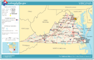
ڤرجينيا
Virginia | |
|---|---|
| Commonwealth of Virginia | |
| الكنية: Old Dominion, Mother of Presidents | |
| الشعار: | |
| النشيد: "Our Great Virginia" | |
 خريطة الولايات المتحدة، موضح فيها Virginia | |
| البلد | الولايات المتحدة |
| قبل الولائية | Colony of Virginia |
| انضمت للاتحاد | June 25, 1788 (10th) |
| العاصمة | Richmond |
| أكبر مدينة | Virginia Beach |
| أكبر منطقة عمرانية | Washington–Baltimore (combined) Washington (metro and urban) |
| الحكومة | |
| • الحاكم | Glenn Youngkin (R) |
| • نائب الحاكم | Winsome Sears (R) |
| المجلس التشريعي | General Assembly |
| • المجلس العلوي | Senate |
| • المجلس السفلى | House of Delegates |
| القضاء | Supreme Court of Virginia |
| سناتورات الولايات المتحدة |
|
| وفد مجلس النواب |
|
| المساحة | |
| • الإجمالي | 42٬774٫2 ميل² (110٬785٫67 كم²) |
| ترتيب المساحة | 35th |
| الأبعاد | |
| • الطول | 430 mi (690 km) |
| • العرض | 200 mi (320 km) |
| المنسوب | 950 ft (290 m) |
| أعلى منسوب | 5٬729 ft (1٬746 m) |
| أوطى منسوب | 0 ft (0 m) |
| التعداد (2020) | |
| • الإجمالي | 8٬654٬542[3] |
| • الترتيب | 12th |
| • الكثافة | 206٫7/sq mi (79٫8/km2) |
| • ترتيب الكثافة | 14th |
| • الدخل الأوسط للأسرة | $71٬535[4] |
| • ترتيب الدخل | 10th |
| صفة المواطن | Virginian |
| اللغة | |
| • اللغة الرسمية | English |
| • اللغة المحكية |
|
| منطقة التوقيت | UTC-05:00 (Eastern) |
| • الصيف (التوقيت الصيفي) | UTC-04:00 (EDT) |
| اختصار البريد | VA |
| ISO 3166 code | US-VA |
| الاختصار التقليدي | Va. |
| خط العرض | 36° 32′ N to 39° 28′ N |
| خط الطول | 75° 15′ W to 83° 41′ W |
| الموقع الإلكتروني | www |
| رموز ولاية Virginia | |
|---|---|
 The علم Virginia | |
 The ختم Virginia | |
 | |
| الشارات الحية | |
| الطائر | Cardinal (Cardinalis cardinalis) |
| الفراشة | Tiger swallowtail butterfly (Papilio glaucus) |
| سلالة الكلاب | American Foxhound (Canis familiaris) |
| السمكة | Brook trout, striped bass |
| الزهرة | Flowering dogwood |
| الحشرة | Tiger swallowtail butterfly (Papilio glaucus) |
| الشجرة | Flowering dogwood |
| الشارات الجامدة | |
| المشروب | Milk |
| الرقصة | Square dance |
| الأحفورة | Chesapecten jeffersonius |
| الصخرة | Nelsonite |
| الصدَفة | Eastern oyster |
| الشعار | "Virginia is for Lovers" |
| ترتان | Virginia Quadricentennial tartan |
| State route marker | |
 | |
| State quarter | |
 Released in 2000 | |
| قوائم رموز الولايات الأمريكية | |
ڤرجينيا Virginia ولاية أمريكية في جنوبي الولايات المتحدة، كانت موقعًا لبعض الأحداث المهمة في التاريخ الأمريكي. وقد أقيمت أول مستوطنة إنجليزية دائمة في أمريكا في جيمستاون سنة 1607م. كما وقعت المعارك الكبيرة للثورة الأمريكية والحرب الأهلية الأمريكية في فرجينيا. وسميت فرجينيا أم الرؤساء لأن ثمانية من رؤساء الولايات المتحدة وُلدوا فيها. ڤرجينيا من الولايات الثلاثة عشر المؤسسين للولايات المتحدة الأمريكية في 1776 عندما ثاروا ضد الحكم البريطاني. و كانت فيرجينيا احدى المستعمرات الست البريطانية الأولى في العالم الجديد.
وتقع العاصمة الوطنية، واشنطن في منطقة كولومبيا، المقتطعة من ولايتي ڤرجينيا ومريلاند.
كانت من ولايات الجنوب (الكونفدرالي) في الحرب الأهلية الأمريكية.
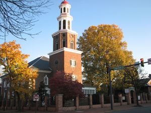
تجتذب فرجينيا السياح لوجود ميادين المواقع الحربية، والكنائس القديمة المشهورة، وبيوت المستعمرات، وغير ذلك من الأماكن التاريخية. كذلك يذهب الكثيرون إلى فرجينيا لمشاهدة المناظر الجميلة فيها. يبلغ عدد سكان الولاية 6,216,568 نسمة. وتبلغ مساحتها 105,149كم². وعاصمة ولاية فرجينيا هي مدينة ريتشموند.
. . . . . . . . . . . . . . . . . . . . . . . . . . . . . . . . . . . . . . . . . . . . . . . . . . . . . . . . . . . . . . . . . . . . . . . . . . . . . . . . . . . . . . . . . . . . . . . . . . . . . . . . . . . . . . . . . . . . . . . . . . . . . . . . . . . . . . . . . . . . . . . . . . . . . . . . . . . . . . . . . . . . . . . .
الجغرافيا
الجيولوجيا والتضاريس
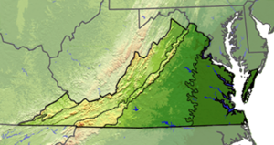
جنوب شرقي فرجينيا سهل وعر مغطى بالغابات حيث شقت المياه الجارية ممرات ضيقة في بعض الأماكن. وتوجد بالمنطقة مناجم فحم حجري كبيرة القيمة. وتمتد عدة سلاسل من الجبال من الشمال إلى الشرق. ومن الجنوب إلى الغرب على طول معظم الحدود الغربية للولاية. كما توجد في الجزء الغربي من تلك المنطقة سلسلة من وديان الأنهار.
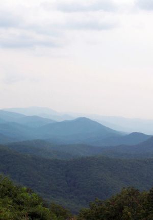
وتشكل السلسلة الزرقاء، وهي السلسلة الشرقية الرئيسية من جبال الأپلاش، حدود السلسلة ومنطقة الوادي. والواقع أن السلسلة الزرقاء هي مَعْلم رائع من معالم ولاية فرجينيا. وهناك سهل ضخم متدرج يقع إلى الشرق من سلسلة جبال الحافة الزرقاء.
يمتد السهل الساحلي في شرق فرجينيا شمالاً وجنوباً على طول المحيط الأطلسي. وكثيراً مايُسمى سهل المد، لأن مياه المد تتدفق على خلجانه وأنهاره.
الطقس
| ڤرجينيا | ||||||||||||||||||||||||||||||||||||||||||||||||||||||||||||
|---|---|---|---|---|---|---|---|---|---|---|---|---|---|---|---|---|---|---|---|---|---|---|---|---|---|---|---|---|---|---|---|---|---|---|---|---|---|---|---|---|---|---|---|---|---|---|---|---|---|---|---|---|---|---|---|---|---|---|---|---|
| جدول الطقس (التفسير) | ||||||||||||||||||||||||||||||||||||||||||||||||||||||||||||
| ||||||||||||||||||||||||||||||||||||||||||||||||||||||||||||
| ||||||||||||||||||||||||||||||||||||||||||||||||||||||||||||
. . . . . . . . . . . . . . . . . . . . . . . . . . . . . . . . . . . . . . . . . . . . . . . . . . . . . . . . . . . . . . . . . . . . . . . . . . . . . . . . . . . . . . . . . . . . . . . . . . . . . . . . . . . . . . . . . . . . . . . . . . . . . . . . . . . . . . . . . . . . . . . . . . . . . . . . . . . . . . . . . . . . . . . .
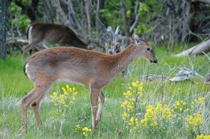
النبات والحيوان
التاريخ
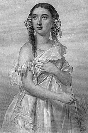

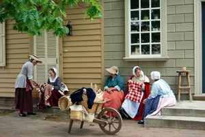
عندما استوطن المستوطنون الإنجليز في جيمستاون عام 1607، كانت القبائل الهندية من مجموعات ألجونكويان السيوان والإيروكوي تعيش في منطقة فرجينيا. وكانت أول هيئة نيابية تشريعية أمريكية قد شكلت في فرجينيا عام 1619م.
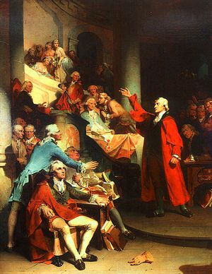
أدى قادة فرجينيا دوراً مهمًا في نضال أمريكا من أجل الاستقلال وكان توماس جيفرسون هو الذي كتب إعلان الاستقلال. وقاد جيمس ماديسون وآخرون من فرجينيا الجهد الذي أدىّ إلى وضع دستور الولايات المتحدة. كما أصبح جورج واشنطن أول رئيس للولايات المتحدة الأمريكية.
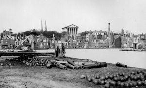
وفي سنة 1831م، قاد نات تيرنر، وهو عبد أسود ومنصر من مقاطعة ساوثامبتون ثورة عبيد شهيرة. في 17 إبريل سنة 1861م، انفصلت فرجينيا عن الولايات المتحدة. وكان روبرت إدوارد لي، من فرجينيا، هو القائد الفذ للولايات الانفصالية خلال الحرب الأهلية الأمريكية (1861-1865م). وقد عارض العديد من الغربيين في فرجينيا الانفصال. وفي سنة 1863م، كونت 48 مقاطعة من شمال غرب فرجينيا ولاية فرجينيا الغربية. وفي الخمسينيات من القرن العشرين، قاومت بعض المدارس في فرجينيا الأوامر الفيدرالية الخاصة بالاندماج، بعد نمو الصناعة وتصاعد التلوث في السبعينيات، كما بدأت جهود كبيرة لتنظيف خليج تشيسابيك خلال الثمانينيات من القرن العشرين أيضًا.
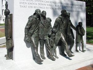
المدن والبلدات
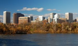
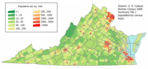
التوزيع السكاني
| التعداد تاريخياً | |||
|---|---|---|---|
| الإحصاء | التعداد | %± | |
| 1790 | 691٬737 | ||
| 1800 | 807٬557 | 16.7% | |
| 1810 | 877٬683 | 8.7% | |
| 1820 | 938٬261 | 6.9% | |
| 1830 | 1٬044٬054 | 11.3% | |
| 1840 | 1٬025٬227 | -1.8% | |
| 1850 | 1٬119٬348 | 9.2% | |
| 1860 | 1٬219٬630 | 9.0% | |
| 1870 | 1٬225٬163 | 0.5% | |
| 1880 | 1٬512٬565 | 23.5% | |
| 1890 | 1٬655٬980 | 9.5% | |
| 1900 | 1٬854٬184 | 12.0% | |
| 1910 | 2٬061٬612 | 11.2% | |
| 1920 | 2٬309٬187 | 12.0% | |
| 1930 | 2٬421٬851 | 4.9% | |
| 1940 | 2٬677٬773 | 10.6% | |
| 1950 | 3٬318٬680 | 23.9% | |
| 1960 | 3٬966٬949 | 19.5% | |
| 1970 | 4٬648٬494 | 17.2% | |
| 1980 | 5٬346٬818 | 15.0% | |
| 1990 | 6٬187٬358 | 15.7% | |
| 2000 | 7٬078٬515 | 14.4% | |
| تقديري 2008 | 7٬769٬089 | 9.8% | |
العرق (الجنس)
| |||||||||||||||||||||||||||||||||
. . . . . . . . . . . . . . . . . . . . . . . . . . . . . . . . . . . . . . . . . . . . . . . . . . . . . . . . . . . . . . . . . . . . . . . . . . . . . . . . . . . . . . . . . . . . . . . . . . . . . . . . . . . . . . . . . . . . . . . . . . . . . . . . . . . . . . . . . . . . . . . . . . . . . . . . . . . . . . . . . . . . . . . .
الديانة
| Religion (2008) | ||
|---|---|---|
| Christian[6] | 76% | |
| Baptist | 27% | |
| الكاثوليكية | 11% | |
| المثودية | 8% | |
| اللوثرية | 2% | |
| Other Christian | 28% | |
| اليهودية | 1% | |
| الإسلام | 0.5% | |
| البوذية | 1% | |
| الهندوسية | 1% | |
| Unaffiliated | 18% | |
الإقتصاد
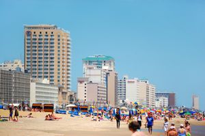
يعمل بصناعات الخدمات نحو ثلاثة أرباع عمال فرجينيا في قطاعات: الخدمات، والتعليم، والعناية الصحية الحكومية، والتجارة. وتوظف الحكومة الفيدرالية العديد من العاملين في شمال شرقي فرجينيا، وهي منطقة تقع خلف ا لعاصمة القومية الأمريكية واشنطن دي سي. وفي فرجينيا أيضًا عدة قواعد عسكرية ضخمة، وميناءان من أكثر الموانئ البحرية ازدحامًا في الولايات المتحدة، في مدينتي نورفوك ونيوبورت نيوز.
السلع الرئيسية التي تصنع في فرجينيا هي المنتجات الكيميائية والسجائر (التبغ). وتتضمن المنتجات الكيميائية المنتجات الصيدلية والألياف الصناعية. أما الأنشطة الزراعية الرئيسية فهي تربية الأبقار والدواجن. وهناك أيضًا صناعة تعدين لاستخراج الفحم الحجري في الجزء الجنوبي الشرقي من فرجينيا.
الثقافة
الفنون الجميلة والمسرحية

المهرجانات
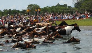
الإعلام

التعليم
الصحة
النقل
القانون والحكومة
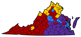
السياسة
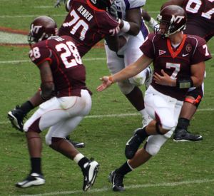
الرياضات
رموز الولاية
انظر أيضا
المصادر
- الهامش
- ^ خطأ استشهاد: وسم
<ref>غير صحيح؛ لا نص تم توفيره للمراجع المسماةfactpack - ^ خطأ استشهاد: وسم
<ref>غير صحيح؛ لا نص تم توفيره للمراجع المسماةmtrogers - ^ Bureau, US Census (April 26, 2021). "2020 Census Apportionment Results". The United States Census Bureau. Retrieved April 27, 2021.
- ^ "Median Annual Household Income". The Henry J. Kaiser Family Foundation. 2017. Retrieved March 16, 2019.
- ^ Heinemann et al. 2007, p. 3
- ^ خطأ استشهاد: وسم
<ref>غير صحيح؛ لا نص تم توفيره للمراجع المسماةaris - ^ Wood, Norm (December 28, 2008). "Bowl streak began humbly". Daily Press. Retrieved September 11, 2009.
- قائمة المراجع
- Abrams, Ann Uhry (1999). The pilgrims and Pocahontas: rival myths of American origin. Boulder, CO: Westview Press. ISBN 0-8133-3497-7.
{{cite book}}: Invalid|ref=harv(help) - Accordino, John J. (2000). Captives of the Cold War Economy. Westport, CT: Greenwood Publishing Group. ISBN 0-2759-6561-9.
{{cite book}}: Invalid|ref=harv(help) - Burnham, Bill; Burnham, Mary (2004). Hiking Virginia: A Guide to Virginia's Greatest Hiking Adventures. Guilford, CT: Globe Pequot. ISBN 0-7627-2747-0.
{{cite book}}: Invalid|ref=harv(help) - Carroll, Steven; Miller, Mark (2002). Wild Virginia: A Guide to Thirty Roadless Recreation Areas Including Shenandoah National Park. Guilford, CT: Globe Pequot. ISBN 0-7627-2315-7.
{{cite book}}: Invalid|ref=harv(help) - Chambers, Douglas B. (2005). Murder at Montpelier: Igbo Africans in Virginia. Jackson: University Press of Mississippi. ISBN 1-5780-6706-5.
{{cite book}}: Invalid|ref=harv(help) - Conlin, Joseph R. (2009). The American Past: A Survey of American History. Belmont, CA: Thomson Learning. ISBN 0-4955-6609-8.
{{cite book}}: Invalid|ref=harv(help) - Cooper, Jean L. (2007). A Guide to Historic Charlottesville and Albemarle County, Virginia. Charleston, SC: The History Press. ISBN 1-596-29173-7.
{{cite book}}: Invalid|ref=harv(help) - Dailey, Jane Elizabeth; Gilmore, Glenda Elizabeth; Simon, Bryant (2000). Jumpin' Jim Crow: Southern Politics from Civil War to Civil Rights. Princeton, NJ: Princeton University Press. ISBN 0-6910-0193-6.
{{cite book}}: Invalid|ref=harv(help) - Davis, David Brion (2006). Inhuman Bondage: The Rise and Fall of Slavery in the New World. New York: Oxford University Press. ISBN 0-1951-4073-7.
{{cite book}}: Invalid|ref=harv(help) - The Encyclopedia of Virginia. Vol. 1 (4 ed.). St. Clair Shores, MI: Somerset Publishers. 1999. ISBN 0-4030-9753-3.
- Fischer, David Hackett; Kelly, James C. (2000). Bound Away: Virginia and the Westward Movement. Charlottesville: University of Virginia Press. ISBN 0-8139-1774-3.
{{cite book}}: Invalid|ref=harv(help) - Goodwin, Bill (2008). Frommer's Virginia. Hoboken, NJ: John Wiley & Sons. ISBN 0-4701-7591-5.
{{cite book}}: Invalid|ref=harv(help) - Gordon, John Steele (2004). An Empire of Wealth: The Epic History of American Economic Power. New York: HarperCollins. ISBN 0-0600-9362-5.
{{cite book}}: Invalid|ref=harv(help) - Gray, Richard J.; Robinson, Owen (2004). A Companion to the Literature and Culture of the American South. Oxford: Wiley-Blackwell. ISBN 0-6312-2404-1.
{{cite book}}: Invalid|ref=harv(help) - Gutzman, Kevin R. C. (2007). Virginia's American Revolution: From Dominion to Republic, 1776–1840. Lanham, MD: Lexington Books. ISBN 0-7391-2131-6.
{{cite book}}: Invalid|ref=harv(help) - Hashaw, Tim (2007). The Birth of Black America. New York: Carroll & Graf Publishers. ISBN 0-7867-1718-1.
{{cite book}}: Invalid|ref=harv(help) - Heinemann, Ronald L.; Kolp, John G.; Parent, Jr., Anthony S.; Shade, William G. (2007). Old Dominion, New Commonwealth. Charlottesville: University of Virginia Press. ISBN 0-8139-2609-2.
{{cite book}}: Invalid|ref=harv(help) - Hoffer, Peter Charles (2006). The Brave New World: A History of Early America. Baltimore: JHU Press. ISBN 0-8018-8483-7.
{{cite book}}: Invalid|ref=harv(help) - Howard, Blair; Burnham, Mary; Burnham, Bill (2006). The Virginia Handbook (3 ed.). Edison, NJ: Hunter Publishing. ISBN 1-5884-3512-1.
{{cite book}}: Invalid|ref=harv(help) - Hubbard, Jr., Bill (2009). American Boundaries: The Nation, the States, the Rectangular Survey. Chicago: University of Chicago Press. ISBN 0-2263-5591-8.
{{cite book}}: Invalid|ref=harv(help) - Joseph, John Earl (2006). Language and Politics. Edinburgh: Edinburgh University Press. ISBN 0-7486-2453-8.
{{cite book}}: Invalid|ref=harv(help) - McGraw, Eliza (June 24, 2005). Two Covenants: Representations of Southern Jewishness. Baton Rouge: Louisiana State University Press. ISBN 0-8071-3043-5.
{{cite book}}: Invalid|ref=harv(help) - Miller, Kerby A.; Schrier, Arnold; Boling, Bruce D.; Doyle, David N. (2003). Irish immigrants in the land of Canaan. New York: Oxford University Press. ISBN 0-1950-4513-0.
{{cite book}}: Invalid|ref=harv(help) - Moran, Michael G. (2007). Inventing Virginia: Sir Walter Raleigh and the Rhetoric of Colonization, 1584–1590. New York: Peter Lang. ISBN 0-8204-8694-9.
{{cite book}}: Invalid|ref=harv(help) - Morgan, Lynda (1992). Emancipation in Virginia's Tobacco Belt, 1850–1870. Athens, GA: University of Georgia Press. ISBN 0-8203-1415-3.
{{cite book}}: Invalid|ref=harv(help) - Morgan, Philip D. (1998). Slave Counterpoint. Chapel Hill: University of North Carolina Press. ISBN 0-8078-4717-8.
{{cite book}}: Invalid|ref=harv(help) - Palmer, Tim (1998). America by Rivers. Washington, D.C.: Island Press. ISBN 1-5596-3264-X.
{{cite book}}: Invalid|ref=harv(help) - Olitzky, Kerry (1996). The American Synagogue. Westport, CT: Greenwood Press. ISBN 0-3132-8856-9.
{{cite book}}: Invalid|ref=harv(help) - Scott, David L.; Scott, Kay W. (2004). Guide to the National Park Areas. Guilford, CT: Globe Pequot. ISBN 0-7627-2988-0.
{{cite book}}: Invalid|ref=harv(help) - Smith, Julian (2008). Moon Virginia: Including Washington, D.C. (4 ed.). Berkeley, CA: Avalon Travel. ISBN 1-5988-0011-6.
{{cite book}}: Invalid|ref=harv(help) - Pazzaglia, Frank James (2006). Excursions in Geology and History: Field Trips in the Middle Atlantic States. Boulder, CO: Geological Society of America. ISBN 0-8137-0008-6.
{{cite book}}: Invalid|ref=harv(help) - Robertson, James I. (1993). Civil War Virginia: Battleground for a Nation. Charlottesville: University of Virginia Press. ISBN 0-8139-1457-4.
{{cite book}}: Invalid|ref=harv(help) - Stewart, George (2008). Names on the Land: A Historical Account of Place-Naming in the United States. New York: Random House. ISBN 1-5901-7273-6.
{{cite book}}: Invalid|ref=harv(help) - Vollmann, William T. (2002). Argall: The True Story of Pocahontas and Captain John Smith. New York: Penguin Group. ISBN 0-1420-0150-3.
{{cite book}}: Invalid|ref=harv(help) - Wallenstein, Peter (2007). Cradle of America: Four Centuries of Virginia History. Lawrence, KS: University Press of Kansas. ISBN 978-0-7006-1507-0.
{{cite book}}: Invalid|ref=harv(help) - Williamson, CiCi (2008). The Best of Virginia Farms Cookbook and Tour Book. Birmingham, AL: Menasha Ridge Press. ISBN 0-8973-2657-1.
{{cite book}}: Invalid|ref=harv(help)
وصلات خارجية
عامة
- ڤرجينيا at the Open Directory Project
حكومية
- State Government website
- Virginia General Assembly
- Virginia's Judicial system
- Constitution of Virginia
السياحة والترويح
- Virginia Tourism Website
- Virginia State Parks
- Virginia Main Street Communities Travel
- WikiTravel guide
الثقافة والتاريخ
خرائط وديمغرافيا
|
| سبقه نيو هامپشر |
List of U.S. states by date of statehood | تبعه نيويورك |
- Short description is different from Wikidata
- Missing redirects
- Pages using infobox settlement with possible nickname list
- Articles containing لاتينية-language text
- Pages using infobox settlement with possible motto list
- Pages using infobox settlement with no coordinates
- Articles with hatnote templates targeting a nonexistent page
- Coordinates on Wikidata
- ڤيرجينيا
- Confederate states (1861-1865)
- الولايات المتحدة الجنوبية
- مستعمرات بريطانية سابقة
- دول وأراضي تأسست في 1788
- دول وأراضي تأسست في 1607
- ولايات الولايات المتحدة الأمريكية


