ميشيغان
ولاية مشيگن | |
|---|---|
| الكنية: The Wolverine State, ولاية البحيرات العظمى, ولاية صناعة السيارات, Water-Winter Wonderland | |
| الشعار: Si quaeris peninsulam amoenam circumspice (لو كنت تبحث عن شبه جزيرة مبهجة, فانظر حولك) | |
| النشيد: "My Michigan" | |
 خريطة الولايات المتحدة، موضح فيها | |
| البلد | الولايات المتحدة |
| قبل الولائية | Michigan Territory |
| انضمت للاتحاد | January 26, 1837 (26th) |
| العاصمة | لانسنگ |
| أكبر مدينة | دترويت |
| أكبر منطقة عمرانية | مترو دترويت |
| الحكومة | |
| • الحاكم | Gretchen Whitmer (D) |
| • نائب الحاكم | Garlin Gilchrist (D) |
| المجلس التشريعي | Michigan Legislature |
| • المجلس العلوي | Senate |
| • المجلس السفلى | House of Representatives |
| القضاء | Michigan Supreme Court |
| سناتورات الولايات المتحدة | دِبي ستابـِنو (د) Gary Peters (D) |
| وفد مجلس النواب | 7 Democrats 6 Republicans 1 Libertarian (القائمة) |
| المساحة | |
| • الإجمالي | 96٬716 ميل² (250٬493 كم²) |
| ترتيب المساحة | 11th |
| الأبعاد | |
| • الطول | 456[1] mi (734 km) |
| • العرض | 386[1] mi (621 km) |
| المنسوب | 900 ft (270 m) |
| أعلى منسوب | 1٬979 ft (603 m) |
| أوطى منسوب | 571 ft (174 m) |
| التعداد (2020) | |
| • الإجمالي | 10٬077٬331[3] |
| • الترتيب | 10th |
| • الكثافة | 174/sq mi (67٫1/km2) |
| • ترتيب الكثافة | 17th |
| • الدخل الأوسط للأسرة | $54٬900[4] |
| • ترتيب الدخل | 32nd |
| صفة المواطن | Michigander, Michiganian, Yooper (for residents of the Upper Peninsula)[5] |
| اللغة | |
| • اللغة الرسمية | لا توجد (الإنگليزية, واقعياً) |
| • اللغة المحكية | English 91.11% Spanish 2.93% Arabic 1.04% Other 4.92% |
| منطقة التوقيت | |
| Most of state | UTC−05:00 (Eastern) |
| • الصيف (التوقيت الصيفي) | UTC−04:00 (EDT) |
| 4 U.P. counties (Gogebic, Iron, Dickinson, and Menominee) | UTC−06:00 (Central) |
| • Summer (DST) | UTC−05:00 (CDT) |
| اختصار البريد | MI |
| ISO 3166 code | US-MI |
| الاختصار التقليدي | Mich. |
| خط العرض | 41°41′ N to 48°18′ N |
| خط الطول | 82°7′ W to 90°25′ W |
| الموقع الإلكتروني | michigan |
| رموز حية | |
|---|---|
| الطائر | American robin (Turdus migratorius) |
| السمك | Brook trout (Salvelinus fontinalis) |
| الزهرة | Apple blossom (Malus domestica) Wildflower: Dwarf lake iris (Iris lacustris) |
| الثديي | Unofficial: Wolverine (Gulo gulo luscus) Game animal: White-tailed deer (Odocoileus virginianus) |
| الزاحف | Painted turtle (Chrysemys picta) |
| الشجرة | Eastern white pine (Pinus strobus) |
| رموز جامدة | |
| الأحفورة | Mastodon (Mammut americanum) |
| الحجر الكريم | Isle Royale greenstone |
| الصخر | Petoskey stone |
| التربة | Kalkaska sand |
| علامة طريق ولائي | |
 | |
| ربع دولار الولاية | |
 طـُرِح في 2004 | |
| قوائم رموز الولايات الأمريكية | |
مشيگـَن أو ميشيغان ( Michigan ، /ˈmɪʃɪɡən/ (![]() استمع) MISH-ig-ən) هي ولاية في منطقة البحيرات العظمى في Midwestern United States upper. في upper peninsula, it has land borders with Wisconsin to the northwest, and in the lower peninsula with Indiana and Ohio to the south; it is also connected by Lakes Superior, Michigan, Huron, and Erie to the states of Minnesota and Illinois, and the Canadian province of Ontario. With a population of nearly 10.12 million and an area of 96،716 sq mi (250،490 km2), Michigan is the 10th-largest state by population, the 11th-largest by area, and the largest by area east of the Mississippi River.[ب] Its capital is Lansing, and its largest city is Detroit. Metro Detroit is among the nation's most populous and largest metropolitan economies. Its name derives from a gallicized variant of the original Ojibwe word ᒥᓯᑲᒥ (mishigami),[ت] meaning "large water" or "large lake".[1][6]
استمع) MISH-ig-ən) هي ولاية في منطقة البحيرات العظمى في Midwestern United States upper. في upper peninsula, it has land borders with Wisconsin to the northwest, and in the lower peninsula with Indiana and Ohio to the south; it is also connected by Lakes Superior, Michigan, Huron, and Erie to the states of Minnesota and Illinois, and the Canadian province of Ontario. With a population of nearly 10.12 million and an area of 96،716 sq mi (250،490 km2), Michigan is the 10th-largest state by population, the 11th-largest by area, and the largest by area east of the Mississippi River.[ب] Its capital is Lansing, and its largest city is Detroit. Metro Detroit is among the nation's most populous and largest metropolitan economies. Its name derives from a gallicized variant of the original Ojibwe word ᒥᓯᑲᒥ (mishigami),[ت] meaning "large water" or "large lake".[1][6]
Michigan consists of two peninsulas. The Lower Peninsula resembles the shape of a mitten, and comprises a majority of the state's land area. The Upper Peninsula (often called "the U.P.") is separated from the Lower Peninsula by the Straits of Mackinac, a خمسة-ميل (8 km) channel that joins Lake Huron to Lake Michigan. The Mackinac Bridge connects the peninsulas. Michigan has the longest freshwater coastline of any political subdivision in the United States, being bordered by four of the five Great Lakes and Lake St. Clair.[7] It also has 64,980 inland lakes and ponds.[8] Michigan has the second-most water area of any state, behind only Alaska.[9]
The area was first occupied by a succession of Native American tribes over thousands of years. In the 17th century, French explorers claimed it as part of the New France colony, when it was largely inhabited by indigenous peoples. French and Canadian traders and settlers, Métis, and others migrated to the area, settling largely along the waterways. After France's defeat in the French and Indian War in 1762, the region came under British rule. Britain ceded the territory to the newly independent United States after its defeat in the American Revolutionary War.
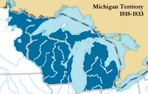
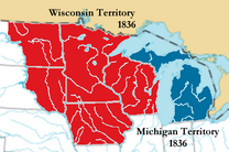
The area was part of the larger Northwest Territory until 1800, when western Michigan became part of the Indiana Territory. Michigan Territory was formed in 1805, but some of the northern border with Canada was not agreed upon until after the War of 1812. Michigan was admitted into the Union in 1837 as the 26th state, a free one. It soon became an important center of industry and trade in the Great Lakes region, attracting immigrants in the late 19th and early 20th centuries from many European countries. Immigrants from Finland, Macedonia, and the Netherlands were especially numerous.[10] Migration from Appalachia and of Black Southerners as part of the Great Migration increased in the 1930s,[11][12] with many settling in Metro Detroit.
Although Michigan has developed a diverse economy, in the early 20th century it became widely known as the center of the U.S. automotive industry, which developed as a major national economic force. It is home to the country's three major automobile companies (whose headquarters are all in Metro Detroit). Once exploited for logging and mining, today the sparsely populated Upper Peninsula is important for tourism because of its abundance of natural resources.[13][14] The Lower Peninsula is a center of manufacturing, forestry, agriculture, services, and high-tech industry.
التاريخ
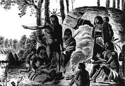
When the first European explorers arrived, the most populous tribes were the Algonquian peoples, which include the Anishinaabe groups of Ojibwe, Odaawaa/Odawa (Ottawa), and the Boodewaadamii/Bodéwadmi (Potawatomi). The three nations coexisted peacefully as part of a loose confederation called the Council of Three Fires. The Ojibwe, whose numbers are estimated to have been between 25,000 and 35,000, were the largest.
The Ojibwe Indians (also known as Chippewa in the U.S.), an Anishinaabe tribe, were established in Michigan's Upper Peninsula and northern and central Michigan. Bands also inhabited Ontario and southern Manitoba, Canada; and northern Wisconsin, and northern and north-central Minnesota. The Ottawa Indians lived primarily south of the Straits of Mackinac in northern, western, and southern Michigan, but also in southern Ontario, northern Ohio, and eastern Wisconsin. The Potawatomi were in southern and western Michigan, in addition to northern and central Indiana, northern Illinois, southern Wisconsin, and southern Ontario. Other Algonquian tribes in Michigan, in the south and east, were the Mascouten, the Menominee, the Miami, the Sac (or Sauk), and the Meskwaki (Fox). The Wyandot were an Iroquoian-speaking people in this area; they were historically known as the Huron by the French, and were the historical adversaries of the Iroquois Confederation.
القرن السابع عشر
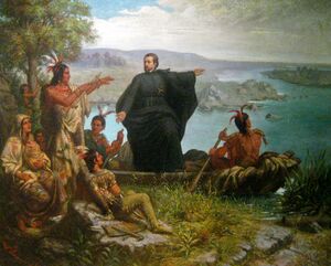
French voyageurs and coureurs des bois explored and settled in Michigan in the 17th century. The first Europeans to reach what became Michigan were those of Étienne Brûlé's expedition in 1622. The first permanent European settlement was founded in 1668 on the site where Père Jacques Marquette established Sault Ste. Marie, Michigan, as a base for Catholic missions.[15][16] Missionaries in 1671–75 founded outlying stations at Saint Ignace and Marquette. Jesuit missionaries were well received by the area's Indian populations, with few difficulties or hostilities. In 1679, Robert Cavelier, Sieur de la Salle built Fort Miami at present-day St. Joseph. In 1691, the French established a trading post and Fort St. Joseph along the St. Joseph River at the present-day city of Niles.
القرن الثامن عشر
In 1701, French explorer and army officer Antoine de la Mothe Cadillac founded Fort Pontchartrain du Détroit or "Fort Pontchartrain on-the-Strait" on the strait, known as the Detroit River, between lakes Saint Clair and Erie. Cadillac had convinced King Louis XIV's chief minister, Louis Phélypeaux, Comte de Pontchartrain, that a permanent community there would strengthen French control over the upper Great Lakes and discourage British aspirations.
The hundred soldiers and workers who accompanied Cadillac built a fort enclosing one arpent (about 0.85 acre (3،400 m2),[17][18] the equivalent of just under 200 أقدام (61 m) per side) and named it Fort Pontchartrain. Cadillac's wife, Marie Thérèse Guyon, soon moved to Detroit, becoming one of the first European women to settle in what was considered the wilderness of Michigan. The town quickly became a major fur-trading and shipping post. The Église de Saint-Anne (Catholic Church of Saint Anne) was founded the same year. While the original building does not survive, the congregation remains active. Cadillac later departed to serve as the French governor of Louisiana from 1710 to 1716. French attempts to consolidate the fur trade led to the Fox Wars, in which the Meskwaki (Fox) and their allies fought the French and their Native allies.
At the same time, the French strengthened Fort Michilimackinac at the Straits of Mackinac to better control their lucrative fur-trading empire. By the mid-18th century, the French also occupied forts at present-day Niles and Sault Ste. Marie, though most of the rest of the region remained unsettled by Europeans. France offered free land to attract families to Detroit, which grew to 800 people in 1765. It was the largest city between Montreal and New Orleans.[19] French settlers also established small farms south of the Detroit River opposite the fort, near a Jesuit mission and Huron village.
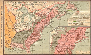
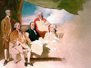
From 1660 until the end of French rule, Michigan was part of the Royal Province of New France.[ث] In 1760, Montreal fell to the British forces, ending the French and Indian War (1754–1763), the North American front of the Seven Years' War in Europe. Under the 1763 Treaty of Paris, Michigan and the rest of New France east of the Mississippi River were ceded by defeated France to Great Britain.[20] After the Quebec Act was passed in 1774, Michigan became part of the British Province of Quebec. By 1778, Detroit's population reached 2,144 and it was the third-largest city in Quebec province.[21]
During the American Revolutionary War, Detroit was an important British supply center. Most of the inhabitants were French-Canadians or American Indians, many of whom had been allied with the French because of long trading ties. Because of imprecise cartography and unclear language defining the boundaries in the 1783 Treaty of Paris, the British retained control of Detroit and Michigan after the American Revolution. When Quebec split into Lower and Upper Canada in 1791, Michigan was part of Kent County, Upper Canada. It held its first democratic elections in August 1792 to send delegates to the new provincial parliament at Newark (now Niagara-on-the-Lake).[22]
Under terms negotiated in the 1794 Jay Treaty, Britain withdrew from Detroit and Michilimackinac in 1796. It retained control of territory east and south of the Detroit River, which are now included in Ontario, Canada. Questions remained over the boundary for many years, and the United States did not have uncontested control of the Upper Peninsula and Drummond Island until 1818 and 1847, respectively.
القرن 19
During the War of 1812, the United States forces at Fort Detroit surrendered Michigan Territory (effectively consisting of Detroit and the surrounding area) after a nearly bloodless siege in 1812. A U.S. attempt to retake Detroit resulted in a severe American defeat in the River Raisin Massacre. This battle, still ranked as the bloodiest ever fought in the state, had the highest number of American casualties of any battle of the war.
Michigan was recaptured by the Americans in 1813 after the Battle of Lake Erie. They used Michigan as a base to launch an invasion of Canada, which culminated in the Battle of the Thames. But the more northern areas of Michigan were held by the British until the peace treaty restored the old boundaries. A number of forts, including Fort Wayne, were built by the United States in Michigan during the 19th century out of fears of renewed fighting with Britain.
Michigan Territory governor and judges established the University of Michigan in 1817, as the Catholepistemiad, or the University of Michigania.
The population grew slowly until the opening in 1825 of the Erie Canal through the Mohawk Valley in New York, connecting the Great Lakes to the Hudson River and New York City. The new route attracted a large influx of settlers to the Michigan territory. They worked as farmers, lumbermen, shipbuilders, and merchants and shipped out grain, lumber, and iron ore. By the 1830s, Michigan had 80,000 residents, more than enough to apply and qualify for statehood.
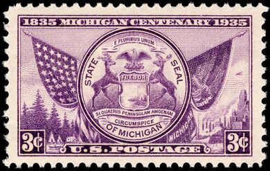
On November 1, 1935, the U.S. Post Office issued a commemorative 3-cent stamp celebrating the 100th anniversary of Michigan statehood. Michigan's statehood, however, wasn't officially established until January 26, 1837, but since the campaign for statehood actually began in 1835, Michigan chose to hold its centennial celebration in 1935, the year the stamp was first issued.[23]
A constitutional convention of assent was held to lead the territory to statehood.[24] In October 1835 the people approved the constitution of 1835, thereby forming a state government. Congressional recognition was delayed pending resolution of a boundary dispute with Ohio known as the Toledo War. Congress awarded the "Toledo Strip" to Ohio. Michigan received the western part of the Upper Peninsula as a concession and formally entered the Union as a free state on January 26, 1837. The Upper Peninsula proved to be a rich source of lumber, iron, and copper. Michigan led the nation in lumber production from the 1850s to the 1880s. Railroads became a major engine of growth from the 1850s onward, with Detroit the chief hub.
A second wave of French-Canadian immigrants settled in Michigan during the late 19th to early 20th century, working in lumbering areas in counties on the Lake Huron side of the Lower Peninsula, such as the Saginaw Valley, Alpena, and Cheboygan counties, as well as throughout the Upper Peninsula, with large concentrations in Escanaba and the Keweenaw Peninsula.[25] This was also a period of development of the gypsum industry in Alabaster, Michigan, which became nationally prominent.
The first statewide meeting of the Republican Party took place on July 6, 1854, in Jackson, Michigan, where the party adopted its platform. The state was predominantly Republican until the 1930s, reflecting the political continuity of migrants from across the Northern Tier of New England and New York. Michigan made a significant contribution to the Union in the American Civil War and sent more than forty regiments of volunteers to the federal armies.
Michigan modernized and expanded its system of education in this period. The Michigan State Normal School, now Eastern Michigan University, was founded in 1849, for the training of teachers. It was the fourth oldest normal school in the United States and the first U.S. normal school outside New England. In 1899, the Michigan State Normal School became the first normal school in the nation to offer a four-year curriculum. Michigan Agricultural College (1855), now Michigan State University in East Lansing, was founded as the first agricultural college in the nation. Many private colleges were founded as well, and the smaller cities established high schools late in the century.[26]
ومع نهاية الأربعينيات من القرن التاسع عشر، ازدهرت أعمال التعدين في الولاية. وحُفرت قناة سو وانتهى العمل فيها، وتم افتتاحها عام 1855م؛ نظرًا للحاجة الشديدة إلى شحن قضبان الحديد. وأصبح إنتاج الخشب مهمًا في ميتشيجان بعد الحرب الأهلية (1861 – 1865م). وزاد عدد السكان في الفترة ما بين عامي 1870 – 1900م إلى أكثر من الضعفين.
القرنان 20 و 21
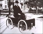
Michigan's economy underwent a transformation at the turn of the 20th century. Many individuals, including Ransom E. Olds, John and Horace Dodge, Henry Leland, David Dunbar Buick, Henry Joy, Charles King, and Henry Ford, provided the concentration of engineering know-how and technological enthusiasm to develop the automotive industry.[27] Ford's development of the moving assembly line in Highland Park marked a new era in transportation. Like the steamship and railroad, mass production of automobiles was a far-reaching development. More than the forms of public transportation, the affordable automobile transformed private life. Automobile production became the major industry of Detroit and Michigan, and permanently altered the socioeconomic life of the United States and much of the world.
وقامت المصانع في ميتشيجان ببناء العديد من الصناعات الحربية وذلك بعد أن دخلت الولايات المتحدة الأمريكية الحرب العالمية الأولى عام 1917م. وتحولت صناعات السيارات كلها في الولاية إلى الإنتاج الحربي خلال الحرب العالمية الثانية (1939 – 1945). وقد أدَّى الكساد الذي طال الولايات المتحدة بأكملها خلال السبعينيات والثمانينيات إلى هبوط كبير في صناعة السيارات. وفي منتصف الثمانينيات، أدَّى التحسن في مبيعات السيارات إلى انخفاض البطالة في الولاية.
With the growth, the auto industry created jobs in Detroit that attracted immigrants from Europe and migrants from across the United States, including both blacks and whites from the rural South. By 1920, Detroit was the fourth-largest city in the U.S. residential housing was in short supply, and it took years for the market to catch up with the population boom. By the 1930s, so many immigrants had arrived that more than 30 languages were spoken in the public schools, and ethnic communities celebrated in annual heritage festivals.[28] Over the years immigrants and migrants contributed greatly to Detroit's diverse urban culture, including popular music trends. The influential Motown Sound of the 1960s was led by a variety of individual singers and groups.
Grand Rapids, the second-largest city in Michigan, also became also an important center of manufacturing. Since 1838, the city has been noted for its furniture industry.[29][30] In the 21st century, it is home to five of the world's leading office furniture companies. Grand Rapids is home to a number of major companies including Steelcase, Amway, and Meijer. Grand Rapids is also an important center for GE Aviation Systems.
Michigan held its first United States presidential primary election in 1910. With its rapid growth in industry, it was an important center of industry-wide union organizing, such as the rise of the United Auto Workers.
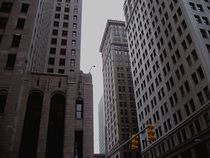
In 1920 WWJ (AM) in Detroit became the first radio station in the United States to regularly broadcast commercial programs. Throughout that decade, some of the country's largest and most ornate skyscrapers were built in the city. Particularly noteworthy are the Fisher Building, Cadillac Place, and the Guardian Building, each of which has been designated as a National Historic Landmark (NHL).
In 1927 a school bombing took place in Clinton County. The Bath School disaster, perpetrated by an adult man, resulted in the deaths of 38 schoolchildren and constitutes the deadliest mass murder in a school in U.S. history.[31]
Michigan converted much of its manufacturing to satisfy defense needs during World War II; it manufactured 10.9% of the United States military armaments produced during the war, ranking second (behind New York) among the 48 states.[32]
Detroit continued to expand through the 1950s, at one point doubling its population in a decade. After World War II, housing was developed in suburban areas outside city cores to meet demand for residences. The federal government subsidized the construction of interstate highways, which were intended to strengthen military access, but also allowed commuters and business traffic to travel the region more easily. Since 1960, modern advances in the auto industry have led to increased automation, high-tech industry, and increased suburban growth.
Michigan became the leading auto-producing state in the U.S., with the industry primarily located throughout the Midwestern United States; Ontario, Canada; and the Southern United States.[33] With almost ten million residents in 2010, Michigan is a large and influential state, ranking tenth in population among the fifty states. Detroit is the centrally located metropolitan area of the Great Lakes megalopolis and the second-largest metropolitan area in the U.S. (after Chicago) linking the Great Lakes system.
The Metro Detroit area in Southeast Michigan is the state's largest metropolitan area (roughly 50% of the population resides there) and the eleventh largest in the United States. The Grand Rapids metropolitan area in Western Michigan is the state's fastest-growing metro area, with more than 1.3 million residents اعتبارا من 2006[تحديث].
الجغرافيا
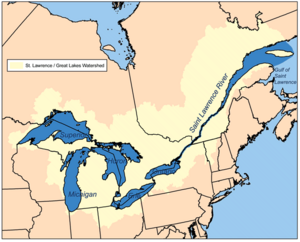
تضم ولاية ميتشيجان إقليمين بريين رئيسيين؛ البر العلوي وسهول البحيرات العظمى. ويمتد البر العلوي على طول بحيرة سوبيريور، ويغطّي النصف الغربي من شبه الجزيرة العلوية. ومعظم أرض هذا الإقليم وعرة. وتضم أعلى هضاب في ميتشيجان.
وتُعدُّ سهول البحيرات العظمى جزءًا من إقليم الغرب الأوسط الذي يُسمى السهول الداخلية. ويغطي الإقليم في ميتشيجان، الجزء الشرقي من شبه الجزيرة العلوية، وكل شبه الجزيرة السفلية. وفي شبه الجزيرة العلوية توجد أجزاء منخفضة من السهول مغطاة بالمستنقعات. وجزءٌ كبير من شبه الجزيرة السفلية يغلب عليه الاستواء بشكل عام. ويوجد كثير من الجروف والكثبان الرملية عند حدود بحيرة ميتشيجان. ويحتوي النصف الجنوبي من شبه الجزيرة السفلية على مساحات كبيرة من الأراضي الزراعية الخصبة.
Michigan consists of two peninsulas separated by the Straits of Mackinac. The 45th parallel north runs through the state, marked by highway signs and the Polar-Equator Trail—[34] along a line including Mission Point Light near Traverse City, the towns of Gaylord and Alpena in the Lower Peninsula and Menominee in the Upper Peninsula. With the exception of two tiny areas drained by the Mississippi River by way of the Wisconsin River in the Upper Peninsula and by way of the Kankakee-Illinois River in the Lower Peninsula, Michigan is drained by the Great Lakes-St. Lawrence watershed and is the only state with the majority of its land thus drained. No point in the state is more than ستة ميل (9.7 km) from a natural water source or more than 85 ميل (137 km) from a Great Lakes shoreline.[35]
The Great Lakes that border Michigan from east to west are Lake Erie, Lake Huron, Lake Michigan and Lake Superior. The state is bounded on the south by the states of Ohio and Indiana, sharing land and water boundaries with both. Michigan's western boundaries are almost entirely water boundaries, from south to north, with Illinois and Wisconsin in Lake Michigan; then a land boundary with Wisconsin and the Upper Peninsula, that is principally demarcated by the Menominee and Montreal Rivers; then water boundaries again, in Lake Superior, with Wisconsin and Minnesota to the west, capped around by the Canadian province of Ontario to the north and east.
The heavily forested Upper Peninsula is relatively mountainous in the west. The Porcupine Mountains, which are part of one of the oldest mountain chains in the world,[36] rise to an altitude of almost 2،000 أقدام (610 m) above sea level and form the watershed between the streams flowing into Lake Superior and Lake Michigan. The surface on either side of this range is rugged. The state's highest point, in the Huron Mountains northwest of Marquette, is Mount Arvon at 1،979 أقدام (603 m). The peninsula is as large as Connecticut, Delaware, Massachusetts, and Rhode Island combined but has fewer than 330,000 inhabitants. They are sometimes called "Yoopers" (from "U.P.'ers"), and their speech (the "Yooper dialect") has been heavily influenced by the numerous Scandinavian and Canadian immigrants who settled the area during the lumbering and mining boom of the late 19th century.
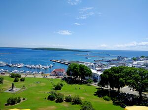
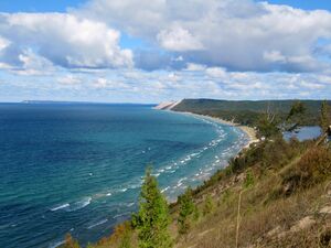
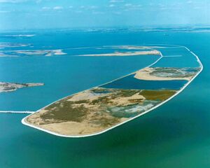
The Lower Peninsula is shaped like a mitten and many residents hold up a hand to depict where they are from.[37] It is 277 ميل (446 km) long from north to south and 195 ميل (314 km) from east to west and occupies nearly two-thirds of the state's land area. The surface of the peninsula is generally level, broken by conical hills and glacial moraines usually not more than a few hundred feet tall. It is divided by a low water divide running north and south. The larger portion of the state is on the west of this and gradually slopes toward Lake Michigan. The highest point in the Lower Peninsula is either Briar Hill at 1،705 أقدام (520 m), or one of several points nearby in the vicinity of Cadillac. The lowest point is the surface of Lake Erie at 571 أقدام (174 m).
The geographic orientation of Michigan's peninsulas makes for a long distance between the ends of the state. Ironwood, in the far western Upper Peninsula, lies 630 ميل (1،010 كيلومتر) by highway from Lambertville in the Lower Peninsula's southeastern corner. The geographic isolation of the Upper Peninsula from Michigan's political and population centers makes the region culturally and economically distinct. Frequent attempts to establish the Upper Peninsula as its own state have failed to gain traction.[38][39]
A feature of Michigan that gives it the distinct shape of a mitten is the Thumb. This peninsula projects out into Lake Huron and the Saginaw Bay. The geography of the Thumb is mainly flat with a few rolling hills. Other peninsulas of Michigan include the Keweenaw Peninsula, making up the Copper Country region of the state. The Leelanau Peninsula lies in the Northern Lower Michigan region. See Also Michigan Regions
Numerous lakes and marshes mark both peninsulas, and the coast is much indented. Keweenaw Bay, Whitefish Bay, and the Big and Little Bays De Noc are the principal indentations on the Upper Peninsula. The Grand and Little Traverse, Thunder, and Saginaw bays indent the Lower Peninsula. Michigan has the second longest shoreline of any state—3،288 ميل (5،292 km),[40] including 1،056 ميل (1،699 km) of island shoreline.[41]
The state has numerous large islands, the principal ones being the North Manitou and South Manitou, Beaver, and Fox groups in Lake Michigan; Isle Royale and Grande Isle in Lake Superior; Marquette, Bois Blanc, and Mackinac islands in Lake Huron; and Neebish, Sugar, and Drummond islands in St. Mary's River. Michigan has about 150 lighthouses, the most of any U.S. state.[42] The first lighthouses in Michigan were built between 1818 and 1822. They were built to project light at night and to serve as a landmark during the day to safely guide the passenger ships and freighters traveling the Great Lakes (see: lighthouses in the United States).
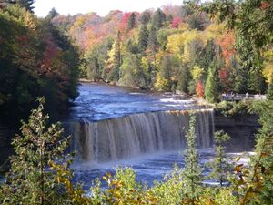
The state's rivers are generally small, short and shallow, and few are navigable. The principal ones include the Detroit River, St. Marys River, and St. Clair River which connect the Great Lakes; the Au Sable, Cheboygan, and Saginaw, which flow into Lake Huron; the Ontonagon, and Tahquamenon, which flow into Lake Superior; and the St. Joseph, Kalamazoo, Grand, Muskegon, Manistee, and Escanaba, which flow into Lake Michigan. The state has 11,037 inland lakes—totaling 1،305 ميل مربع (3،380 km2) of inland water—in addition to 38،575 ميل مربع (99،910 km2) of Great Lakes waters. No point in Michigan is more than ستة ميل (9.7 km) from an inland lake or more than 85 ميل (137 km) from one of the Great Lakes.[43]
The state is home to several areas maintained by the National Park Service including: Isle Royale National Park, in Lake Superior, about 30 ميل (48 km) southeast of Thunder Bay, Ontario. Other national protected areas in the state include: Keweenaw National Historical Park, Pictured Rocks National Lakeshore, Sleeping Bear Dunes National Lakeshore, Huron National Forest, Manistee National Forest, Hiawatha National Forest, Ottawa National Forest and Father Marquette National Memorial. The largest section of the North Country National Scenic Trail passes through Michigan.
With 78 state parks, 19 state recreation areas, and six state forests, Michigan has the largest state park and state forest system of any state.
المناخ
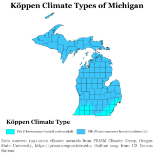
Michigan has a continental climate, although there are two distinct regions. The southern and central parts of the Lower Peninsula (south of Saginaw Bay and from the Grand Rapids area southward) have a warmer climate (Köppen climate classification Dfa) with hot summers and cold winters. The northern part of Lower Peninsula and the entire Upper Peninsula has a more severe climate (Köppen Dfb), with warm, but shorter summers and longer, cold to very cold winters. Some parts of the state average high temperatures below freezing from December through February, and into early March in the far northern parts. During the winter through the middle of February, the state is frequently subjected to heavy lake-effect snow. The state averages from 30 إلى 40 بوصات (76 إلى 102 cm) of precipitation annually; however, some areas in the northern lower peninsula and the upper peninsula average almost 160 بوصات (4،100 mm) of snowfall per year.[44] Michigan's highest recorded temperature is 112 °F (44 °C) at Mio on July 13, 1936, and the coldest recorded temperature is −51 °F (−46 °C) at Vanderbilt on February 9, 1934.[45]
The state averages 30 days of thunderstorm activity per year. These can be severe, especially in the southern part of the state. The state averages 17 tornadoes per year, which are more common in the state's extreme southern section. Portions of the southern border have been almost as vulnerable historically as states further west and in Tornado Alley. For this reason, many communities in the very southern portions of the state have tornado sirens to warn residents of approaching tornadoes. Farther north, in Central Michigan, Northern Michigan, and the Upper Peninsula, tornadoes are rare.[46][47]
الجيولوجيا
The geological formation of the state is greatly varied, with the Michigan Basin being the most major formation. Primary boulders are found over the entire surface of the Upper Peninsula (being principally of primitive origin), while Secondary deposits cover the entire Lower Peninsula. The Upper Peninsula exhibits Lower Silurian sandstones, limestones, copper and iron bearing rocks, corresponding to the Huronian system of Canada. The central portion of the Lower Peninsula contains coal measures and rocks of the Pennsylvanian period. Devonian and sub-Carboniferous deposits are scattered over the entire state.
Michigan rarely experiences earthquakes, and those that it does experience are generally smaller ones that do not cause significant damage. A 4.6-magnitude earthquake struck in August 1947. More recently, a 4.2-magnitude earthquake occurred on Saturday, May 2, 2015, shortly after noon, about five miles south of Galesburg, Michigan (9 miles southeast of Kalamazoo) in central Michigan, about 140 miles west of Detroit, according to the Colorado-based U.S. Geological Survey's National Earthquake Information Center. No major damage or injuries were reported, according to then-Governor Rick Snyder's office.[48]
التقسيمات الإدارية
State government is decentralized among three tiers—statewide, county and township. Counties are administrative divisions of the state, and townships are administrative divisions of a county. Both of them exercise state government authority, localized to meet the particular needs of their jurisdictions, as provided by state law. There are 83 counties in Michigan.[49]
Cities, state universities, and villages are vested with home rule powers of varying degrees. Home rule cities can generally do anything not prohibited by law. The fifteen state universities have broad power and can do anything within the parameters of their status as educational institutions that is not prohibited by the state constitution. Villages, by contrast, have limited home rule and are not completely autonomous from the county and township in which they are located.
There are two types of township in Michigan: general law township and charter. Charter township status was created by the Legislature in 1947 and grants additional powers and stream-lined administration in order to provide greater protection against annexation by a city. اعتبارا من أبريل 2001[تحديث], there were 127 charter townships in Michigan. In general, charter townships have many of the same powers as a city but without the same level of obligations. For example, a charter township can have its own fire department, water and sewer department, police department, and so on—just like a city—but it is not required to have those things, whereas cities must provide those services. Charter townships can opt to use county-wide services instead, such as deputies from the county sheriff's office instead of a home-based force of ordinance officers.
| الترتيب | County | التعداد | |||||||
|---|---|---|---|---|---|---|---|---|---|
 Detroit Grand Rapids |
1 | Detroit | Wayne | 639,111 |  Warren  Sterling Heights | ||||
| 2 | Grand Rapids | Kent | 198,917 | ||||||
| 3 | Warren | Macomb | 139,387 | ||||||
| 4 | Sterling Heights | Macomb | 134,346 | ||||||
| 5 | Ann Arbor | Washtenaw | 123,851 | ||||||
| 6 | Lansing | Ingham | 112,644 | ||||||
| 7 | Dearborn | Wayne | 109,976 | ||||||
| 8 | Clinton Charter Township | Macomb | 100,513 | ||||||
| 9 | Canton Charter Township | Wayne | 98,659 | ||||||
| 10 | Livonia | Wayne | 95,535 | ||||||
أهم المدن
- ديترويت: عاصمة صناعة السيارات في العالم، حيث تنتج حوالي 9 مليون سيارة في العام، حيث يتمركز حولها شركات جنرال موتورز وفورد وكرايسلر.
- هولاند، متشيجان: عاصمة صناعة أثاث المكاتب في العالم، حيث يتمركز فيها شركتا ستيلكيس Steelcase و هاورث.
- ديربورن: مقر شركة فورد وصاحبة أكبر جالية عربية بالولايات المتحدة.
السكان
| التعداد | Pop. | ملاحظة | %± |
|---|---|---|---|
| 1800 | 3٬757 | — | |
| 1810 | 4٬762 | 26٫8% | |
| 1820 | 7٬452 | 56٫5% | |
| 1830 | 28٬004 | 275٫8% | |
| 1840 | 212٬267 | 658�0% | |
| 1850 | 397٬654 | 87٫3% | |
| 1860 | 749٬113 | 88٫4% | |
| 1870 | 1٬184٬059 | 58٫1% | |
| 1880 | 1٬636٬937 | 38٫2% | |
| 1890 | 2٬093٬890 | 27٫9% | |
| 1900 | 2٬420٬982 | 15٫6% | |
| 1910 | 2٬810٬173 | 16٫1% | |
| 1920 | 3٬668٬412 | 30٫5% | |
| 1930 | 4٬842٬325 | 32�0% | |
| 1940 | 5٬256٬106 | 8٫5% | |
| 1950 | 6٬371٬766 | 21٫2% | |
| 1960 | 7٬823٬194 | 22٫8% | |
| 1970 | 8٬875٬083 | 13٫4% | |
| 1980 | 9٬262٬078 | 4٫4% | |
| 1990 | 9٬295٬297 | 0٫4% | |
| 2000 | 9٬938٬444 | 6٫9% | |
| 2010 | 9٬883٬640 | −0٫6% | |
| 2020 | 10٬077٬331 | 2�0% | |
| 2023 (تق.) | 10٬037٬261 | −0٫4% | |
| Sources: 1910–2020[51]
2022[52] | |||
Since 1800 U.S. census, Michigan has experienced relatively positive and stable population growth trends; beginning with a population of 3,757, the 2010 census recorded 9,883,635 residents. At the 2020 United States census, its population was 10,077,331, an increase of 2.03% since 2010's tabulation. According to the United States Census Bureau, it is the third-most populous state in the Midwest and its East North Central subregion, behind Ohio and Illinois.
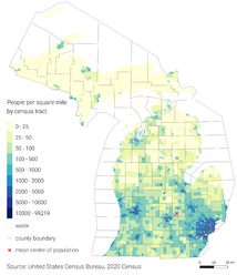
The center of population of Michigan is in Shiawassee County, in the southeastern corner of the civil township of Bennington, which is northwest of the village of Morrice.[53]
According to the American Immigration Council in 2019, an estimated 6.8% of Michiganders were immigrants, while 3.8% were native-born U.S. citizens with at least one immigrant parent.[54] Numbering approximately 678,255 according to the 2019 survey, the majority of Michigander immigrants came from Mexico (11.5%), India (11.3%), Iraq (7.5%), China (5.3%), and Canada (5.3%); the primary occupations of its immigrants were technology, agriculture, and healthcare. Among its immigrant cohort, there were 108,105 undocumented immigrants, making up 15.9% of the total immigrant population.[54]
According to HUD's 2022 Annual Homeless Assessment Report, there were an estimated 8,206 homeless people in Michigan.[55][56]
الأعراق
| Self-identified race | 1970[57] | 1990[57] | 2000[58] | 2010[59] | 2020[60] |
|---|---|---|---|---|---|
| White American | 88.3% | 83.4% | 80.1% | 78.9% | 73.9% |
| Black or African American | 11.2% | 13.9% | 14.2% | 14.2% | 13.7% |
| Asian American | 0.2% | 1.1% | 1.8% | 2.4% | 3.3% |
| American Indian | 0.2% | 0.6% | 0.6% | 0.6% | 0.6% |
| Native Hawaiian and other Pacific Islander |
— | — | — | — | — |
| Other race | 0.2% | 0.9% | 1.3% | 1.5% | 2.2% |
| Two or more races | — | — | 1.9% | 2.3% | 6.3% |
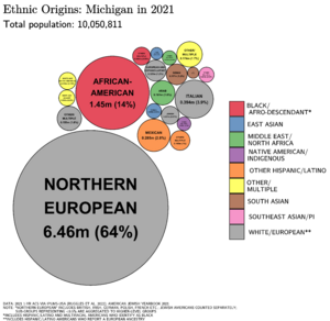
Since colonial European and American settlement, the majority of Michigan's population has been predominantly non-Hispanic or non-Latino white; Americans of European descent live throughout every county in the state, and most of Metro Detroit. Large European American groups include those of German, British, Irish, Polish and Belgian ancestry.[61] Scandinavian and Finnish Americans have a notable presence in the Upper Peninsula.[62] Western Michigan is known for its Dutch heritage, especially in Holland and metropolitan Grand Rapids.[63]
Black and African Americans—coming to Detroit and other northern cities in the Great Migration of the early 20th century—have formed a majority of the population in Detroit and other cities including Flint and Benton Harbor. Since the 2021 census estimates—while Detroit was still the largest city in Michigan with a majority black population—it was no longer the largest black-majority city in the U.S., citing crime and higher-paying jobs given to whites.[64][65]
اعتبارا من 2007[تحديث], about 300,000 people in Southeastern Michigan trace their descent from the Middle East and Asia.[66] Dearborn has a sizeable Arab American community, with many Assyrian/Chaldean/Syriac, and Lebanese who immigrated for jobs in the auto industry in the 1920s, along with more recent Yemenis and Iraqis.[67] اعتبارا من 2007[تحديث], almost 8,000 Hmong people lived in the state of Michigan, about double their 1999 presence in the state.[68] Most lived in northeastern Detroit, but they had been increasingly moving to Pontiac and Warren.[69] By 2015, the number of Hmong in the Detroit city limits had significantly declined.[70] Lansing hosts a statewide Hmong New Year Festival.[69] The Hmong community also had a prominent portrayal in the 2008 film Gran Torino, which was set in Detroit.
اعتبارا من 2015[تحديث], 80% of Michigan's Japanese population lived in the counties of Macomb, Oakland, Washtenaw, and Wayne in the Detroit and Ann Arbor areas.[71] اعتبارا من أبريل 2013[تحديث], the largest Japanese national population is in Novi, with 2,666 Japanese residents, and the next largest populations are respectively in Ann Arbor, West Bloomfield Township, Farmington Hills, and Battle Creek. The state has 481 Japanese employment facilities providing 35,554 local jobs. 391 of them are in Southeast Michigan, providing 20,816 jobs, and the 90 in other regions in the state provide 14,738 jobs. The Japanese Direct Investment Survey of the Consulate-General of Japan, Detroit stated more than 2,208 additional Japanese residents were employed in the State of Michigan اعتبارا من 1 أكتوبر 2012[تحديث], than in 2011.[72] During the 1990s, the Japanese population of Michigan experienced an increase, and many Japanese people with children moved to particular areas for their proximity to Japanese grocery stores and high-performing schools.[71]
اللغات
In 2010, about 91.11% (8,507,947) of Michigan residents age five and older spoke only English at home, while 2.93% (273,981) spoke Spanish, 1.04% (97,559) Arabic, 0.44% (41,189) German, 0.36% (33,648) Chinese (which includes Mandarin), 0.31% (28,891) French, 0.29% (27,019) Polish, and Syriac languages (such as Modern Aramaic and Northeastern Neo-Aramaic) was spoken as a main language by 0.25% (23,420) of the population over the age of five. In total, 8.89% (830,281) of Michigan's population age five and older spoke a mother language other than English.[73] Since 2021, 90.1% of residents aged five and older spoke only English at home, and Spanish was the second-most spoken language with 2.9% of the population speaking it.[74]
الدين
Religious self-identification, per Public Religion Research Institute's 2021 American Values Survey[75]
Historically, several Native American religions have been practiced in the present-day state of Michigan. Following British and French colonization of the region surrounding Michigan, Christianity became the dominant religion, with Roman Catholicism historically being the largest single Christian group for the state. Until the 19th century, the Roman Catholic Church was the only organized religious group in Michigan, reflecting the territory's French colonial roots. Detroit's St. Anne's parish, established in 1701 by Antoine de la Mothe Cadillac, is the second-oldest Roman Catholic parish in the United States.[76] On March 8, 1833, the Holy See formally established a diocese in the Michigan territory, which included all of Michigan, Wisconsin, Minnesota, and the Dakotas east of the Mississippi River. When Michigan became a state in 1837, the boundary of the Roman Catholic Diocese of Detroit was redrawn to coincide with that of the state; the other dioceses were later carved out from the Detroit Diocese but remain part of the Ecclesiastical Province of Detroit.[77]
According to the Association of Religion Data Archives in 2020, there were 1,492,732 adherents of Roman Catholicism.[78] Additionally, there's also a significant Independent Catholic presence centered in Metro Detroit. As of 2016, the most notable Independent Catholic jurisdiction is the Ecumenical Catholic Church of Christ established by Archbishop Karl Rodig; the see of this church operates in a former Roman Catholic parish church.[79][80][81]
With the introduction of Protestantism to the state, it began to form the largest collective Christian group. In 2010, the Association of Religion Data Archives reported the largest Protestant denomination was the United Methodist Church with 228,521 adherents;[82] followed by the Lutheran Church–Missouri Synod with 219,618, and the Evangelical Lutheran Church in America with 120,598 adherents. The Christian Reformed Church in North America had almost 100,000 members and more than 230 congregations in Michigan.[83] The Reformed Church in America had 76,000 members and 154 congregations in the state.[84] By the 2020 study, non- and inter-denominational Protestant churches formed the largest Protestant group in Michigan, numbering 508,904. The Lutheran Church–Missouri Synod grew to become the second-largest single Christian denomination, and United Methodists declined to being the third-largest. The Lutheran Protestant tradition was introduced by German and Scandinavian immigrants. Altogether, Baptists numbered 321,581 between the National Missionary Baptists, National Baptists, American Baptists, Southern Baptists, National Baptists of America, Progressive National Baptists, and Full Gospel Baptists; black Baptists formed the largest constituency.[78] In West Michigan, Dutch immigrants fled from the specter of religious persecution and famine in the Netherlands around 1850 and settled in and around what is now Holland, Michigan, establishing a "colony" on American soil that fervently held onto Calvinist doctrine that established a significant presence of Reformed churches.[85]
In the same 2010 survey, Jewish adherents in the state of Michigan were estimated at 44,382, and Muslims at 120,351.[86] The first Jewish synagogue in the state was Temple Beth El, founded by twelve German Jewish families in Detroit in 1850.[87] Islam was introduced by immigrants from the Near East during the 20th century.[88] Michigan is home to the largest mosque in North America, the Islamic Center of America in Dearborn. Battle Creek, Michigan, is also the birthplace of the Seventh-day Adventist Church, which was founded on May 21, 1863.[89][90]
الاقتصاد
قالب:Publicly traded companies in Michigan
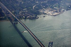
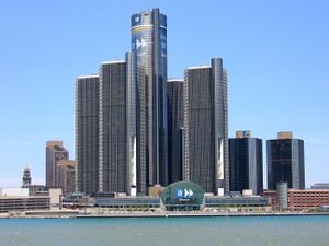
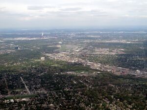
In 2017, 3,859,949 people in Michigan were employed at 222,553 establishments, according to the U.S. Census Bureau.[91]
The U.S. Bureau of Economic Analysis estimated Michigan's Q1 2023 gross state product to be $645.293 billion, ranking 14th out of the 50 states.[92] According to the U.S. Bureau of Labor Statistics, اعتبارا من أغسطس 2023[تحديث], the state's seasonally adjusted unemployment rate was estimated at 3.7%.[93]
Products and services include automobiles, food products, information technology, aerospace, military equipment, furniture, and mining of copper and iron ore.[كمية] Michigan is the third-largest grower of Christmas trees with 60،520 acre (245 km2) of land dedicated to Christmas tree farming in 2007.[94][95] The beverage Vernors Ginger Ale was invented in Michigan in 1866, sharing the title of oldest soft drink with Hires Root Beer. Faygo was founded in Detroit on November 4, 1907. Two of the top four pizza chains were founded in Michigan and are headquartered there: Domino's Pizza by Tom Monaghan and Little Caesars Pizza by Mike Ilitch. Michigan became the 24th right-to-work state in the U.S. in 2012, however, in 2023 this law was repealed.[96]
Since 2009, GM, Ford and Chrysler have managed a significant reorganization of their benefit funds structure after a volatile stock market which followed the September 11 attacks and early 2000s recession impacted their respective U.S. pension and benefit funds (OPEB).[97] General Motors, Ford, and Chrysler reached agreements with the United Auto Workers Union to transfer the liabilities for their respective health care and benefit funds to a 501(c)(9) Voluntary Employee Beneficiary Association (VEBA). Manufacturing in the state grew 6.6% from 2001 to 2006,[98] but the high speculative price of oil became a factor for the U.S. auto industry during the economic crisis of 2008 impacting industry revenues. In 2009, GM and Chrysler emerged from Chapter 11 restructurings with financing provided in part by the U.S. and Canadian governments.[99][100] GM began its initial public offering (IPO) of stock in 2010.[101] For 2010, the Big Three domestic automakers have reported significant profits indicating the beginning of rebound.[102][103][104][105]
اعتبارا من 2002[تحديث], Michigan ranked fourth in the U.S. in high-tech employment with 568,000 high-tech workers, which includes 70,000 in the automotive industry.[106] Michigan typically ranks third or fourth in overall research and development (R&D) expenditures in the United States.[107][108] Its research and development, which includes automotive, comprises a higher percentage of the state's overall gross domestic product than for any other U.S. state.[109] The state is an important source of engineering job opportunities. The domestic auto industry accounts directly and indirectly for one of every ten jobs in the U.S.[110]
Michigan was second in the U.S. in 2004 for new corporate facilities and expansions. From 1997 to 2004, Michigan was the only state to top the 10,000 mark for the number of major new developments;[33][111] however, the effects of the late 2000s recession have slowed the state's economy. In 2008, Michigan placed third in a site selection survey among the states for luring new business which measured capital investment and new job creation per one million population.[112] In August 2009, Michigan and Detroit's auto industry received $1.36 B in grants from the U.S. Department of Energy for the manufacture of electric vehicle technologies which is expected to generate 6,800 immediate jobs and employ 40,000 in the state by 2020.[113] From 2007 to 2009, Michigan ranked 3rd in the U.S. for new corporate facilities and expansions.[114][115]
As leading research institutions, the University of Michigan, Michigan State University, and Wayne State University are important partners in the state's economy and its University Research Corridor.[116] Michigan's public universities attract more than $1.5 B in research and development grants each year.[117] The National Superconducting Cyclotron Laboratory is at Michigan State University. Michigan's workforce is well-educated and highly skilled, making it attractive to companies. It has the third highest number of engineering graduates nationally.[118]
Detroit Metropolitan Airport is one of the nation's most recently expanded and modernized airports with six major runways, and large aircraft maintenance facilities capable of servicing and repairing a Boeing 747 and is a major hub for Delta Air Lines. Michigan's schools and colleges rank among the nation's best. The state has maintained its early commitment to public education. The state's infrastructure gives it a competitive edge; Michigan has 38 deep water ports.[119] In 2007, Bank of America announced that it would commit $25 billion to community development in Michigan following its acquisition of LaSalle Bank in Troy.[120]
Michigan led the nation in job creation improvement in 2010.[121]
On December 20, 2019, Governor Gretchen Whitmer signed a package of bills into law effectively legalizing online gambling activities in Michigan, which allowed commercial and tribal casinos to apply for internet gaming licenses.[122]
تُعتبر مدينة دترويت مركز الصناعات الرئيسي في ميتشيجان. وتُنْتج منطقة دترويت عددًا كبيرًا من السيارات والشاحنات يفوق إنتاج أي مكان آخر في الولايات المتحدة. ومن المدن الصناعية الأخرى المهمة مدينة باتل كريك، وجراند رابيدز، ولانسينج، وليفونيا، وبونتياك.
ويعمل بقطاع الخدمات الصناعية ما يقرب من 70% من عمال ميتشيجان. وتُعتبر مدينة دترويت من المراكز القيادية في الولايات المتحدة الخاصة بتجارة الجملة والتجزئة. وتُشحن كميات كبيرة من المنتجات الصناعية من دترويت بوساطة السفن والشاحنات والقطارات. وتعتبر دترويت ـ أيضًا ـ المركز المالي الرئيسي لولاية ميتشيجان.
يضم الجزء الجنوبي من ولاية ميتشيجان العديد من مزارع الذرة الشامية والأبقار. ويوجد بشبه الجزيرة السفلية لميتشيجان مخزون مهم من النفط والغاز الطبيعي. ويتوافر في شبه الجزيرة العلوية الحديد الخام.
Taxation
Michigan's personal income tax is a flat rate of 4.25%. In addition, 22 cities impose income taxes; rates are set at 1% for residents and 0.5% for non-residents in all but four cities.[123] Michigan's state sales tax is 6%, though items such as food and medication are exempted. Property taxes are assessed on the local level, but every property owner's local assessment contributes six mills (a rate of $6 per $1000 of property value) to the statutory State Education Tax. Property taxes are appealable to local boards of review and need the approval of the local electorate to exceed millage rates prescribed by state law and local charters. In 2011, the state repealed its business tax and replaced it with a 6% corporate income tax which substantially reduced taxes on business.[124][125] Article IX of the Constitution of the State of Michigan also provides limitations on how much the state can tax.
A 6% use tax is levied on goods purchased outside the state (that are brought in and used in state), at parity with the sales tax.[126] The use tax applies to internet sales/purchases from outside Michigan and is equivalent to the sales tax.[127]
Agriculture
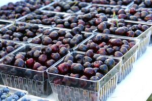
A wide variety of commodity crops, fruits, and vegetables are grown in Michigan, making it second only to California among US states in the diversity of its agriculture.[128] The state has 54,800 farms utilizing 10،000،000 acre (40،000 km2) of land which sold $6.49 billion worth of products in 2010.[129] The most valuable agricultural product is milk. Leading crops include corn, soybeans, flowers, wheat, sugar beets, and potatoes. Livestock in the state included 78,000 sheep, a million cattle, a million hogs, and more than three million chickens. Livestock products accounted for 38% of the value of agricultural products while crops accounted for the majority.
Michigan is a leading grower of fruit in the US, including blueberries, tart cherries, apples, grapes, and peaches.[130][131] Plums, pears, and strawberries are also grown in Michigan. These fruits are mainly grown in West Michigan due to the moderating effect of Lake Michigan on the climate. There is also significant fruit production, especially cherries, but also grapes, apples, and other fruits, in northwest Michigan along Lake Michigan. Michigan produces wines, beers and a multitude of processed food products. Kellogg's cereal is based in Battle Creek, Michigan and processes many locally grown foods. Thornapple Valley, Ball Park Franks, Koegel Meat Company, and Hebrew National sausage companies are all based in Michigan.
Michigan is home to very fertile land in the Saginaw Valley and Thumb areas. Products grown there include corn, sugar beets, navy beans, and soybeans. Sugar beet harvesting usually begins the first of October. It takes the sugar factories about five months to process the 3.7 million tons of sugarbeets into 485,000 tons of pure, white sugar.[132] Michigan's largest sugar refiner, Michigan Sugar Company[133] is the largest east of the Mississippi River and the fourth largest in the nation. Michigan sugar brand names are Pioneer Sugar and the newly incorporated Big Chief Sugar. Potatoes are grown in Northern Michigan, and corn is dominant in Central Michigan. Alfalfa, cucumbers, and asparagus are also grown.
Tourism
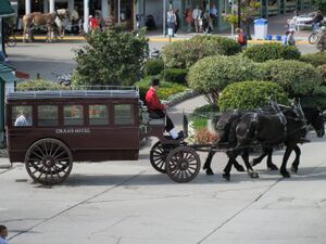
As of 2011, Michigan's tourists spent $17.2 billion per year in the state, supporting 193,000 tourism jobs.[134] Michigan's tourism website ranks among the busiest in the nation.[135] Destinations draw vacationers, hunters, and nature enthusiasts from across the United States and Canada. Michigan is over 50% forest land,[136] much of it quite remote. The forests, lakes and thousands of miles of beaches are top attractions. Event tourism draws large numbers to occasions like the Tulip Time Festival and the National Cherry Festival.
In 2006, the Michigan State Board of Education mandated all public schools in the state hold their first day of school after Labor Day, in accordance with the new post-Labor Day school law. A survey found 70% of all tourism business comes directly from Michigan residents, and the Michigan Hotel, Motel, & Resort Association claimed the shorter summer between school years cut into the annual tourism season.[137] However, a bill introduced in 2023 would cancel this requirement, allowing individual districts to decide when their school year should begin.[138][139]
Tourism in metropolitan Detroit draws visitors to leading attractions, especially The Henry Ford, the Detroit Institute of Arts, the Detroit Zoo, and to sports in Detroit. Other museums include the Detroit Historical Museum, the Charles H. Wright Museum of African American History, museums in the Cranbrook Educational Community, and the Arab American National Museum. The metro area offers four major casinos, MGM Grand Detroit, Hollywood Casino, Motor City, and Caesars Windsor in Windsor, Ontario, Canada; moreover, Detroit is the largest American city and metropolitan region to offer casino resorts.[140]
Hunting and fishing are significant industries in the state. Charter boats are based in many Great Lakes cities to fish for salmon, trout, walleye, and perch. Michigan ranks first in the nation in licensed hunters (over one million) who contribute $2 billion annually to its economy. More than three-quarters of a million hunters participate in white-tailed deer season alone. Many school districts in rural areas of Michigan cancel school on the opening day of firearm deer season, because of attendance concerns.[citation needed]
Michigan's Department of Natural Resources manages the largest dedicated state forest system in the nation. The forest products industry and recreational users contribute $12 billion and 200,000 associated jobs annually to the state's economy. Public hiking and hunting access has also been secured in extensive commercial forests. The state has the highest number of golf courses and registered snowmobiles in the nation.[141]
The state has numerous historical markers, which can themselves become the center of a tour.[142] The Great Lakes Circle Tour is a designated scenic road system connecting all of the Great Lakes and the St. Lawrence River.[143]
With its position in relation to the Great Lakes and the countless ships that have foundered over the many years they have been used as a transport route for people and bulk cargo, Michigan is a world-class scuba diving destination. The Michigan Underwater Preserves are 11 underwater areas where wrecks are protected for the benefit of sport divers.
Culture
Arts
Music
Michigan music is known for three music trends: early punk rock, Motown/soul music and techno music. Michigan musicians include Tally Hall, Bill Haley & His Comets, the Supremes, the Marvelettes, the Temptations, the Four Tops, Stevie Wonder, Marvin Gaye "The Prince of Soul", Smokey Robinson and the Miracles, Aretha Franklin, Mary Wells, Tommy James and the Shondells, ? and the Mysterians, Al Green, The Spinners, Grand Funk Railroad, the Stooges, the MC5, the Knack, Madonna "The Queen of Pop", Bob Seger, Jack Scott, Ray Parker Jr., Jackie Wilson, Aaliyah, Eminem, Babytron, Kid Rock, Jack White and Meg White (the White Stripes), Big Sean, Alice Cooper, Greta Van Fleet, Mustard Plug, and Del Shannon.[144]
Performance arts
Major theaters in Michigan include the Fox Theatre, Music Hall, Gem Theatre, Masonic Temple Theatre, the Detroit Opera House, Fisher Theatre, The Fillmore Detroit, Saint Andrew's Hall, Majestic Theater, and Orchestra Hall.
The Nederlander Organization, the largest controller of Broadway productions in New York City, originated in Detroit.[145]
Sports
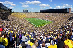
Michigan's major-league sports teams include: Detroit Tigers baseball team, Detroit Lions football team, Detroit Red Wings ice hockey team, and the Detroit Pistons men's basketball team. All of Michigan's major league teams play in the Metro Detroit area. The state also has a professional second-tier (USL Championship) soccer team in Detroit City FC, which plays its home games at Keyworth Stadium in Hamtramck, Michigan.
The Pistons played at Detroit's Cobo Arena until 1978 and at the Pontiac Silverdome until 1988 when they moved into The Palace of Auburn Hills. In 2017, the team moved to the newly built Little Caesars Arena in downtown Detroit. The Detroit Lions played at Tiger Stadium in Detroit until 1974, then moved to the Pontiac Silverdome where they played for 27 years between 1975 and 2002 before moving to Ford Field in Detroit in 2002. The Detroit Tigers played at Tiger Stadium (formerly known as Navin Field and Briggs Stadium) from 1912 to 1999. In 2000 they moved to Comerica Park. The Red Wings played at Olympia Stadium before moving to Joe Louis Arena in 1979. They later moved to Little Caesars Arena to join the Pistons as tenants in 2017. Professional hockey got its start in 1903 in Houghton,[146] when the Portage Lakers were formed.[147]
The Michigan International Speedway is the site of NASCAR races and Detroit was formerly the site of a Formula One World Championship Grand Prix race. From 1959 to 1961, Detroit Dragway hosted the NHRA's U.S. Nationals.[148] Michigan is home to one of the major canoeing marathons: the 120-ميل (190 km) Au Sable River Canoe Marathon. The Port Huron to Mackinac Boat Race is also a favorite.
Twenty-time Grand Slam champion Serena Williams was born in Saginaw. The 2011 World Champion for Women's Artistic Gymnastics, Jordyn Wieber is from DeWitt. Wieber was also a member of the gold medal team at the London Olympics in 2012.
Collegiate sports in Michigan are popular in addition to professional sports. The state's two largest athletic programs are the Michigan Wolverines and Michigan State Spartans, which play in the NCAA Big Ten Conference. Michigan Stadium in Ann Arbor, home to the Michigan Wolverines football team, is the largest stadium in the Western Hemisphere and the third-largest stadium worldwide.
The Michigan High School Athletic Association features around 300,000 participants.
Education
Michigan's education system serves 1.6 million K-12 students in public schools. More than 124,000 students attend private schools and an uncounted number are homeschooled under certain legal requirements.[149][150] The public school system had a $14.5 billion budget in 2008–09.[151] From 2009 to 2019, over 200 private schools in Michigan closed, partly due to competition from charter schools.[152] In 2022, U.S. News & World Report rated three Michigan high schools among the nation's 100 best: City High Middle School (18th), the International Academy of Macomb (21st), and the International Academy (52nd). Washtenaw International High School ranked 107th.[153]
The University of Michigan is Michigan's oldest higher educational institution and among the oldest research universities in the nation. It was founded in 1817, 20 years before Michigan Territory achieved statehood.[154][155] Kalamazoo College is the state's oldest private liberal arts college, founded in 1833 by a group of Baptist ministers as the Michigan and Huron Institute. From 1840 to 1850, the college operated as the Kalamazoo Branch of the University of Michigan. Methodist settlers in Spring Arbor Township founded Albion College in 1835. It is the state's second-oldest private liberal arts college.
Michigan Technological University is the first post-secondary institution in the Upper Peninsula of Michigan, founded in 1885 as the Michigan Mining School. Eastern Michigan University was founded in 1849 as the Michigan State Normal School for the training of teachers. It was the nation's fourth-oldest normal school and the first U.S. normal school outside New England. In 1899, the Michigan State Normal School became the nation's first normal school to offer a four-year curriculum. Michigan State University was founded in 1855 as the nation's first agricultural college.
The Carnegie Foundation classifies eight of the state's institutions (Michigan State University, Michigan Technological University, Eastern Michigan University, Wayne State University, Central Michigan University, Western Michigan University, Oakland University, University of Michigan) as research universities.[156]
Infrastructure
Energy
In 2020, Michigan consumed 113,740- gigawatt-hours (GWh) of electrical energy and produced 116,700 (GWh) of electrical energy.[157]
Coal power is Michigan's leading source of electricity, producing roughly half its supply or 53,100 GWh of electrical energy (12.6 GW total capacity) in 2020.[157] Although Michigan has no active coal mines, coal is easily moved from other states by train and across the Great Lakes by lake freighters. The lower price of natural gas is leading to the closure of most coal plants, with Consumer Energy planning to close all of its remaining coal plants by 2025;[158] DTE plans to retire 2100MW of coal power by 2023.[159] The coal-fired Monroe Power Plant in Monroe, on the western shore of Lake Erie, is the nation's 11th-largest electric plant, with a net capacity of 3,400 MW.
Nuclear power is also a significant source of electrical power in Michigan, producing roughly one-quarter of the state's supply or 28,000-gigawatt-hours (GWh) of electrical energy (4.3 GW total capacity) in 2020.[157] The three active nuclear power plants supply Michigan with about 26% of its electricity. Donald C. Cook Nuclear Plant, just north of Bridgman, is the state's largest nuclear power plant, with a net capacity of 2,213 MW. The Enrico Fermi Nuclear Generating Station is the second-largest, with a net capacity of 1,150 MW. It is also one of the two nuclear power plants in the Detroit metropolitan area (within a 50-mile radius of Detroit's city center), about halfway between Detroit and Toledo, Ohio, the other being the Davis–Besse Nuclear Power Station, in Ottawa County, Ohio. The Palisades Nuclear Power Plant, south of South Haven, closed in May 2022.[160] The Big Rock Point Nuclear Power Plant, Michigan's first nuclear power plant and the nation's fifth, was decommissioned in 1997.
Transportation
International crossings
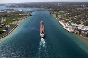
Michigan has nine international road crossings with Ontario, Canada:
- Ambassador Bridge, North America's busiest international border, crossing the Detroit River
- Blue Water Bridge, a twin-span bridge (Port Huron, Michigan, and Point Edward, Ontario, but the larger city of Sarnia is usually referred to on the Canadian side)
- Blue Water Ferry (Marine City, Michigan, and Sombra, Ontario)
- Canadian Pacific Railway tunnel
- Detroit–Windsor Truck Ferry (Detroit and Windsor)
- Detroit–Windsor Tunnel
- International Bridge (Sault Ste. Marie, Michigan, and Sault Ste. Marie, Ontario)
- St. Clair River Railway Tunnel (Port Huron and Sarnia)
- Walpole Island Ferry (Algonac, Michigan, and Walpole Island First Nation, Ontario)
The Gordie Howe International Bridge, a second international bridge between Detroit and Windsor, is under construction. It is expected to be completed in 2024.[161][162][163]
Railroads
Michigan is served by four Class I railroads: the Canadian National Railway, the Canadian Pacific Railway, CSX Transportation, and the Norfolk Southern Railway. These are augmented by several dozen short line railroads. The vast majority of rail service in Michigan is devoted to freight, with Amtrak and various scenic railroads the exceptions.[164]
Three Amtrak passenger rail routes serve the state. The Pere Marquette from Chicago to Grand Rapids, the Blue Water from Chicago to Port Huron, and the Wolverine from Chicago to Pontiac. There are plans for commuter rail for Detroit and its suburbs (see SEMCOG Commuter Rail).[165][166][167]
Roadways

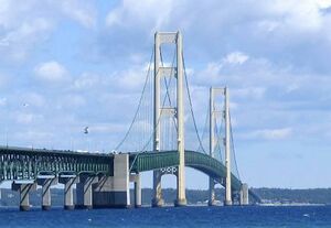
- Interstate 75 (I-75) is the main thoroughfare between Detroit, Flint, and Saginaw extending north to Sault Ste. Marie and providing access to Sault Ste. Marie, Ontario. The freeway crosses the Mackinac Bridge between the Lower and Upper Peninsulas. Auxiliary highways include I-275 and I-375 in Detroit; I-475 in Flint; and I-675 in Saginaw.
- I-69 enters the state near the Michigan–Ohio–Indiana border, and it extends to Port Huron and provides access to the Blue Water Bridge crossing into Sarnia, Ontario.
- I-94 enters the western end of the state at the Indiana border, and it travels east to Detroit and then northeast to Port Huron and ties in with I-69. I-194 branches off from this freeway in Battle Creek. I-94 is the main artery between Chicago and Detroit.
- I-96 runs east–west between Detroit and Muskegon. I-496 loops through Lansing. I-196 branches off from this freeway at Grand Rapids and connects to I-94 near Benton Harbor. I-696 branches off from this freeway at Novi and connects to I-94 near St. Clair Shores.
- U.S. Highway 2 (U.S. 2) enters Michigan at the city of Ironwood and travels east to the town of Crystal Falls, where it turns south and briefly re-enters Wisconsin northwest of Florence. It re-enters Michigan north of Iron Mountain and continues through the Upper Peninsula of Michigan to the cities of Escanaba, Manistique, and St. Ignace. Along the way, it cuts through the Ottawa and Hiawatha national forests and follows the northern shore of Lake Michigan. Its eastern terminus lies at exit 344 on I-75, just north of the Mackinac Bridge.
- U.S. Highway 23 enters Michigan at the Ohio state line in the suburban spillover of Toledo, Ohio, as a freeway and leads northward to Ann Arbor before merging with I-75 just south of Flint. Concurrent with I-75 through Flint, Saginaw, and Bay City, it splits from I-75 at Standish as an intermittently four lane/two-lane surface road closely following the western shore of Lake Huron generally northward through Alpena before turning west to northwest toward Mackinaw City and Interstate 75 again, where it terminates.
- U.S. Highway 31 enters Michigan as Interstate-quality freeway at the Indiana state line just northwest of South Bend, Indiana, heads north to Interstate 196 near Benton Harbor, and follows the eastern shore of Lake Michigan to Mackinaw City, where it has its northern terminus.
- U.S. Highway 127 enters Michigan from Ohio south of Hudson as a two-lane, undivided highway and closely follows the Michigan meridian, the principal north–south line used to survey Michigan in the early 19th century. It passes north through Jackson and Lansing before terminating south of Grayling at I-75, and is a four-lane freeway for the majority of its course.
- U.S. Highway 131 has its southern terminus at the Indiana Toll Road roughly one mile south of the Indiana state line as a two-lane surface road. It passes through Kalamazoo and Grand Rapids as a freeway of Interstate standard and continues as such to Manton, where it reverts to two-lane surface road to its northern terminus at U.S. 31 in Petoskey.
Intercity bus services
Airports
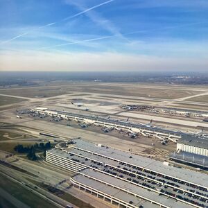
Detroit Metropolitan Airport in the western suburb of Romulus, was in 2010 the 16th busiest airfield in North America measured by passenger traffic.[168] The Gerald R. Ford International Airport in Grand Rapids is the next busiest airport in the state, served by eight airlines to 23 destinations. Flint Bishop International Airport is the third largest airport in the state, served by four airlines to several primary hubs. Other frequently trafficked airports include Cherry Capital Airport, in Traverse City; Kalamazoo/Battle Creek International Airport, serving the Kalamazoo and Battle Creek region; Capital Region International Airport, located outside of Lansing; and MBS International Airport serving the Midland, Bay City and Saginaw tri-city region. Additionally, smaller regional and local airports are located throughout the state including on several islands.
Government
State government
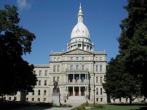
Michigan is governed as a republic, with three branches of government: the executive branch consisting of the Governor of Michigan and the other independently elected constitutional officers; the legislative branch consisting of the House of Representatives and Senate; and the judicial branch. The Michigan Constitution allows for the direct participation of the electorate by statutory initiative and referendum, recall, and constitutional initiative and referral (Article II, § 9,[169] defined as "the power to propose laws and to enact and reject laws, called the initiative, and the power to approve or reject laws enacted by the legislature, called the referendum. The power of initiative extends only to laws which the legislature may enact under this constitution"). Lansing is the state capital and is home to all three branches of state government.
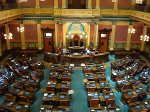
The governor and the other state constitutional officers serve four-year terms and may be re-elected only once. The current governor is Gretchen Whitmer. Michigan has two official Governor's Residences; one is in Lansing, and the other is on Mackinac Island. The other constitutionally elected executive officers are the lieutenant governor, who is elected on a joint ticket with the governor; the secretary of state; and the attorney general. The lieutenant governor presides over the Senate (voting only in case of a tie) and is also a member of the cabinet. The secretary of state is the chief elections officer and is charged with running many licensure programs including motor vehicles, all of which are done through the branch offices of the secretary of state.
The Michigan Legislature consists of a 38-member Senate and 110-member House of Representatives. Members of both houses of the legislature are elected through first past the post elections by single-member electoral districts of near-equal population that often have boundaries which coincide with county and municipal lines. Senators serve four-year terms concurrent to those of the governor, while representatives serve two-year terms. The Michigan State Capitol was dedicated in 1879 and has hosted the executive and legislative branches of the state ever since.
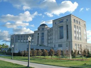
The Michigan judiciary consists of two courts with primary jurisdiction (the Circuit Courts and the District Courts), one intermediate level appellate court (the Michigan Court of Appeals), and the Michigan Supreme Court. There are several administrative courts and specialized courts. District courts are trial courts of limited jurisdiction, handling most traffic violations, small claims, misdemeanors, and civil suits where the amount contended is below $25,000. District courts are often responsible for handling the preliminary examination and for setting bail in felony cases. District court judges are elected to terms of six years. In a few locations, municipal courts have been retained to the exclusion of the establishment of district courts. There are 57 circuit courts in the State of Michigan, which have original jurisdiction over all civil suits where the amount contended in the case exceeds $25,000 and all criminal cases involving felonies. Circuit courts are also the only trial courts in the State of Michigan which possess the power to issue equitable remedies. Circuit courts have appellate jurisdiction from district and municipal courts, as well as from decisions and decrees of state agencies. Most counties have their own circuit court, but sparsely populated counties often share them. Circuit court judges are elected to terms of six years. State appellate court judges are elected to terms of six years, but vacancies are filled by an appointment by the governor. There are four divisions of the Court of Appeals in Detroit, Grand Rapids, Lansing, and Marquette. Cases are heard by the Court of Appeals by panels of three judges, who examine the application of the law and not the facts of the case unless there has been grievous error pertaining to questions of fact. The Michigan Supreme Court consists of seven members who are elected on non-partisan ballots for staggered eight-year terms. The Supreme Court has original jurisdiction only in narrow circumstances but holds appellate jurisdiction over the entire state judicial system.
Law
Michigan has had four constitutions, the first of which was ratified on October 5 and 6, 1835.[170] There were also constitutions from 1850 and 1908, in addition to the current constitution from 1963. The current document has a preamble, 11 articles, and one section consisting of a schedule and temporary provisions. Michigan, like every U.S. state except Louisiana, has a common law legal system.
Politics
Having been a Democratic-leaning state at the presidential level since the 1990s, Michigan has evolved into a swing state after Donald Trump won the state in 2016. Governors since the 1970s have alternated between the Democrats and Republicans, and statewide offices including attorney general, secretary of state, and senator have been held by members of both parties in varying proportion. Additionally, from 1994 until 2022, the governor-elect had always come from the party opposite the presidency. The Democratic Party has a slim majority of two seats in the Senate of the Michigan Legislature, and the House is currently deadlocked at 54 seats for each party. The state's congressional delegation is commonly split, with one party or the other typically holding a narrow majority.
Michigan was the home of Gerald Ford, the 38th president of the United States. Born in Nebraska, he moved as an infant to Grand Rapids.[171][172] The Gerald R. Ford Museum is in Grand Rapids, and the Gerald R. Ford Presidential Library is on the campus of his alma mater, the University of Michigan in Ann Arbor.
In a 2020 study, Michigan was ranked as the 13th easiest state for citizens to vote in.[173]
State symbols and nicknames
Michigan is traditionally known as "The Wolverine State", and the University of Michigan uses the wolverine as its mascot. The association is well and long established: for example, many Detroiters volunteered to fight during the American Civil War and George Armstrong Custer, who led the Michigan Brigade, called them the "Wolverines". The origins of this association are obscure; it may derive from a busy trade in wolverine furs in Sault Ste. Marie in the 18th century or may recall a disparagement intended to compare early settlers in Michigan with the vicious mammal. Wolverines are, however, extremely rare in Michigan. A sighting in February 2004 near Ubly was the first confirmed sighting in Michigan in 200 years.[174] The animal was found dead in 2010.[175]
- State nicknames: Wolverine State, Great Lake State, Mitten State, Water-Winter Wonderland
- State motto: Si quaeris peninsulam amoenam circumspice (Latin: "If you seek a pleasant peninsula, look about you") adopted in 1835 on the coat-of-arms, but never as an official motto. This is a paraphrase of the epitaph of British architect Sir Christopher Wren about his masterpiece, St. Paul's Cathedral.[176][177]
- State song: "My Michigan" (official since 1937, but disputed amongst residents),[178] "Michigan, My Michigan" (Unofficial state song, since the civil war)
- State bird: American robin (since 1931)
- State animal: wolverine (traditional)
- State game animal: white-tailed deer (since 1997)
- State fish: brook trout (since 1965)
- State reptile: painted turtle (since 1995)
- State fossil: mastodon (since 2000)
- State flower: apple blossom (adopted in 1897, official in 1997)
- State wildflower: dwarf lake iris (since 1998) a federally listed threatened species
- State tree: white pine (since 1955)
- State stone: Petoskey stone (since 1965). It is composed of fossilized coral (Hexagonaria pericarnata) from long ago when the middle of the continent was covered with a shallow sea.
- State gem: Isle Royale greenstone (since 1973). Also called chlorastrolite (literally "green star stone"), the mineral is found on Isle Royale and the Keweenaw peninsula.
- State quarter: US coin issued in 2004 with the Michigan motto "Great Lakes State".
- State soil: Kalkaska sand (since 1990), ranges in color from black to yellowish brown, covers nearly 1،000،000-acre (4،000 km2) in 29 counties.
Sister regions
 Shiga Prefecture, Japan[179]
 Sichuan Province, People's Republic of China[180]
انظر أيضا
- Index of Michigan-related articles
- Outline of Michigan: organized list of topics about Michigan
- USS Michigan, 3 ships
Notes
- ^ أ ب Elevation adjusted to North American Vertical Datum of 1988.
- ^ i.e., including water that is part of state territory. Georgia is the largest state by land area alone east of the Mississippi and Michigan the second-largest.
- ^ The first form is the way it is spelled in Ojibwe native syllabics.
- ^ The Province included the modern states of Wisconsin, eastern Minnesota, Illinois, Indiana, Ohio, Kentucky, Tennessee, Mississippi, Alabama, two-thirds of Georgia, and small parts of West Virginia, Pennsylvania, New York, Vermont, and Maine.
المصادر
- ^ أ ب ت Michigan in Brief: Information About the State of Michigan (PDF). Library of Michigan. Archived from the original (PDF) on November 8, 2006. Retrieved November 28, 2006.
- ^ أ ب "Elevations and Distances in the United States". United States Geological Survey. 2001. Archived from the original on October 15, 2011. Retrieved October 24, 2011.
- ^ "Resident Population for the 50 States, the District of Columbia, and Puerto Rico: 2020 Census" (PDF). United States Census Bureau. Retrieved April 26, 2021.
- ^ "Median Annual Household Income". The Henry J. Kaiser Family Foundation. Archived from the original on December 20, 2016. Retrieved December 9, 2016.
- ^ Hansen, Liane (September 27, 2009). "What Is a Yooper?". Weekend Edition Sunday. NPR. Archived from the original on August 21, 2013. Retrieved June 13, 2013.
- ^ "Ojibwe-English-Ojibwe online dictionary". FREELANG. Archived from the original on March 15, 2008. Retrieved March 24, 2008.
- ^ "Ocean and Coastal Management in Michigan". NOAA Office of Ocean and Coastal Resource Management. Archived from the original on February 15, 2013. Retrieved July 25, 2010.
- ^ Breck, James E. "Compilation of Databases on Michigan Lakes" (PDF). Michigan Department of Natural Resources. p. 5. Archived (PDF) from the original on March 14, 2009. Retrieved April 18, 2009.
Another unique code (Unique_ID) was previously assigned to all 70,542 polygons, including 5,527 islands, 35 streams and 64,980 lakes and ponds down to 0.008 acres (31.4 m2, 338 ft2 ).
- ^ "United States Summary: 2010, Population and Housing Unit Counts, 2010 Census of Population and Housing" (PDF). United States Census Bureau. September 2012. pp. V–2, 1 & 41 (Tables 1 & 18). Retrieved February 7, 2014.
- ^ Ueda, Reed (2017). America's Changing Neighborhoods: An Exploration of Diversity through Places. Greenwood. ISBN 978-1-4408-2864-5.
- ^ Balestier, Courtney (November 10, 2016). "In search of the Hillbilly Highway". metromode. Archived from the original on December 8, 2022. Retrieved October 4, 2022.
- ^ "February: Shaping Black Detroit". Research Guides. Wayne State University Libraries. Archived from the original on February 14, 2023. Retrieved October 4, 2022.
- ^ Kandell, Jonathan (May 2011). "The Wonderful Wilderness of Michigan's Upper Peninsula". Smithsonian Magazine. Archived from the original on March 1, 2019. Retrieved February 28, 2019.
- ^ Archibald, Robert. "An Environmental History of the Upper Peninsula of Michigan: An Outline". NMU Center for U.P. Studies. Archived from the original on March 1, 2019. Retrieved February 28, 2019.
- ^ "Chronology of Michigan History" (PDF). p. 3. Archived (PDF) from the original on July 21, 2011. Retrieved September 30, 2009.
- ^ "Sault Ste Marie Pure Michigan". Sault Ste Marie. Archived from the original on June 12, 2016. Retrieved June 9, 2016.
- ^ "Cadillac's Village or Detroit under Cadillac". Archived from the original on December 9, 2006. Retrieved January 5, 2007.
- ^ "History Detroit 1701–2001". Archived from the original on December 9, 2006. Retrieved January 5, 2007.
- ^ "French Ontario in the 17th and 18th centuries: Detroit". Archives of Ontario. July 14, 2008. Archived from the original on August 24, 2004. Retrieved July 23, 2008.
- ^
 Chisholm, Hugh, ed. (1911). . دائرة المعارف البريطانية. Vol. 18 (eleventh ed.). Cambridge University Press. pp. 371–377, see page 376.
 {{cite encyclopedia}}: Cite has empty unknown parameter:|coauthors=(help) - ^ Peterson, Jacqueline & Brown, Jennifer S.H. (2001). Many Roads to Red River. p. 69.[استشهاد ناقص]
- ^ Farmer, Silas (2005) [1889]. "Legislatures and Laws". The History of Detroit and Michigan; or, The Metropolis Illustrated; A Full Record of Territorial Days in Michigan, and the Annals of Wayne County. p. 94. Retrieved June 15, 2006 – via University of Michigan Library.
- ^ أ ب "Michigan Centenary Issue". Smithsonian National Postal Museum. Retrieved November 3, 2023.
- ^ Men of Progress: Embracing Biographical Sketches of Representative Michigan Men with an Outline History of the State. Evening News Association. 1900. p. 313. Archived from the original on August 18, 2018. Retrieved October 31, 2016.
- ^ Dulong, John (2001). French Canadians in Michigan. Lansing, Michigan: Michigan State University Press. pp. 3–5. ISBN 978-0-87013-582-8.
- ^ Dunbar & May (1980). "Chapter 14". Michigan: A History of the Wolverine State. Eerdman. ISBN 9780802870438.
- ^ Rae, John B. (1983). "Why Michigan". In Lewis, David L.; Goldstein, Laurence (eds.). The Automobile and American Culture. Ann Arbor: University of Michigan Press. pp. 2–9.
- ^ "A brief history of housing in Detroit". Model D (in الإنجليزية). Retrieved June 29, 2023.
- ^ "A Trip Through Time: Grand Rapids Furniture History". The Woodshop Blog (in الإنجليزية الأمريكية). September 18, 2014. Retrieved June 29, 2023.
- ^ "Furniture City: The story behind Grand Rapids's original identity". FOX 17 West Michigan News (in الإنجليزية). March 2, 2023. Retrieved June 29, 2023.
- ^ Haddad, Ken (May 18, 2023). "96 years later: Michigan's Bath School disaster remains deadliest in US history". WDIV (in الإنجليزية). Retrieved June 29, 2023.
- ^ Peck, Merton J.; Scherer, Frederic M. (1962). The Weapons Acquisition Process: An Economic Analysis. Harvard Business School. p. 111.
- ^ أ ب "Facts about Michigan Manufacturing". National Association of Manufacturers. February 2008. Archived from the original on October 23, 2008. Retrieved January 11, 2009.
- ^ "In Michigan, drive a crooked line to follow the 45th Parallel". Twin Cities (in الإنجليزية الأمريكية). June 27, 2009. Retrieved June 29, 2023.
- ^ "Michigan Tourism Facts". Michigan Economic Development Corporation. Archived from the original on October 15, 2016. Retrieved July 25, 2016.
In Michigan, you are never more than six miles from a lake or stream Stand anywhere in Michigan and you are within 85 miles of a Great Lake
- ^ "Michigan Dept. of Natural Resources". Archived from the original on December 3, 2010. Retrieved December 26, 2008.
- ^ Keilman, John (December 9, 2011). "Hand-to-hand combat". Chicago Tribune. Archived from the original on February 26, 2012. Retrieved February 29, 2012.
- ^ Cox, Bruce K. (2010). Ted & Superior: Ted Albert & the 51st State of Superior. Wakefield, Michigan: Agogeebic Press LLC. ISBN 978-0-9822390-0-1.
- ^ "51st state? Yoopers Are Talking Up Secession from Michigan Again". Detroit Free Press. May 6, 2012.
- ^ "Does Michigan have the longest coast line in the United States?". State of Michigan. July 28, 2011. Archived from the original on August 14, 2006. Retrieved November 5, 2011.
- ^ "Shorelines of the Great Lakes". Michigan Department of Natural Resources and Environment. Archived from the original on July 20, 2010. Retrieved July 8, 2010.
- ^ B, Lisha (September 13, 2022). "Did You Know That Michigan Has the Most Lighthouses in the U.S.?". Mix 95.7FM (in الإنجليزية). Retrieved June 29, 2023.
- ^ "Why is Michigan sometimes called 'The Wolverine State?'". Michigan FAQ. Department of History, Arts and Libraries. Archived from the original on January 2, 2009. Retrieved January 11, 2009.
Another nickname for Michigan is the "Great Lake State". Michigan's shores touch four of the five Great Lakes, and Michigan has more than 11,000 inland lakes. In Michigan, you are never more than six miles from an inland lake or more than 85 miles from a Great Lake.
- ^ NWS Gaylord Region (August 31, 2010). "Mean Annual Snowfall". National Weather Service. Archived from the original on November 9, 2011. Retrieved June 1, 2011.
- ^ "The Geography of Michigan". netstate.com. Archived from the original on March 21, 2011. Retrieved March 20, 2011.
- ^ "Tornadoes". geo.msu.edu. Archived from the original on July 6, 2015. Retrieved April 12, 2015.
- ^ "Thunderstorm hazards". srh.noaa.gov. Archived from the original on October 15, 2006. Retrieved November 1, 2006.
- ^ "No injuries reported after earthquake rattles Michigan". Archived from the original on May 3, 2015. Retrieved May 3, 2015.
- ^ "Michigan Counties". State of Michigan.
- ^ "Explore Census Data". United States Census Bureau. Retrieved September 23, 2021.
- ^ "Historical Population Change Data (1910–2020)". Census.gov. United States Census Bureau. Archived from the original on April 29, 2021. Retrieved May 1, 2021.
- ^ "Growth in U.S. Population Shows Early Indication of Recovery Amid COVID-19 Pandemic". Census Bureau QuickFacts. December 22, 2022. Retrieved April 20, 2023.
- ^ "Population and Population Centers by State: 2010". United States Census Bureau. Archived from the original on April 29, 2011. Retrieved April 5, 2011.
- ^ أ ب "Take a look: How immigrants drive the economy in Michigan". American Immigration Council (in الإنجليزية الأمريكية). Retrieved June 29, 2023.
- ^ "2007-2022 PIT Counts by State".
- ^ "The 2022 Annual Homelessness Assessment Report (AHAR) to Congress" (PDF).
- ^ أ ب "Historical Census Statistics on Population Totals By Race, 1790 to 1990, and By Hispanic Origin, 1970 to 1990, For The United States, Regions, Divisions, and States". Archived from the original on July 25, 2008.
- ^ "Population of Michigan: Census 2010 and 2000 Interactive Map, Demographics, Statistics, Quick Facts".[dead link]
- ^ "2010 Census Data". Retrieved December 11, 2017.
- ^ "Race and Ethnicity in the United States: 2010 Census and 2020 Census". U.S. Census Bureau. August 12, 2021. Retrieved August 12, 2021.
- ^ "Selected Social Characteristics in the United States: 2016 American Community Survey 5-Year Estimates". United States Census Bureau. 2016. Retrieved December 22, 2017.
- ^ "Norway Our Community Tour: Connections between the U.P. and Scandinavian countries". WJMN - UPMatters.com (in الإنجليزية الأمريكية). July 21, 2021. Retrieved June 29, 2023.
- ^ "West Michigan's 'Dutchness' has evolved to be quite different from the Netherlands". The Holland Sentinel (in الإنجليزية الأمريكية). Retrieved June 29, 2023.
- ^ "Detroit is No Longer the Largest Majority-Black City". The Michigan Chronicle (in الإنجليزية الأمريكية). May 24, 2023. Retrieved June 29, 2023.
- ^ "Census Shows Memphis Is Largest Majority-Black City, Replacing Detroit". BET (in الإنجليزية). Retrieved June 29, 2023.
- ^ Karoub, Jeff. "Detroit Expects Half of Iraqi Refugees". Philadelphia: WPVI-TV. Associated Press. Archived from the original on October 5, 2013. Retrieved May 5, 2013.
Southeastern Michigan has about 300,000 people who trace their roots to the Middle East.
- ^ Miyares, Ines M. & Airriess, Christopher A. (2007). Contemporary Ethnic Geographies in America. Rowman & Littlefield. p. 320. ISBN 978-0-7425-3772-9.
- ^ Kaiser, Robert L. (December 27, 1999). "After 25 Years in U.S., Hmong Still Feel Isolated". Chicago Tribune. p. 2. Archived from the original on September 9, 2017. Retrieved April 14, 2012.
- ^ أ ب "Michigan Hmong". Michigan Daily. University of Michigan. January 10, 2007. p. 2. Archived from the original on January 17, 2013. Retrieved November 8, 2012.
- ^ Rosen, Zak (April 23, 2015). "Meet One of Detroit's Last Remaining Hmong Families". Michigan Radio. Archived from the original on July 8, 2015. Retrieved July 1, 2015.
- ^ أ ب Wilkinson, Sook (2015). Asian Americans in Michigan: Voices from the Midwest. Detroit: Wayne State University Press. p. 158. ISBN 978-0-8143-3974-9. Archived from the original on September 4, 2015. Retrieved July 5, 2015.
- ^ Stone, Cal (April 11, 2013). "State's Japanese employees increasing". Observer & Eccentric. Detroit. Archived from the original on April 13, 2013. Retrieved May 5, 2013.
- ^ "Michigan". Modern Language Association. Archived from the original on December 1, 2007. Retrieved August 15, 2013.
- ^ "2021 Languages Spoken at Home". United States Census Bureau. Retrieved June 29, 2023.
- ^ Staff (February 24, 2023). "American Values Atlas: Religious Tradition in Michigan". Public Religion Research Institute. Archived from the original on April 4, 2017. Retrieved April 4, 2023.
- ^ Orlando, Jim. "Ste. Anne de Detroit Catholic Church". Ste-anne.org. Archived from the original on September 27, 2011. Retrieved November 5, 2011.
- ^ "The Official Web Site for the Archdiocese of Detroit". Archdiocese of Detroit. Archived from the original on October 13, 2011. Retrieved November 5, 2011.
- ^ أ ب "2020 Congregational Membership Reports". The Association of Religion Data Archives. Retrieved June 29, 2023.
- ^ "Unusual church in no-man's land welcomes everyone". The Detroit News (in الإنجليزية الأمريكية). Retrieved June 29, 2023.
- ^ "Cathedral of St. Anthony". Historic Detroit. Retrieved June 29, 2023.
- ^ "Statement regarding "Archbishop" Karl Rodig and the Cathedral Abbey of St. Anthony". Archdiocese of Detroit (in الإنجليزية الأمريكية). Retrieved June 29, 2023.
- ^ "State Membership Report". The Association of Religion Data Archives. Archived from the original on December 2, 2013. Retrieved November 22, 2013.
- ^ "Christian Reformed Church in North America—Religious Groups". The Association of Religion Data Archives. Archived from the original on November 1, 2013. Retrieved January 31, 2014.
- ^ "Reformed Church in America—Religious Groups". The Association of Religion Data Archives. Archived from the original on October 4, 2013. Retrieved January 31, 2014.
- ^ "Historical Journey of the CRC (Christian Reformed Church)". Christian Reformed Church of North America. Archived from the original on November 5, 2011. Retrieved November 5, 2011.
- ^ "State Membership Report". The Association of Religion Data Archives. Archived from the original on December 2, 2013. Retrieved November 22, 2013.
- ^ "History". Archived from the original on May 22, 2009.
- ^ "Michigan: Religions". Archived from the original on September 7, 2008. Retrieved September 13, 2008.
- ^ "United for Mission: One Hundred and Fifty Years". General Conference of Seventh-day Adventists. September 18, 2013. Archived from the original on October 8, 2014. Retrieved October 7, 2014.
- ^ Thiruvananthapuram (September 11, 2014). "SDA Church Valedictory Fete". The New Indian Express. The New Indian Express Group. Archived from the original on October 14, 2014. Retrieved October 7, 2014.
- ^ "U.S. Census Bureau QuickFacts: Michigan". Archived from the original on November 11, 2019. Retrieved November 11, 2019.
- ^ "Gross Domestic Product by State and Region: Level and Percent Change from Preceding Period". Bureau of Economic Analysis. Archived from the original on March 29, 2019. Retrieved February 12, 2023.
- ^ "Economy at a Glance: Michigan". U.S. Bureau of Labor Statistics. Retrieved February 14, 2023.
- ^ "2002 Census of Agriculture – State Data" (PDF). USDA, National Agricultural Statistics Service. p. 511. Archived from the original (PDF) on December 17, 2008.
- ^ "National Christmas Tree Association: Industry Statistics". National Christmas Tree Association. Archived from the original on June 16, 2010. Retrieved July 25, 2010.
- ^ Mikula, Christopher R.; Stuart, Eric C. (March 27, 2023). "Michigan Governor Signs Legislation Repealing Right-to-Work Law". Society for Human Resource Management. Archived from the original on May 31, 2023. Retrieved May 31, 2023.
- ^ Sloan, Allan (April 10, 2007). "GM's High-Performance Pension Machine". The Washington Post. p. D02. Archived from the original on May 25, 2017. Retrieved September 5, 2017.
- ^ "Facts about Michigan Manufacturing". National Association of Manufacturers. February 2008. Archived from the original on October 23, 2008. Retrieved June 17, 2009.
- ^ Garrett, Major (March 31, 2009). "White House Plots GM Bankruptcy, Unsure When Taxpayers Will Recoup $50 Billion Investment". Fox News. Archived from the original on June 8, 2009. Retrieved June 23, 2009.
- ^ Stoll, John D. & King, Neil Jr. (July 10, 2009). "GM Emerges From Bankruptcy". The Wall Street Journal. Archived from the original on January 23, 2015. Retrieved July 10, 2009.
- ^ Stoll, John D. & McLaughlin, David (July 2, 2009). "General Motors Aims for IPO Next Year". The Wall Street Journal. Archived from the original on January 23, 2015. Retrieved July 10, 2009.
- ^ Shoenberger, Robert (May 25, 2010). "Rebounding auto industry boosts Shiloh Industries' second-quarter sales, profit". Cleveland Plain Dealer. Archived from the original on September 11, 2010. Retrieved September 18, 2010.
- ^ Schroeder, Robert (July 30, 2010). "Obama says U.S. auto industry on rebound". The Wall Street Journal. Archived from the original on August 2, 2010. Retrieved September 9, 2010.
- ^ Isidore, Chris (August 12, 2010). "GM posts profit, CEO Whitacre to retire". CNN Money. CNN. Archived from the original on September 14, 2010. Retrieved September 18, 2010.
- ^ Cwiek, Sarah (November 30, 2010). "New study shows strong economic recovery in Metro Detroit". NPR Michigan. Archived from the original on May 11, 2011. Retrieved December 4, 2010.
- ^ Kopp-Owens, Jennifer (November 16, 2002). "Michigan: The High-Technology Automotive State". Michigan Economic Development Corporation. Archived from the original on January 10, 2013. Retrieved February 21, 2013.
- ^ "Michigan Advantage". Michigan Economic Development Corporation. 2009. Archived from the original on March 21, 2009. Retrieved June 23, 2009.
- ^ Bennof, Richard J. (March 23, 2001). "R&D Spending is Highly Concentrated in a Small Number of States". National Science Foundation. 01-320. Archived from the original on October 13, 2017. Retrieved April 6, 2018.
- ^ "Federal Scientific R&D in Michigan" (PDF). Archived (PDF) from the original on July 24, 2011. Retrieved November 5, 2011.
- ^ "From the 2003 Study "Contributions of the Automotive Industry to the U.S. Economy" University of Michigan and the Center for Automotive Research". Alliance of Automobile Manufacturers (2006). Archived from the original on April 2, 2004. Retrieved January 3, 2009.
- ^ "Michigan#2 in the Nation for New Corporate Facilities and Expansions in 2004" (Press release). Michigan Economic Development Corporation. March 3, 2005. Archived from the original on September 27, 2007. Retrieved June 27, 2006.
- ^ "King of the Hill: Top ten competitive states for 2008". Site Selection Magazine. Archived from the original on July 15, 2009. Retrieved July 8, 2009.
- ^ Priddle, Alisa & Shepardson, David (August 6, 2009). "Mich. gets $1.3B battery jolt". The Detroit News. Retrieved August 6, 2009.[dead link]
- ^ Lane, Amy (March 5, 2010). "Michigan retains 3rd-place ranking by Site Selection magazine". Crains Detroit Business. Archived from the original on July 8, 2011. Retrieved April 17, 2010.
- ^ Medernach, Karen & O'Conner, Mike (March 2010). "2007–2009 New Corporate Facilities and Expansions" (PDF). Site Selection Magazine. Archived from the original (PDF) on July 16, 2011. Retrieved April 17, 2010.
- ^ "University Research Corridor". Urcmich.org. Archived from the original on July 24, 2010. Retrieved July 25, 2010.
- ^ Bruns, Adam (January 2009). "How Are You Helping Companies Grow?". Site Selection Magazine. Archived from the original on April 12, 2009. Retrieved December 27, 2009.
- ^ "Economic development: Why Michigan". DTE. Archived from the original on January 16, 2010. Retrieved December 27, 2009.
- ^ "Commercial Ports". Michigan Economic Development Corporation. 2006. Archived from the original on April 21, 2006.
- ^ "Bank of America commits $25 billion for community development in Michigan". Crain's Detroit Business. October 4, 2007. Archived from the original on November 10, 2007. Retrieved January 3, 2008.
- ^ Headapohl, Jackie (February 28, 2011). "Michigan led the nation in job creation improvement in 2010". MLive. Booth Newspapers. Archived from the original on March 7, 2011. Retrieved March 8, 2011.
- ^ "Governor Whitmer Signs Bipartisan Legislation Legalizing Sports Betting in Michigan" (Press release) (in الإنجليزية الأمريكية). Office of the Governor. December 20, 2019. Retrieved March 21, 2023.
- ^ "Taxes – What cities impose an income tax?". Michigan Department of Treasury. Archived from the original on May 26, 2013. Retrieved June 28, 2012.
- ^ Luke, Peter (May 25, 2011). "Gov. Rick Snyder signs Michigan business/income tax overhaul into law". Bridge Magazine. Archived from the original on December 26, 2011. Retrieved December 3, 2011.
- ^ Bell, Dawson (November 18, 2011). "Michigan Supreme Court hands Gov. Rick Snyder a victory on plan to tax pensions". Lansing State Journal. Retrieved December 3, 2011.[dead link]
- ^ "Find the difference between sales and use tax". State of Michigan. Archived from the original on April 27, 2016. Retrieved May 4, 2016.
- ^ "Act 94 of 1937". Michigan Legislature. Archived from the original on May 5, 2016. Retrieved May 4, 2016.
- ^ Thiel, Craig. "Michigan agricultural exports" (PDF). Archived (PDF) from the original on September 9, 2008. Retrieved September 3, 2008.
- ^ Andersen, Jeff (October 7, 2011). "Number of farms and land in farms, 2009–2010" (PDF). National Agricultural Statistics Service, Michigan Field Office, Michigan Department of Agriculture. NR-09-77. Archived from the original (PDF) on May 15, 2006.
- ^ Agriculture Experiment Station. "Michigan Blueberries". Michigan State University. Archived from the original on July 20, 2011. Retrieved January 3, 2008.
- ^ Hanson, Eric (July 28, 1998). "Small Fruit Crops". Ag Experiment Station Special Reports. Michigan State University. Archived from the original on April 17, 2006. Retrieved January 3, 2008.
- ^ "Michigan Sugar Company: Education". Michigansugar.com. Archived from the original on August 21, 2010. Retrieved July 25, 2010.
- ^ "Michigan Sugar Company". Archived from the original on May 14, 2008. Retrieved May 25, 2008.
- ^ Lane, Amy (May 25, 2011). "Report: Tourism spending increase in 2010 was biggest ever in Michigan". Crain's Detroit Business. Archived from the original on May 29, 2011. Retrieved July 16, 2011.
- ^ "Michigan's Tourism Website No. 1 in the U.S." Great Lakes IT Report. May 3, 2007. Archived from the original on September 28, 2007. Retrieved August 10, 2007.
- ^ Cook, Bill (September 5, 2019). "Facing the Facts". MSU College of Agriculture and Natural Resources.
- ^ "Michigan Tourism Business". Imakenews.com. Archived from the original on July 13, 2011. Retrieved July 25, 2010.
- ^ LeBlanc, Beth (June 6, 2023). "Michigan lawmakers weigh bill ditching post-Labor Day school start requirement". The Detroit News. Retrieved June 13, 2023.
- ^ Bowie, Taylor (June 7, 2023). "Bill aims to end mandate requiring Michigan public schools to start after Labor Day". Michigan Radio. Retrieved June 13, 2023.
- ^ Mink, Randy & Mink, Karen (July 2001). "Detroit Turns 300: Detroit 300 Festival". Travel America. World Publishing Co., Gale Group.
- ^ "Economic Impact: Natural Resources Boost Michigan's Economy". Michigan Department of Natural Resources. Archived from the original on October 16, 2013.
- ^ "Traveling Through time: A guide to Michigan Historical Markers". Michigan Historical Markers. Archived from the original on July 28, 2009.
- ^ "Great Lakes Circle Tour". Great-lakes.net. July 5, 2005. Archived from the original on July 25, 2010. Retrieved July 25, 2010.
- ^ Perini, Mike (April 26, 2011). "Del Shannon's "Runaway" tops charts 50 years ago this week". Michigan Radio. Retrieved June 21, 2020.
- ^ Gavrilovich, Peter; McGraw, Bill (2006). The Detroit Almanac, 2nd edition. Detroit Free Press. ISBN 978-0-937247-48-8.
- ^ Hoey, Mike (March 25, 2014). "Marquette Regional History Center Will Host Houghton Hockey History Talk". Ishpeming, MI: WBUP-TV. Archived from the original on May 13, 2014. Retrieved May 8, 2014.
- ^ "ice hockey | History, Rules, Equipment, Players, & Facts". Britannica (in الإنجليزية). Retrieved June 23, 2022.
- ^ "50th Anniversary Mac Tools U.S. Nationals: History". 50th-usnationals.com. Archived from the original on October 17, 2013. Retrieved November 5, 2011.
- ^ Number of Non Public Schools in Michigan Archived يوليو 25, 2010 at the Wayback Machine, Michigan Department of Education, 2010
- ^ "Number of Public Schools in Michigan" (PDF). Michigan Department of Education. 2010. Archived (PDF) from the original on July 28, 2010. Retrieved August 5, 2010.
- ^ "2008–2009 BULLETIN 1011 Analysis of Michigan Public School Districts Revenues and Expenditures" (PDF). Michigan Department of Education. 2009. Archived (PDF) from the original on December 3, 2010. Retrieved August 5, 2010.
- ^ Wisely, John (May 28, 2019). "200 private schools have closed in Michigan in the last decade". Detroit Free Press. Retrieved May 2, 2020.
- ^ "Rankings: Best High Schools". U.S. News & World Report. Retrieved May 1, 2020.
- ^ "University of Michigan Timelines: General University Timeline". Bentley Historical Library. July 5, 2007. Archived from the original on April 21, 2009. Retrieved March 9, 2013.
- ^ Morris-Robertson, Kay (2012). A to Zee Across America. AuthorHouse. ISBN 978-1-4685-0328-9.
- ^ "The Carnegie Classification of Institutions of Higher Education (RU/VH: Research Universities (very high research activity))". The Carnegie Foundation for the Advancement of Teaching. 2010. Retrieved March 9, 2011.
- ^ أ ب ت State of Michigan ENERGY SECTOR RISK PROFILE, U.S. Department of Energy, March 2021
- ^ Consumers Energy Agrees to Stop Burning Coal by 2025, Sarah Cwiek, Michigan Radio, April 20, 2022
- ^ DTE Electric plans to keep Belle River, Monroe coal plants running: official, Platts, April 27, 2018
- ^ "Palisades Power Plant shuts down early". WOODTV.com. May 20, 2022. Retrieved June 19, 2022.
- ^ Battagello, Dave (February 28, 2020). "Gordie Howe bridge construction continues to ramp up, properties fully secured". Windsor Star. Archived from the original on April 3, 2020. Retrieved June 16, 2020.
- ^ "Detroit River International Crossing Study Website". Archived from the original on May 4, 2010. Retrieved December 2, 2019.
- ^ "$3.8B to build Gordie Howe bridge, complete by end of 2024". CBC. September 28, 2018. Retrieved June 16, 2020.
- ^ Michigan Department of Transportation. Railroads Operating in Michigan (PDF) (Map). Michigan Department of Transportation. Archived (PDF) from the original on February 16, 2008. Retrieved February 15, 2008.
- ^ Gray, Kathleen (January 22, 2007). "Commuter rail plan to Detroit gets a push: Amtrak from Ann Arbor". Detroit Free Press. Archived from the original on February 10, 2007.
- ^ "Commuter rail service facts". Archived from the original on February 25, 2008.
- ^ Mulcahy, John (March 10, 2009). "Commuter rail line will have stop in Ypsilanti". The Ann Arbor News. Archived from the original on March 13, 2009. Retrieved March 17, 2009.
- ^ "Airports Council International 2010 Final Airport Traffic Report". Archived from the original on March 16, 2012.
- ^ "Article II, § 9 of State Constitution". Michigan Legislature. Archived from the original on January 17, 2013. Retrieved June 27, 2012.
- ^ Harvey, Mark (May 18, 2006). "Constitution of the State of Michigan of 1835". State of Michigan. Archived from the original on July 17, 2012. Retrieved June 27, 2012.
- ^ "Biography of Gerald R. Ford". whitehouse.gov. August 9, 1974. Archived from the original on June 10, 2010. Retrieved July 25, 2010 – via National Archives.
- ^ Funk, Josh (2006). "Nebraska-Born, Ford Left State As Infant". The Boston Globe. Associated Press. Archived from the original on January 5, 2009. Retrieved October 6, 2007.
- ^ J. Pomante II, Michael; Li, Quan (December 15, 2020). "Cost of Voting in the American States: 2020". Election Law Journal: Rules, Politics, and Policy. 19 (4): 503–509. doi:10.1089/elj.2020.0666. S2CID 225139517.
- ^ Runk, David (February 25, 2004). "First Michigan wolverine spotted in 200 years". NBC News. Associated Press. Archived from the original on February 18, 2013. Retrieved December 23, 2008.
- ^ Bell, Dawson (March 15, 2010). "Only known wolverine in the Michigan wild dies". Detroit Free Press. Archived from the original on July 6, 2015.
- ^ "Michigan state motto, at least on its coat of arms". Archived from the original on January 25, 2008. Retrieved December 29, 2007.
- ^ "Law enacting State Court of Arms". Archived from the original on September 19, 2008. Retrieved December 29, 2007.
- ^ "Michigan's State Songs". Archived from the original on August 2, 2009.
- ^ "Birmingham Sister City Program". Archived from the original on November 5, 2015.
- ^ "Briefing on Sichuan International Sister Cities Cooperation and Development Week 2005". Archived from the original on June 7, 2008.
قراءات إضافية
- Bald, F. Clever, Michigan in Four Centuries (1961)/
- Browne, William P. and - Kenneth VerBurg. Michigan Politics & Government: Facing Change in a Complex State University of Nebraska Press. 1995.
- Bureau of Business Research, Wayne State U. Michigan Statistical Abstract (1987).
- Cappel, Constance, editor, "Odawa Language and Legends: Andrew J. Blackbird and Raymond Kiogima," Philadelphia, PA: Xlibris, 2006.
- Cappel, Constance, "The Smallpox Genocide of the Odawa Tribe at L'Arbre Croche, 1763: The History of a Native American People," Lewiston,NY: Edwin Mellen Press, 2007.
- Clarke Historical Library, Central Michigan University, Bibliographies for Michigan by region, counties, etc..
- Michigan, State of. Michigan Manual (annual), elaborate detail on state government.
- Michigan Historical Review Central Michigan University (quarterly).
- Press, Charles et al., Michigan Political Atlas (1984).
- Public Sector Consultants. Michigan in Brief. An Issues Handbook (annual)
- Rubenstein, Bruce A. and Lawrence E. Ziewacz. Michigan: A History of the Great Lakes State. (2002)
- Sisson, Richard, Ed. The American Midwest: An Interpretive Encyclopedia (2006)
- Weeks, George, Stewards of the State: The Governors of Michigan (Historical Society of Michigan, 1987).
- Wilbur Rich. Coleman Young and Detroit Politics: From Social Activist to Power Broker (Wayne State University Press, 1988).
- Willis F. Dunbar and George S. May. Michigan: A History of the Wolverine State (1995)
وصلات خارجية
![]() تعريفات قاموسية في ويكاموس
تعريفات قاموسية في ويكاموس
![]() كتب من معرفة الكتب
كتب من معرفة الكتب
![]() اقتباسات من معرفة الاقتباس
اقتباسات من معرفة الاقتباس
![]() نصوص مصدرية من معرفة المصادر
نصوص مصدرية من معرفة المصادر
![]() صور و ملفات صوتية من كومونز
صور و ملفات صوتية من كومونز
![]() أخبار من معرفة الأخبار.
أخبار من معرفة الأخبار.
- State of Michigan government website
- Energy Data & Statistics for Michigan
- Info Michigan, detailed information on 630 cities
- Michigan Historic Markers
- Michigan History Magazine
- Michigan Lighthouse Chronology - Clark Historical Library
- Michigan Official Travel Site
- Michigan travel guide from Wikitravel
- ميشيغان at the Open Directory Project
- Michigan State Fact Sheet from the U.S. Department of Agriculture
- Michigan Underwater Preserves Council
- The Michigan Municipal League
- USGS real-time, geographic, and other scientific resources of Michigan

|
Ontario, كندا Lake Huron |
Ontario, كندا Lake Superior |
منيسوتا Lake Superior |

|
| Ontario, كندا Lake Huron Lake Saint Clair |
Wisconsin Lake Michigan | |||
| Ohio Lake Erie |
Indiana | إلينوي (L.P.) Wisconsin (U.P.) Lake Michigan |
- Bold Faced States/Provinces bound Michigan completely over water.
- Bold Italicized States bound Michigan partially over water.
- None of Michigan's neighbors border them completely over land. Even Indiana and Ohio have small portions of border that is over one of the Great Lakes, Lake Michigan (Indiana) and Lake Erie (Ohio).
- Wisconsin's border with Michigan is mainly over water except for most of their border with the Upper Peninsula, which is over land and to the southwest.
| سبقه أركنسا |
{{{title}}} | تبعه فلوريدا |
- مقالات المعرفة المحتوية على معلومات من دائرة المعارف البريطانية طبعة 1911
- Articles with incomplete citations from July 2015
- All articles with incomplete citations
- CS1 الإنجليزية الأمريكية-language sources (en-us)
- Articles with dead external links from January 2021
- Articles with dead external links from December 2012
- Articles with dead external links from March 2017
- Short description is different from Wikidata
- Missing redirects
- Pages using infobox settlement with possible nickname list
- Articles containing لاتينية-language text
- Pages using infobox settlement with possible motto list
- صفحات تستخدم جدول مستوطنة بقائمة محتملة لصفات المواطن
- Pages using infobox settlement with no coordinates
- Pages including recorded pronunciations
- Articles containing Ojibwe-language text
- Articles with hatnote templates targeting a nonexistent page
- Pages using multiple image with auto scaled images
- مقالات فيها عبارات متقادمة منذ 2006
- جميع المقالات التي فيها عبارات متقادمة
- مقالات فيها عبارات متقادمة منذ 2001
- مقالات فيها عبارات متقادمة منذ 2007
- مقالات فيها عبارات متقادمة منذ 2015
- مقالات فيها عبارات متقادمة منذ أبريل 2013
- مقالات فيها عبارات متقادمة منذ أكتوبر 2012
- مقالات فيها عبارات متقادمة منذ أغسطس 2023
- كل المقالات ذات العبارات غير المسندة
- مقالات ذات عبارات غير مسندة from March 2020
- مقالات فيها عبارات متقادمة منذ 2002
- Articles with unsourced statements from December 2022
- Pages with empty portal template
- مشيگن
- ولايات أمريكية
- دول ومناطق تأسست في 1837
- تأسيسات 1837
- States and territories established in 1837
- States of the United States
- Midwestern United States
- مستعمرات فرنسية سابقة
- New France
- 1837 establishments in Michigan
- Contiguous United States

