بزانسون
بزانسون Besançon | |
|---|---|
Prefecture and commune | |
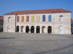
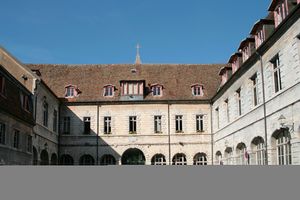
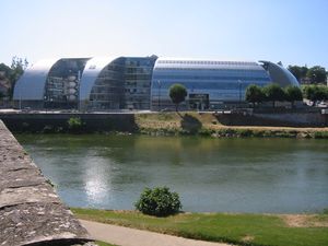
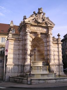
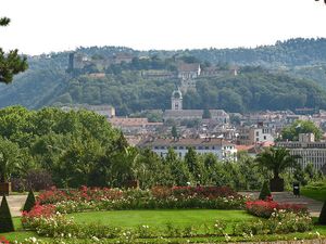
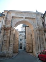
Left to right, top to bottom: the citadel, the tramway in Battant, an aerial view of the oxbow of the river Doubs, the Vauban quay, the Museum of Fine Arts and Archeology, the parc de la Gare-d'Eau, the Porte Noire and St. John's Cathedral, the Granvelle Palace. | |
| الشعار: Plût A Dieu ("If God wills") or Utinam | |
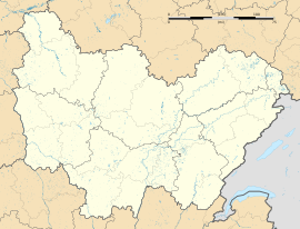
Location of بزانسون Besançon خطأ: الوظيفة "main" غير موجودة. | |
| الإحداثيات: 47°14′24″N 6°1′12″E / 47.24000°N 6.02000°E | |
| البلد | فرنسا |
| المنطقة | بورگون-فرانش-كومتيه |
| الإقليم | Doubs |
| الدائرة | Besançon |
| الكانتون | Besançon-1, 2, 3, 4, 5 and 6 |
| بينالتجمعات | Grand Besançon Métropole |
| الحكومة | |
| • العمدة (2020–2026) | Anne Vignot[1] (The Greens) |
| المساحة 1 | 65٫05 كم² (25٫12 ميل²) |
| • الحضر (2020) | 528٫6 كم² (204٫1 ميل²) |
| • العمران (2020) | 2٬514٫5 كم² (970٫9 ميل²) |
| التعداد (يناير 2019) | 117٬912 |
| • الترتيب | 32nd in France |
| • الكثافة | 1٬800/km2 (4٬700/sq mi) |
| • Urban (2020) | 196٬278 |
| • الكثافة الحضرية | 370/km2 (960/sq mi) |
| • العمرانية (2020[2]) | 281٬610 |
| • الكثافة العمرانية | 110/km2 (290/sq mi) |
| منطقة التوقيت | UTC+01:00 (CET) |
| • الصيف (التوقيت الصيفي) | UTC+02:00 (CEST) |
| INSEE/الرمز البريدي | 25056 /25000 |
| الموقع الإلكتروني | www |
| 1 French Land Register data, which excludes lakes, ponds, glaciers > 1 km2 (0.386 sq mi or 247 acres) and river estuaries. | |
بزانسون ( Besançon ؛ UK: /ˈbɛzənsɒn/,[3] US: /bəˈzænsən/,[4] بالفرنسية: [bəzɑ̃sɔ̃] (![]() استمع), فرنكو-پروڤنسال: [bəzɑ̃ˈsɔ̃]; archaic ألمانية: Bisanz; لاتينية: Vesontio)، مدينة تقع في دوب شرق فرنسا، وهي عاصمة فرانش كونته. لعبت المدينة دورا هاما في العصور الرومانية وجعلت منها التضاريس الجغرافية معقلاً عسكرياً هاماً في شرق فرنسا خاصة أنها على الحدود مع سويسرا وهي أيضاً مركز سياسي وعاصمة دينية.
استمع), فرنكو-پروڤنسال: [bəzɑ̃ˈsɔ̃]; archaic ألمانية: Bisanz; لاتينية: Vesontio)، مدينة تقع في دوب شرق فرنسا، وهي عاصمة فرانش كونته. لعبت المدينة دورا هاما في العصور الرومانية وجعلت منها التضاريس الجغرافية معقلاً عسكرياً هاماً في شرق فرنسا خاصة أنها على الحدود مع سويسرا وهي أيضاً مركز سياسي وعاصمة دينية.
أعلنت كأكثر مدينة خضراء في فرنسا لكثرة وتنوع أشجارها. لدى مدينة بيزانسون تراث غني تاريخياً وثقافياً ومعمارياً ووضعت على لائحة التراث العالمي ومدينة بزانسون هي مسقط رأس ڤكتور هوگو.
In 2020 the city had a population of 118,258, in a metropolitan area of 281,610, the second in the region in terms of population.
Established in a meander of the river Doubs, the city was already important during the Gallo-Roman era under the name of Vesontio, capital of the Sequani. Its geography and specific history turned it into a military stronghold, a garrison city, a political centre, and a religious capital.
Besançon is the historical capital of watchmaking in France. This has led it to become a centre for innovative companies in the fields of microtechnology, micromechanics, and biomedical engineering.[5] The University of Franche-Comté, founded in 1423, enrolls nearly 30,000 students each year, including around 4,000 trainees from all over the world within its Centre for Applied Linguistics (CLA).
The greenest city in France,[6] it enjoys a quality of life recognized in Europe. Thanks to its rich historical and cultural heritage and its unique architecture, Besançon has been labeled a "Town of Art and History" since 1986. Its fortifications, designed by Vauban, have been listed as a UNESCO World Heritage Site since 2008.[7]
التاريخ
الاسم الجغرافي
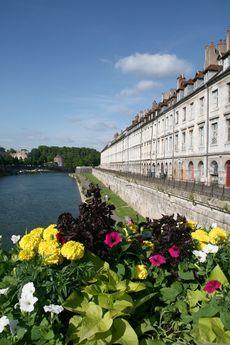
The city is first recorded in 58 BC as Vesontio in Book I of Julius Caesar's Commentarii de Bello Gallico. The etymology of Vesontio is uncertain. The most common explanation is that the name is of Celtic origin, derived from wes, meaning 'mountain'. During the 4th century, the letter B took the place of the V, and the city name changed to Besontio or Bisontion and then underwent several transformations to become Besançon in 1243.
التاريخ القديم
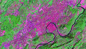
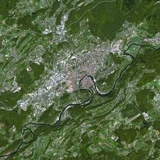
The city sits within an oxbow of the river Doubs (a tributary of the Saône); a mountain closes the fourth side. During the Bronze Age, c.1500 BC, tribes of Gauls settled the oxbow.
From the 1st century BC through the modern era, the town had a significant military importance because the Alps rise abruptly to its immediate south, presenting a significant natural barrier.
The Arar (Saône) River formed part of the border between the Haedui and their hereditary rivals, the Sequani.[citation needed] According to Strabo, the cause of the conflict was commercial.[8] Each tribe claimed the Arar and the tolls on trade along it. The Sequani controlled access to the Rhine River and had built an oppidum (a fortified town) at Vesontio to protect their interests. The Sequani defeated and massacred the Haedui at the Battle of Magetobriga, with the help of the Arverni tribe and the Germanic Suebi tribe under the Germanic king Ariovistus.
Julius Caesar, in his commentaries detailing his conquest of Gaul, describes Vesontio (possibly Latinized), as the largest town of the Sequani, a smaller Gaulic tribe, and mentions that a wooden palisade surrounded it. It appears as Vesontine in the Tabula Peutingeriana.
Over the centuries, the name permutated to become Besantio, Besontion, Bisanz in Middle High German, and gradually arrived at the modern French Besançon. The locals retain their ancient heritage referring to themselves as Bisontins (feminine: Bisontine).
It has been an archbishopric since the 4th century.
العصور الوسطى
In 843, the Treaty of Verdun divided up Charlemagne's empire. Besançon became part of Lotharingia، تحت دوق برگندي.
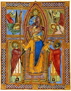
As part of the Holy Roman Empire since 1034, the city became an archbishopric, and was designated the Free Imperial City of Besançon (an autonomous city-state under the Holy Roman Emperor) in 1184. In 1157, Emperor Frederick Barbarossa held the Diet of Besançon. There, Cardinal Orlando Bandinelli (the future Pope Alexander III, then adviser of Pope Adrian IV) openly asserted before the Emperor that the imperial dignity was a papal beneficium (in the more general sense of favour, not the strict feudal sense of fief), which incurred the wrath of the German princes. He would have fallen on the spot under the battle-axe of his lifelong foe, Otto of Wittelsbach, had Frederick not intervened. The Archbishops were elevated to Princes of the Holy Roman Empire in 1288. The close connection to the Empire is reflected in the city's coat of arms.
In 1290, after a century of fighting against the power of the archbishops, the Emperor granted Besançon its independence.
عصر النهضة
In the 15th century, Besançon came under the influence of the dukes of Burgundy. After the marriage of Mary of Burgundy to Maximilian I, Holy Roman Emperor, the city was in effect a Habsburg fief. In 1519 Charles V, Holy Roman Emperor, King of Spain, became the Holy Roman Emperor. This made him master of the Franche-Comté and Besançon, a francophone imperial city. In 1526 the city obtained the right to mint coins, which it continued to strike until 1673. Nevertheless, all coins bore the name of Charles V.
When Charles V abdicated in 1555, he gave the Franche-Comté to his son, Philip II, King of Spain. Besançon remained a free imperial city under the protection of the King of Spain. In 1598, Philip II gave the province to his daughter on her marriage to an Austrian archduke. It remained formally a portion of the Empire until its cession at the peace of Westphalia in 1648. Spain regained control of Franche-Comté and the city lost its status as a free city. Then in 1667, Louis XIV claimed the province as a consequence of his marriage to Marie-Thérèse of Spain in the War of Devolution.
Louis conquered the city for the first time in 1668, but the Treaty of Aix-la-Chapelle returned it to Spain within a matter of months. While it was in French hands, the famed military engineer Vauban visited the city and drew up plans for its fortification. The Spaniards built the main centre point of the city's defences, "la Citadelle", siting it on Mont Saint-Étienne, which closes the neck of the oxbow that is the site of the original town. In their construction, the Spaniards followed Vauban's designs.
In 1674, French troops recaptured the city, which the Treaty of Nijmegen (1678) then awarded to France. At this time the city became the administrative centre for the Franche-Comté, with its own Parlement of Besançon, which replaced Dole.
As a result of control passing to France, Vauban returned to working on the citadel's fortifications, and those of the city. This process lasted until 1711, some 30 years, and the walls built then surround the city. Between the train station and the central city there is a complex moat system that now serves road traffic. Numerous forts, some of which date back to that time and that incorporate Vauban's designs elements sit on the six hills that surround the city: Fort de Trois Châtels, Fort Chaudanne, Fort du Petit Chaudanne, Fort Griffon, Fort des Justices, Fort de Beauregard and Fort de Brégille. The citadel itself has two dry moats, with an outer and inner court. In the evenings, the illuminated Citadelle stands above the city as a landmark and a testament to Vauban's genius as a military engineer.
أوروبا الحديثة
In 1814, the Austrians invaded and bombarded the city. It also occupied an important position during the Franco-Prussian War of 1870–71. In 1871, a project of Besançon Commune is engaged.
The Nazis occupied the citadel during World War II. Between 1940 and 1944, the Germans executed some one hundred French resistance fighters there. However, Besançon saw little action during the war. The allies bombed the railway complex in 1943, and the next year the Germans resisted the U.S. advance for four days.
Besançon was also the location, between 1940 and 1941, of an Internment Camp (Konzentrationslager), Frontstalag 142, also known as Caserne Vauban, which the Germans set up for 3–4,000 holders of British passports, all women and children. The conditions were harsh; many hundreds of internees died of pneumonia, diarrhea, food poisoning, dysentery, and frostbite.[9]
In 1959, the French Army turned the citadel over to the city of Besançon, which turned it into a museum.
The forts of Brégille and Beauregard sit across the Doubs from the city. In 1913, a private company built a funicular to the Brégille Heights. The funicular passed from private ownership to the SNCF, who finally closed it in 1987. The funicular's tracks, stations and even road signs remain in place to this day.
الجغرافيا
الموقع
Besançon is located in the north-east quarter of France on the river Doubs. It is about 325 كيلومتر (202 ميل) east of the national capital of Paris, 100 كيلومتر (62 ميل) east of Dijon in Burgundy, 125 km (78 mi) northwest of Lausanne in Switzerland, and 100 km (62 mi) southwest of Belfort in Franche-Comté. It is located at the edge of the Jura Mountains.
التضاريس
The city initially developed in a natural meander (or oxbow loop) of the river Doubs with a diameter of almost 1،000 متر (3،281 أقدام). The flat inner loop has an elevation of about 250 متر (820 أقدام), and is bounded to the south by a hill called Mont Saint-Étienne, which has a maximum height of 371 متر (1،217 أقدام). The city is surrounded by six other hills which range in elevation from 400 إلى 500 متر (1،312 إلى 1،640 أقدام): Brégille, Griffon, Planoise, Chaudanne, Montfaucon, and Montboucon. (There is a barge canal that cuts through rock under Mont Saint-Étienne, short-cutting the meander.)
المناخ
Besançon is under the influence of both an oceanic climate (notable precipitations in quantity as much as in frequency) and a continental climate with hard winters (snow, frost) and warm and dry summers. The year-round average is 11.5 °C (53 °F). The warmest month is July 20 °C (68 °F) and the coldest is January 2.1 °C (36 °F). Besançon receives about 1،059 mm (42 in) of precipitation per year. The wettest month is May (108.4 mm (4.3 in)); the driest is August (76.9 mm (3.0 in)). The highest temperature ever, recorded on 28 July 1921, was 40.3 °C (104.5 °F), and the lowest was a −20.7 °C (−5.3 °F) reached on 1 January 1985.
| بيانات المناخ لـ بزانسون | |||||||||||||
|---|---|---|---|---|---|---|---|---|---|---|---|---|---|
| الشهر | ينا | فب | مار | أبر | ماي | يون | يول | أغس | سبت | أكت | نوف | ديس | السنة |
| متوسط القصوى اليومية °س (°ف) | 5 (41) |
6.1 (43.0) |
10.8 (51.4) |
14.9 (58.8) |
20.7 (69.3) |
23.4 (74.1) |
25.7 (78.3) |
26.1 (79.0) |
22.2 (72.0) |
18.0 (64.4) |
13.2 (55.8) |
7.1 (44.8) |
16.1 (61.0) |
| المتوسط اليومي °س (°ف) | 2.1 (35.8) |
3.1 (37.6) |
6.7 (44.1) |
9.7 (49.5) |
15.2 (59.4) |
17.9 (64.2) |
20 (68) |
20.2 (68.4) |
16.9 (62.4) |
13.4 (56.1) |
8.8 (47.8) |
4.1 (39.4) |
11.5 (52.7) |
| متوسط الدنيا اليومية °س (°ف) | −0.8 (30.6) |
0 (32) |
2.5 (36.5) |
4.5 (40.1) |
9.7 (49.5) |
12.4 (54.3) |
14.2 (57.6) |
14.3 (57.7) |
11.6 (52.9) |
8.8 (47.8) |
4.4 (39.9) |
1.0 (33.8) |
6.9 (44.4) |
| متوسط تساقط الأمطار mm (inches) | 88.5 (3.48) |
81.8 (3.22) |
83.5 (3.29) |
90.6 (3.57) |
108.4 (4.27) |
97.1 (3.82) |
78.5 (3.09) |
76.9 (3.03) |
78.2 (3.08) |
85.8 (3.38) |
96.7 (3.81) |
93.0 (3.66) |
1٬059 (41.7) |
| Source: Météo France | |||||||||||||
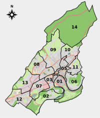
المناطق
|
- Center (the buckleet and Saint-Jean) – Chapelle des Buis
- Battant
- Bregille
- Vaites – Clairs-Soleils
- Velotte
- Butte – Grette
- Chaprais – Cras
- Palente – Orchamps – Combe Saragosse
- Tilleroyes
- Montrapon – Montboucons – Fontaine-écu
- Planoise – Châteaufarine
- Saint-Claude – Torcols
- Saint-Ferjeux – Rosemont
- Chailluz
الحدائق والمنتزهات
- Jardin botanique de Besançon
- Parc Micaud
- Parc de la Gare d'Eau
- Parc de la Citadelle
- Promenade Granvelle
- Promenade Chamars
السكان
| السنة | تعداد | ±% |
|---|---|---|
| 1800 | 28٬436 | — |
| 1836 | 29٬718 | +4.5% |
| 1841 | 36٬461 | +22.7% |
| 1861 | 46٬786 | +28.3% |
| 1876 | 54٬404 | +16.3% |
| 1896 | 57٬556 | +5.8% |
| 1911 | 57٬978 | +0.7% |
| 1921 | 55٬652 | −4.0% |
| 1936 | 65٬022 | +16.8% |
| 1946 | 63٬508 | −2.3% |
| 1954 | 73٬445 | +15.6% |
| 1962 | 95٬642 | +30.2% |
| 1968 | 113٬220 | +18.4% |
| 1975 | 120٬315 | +6.3% |
| 1982 | 113٬283 | −5.8% |
| 1990 | 113٬828 | +0.5% |
| 1999 | 117٬733 | +3.4% |
| 2008 | 117٬599 | −0.1% |
الحكومة والسياسة
الاقتصاد
التعليم
الثقافة
أهم المواقع
- several Roman remains,
- the 16th century Palais Granvelle,
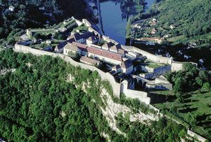
- Vauban's citadel (Citadel of Besançon)
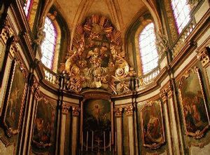
- the Cathedral of St. Jean,
- several Spanish Renaissance-style buildings
- the Église de la Madeleine, and
- the river frontage.
قلعة بزانسون
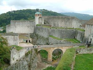
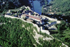
قلعة بزانسون بناها سيباستيان فوبان 1678–1771 ويزورها حوالي 250000 زائر سنوياً وهي المكان الأكثر زيارة في فرانش كونته ويغطي عدة هكتارات وتقع فوق قمة سانت إيتيان على ارتفاع بين 330 و 370 م.و تضم القلعة متحف للمقاومة الفرنسية ضد ألمانيا النازية ومتحف الحياة المحلية ومتحف أثري وحديقة حيوانات التي تنتشر في جميع أرجاء القلعة.
| قلعة بيزانسون | |
|---|---|
| |
متاحف أخرى، وأحواض السمك، وحدائق الحيوان
- Museum of Time
- Museum of Franche-Comté
- Museum of Natural history, which contains a zoo, aquarium, insectarium, noctarium, and a climatology exhibit
مراكز الفنون المسرحية
- Opéra Théâtre: construit par Ledoux de 1778 à 1784
- Grand Kursaal
- Nouveau Théâtre – Centre Dramatique National
- Cirque Plume
- Théâtre Bacchus
- Théâtre de la Bouloie
- Théâtre de l'Espace
الأحداث السنوية الثقافية والمعارض
الرياضة
| النادي | الرياضة | الدوري | الاستاد |
|---|---|---|---|
| Besançon Racing Club | Football | Championnat de France Amateurs | Stade Léo Lagrange |
| Entente Sportive Bisontine Masculin | Handball | Nationale 1 | Gymnase des Montboucons |
| Entente Sportive Bisontine Feminin | Handball | Division 1 (women's) | Palais des Sports |
النقل
المواليد
- Claude Goudimel (1510–1572) – Musician, Teacher of Palestrina. Composer of the music for Protestant hymns
- Antoine Perrenot de Granvelle (1517–1586) – Cardinal, statesman and humanist. Counsellor of Charles V, Viceroy of Naples
- Jean-Baptiste Besard (1567-1625?) - Lawyer, Doctor of Medicine and Composer for the Lute
- Jean Mairet (1604–1686) – Dramatist
- Charles Fourier (1772–1837) – Inventor of socialist "phalansteries" (vast communal buildings surrounded by a highly cultivated agricultural area)
- Charles-Etienne Francois Ruty (1777-1828) - Comte, General, Peer - commissioned into the army in 1793 and served at first in northern France and on the Franco-German border. He took part in the Egyptian campaign and commanded the artillery at the battle of Aboukir. He was promoted to brigadier-general in 1807 and served with distinction in Spain, then promoted to Lt General in 1813. In 1815 he rallied to Napoléon but he remained in favour under the Bourbon monarchy. His name is inscribed on the south side of the Arc de Triomphe.
- Charles Nodier (1780–1844) – Writer. Leader of the Romantic movement
- Jean Claude Eugène Péclet (1793–1857) – physicist, gave his name to the Péclet number
- Victor Hugo (1802–1885) – Writer and poet
- Pierre-Joseph Proudhon (1809–1865)- Journalist (Le Peuple) and author of world-renowned anarchist theories
- Adolphe Braun (1812–1877) - Early photographer
- Hilaire de Chardonnet (1838–1924) – Inventor of artificial silk
- Louis-Jean Résal (1854–1920) – Engineer who built the Pont Mirabeau and the Pont Alexandre III in Paris
- Auguste and Louis Lumière, (1862–1954) and (1864–1948) – Inventors of cinematography
- Tristan Bernard (1866–1947) – Journalist and Humorist
- Albert Seitz (1872–1937) – composer and violist
- Ludovic Arrachart (1897–1933), aviator
- Jean de Gribaldy (1922–1987) – Professional racing cyclist and directeur sportif
- Raymond Blanc (1949– ) – Chef
- Morrade Hakkar (1972– ) – Boxer
- Gaspard Augé (1979– ) – One half of electro group Justice
- Cyril Kali footballer
- Yohann Lasimant footballer
- Lucien Laurent footballer
المصادر الأدبية
- Julius Caesar, in his account Commentarii de Bello Gallico gives a description of the antique city of Besançon, named Vesontio (first book, section 38):
- [1.38] When he had proceeded three days' journey, word was brought to him that Ariovistus was hastening with all his forces to seize on Vesontio, which is the largest town of the Sequani, and had advanced three days' journey from its territories. Caesar thought that he ought to take the greatest precautions lest this should happen, for there was in that town a most ample supply of every thing which was serviceable for war; and so fortified was it by the nature of the ground, as to afford a great facility for protracting the war, inasmuch as the river Doubs almost surrounds the whole town, as though it were traced round it with a pair of compasses. A mountain of great height shuts in the remaining space, which is not more than 600 أقدام (180 m), where the river leaves a gap, in such a manner that the roots of that mountain extend to the river's bank on either side. A wall thrown around it makes a citadel of this [mountain], and connects it with the town.
- Gary Jennings's novel Raptor, which takes place in the 5th century AD, describes Vesontio lavishly.
- In Stendhal's novel Le rouge et le noir, Julien Sorel, the main character, studies for a while at the Catholic seminary at Besançon (first book, chapters 24 to 30):
- Eventually he saw the white walls beyond the distant mountain; it was the citadel of Besançon. "What a difference", he said, sighing, "if I could come into this fine city as a sub-lieutenant of one of these regiments of the post." Besançon is not only one of the prettiest cities in France, but it abounds in brave and intelligent men. Julien, however, was only a little peasant, without any means of approaching distinguished personages.
- In the poem This century was two years old (Les Feuilles d'automne; literally – "The Leaves of Autumn"), Victor Hugo evokes his birth in Besançon:
- This century was two years old. Rome was replacing Sparta;
- Already Napoleon was emerging from under Bonaparte.
- And already the First Consul's tight mask
- Had been split in several places by the Emperor's brow.
- It was then that in Besançon, that old Spanish town,
- Cast like a seed into the flying wind,
- A child was born of mixed blood—Breton and Lorraine --
- Pallid, blind and mute,...
- That child, whom Life was scratching from its book,
- And who had not another day to live,
- Was me.
- Besançon is where the Touché! series, an Australian series of books that teaches people French, is set. The series is about an Australian boy called Nick, who moves to Besançon after his parents separate. He settles in a street called rue Cézanne where he befriends a French girl called Marianne. She introduces him to other residents of rue Cézanne, such as Ahmed, Annick, François Petitpain, Émile Mesquin, Monsieur Fric, Madame Boulin and Mademoiselle Moh. The first two books of the series take place in Besançon, whilst in the third, Nick visits his uncle in New Caledonia. In the fourth, Nick stays in Quebec, Canada. After the fourth book, Nick returns to Besançon.
- Julian Barnes's novel A History of the World in 10½ Chapters features as chapter 3: "Wars of Religion"—a fictional manuscript reportedly from the Archives Municipales de Besançon.
- Balzac's novel Albert Savaron takes place in Besançon.
- Colonel Sainte-Hermine, the fictional hero of Alexandre Dumas' The Last Cavalier, is a native of Besançon.
المدن الشقيقة
 Tver (روسيا)
 Freiburg im Breisgau (ألمانيا)
 Kuopio (فنلندة)
 Huddersfield – Kirklees (المملكة المتحدة)
 Bielsko-Biala (پولندا)
 Neuchâtel (سويسرا)
 Bistriţa (رومانيا)
 پاڤيا (ايطاليا)
 Hadera (إسرائيل)
 Douroula (Burkina Faso)
 Man (Côte d'Ivoire)
 Charlottesville – ڤرجينيا (الولايات المتحدة)
انظر أيضا
المصادر
- ^ "Répertoire national des élus: les maires" (in الفرنسية). data.gouv.fr, Plateforme ouverte des données publiques françaises. 13 September 2022.
- ^ INSEE. "France par aire d'attraction des villes - Population municipale 2019 >> Tableau". Retrieved 20 June 2022.
- ^ "Besançon". Lexico UK English Dictionary. Oxford University Press. Archived from the original on 2020-08-18.
- ^ قالب:Cite Merriam-Webster
- ^ Beckett, Kathleen (2018-01-15). "The Watch Capital of France? Besançon". The New York Times (in الإنجليزية الأمريكية). ISSN 0362-4331. Retrieved 2022-03-06.
- ^ Considering surface green spaces per inhabitant, Numbers available on the encyclopedia site Quid, at the bottom of the page Archived 9 فبراير 2010 at the Wayback Machine
- ^ "Fortifications of Vauban". UNESCO World Heritage Centre. United Nations Educational, Scientific, and Cultural Organization. Retrieved 14 November 2021.
- ^ Strabo, Geography 4.3.2
- ^ Shakespeare, Nicholas (2013) Priscilla: The Hidden Life of an Englishwoman in Wartime France. (Harvill Secker).
وصلات خارجية
- City Council Website (in French)
قالب:Doubs communes قالب:Fortifications of Vauban UNESCO World Heritage Sites
- Pages using gadget WikiMiniAtlas
- CS1 الفرنسية-language sources (fr)
- CS1 الإنجليزية الأمريكية-language sources (en-us)
- Short description is different from Wikidata
- Articles with hatnote templates targeting a nonexistent page
- Missing redirects
- Coordinates on Wikidata
- Pages using infobox settlement with image map1 but not image map
- France articles requiring maintenance
- Pages with plain IPA
- Articles containing ألمانية-language text
- Pages using Lang-xx templates
- Articles containing لاتينية-language text
- Articles with unsourced statements from July 2022
- بزانسون
- بلديات دوب
- Sequani
- مقاطعات فرنسا


