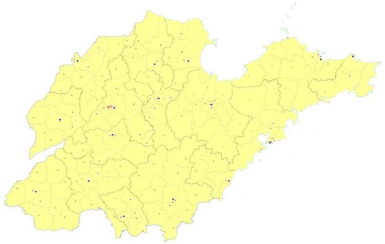
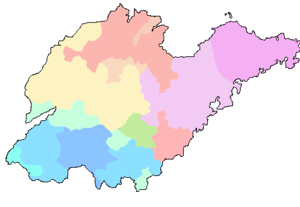
شاندونگ Shandong
مقاطعة شاندونگ
山东省 Shandong Province | |
|---|---|
| الترجمة اللفظية بالـ الاسم | |
| • الصيني | 山东省 (Shāndōng Shěng) |
| • الاختصار | SD / 鲁 (پنين: Lǔ) |
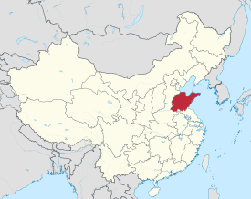 خريطة توضح موقع مقاطعة شاندونگ. | |
| الإحداثيات: 36°24′N 118°24′E / 36.4°N 118.4°E | |
| العاصمة | جينان |
| أكبر مدينة | لينيي (تعداداً ومساحةً)
جينان (عدد السكان الحضريين وعدد سكان المناطق الحضرية ووسط المدينة) چینگداو (منطقة وسط المدينة) |
| الأقسام | 16 محافظة، 140 ناحية، 1941 بلدية |
| الحكومة | |
| • الأمين | لين وو[1] |
| • رئيس المؤتمر | يلن وو |
| • الحاكم | ژو نايشيانگ |
| • رئيس المؤتمر السياسي الاستشاري للحزب | گى هويجون |
| • التمثيل في مؤتمر الشعب الوطني | 174 نائب |
| المساحة | |
| • الإجمالي | 157٬100 كم² (60٬700 ميل²) |
| ترتيب المساحة | رقم 20 |
| أعلى منسوب (جبل تاي) | 1٬545 m (5٬069 ft) |
| التعداد (2020)[3] | |
| • الإجمالي | 101٫527٫453 |
| • الترتيب | رقم 2 |
| • الكثافة | 0٫00٬065/km2 (0٫0٬017/sq mi) |
| • ترتيب الكثافة | رقم 5 |
| صفة المواطن | Shandongese |
| الديموغرافيا | |
| • التركيب العرقي | |
| • اللغات واللهجات | مندرينية جياولياو، مندرينية جيلو، مندرينية ژونگيوان |
| ن.م.إ. (2023)[4] | |
| • Total | 9.21 تريليون يوان (رقم 3) (1.31 تريليون دولار) |
| • للفرد | 90.772 يوان رقم 11) (12.881 دولار) |
| ISO 3166 code | CN-SD |
| م.ت.ب. (2022) | 0.789[5] (رقم 13) – مرتفع |
| الموقع الإلكتروني | sd |
| شاندونغ | |||||||||||||||||||||||||||||||||
|---|---|---|---|---|---|---|---|---|---|---|---|---|---|---|---|---|---|---|---|---|---|---|---|---|---|---|---|---|---|---|---|---|---|
 "شاندونگ " بالحروف الصينية المبسطة (أعلى) والتقليدية (أسفل). | |||||||||||||||||||||||||||||||||
| الصينية المبسطة | 山东 | ||||||||||||||||||||||||||||||||
| الصينية التقليدية | 山東 | ||||||||||||||||||||||||||||||||
| المعنى الحرفي | "شرق الجبال (تايهانگ)" | ||||||||||||||||||||||||||||||||
| |||||||||||||||||||||||||||||||||
شاندونگ ، (شاندونگ ، بالصينية: 山东省، بالإنگليزية: Shandong) [note 1]، هي مقاطعة ساحلية في شرق الصين.[8] لعبت شاندونگ دوراً رئيسياً في التاريخ الصيني منذ فجر الحضارة الصينية على امتداد النهر الأصفر. وكانت مركزاً ثقافياً ودينياً محورياً للطاوية والبوذية الصينية والكونفوشيوسية. يُعد جبل تاي في شاندونگ أكثر جبال الطاوية تبجيلاً، وهو موقعٌ يتميز بواحدٍ من أطول تواريخ العبادة الدينية المتواصلة في العالم.[9] كانت المعابد البوذية في الجبال الواقعة جنوب العاصمة الإقليمية جينان من بين أهم المواقع البوذية في الصين.[10] كانت مدينة تشوفو مسقط رأس كونفوشيوس، وأصبحت فيما بعد مركزاً للكونفوشيوسية.[11]
ساهم موقع شاندونگ عند تقاطع طرق التجارة القديمة والحديثة بين الشمال والجنوب والشرق والغرب في ترسيخ مكانتها كمركزاً اقتصادياً. بعد فترة من عدم الاستقرار السياسي والصعوبات الاقتصادية التي بدأت في أواخر القرن التاسع عشر، شهدت شاندونگ نمواً سريعاً في العقود الأخيرة. يبلغ عدد سكان شاندونگ أكثر من 100 مليون نسمة، وهي سادس أكبر كيان دون وطني اكتظاظاً بالسكان في العالم، وثاني أكبر المقاطعات الصينية اكتظاظاً بالسكان.[12] اقتصاد شاندونگ هو ثالث أكبر اقتصاد إقليمي في الصين، حيث بلغ الناتج المحلي الإجمالي 8.3 تريليون يوان (1.3 تريليون دولار أمريكي) عام 2021، وهو ما يعادل الناتج المحلي الإجمالي للمكسيك.[13][14] إذا ما أُعتبرت من بين الدول السيادية، فستحتل شاندونگ المرتبة 15 من حيث الاقتصاد، والمرتبة 15 من حيث عدد السكان، اعتباراً من 2021.[15] ناتجها المحلي الإجمالي حول المتوسط الوطني.
شاندونگ إحدى المقاطعات الرائدة في مجال التعليم والبحث العلمي في الصين. تضم 153 مؤسسة للتعليم العالي، وتحتل المرتبة الثانية في شرق الصين بعد جيانگسو، والرابعة بين جميع المقاطعات الصينية بعد جيانگسو وگوانگدونگ وخـِنان.[16] اعتبارًا من عام 2024، صنف مؤشر نيتشر مدينتين رئيسيتين في شاندونگ (جينان رقم 31 وچینگداو رقم 38) ضمن أفضل 40 مدينة عالمية من حيث إنتاج البحث العلمي.[17]
الاسم
بشكل فردي، يعني الحرفان الصينيان في اسم شاندونگ "الجبل" (山) و"الشرق" (东. وبالتالي، يمكن ترجمة شاندونگ حرفياً إلى "شرق الجبال"، وتشير إلى موقع المقاطعة شرق جبال تايهانگ.[18] اسم التدليل الشائع لشاندونگ هو تشيلو (الصينية المبسطة: 齐鲁; الصينية التقليدية: 齊魯)، على اسم دويلتي تشي ولو اللتين كانتا قائمتين في المنطقة خلال فترة الربيع والخريف، كانت دويلة تشي قوة عظمى في عصرها، بينما كان دور دويلة لو محدوداً في السياسة آنذاك. مع ذلك، اشتهرت لو بكونها موطن كونفوشيوس، وبالتالي تفوق تأثيرها الثقافي على تأثير دويلة تشي. تتجلى الهيمنة الثقافية لتراث دولة لو في الاختصار الرسمي لشاندونگ وهو "鲁" (الصينية: 魯; پنين: Lǔ). أطلق الناطقون بالإنگليزية في القرن التاسع عشر على المقاطعة اسم "شان-تونگ".[19]
التاريخ
التاريخ القديم
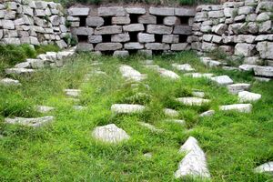
بفضل موقعها على الحافة الشرقية لسهل شمال الصين، كانت شاندونگ موطناً لسلسلة من ثقافات العصر الحجري الحديث لآلاف السنين، بما في ذلك ثقافة هولي (ح. 6500-5500 ق.م.)، بـِيْشين (ح. 5300-4100 ق.م.)، دوونكو (ح. 4100-2600 ق.م.)، لونگشان (ح. 3000-2000 ق.م.)، ويوىشي (ح. 1900-1500 ق.م.).
مارست أسرتا شانگ وژو درجات متفاوتة من السيطرة على غرب شاندونگ، بينما سكن شعوب الدونگي شرق شاندونگ، الذين اعتبرهم سكان السهل الأوسط برابرة. بعد ضم دويلة تشي عام 567 ق.م، أصبحت الدونگي تدريجياً صينيو الطابع.
خلال فترتي الربيع والخريف والدويلات المتناحرة، تراكمت السلطة بين الدويلات الإقليمية؛ فكانت شاندونگ موطناً لدويلة تشي المتمركزة في لينزي القديمة، ودويلة لو المتمركزة في تشوفو. اشتهرت لو بكونها موطناً لكونفوشيوس؛ إلا أنها كانت صغيرة نسبياً، وضمتها في النهاية دويلة تشو المجاورة جنوبها. في غضون ذلك، كانت تشي قوة عظمى طوال تلك الفترة، وحكمت مدناً منها لينزي، جيمو (بالقرب من چینگداو المعاصرة)، وجو.
التاريخ الإمبراطوري
غزت أسرة تشين دويلة تشي وأسست أول دولة صينية مركزية عام 221 ق.م. وأسست أسرة هان التالية عدة قيادات عسكرية تشرف عليها منطقتان (刺史部) فيما يُعرف الآن بشاندونگ: تشينگژو (青州) في الشمال ويانژو (兗州) في الجنوب. خلال فترة الممالك الثلاث، كانت شاندونگ جزءاً من مملكة تساو وِيْ الشمالية، التي حكمت شمال الصين.
بعد فترة الممالك الثلاث، أفسحت فترة وجيزة من الوحدة في عهد أسرة جين الغربية المجال لغزوات البدو الرحل من الشمال. اجتاح شمال الصين، بما في ذلك شاندونگ. وعلى مدار القرن التالي تقريبًا، انتقلت السيطرة على شاندونگ عدة مرات، فسقطت في أيدي أسرة ژاو السابقة، ثم يان السابقة، ثم چين السابقة، ثم يان اللاحقة، ثم يان الجنوبية، ثم أسرة سونگ، وأخيراً وِيْ الشمالية، أولى الأسر الشمالية خلال فترة الأسر الشمالية والجنوبية. وظلت شاندونگ تحت سيطرة الأسر الشمالية طوال هذه الفترة.
عام 412 م، نزل الراهب الصيني البوذي فاشيآن في لاوشان، على الحافة الجنوبية لشبه جزيرة شاندونگ، وتوجه إلى تشينگژو لتحرير وترجمة الكتب المقدسة التي أحضرها معه من الهند.
أعادت أسرة سوي الوحدة عام 589، وترأست أسرة تانگ (618-907) العصر الذهبي التالي للصين. في بداية هذه الفترة، كانت شاندونگ تُحكم كجزء من دائرة خـِنان، إحدى دوائر الصين (تقسيم سياسي). لاحقاً، انقسمت الصين إلى فصائل أمراء حرب، مما أدى إلى ظهور فترة الأسر الخمس والممالك العشر. كانت شاندونگ جزءاً من الأسر الخمس، وجميعها متمركزة في الشمال.
أعادت أسرة سونگ توحيد الصين في أواخر القرن العاشر. استندت الرواية الكلاسيكية حافة الماء إلى حكايات شعبية عن عصابات خارجة عن القانون نشطت في شاندونگ في عهد سلالة سونگ. في عام 1996، أُشيد باكتشاف أكثر من مئتي تمثال بوذي مدفون في تشينگژو باعتباره اكتشافاً أثرياً هاماً. تضمنت التماثيل نماذج مبكرة لشخصيات مرسومة، ويُعتقد أنها دُفنت بسبب قمع الإمبراطور هويزونگ للبوذية (حيث كان مؤيداً للطاوية).
أُجبرت أسرة سونگ على التنازل عن شمال الصين لأسرة جورتشن جين عام 1142. خضعت شاندونگ لإدارة جين باعتبارها دائرة شاندونگ الشرقية ودائرة شاندونگ الغربية - وهو أول استخدام لاسمها الحالي.
التاريخ الحديث المبكر
تأسست مقاطعة شاندونگ الحديثة في عهد أسرة مينگ، حيث امتدت أراضيها إلى مساحة أوسع، بما في ذلك المنطقة الزراعية من لياوننگ. بعد انتقال مينگ-تشينگ عام 1644، اكتسبت شاندونگ حدودها الحالية تقريباً.
في 25 يوليو 1668، ضرب شاندونگ زلزال بقوة 8.5 ريختر، وكان مركزه شمال شرق ليني، مما أدى إلى تدمير المقاطعة ومقتل 43.000-50.000 شخص.[20][21]
خلال القرن التاسع عشر، أصبحت الصين أكثر تعرضاً للتأثير الغربي؛ وتأثرت مقاطعة شاندونگ الساحلية الخاضعة لدوقية شيأونگ بشكل كبير. تم تأجير چینگداو لألمانيا عام 1897 ووِيْهاي لبريطانيا عام 1898. ونتيجة للضغوط الأجنبية من قبل الإمبراطورية الروسية، التي ضمت منشوريا الخارجية بحلول عام 1860، شجعت أسرة تشينگ شعب الشاندونگ على استيطان ما تبقى من منشوريا.
كانت شاندونگ من أولى المناطق التي اندلعت فيها ثورة الملاكمين، وأصبحت إحدى مراكز الانتفاضة. عام 1899، عُيّن يوان شيكاي، جنرال أسرة تشينگ، حاكماً للمقاطعة من أجل قمع الانتفاضة، وشغل هذا المنصب لثلاث سنوات.
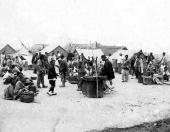
سيطرت ألمانيا على شبه الجزيرة عام 1898، واستأجرت خليج جياوژو وميناء چینگداو بالقوة. كان التطوير أولوية قصوى للألمان: فقد استُثمر أكثر من 200 مليون مارك في مرافق ميناء عالمية المستوى، بما في ذلك المراسي، والآلات الثقيلة، وأحواض السكك الحديدية، وحوض جاف عائم. وعملت الشركات الخاصة في جميع أنحاء مقاطعة شاندونگ، حيث افتتحت مناجم وبنوكاً ومصانع وخطوط سكك حديدية.[22] نتيجةً للحرب العالمية الأولى، استولت اليابان على الممتلكات الألمانية في چینگداو وشاندونگ. نقلت معاهدة ڤرساي 1919 الملكية إلى اليابان بدلاً من استعادة السيادة الصينية على المنطقة. أدى الاستياء الشعبي من هذه النتيجة، المعروف باسم مسألة شاندونگ، إلى احتجاجات طلابية عنيفة في تجلت في حركة الرابع من مايو. من بين التحفظات على المعاهدة التي وافقت عليها لجنة العلاقات الخارجية بمجلس الشيوخ الأمريكي "منح شاندونگ للصين"، إلا أن المعاهدة التي تضمنت تحفظات لم تُعتمد. أخيراً، عادت شاندونگ إلى السيطرة الصينية عام 1922 بعد وساطة الولايات المتحدة خلال مؤتمر واشنطن البحري. تلتها وِيْهاي عام 1930.[23]
عادت السيطرة على شاندونگ إلى عصر أمراء الحرب في جمهورية الصين. سُلّمت شاندونگ إلى عصبة ژيلي، لكن بعد حرب ژيلي-فنگتيان الثانية 1924، تولّت عصبة فنگتيان المتمركزة في شمال شرق الصين زمام الأمور. في أبريل 1925، نصّبت فنگتيان أمير الحرب ژانگ زونگتشانگ، الملقب بـ"الجنرال اللعين"، حاكماً عسكرياً لمقاطعة شاندونگ. وصفته مجلة تايم بأنه "أحط أمراء الحرب" في الصين.[مطلوب توضيح][24] حكم المقاطعة حتى عام 1928، حين أُطيح به في أعقاب الحملة الشمالية. خلفه هان فوجو، الذي كان موالياً للقائد العسكري فنگ يوشيانگ، لكنه غيّر ولائه لاحقاً إلى حكومة نانجينگ برئاسة تشيانگ كاي-شك. كما أطاح هان فوجو بالقائد العسكري ليو ژننيان، الملقب "بملك شرق شاندونگ"، الذي حكم شرق مقاطعة شاندونگ، موحداً المقاطعة تحت حكمه.
عام 1937، بدأت اليابان غزوها للصين الداخلية أثناء الحرب الصينية اليابانية الثانية، والتي أصبحت لاحقاً جزءاً من مسرح عمليات المحيط الهادي خلال الحرب العالمية الثانية. عُيّن هان فوجو نائباً للقائد العام لمنطقة الحرب الخامسة، وتولى مسؤولية الدفاع عن وادي النهر الأصفر السفلي. إلا أنه تخلى عن قاعدته في جينان عندما عبرت القوات اليابانية النهر الأصفر. وأُعدم بعد ذلك بوقت قصير لعدم امتثاله للأوامر.
أثناء الاحتلال الياباني، ومع استمرار المقاومة في الريف، كانت شاندونگ إحدى المقاطعات التي طبّق فيها الجنرال الياباني ياسوجي أوكامورا سياسة الأرض المحروقة، سياسة الكل الثلاثة ("اقتل الكل"، "أحرق الكل" و"انهَب الكل". واستمر هذا حتى استسلام اليابان عام 1945، مما أسفر عن مقتل ملايين الأشخاص في شاندونگ وشمال الصين. وبحلول عام 1945، كانت قوات الجيش الأحمر الصيني الشيوعي قد سيطرت بالفعل على بعض أجزاء شاندونگ. على مدار السنوات الأربع التالية من الحرب الأهلية الصينية، وسّعوا نفوذهم، مما أدى في النهاية إلى طرد الكومنتانگ (حكومة جمهورية الصين) من شاندونگ إلى جزيرة تايوان بحلول يونيو 1949، بمن فيهم أحد نبلاء أسرة شيأونگ (熊) الذي كان حاكماً، والذي كان دوقية في العصر الإمبراطوري، وكونتية قديمة تعود أصولها إلى عهد أسرة تشو. أُعلنت جمهورية الصين الشعبية في أكتوبر من ذلك العام.
في ظل الحكومة الجديدة، مُنحت أجزاء من غرب شاندونگ في البداية لمقاطعة پينگيوان قصيرة العمر، لكن هذا لم يدم طويلاً. كما استحوذت شاندونگ على منطقتي شوژو وليانيونگانگ من مقاطعة جيانگسو، لكن هذا لم يدم طويلاً أيضاً. في معظم الأحيان، حافظت شاندونگ على حدودها الحالية.
لقى قرابة ستة ملايين شخص جوعاً في شاندونگ أثناء مجاعة الصين الكبرى.[25]
في السنوات الأخيرة، شهدت مقاطعة شاندونگ ، وخاصة شرق شاندونگ، تنمية اقتصادية كبيرة، لتصبح واحدة من أغنى مقاطعات جمهورية الصين الشعبية.
الجغرافيا


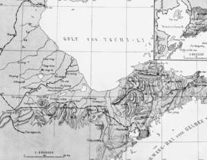
تقع مقاطعة شاندونگ على الحافة الشرقية لسهل شمال الصين وفي المجرى السفلي للنهر الأصفر، وتمتد إلى البحر كشبه جزيرة شاندونگ. يحدها بحر بوهاي من الشمال، خىبـِيْ من الشمال الغربي، خـِنان من الغرب، جيانگسو من الجنوب، والبحر الأصفر من الشمال الشرقي والشرق والجنوب الشرقي. وتشترك في حدود قصيرة مع آنهوي بين خـِنان وجيانگسو.
الأجزاء الشمالية الغربية والغربية والجنوبية الغربية من المقاطعة جميعها جزء من سهل شمال الصين الشاسع. يتميز مركز المقاطعة بتضاريس جبلية أكثر، وأبرزها جبل تاي. يمتد شرق المقاطعة عبر شبه جزيرة شاندونگ الجبلية الممتدة حتى البحر؛ أما أرخبيل مياوداو، فيقع شمال شبه جزيرة شاندونگ، ويحدها بحر بوهاي (غرباً) والبحر الأصفر (شرقاً). أعلى قمة في شاندونگ هي قمة الإمبراطور جايد، بارتفاع 1545 متراً، وهي أيضاً أعلى قمة في سلسلة جبال تاي.[citation needed]
يمر النهر الأصفر عبر المناطق الغربية لشاندونگ، ومنذ عام 1855، يصب في البحر وصولاً إلى الساحل الشمالي لشاندونگ. في شاندونگ، يتدفق على جسر طبيعي أعلى من مستوى الأرض المحيطة، ويقسم غرب شاندونگ إلى حوض هاي هي في الشمال وحوض نهر هواي في الجنوب. تدخل القناة الكبرى شاندونگ من الشمال الغربي وتخرج من الجنوب الغربي. بحيرة وِيْشان هي أكبر بحيرة في المقاطعة. يبلغ طول ساحل شاندونگ 3000 كيلومتر.
تتميز شبه جزيرة شاندونگ بساحل صخري مليء بالمنحدرات والخلجان والجزر؛ ويحد خليج لايژو، وهو أقصى الخلجان الثلاثة جنوباً في بحر بوهاي، الساحل الشمالي بين دونگينگ وپنگلاي؛ بينما تحيط مدينة [[چینگداو ] بخليج جياوژو، وهو أصغر بكثير. تمتد جزر مياوداو شمالاً من أقصى ساحل شمال شبه الجزيرة، فاصلةً بين بحر بوهاي والبحر الأصفر.
مع كون جينان بمثابة المركز الاقتصادي والثقافي للمقاطعة، أدت القوة الاقتصادية للمقاطعة إلى تطوير المدن الساحلية الحديثة الواقعة في چینگداو ، ووِيْهاي، ويانتاي.[citation needed]
المناخ
تتمتع شاندونگ بمناخ معتدل: مناخ قاري رطب (كوپن Dwa)؛ وفي الجنوب تقع على حدود المناخ شبه المداري الرطب (Cwa بحسب تصنيف كوپن للمناخ). بصفة عام، يكون الصيف حاراً (درجة الحرارة القصوى 35 درجة مئوية) وممطراً (باستثناء الأجزاء الشرقية من شبه جزيرة جياودونگ (درجة الحرارة القصوى 28 درجة مئوية) وجبل تاي (درجة الحرارة القصوى 20 درجة مئوية)، بينما يكون الشتاء بارداً وجافاً. يتراوح متوسط درجات الحرارة بين 9 و1 درجة مئوية في يناير، وبين 18 و28 درجة مئوية في يوليو. يتراوح معدل هطول الأمطار السنوي بين 550 و950 ملم، ويحدث معظمه خلال فصل الصيف، بسبب تأثيرات الرياح الموسمية.
الجيولوجيا
شاندونگ هي جزء من الكتلة الشرقية من راسخ شمال الصين. بدءاً من الحقبة الوسطى، شهدت شاندونگ ترققاً قشرياً غير معتاد في الراسخ، مما أدى إلى انخفاض سمك القشرة من 200 كم إلى 80 كم فقط. ولذلك، شهدت شاندونگ نشاطاً بركانياً واسع النطاق في العصر الثلاثي.
بعض التكوينات الجيولوجية في شاندونگ غنية بالأحفورات. على سبيل المثال، كانت ژوتشنگ في جنوب شرق شاندونگ موقع اكتشاف العديد من أحفورات الديناصورات. عام 2008، عُثر على حوالي 7600 عظمة من ديناصورات التيرانوصور والأنكيلوصور وأجناس أخرى، وهي على الأرجح أكبر مجموعة تُكتشف في موقع واحد على الإطلاق.[26]
السياسة
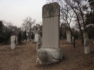
مجلس نواب الشعب بمقاطعة شاندونگ هو أعلى جهاز للسلطة في مقاطعة شاندونگ، وهو الهيئة التشريعية الإقليمية للمقاطعة. تمارس لجنته الدائمة غالبية صلاحيات مجلس نواب الشعب بمقاطعة شاندونگ. الرئيس الحالي للجنة الدائمة هو ليو جيآي.
حكومة مقاطعة شاندونگ الشعبية هي الإدارة الحكومية في المقاطعة. يُنتخب ويُعيّن كبار مسؤوليها من قِبل مجلس الشعب بمقاطعة شاندونگ. وترفع حكومة المقاطعة تقاريرها إلى مجلس الشعب لمقاطعة شاندونگ ومجلس الدولة بجمهورية الصين الشعبية. حاكم شاندونگ الحالي هو گونگ ژنگ.
الاقتصاد
اعتباراً من عام 1832، كانت مقاطعة شاندونگ تصدر الفاكهة والخضروات والنبيذ والمخدرات وجلود الغزلان، وغالباً ما كانت تتجه إلى گوانگژو لتبادل الملابس والأقمشة.[19] اقتصاد شاندونگ هو ثالث أكبر اقتصاد إقليمي في الصين بناتج محلي إجمالي قدره 8.3 تريليون يوان صيني عام 2021 أو 1.3 تريليون دولار أمريكي (الاسمي)، وهو ما يعادل الناتج المحلي الإجمالي للمكسيك.[13][14] يبلغ نصيب الفرد من الناتج المحلي الإجمالي فيها حوالي المتوسط الوطني. وبالمقارنة مع أي دولة، ستحتل المرتبة 15 كأكبر اقتصاد في الصين والمرتبة 15 من حيث عدد السكان اعتباراً من عام 2021.[15]
تحتل شاندونگ المرتبة الأولى بين المقاطعات الصينية في إنتاج مجموعة متنوعة من المنتجات، بما في ذلك القطن والقمح والثوم[27] بالإضافة إلى المعادن الثمينة مثل الذهب والماس. كما أنها تحتوي على أحد أكبر رواسب للياقوت أزرق في العالم.[28] تشمل المحاصيل المهمة الأخرى الذرة الرفيعة والذرة الصفراء. كما تمتلك شاندونگ رواسب نفطية ضخمة، وخاصةً حقل شنگلي للنفط[29] (حرفياً: حقل النصر للنفط) في منطقة دونگينگ في دلتا النهر الأصفر. كما تنتج شاندونگ البروم من الآبار الجوفية والملح من مياه البحر. وهي أكبر مُصدر زراعي في الصين.
تعتبر شاندونگ من أغنى مقاطعات الصين، ويركز نموها الاقتصادي على الشركات الكبرى ذات العلامات التجارية المعروفة. شاندونگ هي أكبر منتج صناعي وإحدى أبرز مقاطعات التصنيع في الصين. كما استفادت شاندونگ من الاستثمارات والسياحة الكورية الجنوبية واليابانية، نظراً لقربها الجغرافي من هذين البلدين.[30] أغنى مناطق المقاطعة هي شبه جزيرة شاندونگ، حيث تُعد مدينة چینگداو موطناً لثلاثة من أشهر العلامات التجارية في الصين: بيرة تسينگتاو، هاير، وهايسنس. إضافة إلى ذلك، تُشكّل حقول النفط والصناعات البترولية في دونگينگ جزءاً هاماً من اقتصاد شاندونگ. ورغم هيمنة قطاع الطاقة في شاندونگ، إلا أن المقاطعة تعاني أيضاً من مشاكل عدم الكفاءة، وتُصنّف كأكبر مستهلك للوقود الأحفوري في الصين.[30]
| ن.م.إ. التاريخي لشاندونگ، 1952-الحاضر (SNA2008)[31] (القوة الشرائية المعادلة لليوان الصيني، كدولار دولي بحسب تقرير صندوق النقد الدولي أكتوبر 2017[note 2] | |||||||||
| السنة | ن.م.إ. | ن.م.إ. للفرد (GDPpc) بحسب السكان منتصف السنة |
مؤشر المرجع | ||||||
| ن.م.إ. بالمليون | النمو الحقيقي (%) |
GDPpc | exchange rate 1 العملة الأجنبية مقابل CNY | ||||||
| CNY | USD | PPP (Int'l$.) |
CNY | USD | PPP (Int'l$.) |
USD 1 | Int'l$. 1 (PPP) | ||
| 2016 | 6.802.449 | 1.024.110 | 1.943.057 | 7.6 | 68.733 | 10.348 | 19.633 | 6.6423 | 3.5009 |
| 2015 | 6.393.074 | 1.026.439 | 1.801.120 | 8.0 | 65.114 | 10.454 | 18.345 | 6.2284 | 3.5495 |
| 2014 | 6.030.036 | 981.643 | 1.698.410 | 8.7 | 61.774 | 10.056 | 17.399 | 6.1428 | 3.5504 |
| 2013 | 5.602.372 | 904.601 | 1.566.265 | 9.6 | 57.702 | 9.317 | 16.132 | 6.1932 | 3.5769 |
| 2012 | 5.071.045 | 803.334 | 1.428.142 | 9.9 | 52.490 | 8.315 | 14.783 | 6.3125 | 3.5508 |
| 2011 | 4.543.951 | 703.529 | 1.296.235 | 10.9 | 47.416 | 7.341 | 13.526 | 6.4588 | 3.5055 |
| 2010 | 3.962.074 | 585.283 | 1.196.784 | 12.3 | 41.579 | 6.142 | 12.559 | 6.7695 | 3.3106 |
| 2009 | 3.425,154 | 501.413 | 1.084.768 | 12.2 | 36.270 | 5.310 | 11.487 | 6.8310 | 3.1575 |
| 2008 | 3.123,138 | 449.689 | 983.108 | 12.1 | 33.253 | 4.788 | 10.467 | 6.9451 | 3.1768 |
| 2007 | 2.599,074 | 341.804 | 862.076 | 14.3 | 27.833 | 3.660 | 9.232 | 7.6040 | 3.0149 |
| 2006 | 2.205,967 | 276.721 | 766.573 | 14.7 | 23.775 | 2.982 | 8.262 | 7.9718 | 2.8777 |
| 2005 | 1.849.700 | 225.802 | 646.974 | 15.1 | 20.075 | 2.451 | 7.022 | 8.1917 | 2.8590 |
| 2000 | 833.747 | 100.714 | 306.604 | 10.3 | 9.326 | 1.127 | 3.430 | 8.2784 | 2.7193 |
| 1990 | 151.119 | 31.594 | 88.758 | 5.3 | 1.815 | 379 | 1.066 | 4.7832 | 1.7026 |
| 1980 | 29.213 | 19.496 | 19.534 | 12.2 | 402 | 268 | 269 | 1.4984 | 1.4955 |
| 1978 | 22.545 | 14.498 | 10.1 | 316 | 203 | 1.5550 | |||
| 1970 | 12.631 | 5.131 | 15.7 | 199 | 81 | 2.4618 | |||
| 1965 | 8.625 | 3.504 | 22.0 | 152 | 62 | 2.4618 | |||
| 1957 | 6.139 | 2.358 | -3.5 | 116 | 45 | 2.6040 | |||
| 1952 | 4.381 | 1.971 | 91 | 41 | 2.2227 | ||||
صناعة النبيذ
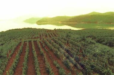
يمثل إنتاج النبيذ ثاني أكبر[citation needed] صناعة في مقاطعة شاندونگ، وثاني أكبر مكون في القطاع الزراعي. جغرافياً، تبقى المناطق الساحلية مسطحة نسبياً. معظم التربة رخوة وجيدة التهوية وغنية بالمعادن والمواد العضوية التي تُمكن من النمو الكامل للجذور.
يوجد حالياً أكثر من 140 مصنعاً للنبيذ في المنطقة، موزعة بشكل رئيسي في وادي نانوانگ للعنب وطريق يان-پنگ السياحي (كلاهما في يانتاي). تُسهم المنطقة بأكثر من 40% من إنتاج نبيذ العنب في الصين.[34]
المنتجون الرئيسيون
مناطق التنمية الاقتصادية والتكنولوجية
- منطقة جينان لتنمية صناعات التكنولوجيا المتقدمة
تأسست منطقة جينان لتنمية صناعات التكنولوجيا المتقدمة عام 1991، وكانت من أوائل المناطق التي وافق عليها مجلس الدولة. تقع المنطقة شرق المدينة، وتغطي مساحة تخطيطية إجمالية قدرها 83 كم²، مقسمة إلى منطقة مركزية بمساحة 33 كم²، ومنطقة معالجة الصادرات بمساحة 10 كم²، ومنطقة امتداد شرقية بمساحة 40 كم². منذ تأسيسها، استقطبت منطقة جينان الصناعية شركات مثل إل جي، پاناسونيك، ڤولڤو، وسانيو. عام 2000، انضمت إلى الرابطة العالمية للعلوم والتكنولوجيا، وأنشأت منتزه تعاون تكنولوجي عالي المستوى بين الصين وأوكرانيا. وأصبح منتزه تشيلو للبرمجيات المنتزه الشقيق لمنتزه بنگالور الهندي.[citation needed]
- Jinan Export Processing Zone
The export processing zone is located in the eastern suburbs of Jinan, east of the Jinan High-tech Industrial Development Zone, and to the north of the Jiwang highway. The distances to the Jiqing Highway and the Jinan Airport are 9 و 18 km (5.6 و 11.2 mi) respectively.[35]
- Qingdao Economic & Technological Development Area
Approved by the State Council in October 1984, Qingdao Economic and Technical Development Zone has a plan of 12.5 km2 (4.8 sq mi). In 2004 the local GDP was ¥27.51 billion, which increased by 28.9%; the total industrial output value is ¥60.6 billion, which increased by 31%. There have been 48 projects invested by companies listed among the Global Fortune 500 in the zone. With the fast development of reform and opening-up, Haier, Hisense, Aucma, Sinopec, CSIC, CNOOC, CIMC etc. are all located in the zone.[36]
- Qingdao Free Trade Zone
The State Council established Qingdao Free Trade Zone in 1992. The zone is 60 km (37 mi) away from Qingdao Liuting Airport. It is also close to Qingdao Qianwan Container Terminal. At present, more than 40 foreign-invested enterprises have moved in, and 2000 projects have been approved. It is one of the special economic areas which enjoys the most favorable investment policies on customs, foreign exchange, foreign trade, and taxation in China.[citation needed]
- Qingdao High-tech Industrial Zone
The State Council approved Qingdao High-Tech Industrial Development Zone in 1992. The zone is located close to Qingdao Liuting Airport and Qingdao Harbor. Encouraged industries include electronic information, biotechnology, medicine, new materials, new energy, advanced equipment manufacturing, marine science & technology, national defense technology.[37]
- Weifang Binhai Economic & Technological Development Area (BEDA)
Established in August 1995, Weifang Binhai Economic & Technological Development Area (BEDA) is a national economic and technological development area approved by the State Council. Covering an area of 677 km2 (261 sq mi), BEDA has a population of 100,000. BEDA possesses a large state-owned industrial land for use with an area of 400 km2 (150 sq mi). The land can be transacted conveniently, guaranteeing the demand of any project construction and providing broad development space for the enterprises in the area. Continuously, BEDA has been accredited as National Demonstration Zone invigorating the Sea by Science and Technology, National Innovation Base for Rejuvenating Trade through Science and Technology and National Demonstration Eco-Industry Park.
- Weihai Economic & Technological Development Zone
Weihai Economic and Technological Development Zone is a state-level development zone approved by the State Council on Oct 21, 1992. The administrative area has an area of 194 km2 (75 sq mi), including the programmed area of 36 km2 (14 sq mi) and an initial area of 11.88 km2 (4.59 sq mi). Its nearest port is Weihai Port, and the airport closest to the zone is Wuhai Airport.[citation needed]
- Weihai Export Processing Zone
Weihai Export & Processing Zone (EPZ) was set up by the approval of the State Council on April 27, 2000. Weihai EPZ is located in Weihai Economic & Technological Development Zone with programmed area of 2.6 km2 (1.0 sq mi). Weihai EPZ belongs to comprehensive export & processing zone. The EPZ is located 30 km (19 mi) to Weihai Airport, 3 km (1.9 mi) to Weihai railway station and 4 km (2.5 mi) to Weihai Harbor.[citation needed]
- Weihai Torch Hi-Tech Science Park
Weihai Torch Hi-Tech Science Park is a state-level development zone approved by the State Council in March 1991. Located in Weihai's northwest zone of culture, education and science, the Park has the total area of 111.9 متر كيلومربع (43.2 sq mi), the coastal line of 30.5 كيلومتر (19.0 mi) and 150,000 residents. It is 3 km (1.9 mi) away from the city center, 4 km (2.5 mi) away from Weihai Port, 10 km (6.2 mi) away from Weihai railway station, 30 km (19 mi) away from Weihai Airport and 80 km (50 mi) away from Yantai Airport.[38]
- Yantai Economic and Technological Development Area
Yantai Economic and Technological Development Area is one of the earliest approved state level economic development zones in China. It now has planned area of 10 km2 (3.9 sq mi) and a population of 115,000. It lies on the tip of the Shandong Peninsula facing the Yellow Sea. It adjoins to downtown Yantai, merely 6 km (3.7 mi) away from Yantai Port, 6 km (3.7 mi) away from Yantai railway station, and a 30-minute drive to Yantai International Airport.[39]
- Yantai Export Processing Zone
Yantai Export Processing Zone (YTEPZ) is one of the first 15 export processing zones approved by the State Council. The total construction area of YTEPZ is 4.17 m2 (44.9 sq ft), in which the initial zone covers 3 km2 (1.2 sq mi). After developing for several years, YTEPZ is completely constructed. At present, the infrastructure has been completed, standard workshops of 120،000 m2 (140،000 sq yd) and bonded warehouses of 40،000 m2 (430،000 sq ft) have been built up. Up to now, owning perfect investment environment and conditions, YTEPZ has attracted investors both from foreign countries and regions such as Japan, Korea, Singapore, Hong Kong, Taiwan, Sweden, the United States, Canada, etc., and from the domestic to invest and operate in the zone.[40]
- Zibo National New & Hi-Tech Industrial Development Zone
الديموغرافيا
| السنة | تعداد | ±% |
|---|---|---|
| 1912[41] | 30.989.000 | — |
| 1928[42] | 28.672.000 | — |
| 1936-37[43] | 38.100.000 | — |
| 1947[44] | 38.865.000 | — |
| 1954[45] | 48.876.548 | — |
| 1964[46] | 55.519.038 | — |
| 1982[47] | 74.419.054 | — |
| 1990[48] | 84.392.827 | — |
| 2000[49] | 89.971.789 | — |
| 2010[50] | 95.793.065 | — |
| 2020[3] | 101.527.453 | — |
| كانت چینگداو جزءاً من مقاطعة شاندونگ حتى عام 1929؛ ثم حُلت عام 1949 ودُمجت في مقاطعة شاندونگ. وِيْهاي، تُعرف أيضاً باسم وِيْهايوِيْ. تأسست عام 1930، حُلت عام 1945، ودُمجت في مقاطعة شاندونگ. | ||
شاندونگ هي ثاني أكبر مقاطعة من حيث عدد السكان في الصين، بعد گوانگدونگ، متقدمة بفارقٍ طفيف على خـِنان، حيث بلغ عدد سكانها أكثر من 101.527.453 نسمةً وفقاً لتعداد الصين 2020 أكثر من 99% من سكان شاندونگ من عرقية الهان. تشمل الأقليات في المقاطعة عرقيتي الهوي والمانچو. كما يُعرف عن سكان شاندونگ أنهم أصحاب أطول متوسط طول بين جميع المقاطعات الصينية. عام 2010، بلغ متوسط طول الطلبة الذكور الذين تتراوح أعمارهم بين 16 و18 عاماً في يانتاي 176.4 سم، بينما بلغ متوسط طول الطالبات 164 سم.[51]
الديانات
الديانات السائدة في شاندونگ هي الديانات الشعبية الصينية، التقاليد الطاوية، والبوذية الصينية. ووفقاً لاستطلاعات رأي أُجريت عامي 2007 و2009، فإن 25.28% من السكان يؤمنون بتبجيل الأسلاف، بينما يُعرّف 1.21% من السكان أنفسهم كمسيحيين، بانخفاض عن 1.30% عام 2004.[52] شكّل المسيحيون 1.89% من سكان المقاطعة عام 1949، وهي النسبة الأكبر في الصين آنذاك.[52] ووفقاً لاستطلاع رأي أُجري عام 2010، شكل المسلمون 0.55% من سكان شاندونگ، بزيادة عن 0.14% عام 1949.[53][54]
لم تُقدم التقارير أرقاماً عن ديانات أخرى؛ إذ يُقدر أن 80.05% من السكان إما لادينيين أو مُنخرطين في عبادة آلهة الطبيعة، البوذية، الكونفوشيوسية، الطاوية، والطوائف الدينية الشعبية. شاندونگ هي المقاطعة التي وُلد فيها كونفوشيوس عام 551 ق.م.
الكونفوشيوسية: أشهر ديانة و/أو فلسفة في شاندونگ هي الكونفوشيوسية. يأتي آلاف الزوار سنوياً لزيارة شاندونگ والتعرف على ثقافتها. ووفقاً للتقاليد الصينية، كان كونفوشيوس مفكراً وسياسياً ومعلماً ومؤسس مدرسة رو للفكر الصيني. تُشكل تعاليمه، المحفوظة في لونيو أو "المحاورات"، أساساً لكثير من التكهنات الصينية اللاحقة حول تعليم وسلوك الرجل المثالي، وكيف ينبغي أن يعيش حياته ويتفاعل مع الآخرين، وأشكال المجتمع والحكم التي ينبغي أن يشارك فيها. بالإضافة إلى ذلك، هناك العديد من الكتب الشهيرة عن كونفوشيوس؛ أشهرها "المحاورات" التي كتبها تلاميذه. كما ساعد كونفوشيوس في تحرير الكلاسيكيات الخمس (五经)]]. تشمل هذه الكلاسيكيات الخمس "كتاب الشعر" و"الوثائق" و"التغيرات" و"الحوليات".[55][56]
الفنون والمعالم الشهيرة
- يُدرَّس في هذه المقاطعة أيضاً أسلوب فرس النبي السبع نجوم، أحد أساليب الفنون القتالية المعروفة بشاولين الشمالي. ويُقال أيضاً إن هذا الأسلوب قد نشأ هنا، وليس في معبد شاولين بمقاطعة خـِنان، وهو ما يُذكر دائماً في الكتب.[citation needed]
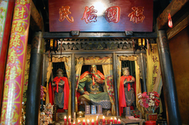
- يُعرف گواندي أيضاً باسم گواندونگ، گوانيو. وهو جنرال شهير في رواية غراميات الممالك الثلاث. وفي ديانة داوجياو (ديانة صينية تقليدية)، يُعد گواندونگ أيضاً أحد الحماة الأربعة.[citation needed]
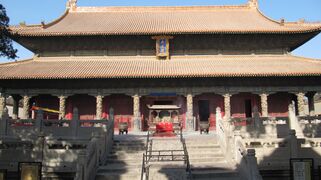
- معبد ومقبرة كونفوشيوس، والكونگ، الذي يُعد موقع تراث عالمي شهير في الصين، وهو أيضاً معلم سياحي من الفئة الخامسة. يقع قصر عائلة كونگ شرق المعبد، وقد تطور من منزل عائلي صغير متصلٍ بالمعبد إلى قصرٍ أرستقراطي. عاش وعمل فيه أحفاد كونفوشيوس الذكور.[57][58]
|
التقسيمات الإدارية
تنقسسم شان دونگ إلى 17 تقسيم بمستوى محافظة، وجميعهم مدن بمستوى محافظات.
في 1 يناير 2019، كانت لايوو قد ضُمت بالكامل إلى جينان.
| التقسيمات الادارية لشاندونگ | |||||||||||
|---|---|---|---|---|---|---|---|---|---|---|---|
| كود التقسيم[59] | التقسيم | المساحة كم2[60] | تعداد 2010[61] | المركز | التقسيمات [62] | ||||||
| المديريات | النواحي | مدن نواحي | |||||||||
| 370000 | مقاطعة شاندونگ | 157100.00 | 95.792.719 | مدينة جينان | 58 | 52 | 26 | ||||
| 370100 | مدينة جينان | 10247.01 | 8.112.513 | مديرية ليشيا | 10 | 2 | |||||
| 370200 | مدينة چینگداو | 11175.30 | 8.715.087 | مديرية شينان | 7 | 3 | |||||
| 370300 | مدينة زيبو | 5965.17 | 4.530.597 | مديرية ژانگديان | 5 | 3 | |||||
| 370400 | مدينة زاوزوانگ | 4563.22 | 3.729.140 | مديرية شوىتشنگ | 5 | 1 | |||||
| 370500 | مدينة دونگيينگ | 7923.26 | 2.035.338 | مديرية دونگيينگ | 3 | 2 | |||||
| 370600 | مدينة يانتاي | 13746.47 | 6.968.202 | مديرية لايشان | 5 | 6 | |||||
| 370700 | مدينة وِيْفانگ | 16143.14 | 9.086.241 | مديرية كويون | 4 | 2 | 6 | ||||
| 370800 | مدينة جينينگ | 11186.98 | 8.081.905 | مديرية رنتشنگ | 2 | 7 | 2 | ||||
| 370900 | مدينة تايآن | 7761.83 | 5.494.207 | مديرية تايشان | 2 | 2 | 2 | ||||
| 371000 | مدينة وِيْهاي | 5796.98 | 2.804.771 | مديرية هوانتسوي | 2 | 2 | |||||
| 371100 | مدينة ريژاو | 5347.99 | 2.801.013 | مديرية دونگگانگ | 2 | 2 | |||||
| 371300 | مدينة لينيي | 17191.21 | 10.039.440 | مديرية لانشان | 3 | 9 | |||||
| 371400 | مدينة دىژو | 10356.32 | 5.568.235 | مديرية دىتشنگ | 2 | 7 | 2 | ||||
| 371500 | مدينة لياوتشنگ | 8714.57 | 5.789.863 | مديرية دونگتشانگفو | 2 | 5 | 1 | ||||
| 371600 | مدينة بينژو | 9444.65 | 3.748.474 | مديرية بينتشنگ | 2 | 4 | 1 | ||||
| 371700 | مدينة خىزى | 12193.85 | 8.287.693 | مديرية مودان | 2 | 7 | |||||
| التقسيمات الادارية بالصينية وبتنويعات الرومنة | ||||
|---|---|---|---|---|
| بالعربية | بالصينية | پنين | ||
| مقاطعة شاندونگ | 山东省 | Shāndōng Shěng | ||
| مدينة جينان | 济南市 | Jǐnán Shì | ||
| مدينة چینگداو | 青岛市 | Qīngdǎo Shì | ||
| مدينة Zibo | 淄博市 | Zībó Shì | ||
| مدينة Zaozhuang | 枣庄市 | Zǎozhuāng Shì | ||
| مدينة Dongying | 东营市 | Dōngyíng Shì | ||
| مدينة يانتاي | 烟台市 | Yāntái Shì | ||
| مدينة وِيْفانگ | 潍坊市 | Wéifāng Shì | ||
| مدينة Jining | 济宁市 | Jǐníng Shì | ||
| مدينة تايآن | 泰安市 | Tài'ān Shì | ||
| مدينة وِيْهاي | 威海市 | Wēihǎi Shì | ||
| مدينة ريژاو | 日照市 | Rìzhào Shì | ||
| مدينة لينيي | 临沂市 | Línyí Shì | ||
| مدينة دىژو | 德州市 | Dézhōu Shì | ||
| مدينة Liaocheng | 聊城市 | Liáochéng Shì | ||
| مدينة Binzhou | 滨州市 | Bīnzhōu Shì | ||
| مدينة خىزى | 菏泽市 | Hézé Shì | ||
المناطق الحضرية
| التعداد حسب المناطق الحضرية للمدن المحافظات والمدن النواحي | |||||
|---|---|---|---|---|---|
| # | المدينة | المساحة الحضرية[63] | مساحة المديرية[63] | المدينة نفسها[63] | تاريخ التعداد |
| 1 | جينان[أ] | 3,527,566 | 4,335,989 | 8,396,142 | 2010-11-01 |
| (1) | جينان (new districts)[أ] | 1.261.040 | 2.880.687 | انظر جينان | 2010-11-01 |
| 2 | چینگداو[ب] | 3.519.919 | 3.718.835 | 8.715.087 | 2010-11-01 |
| (2) | Qingdao (new district)[ب] | 1.036.158 | 2.045.549 | انظر چینگداو | 2010-11-01 |
| 3 | زيبو | 2.261.717 | 3.129.228 | 4.530.597 | 2010-11-01 |
| 4 | يانتاي | 1.797.861 | 2.227.733 | 6.968.202 | 2010-11-01 |
| 5 | لينيي | 1.522.488 | 2.303.648 | 10.039.440 | 2010-11-01 |
| 6 | وِيْفانگ | 1.261.582 | 2.044.028 | 9.086.241 | 2010-11-01 |
| 7 | تايآن | 1.123.541 | 1.735.425 | 5.494.207 | 2010-11-01 |
| 8 | زاوژوانگ | 980.893 | 2.125.481 | 3.729.140 | 2010-11-01 |
| 9 | جينينگ[ت] | 939.034 | 1.241.012 | 8.081.905 | 2010-11-01 |
| (9) | جينينگ (new district)[ت] | 388.449 | 618.394 | انظر جينينگ | 2010-11-01 |
| 10 | ريژاو | 902.272 | 1.320.578 | 2.801.013 | 2010-11-01 |
| 11 | دونگيينگ[ث] | 848,958 | 1.004.271 | 2.035.338 | 2010-11-01 |
| (11) | Dongying (new district)[ث] | 114.073 | 242.292 | انظر دونگيينگ | 2010-11-01 |
| 12 | تنگژو | 783.473 | 1.603.659 | انظر زاوژوانگ | 2010-11-01 |
| 13 | وِيْهاي[ج] | 698.863 | 844.310 | 2.804.771 | 2010-11-01 |
| (13) | وِيْهاي (new district)[ج] | 310.628 | 673.625 | انظر وِيْهاي | 2010-11-01 |
| 14 | شينتاي | 672.207 | 1.315.942 | انظر تايآن | 2010-11-01 |
| 15 | لياوتشنگ | 606.366 | 1.229.768 | 5.789.863 | 2010-11-01 |
| 16 | ژوتشنگ | 586.652 | 1.086.222 | انظر وِيْفانگ | 2010-11-01 |
| 17 | خىزى[ح] | 559.636 | 1.346.717 | 8.287.693 | 2010-11-01 |
| (17) | خىزى (new district)[ح] | 166.037 | 565.793 | انظر خىزى | 2010-11-01 |
| 18 | دىژو[خ] | 526.232 | 679.535 | 5.568.235 | 2010-11-01 |
| (18) | دىژو (new district)[خ] | 170.317 | 569.007 | انظر دىژو | 2010-11-01 |
| 19 | زوتشنگ | 513.418 | 1.116.692 | انظر جينينگ | 2010-11-01 |
| 20 | شوگوانگ | 476.274 | 1.139.454 | انظر وِيْفانگ | 2010-11-01 |
| 21 | فيْتشنگ | 472.775 | 946.627 | انظر تايآن | 2010-11-01 |
| 22 | گاومي | 466.786 | 895.582 | انظر وِيْفانگ | 2010-11-01 |
| 23 | پينگدو | 427,694 | 868,348 | انظر چینگداو | 2010-11-01 |
| 24 | بينژو[د] | 407.820 | 682.717 | 3.748.474 | 2010-11-01 |
| (24) | بينژو (new district)[د] | 146.577 | 351.672 | انظر بينژو | 2010-11-01 |
| 25 | جياوژو | 404.216 | 1.357.424 | انظر چینگداو | 2010-11-01 |
| (26) | زوپينگ[ذ] | 389.003 | 778.777 | انظر بينژو | 2010-11-01 |
| 27 | لونگكو | 388.770 | 688.255 | انظر يانتاي | 2010-11-01 |
| 28 | تشينگژو | 384.358 | 940.355 | انظر وِيْفانگ | 2010-11-01 |
| 29 | لايژو | 379.789 | 883.896 | انظر يانتاي | 2010-11-01 |
| 30 | لينتشينگ | 376.337 | 719.611 | انظر لياوتشنگ | 2010-11-01 |
| 31 | رونگLiaochengتشنگ | 363.420 | 714.355 | انظر وِيْهاي | 2010-11-01 |
| 32 | لاييانگ | 358.092 | 878.591 | انظر يانتاي | 2010-11-01 |
| 33 | لايشي | 347.452 | 750.225 | انظر چینگداو | 2010-11-01 |
| 34 | تشوفو | 302.805 | 640.498 | انظر جينينگ | 2010-11-01 |
| 35 | آنتشيو | 300.160 | 926.894 | انظر وِيْفانگ | 2010-11-01 |
| 36 | تشانگيي | 287.720 | 603.482 | انظر وِيْفانگ | 2010-11-01 |
| 37 | ژاويوان | 281.780 | 566.244 | انظر يانتاي | 2010-11-01 |
| 38 | روشان | 259.876 | 572.481 | انظر وِيْهاي | 2010-11-01 |
| 39 | هاييانگ | 244.600 | 638.729 | انظر يانتاي | 2010-11-01 |
| 40 | لىلينگ | 214.238 | 652.415 | انظر دىژو | 2010-11-01 |
| 41 | تشيشيا | 204.633 | 589.620 | انظر يانتاي | 2010-11-01 |
| 42 | يوتشنگ | 203.724 | 490.031 | انظر دىژو | 2010-11-01 |
| 43 | پنگلاي | 185.894 | 451.109 | انظر يانتاي | 2010-11-01 |
- ^ أ ب Laiwu PLC is currently no longer exist after census it merged with Jinan in 2019. Laiwu PLC's districts merged after census: Laiwu (Laicheng), Gangcheng; and new districts established after census: Zhangqiu (Zhangqiu CLC), Jiyang (Jiyang County). Laiwu PLC's districts and the new districts not included in the urban area & district area count of the pre-expanded city.
- ^ أ ب New district established after census: Jimo (Jimo CLC); Jiaonan CLC merged into Xihai'an (Huangdao) after census. The new district and annexed area not included in the urban area & district area count of the pre-expanded city.
- ^ أ ب New district established after census: Yanzhou (Yanzhou CLC). The new district not included in the urban area & district area count of the pre-expanded city.
- ^ أ ب New district established after census: Kenli (Kenli County). The new district not included in the urban area & district area count of the pre-expanded city.
- ^ أ ب New district established after census: Wendeng (Wendeng CLC). The new district not included in the urban area & district area count of the pre-expanded city.
- ^ أ ب New district established after census: Dingtao (Dingtao County). The new district not included in the urban area & district area count of the pre-expanded city.
- ^ أ ب New district established after census: Lingcheng (Lingxian County). The new district not included in the urban area & district area count of the pre-expanded city.
- ^ أ ب New district established after census: Zhanhua (Zhanhua County). The new district not included in the urban area & district area count of the pre-expanded city.
- ^ Zouping County is currently known as Zouping CLC after census.
أكبر المدن في شاندونگ
المصدر: China Urban Construction Statistical Yearbook 2018 Urban Population and Urban Temporary Population[64] | |||||||||
|---|---|---|---|---|---|---|---|---|---|
| الترتيب | التعداد | الترتيب | التعداد | ||||||
 چینگداو  جينان |
1 | چینگداو | 5.127.000 | 11 | وِيْهاي | 968.500 |  لينيي  يانتاي | ||
| 2 | جينان | 4.154.900 | 12 | خىزى | 917.900 | ||||
| 3 | لينيي | 2.188.300 | 13 | دونگيينگ | 911.900 | ||||
| 4 | يانتاي | 2.186.100 | 14 | لياوتشنگ | 910.600 | ||||
| 5 | زيبو | 1.824.600 | 15 | ريژاو | 900.000 | ||||
| 6 | جينينگ | 1.577.400 | 16 | بينژو | 887.600 | ||||
| 7 | وِيْفانگ | 1.497.600 | 17 | لايوو | 720.000 | ||||
| 8 | دىژو | 1.074.200 | 18 | شوگوانگ | 574.900 | ||||
| 9 | تايآن | 1.027.100 | 19 | شينتاي | 555.000 | ||||
| 10 | زوژوانگ | 1.025.800 | 20 | ژوتشنگ | 496.900 | ||||
الثقافة
تُستخدم اللهجات المندرينية في مقاطعة شاندونگ. ويُصنّف اللغويون هذه اللهجات إلى ثلاث فئات رئيسية: مندرينية جي لو، المستخدمة في الشمال الغربي (وكذلك في مقاطعة خىبـِيْ المجاورة)، مثل لهجة جينان؛ مندرينية ژونگيوان، المُستخدمة في الجنوب الغربي (وكذلك في مقاطعة خـِنان المجاورة)؛ ومنديرينة جياو لياو، المستخدمة في شبه جزيرة شاندونگ (وكذلك في شبه جزيرة لياودونگ عبر البحر)، مثل لهجة چینگداو. عندما يتحدث الناس عن "لهجة شاندونگ" (山東話)، فإن المقصود عادةً هي اللهجة الأولى أو الثانية؛ وتُسمى لهجات جياو لياو في شاندونگ عادةً "لهجة جياودونگ" (膠東話).
يعد مطبخ شاندونگ (鲁菜) أحد التقاليد الثمانية العظيمة في المطبخ الصيني. ويمكن تقسيمه إلى مطبخ شاندونگ الداخلي (مثل مطبخ جينان)؛ ومطبخ جياودونگ المتمركز حول المأكولات البحرية في شبه الجزيرة؛ ومطبخ قصر كونفوشيوس، وهو تقليد مقعد كان مخصصاً في الأصل للأعياد الإمبراطورية وغيرها من المناسبات الهامة. شاندونگ بانگزي ولوجو هما نوعان شائعان من الأوپرا الصينية في شاندونگ؛ وكلاهما نشأ في جنوب غرب شاندونگ.
النقل
النقل بالسكك الحديدية
يعد خطا سكة حديد جينگجيو (بكين-كولون) و[[سكة حديد جينگهو (بكين-شنغهاي) خطين رئيسيين للسكك الحديدية يمران عبر الجزء الغربي من شاندونگ. يمر خط جينگجيو عبر لياوتشنگ وخىزى، بينما يمر خط جينگهو عبر دىژو، جينان، تايآن، ويانژو (سيمرّ خط سكة حديد جينگهو فائق السرعة عبر تشوفو) وزاوژوانگ. أما خط سكة حديد جياوجي، فهو خط سكة حديد هام في شاندونگ، يربط بين أكبر مدينتين فيها، چینگداو وجينان، وله تاريخ عريق.
اعتباراً من نهاية عام 2018، أصبحت چینگداو المدينة الوحيدة في مقاطعة شاندونگ التي تضم نظام مترو، بأربعة خطوط قيد التشغيل. افتُتح مترو جينان في أوائل 2019.
النقل البري
تتمتع مقاطعة شاندونگ بوادة أكثر شبكات الطرق السريعة كثافة وأعلى جودة بين جميع المقاطعات الصينية. تمر هذه الطرق السريعة التابعة لنظام الطرق السريعة الوطنية عبر شاندونگ أو تبدأ منها. الطرق السريعة التي تبدأ في شاندونگ مكتوبة بالخط العريض:
- G2 طريق جينگهو السريع (بكين–شنغهاي)
- G3 طريق جينگهاي السريع (بكين–تايپـِيْ، تايوان)
- G15 طريق شنهاي السريع (شنيانگ، لياوننگ–هايكو، هاينان)
- G18 طريق رونگوو السريع (رونگتشنگ–ووهاي، منغوليا الداخلية)
- G20 طريق گينگداو السريع (چینگداو–ينتشوان، نينگشيا)
- G22 طريق تشينگلان السريع (چینگداو–لانژو، گانسو)
- G25 طريق تشانگشن السريع (چانگچون، جيلين–شنژن، گوانگدونگ)
هناك أيضاً العديد من الطرق السريعة الإقليمية الأقصر داخل مقاطعة شاندونگ.
النقل البحري
تضم شبه جزيرة شاندونگ، بخلجانها وموانئها، العديد من الموانئ الهامة، منها چینگداو، يانتاي، وِيْهاي، ريژاو، دونگيينگ، ولونگكو. للعديد من هذه الموانئ أهمية تاريخية، إذ تضم مواقع قواعد بحرية أجنبية سابقة أو شهدت معارك تاريخية. تربط العبارات المدن الواقعة على الساحل الشمالي لشبه الجزيرة بشبه جزيرة لياودونگ، الواقعة شمالًا عبر البحر. كما تربط عبارة وِيْدونگ شاندونگ بإنچن.
النقل الجوي
تتضمن المطارات الهامة مطار جينان ياوتشيانگ ومطار چینگداو جياودونگ الدولي. المطارات الأخرى هي مطار دونگينگ شنگلي، مطار جينينگ تشوفو، مطار ليني شوبولينگ، مطار وِيْفانگ، مطار وِيْهاي داسوهويبو و مطار يانتاي لايشان الدولي.
السياحة
تتضمن المعالم السياحية في شاندونگ:
- جينان، عاصمة شاندونگ منذ عهد أسرة مينگ، تشتهر بـ 72 ينبوع الشهير.
- نبع باوتو، نبع كارستي ارتوازي ذو أهمية ثقافية، أُعلنه الامبراطور چيانلونگ من أسرة چيانلونگ "النبع رقم واحد تحت السماء" (天下第一泉).
- بحيرة دامينگ، أكبر بحيرة في جينان، ومياهها من ينابيع المنطقة. وقد وصف ماركو پولو جمالها في أعماله.
- جبل الألف بوذا، يشتهر بتماثيل بوذا العديدة المنحوتة على واجهات الصخور في التل أو الهياكل المستقلة التي أقيمت منذ عهد أسرى سوي ومعبد شينگگوتشان.
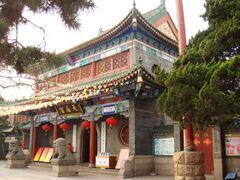
- معبد كونفوشيوس في جينان فوشوى.
- معبد لينگيان، واحداً من المعابد الأربعة الشهيرة (四大名刹) في عهد أسرة تانگ، حيث يوجد معبد پيژي الذي يعود تاريخه إلى القرن 11 وقاعة ألف بوذا التي تضم تمثال بوذا البرونزي من عهد أسرة مينگ بالإضافة إلى 40 تمثالاً من الطين المطلي للوهان بالحجم الطبيعي من عهد أسرة سونگ.
- بقايا سور تشي العظيم، أقدم سور عظيم موجود في الصين، والذي بُني عام 685 ق.م. ويمتد من جينان إلى چینگداو.
- پنگلاي، وهي مدينة تقع في شمال شبه جزيرة شاندونگ وتشتهر بالطاوية.
- چینگداو (مدينة ساحلية ألمانية سابقة)، هي مدينة-منتجع ساحلي تقع في جنوب شبه الجزيرة وتتميز بتراث معماري يعود إلى الفترة الألمانية وتشتهر أيضاً بيرة تسينگتاو.
- با دا گوان، يتكون من ثمانية شوارع سميت على اسم الحصون العسكرية الثمانية العظيمة في العصور القديمة.
- ژان تشياو، رصيف شريطي طويل يمتد إلى البحر وكان أول رصيف في چینگداو.
- لاوشان، منطقة ذات مناظر خلابة ومركز طاوي إلى الشرق من چینگداو.
- تشينگژو، مركز تجاري وإداري قديم يضم بعض الاكتشافات الأثرية الشهيرة.
- وِيْهاي، مدينة ساحلية بريطانية سابقة هامة في الحرب الصينية اليابانية الثانية، تتمتع بتراث معماري يعود إلى العصر البريطاني].
- مواقع التراث العالمي:
- معبد ومقبرة كونفوشيوس، وقصر عائلة كونگ في تشوفو.

- تزخر مدينة وِيْفانگ بالعديد من المعالم الطبيعية والتاريخية، مثل حديقة شيو (من أواخر عهد أسرة مينگ وأوائل عهد أسرة تشينگ)، وجناح فانگونگ (من عهد أسرة سونگ)، ومواقع الأحفورات (بما في ذلك أحفورات الديناصورات في شانوانگ، لينتشو)، ومنتزه جبل يي الوطني للغابات، وجبل تشينگيون. كما رسم يانگجيابو نقوشاً خشبية احتفالاً برأس السنة الجديدة، وهي مشهورة أيضاً في جميع أنحاء الصين.
التعليم
الجامعات والكليات
- جامعة شاندونگ (جينان)
- جامعة الصين للمحيطات (چینگداو)
- جامعة الصين للبترول (دونگينگ وچینگداو)
- جامعة جينان (جينان)
- جامعة شاندونگ للمعلمين
- جامعة شاندونگ الزراعية (تايآن)
- جامعة شاندونگ للمالية والاقتصاد (جينان)
- جامعة شاندونگ للطب الصيني التقليدي (جينان)
- معهد هاربين للتكنولوجيا (وِيْهاي)
- جامعة الصين الزراعية (يانتاي)
- جامعة هاربين للعلوم والتكنولوجيا (وِيْهاي)
- جامعة يانتاي (يانتاي)
- جامعة تشوفو للمعلمين (تشوفو)
- جامعة چینگداو (چینگداو)
- جامعة شاندونگ للعلوم والتكنولوجيا (چینگداو)
- جامعة شاندونگ للتكنولوجيا (زيبو)
- جامعة لياوتشنگ (لياوتشنگ)
- جامعة لينيي (لينيي)
- جامعة چینگداو الزراعية (چینگداو)
- كلية بينژو الطبية (بينژو)
- جامعة جينينگ الطبية (جينينگ)
- جامعة وِيْفانگ الطبية (وِيْفانگ)
- جامعة وِيْفانگ (وِيْفانگ)
- معهد شاندونگ للأعمال والتكنولوجيا (يانتاي)
- جامعة شاندونگ للبنات (جينان)
- كلية چینگداو التقنية (چینگداو)
- جامعة ريژاو متعددة التقنيات (ريژاو)
- معهد زيبو المهني (زيبو)
- جامعة چینگداو بينهاي (چینگداو)
- كلية شاندونگ المهنية للغات الأجنبية (ريژاو)
الرياضة
فعاليات تُعقد في شاندونگ
- الألعاب الوطنية الصينية 2009
- كأس العالم لتنس الطاولة 2002
- كأس آسيا 2004
- 2007 A3 Champions Cup
- Sailing at the 2008 Summer Olympics and Paralympics
- 2011 Sudirman Cup
- 2012 Badminton Asia Championships
- ألعاب الشاطئ الآسيوية 2012
الفرق الرياضية الاحترافية في شاندونگ
انظر أيضا
- المواقع التاريخية والثقافية الرئيسية في شاندونگ
- شعب شاندونگ
- سحلية شانتونگ
- مسألة شانتونگ
- العواصف الثلجية الشرق آسيوية 2009-2010
- العواصف الثلجية الشرق آسيوية في أواخر 2009
الهوامش
- ^ UK: /ʃænˈdʊŋ/ shan-DUUNG,[6] US: /ʃɑːnˈdɔːŋ/ shahn-DAWNG;[7] الصينية المبسطة: 山东; الصينية التقليدية: 山東; alternately romanized as Shantung
- ^ Purchasing power parity of Chinese Yuan, as Int'l.dollar based on IMF WEO October 2017. Purchasing power parity (PPP) for Chinese yuan is estimate according to IMF WEO[32] data; Exchange rate of CN¥ to US$ is according to State Administration of Foreign Exchange, published in the China Statistical Yearbook.[33]
- ^ The data was collected by the Chinese General Social Survey (CGSS) of 2009 and by the Chinese Spiritual Life Survey (CSLS) of 2007, reported and assembled by Xiuhua Wang (2015)[52] in order to confront the proportion of people identifying with two similar social structures: ① Christian churches, and ② the traditional Chinese religion of the lineage (i. e. people believing and worshipping ancestral deities often organised into lineage "churches" and ancestral shrines). Data for other religions with a significant presence in China (deity cults, Buddhism, Taoism, folk religious sects, Islam, et al.) was not reported by Wang. The number of Muslims is taken from a survey reported in the year 2010.[53]
- ^ This may include:
- البوذية
- الكونفوشيوسية
- عبادة الآلهة
- الطاوية
- الطوائف الدينية الشعبية
- الأشخاص غير المقيدين في أي دين مؤسسي أو منتشر، ولا يمارسون أي دين.
المصادر
- ^ Назначены новые секретари парткомов провинций Шаньдун и Шаньси (in الروسية). dknews.kz. 2022-12-30. Archived from the original on 30 December 2022.
- ^ "Doing Business in China - Survey". Ministry Of Commerce - People's Republic Of China. Retrieved 5 August 2013.
- ^ أ ب "Communiqué of the Seventh National Population Census (No. 3)". National Bureau of Statistics of China. 2021-05-11. Archived from the original on May 11, 2021. Retrieved 2021-05-11.
- ^ "National Data". China NBS. March 2024. Retrieved June 22, 2024. see also "zh: 2023年山东省国民经济和社会发展统计公报". shandong.gov.cn. March 3, 2024. Retrieved June 19, 2024. The average exchange rate of 2023 was CNY 7.0467 to 1 USD dollar "Statistical communiqué of the People's Republic of China on the 2023 national economic and social development" (Press release). China NBS. February 29, 2024. Retrieved June 22, 2024.
- ^ "Human Development Indices (8.0)- China". Global Data Lab. Retrieved 23 September 2024.
- ^ "Shandong". Lexico UK English Dictionary. Oxford University Press. Archived from the original on 18 May 2021.
- ^ قالب:Cite Merriam-Webster
- ^ Tian Xia; Bai Bo (2005). Atlas of World Heritage—China. Long River. p. 70. ISBN 9781592650606.
- ^ "Mount Taishan". UNESCO. n.d. Archived from the original on 21 November 2020. Retrieved 2019-09-30.
- ^ Kelly, Margaret, ed. (2007). China. Fodor's Travel Publications. ISBN 978-1-400-01731-7.
- ^ Berling, Judith A. (n.d.). "Confucianism". Asia Society. Archived from the original on 16 November 2020. Retrieved 2022-08-09.
- ^ "Main Data of the Seventh National Population Census". National Bureau of Statistics of China. 2021-05-11. Archived from the original on 2021-05-11.
- ^ أ ب "Decoding China's 2021 GDP Growth Rate: A Look at Regional Numbers". China Briefing News. 2022-02-07. Archived from the original on 19 August 2022. Retrieved 2022-09-15.
- ^ أ ب "GDP of Mexico". World Bank. Archived from the original on 15 September 2022. Retrieved 2022-09-15.
- ^ أ ب "GDP Data". World Bank. Archived from the original on 15 September 2022. Retrieved 2022-09-15.
- ^ ""List of National Colleges and Universities - Government Portal of the Ministry of Education of the People's Republic of China"". Ministry of Education of the People's Republic of China. Archived from the original on June 19, 2022. Retrieved 2022-11-07.
- ^ "Leading 200 science cities | | Supplements | Nature Index". www.nature.com. Retrieved 2024-12-09.
- ^ (in صينية) Origin of the Names of China's Provinces, People's Daily Online.
- ^ أ ب Roberts, Edmund (1837). Embassy to the Eastern Courts of Cochin-China, Siam, and Muscat. New York: Harper & Brothers. pp. 122–123.
- ^ "25 July 1668 Tancheng (Shandong)". GHEA. Archived from the original on July 23, 2021. Retrieved 2023-12-08.
- ^ "CHINA: SHANDONG PROVINCE". National Geophysical Data Center. Archived from the original on July 25, 2021. Retrieved 2023-12-08.
- ^ Burkman, Thomas W. (2008). Japan and the League of Nations: Empire and World Order, 1914–1938. University of Hawaiʻi Press. p. 4. doi:10.2307/j.ctt6wqrcq. ISBN 978-0-824-82982-7. JSTOR j.ctt6wqrcq.
- ^ Craft, Stephen G. (1997). "John Bassett Moore, Robert Lansing, and the Shandong Question". Pacific Historical Review. 66 (2): 231–249. doi:10.2307/3640629. JSTOR 3640629.
- ^ "CHINA: Basest War Lord". TIME. 1927-03-07. Archived from the original on 2010-11-25. Retrieved 2022-08-09.
- ^ Gu, Chang-Sheng (2009). Awaken: Memoirs of a Chinese Historian. pp. 130–131.
- ^ Jackson, Steve (2008-12-31). "China finds major dinosaur site". BBC News. Archived from the original on October 7, 2023. Retrieved 2022-08-09.
- ^ Fresh Garlic from China, Inv. 731-TA-683 (Second Review). DIANE Publishing. n.d. p. I-24. ISBN 9781457818745.
- ^ "Location and how discovered". China Sapphire. n.d. Archived from the original on 2007-07-03. Retrieved 2009-01-05.
- ^ Zhan, Jing Vivian (2022). China's Contained Resource Curse: How Minerals Shape State-Capital-Labor Relations. Cambridge, United Kingdom: Cambridge University Press. ISBN 978-1-009-04898-9.
- ^ أ ب "Shandong Province". The China Perspective. n.d. Archived from the original on 2012-03-05. Retrieved 2022-08-09.
- ^ "关于将研究与开发支出计入生产总值核算修订生产总值核算数据的公告" (in الصينية). Shandong Provincial Bureau of Statistics. 2017-10-13. Archived from the original on 2017-12-27. Retrieved 2022-08-09.
- ^ "The World Economic Outlook Database". International Monetary Fund. 2021. Archived from the original on November 26, 2020. Retrieved 2022-08-09.
- ^ "Annual Data". National Bureau of Statistics of China. n.d. Archived from the original on October 20, 2015. Retrieved 2022-08-09.
- ^ "The wine output of Yantai will reach 230000 kiloliters in 2008". China Wines Information Website. 2008-12-30. Archived from the original on 2009-02-15. Retrieved 2009-06-28.
- ^ "Ji'nan Export Processing Zone". RightSite.Asia. n.d. Archived from the original on 2010-01-11. Retrieved 2022-08-09.
- ^ "Qingdao Economic and Technical Development Zone". RightSite.Asia. n.d. Archived from the original on 2010-02-07. Retrieved 2022-08-09.
- ^ "Qingdao Hi-Tech Industrial Development Zone". RightSite.Asia. n.d. Archived from the original on 2009-11-20. Retrieved 2022-08-09.
- ^ "Weihai Torch Hi-Tech Science Park". RightSite.Asia. n.d. Archived from the original on 2010-03-03. Retrieved 2022-08-09.
- ^ "Yantai Economic and Technological Development Area". RightSide.Asia. n.d. Archived from the original on 2010-02-09. Retrieved 2022-08-09.
- ^ "Yantai Export Processing Zone". RightSite.Asia. n.d. Archived from the original on 2010-05-10. Retrieved 2022-08-09.
- ^ "付表2 1912年中国人口(統計)" (in اليابانية). ier.hit-u.ac.jp. n.d. Archived from the original on September 24, 2015. Retrieved 2014-03-06.
- ^ "付表3 1928年中国人口(統計)" (in اليابانية). ier.hit-u.ac.jp. n.d. Archived from the original on September 24, 2015. Retrieved 2014-03-06.
- ^ "付表4 1936-37年の中国人口(統計)" (in اليابانية). ier.hit-u.ac.jp. n.d. Archived from the original on September 24, 2015. Retrieved 2014-03-06.
- ^ "付表5 1947年全国人口(統計)" (in اليابانية). ier.hit-u.ac.jp. n.d. Archived from the original on September 13, 2013. Retrieved 2014-03-06.
- ^ "中华人民共和国国家统计局关于第一次全国人口调查登记结果的公报" (in الصينية). National Bureau of Statistics of China. n.d. Archived from the original on 2009-08-05. Retrieved 2014-03-06.
- ^ "第二次全国人口普查结果的几项主要统计数字" (in الصينية). National Bureau of Statistics of China. n.d. Archived from the original on 2012-09-14. Retrieved 2014-03-06.
- ^ "中华人民共和国国家统计局关于一九八二年人口普查主要数字的公报" (in الصينية). National Bureau of Statistics of China. n.d. Archived from the original on 2012-05-10. Retrieved 2014-03-06.
- ^ "中华人民共和国国家统计局关于一九九○年人口普查主要数据的公报" (in الصينية). National Bureau of Statistics of China. n.d. Archived from the original on 2012-06-19. Retrieved 2014-03-06.
- ^ "现将2000年第五次全国人口普查快速汇总的人口地区分布数据公布如下" (in الصينية). National Bureau of Statistics of China. n.d. Archived from the original on 2012-08-29. Retrieved 2014-03-06.
- ^ "Communiqué of the National Bureau of Statistics of People's Republic of China on Major Figures of the 2010 Population Census[1] (No. 2)". National Bureau of Statistics of China. 2011-04-29. Archived from the original on 2013-07-27. Retrieved 2014-03-06.
- ^ "山东18岁男女平均身高出炉!烟台人竟然5年前就完爆这一数据!" (in الصينية). Chuan Song. 2016-08-12. Archived from the original on 2018-04-29. Retrieved 2018-04-29.
- ^ أ ب ت ث Wang, Xiuhua (2015). "Four" (PDF). Explaining Christianity in China: Why a Foreign Religion has Taken Root in Unfertile Ground (Master's thesis). Baylor University. p. 15. Archived (PDF) from the original on August 9, 2022. Retrieved 2022-08-09.
- ^ أ ب Min Junqing (2010). "The Present Situation and Characteristics of Contemporary Islam in China" (PDF). JISMOR: 29. Archived (PDF) from the original on August 9, 2022. Retrieved 2022-08-09.
- ^ Yang Zongde (2010). "Study on Current Muslim Population in China". Jinan Muslim (2).
- ^ Csikszentmihalyi, Mark (2020-03-31). "Confucius". Stanford Encyclopedia of Philosophy. Archived from the original on May 20, 2022. Retrieved 2022-08-09.
- ^ Richey, Jeff (n.d.). "Confucius (551—479 B.C.E.)". Internet Encyclopedia of Philosophy. Archived from the original on November 19, 2016. Retrieved 2016-12-07.
- ^ "Temple and Cemetery of Confucius and the Kong Family Mansion in Qufu". UNESCO. n.d. Archived from the original on December 28, 2019. Retrieved 2016-12-07.
- ^ "The Confucian Temple, Cemetery and Family Mansion in Qufu". China Through a Lens. 2003-09-12. Archived from the original on May 8, 2016. Retrieved 2016-12-07.
- ^ 中华人民共和国县以上行政区划代码 (in الصينية المبسطة). Ministry of Civil Affairs.
- ^ Shenzhen Bureau of Statistics. 《深圳统计年鉴2014》 (in الصينية المبسطة). China Statistics Print. Retrieved 2015-05-29.
- ^ Census Office of the State Council of the People's Republic of China; Population and Employment Statistics Division of the National Bureau of Statistics of the People's Republic of China (2012). 中国2010人口普查分乡、镇、街道资料 (1 ed.). Beijing: China Statistics Print. ISBN 978-7-5037-6660-2.
- ^ Ministry of Civil Affairs (August 2014). 《中国民政统计年鉴2014》 (in الصينية المبسطة). China Statistics Print. ISBN 978-7-5037-7130-9.
- ^ أ ب ت 国务院人口普查办公室、国家统计局人口和社会科技统计司编 (2012). 中国2010年人口普查分县资料. Beijing: China Statistics Print. ISBN 978-7-5037-6659-6.
- ^ Ministry of Housing and Urban-Rural Development of the People's Republic of China (2019). 中国城市建设统计年鉴2018 [China Urban Construction Statistical Yearbook 2018] (in الصينية). China Statistics Print. Archived from the original on August 10, 2021. Retrieved November 30, 2021.
وصلات خارجية
- موقع حكومة شان دونگ
- (in صينية) Shandong Government website
- (in إنگليزية and صينية) Complete Map of the Seven Coastal Provinces from 1821-1850
- Shandong Article Encyclopædia Britannica
- Pages using gadget WikiMiniAtlas
- Articles containing simplified Chinese-language text
- Articles containing traditional Chinese-language text
- CS1 uses الروسية-language script (ru)
- CS1 الروسية-language sources (ru)
- Articles with صينية-language sources (zh)
- CS1 الصينية-language sources (zh)
- CS1 اليابانية-language sources (ja)
- CS1 uses الصينية-language script (zh)
- CS1 الصينية المبسطة-language sources (zh-hans)
- Short description is different from Wikidata
- Articles containing صينية-language text
- Pages using multiple image with auto scaled images
- Coordinates on Wikidata
- Pages using infobox settlement with missing country
- جميع الصفحات التي تحتاج تنظيف
- مقالات بالمعرفة تحتاج توضيح from July 2021
- Articles with unsourced statements from April 2016
- Articles with hatnote templates targeting a nonexistent page
- Articles with unsourced statements from September 2011
- Articles with unsourced statements from August 2022
- Articles with unsourced statements from February 2022
- Articles with unsourced statements from March 2020
- Articles containing Chinese-language text
- Articles with إنگليزية-language sources (en)
- شاندونگ
- مقاطعات الصين
- شرق الصين


