أسام
| ||||||||||||||||||||||||||||||||||||||||||||||||||||||||||||||||||||||||||||||||||||||||||||||||||||||||||||


أسام ◄ استمع (مساعدة·معلومات) (بالأسامية: অসম Ôxôm [ɔxɔm]) هي ولاية تقع في شمال شرق الهند وفي جنوب غرب الهميالايا. وعاصمتها هي مدينة ديسپور. تشتهر أسام بشاي أسام، مصادر البترول، حرير أسام، وتنوعها البيولوجي.
آسام غنية بثقافتها، وجماعاتها العرقية ولغاتها ولهجاتها وآدابها. وتشتهر بـشاي آسام، ومصادر النفط الكبيرة والقديمة (أول احتياطي نفطي في الهند اِكتُشِف في أسام في أواخر القرن التاسع عشر)، حرير آسام وتنوعها الحيوي الثري. وقد نجحت آسام في الحفاظ على وحيد القرن الهندي من شبه انقراض، وكذلك الخنزير القزم والنمر والعديد من أنواع الطيور، كما تمنح أحد آخر الموائل البرية للفيل الآسيوي. وتصبح بشكل متزايد مقصداً شعبياً لسياحة الحياة البرية. فنرى كازيرانگا وماناس موقعي تراث عالمي.[10] كما كانت آسام معروفة بغابات أشجار السال ومنتجاتها، إلا أن معظمها تبدد الآن. وكأرض غزيرة الأمطار، تنعم آسام بالخضرة الغضة وبنهر براهماپوترا، الذي يمد روافده وبحيرة أوكسبو المنطقة ببيئة مائية فريدة وجميلة.
. . . . . . . . . . . . . . . . . . . . . . . . . . . . . . . . . . . . . . . . . . . . . . . . . . . . . . . . . . . . . . . . . . . . . . . . . . . . . . . . . . . . . . . . . . . . . . . . . . . . . . . . . . . . . . . . . . . . . . . . . . . . . . . . . . . . . . . . . . . . . . . . . . . . . . . . . . . . . . . . . . . . . . . .
التسمية
The first dated mention of the region comes from Periplus of the Erythraean Sea (1st century) and Ptolemy's Geographia (2nd century) which calls the region Kirrhadia after the Kirata population.[11][12] In the classical period and up to the 12th century the region east of the Karatoya river, largely congruent to present-day Assam, was called Kamarupa, and alternatively, Pragjyotisha.[13] Though a western portion of Assam as a region continued to be called Kamrup, the Ahom kingdom that emerged in the east, and which came to dominate the entire Brahmaputra valley, was called Assam (e.g. Mughals used Asham); and the British province too was called Assam. Though the precise etymology of Assam is not clear, the name Assam is associated with the Ahom people, originally called Shyam (Shan).[14]
الجغرافيا


الموقع والحدود
تقع ولاية أسّام في الجزء الشمالي الشرقي من الهند، إلى الشمال الشرقي من دولة بنگلادش. يحدها من الشمال والشمال الغربي دولة بهوتان، والمقاطعة الاتحادية أروناچل پرادش. ومن الشرق ولايتا ناگالاند ومانيبور اللتان تفصلانها عن أراضي دولة ميانمار بورما. ومن الجنوب المقاطعة الاتحادية ميزورام وولاية تريبورا الهندية اللتان تفصلانها عن بنگلادش، وإلى الغرب منها تقع أراضي دولة بنگلادش، وولايتا ميگالايا والبنغال الغربية. وتتصل هذه الولاية في أقصى الشمال الغربي منها ببقية أراضي الهند ببرزخ ضيق يمر بأراضي ولاية البنغال الغربية يقع بين أراضي دولتي بهوتان وبنگلادش.[16]
تبلغ مساحة أراضي ولاية أسّام اليوم نحو 78432 كم2 ، وقبل شهر ديسمبر من عام 1963 كانت تضم أسّام أراضي ولاية ناگالاند إضافة إلى مساحتها اليوم.
المناخ
يتصف مناخ أسّام بارتفاع رطوبته، واعتدال حرارته، ويمتاز فصلان في السنة، أحدهما جاف نسبياً مائل للبرودة يمتد من تشرين الأول حتى شباط، والآخر حار رطب يمتد من آذار حتى أيلول وتهطل فيه معظم أمطار السنة. وتراوح كمية الأمطار السنوية بين 1750مم في گواهاتي (وادي أسّام) و4000مم فوق الهضبة الوسطى، وقد سُجل على مقربة من هذه الولاية أعلى معدل سنوي للأمطار في العالم (11480مم في تشيرابونجي في ولاية مغالايا). وتغطي المناطق المستنقعية وجوانب الأنهار غيضات من القرم (المانگروڤ)، وأشجار الموز، وأدغال الخيزران. كما تغطي المناطق التلية والهضبية الأشجار الغابية المتنوعة، التي تعد أشجار السال أهمها من الناحية الاقتصادية. وتؤلف تلك الغابات ملجأ للحيوانات البرية كالفيل والكركدن، والنمر والأيل، والبيسون (الثور الأمريكي) والكلب الوحشي والدب، ووفرة من الطيور والحشرات.
الفيضانات
Every year, flooding from the Brahmaputra and other rivers such as Barak River etc. deluges places in Assam. The water levels of the rivers rise because of rainfall resulting in the rivers overflowing their banks and engulfing nearby areas. Apart from houses and livestock being washed away by flood water, bridges, railway tracks, and roads are also damaged by the calamity, which causes communication breakdown in many places. Fatalities are also caused by the natural disaster in many places of the State.[17][18]
الوحيش
.jpg)

Assam is one of the richest biodiversity zones in the world and consists of tropical rainforests,[19] deciduous forests, riverine grasslands,[20] bamboo[21] orchards and numerous wetland[22] ecosystems; Many are now protected as national parks and reserved forests.
Assam has wildlife sanctuaries, the most prominent of which are two UNESCO World Heritage sites[23]-the Kaziranga National Park, on the bank of the Brahmaputra River, and the Manas Wildlife Sanctuary, near the border with Bhutan. The Kaziranga is a refuge for the fast-disappearing Indian one-horned rhinoceros. The state is the last refuge for numerous other endangered and threatened species including the white-winged wood duck or deohanh, Bengal florican, black-breasted parrotbill, red-headed vulture, white-rumped vulture, greater adjutant, Jerdon's babbler, rufous-necked hornbill, Bengal tiger, Asian elephant, pygmy hog, gaur, wild water buffalo, Indian hog deer, hoolock gibbon, golden langur, capped langur, barasingha, Ganges river dolphin, Barca snakehead, Ganges shark, Burmese python, brahminy river turtle, black pond turtle, Asian forest tortoise, and Assam roofed turtle. Threatened species that are extinct in Assam include the gharial, a critically endangered fish-eating crocodilian, and the pink-headed duck (which may be extinct worldwide). For the state bird, the white-winged wood duck, Assam is a globally important area.[مطلوب توضيح][24] In addition to the above, there are three other National Parks in Assam namely Dibru Saikhowa National Park, Nameri National Park and the Orang National Park.
Assam has conserved the one-horned Indian rhinoceros from near extinction, along with the pygmy hog, tiger and numerous species of birds, and it provides one of the last wild habitats for the Asian elephant. Kaziranga and Manas are both World Heritage Sites. The state contains Sal tree forests and forest products, much depleted from earlier times. A land of high rainfall, Assam displays greenery. The Brahmaputra River tributaries and oxbow lakes provide the region with hydro-geomorphic environment.[بحاجة لمصدر]
The state has the largest population of the wild water buffalo in the world.[25] The state has the highest diversity of birds in India with around 820 species.[26] With subspecies the number is as high as 946.[27] The mammal diversity in the state is around 190 species.[28]

النبيت
Assam is remarkably rich in Orchid species and the Foxtail orchid is the state flower of Assam.[29] The recently established Kaziranga National Orchid and Biodiversity Park boasts more than 500 of the estimated 1,314 orchid species found in India.
الجيولوجيا
Assam has petroleum, natural gas, coal, limestone and other minor minerals such as magnetic quartzite, kaolin, sillimanites, clay and feldspar.[30] A small quantity of iron ore is available in western districts.[30] Discovered in 1889, all the major petroleum-gas reserves are in Upper parts. A recent USGS estimate shows 399 million barrels (63,400,000 m3) of oil, 1,178 billion cubic feet (3.34×10¹⁰ m3) of gas and 67 million barrels (10,700,000 m3) of natural gas liquids in the Assam Geologic Province.[31][بحاجة لمصدر]
The region is prone to natural disasters like annual floods and frequent mild earthquakes. Strong earthquakes were recorded in 1869, 1897, and 1950.
الحياة النباتية والحيوانية


يبدو التنوع واضحاً في مظاهر السطح في ولاية أسّام، ويمكن تقسيم أراضي هذه الولاية إلى ثلاثة أقسام تضريسية هي: وادي أسّام (براهماپوترا) في الشمال، وسهلا براك وكچار في الجنوب، والإقليم الهضبي ـ التلي في الوسط الذي هو استمرار لهضبة شيلونگ في الغرب. ويؤلف وادي أسّام أهم مظهر طبيعي في هذه الولاية، وطوله في أراضيها 722 كم، واتساعه نحو 80 كم، وتحيط به الجبال والهضاب والتلال من جهاته كافة عدا الجهة الغربية. وتتدفق في هذا الوادي الفسيح مياه نهر پراهمابوترا من الشرق نحو الغرب قبل أن ينعطف جنوباً عند الحدود مع بنغلادش. وينبع من الهضبة الوسطى (متوسط ارتفاعها نحو 1000م) الكثير من الروافد النهرية التي تنتهي في براهماپوترا. أما المنطقة السهلية الجنوبية، فمضرسة قليلاً، تشقها ثلاثة أودية نهرية فرعية تلتقي قبل الحدود مع بنگلادش لتؤلف معاً نهر كوسيارا الذي يرفد نهر ماغنا أحد روافد الغانج الدنيا. وتعد هذه الولاية من أكثر الولايات الهندية تعرضاً للزلازل، وأعنف زلزالين أصاباها كانا في عامي 1897 و1950
. . . . . . . . . . . . . . . . . . . . . . . . . . . . . . . . . . . . . . . . . . . . . . . . . . . . . . . . . . . . . . . . . . . . . . . . . . . . . . . . . . . . . . . . . . . . . . . . . . . . . . . . . . . . . . . . . . . . . . . . . . . . . . . . . . . . . . . . . . . . . . . . . . . . . . . . . . . . . . . . . . . . . . . .
الحكومة والسياسة
Assam has Governor Gulab Chand Kataria as the head of the state,[2] the unicameral Assam Legislative Assembly of 126 members, and a government led by the Chief Minister of Assam. The state is divided into five regional divisions.
في 19 مايو 2016، BJP under the leadership of Sarbananda Sonowal won the Assembly elections, thus forming the first BJP-led government in Assam.[32]
الأضلع الإدارية

الأضلاع الإدارية الاحدى وثلاثون (31) في أسام ينقسمون على أساس سمات جغرافية مثل الأنهار والتلال والغابات.
On 15 August 2015, five new districts were formed:[33][34]
- Part of Sonitpur became the Biswanath district (9 in the nearby map)
- Part of Sivasagar became the Charaideo district (4)
- Part of Nagaon became the Hojai district (14)
- Part of Dhubri became the South Salmara-Mankachar district (33)
- The Karbi Anglong district was divided into East (11) and West (15) districts
On 27 June 2016, an island in the Brahmaputra River was removed from the Jorhat district and declared the Majuli district, India's first district that is a river island.[35]
On 12 January 2021 Bajali has been curves out from Barpeta district and formally declared as a district. With the announcement made by Governor Jagdish Mukhi, it has become the 34th district of Assam.[36]
On 31 December 2022, existing four districts Bajali(with Barpeta), Tamulpur(with Udalguri), Biswanath (with Sonitpur) and Hojai(with Nagaon) and number of district came down to 31.
المحكومات
تنقسم الأضلع الإدارية، بدورها، إلى 54 "تقسيم" أو محكومة.[34] Every district is administered from a district headquarters with the office of the Deputy Commissioner, District Magistrate, Office of the District Panchayat and usually with a district court.
The local governance system is organised under the jila-parishad (District Panchayat) for a district, panchayat for group of or individual rural areas and under the urban local bodies for the towns and cities. There are now 2489 village panchayats covering 26247 villages in Assam.[37] The 'town-committee' or nagar-somiti for small towns, 'municipal board' or pouro-sobha for medium towns and municipal corporation or pouro-nigom for the cities consist of the urban local bodies.
التاريخ
قبل التاريخ
Assam and adjoining regions have evidences of human settlement from the beginning of the Stone Age. The hills at the height of 1,500 to 2,000 feet (460–615 m) were popular habitats probably due to availability of exposed dolerite basalt, useful for tool-making.[38] Ambari site in Guwahati has revealed Shunga-Kushana era artefacts including flight of stairs and a water tank which may date from 1st century BCE and may be 2,000 years old. Experts speculate that another significant find at Ambari is Roman era Roman roulette pottery from the 2nd century BCE.[39][40]
الأسطورة
حسب نص متأخر، كاليكا پورانا (ح. القرن التاسع للعاشر الميلادي)، فأقدم حكام أسام كان ماهيرانگا داناڤ من أسرة داناڤا، التي أطاح بها ناراكا من ميثيلا وأسس أسرة بهاوما. آخر أولئك الحكام، وكان اسمه أيضاً ناراكا، قتله كرشنا. Naraka's son بهاگاداتا became the king, who (it is mentioned in the Mahabharata) fought for the Kauravas in the battle of Kurukshetra with an army of kiratas, chinas and dwellers of the eastern coast. At the same time towards the east in central Assam, Asura Kingdom was ruled by another line of kings.[41]

العصر القديم والوسيط


إن تاريخ هذه الولاية القديم غير معروف تماماً. وأول من عرف من سكان هذه الولاية تاريخياً هم جموع المهاجرين إليها من الصين والتبت وبورمة. وفي القرن الثالث عشر للميلاد كان وادي أسّام معقل جماعات «آهوم» الذين ينتمون إلى قبيلة «شان» البورمية. وقد كان النزاع الداخلي بين البورميين في أسّام عام 1817 وما تلاه من فوضى وخراب، سانحة للتدخل البريطاني، فغدت هذه الولاية جزءاً من الهند البريطانية بين عامي 1826ـ1842. واستقلت مع مجموع الولايات الهندية من السيطرة البريطانية عام 1947. أما عاصمة الولاية منذ عام 1972 فهي مدينة ديسپور Dispur القريبة من مدينة گواهاتي. علماً أن العاصمة السابقة هي مدينة شيلونگ مركز ولاية مغالايا اليوم.
. . . . . . . . . . . . . . . . . . . . . . . . . . . . . . . . . . . . . . . . . . . . . . . . . . . . . . . . . . . . . . . . . . . . . . . . . . . . . . . . . . . . . . . . . . . . . . . . . . . . . . . . . . . . . . . . . . . . . . . . . . . . . . . . . . . . . . . . . . . . . . . . . . . . . . . . . . . . . . . . . . . . . . . .
العصور الوسطى
The Chutia, a Bodo-Kachari group by origin, held the regions on both the banks of Brahmaputra with its domain in the area eastwards from Vishwanath (north bank) and Buridihing (south bank), in Upper Assam and in the state of Arunachal Pradesh. It was annexed by the Ahoms in the year 1524. The rivalry between the Chutias and Ahoms for the supremacy of eastern Assam led to a series of conflicts between them from the early 16th century.
The Dimasa, another Bodo-Kachari dynasty, (13th century–1854) ruled from Dikhow River to central and southern Assam and had their capital at Dimapur. With the expansion of Ahom kingdom, by the early 17th century, the Chutia areas were annexed and since c. 1536 the Kacharis remained only in Cachar and North Cachar, and more as an Ahom ally than a competing force.
The Ahoms, a Tai group, ruled Upper Assam.[42] The Ahom built their kingdom and consolidated their power in Eastern Assam with the modern town of Sibsagar as their capital. Until the early 16th century, the Ahoms ruled a small kingdom in Sibsagar district and suddenly expanded during King Suhungmung's rule taking advantage of weakening rule of Chutia and Dimasa kingdoms. By 1681, the whole track down to the border of the modern district of Goalpara came permanently under their sway. Ahoms ruled for nearly 600 years (1228–1826) with major expansions in the early 16th century at the cost of Chutia and Dimasa Kachari kingdoms. Since the 13th century, the centre of the Ahom polity was upper Assam; the kingdom was gradually extended to the Karatoya River in the 17th or 18th century. It was at its zenith during the reign of Sukhrungphaa or Swargadeo Rudra Singha (c. 1696–1714).
The Koch, another Bodo-Kachari dynasty, established sovereignty around 1510. The Koch kingdom in Western Assam and present-day North Bengal was at its zenith in the early reign of Nara Narayan (c. 1540–1587). It split into two in c. 1581, the western part as a Mughal vassal and the eastern as an Ahom satellite state. Later, in 1682, Koch Hajo was entirely annexed by the Ahoms.
Despite numerous invasions, mostly by the Muslim rulers, no western power ruled Assam until the arrival of the British. Though the Mughals made seventeen attempts to invade, they were never successful. The most successful invader Mir Jumla, a governor of Aurangzeb, briefly occupied Garhgaon (c. 1662–1663), the then capital, but found it difficult to prevent guerrilla attacks on his forces, forcing them to leave. The decisive victory of the Assamese led by general Lachit Borphukan on the Mughals, then under command of Raja Ram Singha, in the Battle of Saraighat in 1671 almost ended Mughal ambitions in this region. The Mughals were comprehensively defeated in the Battle of Itakhuli and expelled from Lower Assam during the reign of Gadadhar Singha in 1682.[43]
أسام البريطانية


| مقاطعة الهند البريطانية[44] | المساحة (بالألف ميل مربع) | السكان (بالمليون نسمة) | الضابط الحاكم | ||||
|---|---|---|---|---|---|---|---|
| بورما | 170 | 9 | نائب-حاكم | ||||
| البنغال | 151 | 75 | نائب-حاكم | ||||
| مادراس | 142 | 38 | حاكم-في-مجلس | ||||
| بومباي | 123 | 19 | حاكم-في-مجلس | ||||
| المقاطعات المتحدة | 107 | 48 | الحاكم-النائب | المقاطعات الوسطى وبارار | 104 | 13 | كبير المفوضين |
| الپنجاب | 97 | 20 | الحاكم-النائب | ||||
| أسام | 49 | 6 | كبير المفوضين |
ما بعد بريطانيا

Nidhanpur Inscription of Kamarupa King Bhaskar Varman.

Copper Plate Seal of Kamarupa Kings.
Ruins of Pragjyotishpura, Kamarupa.


,_Kamarupa_-_Panel_on_Plinth.jpg)

A typical octagonal Ahom coin of Ahom Dynasty.
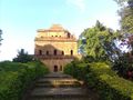
Kareng ghar - the palace of the ahom kings


قضايا اجتماعية
النزاعات مع الولايات المجاورة

According to Assam Government, Assam has border dispute with four states namely Mizoram, Meghalaya, Nagaland, Arunachal Pradesh.[45]
نزاع أسام-ميزورم
Mizoram used to be a district of Assam as Lushai hills before being carved out as a separate union territory and later, becoming another state in 1987. Because of the history, the district's borders did not really matter for locals for a long time. Mizoram shares a border with the districts Cachar, Hailakandi and Karimganj which comes under Barak valley region of Assam. Over time, the two states started having different perceptions about where the demarcation should be. While Mizoram wants it to be along an Inner Line Permit notified in 1875 to protect tribals from outside influence, which Mizos feel is part of their historical homeland, Assam wants it to be demarcated according to district boundaries drawn up much later.[45][46]
نزاع أسام-مغلايا
Meghalaya has identified close to a dozen areas on which it has a dispute with Assam about the state's borders. The chief ministers of the two states, Himanta Biswa Sarma and Megahalya's Conrad Sangma, recently held the first-ever meeting on inter-state border dispute. Both the states have agreed to individually assess the claims for all 12 areas flagged by Meghalaya in the past. A second round of discussion between the two state CMs will be held next month of August. On the question of the role the Union Government is playing in redressing the inter-State border dispute in the country, minister of state for home affairs Nityanand Rai said, “The approach of the Central Government has consistently been that inter-state disputes can be resolved only with the cooperation of the State Governments concerned and that the Central Government acts only as a facilitator for amicable settlement of the dispute in the spirit of mutual understanding.”[45]
نزاع أسام-ناگالاند
The border dispute between the two states has been going on since the formation of Nagaland in 1963. The two states lay claim to Merapani, a small village next to the plains of Assam's Golaghat district. There have been reports of violent clashes in the region since the 1960s.[45][47]
نزاع أسام-أروناتشل پرادش
Assam shares an 804.10 km inter-state boundary with Arunachal Pradesh. The state of Arunachal Pradesh, created in 1987, claims some land that traditionally belonged to its residents has been given to Assam. A tripartite committee had recommended that certain territories be transferred from Assam to Arunachal. The two states have since been battling it out in the Supreme court of India over the issue. Some incidents of local violence have been reported from the borders.[45][48]
مطالب الانفصال كولايات مستقلة عن أسام
بودولاند

The agitation for the creation of a separate Bodoland state resulted in an agreement between the Indian Government, the Assam state government and the Bodo Liberation Tigers Force. According to the agreement made on 10 February 2003, the Bodoland Territorial Council, an entity subordinate to the government of Assam, was created to govern four districts covering 3082 Bodo Kachari-majority villages in Assam.[49][50] Elections to the council were held on 13 May 2003, and Hagrama Mohilary was sworn in as the chief of the 46-member council on 4 June.[51] Demographic wise, the Indigenous Bodo tribe constitutes half of the region's population, along with the region have also significant large number of other ethnic minorities which includes: Assamese, Koch Rajbangshi, Garo, Rabha tribe, Adivasis, Nepalis, Tea tribes, Bengalis, Biharis, Marwaris and Muslims.[52]
كاربي أنگلونگ

كاربي أنگلونگ is one of the 35 districts of Assam. Karbi Anglong was previously known as Mikir Hills. It was part of the Excluded Areas and Partially Excluded Areas (the present North East India) in British India. The British Indian government had never included this area under their government's jurisdiction. Thereby, no government development work or activity were done, nor any tax levied from the hills including Karbi Anglong. The first memorandum for a Karbi homeland was presented to Governor Reid on 28 October 1940 by Semsonsing Ingti and Khorsing Terang at Mohongdijua.[53] The Karbi leaders were then, a part of the All Party Hill Leaders' Conference (APHLC) which was formed on 6 July 1960.[54] The movement again gained momentum when the Karbi Anglong District Council passed a resolution demanding a Separate State in 1981. Then again from 1986 through the leadership of Autonomous State Demand Committee (ASDC), demanded Autonomous statehood of Karbi Anglong and Dima Hasao under Article 244(A). In 2002, the Karbi Anglong Autonomous Council passed another resolution to press for the demand of statehood. Several other memoranda were submitted at different times by several organisations. The demand for a separate state turned violent on 31 July 2013 when student demonstrators set government buildings on fire. Following the incident, the elected leaders of Karbi Anglong jointly submitted a memorandum to the Prime Minister of India demanding a separate State. Demographic wise, more than half of the Karbi Anglong population is made up of Indigenous Karbi tribe with significant migrants from other parts of India.[52]
ديماراجي
.jpg&filetimestamp=20220705063304&)
The Dimasa people of northeast India have been demanding a separate state called ديماراجي أو "ديمالاند" for several decades. It would comprise the Dimasa-Kachari inhabited areas, namely Dima Hasao district, Cachar district, parts of Barak Valley, Nagaon district, Hojai district and Karbi Anglong district in Assam together with part of Dimapur district in Nagaland.
ولاية باراك

Bengalis first came into Assam in 19th century A.D as per as various credible sources.[55][56][57][58] The Barak Valley comprising the present districts of Cachar, Karimganj and Hailakandi is contiguous to Sylhet (Bengal plains), where the Bengali Hindus, according to historian J.B. Bhattacharjee, had settled well before the colonial period, influencing the culture of Dimasa Kacaharis.[59] Bhattacharjee describes that the Dimasa kings spoke Bengali and the inscriptions and coins written were in Bengali script.[59] Migrations to Cachar increased after the British annexation of the region.[59] The native Bengali people of Assam demanded separate state for themselves within the Bengali majority areas of Assam particularly Bengali majority Barak valley comprising three districts: Cachar, Hailakandi, Karimganj along with Dima Hasao and Lumding was also demanded to meet the criteria for creating a separate state for themselves by carving out from Assam's Assamese majority Brahmaputra valley post NRC.[60][61][62][63] Silchar is the proposed capital of Barak state.[64] Barak valley is the most neglected part of Assam in terms of its infrastructure development, tourism sector, educational institutions, hospitals, IT industries, G.D.P, H.D.I etc. which is still lagging behind in comparison to the Assam's mainland Brahmaputra valley which have access to all of those facilities mentioned above.[65][66][67][68][69] In fact, the southern Assam have a overall indigenous Bengali majority population particularly Lumding have (95%) Bengali majority,[70] Barak Valley region have a overwhelming Bengali majority of about (80.3%), while Dima Hasao have approximately (30.2%) significant Bengali plurality on certain pockets specially in the urban areas of the district.[52]
الهجرة من بنگلادش
Assam has been a major site of migration since the Partition of the subcontinent, with the first wave being composed largely of Bengali Hindu refugees arriving during and shortly after the establishment of India and Pakistan (current day Bangladesh was originally part of Pakistan, known as East Pakistan) in 1947–1951. Between the period of first patches (1946-1951), around 274,455 Bengali Hindu refugees have arrived from what is now called Bangladesh (former East Pakistan) in various locations of Assam as permanent settlers and again in second patches between (1952-1958) of the same decade, around 212,545 Bengali Hindus from Bangladesh took shelter in various parts of the state permanently.[71][72] After the 1964 East Pakistan riots many Bengali Hindus have poured into Assam as refugees and the number of Hindu migrants in the state rose to 1,068,455 in 1968 (sharply after 4 years of the riot).[73] The fourth patches numbering around 347,555 have just arrived after Bangladesh liberation war of 1971 as refugees and most of them being Bengali speaking Hindus have decided to stay back in Assam permanently afterwards.[74] Though the governments of India and Bangladesh made agreements for the repatriation of certain groups of refugees after the second and third waves, a large presence of refugees and other migrants and their descendants remained in the state. Nevertheless, still people of Bangladesh have been immigrating to Assam on regular basis. As per reports, about 635 of Bangladeshi people mostly Hindus, use to immigrate to Assam daily.[75][76]
Besides migration caused by displacement, there is also a large and continual unregulated movement between Assam and neighboring regions of Bangladesh with an exceptionally porous border. The situation is called a risk to Assam's as well as India's security.[77] The continual illegal entry of people into Assam, mostly from Bangladesh, has caused economic upheaval and social and political unrest.[78][79] During the Assam Movement (1979–1985), the All Assam Students Union (AASU) and others demanded that government stop the influx of immigrants and deport those who had already settled.[80] During this period, 855 people (the AASU says 860) died in various conflicts with migrants and police.[81][82] The 1983 Illegal Migrants (Determination by Tribunal) Act, applied only to Assam, decreed that any person who entered the Assam after Bangladesh declared independence from Pakistan in 1971 and without authorisation or travel documents is to be considered a foreigner, with the decision on foreigner status to be carried out by designated tribunals. In 1985, the Indian Government and leaders of the agitation signed the Assam accord to settle the conflict.[80]
The 1991 census made the changing demographics of border districts more visible.[83][80] Since 2010, the Indian Government has undertaken the updating of the National Register of Citizens for Assam, and in 2018 the 32.2 million residents of Assam were subject to a review of their citizenship.[84] In August 2019, India released the names of the 2 million residents of Assam that had been determined to be non-citizens and whose names had therefore been struck off the Register of Citizens, depriving them of rights and making them subject to action, and potentially leaving some of them stateless, and the government has begun deporting non-citizens, while detaining 1,000 others that same year.[85][86][87]
In January 2019, the Assam's peasant organisation Krishak Mukti Sangram Samiti (KMSS) claimed that there are around 20 lakh Hindu Bangladeshis in Assam who would become Indian citizens if the Citizenship (Amendment) Bill is passed. BJP, however claimed that only eight lakh Hindu Bangladeshis will get citizenship.[88][89][90] According to various sources, the total number of illegal Hindu Bangladeshis is hard to ascertain.[91][92] According to the census data, the number of Hindu immigrants have been largely exaggerated.[92]
In February 2020, the Assam Minority Development Board announced plans to segregate illegal Bangladeshi Muslim immigrants from the indigenous Muslims of the state, though some have expressed problems in identifying an indigenous Muslim person. According to the board, there are 1.4 crore Muslims in the state, of which 1 crore are of Bangladeshi origin.[93][94][95] A report reveals that out of total 33 districts in Assam, Bangladeshis dominate almost 15 districts of Assam.[96][97][98]
الفيضانات
In the rainy season every year, the Brahmaputra and other rivers overflow their banks and flood adjacent land. Flood waters wash away property including houses and livestock. Damage to crops and fields harms the agricultural sector. Bridges, railway tracks, and roads are also damaged, harming transportation and communication, and in some years requiring food to be air-dropped to isolated towns. Some deaths are attributed to the floods.[99][100]
البطالة
Unemployment is a chronic problem in Assam. It is variously blamed on poor infrastructure, limited connectivity, and government policy;[101] on a "poor work culture";[102] on failure to advertise vacancies;[103] and on government hiring candidates from outside Assam.[104]
في 2020 حدثت سلسلة من أحداث حرق أشخاص أحياء في المنطقة.
تاريخ الشاي


الديموغرافيا

| النمو السكاني | |||
|---|---|---|---|
| Census | Pop. | %± | |
| 1951 | 8٬029٬000 | ||
| 1961 | 10٬837٬000 | 35.0% | |
| 1971 | 14٬625٬000 | 35.0% | |
| 1981 | 18٬041٬000 | 23.4% | |
| 1991 | 22٬414٬000 | 24.2% | |
| 2001 | 26٬656٬000 | 18.9% | |
وصل العدد الإجمالي للسكان في أسام عام 2001 إلى 26.66 مليون نسمة بعدد 4.91 مليون أسرة.[105] وكانت الأعداد الأعلى في السكان في مناطق كامروپ، ناگاؤن، سونيتپور، بارپتا، دهوبري، دارانگ وكچار. ومن المتوقع أن يصل عدد سكان أسام في 2001 إلى 30.57 مليون نسمة, وإلى 34.18 مليون نسمة بحلول 2021 وإلى 35.60 مليون نسمة في 2026.[106]

تضم أسام العديد من الجماعات العرقية وقد درس مشروع شعوب الهند 115 منهم. ومنهم 79 (69%) يصنفون أنفسهم حسب الإقليم الكبير الذي يعيشون فيه، و 22 (19%) يصنفون أنفسهم محلياً و 3 يصنفون أنفسهم كانتشار عابر للحدود الوطنية. وأقدم المستوطنين كانوا الأسترالوآسيويون، ويليهم المتكلمون باللغات تبتو-بورميون، الهندو-آرية وتاي-كاداي.[107] ويتكلم أفراد الجماعات المختلفة خمسة وأربعين لغة، بما فيهم ثلاث عائلات لغات رئيسية: الأسترالوآسيوية (5)، الصينو-تبتية (24) والهندو-أوروبية (12). ثلاثة من اللغات المستخدمة لا ينتمون لتلك العائلات اللغوية. وتوجد درجة عالية من ثنائية اللغة.
بلغ عدد سكان أسّام 22,414,344 نسمة عام 1991، يتركز أغلبهم في وادي أسّام والسهول الجنوبية، إذ يبلغ معدل الكثافة السكانية في الأراضي السهلية وعلى جانبي نهر براهماپوترا نحو 300 نسمة/كم²، وينخفض فوق التلال إلى أقل من 40 نسمة/كم² والأكثرية الساحقة من السكان ريفيون، إذ لا يؤلف سكان المدن أكثر من 8% من مجموع السكان. وينتمي معظم السكان، ولاسيما قاطنو السهول، إلى المجموعة الهندية ـ الأوربية، في حين ينتمي معظم سكان الهضاب والتلال إلى المجموعة المغولية (أصول بورمية، وهندية صينية). ويضاف إلى ذلك جموع المهاجرين إلى هذه الولاية الذين قدموا من ولايتي بيهار وأوريسا للعمل في مزارع الشاي الأسّامية. ويدين نحو ثلثي السكان بالهندوسية، والربع بالإسلام.
الديانة
الهندوسية

الإسلام
| فيديو: تاتا غروب وعلاقتها بإسرائيل |

يمثل المسلمون في آسام نسبة 30.9% من إجمالي عدد سكان الولاية، حيث تعتبر ثاني الولايات الهندية من حيث عدد المسلمين بعد جامو وكشمير، ويبلغ عدد المسلمين بها حوالي ثمانية ملايين ونصف المليون نسمة.
ويضم شمال شرق الهند الذي يشترك في حدوده مع الصين وميانمار وبنجلاديش وبوتان أكثر من 200 مجموعة عرقية وقبلية، ويعاني من حركات انفصالية منذ استقلال الهند عن بريطانيا عام 1947، ويسود شعور بمعاداة الوافدين خصوصًا المسلمين منهم بين أبناء القبائل التي تسكن ولاية آسام، وهي قبائل يدين أغلبية أبنائها بالديانة الهندوسية، وبعضهم تحول إلى المسيحية خلال القرون الثلاثة الماضية.
يذكر أن أحداث العنف التي تشهدها آسام نتيجة تجاوزات البوذيين والهندوس هذه الأيام ليست الأولى من نوعها، وإنما هي أحداث متكررة، تتكرر من حين لآخر، وقد كان أعنفها أحداث آسام 1984، والتي أسفرت عن مجازر راح ضحيتها آلاف المسلمين، فنسأل الله ألاّ تتكرر وأن يتم تجاوز الأزمة الحالية والسيطرة على الوضع، وحماية إخواننا المسلمين هناك من بطش البوذيين والهندوس.
حيث هاجم مسلحون من قبائل بودو البوذية بالولاية السكان المسلمين اعتقادًا منهم بأنهم وراء جريمة قتل لأربعة شبان بوذيين، وكأن مأساة بورما تعاد مرة أخرى، حيث أشيع في أحداث بورما أنها كانت نتيجة لاعتقاد السكان البوذيين أن مسلمًا اعتدى على فتاة بوذية، وهو مسلسل مكرر في غالب الاعتداءات، وكأنها أعمال مدبرة لتبرير ما يعقبها من عمليات قتل وتهجير واعتداء على الأقليات المسلمة.
فقد ارتكبت ميليشيات بوذية في ولاية آسام الهندية الحدودية القريبة من بورما - مجزرة بحق المسلمين في آسام، راح ضحيتها العشرات وأصيب 400 بحسب إحصائيات أولية، فيما نزح أكثر من 50 ألف مسلم إلى مناطق هندية داخلية بعد حرق 500 قرية، كما واجهتهم قوات الشرطة بقمع أمني غير مسبوق، وفتحت النار على الاحتجاجات، وأسفرت المواجهات عن نزوح أكثر من 50 ألف شخص إلى معسكرات الإغاثة هربًا من المواجهات. وذكرت قناة "سي إن إن إي بي إم" الإخبارية الهندية الثلاثاء الماضي أن أعمال العنف العرقي تصاعدت في منطقة "كوكراجهار" بولاية "آسام" الواقعة في شمال شرق البلاد، حيث انتشرت في المناطق المجاورة مثل شيرانج، وتحولت إلى احتجاجات قطعت خلالها خطوط السكك الحديدية.
في أغسطس 2019، قررت أسام الهندية أن 2 مليون مسلم لا يستوفون شروط الجنسية الهندية، رغم وجودهم فيها، أباً عن جد. الولاية تريد ترحيلهم إلى بنگلادش المجاورة، بالرغم من عدم وجود علاقة لهم بها. الولاية تبدأ إنشاء معسكرات اعتقال عملاقة لجمعهم ثم ترحيلهم.[109]
وقد أصدرت أصدرت الحكومة الهندية قائمة إحصاء سكانية ستجرد نحو 4 مليون نسمة في ولاية أسام الهندية من جنسياتهم. ونشر مكتب السجل الوطني للمواطنين قائمة بأسماء الأشخاص المطالبين بإثبات أنهم جاءوا إلى الولاية قبل 24 مارس 1971 ، التاريخ الذي أسست فيه دولة بنگلادش. وتقول الهند إن العملية تهدف إلى اجتثاث جحافل من المهاجرين البنگلاديشيين من الولاية. بيد أن القائمة أثارت مخاوف من أنها قد تكون حملة موجهة ضد الأقليات العرقية في آسام. وخشية اندلاع أحداث العنف، قال مسؤولون في الولاية إنه لن يكون هناك إبعاد فوري لأي شخص.[110]
وأشاروا إلى أن عملية استئناف قضائية طويلة زمنيا ستتاح للجميع، على الرغم من أن ذلك يعني أن تعيش ملايين العوائل معلقة بدون وضع قانوني حتى اتخاذ القرار النهائي لحسم أوضاعهم القانونية.
المسيحية
المسيحين هم كذلك أقلية مضطهده وبعضهم يطالب بالإنفصال عن الهند , وتعد مسيحية ميزورام Mizoram شهيرة بالتعدد ويعتبر Ziona Chana أكثر معدد للزوجات 39 زوجة أنجب منهن 94 طفل, وتدعمهم دول وهيئات ومنظمات مسيحية ... وميزورام هي أكبر كتلة كغالبية مسيحية في الهند ...
السيخية

البوذية
اللغات
لغات أسام عام 1991[111]
اللغات الرئيسة فهي الأسامية، والبنغالية، إلى جانب اللغة التبتية البورمية.
الثقافة


الرمزية

المهرجانات


الأعياد والمهرجانات في أسام:
الفنون التطبيقية


الأدب

الحرف التقليدية


الفنون الجميلة

الاقتصاد


الزراعة

تؤلف الزراعة نحو 75% من واردات هذه الولاية، ويعمل بها معظم السكان. ومن أهم المحصولات الزراعية: الشاي والجوت، وهما من المحصولات الاقتصادية، والأرز وهو المحصول الغذائي الرئيس. وينتج وادي أسّام وحده ما يزيد على 80% من إنتاج الولاية. ويعد الشاي أهم محاصيل أسّام، فهو يعطي أكثر من ربع وارداتها، ويعمل في زراعته أكثر من نصف مليون شخص، ويزيد إنتاجه السنوي على 200 ألف طن.
التعدين
أهم ثروات أسّام المعدنية فهي النفط، والغاز الطبيعي، والفحم، ويتركز استثمارها في أسّام العليا، إذ تنتج هذه الولاية نحو نصف إنتاج الهند من النفط والغاز الطبيعي. والصناعة في أسّام قليلة، تقتصر على مصانع محدودة للإسمنت والجوت والسكر والورق والأسمدة وتكرير النفط.
الصناعة
السياحة
|

|

التعليم


.jpg&filetimestamp=20220705063304)
الحركة العلمية في أسام نشطة نسبياً، ففي الولاية ثلاث جامعات في كل من گواهاتي وجورهات وديبروغر.
يوجد في أسام العديد من المؤسسات التعليمية والبحثية وأهمها تلك المؤسسات:
- Gauhati University, Guwahati
- Dibrugarh University, Dibrugarh
- جامعة أسام, Silchar
- Tezpur University, Tezpur
- Assam Agricultural University, Jorhat
- Indian Institute of Technology Guwahati
- National Institute of Technology, Silchar
- North Eastern Regional Institute of Water and Land Management, Tezpur
- Lokopriya Gopinath Bordoloi Regional Institute of Mental Health, Tezpur
- Defence Research Labroratory,Tezpur
- North East Institute of Science and Technology, Jorhat (Formerly Regional Research Laboratory), Jorhat
- Tocklai Experimental Station, Tea Research Association, Jorhat
- Centre for Plasma Physics, Guwahati
- Assam Engineering College, Jalukbari, Guwahati.
- Jorhat Engineering College, Jorhat.
- Assam Institute of Management, Guwahati.
- Rangia College, Rangia
انظر أيضا
ملاحظات ومصادر
- ^ Steinberg, S. (2016). The Statesman's Year-Book 1964–65: The One-Volume ENCYCLOPAEDIA of all nations. Springer. p. 412. ISBN 978-0-230-27093-0.
- ^ أ ب "Jagdish Mukhi: Few facts about Assam's new Governor". The New Indian Express. 30 September 2017. Archived from the original on 30 September 2017. Retrieved 30 September 2017.
- ^ "MOSPI Gross State Domestic Product". Ministry of Statistics and Programme Implementation, Government of India. 1 March 2019. Retrieved 9 June 2019.
- ^ "Report of the Commissioner for linguistic minorities: 52nd report (July 2014 to June 2015)" (PDF). Commissioner for Linguistic Minorities, Ministry of Minority Affairs, Government of India. pp. 58–59. Archived from the original (PDF) on 28 ديسمبر 2017. Retrieved 16 فبراير 2016.
- ^ India, Press Trust of (9 September 2014). "Govt withdraws Assamese as official language from Barak valley". Business Standard India. Retrieved 29 January 2018.
- ^ "Bodoland Territorial Council (BTC) Accord". Archived from the original on 19 April 2012. Retrieved 30 April 2018.
- ^ "Sub-national HDI – Area Database – Global Data Lab". hdi.globaldatalab.org. Archived from the original on 23 September 2018. Retrieved 13 September 2018.
- ^ أ ب "Census 2011 (Final Data) – Demographic details, Literate Population (Total, Rural & Urban)" (PDF). planningcommission.gov.in. Planning Commission, Government of India. Archived (PDF) from the original on 27 January 2018. Retrieved 3 October 2018.
- ^ "Assam Legislative Assembly - History". Archived from the original on 13 September 2016. Retrieved 14 September 2016.
- ^ World Heritage Centre, UNESCO. "World Heritage List".
- ^ Besatia in the Schoff translation and also sometimes used by Ptolemy, they are a people similar to Kirradai and they lived in the region between "Assam and Sichuan" (Casson 1989, pp. 241–243)
- ^ "The Periplus of the Erythraen Sea (last quarter of the first century A.D) and Ptolemy's Geography (middle of the second century A.D) appear to call the land including Assam Kirrhadia after its Kirata population." (Sircar 1990:60–61)
- ^ "Prior to the thirteenth century the present region was called Kāmarūpa or, alternatively, Prāgjyotiṣapur", Lahiri, Nayanjot., Pre-Ahom Assam (Delhi 1991) p. 14
- ^ "Ahoms also gave Assam and its language their name (Ahom and the modern ɒχɒm 'Assam' come from an attested earlier form asam, acam, probably from a Burmese corruption of the word Shan/Shyam, cf. Siam: Kakati 1962; 1-4)." (Masica 1993, p. 50)
- ^ Wandrey 2004 p3–8
- ^ "أسّام". الموسوعة العربية. Retrieved 2012-10-24.
{{cite web}}: Unknown parameter|autor=ignored (|author=suggested) (help) - ^ "Assam Flood Toll Rises to 13". NDTV. 23 August 2015. Archived from the original on 24 August 2015. Retrieved 25 August 2015.
- ^ "Flood situation in Assam worsens". Hindustan Times. 23 August 2015. Archived from the original on 21 January 2022. Retrieved 25 August 2015.
- ^ Borthakur, Ahir Bhairab (15 January 2002), "Call of the wild", Down to Earth, http://www.downtoearth.org.in/full6.asp?foldername=20020115&filename=gra&sec_id=11&sid=1
- ^ Birdlife International, UK. "Indo-Gangetic Grasslands" (PDF). Archived (PDF) from the original on 15 يونيو 2007. Retrieved 31 مايو 2007.
- ^ National Mission on Bamboo Applications 2004
- ^ Sharma, Pradip (April–June 2003), "An Overview on Wetlands in Assam", ENVIS Assam, Assam Science Technology and Environment Council 2: 7, http://www.envisassam.org/VOL2_2.pdf.
- ^ World Heritage Centre, UNESCO. "World Heritage List". Archived from the original on 6 يونيو 2007. Retrieved 30 مايو 2007.
- ^ Choudhury, A.U.(1996) Survey of the white-winged wood duck and the Bengal florican in Tinsukia district & adjacent areas of Assam and Arunachal Pradesh. The Rhino Foundation for Nature in North East India, Guwahati, India. 82pp+
- ^ Choudhury, A.U. (2010)The vanishing herds : the wild water buffalo. Gibbon Books, Rhino Foundation, CEPF & COA, Taiwan, Guwahati, India
- ^ Choudhury, A.U. (2000)The birds of Assam. Gibbon Books & WWF-India, Guwahati, India
- ^ Choudhury, A.U. (1990). Checklist of the birds of Assam. Sofia Press & Publishers Pvt. Ltd., Guwahati, India. 72 pp+
- ^ Choudhury, A.U. (1997)The check list of the mammals of Assam. Gibbon Books & ASTEC, Guwahati, India
- ^ ENVIS Assam (April–June 2003). "Endemic Orchids of Assam" (PDF). ENVIS Assam, Assam Science Technology and Environment Council. 2: 8. Archived from the original (PDF) on 20 May 2006.
- ^ أ ب NEDFi & NIC-Assam. "North East India Databank". Archived from the original on 18 April 2007.
- ^ Wandrey 2004, p. 17
- ^ "North by Northeast: What explains BJP's stunning win in Assam?". 22 May 2016. Archived from the original on 8 August 2016. Retrieved 5 August 2016.
- ^ "Govt announces 5 new districts". Assam Times. 15 August 2015. Archived from the original on 17 August 2015. Retrieved 16 August 2015.
- ^ أ ب Revenue Department, Government of Assam
- ^ "Assam: Majuli becomes 1st river island district of India". Hindustan Times. Guwahati. 27 يونيو 2016. Archived from the original on 29 أغسطس 2016. Retrieved 28 يونيو 2016.
- ^ Desk, Sentinel Digital (13 January 2021). "'Bajali' Becomes the 34th Full-Fledged District of Assam". www.sentinelassam.com (in الإنجليزية). Archived from the original on 13 January 2021. Retrieved 16 January 2021.
- ^ Directorate of Information and Public Relations, Government of Assam. "Area of the National Parks and Wildlife Sanctuaries in Assam, 2002". Archived from the original on 6 October 2007. Retrieved 29 May 2006.
- ^ Sircar, D C (1990), "Pragjyotisha-Kamarupa", in Barpujari, H K, The Comprehensive History of Assam, I, Guwahati: Publication Board, Assam, pp. 59–78
- ^ "The Assam Tribune Online". www.assamtribune.com. Archived from the original on 27 January 2016. Retrieved 3 January 2019.
- ^ "Relics hold clue to missing history – Sunga-Kushana era terracotta artefacts may say if Guwahati existed before 7th century AD". www.telegraphindia.com. Archived from the original on 4 January 2019. Retrieved 3 January 2019.
- ^ India History Association. Session (2001), Proceedings of North East India History Association North East he came under the 'bad' influence of Banasura, ruler of Sonitapura (identified with Tezpur now under Sonitpur district in central Assam), and ended up sidelining Kamakhya in favour of Siva. Thereafter Naraka forsook the guidance
- ^ Banikanta Kakati, Assamese:Its formation and development
- ^ "In the Battle of Itakhuli in September 1682, the Ahom forces chased the defeated Mughals nearly one hundred kilometers back to the Manas river. The Manas then became the Ahom-Mughal boundary until the British occupation." Richards, John F. (1995). The Mughal Empire. Cambridge: Cambridge University Press. p. 247. ISBN 0521566037. Retrieved 26 January 2013.
- ^ خطأ استشهاد: وسم
<ref>غير صحيح؛ لا نص تم توفيره للمراجع المسماةigi-46 - ^ أ ب ت ث ج "Total seven inter-state border disputes in country; Assam has dispute with four states: Govt | India News - Times of India". The Times of India.
- ^ Deb, Debraj (5 August 2021). "Explained: Why did a 150-year-old Assam-Mizoram dispute get violent now?". The Indian Express (in الإنجليزية). Retrieved 25 May 2022.
- ^ "Assam Nagaland border dispute: Assam signs agreement with Nagaland to diffuse stand-off on eastern front | India News - Times of India". The Times of India.
- ^ "Border dispute with Arunachal at 1,200 places: Himanta Biswa Sarma". The Hindu (in الإنجليزية). 13 August 2021. Retrieved 25 May 2022.
- ^ "The Hindu : Assam: accord and discord". Hinduonnet.com. Archived from the original on 5 September 2012. Retrieved 4 March 2012.
- ^ "Memorandum of Settlement on Bodoland Territorial Council (BTC)". Satp.org. 10 February 2003. Retrieved 4 March 2012.
- ^ "Mahillary sworn in Bodoland council chief". The Hindu. Chennai, India. 4 June 2005. Archived from the original on 15 June 2005.
- ^ أ ب ت "Reference at censusindia.gov.in".
- ^ Dharamsing Teron, "Opium Curse – A Forgotten Chapter", unpublished.
- ^ J. I. Kathar (IAS Retd), "1971 Aningkan Kilik Kehai Un:e....", Thekar (5 February 2013); available from "Reference at thekararnivang.com". Archived from the original on 16 May 2018. Retrieved 14 August 2021.
- ^ "Home | Karimganj District | Government Of Assam, India".
- ^ "Bangla Language - Banglapedia".
- ^ Majumdar, Paramananda (2006). "Introduction of the Bengali Language in 19". Proceedings of the Indian History Congress. 67: 787–792. JSTOR 44147998.
- ^ "Welcome to Jamia Millia Islamia - A Central University". › uploadPDF The Bengalis of Assam - Jamia Millia Islamia
- ^ أ ب ت Baruah, Professor of Political Studies Sanjib; Baruah, Sanjib (29 June 1999). India Against Itself: Assam and the Politics of Nationality (in الإنجليزية). University of Pennsylvania Press. p. 103. ISBN 978-0-8122-3491-6.
- ^ "Assam NRC LIVE: Not Hindus or Muslims, But Bengalis Being Targeted, Says Mamata". News18 (in الإنجليزية). 30 July 2018. Retrieved 25 May 2022.
- ^ "Exclusion of Hindu Bengalis from Assam NRC changing political". Business Standard. PTI. 22 September 2019. Retrieved 25 May 2022.
- ^ "What the NRC reveals about the challenges of being Bengali in Assam". Hindustan Times (in الإنجليزية). 7 September 2018. Retrieved 25 May 2022.
- ^ Daniyal, Shoaib (31 July 2018). "'An expel Bengalis campaign': Opposing NRC in Assam, Mamata makes her strongest identity pitch yet". Scroll.in. Retrieved 25 May 2022.
- ^ "One moment, please..."
- ^ Mazumder, Prasanta (12 July 2018). "Statehood demand grows louder in Assam's Barak Valley". New Indian Express. Retrieved 25 May 2022.
- ^ "Barak organization demands creation of separate state - Sentinelassam". The Sentinel (in الإنجليزية). 27 December 2016. Retrieved 25 May 2022.
- ^ "Give up separate Barak state demand: Sonowal to Dutta Roy". Northeast Now. 26 July 2018. Retrieved 25 May 2022.
- ^ Saikia, Arunabh (29 December 2017). "A tale of two valleys: What's behind the demand for a separate Union Territory in southern Assam?". Scroll.in. Retrieved 25 May 2022.
- ^ "Statehood sought for Assam's Barak Valley". The Hindu (in الإنجليزية). 30 October 2018. Retrieved 25 May 2022.
- ^ Saha, Abhishek; Agarwala, Tora (25 August 2019). "Deadline approaching: What it is to be a name on NRC list — or off it". The Indian Express (in الإنجليزية). Retrieved 25 May 2022.
- ^ India (1951). "Annual Arrival of Refugees in Assam in 1946–1951". Census of India. XII, Part I (I-A): 353 – via web.archive.org.
- ^ "iussp2005". › ...PDF The Brahmaputra valley of India can be compared only with the Indus ...
- ^ "iussp2005". iussp2005.princeton.edu. Retrieved 22 April 2021.
- ^ "Adelaide Research & Scholarship: Home". digital.library.adelaide.edu.au. Retrieved 22 April 2021.
- ^ "Bangladeshi people come to Assam regularly: National Hindu Mahasabha - Pratidin Time". Retrieved 25 May 2022.
- ^ "No Hindus will be left in Bangladesh after 30 years: professor". The Hindu (in الإنجليزية). PTI. 22 November 2016. Retrieved 25 May 2022.
- ^ "Illegal immigration from Bangladesh a national problem". India Today. 4 June 2014. Retrieved 25 August 2015.
- ^ "Soon blueprint to deport illegal Bangladeshis in Assam". Hindustan Times. 10 December 2014. Archived from the original on 10 December 2014. Retrieved 25 August 2015.
- ^ "Illegal Migration into Assam". www.satp.org. Retrieved 9 September 2019.
- ^ أ ب ت "Illegal Migration into Assam". www.satp.org. Retrieved 18 August 2019.
- ^ "Martyrs of Assam Agitation | Implementation of Assam Accord | Government of Assam, India". assamaccord.assam.gov.in. Retrieved 18 August 2019.
- ^ "Assam: Prafulla Mahanta not to campaign for AGP to protest alliance with BJP". www.telegraphindia.com. Retrieved 18 August 2019.
- ^ "1. Population Explosion in West Bengal: A Survey". 20 March 2012. Archived from the original on 20 March 2012. Retrieved 18 August 2019.
- ^ "The National Register of Citizens and India's commitment deficit to international law". LSE Human Rights. 10 August 2020. Retrieved 4 December 2020.
- ^ "Leave in 15 days, BJP MPs tell illegal immigrants in Assam". Firstpost. 2 June 2014. Retrieved 25 August 2015.
- ^ "Assam NRC: What next for 1.9 million 'stateless' Indians?". BBC News (in الإنجليزية البريطانية). 31 August 2019. Retrieved 4 December 2020.
- ^ "India leaves nearly two million people off citizens' list, fate..." Reuters. 31 August 2019. Retrieved 2 September 2019.
- ^ "20 lakh Bangladeshi Hindus to become Indians if Citizenship Bill is passed: Krishak Mukti Sangram Samiti". The Economic Times. 17 January 2019. Retrieved 3 November 2020.
- ^ Saikia, Arunabh (30 August 2020). "Bengali Hindus in this Assam village live the anxious life of 'NRC rejects'". Scroll.in. Retrieved 3 November 2020.
- ^ Tewari, Ruhi (5 September 2019). "Bengali Hindus in Assam look at Citizenship Bill to get out of NRC mess". ThePrint. Retrieved 3 November 2020.
- ^ "Confusion, hope run high among Assam's Hindu Bengalis". Deccan Herald (in الإنجليزية). 17 December 2019. Retrieved 3 November 2020.
- ^ أ ب "Citizenship Amendment Act: BJP chasing ghosts in Assam; Census data shows number of Hindu immigrants may have been exaggerated - India News, Firstpost". Firstpost. 18 December 2019. Retrieved 3 November 2020.
- ^ Hazarika, Mytithili (12 February 2020). "BJP wants to segregate Assamese Muslims from Bangladeshi Muslims, but some ask how". The Print (in الإنجليزية). Retrieved 4 November 2020.
- ^ PTI (10 February 2020). "Assam plans survey to identify indigenous Muslim population". The Hindu (in الإنجليزية). Retrieved 4 November 2020.
- ^ "Online census of Assamese Muslims launched". The Hindu. 15 April 2021.
- ^ "Hari Shankar Brahma report reveals illegal Bangladeshis dominates 15 out of 33 Assam districts, massive threats to indigenous people | Indiablooms - First Portal on Digital News Management".
- ^ "Muslim majority districts in Assam up | India News - Times of India". The Times of India.
- ^ "Assam Elections 2021 | How Muslims of the State, One-third of Electorate, Voted in 2016 and 2019".
- ^ "Assam Flood Toll Rises to 13". NDTV. 23 August 2015. Retrieved 25 August 2015.
- ^ "Flood situation in Assam worsens". Hindustan Times. 23 August 2015. Retrieved 25 August 2015.[dead link]
- ^ "Poor infrastructure, stringent policies bottleneck for Assam's growth". The Economic Times. 9 July 2015. Retrieved 17 November 2019.
- ^ "Panel for study of unemployment problem in Assam". Zee News. 26 October 2012. Retrieved 17 November 2019.
- ^ Thakur, Shivasish (17 October 2013). "Govt inaction deprives local aspirants". The Assam Tribune. Archived from the original on 23 September 2015. Retrieved 17 November 2019.
- ^ "80% of Central jobs occupied by outsiders". The Assam Tribune. 21 January 2014. Archived from the original on 23 September 2015. Retrieved 17 November 2019.
- ^ The Government of Assam 2002-03
- ^ The National Commission on Population 2006
- ^ Taher 1993
- ^ "تعداد الهند - التوجهات الاجتماعية-الثقافية". Government of India, Ministry of Home Affairs. Retrieved 2 March 2011.
{{cite web}}: Cite has empty unknown parameter:|coauthors=(help) - ^ "A Mass Citizenship Check in India Leaves 2 Million People in Limbo". نيويورك تايمز. 2019-08-31. Retrieved 2019-09-22.
- ^ "أربعة ملايين شخص مهددون بالتجريد من الجنسية في ولاية آسام الهندية". بي بي سي. 2019-06-30. Retrieved 2019-09-22.
- ^ "Commissioner Linguistic Minorities (originally from Indian Census, 1991)". Archived from the original on 8 October 2007.
- ^ Government of Assam. "Economic Survey of Assam 2001–2002 in Assam Human Development Report, 2003" (PDF). p. 25. Retrieved 6 June 2007.
{{cite web}}:|chapter=ignored (help)[dead link] - ^ Government of Assam. "Economic Survey of Assam 2005–2006 in NEDFi, Assam Profile, NER Databank". Retrieved 6 June 2007.[dead link]
- Aitchison, C. U. ed (1931), The Treaty of Yandaboo, A Collection of Treaties, Engagements and Sanads: Relating to India and Neighbouring Countries. Vol. XII., Calcutta: Government of India Central Publication Branch
- Assam Small Farmers’ Agri-business Consortium, Fish Species of AssamPDF (400 KiB)
- Assam Tourism 2002, Government of Assam, Arts and Crafts of Assam in About Assam, http://www.assamtourism.org/arts.htm, retrieved on 2007-06-3
- Barpujari, H. K. (ed.) (1990), The Comprehensive History of Assam, 1st edition, Guwahati, India: Assam Publication Board
- Birdlife International, UK, Indo-Gangetic GrasslandsPDF (431 KiB)
- Borthakur, Ahir Bhairab (January 15, 2002), "Call of the wild", Down To Earth
- Directorate of Information and Public Relations, Government of Assam, Area of the National Parks and Wildlife Sanctuaries in Assam, 2002, http://janasanyogassam.nic.in/assamataglance.htm, retrieved on 2006-05-29
- Directorate of Information and Public Relations, Government of Assam, Assam at a Glance, http://janasanyogassam.nic.in/assamataglance.htm, retrieved on 2007-05-25
- Dixit, K. M. (August 2002), "Chicken's Neck (Editorial)", Himal South Asian, http://www.himalmag.com/2002/august/lastpage.htm
- Editorial (6 January 2007), "Assam or Asom?", The Assam Tribune, http://www.assamtribune.com/scripts/details.asp?id=jan0607\edit
- ENVIS Assam (April-June 2003), "Endemic Orchids of AssamPDF (6.46 MiB)", ENVIS Assam, Assam Science Technology and Environment Council 2: 8
- FAO Statistics Division, 2007, Food and Agriculture Organization of the United Nations, FAOSTAT, http://faostat.fao.org/site/340/DesktopDefault.aspx?PageID=340, retrieved on 2006-06-05
- Government of Assam. "Chapter 2, Income, Employment and Poverty Economic Survey of Assam 2001-2002 in Assam Human Development Report, 2003" (PDF). Retrieved on 2007-06-06.
- Government of Assam. "Economic Survey of Assam 2004-2005 in NEDFi, Assam Profile, NER Databank" (html). Retrieved on 2007-06-06.
- Government of Assam. "Economic Survey of Assam 2005-2006 in NEDFi, Assam Profile, NER Databank" (html). Retrieved on 2007-06-06.
- Government of Assam 2002-03, Statistics of Assam, http://www.assamgov.org/generalinformation/assamstatistics.html, retrieved on 2007-06-3
- Governor of Assam (1998-11-08). "Report on Illegal Migration into Assam". Retrieved on 2007-05-26.
- Hazarika, Sanjoy (2003), Strangers of the Mist, Penguin Books Australia Ltd.
- Hussain, Wasbir (September 20, 2004), "Assam: Demographic Jitters, Weekly Assessments & Briefings", South Asia Intelligence Review 3-10
- Kakati, Banikanta (1962), Assamese, Its Formation and Development, 2nd edition, Guwahati, India: Lawyer's Book Stall
- MacFarlane, Alan; MacFarlane, Iris (2003), Green Gold, The Empire of Tea, Ch.6-11, Random House, London
- Nath, T.K., Bamboo Cane and Assam, Guwahati, India: Industrial Development Bank of India, Small Industries Development Bank of India
- National Commission for Women. "Situational Analysis of Women in Assam" (PDF). Retrieved on 2006-07-05.
- National Commission on Population, Census of India. "Population Projections for India and States 2001-2026" (PDF). Retrieved on 2007-05-15.
- National Mission on Bamboo Applications, Assam, State Profile, http://www.bambootech.org/subsubTOP.asp?subsubid=101&subid=37&sname=STATE, retrieved on 2007-05-25
- NEDFi & NIC-Assam, North East India Databank, http://nerdatabank.nic.in/as_minerals.htm, retrieved on 2007-05-20
- Purdue University, The Köppen Classification of Climates, http://www.hort.purdue.edu/newcrop/tropical/lecture_04/lec_04.html, retrieved on 2007-05-25
- Ranjan, M.P.; Iyer, Nilam; Pandya, Ghanshyam, Bamboo and Cane Crafts of Northeast India, National Institute of Design
- Revenue Department, Government of Assam, Revenue Administration - Districts and Subdivisions, http://revenueassam.nic.in/, retrieved on 2007-05-25
- Sharma, Pradip (April-June 2003), "An Overview on Wetlands in AssamPDF (6.46 MiB)", ENVIS Assam, Assam Science Technology and Environment Council 2: 7
- Singh, K. S (ed) (2003) People of India: Assam Vol XV Parts I and II, Anthropological Survey of India, Seagull Books, Calcutta
- Singh, R. L. (1993), India, A Regional Geography, Varanasi, India: National Geographical Society of India
- Taher, Mohammad (1993) The Peopling of Assam and contemporary social structure in Ahmad, Aijazuddin (ed) Social Structure and Regional Development, Rawat Publications, New Delhi
- Times News Network (28 February 2006), "Assam to fall off the map, turn Asom", The Times of India, http://timesofindia.indiatimes.com/articleshow/1431357.cms
- UNDP (2004), Chapter 2, Income, Employment and Poverty in Assam Human Development Report, 2003PDF, Government of Assam
- Wandrey, C. J. (2004), "Sylhet-Kopili/Barail-Tipam Composite Total Petroleum System, Assam Geologic Province, IndiaPDF (1.73 MiB)", U.S. Geological Survey Bulletin 2208-D
- World Heritage Centre, UNESCO. "World Heritage List". Retrieved 2007-06-06.
قراءات إضافية
Language and literature
- Bara, Mahendra (1981), The Evolution of the Assamese Script, Jorhat, Assam: Asam Sahitya Sabha
- Barpujari, H. K. (1983), Amerikan Michanerisakal aru Unabimsa Satikar Asam, Jorhat, Assam: Asam Sahitya Sabha
- Barua, Birinchi Kumar (1965, c1964), History of Assamese Literature, Guwahati: East-West Centre Press
- Barua, Hem (1965), Assamese Literature, New Delhi: National Book Trust
- Brown, William Barclay (1895), An Outline Grammar of the Deori Chutiya Language Spoken in Upper Assam with an Introduction, Illustrative Sentences, and Short Vocabulary, Shillong: The Assam Secretariat Printing Office
- Deka, Bhabananda (1961), Industrialisation of Assam, Guwahati: Gopal Das
- Dhekial Phukan, Anandaram 1829-1859 (1977), Anandaram Dhekiyal Phukanar Racana Samgrah, Guwahati: Lawyer's Book Stall
- Endle, Sidney (1884), Outline of the Kachari (Baro) Language as Spoken in District Darrang, Assam, Shillong: Assam Secretariat Press
- Gogoi, Lila (1972), Sahitya-Samskriti-Buranji, Dibrugarh: New Book Stall
- Gogoi, Lila (1986), The Buranjis, Historical Literature of Assam, New Delhi: Omsons Publications
- Goswami, Praphulladatta (1954), Folk-Literature of Assam, Guwahati: Department of Historical and Antiquarian Studies in Assam
- Gurdon, Philip Richard Thornhagh (1896), Some Assamese Proverbs, Shillong: The Assam Secretariat Printing Office
- Kakati, Banikanta (1959), Aspects of Early Assamese Literature, Guwahati: Gauhati University
- Kay, S. P. (1904), An English-Mikir Vocabulary, Shillong: The Assam Secretariat Printing Office
- Medhi, Kaliram (1988), Assamese Grammar and Origin of the Assamese Language, Guwahati: Assam Publication Board
- Miles, Bronson (1867), A Dictionary in Assamese and English, Sibsagar, Assam: American Baptist Mission Press
- Morey, Stephen (2005), The Tai languages of Assam : a grammar and texts, Canberra: Pacific Linguistics, ISBN 0858835495
History
- Antrobus, H. (1957), A History of the Assam Company, Edinburgh: Private Printing by T. and A. Constable
- Barabaruwa, Hiteswara 1876-1939 (1981), Ahomar Din, Guwahati: Assam Publication Board
- Barooah, Nirode K. (1970), David Scott In North-East India, 1802-1831, New Delhi: Munshiram Manoharlal Publishers
- Barua, Harakanta 1813-1900 (1962), Asama Buranji, Guwahati: Department of Historical and Antiquarian Studies, Assam
- Barpujari, H. K. (1963), Assam in the Days of the Company, 1826-1858, Guwahati: Lawyer's Book Stall
- Barpujari, H. K. (1977), Political History of Assam. Department for the Preparation of Political History of Assam, Guwahati: Government of Assam
- Barua, Kanak Lal, An Early History of Kamarupa, From the Earliest Time to the Sixteenth Century, Guwahati: Lawyers Book Stall
- Barua, Kanak Lal, Studies in the Early History of Assam, Jorhat, Assam: Asam Sahitya Sabha
- Baruah, Swarna Lata (1993), Last days of Ahom monarchy : a history of Assam from 1769-1826, New Delhi: Munshiram Manoharlal Publishers
- Bhuyan, Suryya Kumar (1949), Anglo-Assamese Relations, 1771-1826, Guwahati: Department of Historical and Antiquarian Studies in Assam
- Bhuyan, Suryya Kumar (1947), Annals of the Delhi Badshahate, Guwahati: Department of Historical and Antiquarian Studies, Government of Assam
- Bhuyan, Suryya Kumar (1957), Atan Buragohain and His Times, Guwahati: Lawyer's Book Stall
- Bhuyan, Suryya Kumar (1962), Deodhai Asam Buranji, Guwahati: Department of Historical and Antiquarian Studies
- Bhuyan, Suryya Kumar (1928), Early British Relations with Assam, Shillong: Assam Secretariat Press
- Bhuyan, Suryya Kumar (1947), Lachit Barphukan and His Times, Guwahati: Department of Historical and Antiquarian Studies, Government of Assam
- Bhuyan, Suryya Kumar (1964), Satasari Asama Buranji, Guwahati: Gauhati University
- Bhuyan, Suryya Kumar (1975), Swargadew Rajeswarasimha, Guwahati: Assam Publication Board
- Buchanan, Francis Hamilton 1762-1829 (1963), An Account of Assam, Guwahati: Department of Historical and Antiquarian Studies
- Duara Barbarua, Srinath (1933), Tungkhungia Buranji, Bombay: H. Milford, Oxford University Press
- Gait, Edward Albert 1863-1950 (1926), A History of Assam, Calcutta: Thacker, Spink & Co.
- Gogoi, Padmeswar (1968), The Tai and the Tai Kingdoms, Guwahati: Gauhati University
- Guha, Amalendu (1983), The Ahom Political System, Calcutta: Centre for Studies in Social Sciences
- Hunter, William Wilson 1840-1900 (1879), A Statistical Account of Assam, London: Trubner & Co.
Tradition and Culture
- Barkath, Sukumar (1976), Hastibidyarnnara Sarasamgraha (English & Assamese), 18th Century, Guwahati: Assam Publication Board
- Barua, Birinchi Kumar (1969), A Cultural History of Assam, Guwahati: Lawyer's Book Stall
- Barua, Birinchi Kumar (1960), Sankardeva, Guwahati: Assam Academy for Cultural Relations
- Gandhiya, Jayakanta (1988), Huncari, Mukali Bihu, aru Bihunac, Dibrugarh
- Goswami, Praphulladatta (1960), Ballads and Tales of Assam, Guwahati: Gauhati University
- Goswami, Praphulladatta (1988), Bohag Bihu of Assam and Bihu Songs, Guwahati: Assam Publication Board
- Mahanta, Pona (1985), Western Influence on Modern Assamese Drama, Delhi: Mittal Publications
- Medhi, Kaliram (1978), Studies in the Vaisnava Literature and Culture of Assam, Jorhat, Assam: Asam Sahitya Sabha
وصلات خارجية
- atributetosankaradeva.org - The Religion, Philosophy, Literature, Art, Culture (and more) of Mahapurusha Srimanta Sankaradeva.
- Government of Assam
- أسام at the Open Directory Project
أماكن قريبة من أسام | |
|---|---|
| الولايات | ||
|---|---|---|
| الأقاليم الاتحادية | ||
قالب:Fairs and Festivals in Assam
- Harv and Sfn no-target errors
- CS1 errors: unsupported parameter
- CS1 الإنجليزية البريطانية-language sources (en-gb)
- Articles with dead external links from August 2021
- CS1 errors: chapter ignored
- Articles with dead external links from November 2008
- Articles with dead external links from September 2010
- Short description is different from Wikidata
- Articles with hatnote templates targeting a nonexistent page
- Articles containing أسامية-language text
- Coordinates on Wikidata
- Pages using infobox region symbols with unknown parameters
- Pages using Infobox region symbols with overlapping parameters
- Pages using infobox settlement with unknown parameters
- مقالات تحوي لفظ صوتي
- جميع الصفحات التي تحتاج تنظيف
- مقالات بالمعرفة تحتاج توضيح from August 2014
- Articles with unsourced statements from March 2015
- Articles with unsourced statements from August 2014
- أسام
- States and union territories of India
- States and territories established in 1947
- Tourism in Northeast India
- بلدان وأراضي ناطقة بالإنگليزية
- شمال شرق الهند