شينينغ
شيننگ
西宁市 Xining | |
|---|---|
 مع عقارب الساعة من أعلى: قصر ما بوفانگ، مسجد دووبا، Dongguan Mosque، معبد تائر. | |
 | |
 موقع نطاق مدينة شيننگ (بالأزرق الداكن) في چينگهاي | |
 شيننگ موقع وسط المدينة في چينگهاي  شيننگ شيننگ (الصين) | |
| Coordinates (Qinghai People's Government): 36°37′21″N 101°46′49″E / 36.6224°N 101.7804°E | |
| البلد | الصين |
| المقاطعة | چينگهاي |
| المقر البلدي | Chengzhong District |
| Government | |
| • Type | Prefecture-level city |
| • Body | Xining Municipal People's Congress |
| • أمين الحزب الشيوعي | Wang Weidong |
| • Congress Chairman | Song Chenxi |
| • العمدة | Shi Jianping |
| • CPPCC Chairman | Duan Fada |
| Area | |
| 7٬596 كم² (2٬933 ميل²) | |
| • Urban | 2٬892٫7 كم² (1٬116٫9 ميل²) |
| • Metro | 2٬892٫7 كم² (1٬116٫9 ميل²) |
| Elevation | 2٬275 m (7٬464 ft) |
| Population (2020 census)[1] | |
| 2٬467٬965 | |
| • Density | 320/km2 (840/sq mi) |
| • Urban | 1٬954٬795 |
| • Urban density | 680/km2 (1٬800/sq mi) |
| • Metro | 1٬954٬795 |
| • كثافة الحضر | 680/km2 (1٬800/sq mi) |
| Time zone | UTC+8 (China Standard) |
| Postal code | 810000 |
| Area code | 971 |
| ISO 3166 code | CN-QH-01 |
| License plate prefixes | 青A |
| Website | www.xining.gov.cn (in صينية) |
| شينينغ | |||||||||||||||||||||||||||||||||
|---|---|---|---|---|---|---|---|---|---|---|---|---|---|---|---|---|---|---|---|---|---|---|---|---|---|---|---|---|---|---|---|---|---|
 "Xīníng" in Traditional (أعلى) and Simplified (أسفل) Chinese characters | |||||||||||||||||||||||||||||||||
| Chinese name | |||||||||||||||||||||||||||||||||
| الصينية المبسطة | 西宁 | ||||||||||||||||||||||||||||||||
| الصينية التقليدية | 西寧 | ||||||||||||||||||||||||||||||||
| البريد | Sining or Ziling | ||||||||||||||||||||||||||||||||
| المعنى الحرفي | "Western tranquility" | ||||||||||||||||||||||||||||||||
| |||||||||||||||||||||||||||||||||
| Tibetan name | |||||||||||||||||||||||||||||||||
| Tibetan | ཟི་ལིང | ||||||||||||||||||||||||||||||||
| |||||||||||||||||||||||||||||||||
| Mongolian name | |||||||||||||||||||||||||||||||||
| Mongolian Cyrillic | Сэлэнг | ||||||||||||||||||||||||||||||||
| Mongolian script | ᠰᠢᠨᠢᠩ | ||||||||||||||||||||||||||||||||
| |||||||||||||||||||||||||||||||||
شيننگ (الصينية: 西宁 Xīníng [ɕí.nǐŋ]; قالب:Lang-bo Ziling; بالمنغولية: ᠰᠢᠨᠢᠩ Seleng) هي عاصمة مقاطعة چينگهاي في غرب الصين،[2] وأكبر مدينة على هضبة التبت. وبلغ عدد سكانها 2,208,708 نسمة في تعداد 2010 منهم 1,198,304 يعيشون في منطقة عمرانية تتكون من 4 أقسام حضرية.[3]
كانت المدينة مركزاً تجارياً على رواق خىشي ضمن طريق الحرير الشمالي لأكثر من 2000 سنة، and was a stronghold of the Han, Sui, Tang, and Song dynasties' resistance against nomadic attacks from the west. Although long a part of Gansu province, Xining was added to Qinghai in 1928. Xining holds sites of religious significance to Muslims and Buddhists, including the Dongguan Mosque and Ta'er Monastery. The city lies in the Huangshui River valley, and owing to its high altitude, has a cold semi-arid climate. It is connected by rail إلى لهاسا، التبت و connected by high-speed rail to Lanzhou, Gansu and Urumqi, شينجيانگ.
The city is home to Qinghai University, a comprehensive university and the only Double First Class University in Xining.
التاريخ
Xining has a history of over 2,100 years[4] and was a chief commercial hub on the Hexi Corridor caravan route to Tibet, handling especially timber, wool and salt in ancient times. The trade along the Hexi Corridor was part of a larger trade corridor along the Northern Silk Road, whose use was intensified in the 1st century BC after efforts by the Han dynasty to control this route.[5]
Under the Han dynasty (206 BC – 220 AD) a county called Linqiang was established to control the local Qiang tribesmen. It was again a frontier county under the Sui (581–618) and Tang (618–907) dynasties; during the 7th and early 8th centuries it was a center of constant warfare with Tuyuhun and Tibet. In 763, it was overrun by the Tibetans and while under Tibetan control was known to the Chinese as Qingtang cheng (青唐城). Recovered by the Song dynasty in 1104, it received the name Xining (meaning "peace in the west") and has been the seat of a prefecture or superior prefecture under that name since that time. In the late 16th century, the Kumbum Monastery was founded some 19 km (12 mi) to the southeast, establishing Xining as an important religious center for the Gelug School of Buddhists.
A major earthquake occurred May 22, 1927, measuring at a magnitude of 7.6. It was one of the deadliest earthquakes in China with a total count of over 40,000 deaths. It also caused large land fractures.
Xining was the extraterritorial capital of the Koko Nor territory and remained in Gansu until 1928, when it became the provincial capital of the newly established independent province of Qinghai.[6][7]
Xining was subjected to aerial bombardment by Japanese warplanes in 1941 during the Second Sino-Japanese War. The bombing spurred all ethnicities in Qinghai, including the local Qinghai Mongols and Qinghai Tibetans, against the Japanese.[8][9] The Salar Muslim General Han Youwen directed the defense of the city of Xining during air raids by Japanese planes.[10][11]
Xining was given municipal status in 1945.
Under the rule of Governor Ma Bufang, Xining, like the rest of Qinghai, underwent industrialization and modernization. In 1947 the USA sold Ma Bufang a piped water (sewage) system which was installed in Xining.[12] Ma Bufang also promoted education. He made businessmen methodically clean up Xining by serving as insect exterminators.[13]
Since the late 1950s, when the Liujiaxia Dam and hydroelectric project came into operation in neighboring Gansu province, Xining has been linked by a high-tension electrical grid to both Liujia and Lanzhou. It also uses local coal from mines at Datongxian to the north. A modern woollen mill was installed at Xining before 1957. The city also has a leather industry and is a market for salt from the Qaidam region. During the late 1950s medium-sized iron and steelworks were built there, supplying metal to Lanzhou.
Construction of a highway to the mineral-rich Qaidam basin, and completion in 1959 a link to the Chinese rail network via Lanzhou in Gansu province, has spurred industrial development. This effort was part of a plan of the central government to rapidly exploit oil and pasturage in the Xining area beginning in the 1950s.[14]
الجغرافيا والمناخ
Xining is located in the eastern part of Qinghai Province and lies on the Huangshui River. The four urban districts have a total area of 343 km2 (132 sq mi).
Xining is located on the eastern edge of the Qinghai–Tibet Plateau and the upper reaches of the Huangshui River. It is the political, economic, and cultural center of Qinghai Province with an average altitude of about 2،200 متر (7،200 ft). Human activity in the region can be traced to 2,100 years ago. During the Western and Eastern Han dynasties, owing to its developing agriculture, Xining was paid notice due to its economic and military significance. As well as being an important hinge between the Central Plains and the western part of China in ancient times, Xining was an important link in the Silk Road. It continues to be an important rail and road link to the hinterlands of the Qinghai–Tibet Plateau.
Xining has also been dubbed the Summer Resort Capital of China owing to its cool summer, with a borderline cold semi-arid climate (Köppen BSk)/dry winter humid continental climate (Dwb). Conditions are influenced by the aridity and high altitude. Nights are cold or cool throughout the year, and the diurnal temperature variation often reaches or exceeds 15 °C (27 °F). The monthly 24-hour average temperatures ranges from −7.3 °C (18.9 °F) in January to 17.4 °C (63.3 °F) in July; the annual mean is 6.12 °C (43.0 °F), still making it one of the warmest locations in Qinghai due to the low elevation by provincial standards. Rainfall falls mainly from May to September, and the area is often dry and sunny: with monthly percent possible sunshine ranging from 53 percent in September to 69 percent in November and January, the city receives 2,676 hours of bright sunshine per year. Extreme temperatures have ranged from −26.6 °C (−16 °F) to 36.5 °C (98 °F).[15] Snow cover is very sparse due to the dry winters.
| شيننگ | ||||||||||||||||||||||||||||||||||||||||||||||||||||||||||||
|---|---|---|---|---|---|---|---|---|---|---|---|---|---|---|---|---|---|---|---|---|---|---|---|---|---|---|---|---|---|---|---|---|---|---|---|---|---|---|---|---|---|---|---|---|---|---|---|---|---|---|---|---|---|---|---|---|---|---|---|---|
| جدول طقس (التفسير) | ||||||||||||||||||||||||||||||||||||||||||||||||||||||||||||
| ||||||||||||||||||||||||||||||||||||||||||||||||||||||||||||
| ||||||||||||||||||||||||||||||||||||||||||||||||||||||||||||
Xining is located in the eastern part of Qinghai Province and lies on the Huangshui River. It has a total area of 350 km2 (140 sq mi)."total" means administrative[محل شك]
| بيانات المناخ لـ شيننگ (1971–2000) | |||||||||||||
|---|---|---|---|---|---|---|---|---|---|---|---|---|---|
| الشهر | ينا | فب | مار | أبر | ماي | يون | يول | أغس | سبت | أكت | نوف | ديس | السنة |
| القصوى القياسية °س (°ف) | 13.9 (57.0) |
20.8 (69.4) |
26.2 (79.2) |
31.8 (89.2) |
30.7 (87.3) |
31.9 (89.4) |
36.5 (97.7) |
34.0 (93.2) |
29.9 (85.8) |
25.2 (77.4) |
19.3 (66.7) |
13.3 (55.9) |
36.5 (97.7) |
| متوسط القصوى اليومية °س (°ف) | 1.4 (34.5) |
4.3 (39.7) |
9.5 (49.1) |
15.9 (60.6) |
19.8 (67.6) |
22.6 (72.7) |
24.6 (76.3) |
23.9 (75.0) |
19.0 (66.2) |
13.9 (57.0) |
7.8 (46.0) |
2.8 (37.0) |
13.8 (56.8) |
| المتوسط اليومي °س (°ف) | −7.4 (18.7) |
−3.9 (25.0) |
1.9 (35.4) |
8.1 (46.6) |
12.4 (54.3) |
15.3 (59.5) |
17.3 (63.1) |
16.6 (61.9) |
12.3 (54.1) |
6.6 (43.9) |
−0.3 (31.5) |
−5.7 (21.7) |
6.1 (43.0) |
| متوسط الدنيا اليومية °س (°ف) | −13.6 (7.5) |
−10 (14) |
−3.7 (25.3) |
1.9 (35.4) |
6.3 (43.3) |
9.5 (49.1) |
11.5 (52.7) |
11.1 (52.0) |
7.5 (45.5) |
1.5 (34.7) |
−5.6 (21.9) |
−11.6 (11.1) |
0.4 (32.7) |
| الصغرى القياسية °س (°ف) | −24.9 (−12.8) |
−20.7 (−5.3) |
−16.9 (1.6) |
−12.5 (9.5) |
−2.3 (27.9) |
0.2 (32.4) |
4.2 (39.6) |
3.7 (38.7) |
−1.1 (30.0) |
−12.5 (9.5) |
−19.0 (−2.2) |
−26.6 (−15.9) |
−26.6 (−15.9) |
| متوسط تساقط الأمطار mm (inches) | 1.2 (0.05) |
2.2 (0.09) |
7.0 (0.28) |
19.0 (0.75) |
43.0 (1.69) |
59.2 (2.33) |
88.2 (3.47) |
74.0 (2.91) |
54.4 (2.14) |
20.5 (0.81) |
3.9 (0.15) |
1.2 (0.05) |
373.8 (14.72) |
| Average precipitation days (≥ 0.1 mm) | 2.7 | 3.4 | 5.2 | 6.5 | 10.7 | 14.6 | 15.0 | 13.8 | 13.1 | 7.3 | 2.4 | 2.2 | 96.9 |
| متوسط الرطوبة النسبية (%) | 45 | 44 | 47 | 48 | 53 | 60 | 65 | 66 | 68 | 63 | 54 | 49 | 55 |
| Mean monthly ساعات سطوع الشمس | 209.8 | 204.9 | 222.5 | 241.0 | 253.9 | 236.5 | 243.8 | 244.4 | 196.9 | 208.1 | 212.7 | 201.2 | 2٬675٫7 |
| نسبة السطوع المحتمل للشمس | 69 | 67 | 60 | 62 | 58 | 54 | 55 | 58 | 53 | 60 | 69 | 67 | 60 |
| Source: China Meteorological Administration[16] | |||||||||||||
ادارة الأنهار
In 2007, the World Bank lent US$1 billion to aid river treatment in Xining, including Sanxian County's anti-flooding project, with an added US$1 billion to support infrastructure. Qinghai has invested large amounts in the treatment of Huangshui Main River and Nanchuan River, totalling 24.5 km (15.2 mi). However, a treatment on a 40 km (25 mi) river course and 10 flash flood relief channels remain pending due to lack of equipment. In Sanxian County, a 108.4 m (356 ft) long river course and 80 flash flood relief channels need treatment.
نوعية الهواء
According to a 2011 World Health Organization (based on Chinese statistics), Xining has the second worst air quality (annual mean PM10 ug/m3 of 141) among eleven western China cities, and is worse than Beijing (121).[17]
الاقتصاد

The GDP per capita was 49,200 RMB (US$7,897) in 2015. Its main industries are wool spinning and textiles, fur, meat, milk, salt, and light processing industries.
Economic and Technological Development Zones
- Xining Economic & Technological Development Zone
Xining Economic & Technological Development Zone XETDZ) was approved as state-level development zone in July 2000. It has a planned area of 4.4 km2 (1.7 sq mi). XETDZ lies in the east of Xining, 5 km (3.1 mi) away from downtown. The XETDZ is the first of its kind at the national level on the Qinghai-Tibet Plateau. It is established to fulfill the nation's strategy of developing the west.
XETDZ enjoys a convenient transportation system, connected by the Xining–Lanzhou expressway and run through by two main roads, the broadest roads of the city. It is 4 km (2.5 mi) away from the railway station,[which?] 15 km (9.3 mi) from Xining Airport.
It focuses on the development of following industries: chemicals based on salt lake resources, nonferrous metals, and petroleum and natural gas processing; special medicine, foods and bio-chemicals using local plateau animals and plants; new products involving ecological and environmental protection, high technology, new materials as well as information technology; and services such as logistics, banking, real estate, tourism, hotel, catering, agency and international trade.[18]
السكان
الديمغرافيا
.jpg&filetimestamp=20170630162304&)
التنوع العرقي
There are about 37 nationalities living here, though only the Han, Hui, Monguor (Tu people in Chinese: 土族) and Tibetan are numerically significant. Local traditions and customs are influenced by the Tibetans, Monguor, Muslims and Han. On 2010 Census numbers, Han Chinese represent 74.04 percent of the total population of Xining, while Hui (16.26 percent), Tibetan (5.51 percent) and Tu (2.6 percent) are the main minority groups in the city.
الدين

Located in the southwest part of Xining City, the Kumbum Monastery or Ta'er Monastery is one of six famous monasteries in the Gelug (also called Yellow Hat Sect) of Tibetan Buddhism and has hundreds of monks.
Having a history of over 600 years, the Dongguan Mosque, located in the Xining City Zone, is one of the most famous mosques in the northwest region of China. It has splendid and diversiform towers, walls and halls in the mosque.
Another unique religious structure is the Beishan Si (North Mountain Temple), a Taoist facility.
There are more than 300 Christian meeting points في شيننگ.[19]
The Catholic minority is pastorally served by the (pre-diocesan) Apostolic Prefecture of Xining.
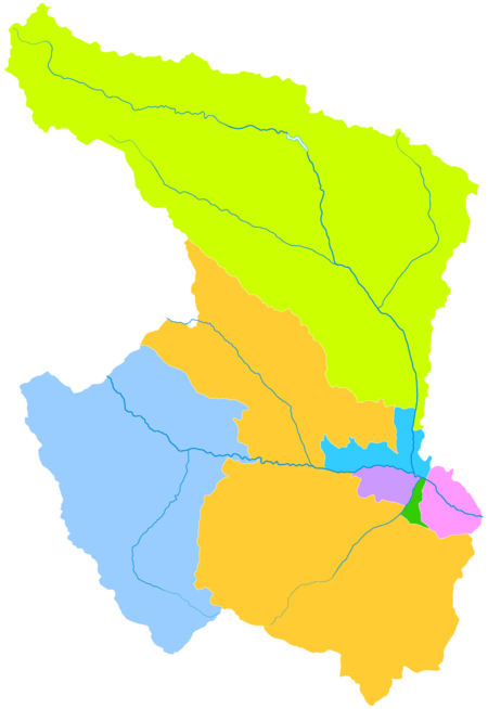
التقسيمات الادارية
The municipality oversees seven districts and counties. The data here are presented in km² and in population according to 2010 Census:
| الخريطة | |||||||
|---|---|---|---|---|---|---|---|
| الاسم | الصينية المبسطة | هانيو پنين | المساحة (كم²) | التعداد (2010) |
الكثافة (/km2) | ||
| المدينة نفسها | |||||||
| Chengzhong District | 城中区 | Chéngzhōng Qū | 11 | 296,987 | 26,999 | ||
| الضواحي | |||||||
| Chengdong District | 城东区 | Chéngdōng Qū | 115 | 359,688 | 3,128 | ||
| Chengxi District | 城西区 | Chéngxī Qū | 79 | 242,627 | 3,071 | ||
| Chengbei District | 城北区 | Chéngběi Qū | 138 | 299,002 | 2,167 | ||
| الريف | |||||||
| Huangyuan County | 湟源县 | Huángyuán Xiàn | 1,609 | 136,632 | 85 | ||
| Huangzhong County | 湟中县 | Huángzhōng Xiàn | 2,430 | 437,835 | 180 | ||
| Datong Hui and Tu Autonomous County |
大通回族土族自治县 | Dàtōng Huízú Tǔzú Zìzhìxiàn | 3,090 | 435,937 | 139 | ||
التعليم
الكليات والجامعات
المدارس الخاصة
Xining International Academy is an English-language international school.
السياحة
This section is empty. You can help by adding to it. (March 2014) |
.jpg&filetimestamp=20170630161959&)
المواصلات

Xining is situated in a fertile mountain basin in the valley of the Huangshui (river), a tributary of the Yellow River, that acts as a river port. The city lies about 200 km (120 mi) west of Lanzhou, the capital of Gansu province, on what was traditionally the main trade route from northern China into Tibet and the Qaidam Basin. These routes are now followed by modern highways.
السكك الحديدية

الطعام

كعاصمة مقاطعة چينگهاي، فإن شيننگ almost boasts all varieties of local flavors. Xining's cuisine is distinct from other varieties of Chinese cities using mainly food products native to the area. Food here is substantial, but quite inexpensive.
في شيننگ، some restaurants serve varieties of 'plateau flavor', such as Feng'er Liji (a round lamb tenderloin), Danbai Chongcao Ji (a medicine cuisine made of chicken, Chinese caterpillar fungus and eggs), Jinyu Facai (pork wrapped in flagelliform nostoc and shaped as a goldfish) among others. These dishes are often cooked by the locals at home.
There are also many small restaurants offering noodles. Gan Ban is a very common noodle dish. Perhaps Mian Pian, which means "noodle leaves" is the most common noodle plate among the Qinghai people. On the streets, many Muslims sell spicy lamb brochettes. Due to the cold climate, residents of Xining are also fond of strong spirits—Xining has the reputation of being one of the heaviest regions of alcohol consumption in China.
الهامش
- ^ "China: Qīnghăi (Prefectures, Cities, Districts and Counties) - Population Statistics, Charts and Map".
- ^ "Illuminating China's Provinces, Municipalities and Autonomous Regions". PRC Central Government Official Website. Retrieved 2014-05-17.
- ^ 西宁市2010年第六次人口普查主要数据公报[1]. 西宁市统计局 (in Chinese). 西宁市统计局. 14 May 2011. Retrieved 17 July 2015.
{{cite web}}: CS1 maint: unrecognized language (link) - ^ [1] Archived سبتمبر 29, 2007 at the Wayback Machine
- ^ "Silk Road, North China [Northern Silk Road, North Silk Road] Ancient Trackway : The Megalithic Portal and Megalith Map". Megalithic.co.uk. Retrieved 2014-02-07.
- ^ Frederick Roelker Wulsin, Joseph Fletcher, Peabody Museum of Archaeology and Ethnology, National Geographic Society (U.S.), Peabody Museum of Salem (1979). Mary Ellen Alonso (ed.). China's inner Asian frontier: photographs of the Wulsin expedition to northwest China in 1923 : from the archives of the Peabody Museum, Harvard University, and the National Geographic Society (illustrated ed.). The Museum : distributed by Harvard University Press. p. 49. ISBN 0-674-11968-1. Retrieved 2010-06-28.
{{cite book}}: CS1 maint: multiple names: authors list (link)(Original from the University of Michigan) - ^ Graham Hutchings (2003). Modern China: a guide to a century of change (illustrated, reprint ed.). Harvard University Press. p. 351. ISBN 0-674-01240-2. Retrieved 2010-06-28.
- ^ 回顾1941年日机轰炸西宁:改变青海历史轨迹 - 抗战故事 - 抗日战争纪念网.
- ^ "1941:日军飞机轰炸西宁--党史频道-人民网".
- ^ "怀念我的父亲──韩有文". Archived from the original on March 22, 2012. Retrieved April 3, 2011.
- ^ http://www.kunlunpai.cn/thread-1211-1-1.html[dead link]
- ^ "CITY IN WEST CHINA TO GET PIPED WATER; American 'Sells' Warlord at Sining on System to Aid Health --People Suspect Clear Fluid". THE NEW YORK TIMES. 3 February 1947. Retrieved 2010-11-28.
- ^ HENRY R. LIEBERMAN (15 September 1948). "ENLIGHTENED RULE BOLSTERS TSINGHAI; General Ma, War Lord, Enjoys Passion for Education -- He Taxes as Need Arises". The New York Times. Retrieved 2010-11-28.
- ^ Greg Rohlf (2003-10-01). "Dreams of Oil and Fertile Fields". Modern China. Mcx.sagepub.com. 29 (4): 455–489. doi:10.1177/0097700403257134. S2CID 143975998.
- ^ 中国气象科学数据共享服务网. China Meteorological Administration. Archived from the original on March 2, 2015. Retrieved February 22, 2014.
- ^ China Meteorological Administration Archived سبتمبر 21, 2013 at the Wayback Machine
- ^ WHO report OAP_database_8_2011.xls
- ^ "Xining Economic & Technology Development Zone | China Industrial Space". Rightsite.asia. 2013-11-18. Retrieved 2014-02-07.
- ^ "Discovering China: CityScape". Library.thinkquest.org. Retrieved 2014-02-07.
وصلات خارجية
|  | |
| International | |
|---|---|
| National | |
- Pages using gadget WikiMiniAtlas
- CS1 uses الصينية-language script (zh)
- Articles with dead external links from July 2016
- Short description is different from Wikidata
- Articles containing صينية-language text
- Coordinates on Wikidata
- Articles with صينية-language sources (zh)
- Pages using infobox settlement with potentially too many maps
- Articles containing منغولية-language text
- مقالات تحتوي نصوصاً باللغة الصينية المبسطة
- مقالات ذات عبارات محل شك
- All articles with specifically marked weasel-worded phrases
- Articles with specifically marked weasel-worded phrases from February 2013
- Articles to be expanded from March 2014
- All articles to be expanded
- Articles with empty sections from March 2014
- All articles with empty sections
- شيننگ
- Amdo
- Cities in Qinghai
- عواصم المقاطعات في الصين
- صفحات مع الخرائط