نهر دلاوير
.jpg&filetimestamp=20220616135946&)


نهر دلاوير Delaware River، هو نهر رئيسي على الساحل الأطلسي في الولايات المتحدة. مستجمعات المياه تتجمع في مساحة 36.570 كم² في خمس ولايات أمريكية-نيويورك، نيوجرزي، پنسلڤانيا، مريلاند، ودلاوير. صاعداً في فرعين في جبال كاتسكيل بولاية نيويورك، يتدفق النهر بطول 674 كم داخل خليج دلاوير حيث تدخل مياهه المحيط الأطلسي بالقرب من كيپ ماي في نيوجرزي وكيپ هنلوپن في دلاوير. باستثناء خليج دلاوير، يتضمن طول النهر طول فرعيه 624 كم.[1][2] نهر دلاوير هو واحد من "المياه العظمى" التسعة عشر المعترف بها من قبل التحالف الأمريكي للمياه العظيمة.[3]
ينقسم نهر دلاوير إلى فرعين رئيسيين التي تنحدر من الجهة الغربية لجبال كاتسكيل في نيويورك. الفرع الغربي يبدأ بالقرب من جبل جفرسون في بلدة جفرسون في مقاطعة شوهاري. الفرع الشرقي يبدأ عند الخانق العظيم بالقرب من روكسبري، مقاطعة دلاوير. يتدفق الفرعان غرباً ويلتقيان بالقرب من هانكوك في مقاطعة دلاوير وتتدفق المياه المتجمعة في جنوب نهر دلاوير. عبر مساره، يشكل نهر دلاوير الحدود بين پنسلڤانيا ونيويورك، كل الحدود بين نيوجرزي وپنسلڤانيا، ومعظم الحدود بين دلاوير ونيوجرزي. يلتقي النهر بمياه المد عند تقاطع موريسڤيل، پنسلڤانيا، وترنتون، نيوجرزي عند شلالات دلاوير. النهر قابل للملاحة، يعمل قطاع المد كقانة للشحن والنقل التي ساعدت على تطوير المدن الصناعية مثل ترنتون، كامدن، وفيلادلفيا. متوسط تصريف المياه العذبة لنهر دلاوير داخل مصب خليج دلاوير يبلغ (330 م³) في الثانية.
عام 1609، كانت أول زيارة للنهر من قبل بعثة شركة الهند الشرقية الهولندية بقيادة هنري هدسون. هدسون، الملاح الإنگليزي، كُلف بالعثور على مسار غربي إلى كاثاي (الصين حالياً)، لكن اكتشافاته مهدت الطريق للاستعمار الهولندي لأمريكا الشمالية في القرن السابع عشر. تأسست المستعمرات الهولندية والسويدية المبكرة على طول القطاع السفلي من النهر وخليج دلاوير. أطلق القوتان الاستعماريتان على النهر اسم النهر الجنوبي مقارنة بنهر هدسون والذي كان يعرف بالنهر الشمالي. بعد طرد الإنگليز للهولنديين والسيطرة على مستعمرة هولندا الجديدة عام 1664، أعيد تسميته بدلاوير على اسم سير توماس وست بارو ثالث دي لا وير، نبيل إنگليزي وأول حاكم ملكي لمستعمرة ڤرجنيا الذي دافع عن المستعمرة أثناء الحرب الأنگلو-پوهاتية الأولى.
الاسم
 |
The Delaware River is named in honor of Thomas West, 3rd Baron De La Warr (1577–1618), an English nobleman and the Virginia colony's first royal governor, who defended the colony during the First Anglo-Powhatan War.[4] Lord de la Warr waged a punitive campaign to subdue the Powhatan after they had killed the colony's council president, John Ratcliffe, and attacked the colony's fledgling settlements.[5][6] Lord de la Warr arrived with 150 soldiers in time to prevent the colony's original settlers at Jamestown from giving up and returning to England and is credited with saving the Virginia colony.[4] The name of the barony (later an earldom) is pronounced as in the current spelling form "Delaware" (/ˈdɛləwɛər/ ( استمع) DEL-ə-wair)[7] and is thought to derive from French de la Guerre.
It has often been reported that the river and bay received the name "Delaware" after English forces under Richard Nicolls expelled the Dutch and took control of the New Netherland colony in 1664.[8][9] However, the river and bay were known by the name Delaware as early as 1641.[10] The state of Delaware was originally part of the William Penn's Pennsylvania colony. In 1682, the Duke of York granted Penn's request for access to the sea and leased him the territory along the western shore of Delaware Bay, which became known as the "Lower Counties on the Delaware".[11] In 1704, the Lower Counties were given political autonomy to form a separate provincial assembly, but they shared Pennsylvania's provincial governor until the two colonies separated on June 15, 1776, and they remained separate as states after the establishment of the United States.
The name "Delaware" also came to be used as a collective name for the Lenape, a Native American people who inhabited an area of the basins of the Susquehanna River, Delaware River, and lower Hudson River in the northeastern United States at the time of European settlement,[12] as well as for their language. As a result of disruption following the French and Indian War, American Revolutionary War, and the later Indian removals from the eastern United States, the name "Delaware" has been spread with the Lenape's diaspora to municipalities, counties and other geographical features in the American Midwest and Canada.[13] The Lenape refer to this river as the Lënapei Sipu, Lenapewihittuck, or Kithanna.[14]
الطول
The length of the main stem of the Delaware River from the confluence of its branches to the head of Delaware Bay at Liston Point is 282 ميل (454 km).[15] However, the river's tidal estuary widens gradually, and there is no clear hydrological dividing point between the river and the bay. Liston Point is considered the head of Delaware Bay only by legal agreement between New Jersey and Delaware, as marked by a pair of survey monuments. As such, some observers may include the entire 48-ميل (77 km) length of Delaware Bay from Liston Point to the Atlantic Ocean in the length of the river, giving the Delaware River an overall length of 330 ميل (530 km).
At either length the main stem of the Delaware River is the longest free-flowing river in the Eastern United States. "Free-flowing" means the river is not impounded by dams and its course is not significantly altered or diverted. Idaho's Salmon River is the longest free-flowing river in the contiguous United States, at 425 ميل (684 km).[16]
There are two wing dams on the river, one between Lambertville and New Hope and one between Lumberville and Bulls Island at Raven Rock. The wing dams affect the accumulation of sediment but do not cross the entire width of the river. The Lumberville Wing Dam was built to divert water into the feeder canal of the Delaware and Raritan Canal.[17] Many tributaries of the Delaware River are dammed or diverted, including its two upper branches. Cannonsville Reservoir impounds the West Branch and Pepacton Reservoir impounds the East Branch, controlling the release of water in to the main stem Delaware River.
-
 Lumberville Wing Dam

المستجمعات المائية

The Delaware River's drainage basin has an area of 13،539 ميل مربع (35،070 km2) and encompasses 42 counties and 838 municipalities in five U.S. states: New York, New Jersey, Pennsylvania, Maryland, and Delaware.[18] This total area constitutes approximately 0.4% of the land mass in the United States.[18] In 2001, the watershed was 18% agricultural land, 14% developed land, and 68% forested land.[18]
There are 216 tributary streams and creeks comprising an estimated 14,057 miles of streams and creeks, in the watershed.[18] While the watershed is home to 4.17 million people according to the 2000 Federal Census, these bodies of water provide drinking water to 17 million people—roughly 6% of the population of the United States.[18] The waters of the Delaware River's basin are used to sustain "fishing, transportation, power, cooling, recreation, and other industrial and residential purposes."[18] It is the 33rd largest river in the United States in terms of flow, but is among the nation's most heavily used rivers in daily freight tonnage.[18] The average annual flow rate of the Delaware is 11,700 cubic feet per second at Trenton, New Jersey.[18] With no dams or impediments on the river's main stem, the Delaware is one of the few remaining large free-flowing rivers in the United States.[18]
-
 East Branch of the Delaware River near Margaretville, New York
 -
 Canoeing on the river at Hawk's Nest (Orange County, New York)
 -
 A still remaining section of the Delaware and Hudson Canal seen from U.S. 209 near Summitville, New York
 -
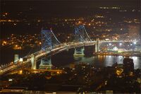
 Easton–Phillipsburg Toll Bridge crosses the Delaware, connecting Easton, Pennsylvania and Phillipsburg, New Jersey, in the Lehigh Valley.
 -
-

-
-
 The Delaware within the southern portion of the Delaware Water Gap National Recreation Area, near Worthington State Forest in New Jersey
 -
 A flood in Westfall, Pennsylvania, in 2006


المسار
الفرع الغربي

The West Branch of the Delaware River, also called the Mohawk Branch, spans approximately 90 ميل (140 km) from the northern Catskill Mountains to its confluence with the Delaware River's East Branch at Hancock, New York. The last 6 ميل (9.7 km) forms part of the boundary between New York and Pennsylvania.
The West Branch rises in Schoharie County, New York at 1،886 أقدام (575 m) above sea level, near Mount Jefferson, and flows tortuously through the plateau in a deep trough. The branch flows generally southwest, entering Delaware County and flowing through the towns of Stamford and Delhi. In southwestern Delaware County it flows in an increasingly winding course through the mountains, generally southwest. At Stilesville the West Branch was impounded in the 1960s to form the Cannonsville Reservoir, the westernmost of the reservoirs in the New York City water system. It is the most recently constructed New York City reservoir and began serving the city in 1964. Draining a large watershed of 455 ميل مربع (1،180 km2), the reservoir's capacity is 95.7 billion غالون أمريكي (362،000،000 m3). This water flows over halfway through the reservoir to enter the 44-ميل (71 km) West Delaware Tunnel in Tompkins, New York. Then it flows through the aqueduct into the Rondout Reservoir, where the water enters the 85 ميل (137 km) Delaware Aqueduct, that contributes to roughly 50% of the city's drinking water supply. At Deposit, on the border between Broome and Delaware counties, it turns sharply to the southeast and is paralleled by New York State Route 17. It joins the East Branch at 880 أقدام (270 m) above sea level at Hancock to form the Delaware.
الفرع الشرقي

Similarly, the East Branch begins from a small pond south of Grand Gorge in the town of Roxbury in Delaware County, flowing southwest toward its impoundment by New York City to create the Pepacton Reservoir, the largest reservoir in the New York City water supply system. Its tributaries are the Beaver Kill River and the Willowemoc Creek which enter into the river عشرة ميل (16 km) before the West Branch meets the East Branch. The confluence of the two branches is just south of Hancock.
The East Branch and West Branch of the Delaware River parallel each other, both flowing in a southwesterly direction.
وادي أعالي دلاوير

From Hancock, New York, the Delaware flows between the northern Poconos in Pennsylvania, and the lowered shale beds north of the Catskills. The river flows down a broad Appalachian valley, passing Hawk's Nest overlook on the Upper Delaware Scenic Byway. The river flows southeast for 78 miles through rural regions along the New York-Pennsylvania border to Port Jervis and Shawangunk Ridge.

التاريخ

At the time of the arrival of the Europeans in the early 17th century, the area near the Delaware River was inhabited by the Native American Lenape people, who called the Delaware River Lënapei Sipu,[19] meaning "Lenape river", or Lenape Wihittuck, which means "the rapid stream of the Lenape".[20] The Delaware River played a key factor in the economic and social development of the Mid-Atlantic region.
In the 17th century, the river provided the conduit for colonial settlement by the Dutch (New Netherland) and the Swedish (New Sweden). Beginning in 1664, the region became an English possession as settlement by Quakers established the colonies of Pennsylvania (including present-day Delaware) and West Jersey. In the eighteenth century, cities like Philadelphia, Camden (then Cooper's Ferry), Trenton, Wilmington and New Castle were established upon the Delaware and their continued commercial success into the present day has been dependent on access to the river for trade and power. The river provided the path for the settlement of northeastern Pennsylvania's Lehigh Valley, and northwestern New Jersey by German Palatine immigrants—a population that became key in the agricultural development of the region.
الاستعمار السويدي (1638–1655)
In 1638, Swedish settlers, led by Peter Menuet, established New Sweden along the Delaware River. This settlement marked one of the earliest European establishments in the region, with Fort Christina (located near modern-day Wilmington, Delaware) becoming a key trading post and symbol of Swedish colonial ambition. The Swedes engaged in peaceful land negotiations with the local Lenape people and developed a thriving colony. New Sweden became a center for trade and cultural exchange between the Swedish settlers, Native Americans, and neighboring Dutch colonies. Although the Dutch would later assert dominance over the region in 1655, New Sweden laid the groundwork for European settlement along the Delaware River. The fort and surrounding settlements played a crucial role in the early European rivalry for control of North America's resources and territory. This era of Swedish colonization is an important part of the Delaware River's history, adding to its diverse cultural legacy.
الحرب الثورية الأمريكية


The strategic Delaware River was the scene of several important campaigns during the American Revolutionary War. Perhaps the most famous event was George Washington's crossing of the Delaware River with the Continental Army on the night of December 25–26, 1776, leading to a successful surprise attack and victory against the Hessian troops occupying Trenton, New Jersey, on the morning of December 26.[21][22]
During the Philadelphia Campaign control of the Delaware River was urgently needed by the British, allowing their naval fleet to supply troops occupying Philadelphia. To this end, the Battle of Red Bank and the Siege of Fort Mifflin were fought on and along the shores of the Delaware by the American and British navies, commanded by Commodore John Hazelwood and Admiral Francis Reynolds respectively.[23][24][25] See historical map of that campaign.
القنوات
The magnitude of the commerce of Philadelphia has made the improvements of the river below that port of great importance. Small improvements were attempted by Pennsylvania as early as 1771. Commerce was once important on the upper river, primarily prior to railway competition of 1857.
- The Delaware Division of the Pennsylvania Canal, running parallel with the river from Easton to Bristol, opened in 1830.
- The Delaware and Raritan Canal, which runs along the New Jersey side of the Delaware River from Bulls Island, New Jersey to Trenton, unites the waters of the Delaware and Raritan rivers as it empties the waters of the Delaware River via the canal outlet in New Brunswick. This canal water conduit is still used as a water supply source by the State of New Jersey.
- The Morris Canal (now abandoned and almost completely filled in) and the Delaware and Hudson Canal connected the Delaware and Hudson rivers.
- The Chesapeake and Delaware Canal joins the waters of the Delaware with those of the Chesapeake Bay.
Delaware Water Gap National Recreation Area
The Delaware Water Gap National Recreation Area came about as a result of the failure of a controversial plan to build a dam on the Delaware River at Tocks Island, just north of the Delaware Water Gap to control water levels for flood control and hydroelectric power generation. The dam would have created a 37-ميل (60 km) lake in the center of present park for use as a reservoir. Starting in 1960, the present-day area of the Recreation Area was acquired for the Army Corps of Engineers through eminent domain. Between 3,000 and 5,000 dwellings were demolished, including historical sites, and about 15,000 people were displaced by the project.
Because of massive environmental opposition, dwindling funds, and an unacceptable geological assessment of the dam's safety, the government transferred the property to the National Park Service in 1978. The National Park Service found itself as the caretaker of the previously endangered territory, and with the help of the federal government and surrounding communities, developed recreational facilities and worked to preserve the remaining historical structures.[26][27]
The nearby Shawnee Inn,[28][29] was identified in the 1990s as the only resort along the banks of the Delaware River.[30][31]
American Rivers, an environmental advocacy group, named the Delaware River as the River of the Year for 2020, citing 75 years of progress in reducing pollution and restoring wildlife.[32]
انظر أيضاً
- Delaware Riverkeeper Network
- Geography of Pennsylvania
- List of municipalities on the Delaware River
- List of crossings of the Delaware River
- List of rivers of Delaware
- List of rivers of New Jersey
- List of rivers of New York
- List of rivers of Pennsylvania
- List of most-polluted rivers
- Partnership for the Delaware Estuary
- Upper Delaware Scenic and Recreational River
الهوامش
- ^ The main stem from Hancock, New York to the head of Delaware Bay is 301 ميل (484 km).
- ^ U.S. Geological Survey. National Hydrography Dataset high-resolution flowline data. The National Map, accessed April 1, 2011
- ^ National Wildlife Federation (August 18, 2010). "America's Great Waters Coalition". Retrieved 2011-18-20.
{{cite news}}: Check date values in:|accessdate=(help) - ^ أ ب Pollard, Albert Frederick (1899). "West, Thomas (1577–1618)". In Lee, Sidney (ed.). Dictionary of National Biography (in الإنجليزية). Vol. 60. London: Smith, Elder & Co. pp. 344–345.
- ^ Tyler, Lyon Gardiner, ed. (1915). Encyclopedia of Virginia Biography. Vol. I. New York: Lewis Historical Publishing Company. pp. 33–34.
- ^ Grenier, John (2005). The First Way of War: The American War-Making of the Frontier, 1607–1814. New York: Cambridge University Press. pp. 24–25. ISBN 0-521-84566-1.
- ^ Random House Dictionary
- ^ World Digital Library. Articles about the Transfer of New Netherland on the 27th of August, Old Style, Anno 1664 Archived يناير 26, 2013 at the Wayback Machine. Retrieved March 21, 2013
- ^ Versteer, Dingman (editor). "New Amsterdam Becomes New York" in The New Netherland Register. Volume 1 No. 4 and 5 (April/May 1911): 49-64.
- ^ Evelin, Robert. A direction for Adventurers With small stock to get two for one, and good land freely : And for Gentleman, and all Servants, Labourers, and Artificers to live plentifully, And the true Description of the healthiest, pleasantest and richest plantation of New Albion in North Virginia. (London, s.n., 1641).
- ^ Munroe, John A. (2006). "Chapter 3. The Lower Counties On The Delaware". History of Delaware. Newark, Delaware: University of Delaware Press. p. 45. ISBN 0-87413-947-3.
- ^ Schutt, Amy C. (2007). Peoples of the River Valleys: The Odyssey of the Delaware Indians. Philadelphia: University of Pennsylvania Press. ISBN 978-0-8122-3993-5.
- ^ Weslager, Charles A. (1990). The Delaware Indians: A History. New Brunswick, New Jersey: Rutgers University Press. ISBN 0-8135-1494-0.
- ^ خطأ استشهاد: وسم
<ref>غير صحيح؛ لا نص تم توفيره للمراجع المسماةNames which the Lenni Lenape or Del - ^ "DRB river-mileage spreadsheet" (PDF). River Mileage System. Delaware River Basin Commission. Retrieved 24 October 2022.
- ^ Palmer, Tim (1996). America by rivers. Washington, D.C. ISBN 1559632631.
{{cite book}}: CS1 maint: location missing publisher (link) - ^ "History and Uses of the Delaware and Raritan Canal" (PDF). Regulated Flow Advisory Committee, NJDEP. December 15, 2025.
- ^ أ ب ت ث ج ح خ د ذ Philadelphia Water Department. "Moving from Assessment to Protection…The Delaware River Watershed Source Water Protection Plan" (PWSID #1510001) Archived يوليو 28, 2013 at the Wayback Machine (June 2007). Retrieved July 17, 2013.
- ^ "Lënapei Sipu". Lenape Talking Dictionary. Lenape Language Preservation Project. Retrieved 22 September 2025.
- ^ Delaware Place Names Archived أغسطس 11, 2017 at the Wayback Machine United States Geological Survey
- ^ Savas, 2006, p. 84
- ^ Brooks, 1999 p. 55
- ^ Dorwart 1998, pp. 40–41
- ^ Leach, 1902, p. 2
- ^ McGeorge, 1905, pp. 3–7
- ^ Delaware Water Gap National Recreation Area (pp. 7–8), Obiso, Laura, 2008.
- ^ Delaware Water Gap National Recreation Area Archived أغسطس 3, 2011 at the Wayback Machine, njskylands.com.
- ^ "Shawnee Marking Golden Season". The Daily Record. Stroudsburg, Pennsylvania. June 17, 1960. Retrieved December 21, 2020.
- ^ Squeri, p. 182.
- ^ Fodor's national parks and seashores of the east (1 ed.). New York: Fodor's Travel Publications. 1994. p. 164.
- ^ Shea, Barbara (September 11, 1994). "Let the current set the pace at the Delaware Water Gap". The Courier-News. Somerville, New Jersey.
- ^ Tanenbaum, Michael (15 April 2020). "Delaware River named 2020 River of the Year by national environmental organization". PhillyVoice (in english). Retrieved 14 August 2023.
{{cite news}}: CS1 maint: unrecognized language (link)
المصادر
- Devastation on the Delaware: Stories and Images of the Deadly Flood of 1955 (2005, Word Forge Books, Ferndale, PA) The only comprehensive documentary of this weather disaster in the Delaware River Valley.
- This article incorporates text from a publication now in the public domain: Chisholm, Hugh, ed. (1911). . دائرة المعارف البريطانية. Vol. 7 (eleventh ed.). Cambridge University Press. p. 951.
{{cite encyclopedia}}: Cite has empty unknown parameter:|coauthors=(help)


وصلات خارجية

- Delaware Riverkeeper Network
- Delaware River Vessel Reporting System
- National Park Service: Delaware Water Gap National Recreation Area
- National Park Service: Upper Delaware Scenic & Recreational River
- National Park Service: Lower Delaware Wild & Scenic River
- U.S. Geological Survey: NJ stream gaging stations
- U.S. Geological Survey: NY stream gaging stations
- U.S. Geological Survey: PA stream gaging stations
محتوى تاريخي
- Marine Railway and Sectional Floating Dry Dock, Delaware River, Philadelphia, 1893 by D.J. Kennedy, Historical Society of Pennsylvania
- Winter on the River Delaware, 1856. Shows "U.S.S. Prowhatan" by D.J. Kennedy, HSP
- "Map of the South River in New Netherland" from ca. 1639 via the World Digital Library
- Socioeconomic Value of the Delaware River Basin in Delaware, New Jersey, New York, and Pennsylvania
- Pages using gadget WikiMiniAtlas
- Articles incorporating Cite DNB template
- CS1 maint: location missing publisher
- Short description is different from Wikidata
- Native name checker template errors
- Coordinates on Wikidata
- Articles requiring unit attention
- Articles using Template:Designation with invalid designation
- Pages including recorded pronunciations
- Articles with hatnote templates targeting a nonexistent page
- Missing redirects
- Pages with empty portal template
- مقالات المعرفة المحتوية على معلومات من دائرة المعارف البريطانية طبعة 1911
- Wikipedia articles incorporating text from the 1911 Encyclopædia Britannica
- نهر دلاوير
- أنهار دلاوير
- أنهار نيوجرزي
- أنهار نيويورك
- أنهار پنسلڤانيا
- أنهار برية ومشهدية في الولايات المتحدة
- مستجمعات مياه كاتسكيل/دلاوير
- وادي دلاوير
- Delaware Water Gap National Recreation Area
- مسطحات مائية في فيلادلفيا، پنسلڤانيا
- حدود نيويورك
- حدود دلاوير
- حدود پنسلڤانيا
- حدود نيوجرزي
- صفحات مع الخرائط