رواندا
جمهورية رواندا | |
|---|---|
الشعار الحادي: "Ubumwe, Umurimo, Gukunda Igihugu" "الوحدة، العمل، الوطنية" | |
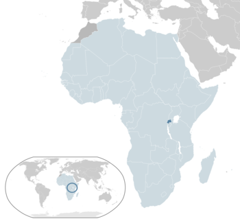 موقع رواندا (dark blue) | |
| العاصمة و أكبر مدينة | كيگالي |
| اللغات الرسمية | |
| صفة المواطن |
|
| الحكومة | جمهورية دستورية [نظام شبه رئاسي |
• الرئيس | پول كاگامه |
| أناستاسه موركزي | |
| التشريع | البرلمان |
| مجلس الشيوخ | |
| مجلس النواب | |
| الاستقلال | |
• عن بلجيكا | 1 يوليو 1962 |
| المساحة | |
• الإجمالية | 26,338 km2 (10,169 sq mi) (149) |
• الماء (%) | 5.3 |
| التعداد | |
• تقدير 2015 | 11,262,564[1] (76) |
• إحصاء 2012 | 10,515,973[2] |
• الكثافة | 445[1]/km2 (1,152.5/sq mi) (29) |
| ن.م.إ. (ق.ش.م.) | تقدير 2015 |
• الإجمالي | $20.343 billion[3] |
• للفرد | $1,784[3] |
| ن.م.إ. (الإسمي) | تقدير 2015 |
• الإجمالي | $8.763 billion[3] |
• للفرد | $769[3] |
| جيني (2011) | 50.8[4] high |
| م.ت.ب. (2013) | low · 151st |
| العملة | الفرنك الرواندي (RWF) |
| التوقيت | UTC+2 (توقيت وسط أفريقيا) |
| جانب السواقة | اليمين |
| مفتاح الهاتف | +250 |
| النطاق العلوي للإنترنت | .rw |
رواندا ( /ɹuːˈɑːndə/ أو /ɹuːˈændə/ (listen )؛ كينيارواندا: [U Rwanda] Error: {{Lang}}: text has italic markup (help) [u.ɾɡwanda](![]() استمع))، رسمياً جمهورية رواندا (كينيارواندا: [Repubulika y'u Rwanda] Error: {{Lang}}: text has italic markup (help)؛ فرنسية: République du Rwanda)، هي دولة سيادية في وسط وشرق أفريقيا. تقع رواندا على بعد بضع درجات من خط الإستواء، وتحدها أوغندا، تنزانيا، بوروندي وجمهورية الكونغو الديمقراطية. تقع رواندا في منطقة البحيرات العظمى الأفريقية وعلى ارتفاع عالي؛ ويهيمن عليها جغرافياً الجبال في الغرب والساڤانا في الشرق، مع العديد من البحيرات المنتشرة في البلاد. تتمتع رواندا بمناخ من معتدل إلى شبه إستوائي، مع موسمين ممطرين وموسمين جافين سنوياً.
استمع))، رسمياً جمهورية رواندا (كينيارواندا: [Repubulika y'u Rwanda] Error: {{Lang}}: text has italic markup (help)؛ فرنسية: République du Rwanda)، هي دولة سيادية في وسط وشرق أفريقيا. تقع رواندا على بعد بضع درجات من خط الإستواء، وتحدها أوغندا، تنزانيا، بوروندي وجمهورية الكونغو الديمقراطية. تقع رواندا في منطقة البحيرات العظمى الأفريقية وعلى ارتفاع عالي؛ ويهيمن عليها جغرافياً الجبال في الغرب والساڤانا في الشرق، مع العديد من البحيرات المنتشرة في البلاد. تتمتع رواندا بمناخ من معتدل إلى شبه إستوائي، مع موسمين ممطرين وموسمين جافين سنوياً.
وتعتبر رواندا من أكثر الأقطار الإفريقية ازدحامًا بالسكان. إذ تصل الكثافة السكانية في المتوسط نحو 290 شخصًا للكيلو متر المربع. وتُعدُّ هذه الكثافة أكثر بنحو ثلاثة عشر ضعفًا من معدل الكثافة السكانية في القارة الإفريقية على وجه العموم.
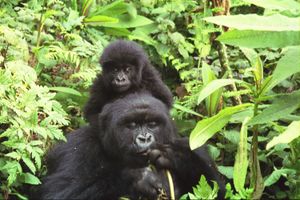
تتنوع المعالم الطبيعية في هذا البلد. فهناك المرتفعات ذات الفوهات البركانية، والأودية النهرية المتعرِّجة، والبحيرات ذات المناظر الخلابة، فضلاً عن السهول الممتدة التي تغطيها الحشائش. ويعتبر متنزه فولكانو الوطني الواقع على جبال فيرونجا شمال غربي رواندا، محمية طبيعية للغوريلا وغيرها من الحيوانات الفطرية النادرة والمعرَّضة للانقراض.
وتعتبر رواندا إحدى الدول الإفريقية الفقيرة؛ حيث إن قطاع الصناعة فيها مازال محدودًا للغاية، كما أنها تُعاني من انفجار سكاني يتجاوز قدرات البلاد. ومدينة كيجالي العاصمة أكبر المدن، إذ يصل تعداد السكان فيها إلى نحو 157,000 نسمة.
كان هذا الإقليم قبل الاستقلال يسمى رواندا-اوروندي ويخضع لوصاية الأمم المتحدة وللإشراف الإداري البلجيكي. وتشكل رواندا الحالية النصف الشمالي مما كان يسمى رواندا ـ أوروندي بينما تشكل بوروندي الحالية النصف الجنوبي من ذلك الشكل الاتحادي. وقد انفصلت الدولتان عقب الاستقلال عام 1962م.
يمثل الهوتو 80% من السكان وقبائل التوتسي 20%. ترجع الأغلبية العظمى من سكان رواندا في أصولهم السلالية إلى قبائل الهوتو التي تسمى أحيانًا الباهوتو بينما تُشكل قبائل التوتسي التي تُسمى أحيانًا الواتوسي الأقلية السكانية في هذا القطر. توجد بها جاليات عربية ومسلمة.
وبالرغم من أن قبائل التوتسي تشكل الأقلية، إلا أنها ظلت تسيطر على قبائل الهوتو سياسيًا واقتصاديًا لمئات السنين. وفي عام 1959م ثارت قبائل الهوتو على هذا الوضع غير العادل، وتمكَّنت بعد حرب دموية ضارية من السيطرة على الحكم وعلى مقدَّرات البلاد الاقتصادية. وقد اضطر الكثيرون من أبناء قبائل التوتسي إلى الهرب إلى بوروندي التي تسيطر عليها جماعات التوتسي وغيرها من الدول المجاورة. وفي عام 1994م، دار صراع دموي بين هاتين القبيلتين، استطاعت التوتسي على إثره أن تسيطر على حكومة البلاد.
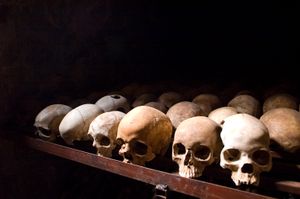
يعد الاستقرار والسلم الاهلي نادر الحدوث في كل من بروندي وروندا بالذات في القرن الماضي، اذ دارت عدة حروب قبلية كان السبب المباشر فيها التدخل البلجيكي في شؤون السكان ورفع شأن بعض الفئات من التوتسي على حساب باقي السكان في بعض الاحيان ومن ثم كسب ود الهوتو الاكثرية والدفع بهم للاخذ بالثأر القبلي من جميع التوتسي وما مذابح 1993 - 1994 الا اكبر دليل اما ردة فعل البلجيك والاروبيين هو اجلاء رعاياهم وعدم التدخل والصمت المطبق سياسيا واعلاميا على المذبحة التي يقال أن تعرض لها زهاء 800 ألف من التوتسي (تقديرات الأمم المتحدة) ومن ثم دعم التوتسي بعد عودتهم إلى سدة الحكم عبر حركة التمرد التي كان يقودها الرئيس الحالي (پول كاگامه) وتعود الاحداث مرة ثانية بقهر الهوتو وظلمهم اذا يجب ان يدفع احدهم الثمن.
. . . . . . . . . . . . . . . . . . . . . . . . . . . . . . . . . . . . . . . . . . . . . . . . . . . . . . . . . . . . . . . . . . . . . . . . . . . . . . . . . . . . . . . . . . . . . . . . . . . . . . . . . . . . . . . . . . . . . . . . . . . . . . . . . . . . . . . . . . . . . . . . . . . . . . . . . . . . . . . . . . . . . . . .
التاريخ
سكنت قبائل الهوتو والأقزام ما يعرف الآن برواندا منذ مئات السنين، وقبل 600 سنة تقريباً تعرضت هذه البلاد إلى اعتداء خارجي من قبل قبائل التوتسي القادمة من الشمال، وقد اشتهرت هذه القبائل بقدراتها القتالية العالية، وعجزت قبائل الهوتو المحلية عن الانتصار عليها أو صد هجماتها، فقبلت قبائل الهوتو الهزيمة ووافقت على أن تكون في خدمة قبائل التوتسي المنتصرة، مقابل حمايتهم وتمكينهم من العيش، ووفقاً لذلك استمرت قبائل التوتسي في السيطرة على مقدرات البلاد حتى عام 1959م، كما ذكر سابقاً.
في نهاية القرن التاسع عشر وبالتحديد عام 1897، سيطرت ألمانيا على الإقليم الذي كان يضم رواندا وبوروندي، وعقب الحرب العالمية الأولى فقدت ألمانيا مستعمراتها في القارة الأفريقية، وأصبح هذا الإقليم تحت وصاية عصبة الأمم، وكلفت بلجيكا بإدارته اعتباراً من عام 1923، وأصبح تحت الانتداب البلجيكي، وبعد الاضطرابات التي حدثت في البلاد، وفي عام 1961، صوت السكان لصالح النظام الجمهوري، وأصبحت في 1 يوليو 1962 دولة مستقلة تشكل النصف الشمالي من الإقليم الذي كان يسمى رواندا-اوروندي، بينما تشكل دولة بوروندي الحالية النصف الجنوبي من هذا الإقليم.[6]
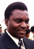
وجرى في نفس العام انتخاب گريگوار كاييباندا أول رئيس لجمهورية رواندا، ينتخب لمدة خمس سنوات، ثم أُعيد انتخابه مرتين، وفي عام 1973، قاد الجنرال ج. جوڤينال هابياريمانا انقلاباً عسكرياً، وتم اعتقال الرئيس كيباندا، وأصبح هابياريمانا نفسه رئيساً للدولة، وتم انتخابه ثلاث مرات على التوالي في الأعوام 1978 و1983 و1988، وفي عام 1978 جرى اعتماد دستور جديد للبلاد، وكذلك انتخاب المجلس الوطني للتنمية (البرلمان)، وهو مجلس مكون من سبعين عضواً ينتخب لمدة خمس سنوات أيضاً. كما يوجد في رواندا حزب سياسي يسمى الحركة الوطنية الثورية من أجل التنمية، تأسس عام 1975، وهو يدعو إلى تطبيق الديموقراطية الملائمة للبلاد، كما توجد بعض المنظمات الوطنية، مثل المنظمة النسائية الرواندية واتحاد الطلاب وغيرهما.
وفي أكتوبر 1990، بدأ المتمردون في الحركة الوطنية الرواندية في شن هجمات علي الحكومة. كان أغلب هؤلاء المتمردين من التوتسي الذين يعيشون في المنفى بأوغندا. وفي عام 1991، عدلت الحكومة الدستور ليسمح بالتعددية الحزبية.
وفي أغسطس 1993، وقعت الحكومة اتفاقية سلام مع الحركة الوطنية الرواندية. وفي أبريل 1994 لقي الرئيس هابياريمانا مصرعه في حادث تحطم الطائرة المقلة له. نقضت مليشيات الهوتو اتفاقية السلام وقتلوا أكثر من نصف مليون نسمة أغلبهم من التوتسي. وشكل الهوتو حكومة لم تعترف بالحركة الرواندية الوطنية. وفي منتصف يوليو استطاعت قوات الحركة من إلحاق هزيمة كبيرة بقوات الهوتو وسيطرت على الحكومة. عينت الحركة حكومة تعددية ضمت بعض الهوتو المعتدلين. نزح أكثر من مليوني مواطن أغلبهم من الهوتو هربًا من قوات الحركة واستقر أغلبهم في منطقة حول مدينة جوما في الكونغو الديمقراطية. لقي عشرات الآلاف من اللاجئين حتفهم من الجوع أو من الكوليرا وغيرها من الأمراض. وفي عامي 1996 و1997، استطاع الثوار في زائير من الاستيلاء على السلطة، وغيروا اسم بلادهم إلى جمهورية الكونغو الديمقراطية. اضطر اللاجئون الروانديون إلى إخلاء معسكراتهم، وعاد بعضهم إلى رواندا بينما نزح الكثيرون إلى مناطق الكونغو الداخلية والأقطار المجاورة.
السياسة والحكومة
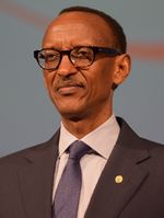
يرأس حكومة رواندا رئيس ينتخبه الشعب. ويرأس رئيس الوزراء مجلس الوزراء الذي يساعد الرئيس في القيام بأعباء الحكم. يعين الرئيس مجلس الوزراء وأعضاء وزراته. وفي عام 1994م، بدأ التوتسي في تعيين شاغلي هذه الوظائف بعد أن أطاحوا بالحكومة. كان حزب الحركة الوطنية الثورية من أجل التنمية الحزب الوحيد في رواندا لفترة طويلة. أما الآن، فقد أطلق على هذا الحزب اسم الحركة الوطنية الجمهورية من أجل الديمقراطية والتنمية. عدل الدستور عام 1991م ليسمح بالتعددية الحزبية. وتشمل أحزاب المعارضة كلاً من الحركة الجمهورية الديمقراطية وحزب رواندا الاشتراكي والحزب الاشتراكي الديمقراطي.
التقسيمات الإدارية
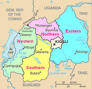
Before western colonization, the Rwandan government system had a quasi-system of political pluralism and power sharing. [7] Despite there being a strict hierarchy, the pre-colonial system achieved an established, combined system of "centralized power and decentralized autonomous units." Under the monarch, the elected Chief governed a province that was divided into multiple districts. Two other officials appointed by head Chief governed the districts; one official was allocated power over the land while the other oversaw cattle. The king (mwami) exercised control through a system of provinces, districts, hills, and neighbourhoods.[8] As of 2003, the constitution divided Rwanda into provinces (intara), districts (uturere), cities, municipalities, towns, sectors (imirenge), cells (utugari), and villages (imidugudu); the larger divisions, and their borders, are established by Parliament.[9] In January 2006, Rwanda was reorganized such that twelve provinces were merged to create five, and 106 districts were merged into thirty.[10] The present borders drawn in 2006 aimed at decentralising power and removing associations with the old system and the genocide. The previous structure of twelve provinces associated with the largest cities was replaced with five provinces based primarily on geography.[11] These are Northern Province, Southern Province, Eastern Province, Western Province, and the Municipality of Kigali in the centre.
The five provinces act as intermediaries between the national government and their constituent districts to ensure that national policies are implemented at the district level. The Rwanda Decentralisation Strategic Framework developed by the Ministry of Local Government assigns to provinces the responsibility for "coordinating governance issues in the Province, as well as monitoring and evaluation".[12] Each province is headed by a governor, appointed by the president and approved by the Senate.[13] The districts are responsible for coordinating public service delivery and economic development. They are divided into sectors, which are responsible for the delivery of public services as mandated by the districts.[14] Districts and sectors have directly elected councils, and are run by an executive committee selected by that council.[15] The cells and villages are the smallest political units, providing a link between the people and the sectors.[14] All adult resident citizens are members of their local cell council, from which an executive committee is elected.[15] The city of Kigali is a provincial-level authority, which coordinates urban planning within the city.[12]
تنقسم روندا إلى خمس محافظات، وهي:
الجغرافيا
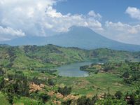
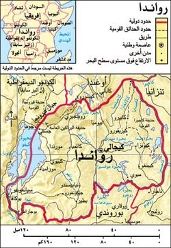
At 26,338 square kilometres (10,169 sq mi), Rwanda is the world's 149th-largest country,[16] and the fourth smallest on the African mainland after Gambia, Eswatini, and Djibouti.[16] It is comparable in size to Burundi, Haiti and Albania.[17][18] The entire country is at a high altitude: the lowest point is the Rusizi River at 950 metres (3,117 ft) above sea level.[17] Rwanda is located in Central/Eastern Africa, and is bordered by the Democratic Republic of the Congo to the west, Uganda to the north, Tanzania to the east, and Burundi to the south.[17] It lies a few degrees south of the equator and is landlocked.[19] The capital, Kigali, is located near the centre of Rwanda.[20]
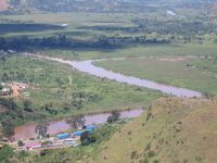
The watershed between the major Congo and Nile drainage basins runs from north to south through Rwanda, with around 80% of the country's area draining into the Nile and 20% into the Congo via the Rusizi River and Lake Tanganyika.[21] The country's longest river is the Nyabarongo, which rises in the south-west, flows north, east, and southeast before merging with the Ruvubu to form the Kagera; the Kagera then flows due north along the eastern border with Tanzania. The Nyabarongo-Kagera eventually drains into Lake Victoria, and its source in Nyungwe Forest is a contender for the as-yet undetermined overall source of the Nile.[22] Rwanda has many lakes, the largest being Lake Kivu. This lake occupies the floor of the Albertine Rift along most of the length of Rwanda's western border, and with a maximum depth of 480 metres (1,575 ft),[23] it is one of the twenty deepest lakes in the world.[24] Other sizeable lakes include Burera, Ruhondo, Muhazi, Rweru, and Ihema, the last being the largest of a string of lakes in the eastern plains of Akagera National Park.[25]
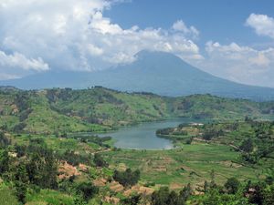
Mountains dominate central and western Rwanda and the country is sometimes called "Pays des mille collines" in French ("Land of a thousand hills").[26] They are part of the Albertine Rift Mountains that flank the Albertine branch of the East African Rift, which runs from north to south along Rwanda's western border.[27] The highest peaks are found in the Virunga volcano chain in the northwest; this includes Mount Karisimbi, Rwanda's highest point, at 4,507 metres (14,787 ft).[28] This western section of the country lies within the Albertine Rift montane forests ecoregion.[27] It has an elevation of 1,500 to 2,500 metres (4,921 to 8,202 ft).[29] The centre of the country is predominantly rolling hills, while the eastern border region consists of savanna, plains and swamps.[30]
. . . . . . . . . . . . . . . . . . . . . . . . . . . . . . . . . . . . . . . . . . . . . . . . . . . . . . . . . . . . . . . . . . . . . . . . . . . . . . . . . . . . . . . . . . . . . . . . . . . . . . . . . . . . . . . . . . . . . . . . . . . . . . . . . . . . . . . . . . . . . . . . . . . . . . . . . . . . . . . . . . . . . . . .
الموقع
تقع رواندا في وسط القارة الأفريقية إلى الجنوب من الدائرة الاستوائية، ضمن نطاق هضبة البحيرات، تحدها تنزانيا من الشرق، وبورندي من الجنوب، وزائير من الغرب، وأوغندا من الشمال، ورواندا دولة داخلية لا سواحل لها، وصلتها بالعالم الخارجي تتم عن طريق جاراتها، مساحتها (26,338 كم)، وهي من البلدان الأفريقية المزدحمة بالسكان، فسكانها في سنة 1408 هـ (6,354,000 نسمة)، والعاصمة مدينة كيگالي، وتوجد في وسط البلاد وسكانها حوالي (200,000 نسمة)، وأهم المدن يوتاريا وروهنجري وكبيبونجو.
المناخ
| بيانات مناخ كيگالي، رواندا | |||||||||||||
|---|---|---|---|---|---|---|---|---|---|---|---|---|---|
| الشهر | يناير | فبراير | مارس | أبريل | مايو | يونيو | يوليو | أغسطس | سبتمبر | اكتوبر | نوفمبر | ديسمبر | العام |
| العظمى المتوسطة °س (°ف) | 26.9 (80.4) |
27.4 (81.3) |
26.9 (80.4) |
26.2 (79.2) |
25.9 (78.6) |
26.4 (79.5) |
27.1 (80.8) |
28.0 (82.4) |
28.2 (82.8) |
27.2 (81) |
26.1 (79) |
26.4 (79.5) |
26٫89 (80٫41) |
| الصغرى المتوسطة °س (°ف) | 15.6 (60.1) |
15.8 (60.4) |
15.7 (60.3) |
16.1 (61) |
16.2 (61.2) |
15.3 (59.5) |
15.0 (59) |
16.0 (60.8) |
16.0 (60.8) |
15.9 (60.6) |
15.5 (59.9) |
15.6 (60.1) |
15٫73 (60٫31) |
| هطول mm (inches) | 76.9 (3.028) |
91.0 (3.583) |
114.2 (4.496) |
154.2 (6.071) |
88.1 (3.469) |
18.6 (0.732) |
11.4 (0.449) |
31.1 (1.224) |
69.6 (2.74) |
105.7 (4.161) |
112.7 (4.437) |
77.4 (3.047) |
950٫9 (37٫437) |
| Avg. precipitation days (≥ 0.1 mm) | 11 | 11 | 15 | 18 | 13 | 2 | 1 | 4 | 10 | 17 | 17 | 14 | 133 |
| Source: World Meteorological Organization [31] | |||||||||||||
تتمتع رواندا بمناخ إستوائي، ولا يثمثل هذا النمط إلا في المناطق المنخضة، أما المرتفعات فتختلف الأحوال المناخية بها تبعا لاختلاف التضاريس، حيث تعدل الجبال من شدة الحرارة، فتجعل الأحوال الحرارية مقبولة، وتسقط الأمطار في الاعتدالين بكميات وفيرة.
يبلغ متوسط درجة الحرارة في مناطق الأخدود الإفريقي العظيم التي تقع في الأجزاء الغربية من رواندا نحو 23°م. بينما يصل متوسط المنسوب السنوي للأمطار إلى نحو 75سم. وتنخفض درجة الحرارة في المرتفعات الغربية لتصل إلى نحو 17°م، بينما يرتفع المعدل السنوي من الأمطار ليصل إلى 147سم. وتزداد مُعدَّلات هطول الأمطار على جبال فيرونجا، أما في الهضاب، فتصل درجة الحرارة في المتوسط إلى نحو 20°م. بينما يبلغ المعدل السنوي للأمطار نحو 120سم.
التضاريس
تبلغ مساحة رواندا نحو 26,338 كم². تغطي الجبال المرتفعة والأراضي الوعرة معظم أرجاء رواندا، وتسود في الأجزاء الشمالية الغربية المرتفعات البركانية الشاهقة، وأهمها جبال فيرونجا التي يصل ارتفاعها إلى 4510م فوق مستوى سطح البحر، وتمثل بحيرة كيڤو ونهر روسيزي جزءاً مهماً من الحدود الغربية للبلاد ويشكلان جزءاً هاماً من الأخدود الإفريقي العظيم، ويصل ارتفاع الجبال المحيطة ببحيرة كيفو إلى 2700م، بينما يغطي نهر أكانيارو أجزاء من حدود رواندا الجنوبية، وتغطي الأجزاء الشرقية من البلاد سلسلة من الهضاب المرتفعة التي يراوح ارتفاعها بين 1500ـ2100م فوق مستوى سطح البحر، ويزداد انحدار هذه الهضاب بالاتجاه نحو الشرق، وتصبح حوافها الشرقية شديدة الانحدار، بينما تنتشر المستنقعات في المناطق المنخفضة من هذه الهضاب، يساير نهر كاگيرا جزءاً من الحدود الشرقية للبلاد.
أدّى هطول الأمطار الغزيرة في المناطق الغربية من البلاد إلى إضعاف خصوبة التربة. كما أدّى الاستغلال المكثف للأرض في النشاط الزراعي إلى تعرية التربة من مقوماتها الأساسية. وتغطي الأجزاء الشرقية من البلاد سلسلة من الهضاب التي يتراوح ارتفاعها ما بين 1,500 ـ 2,100م فوق مستوى سطح البحر.
وتبدأ هذه الهضاب في الانحدار كلما اتجهنا شرقًا. وتكون حوافها الشرقية شديدة الانحدار، بينما تغطي المستنقعات الأطراف السفلى من هذه الهضاب. وقد كانت الغابات في الماضي تغطي سفوح هذه الهضاب إلا أن معظمها أزيل للأغراض الزراعية.
التنوع الحيوي
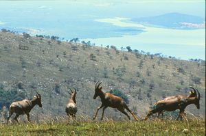
In prehistoric times montane forest occupied one-third of the territory of present-day Rwanda. Naturally occurring vegetation is now mostly restricted to the three national parks, with terraced agriculture dominating the rest of the country.[32] Nyungwe, the largest remaining tract of forest, contains 200 species of tree as well as orchids and begonias.[33] Vegetation in the Volcanoes National Park is mostly bamboo and moorland, with small areas of forest.[32] By contrast, Akagera has a savanna ecosystem in which acacia dominates the flora. There are several rare or endangered plant species in Akagera, including Markhamia lutea and Eulophia guineensis.[34][35]
The greatest diversity of large mammals is found in the three national parks, which are designated conservation areas.[36] Akagera contains typical savanna animals such as giraffes and elephants,[37] while Volcanoes is home to an estimated one-third of the worldwide mountain gorilla population.[38] Nyungwe Forest boasts thirteen primate species including common chimpanzees and Ruwenzori colobus arboreal monkeys; the Ruwenzori colobus move in groups of up to 400 individuals, the largest troop size of any primate in Africa.[39]
Rwanda's population of lions was destroyed in the aftermath of the genocide of 1994, as national parks were turned into camps for displaced people and the remaining animals were poisoned by cattle herders. In June 2015, two South African parks donated seven lions to Akagera National Park, reestablishing a lion population in Rwanda.[40] The lions were held initially in a fenced-off area of the park, and then collared and released into the wild a month later.[41]
Eighteen endangered black rhinos were brought to Rwanda in 2017 from South Africa.[42] After positive results, five more black rhinos were delivered to Akagera National Park from zoos all over Europe in 2019.[43]
Similarly, the white rhino population is growing in Rwanda. In 2021, Rwanda received 30 white rhinos from South Africa with the goal of Akagera being a safe breeding ground for the near-threatened species.[44][45]
There are 670 bird species in Rwanda, with variation between the east and the west.[46] Nyungwe Forest, in the west, has 280 recorded species, of which 26 are endemic to the Albertine Rift;[46] endemic species include the Rwenzori turaco and handsome spurfowl.[47] Eastern Rwanda, by contrast, features savanna birds such as the black-headed gonolek and those associated with swamps and lakes, including storks and cranes.[46]
Recent entomological work in the country has revealed a rich diversity of praying mantises,[48] including a new species Dystacta tigrifrutex, dubbed the "bush tiger mantis".[49]
Rwanda contains three terrestrial ecoregions: Albertine Rift montane forests, Victoria Basin forest-savanna mosaic, and Ruwenzori-Virunga montane moorlands.[50] The country had a 2019 Forest Landscape Integrity Index mean score of 3.85/10, ranking it 139th globally out of 172 countries.[51]
. . . . . . . . . . . . . . . . . . . . . . . . . . . . . . . . . . . . . . . . . . . . . . . . . . . . . . . . . . . . . . . . . . . . . . . . . . . . . . . . . . . . . . . . . . . . . . . . . . . . . . . . . . . . . . . . . . . . . . . . . . . . . . . . . . . . . . . . . . . . . . . . . . . . . . . . . . . . . . . . . . . . . . . .
الاقتصاد
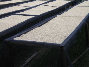
يبني إقتصاد رواندا على حرفتي الزراعة والرعي، ويعمل بها 92% من القوي العاملة وتمارس الزراعة في مناطق متفرقة من البلاد، والحاصلات تثمثل في البن، والشاي، والتبغ، وقصب السكر، والموز، وتربي الأبقار بأعداد لابأس بها والبن أهم الصادرات، وتعاني رواندا من نقص المواصلات، وقدرت ثروثها الحيوانية سنة 1988 بحوالي 660,000 من الماشية و360 من الأغنام و1,200,000 من الماعز، ويستخرج القصدبر من شرقي بحيرة كيفو.
وتعاني رواندا من عدة مشكلات هامة تعيق التنمية الاقتصادية فيها، ومن هذه المشكلات ارتفاع كثافة السكان وانتشار مرض الإيدز بينهم والبعد عن البحر مما يعيق قدرتها على استيراد وتصدير منتجاتها، مما يزيد في التكاليف المادية، كما أنها تعاني من اتباع طرائق غير سليمة في الزراعة، وزراعة المنحدرات بعد القضاء على الغابات، مما يؤدي إلى انجراف التربة وتعرية الأرض، وتناقص مساحة الأراضي الصالحة للزراعة.
الزراعة
يعمل معظم سكان رواندا في الزراعة، إلا أن النشاط الزراعي يعتبر للإعاشة في المقام الأول. وتشمل المحاصيل الزراعية: الموز والفاصوليا والمنيهوت (الكسافا) والذرة والبطاطا الحلوة. ويُعنى بعض سكان الريف بتربية الأبقار. ويحتل البن موقع الصدارة بالنسبة للصادرات. ومن الصادرات المهمة أيضًا، الشاي وحشيشة الحُمَّى. وتتنوع المحاصيل الزراعية بحسب معدلات الارتفاع عن مستوى سطح البحر.
فعلى سبيل المثال، يُزرع نوع من أنواع البن المنشط في بعض المناطق التي يصل ارتفاعها إلى 1,370م فوق مستوى سطح البحر. ويُستخدم هذا النوع من البن في إنتاج القهوة السريعة الذوبان. أمَّا المناطق التي يتراوح ارتفاعها ما بين 1,370 ـ 1,800م، فيزرع فيها البن العربي وهو النوع الذي يحتاج ترشيحًا قبل الاستخدام.
التعدين
في مجال التعدين يأخذ القصدير، والوولفرامايت موقع الصدارة، حيث يشكلان نحو ربع إجمالي صادرات البلاد.
الإعلام والاتصالات
البنية التحتية
تعاني رواندا من شحٍ كبير في إمكاناتها الصناعية. كما أنها تفتقر لخطوط السكك الحديدية بالإضافة إلى أن معظم الطرق البرية تُرابية. ويوجد مطار دولي يقع في مدينة كيجالي وقد ظل التعاون قائمًا بين ما كان يسمى برواندا وأوروندي. فقد كانت صادرات رواندا تشحن عبر أوروندي، ليتم تصديرها إلى الخارج عبر موانئ دار السلام في تنزانيا، ولوبيتو في إنجولا، وبيرا في موزمبيق. غير أن هذا التعاون الوثيق لم يدم طويلاً. إذ تدهورت العلاقات بين رواندا وبوروندي إثر الحرب التي دارت بين قبائل الهوتو والتوتسي. ولهذا تلجأ رواندا كلما كان ذلك ممكنًا ـ إلى نقل صادراتها برًا إلى كمبالا، ليتم نقلها بالقطارات إلى ميناء ممبسا في كينيا، وعليه فقد أصبح من الصعب على رواندا تصدير منتجاتها واستيراد احتياجاتها بسبب التكاليف العالية التي تتطلبها هذه العمليات.
الديموغرافيا
يتكون أغلب سكانها من زنوج البانتو أو ما يطلق عليهم بانتو البحيرات، ويصل تعداد سكان رواندا إلى سبعة ملايين نسمة. وتشكل قبائل الهوتو نحو 90% من إجمالي سكان البلاد. وهم أصل سكان رواندا، والجماعة الثانية التتسي ونسبتهم 10% ويشكلون الطبقة الأرستقراطية، وباقي السكان من جماعات التوا، ومن الأقزام وأقلية مهاجرة، وقد سادت الإضرابات بين التتسي والهوتو عقب الاستقلال وهي ثورات الأغلبية ضد الأقلية، وينتشر الإسلام بين التتسي والهوتو والأقلية المهاجرة، وصلها الإسلام عن طريق التجار المسلمين الذبن توغلوا في قلب أفريقيا قادمين من شرقها ، عندما ازدهرت دولة آل بوسعيد في شرقي أفريقيا.
ويعمل معظم أفراد هذه القبائل في الزراعة لتوفير المحاصيل الضرورية لأسرهم. وبعضهم يُعنى بتربية الأبقار وزراعة البن الذي يعتبر المحصول النقدي الأول في رواندا. ويعمل بعض أفراد قبائل الهوتو في المدن. ونتيجة لصعوبة الحياة المعيشية في الداخل اضطر الكثيرون من أبناء هذه القبائل إلى الهجرة إلى الدول المجاورة طلبًا للرزق. أما قبائل التوتسي فلا تتجاوز نسبتها 5% من إجمالي سكان رواندا. ويعمل مُعظم أبناء قبائل التوتسي إما في التجارة أو في القطاعات الحكومية المختلفة. ويُشكل الأقزام أقل من 1% من إجمالي سكان البلاد. وقد تركز نشاط الأقزام في السابق على الصيد غير أن بعضهم يعيش ويعمل الآن في المدن.
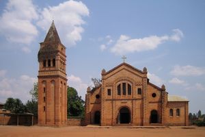
ويعيش القليل من الأوروبيين حاليًا في رواندا، وبعض هؤلاء يعملون في زراعة الشاي وحشيشة الحُمَّى (البيرثرم) التي تستخدم في صناعة المبيدات الحشرية. كما تعمل مجموعة أخرى من الأوروبيين مديرين تنفيذيين في قطاع التعدين. والقلة الباقية من الأوروبيين تعمل في مجال التنصير. أما اللغات الرسمية، فهي: الفرنسية والكينيارواندا. ويتحدث الأخيرة ـ وهي من لغات البانتو ـ مُعظَم سكان رواندا، ويتبع معظم المواطنين الكنيسة الكاثوليكية. وهناك نسبة من المسلمين تقدر بنحو 17% من عدد السكان.
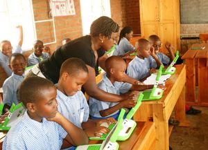
غير أن نسبة ضئيلة من السكان مازالت تمارس بعض المعتقدات التقليدية الإفريقية. وتُدِيْر البعثات النَّصرانيَّة والكاثوليكية مُعظَم المدارس الأولية والثانوية. وتوجد جامعة واحدة في رواندا تسمى جامعة رواندا الوطنية ومقرها مدينة بوتاري وتُؤمِّن الدولة مجانية التعليم العام للجميع. كما أن الدولة تَفْرض إلزامية التعليم على كل الأطفال من السابعة وحتى الرابعة عشرة من العمر، بالرغم من العجز الذي تعانيه في توفير قاعات الدراسة للجميع. إلا أنَّ نسبة الأمية بين البالغين قد تصل إلى 50%.
العلاقات الخارجية
العلاقات مع إسرائيل
تربط كل من رواندا وإسرائيل علاقات ثنائية تعود لإهتمام الأخيرة بخلق وجود لها في أفريقيا، وتحاول إسرائيل دائماً في خطابها التركيز على النخبة الرواندية وإسرائيل بإعتبار إن كلتا الدولتين صغيرتان وسط جيرانهما الكبار، لذا يكون المطلوب التفوق على جيرانهما عسكرياً وحضارياً، مروراً بمحاوةل التشبيه بين مأساة الإبادةالجماعية التي عانى منهاا الشعب الرواندي وما تزعمه تل أبيب من تعرض ما تسميه ب"الشعب اليهودي" للإبادة الجماعية.
ولا يوجد تمثيل دبلوماسي لرواندا في تل ابيب والتمثيل الدبلوماسي الإسرائيلي لدى رواندا غير مقيم، حيث إن السفير الإسرائيلي المعتمد لدى رواندا مقيم في أديس أبابا ويتردد من وقت لآخر على كيجالى، كما تقوم رواندا بتصدير مواد التعدين التي تستخدم في صناعة الشرائح الإلكترونية الخاصة بالحاسبات المعروفة بإسم مادة "التانتالايت" لإسرائيل.
وتقوم شركات أمنية إسرائيلية بتنفيذ عقود للتعاون في التدريب العسكري وتوفد عسكريين إسرائيليين سابقين لتدريب الجيش الرواندي خاصة وحدات الحرس الجمهوري ويتردد أن هناك خبراء عسكريين إسرائيليين موجودين بشكل دائم حول مقر رئاسة الجمهورية، وكانت هناك زيارات متبادلة بين الجانبين تمثلت في الزيارة الأولى من نوعها التي قام بها الرئيس الرواندي لإسرائيل في مايو 2008 ومشاركته إحتفالات إسرائيل بالذكرى الستين لإنشائها، في حين لم يذهب أي مسئول إسرائيلي رفيع المستوى إلى رواندا بالعديد من الأطر الإقليمية وكذلك الإقتصادية كالإتحاد الأفريقي وسوق الكوميسا المشتركة، ويتم التوقيع على 10 وثلئق للتعاون في مجالات مختلفة.
دور رواندا في تلوث النيل
يذكر أن رواندا كان لها دور في مشكلة تلوث منابع النيل، الأمر الذي إتضح بشكل كبير بعد كارثة عام 1994، حيث وصلت عشرات الآلاف من الجثث الطافية فوق سطح المياه العابرة نهر كاجيرا لمسافة مائتي كيلومترحيث إستقرت في بحيرة "فيكتوريا"، وأعلنت أربع مناطق ساحلية على البحيرة كمناطق كوارث، ثم إتضح فيما بعد أن مصدر هذه الجثث كان ضحايا الحروب الأهلية التي تعج بها منطقة منابع نهر النيل، ووصف العلماء الكارثة بأنها أكبر كارثة في العالم يتعرض لها نهر من المياه العذبة، بسبب المقابر الجماعية لضحايا الحرب في رواندا. وهو ما كان يعني أن أوبئة الأمراض الفتاكة الناتجة عن تحلل تلك الجثث في مياه النهر لن تقتصر على دولة بعينها بل سيتم توزيعها على تسع دول تشرب شعوبها من مياه النيل.
الثقافة

Music and dance are an integral part of Rwandan ceremonies, festivals, social gatherings and storytelling. The most famous traditional dance is a highly choreographed routine consisting of three components: the umushagiriro, or cow dance, performed by women;[52] the intore, or dance of heroes, performed by men;[52] and the drumming, also traditionally performed by men, on drums known as ingoma.[53] The best known dance group is the National Ballet. It was established by President Habyarimana in 1974, and performs nationally and internationally.[54] Traditionally, music is transmitted orally, with styles varying between the social groups. Drums are of great importance; the royal drummers enjoyed high status within the court of the King (Mwami).[55] Drummers play together in groups of varying sizes, usually between seven and nine in number.[56] The country has a growing popular music industry, influenced by African Great Lakes, Congolese, and American music. The most popular genre is hip hop, with a blend of dancehall, rap, ragga, R&B and dance-pop.[57]

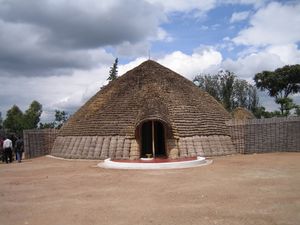
Traditional arts and crafts are produced throughout the country, although most originated as functional items rather than purely for decoration. Woven baskets and bowls are especially common, notably the basket style of the agaseke.[58] Imigongo, a unique cow dung art, is produced in the southeast of Rwanda, with a history dating back to when the region was part of the independent Gisaka kingdom. The dung is mixed with natural soils of various colours and painted into patterned ridges to form geometric shapes.[59] Other crafts include pottery and wood carving.[60] Traditional housing styles make use of locally available materials; circular or rectangular mud homes with grass-thatched roofs (known as nyakatsi) are the most common. The government has initiated a programme to replace these with more modern materials such as corrugated iron.[61][62]
Rwanda does not have a long history of written literature, but there is a strong oral tradition ranging from poetry to folk stories. Many of the country's moral values and details of history have been passed down through the generations.[63] The most famous Rwandan literary figure was Alexis Kagame (1912–1981), who carried out and published research into oral traditions as well as writing his own poetry.[64] The Rwandan Genocide resulted in the emergence of a literature of witness accounts, essays and fiction by a new generation of writers such as Benjamin Sehene and Mfuranzima Fred. A number of films have been produced about the Rwandan Genocide, including the Golden Globe-nominated Hotel Rwanda, 100 Days, Shake Hands with the Devil, Sometimes in April, and Shooting Dogs, the last four having been filmed in Rwanda and having featured survivors as cast members.[65][66]
Fourteen regular national holidays are observed throughout the year,[67] with others occasionally inserted by the government. The week following Genocide Memorial Day on 7 April is designated an official week of mourning.[68] The victory for the RPF over the Hutu extremists is celebrated as Liberation Day on 4 July. The last Saturday of each month is umuganda, a national morning of mandatory community service lasting from 8 am to 11 am, during which all able bodied people between 18 and 65 are expected to carry out community tasks such as cleaning streets or building homes for vulnerable people.[69] Most normal services close down during umuganda, and public transportation is limited.[69]
المطبخ
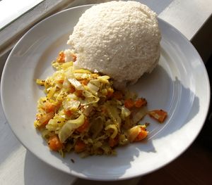
The cuisine of Rwanda is based on local staple foods produced by subsistence agriculture such as bananas, plantains (known as ibitoke), pulses, sweet potatoes, beans, and cassava (manioc).[70] Many Rwandans do not eat meat more than a few times a month.[70] For those who live near lakes and have access to fish, tilapia is popular.[70] The potato, thought to have been introduced to Rwanda by German and Belgian colonialists, is very popular.[71] Ugali, locally known as Ubugari (or umutsima) is common, a paste made from cassava or maize and water to form a porridge-like consistency that is eaten throughout the African Great Lakes.[72] Isombe is made from mashed cassava leaves and can be served with dried fish, rice, ugali, potatoes etc.[71] Lunch is usually a buffet known as mélange, consisting of the above staples and sometimes meat.[73] Brochettes are the most popular food when eating out in the evening, usually made from goat but sometimes tripe, beef, or fish.[73]
In rural areas, many bars have a brochette seller responsible for tending and slaughtering the goats, skewering and barbecuing the meat, and serving it with grilled bananas.[74] Milk, particularly in a fermented yoghurt form called ikivuguto, is a common drink throughout the country.[75] Other drinks include a traditional beer called Ikigage made from sorghum and urwagwa, made from bananas, and a soft drink called Umutobe which is banana juice; these popular drinks feature in traditional rituals and ceremonies.[71] The major drinks manufacturer in Rwanda is Bralirwa, which was established in the 1950s, a Heineken partner, and is now listed on the Rwandan Stock Exchange.[76] Bralirwa manufactures soft drink products from The Coca-Cola Company, under licence, including Coca-Cola, Fanta, and Sprite,[77] and a range of beers including Primus, Mützig, Amstel, and Turbo King.[78] In 2009 a new brewery, Brasseries des Mille Collines (BMC) opened, manufacturing Skol beer and a local version known as Skol Gatanu;[79] BMC is now owned by Belgian company Unibra.[80] East African Breweries also operate in the country, importing Guinness, Tusker, and Bell, as well as whisky and spirits.[81]
الرياضة
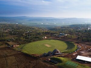
The Rwandan government, through its Sports Development Policy, promotes sport as a strong avenue for "development and peace building",[83] and the government has made commitments to advancing the use of sport for a variety of development objectives, including education.[84] The most popular sports in Rwanda are association football, volleyball, basketball, athletics and Paralympic sports.[85] Cricket has been growing in popularity,[86] as a result of refugees returned from Kenya, where they had learned to play the game.[87] Cycling, traditionally seen largely as a mode of transport in Rwanda, is also growing in popularity as a sport;[88] and Team Rwanda have been the subject of a book, Land of Second Chances: The Impossible Rise of Rwanda's Cycling Team and a film, Rising from Ashes.[89][90]
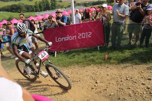
Rwandans have been competing at the Olympic Games since 1984,[91] and the Paralympic Games since 2004.[92] The country sent seven competitors to the 2012 Summer Olympics in London, representing it in athletics, swimming, mountain biking and judo,[91] and 15 competitors to the London Summer Paralympics to compete in athletics, powerlifting and sitting volleyball.[92] The country has also participated in the Commonwealth Games since joining the Commonwealth in 2009.[93][94] The country's national basketball team has been growing in prominence since the mid-2000s, with the men's team qualifying for the final stages of the African Basketball Championship four times in a row since 2007.[95] The country bid unsuccessfully to host the 2013 tournament.[96][97] Rwanda's national football team has appeared in the African Cup of Nations once, in the 2004 edition of the tournament,[98] but narrowly failed to advance beyond the group stages.[99] The team have failed to qualify for the competition since, and have never qualified for the World Cup.[100] Rwanda's highest domestic football competition is the Rwanda National Football League;[101] اعتبارا من 2015[تحديث], the dominant team is APR FC of Kigali, having won 13 of the last 17 championships.[102] Rwandan clubs participate in the Kagame Interclub Cup for Central and East African teams, sponsored since 2002 by President Kagame.[103]
World heritage
In 2023, at the 45th session of the World Heritage Committee held in Riyadh, Rwanda obtained the inscription of Nyungwe National Park and the genocide memorial sites of Nyamata, Murambi, Gisozi and Bisesero on the UNESCO World Heritage List.[104][105]
التعليم
الصحة
انظر أيضاً
الهوامش
- ^ أ ب National Institute of Statistics of Rwanda 2015.
- ^ National Institute of Statistics of Rwanda 2014, p. 3.
- ^ أ ب ت ث IMF (II) 2015.
- ^ "Gini Index". World Bank. Retrieved 2 March 2011.
- ^ "2014 Human Development Report Summary" (PDF). United Nations Development Programme. 2014. pp. 21–25. Retrieved 27 July 2014.
- ^ محمد سليمان. "رواندا". الموسوعة العربية. Retrieved 2015-09-29.
- ^ OAU 2000, p. 14.
- ^ Melvern 2004, p. 5.
- ^ CJCR 2003, article 3.
- ^ Gwillim Law (2010-04-27). "Rwanda Districts". www.statoids.com. Archived from the original on 21 August 2020. Retrieved 2022-10-10.
- ^ BBC News (I) 2006.
- ^ أ ب MINALOC 2007, p. 8.
- ^ Southern Province.
- ^ أ ب MINALOC 2007, p. 9.
- ^ أ ب MINALOC 2004.
- ^ أ ب CIA (II).
- ^ أ ب ت CIA (I).
- ^ Richards 1994.
- ^ U.S. Department of State 2004.
- ^ Encyclopædia Britannica 2010.
- ^ Nile Basin Initiative 2010.
- ^ BBC News (II) 2006.
- ^ Jørgensen 2005, p. 93.
- ^ Briggs & Booth 2006, p. 153.
- ^ Hodd 1994, p. 522.
- ^ Christophe Migeon. "Voyage au Rwanda, le pays des Mille Collines Archived 7 أبريل 2019 at the Wayback Machine" (In French), Le Point, 26 May 2018. Retrieved 31 July 2019.
- ^ أ ب WWF 2001, Location and General Description.
- ^ Mehta & Katee 2005, p. 37.
- ^ Munyakazi & Ntagaramba 2005, p. 7.
- ^ Munyakazi & Ntagaramba 2005, p. 18.
- ^ "World Weather Information Service - Kigali". World Meteorological Organization. Retrieved November 16, 2012.
- ^ أ ب Briggs & Booth 2006, pp. 3–4.
- ^ King 2007, p. 11.
- ^ REMA (Chapter 5) 2009, p. 3.
- ^ "Climate Change Adaption in Rwanda" (PDF). USAID. Archived (PDF) from the original on 7 February 2022. Retrieved 14 March 2022.
- ^ Government of Rwanda (II).
- ^ RDB (III).
- ^ RDB (I) 2010.
- ^ Briggs & Booth 2006, p. 140.
- ^ Smith 2015.
- ^ The New Times 2015.
- ^ "Black rhinos return to Rwanda 10 years after disappearance". The Guardian. Agence France-Presse. 3 May 2017. Archived from the original on 29 November 2022. Retrieved 17 December 2022.
- ^ "Rwanda Just Pulled Off the Largest Transport of Rhinos From Europe to Africa". Condé Nast Traveler. 26 June 2019. Archived from the original on 17 December 2022. Retrieved 17 December 2022.
- ^ "White rhinos flown from South Africa to Rwanda in largest single translocation". The Guardian. 29 November 2021. Archived from the original on 17 December 2022. Retrieved 17 December 2022.
- ^ Hernandez, Joe (30 November 2021). "Conservationists flew 30 white rhinos to Rwanda in a huge operation to protect them". Archived from the original on 17 December 2022. Retrieved 17 December 2022 – via NPR.
- ^ أ ب ت King 2007, p. 15.
- ^ WCS.
- ^ Tedrow 2015.
- ^ Maynard 2014.
- ^ Dinerstein, Eric; et al. (2017). "An Ecoregion-Based Approach to Protecting Half the Terrestrial Realm". BioScience. 67 (6): 534–545. doi:10.1093/biosci/bix014. ISSN 0006-3568. PMC 5451287. PMID 28608869.
- ^ Grantham, H. S.; et al. (2020). "Anthropogenic modification of forests means only 40% of remaining forests have high ecosystem integrity – Supplementary Material". Nature Communications. 11 (1): 5978. Bibcode:2020NatCo..11.5978G. doi:10.1038/s41467-020-19493-3. ISSN 2041-1723. PMC 7723057. PMID 33293507.
- ^ أ ب Rwanda Development Gateway.
- ^ RMCA.
- ^ Briggs 2004.
- ^ Adekunle 2007, pp. 135–136.
- ^ Adekunle 2007, p. 139.
- ^ Mbabazi 2008.
- ^ Adekunle 2007, pp. 68–70.
- ^ Briggs & Booth 2006, p. 243–244.
- ^ Briggs & Booth 2006, p. 31.
- ^ Ntambara 2009.
- ^ Adekunle 2007, p. 75.
- ^ King 2007, p. 105.
- ^ Briggs & Booth 2006, p. 29.
- ^ Milmo 2006.
- ^ Fegley 2016, pp. 55–56.
- ^ Government of Rwanda (I).
- ^ Watson, Renzi & Viggiani 2010, p. 25.
- ^ أ ب Rwanda Governance Board.
- ^ أ ب ت Adekunle 2007, p. 81.
- ^ أ ب ت Adekunle 2007, p. 13.
- ^ Auzias 2007, p. 74.
- ^ أ ب Briggs & Booth 2006, pp. 54–55.
- ^ Anyango 2010.
- ^ Nzabuheraheza 2005.
- ^ Bralirwa (I).
- ^ Bralirwa (II).
- ^ Bralirwa (III).
- ^ Ngarambe 2012.
- ^ Craig 2012.
- ^ Kezio-Musoke 2014.
- ^ "Niyonshuti to carry Rwandan flag in Olympic Games opening ceremony". Cycling News. 27 July 2012. Retrieved 9 April 2015.
- ^ MINISPOC 2012, p. 18.
- ^ McCracken & Colucci 2014, pp. 86–90.
- ^ Ndengeye 2014, pp. 125–128.
- ^ Aglietti 2014.
- ^ BBC News (XI) 2014.
- ^ Hoye et al. 2015, p. 206.
- ^ Robbins 2013.
- ^ Willgoss 2014.
- ^ أ ب BBC Sport (I) 2012.
- ^ أ ب International Paralympic Committee 2015.
- ^ BBC Sport (II) 2010.
- ^ Office of the Prime Minister 2014.
- ^ Bishumba 2015.
- ^ Mackay 2009.
- ^ International Basketball Federation 2011.
- ^ Carlin 2003.
- ^ Copnall 2004.
- ^ Montague 2014, p. 67.
- ^ Mugabe & Kamasa 2014.
- ^ Schöggl 2015.
- ^ CECAFA.
- ^ mondial, UNESCO Centre du patrimoine. "Rwanda - UNESCO Convention du patrimoine mondial". UNESCO Centre du patrimoine mondial (in الفرنسية). Retrieved 2023-09-26.
- ^ "Patrimoine mondial de l'Unesco: "La représentation du continent africain y progresse vraiment"". RFI (in الفرنسية). 2023-09-21. Retrieved 2023-09-26.
المصادر
- الأقليات المسلمة في أفريقيا، سيد عبد المجيد بكر.
- جريدة الدستور المصرية، عدد السبت 5 يونيو 2010.
- Adekunle, Julius (2007). Culture and customs of Rwanda. Westport, Conn.: Greenwood Press. ISBN 978-0-313-33177-0.
{{cite book}}: Invalid|ref=harv(help) - African Development Bank (AfDB) (19 November 2009). "AfDB Approves Funding for Burundi-Rwanda-Tanzania Railway Project Study". Retrieved 16 February 2012.
- African Development Bank (AfDB) (26 August 2011). "Boosting Rwanda's Energy Sector: AfDB, other Lenders Commit USD 91.25 million to Kivuwatt Project". Retrieved 2 March 2012.
- African Development Bank (AfDB); Organisation for Economic Co-operation and Development (OECD) Development Centre (2006). African Economic Outlook (5 ed.). Paris: OECD Publishing. ISBN 978-92-64-02243-0.
- Agutamba, Kenneth (9 August 2015). "BNR 'defeats' speculators but exchange rate woes continue". The New Times. Retrieved 31 August 2015.
{{cite news}}: Invalid|ref=harv(help) - Agutamba, Kenneth (4 December 2014). "Rwanda graft index falters but ranking unaffected". The New Times. Retrieved 30 August 2015.
{{cite news}}: Invalid|ref=harv(help) - Al Jazeera (20 September 2007). "Rwanda blames DR Congo for violence". Retrieved 16 February 2012.
{{cite news}}: Invalid|ref=harv(help) - Amnesty International (2015). "Amnesty International Report 2014/15: The State of the World's Human Rights" (PDF). Retrieved 3 August 2015.
{{cite web}}: Invalid|ref=harv(help) - Anyango, Gloria I. (4 February 2010). "The Barbecue Chef who masters his roast". The New Times. Kigali. Retrieved 16 February 2012.
{{cite news}}: Invalid|ref=harv(help) - Appiah, Anthony; Gates, Henry Louis (2010). Encyclopedia of Africa, Volume 1 (illustrated ed.). Oxford: Oxford University Press. ISBN 978-0-19-533770-9.
{{cite book}}: Invalid|ref=harv(help) - Asiimwe, Bosco R (28 September 2011). "Gov't to sanction officials who failed to declare wealth". The New Times. Kigali. Retrieved 14 March 2012.
{{cite news}}: Invalid|ref=harv(help) - Asiimwe, Dicta (20 December 2014). "Uganda races to meet Monetary Union date". The East African. Retrieved 31 August 2015.
{{cite news}}: Invalid|ref=harv(help) - Banda, Honoré (12 February 2015). "Rwanda's job crunch". The Africa Report. Retrieved 7 September 2015.
{{cite news}}: Invalid|ref=harv(help) - Auzias, Dominique (2007). Rwanda (in French). Paris: Petit Futé. ISBN 978-2-7469-2037-8.
{{cite book}}: Invalid|ref=harv(help)CS1 maint: unrecognized language (link) - BBC News (I) (3 January 2006). "Rwanda redrawn to reflect compass". Retrieved 16 February 2012.
{{cite news}}: Invalid|ref=harv(help) - BBC News (II) (31 March 2006). "Team reaches Nile's 'true source'". Retrieved 16 February 2012.
{{cite news}}: Invalid|ref=harv(help) - BBC News (III) (12 January 2010). "Hutus 'killed Rwanda President Juvenal Habyarimana'". Retrieved 16 February 2012.
{{cite news}}: Invalid|ref=harv(help) - BBC News (IV) (11 August 2010). "Rwanda President Kagame wins election with 93% of vote". Retrieved 16 February 2012.
{{cite news}}: Invalid|ref=harv(help) - BBC News (V) (25 November 2011). "Rwanda country profile". Retrieved 16 February 2012.
{{cite news}}: Invalid|ref=harv(help) - BBC News (VI) (27 August 2010). "Q&A: DR Congo conflict". Retrieved 27 February 2012.
{{cite news}}: Invalid|ref=harv(help) - BBC News (VII) (3 November 2011). "Rwanda gives DR Congo back tonnes of smuggled minerals". Retrieved 12 April 2012.
{{cite news}}: Invalid|ref=harv(help) - BBC Weather. "Kigali". BBC News. Retrieved 16 February 2012.
{{cite news}}: Invalid|ref=harv(help) - Best Country Reports (2007). "Temperature Map of Rwanda". World Trade Press. Retrieved 16 February 2012.
{{cite web}}: Invalid|ref=harv(help) - Birakwate, Bruno (26 March 2012). "Google Maps to promote Rwanda's tourism". Rwanda Focus. Retrieved 3 April 2012.
{{cite news}}: Invalid|ref=harv(help) - Bishumba, Richard (7 February 2015). "Meet Mutokambali, the national hoops team coach". The New Times. Kigali. Retrieved 9 April 2015.
{{cite news}}: Invalid|ref=harv(help) - BiztechAfrica (1 May 2013). "Rwanda mobile penetration tops 57%". Retrieved 3 May 2013.
{{cite news}}: Invalid|ref=harv(help) - Bowdler, Neil (14 May 2010). "Apprentice adviser Nick Hewer's Rwanda mission". BBC News. Retrieved 16 February 2012.
{{cite news}}: Invalid|ref=harv(help) - Boyd, J. Barron (December 1979). "African Boundary Conflict: An Empirical Study". African Studies Review. 22 (3): 1–14. ISSN 0002-0206. JSTOR 523892.
{{cite journal}}: Invalid|ref=harv(help) - Bralirwa (I). "History and Background Information". Retrieved 13 September 2015.
{{cite web}}: Invalid|ref=harv(help) - Bralirwa (II). "Sparkling beverages". Retrieved 13 September 2015.
{{cite web}}: Invalid|ref=harv(help) - Bralirwa (III). "Beer". Retrieved 13 September 2015.
{{cite web}}: Invalid|ref=harv(help) - Briggs, Jimmy (August 2004). "A dance of hope in Rwanda". Dance Magazine. Retrieved 28 June 2015 – via HighBeam.
{{cite news}}: Invalid|ref=harv(help); Unknown parameter|subscription=ignored (|url-access=suggested) (help) - Briggs, Philip; Booth, Janice (2006). Rwanda – The Bradt Travel Guide (3rd ed.). London: Bradt Travel Guides. ISBN 978-1-84162-180-7.
{{cite book}}: Invalid|ref=harv(help) - Butera, Saul (9 January 2010). "MTN Rwanda deploys new Internet technology". The New Times. Kigali. Retrieved 16 February 2012.
{{cite news}}: Invalid|ref=harv(help) - Butera, Saul (17 March 2011). "Mobile subscribers rise 51%". The New Times. Kigali. Retrieved 16 February 2012.
- Butera, Saul (6 April 2011). "MTN, Tigo Reaping From Rwandatel Misery". The New Times. Kigali. Retrieved 16 February 2012.
- Central Intelligence Agency (CIA) (I). "Rwanda". The World Factbook. Retrieved 2 April 2012.
- Central Intelligence Agency (CIA) (II). "Rank Order – Area". The World Factbook. Retrieved 16 February 2012.
- Central Intelligence Agency (CIA) (III) (2011). "Rank Order – Life expectancy at birth". The World Factbook. Retrieved 16 February 2012.
- Central Intelligence Agency (CIA) (IV) (2013). "The World Factbook". The World Factbook. Retrieved 29 July 2013.
- Chrétien, Jean-Pierre (2003). The Great Lakes of Africa: Two Thousand Years of History. Cambridge, Mass.: MIT Press. ISBN 978-1-890951-34-4.
{{cite book}}: Invalid|ref=harv(help) - City Population (2012). "Rwanda: Cities". Retrieved 7 September 2015.
{{cite web}}: Invalid|ref=harv(help) - Clark, Phil (5 August 2010). "Rwanda: Kagame's power struggle". The Guardian. London. Retrieved 16 February 2012.
{{cite news}}: Invalid|ref=harv(help) - Coleman, Isobel (7 April 2010). "Rwanda: Road to Recovery". The Huffington Post. Retrieved 16 February 2012.
{{cite news}}: Invalid|ref=harv(help) - Commission Juridique Et Constitutionnelle Du Rwanda (CJCR) (26 May 2003). "Constitution of the Republic of Rwanda". Archived from the original on 25 March 2009. Retrieved 16 February 2012.
- Dallaire, Roméo (2005). Shake Hands with the Devil: The Failure of Humanity in Rwanda. London: Arrow. ISBN 978-0-09-947893-5.
{{cite book}}: Invalid|ref=harv(help) - Delawala, Imtiyaz (7 September 2001). "What Is Coltan?". ABC News: Nightline. Retrieved 16 February 2012.
{{cite news}}: Invalid|ref=harv(help) - Department of State (I) (2004). "Background Note: Rwanda". Background Notes. Retrieved 16 February 2012.
{{cite web}}: CS1 maint: ref duplicates default (link) - Department of State (II) (2007). "Rwanda". International Religious Freedom Report 2007. Retrieved 16 February 2012.
{{cite web}}: CS1 maint: ref duplicates default (link) - Department of State (III) (2012). "Background Note: Rwanda". Background Notes. Retrieved 16 February 2012.
{{cite web}}: CS1 maint: ref duplicates default (link) - Directorate General of Immigration and Emigration, Republic of Rwanda. "General Information" (PDF). Retrieved 7 March 2012.
- Dorsey, Learthen (1994). Historical Dictionary of Rwanda. Metuchen, N.J.: Scarecrow Press. ISBN 978-0-8108-2820-9.
{{cite book}}: Invalid|ref=harv(help) - Drobac, Peter; Naughton, Brienna (2014-06-15). "Health Equity in Rwanda: The New Rwanda, Twenty Years Later". Harvard International Review. Retrieved 19 August 2015.
{{cite news}}: Invalid|ref=harv(help) - Embassy of Rwanda in Japan. "Akagera National Park". Retrieved 29 February 2012.
{{cite web}}: Invalid|ref=harv(help) - Emery, Neal (20 February 2013). "Rwanda's Historic Health Recovery: What the U.S. Might Learn". The Atlantic. Retrieved 20 August 2015.
{{cite news}}: Invalid|ref=harv(help) - Encyclopædia Britannica (2010). "Rwanda". Retrieved 16 February 2012.
{{cite web}}: Invalid|ref=harv(help) - Evans, Ruth (20 January 2014). "Rwanda's health service evolution – podcast". The Guardian. London. Retrieved 27 July 2015.
{{cite news}}: Invalid|ref=harv(help) - Fletcher, Pascal (30 November 2009). "Rwanda accepted into Commonwealth only 15 years after genocide". The Scotsman. Edinburgh. Retrieved 16 February 2012.
{{cite news}}: Invalid|ref=harv(help) - Food and Agriculture Organization / World Food Programme (FAO / WFP) (1 July 1997). "Special Report: FAO/WFP Crop and Food Supply Assessment Mission to Rwanda". Retrieved 16 February 2012.
- Francophonie. "Welcome to the International Organisation of La Francophonie's official website". Retrieved 16 February 2012.
{{cite web}}: Invalid|ref=harv(help) - Freedom House (2015). "Freedom in the World: Rwanda". Retrieved 23 August 2015.
{{cite web}}: Invalid|ref=harv(help) - Global Nature Fund. "Lake Ihema". Retrieved 29 February 2012.
{{cite web}}: Invalid|ref=harv(help) - Gourevitch, Philip (2000). We Wish To Inform You That Tomorrow We Will Be Killed With Our Families (Reprint ed.). London; New York, N.Y.: Picador. ISBN 978-0-330-37120-9.
{{cite book}}: Invalid|ref=harv(help) - Government of Rwanda. "Official Holidays". Retrieved 8 September 2015.
{{cite web}}: Invalid|ref=harv(help) - Grainger, Sarah (18 June 2007). "East Africa trade bloc expanded". BBC News. Retrieved 16 February 2012.
{{cite news}}: Invalid|ref=harv(help) - Henley, Jon (31 October 2007). "Scar tissue". The Guardian. London. Retrieved 16 February 2012.
{{cite news}}: Invalid|ref=harv(help) - Heuler, Hilary (12 December 2011). "Uganda, Rwanda Move to Mend Troubled Relations". Voice of America News. Retrieved 26 March 2012.
{{cite news}}: Invalid|ref=harv(help) - Human Rights Watch (HRW); Wells, Sarah (2008). Law and reality: progress in judicial reform in Rwanda. ISBN 978-1-56432-366-8. Retrieved 16 February 2012.
- Human Rights Watch (HRW) (2 August 2010). "Rwanda: Silencing Dissent Ahead of Elections". Retrieved 28 February 2012.
- India Tech Online (31 March 2012). "Airtel launches operations in Rwanda, in 83 days: fastest Greenfield launch in history of Sub-Saharan Africa". Retrieved 3 May 2013.
{{cite news}}: Invalid|ref=harv(help) - International Development Association (IDA). "Rwanda: Bringing Clean Water to Rural Communities". Retrieved 16 February 2012.
- International Monetary Fund (IMF) (I) (2012). "Gross domestic product based on purchasing-power-parity (PPP) per capita GDP, Rwanda, 1994". World Economic Outlook Database. Retrieved 19 February 2013.
- International Monetary Fund (IMF) (II) (2015). "Rwanda". Retrieved 30 August 2015.
- International Union for Conservation of Nature (IUCN) (2011). "IUCN welcomes Rwanda as new State Member". Retrieved 16 February 2012.
- Inter-Parliamentary Union (1 August 2015). "Women in national parliaments". Retrieved 31 August 2015.
{{cite web}}: Invalid|ref=harv(help) - Jefremovas, Villia (1995). "Acts of Human Kindness: Tutsi, Hutu and the Genocide". Issue: A Journal of Opinion. 23 (2): 28–31. doi:10.2307/1166503. ISSN 0047-1607. JSTOR 1166503.
{{cite journal}}: Invalid|ref=harv(help) - Jørgensen, Sven Erik (2005). Lake and reservoir management. Amsterdam: Elsevier. ISBN 978-0-444-51678-7.
{{cite book}}: Invalid|ref=harv(help) - Kabalira, Marie-Brigitte (30 January 2012). "Country on course to reduce infant deaths, but huge task ahead". Rwanda Focus. Retrieved 20 January 2013.
{{cite news}}: Invalid|ref=harv(help) - Kigali City. "Kigali at a glance". Retrieved 16 February 2012.
{{cite web}}: Invalid|ref=harv(help) - Kigali Health Institute (KHI) (22 March 2012). "About KHI". Retrieved 26 April 2012.
- King, David C. (2007). Rwanda (Cultures of the World). New York, N.Y.: Benchmark Books. ISBN 978-0-7614-2333-1.
{{cite book}}: Invalid|ref=harv(help) - Lacey, Marc (26 August 2003). "Rwandan President Declares Election Victory". New York Times. Retrieved 16 February 2012.
{{cite news}}: Invalid|ref=harv(help) - Lavelle, John (5 July 2008). "Resurrecting the East African Shilling". East African Business Week. Retrieved 16 February 2012.
{{cite news}}: Invalid|ref=harv(help) - Majyambere, Gertrude (14 May 2010). "Rwandatel's Landline Telephony Increases By 7 Percent". The New Times. Kigali. Retrieved 16 February 2012.
{{cite news}}: Invalid|ref=harv(help) - Mamdani, Mahmood (2002). When Victims Become Killers: Colonialism, Nativism, and the Genocide in Rwanda. Princeton, N.J.: Princeton University Press. ISBN 978-0-691-10280-1.
{{cite book}}: Invalid|ref=harv(help) - Mbabazi, Linda (11 May 2008). "Hip Hop Dominating Music Industry". The New Times. Kigali. Retrieved 16 February 2012.
{{cite news}}: Invalid|ref=harv(help) - McGreal, Chris (17 December 2008). "'We are the future'". The Guardian. London. Retrieved 31 August 2015.
{{cite news}}: Invalid|ref=harv(help) - McGreal, Chris (16 January 2009). "Why Rwanda said adieu to French". The Guardian. London. Retrieved 16 February 2012.
{{cite news}}: Invalid|ref=harv(help) - McNeil, Donald G. (14 June 2010). "In Desperately Poor Rwanda, Most Have Health Insurance". The New York Times. New York, N.Y. Retrieved 26 April 2012.
{{cite news}}: Invalid|ref=harv(help) - Media High Council, Republic of Rwanda. "Constitution of June 2003". Retrieved 29 February 2012.
- Mehta, Hitesh; Katee, Christine (2005). "Virunga Massif Sustainable Tourism Development Plan" (PDF). International Gorilla Conservation Programme (IGCP). Retrieved 16 February 2012.
{{cite web}}: Invalid|ref=harv(help) - Melvern, Linda (2004). Conspiracy to Murder: The Rwandan Genocide. Revised. London; New York, N.Y.: Verso Books. ISBN 978-1-85984-588-2.
{{cite book}}: Invalid|ref=harv(help) - Milmo, Cahal (29 March 2006). "Flashback to terror: Survivors of Rwandan genocide watch screening of Shooting Dogs". The Independent. London. Retrieved 16 February 2012.
{{cite news}}: Invalid|ref=harv(help) - Ministry of Agriculture (MINAGRI), Republic of Rwanda (10 June 2006). "Livestock production". Retrieved 16 February 2012.
- Ministry of Education (MINEDUC), Republic of Rwanda (13 July 2010). "Achievements (2003–2010)" (PDF). Retrieved 16 February 2012.
- Ministry of Finance and Economic Planning (MINECOFIN), Republic of Rwanda (June 2002). "Poverty Reduction Strategy Paper". Retrieved 16 February 2012.
- Ministry of Infrastructure (MININFRA), Republic of Rwanda (July 2009). "Electricity". Retrieved 16 February 2012.
- Ministry of Local Government (MINALOC), Republic of Rwanda (2004). "Administrative Units". Retrieved 16 February 2012.
- Ministry of Local Government (MINALOC), Republic of Rwanda (August 2007). "Rwanda Decentralization Strategic Framework". Archived from the original (PDF) on 31 August 2007. Retrieved 16 February 2012.
- Mufulukye, Fred (22 January 2015). "Analysing Rwanda's presidential term limits". ConstitutionNet. Stockholm. Retrieved 31 August 2015.
{{cite news}}: Invalid|ref=harv(help) - Mukaaya, Eddie (15 January 2009). "Mining industry generated $93 million in 2008". The New Times. Kigali. Retrieved 16 February 2012.
{{cite news}}: Invalid|ref=harv(help) - Munyakazi, Augustine; Ntagaramba, Johnson Funga (2005). Atlas of Rwanda (in French). Oxford: Macmillan Education. ISBN 0-333-95451-3.
{{cite book}}: Invalid|ref=harv(help)CS1 maint: unrecognized language (link) - Munyaneza, James (18 September 2013). "Women take 64% seats in Parliament". The New Times. Kigali. Retrieved 31 August 2015.
{{cite news}}: Invalid|ref=harv(help) - Musoni, Edwin (28 July 2010). "Kagame Promises 12 Years of Free Education". The New Times. Kigali. Retrieved 16 February 2012.
{{cite news}}: Invalid|ref=harv(help) - Nakayima, Lillian (23 June 2010). "Nkombo Island's Hope for the Future". The New Times. Kigali. Retrieved 2 March 2012.
{{cite news}}: Invalid|ref=harv(help) - Namata, Berna (28 December 2008). "Rwanda to restock water bodies with fisheries". The New Times. Retrieved 16 February 2012.
{{cite news}}: Invalid|ref=harv(help) - Nantaba, Eriosi (18 October 2010). "Rwanda services sector boosts GDP". East African Business Week. Retrieved 16 February 2012.
{{cite news}}: Invalid|ref=harv(help) - National Census Service (February 2003). "The General Census of Population and Housing, Rwanda" (PDF). Retrieved 16 February 2012.
{{cite web}}: Invalid|ref=harv(help) - National Commission for the Fight against Genocide, Republic of Rwanda (15 October 2008). "Law No 18/2008 of 23/07/2008 Relating to the Punishment of the Crime of Genocide Ideology". Retrieved 26 March 2012.
- National Institute of Statistics of Rwanda (February 2012). "The third Integrated Household Living Conditions Survey (EICV 3) – Main indicators Report". Retrieved 16 March 2012.
{{cite web}}: Invalid|ref=harv(help) - National Institute of Statistics of Rwanda (January 2014). "Fourth Population and Housing Census, Rwanda, 2012—Final Results: Main indicators report" (PDF). Retrieved 13 August 2015.
{{cite web}}: Invalid|ref=harv(help) - National Institute of Statistics of Rwanda (2015). "Featured indicators". Retrieved 7 September 2015.
{{cite web}}: Invalid|ref=harv(help) - Nielsen, Hannah; Spenceley, Anna (April 2010). "The success of tourism in Rwanda – Gorillas and more" (PDF). African Success Stories Study. World Bank & SNV Netherlands Development Organisation. Retrieved 16 February 2012.
{{cite web}}: Invalid|ref=harv(help) - Nile Basin Initiative (2010). "Nile Basin Countries". Retrieved 16 February 2012.
{{cite web}}: Invalid|ref=harv(help) - Ntambara, Paul (9 December 2009). "Minister Irked By Big Number of Grass-Thatched Houses". The New Times. Kigali. Retrieved 16 February 2012.
{{cite news}}: Invalid|ref=harv(help) - Nzabuheraheza, François Dominicus (2005). "Milk Production and Hygiene in Rwanda". African Journal of Food, Agriculture, Nutrition and Development (AJFAND). 5 (2). ISSN 1684-5374. Retrieved 16 February 2012.
{{cite journal}}: Invalid|ref=harv(help) - Office of the Ombudsman, Republic of Rwanda. "Office of the Ombudsman". Retrieved 14 March 2012.
- Organization of African Unity (OAU) (2000). "Rwanda – The preventable genocide" (PDF). The Report of International Panel of Eminent Personalities to Investigate the 1994 Genocide in Rwanda and Surrounding Events. Retrieved 16 February 2012.
- Partners In Health (20 November 2013). "Rwanda Launches Bold Medical Education Partnership". Boston, Mass. Retrieved 20 August 2015.
{{cite news}}: Invalid|ref=harv(help) - Percival, Valerie; Homer-Dixon, Thomas (1995). "Environmental Scarcity and Violent Conflict, The Case of Rwanda". Occasional Paper: Project on Environment, Population and Security. University of Toronto. Retrieved 16 February 2012.
{{cite journal}}: Invalid|ref=harv(help) - Prunier, Gérard (1995). The Rwanda Crisis, 1959–1994: History of a Genocide (2nd ed.). London: C. Hurst & Co. Publishers. ISBN 978-1-85065-243-4.
{{cite book}}: Invalid|ref=harv(help) - Reporters Without Borders (14 April 2010). "Two leading independent weeklies suspended for six months". Retrieved 16 February 2012.
{{cite web}}: Invalid|ref=harv(help) - Reuters (16 March 2011). "Rwanda completes $95 mln fibre optic network". Retrieved 16 February 2012.
{{cite news}}:|author=has generic name (help); Invalid|ref=harv(help) - Richards, Charles (24 July 1994). "Rwanda: Question Time: How could it happen?: Rebellion, slaughter, exodus, cholera: the catastrophe in Rwanda is beyond our worst imaginings. Who is to blame? Who are the Hutus and Tutsis? Can peace ever be restored? Some answers ..." The Independent. London. Retrieved 16 February 2012.
{{cite news}}: Invalid|ref=harv(help) - Rosenberg, Tina (3 July 2012). "In Rwanda, Health Care Coverage That Eludes the U.S." New York Times. Retrieved 19 August 2015.
{{cite news}}: Invalid|ref=harv(help) - Roth, Kenneth (11 April 2009). "The power of horror in Rwanda". Human Rights Watch. Retrieved 26 March 2012.
{{cite web}}: Invalid|ref=harv(help) - Royal Museum for Central Africa (RMCA). "Ingoma". Retrieved 16 February 2012.
- Rwanda Development Board (RDB) (I) (6 January 2009). "Tourism and Conservation Performance in 2008". Retrieved 16 February 2012.
- Rwanda Development Board (RDB) (II) (7 May 2010). "World Environment Day & Kwita Izina". Retrieved 16 February 2012.
- Rwanda Development Board (RDB) (III) (2011). "Highlights of Tourist Arrivals in Rwanda January–June 2011" (PDF). Retrieved 16 March 2012.
- Rwanda Development Board (RDB) (IV). "National Parks". Retrieved 1 March 2012.
- Rwanda Development Gateway. "National Ballet – Urukerereza". Retrieved 16 February 2012.
{{cite web}}: Invalid|ref=harv(help) - Rwanda Environment Management Authority (REMA) (Chapter 2) (2009). "Chap II. Population, Health and human settlements". Rwanda State of Environment and Outlook Report. Retrieved 16 February 2012.
{{cite web}}: CS1 maint: numeric names: authors list (link) - Rwanda Environment Management Authority (REMA) (Chapter 5) (2009). "Chap V. Biodiversity and Genetic Resources". Rwanda State of Environment and Outlook Report. Retrieved 17 March 2012.
{{cite web}}: CS1 maint: numeric names: authors list (link) - Rwanda Governance Board. "Umuganda". Retrieved 8 September 2015.
{{cite web}}: Invalid|ref=harv(help) - RwandAir. "Flights Schedule". Retrieved 2 March 2012.
{{cite web}}: Invalid|ref=harv(help) - Samuelson, Beth Lewis; Freedman, Sarah Warshauer (2010). "Language policy, multilingual education, and power in Rwanda" (PDF). Language Policy. 9 (3): 191–215. doi:10.1007/s10993-010-9170-7. ISSN 1568-4555.
{{cite journal}}: Invalid|ref=harv(help) - Shyaka, Anastase. "The Rwandan Conflict: Origin, Development, Exit Strategies" (PDF). National Unity and Reconciliation Commission, Republic of Rwanda. Retrieved 16 February 2012.
{{cite web}}: Invalid|ref=harv(help) - Southern Province. "Governor". Retrieved 16 February 2012.
{{cite web}}: Invalid|ref=harv(help) - Streissguth, Thomas (2007). Rwanda in Pictures. Minneapolis, Minn.: Twenty-First Century Books. ISBN 978-0-8225-8570-1.
{{cite book}}: Invalid|ref=harv(help) - Transit Transport Coordination Authority of the Northern Corridor (TTCA) (June 2004). "Investment Opportunities in the Northern Corridor with emphasis in Transport Infrastructure" (PDF). OECD. Retrieved 16 February 2012.
- Transparency International (2014). "Corruption Perceptions Index 2014 Results". Retrieved 30 August 2015.
{{cite web}}: Invalid|ref=harv(help) - United Nations (I). "United Nations Member States". Retrieved 16 February 2012.
{{cite web}}: Invalid|ref=harv(help) - United Nations (II). "International Trusteeship System". Retrieved 28 February 2012.
{{cite web}}: Invalid|ref=harv(help) - United Nations (III). "Trust and Non-Self-Governing Territories (1945–1999)". Retrieved 28 February 2012.
{{cite web}}: Invalid|ref=harv(help) - United Nations Children's Fund (UNICEF) (19 July 2012). "Rwanda: Statistics". Retrieved 20 January 2013.
- United Nations Development Fund for Women (UNIFEM) (22 September 2008). "Rwandan Women Secure 56% of Parliamentary Seats in Historic Election Result". Retrieved 16 February 2012.
- United Nations Development Programme (UNDP) (I) (2007). "Assessment of Development Results: Rwanda" (PDF). 2. Retrieved 16 February 2012.
- United Nations Development Programme (UNDP) (II) (2011). "Human Development Index Trends, 1980–2011" (PDF). Retrieved 16 February 2012.
- United Nations Development Programme (UNDP) (III) (2010). "Human Development Index Trends, 1980–2010" (PDF). Retrieved 29 February 2012.
- United Nations Development Programme (UNDP) (IV) (2015). "Millennium Development Goal 4: Reduce child mortality". Retrieved 20 August 2015.
- United Nations Development Programme (UNDP) (V) (2015). "Millennium Development Goal 5: Improve maternal health". Retrieved 20 August 2015.
- United Nations Development Programme (UNDP) (VI) (2015). "Millennium Development Goal 6: Combat HIV/AIDS, malaria, and other diseases". Retrieved 20 August 2015.
- United Nations Development Programme (UNDP) (VII) (2013). "Human Development Report 2013: Rwanda" (PDF). Retrieved 31 August 2015.
- United Nations Statistics Division. "Under-five mortality rate (U5MR)". UN Data. Retrieved 16 March 2012.
{{cite web}}: Invalid|ref=harv(help) - United States Agency for International Development (USAID) (I) (2008). "Rwanda: Water and Sanitation Profile" (PDF). Retrieved 16 February 2012.
- United States Agency for International Development (USAID) (II) (2015). "Health Insurance Expands Care For Rwanda's Poorest". Retrieved 19 August 2015.
- United States Agency for International Development (USAID) (III) (2015). "Rwanda: Global Health". Retrieved 19 August 2015.
- Université Laval (2010). "Rwanda: Aménagement linguistique dans le monde" (in French). Retrieved 16 February 2012.
{{cite web}}: Invalid|ref=harv(help)CS1 maint: unrecognized language (link) - Unrepresented Nations and Peoples Organization (UNPO) (25 March 2008). "Batwa". Retrieved 16 February 2012.
- USA Today (29 October 2008). "Congolese army claims attack by Rwandan troops". Retrieved 16 February 2012.
{{cite news}}: Invalid|ref=harv(help) - Uwiringiyamana, Clement (14 July 2015). "Rwanda elections: MPs back move to let President Paul Kagame run for unprecedented third term". The Independent. London. Retrieved 31 August 2015.
{{cite news}}: Invalid|ref=harv(help) - Walker, Robert (30 March 2004). "Rwanda still searching for justice". BBC News. Retrieved 16 February 2012.
- Walker, Robert (1 April 2004). "Rwanda's religious reflections". BBC News. Retrieved 16 February 2012.
- Wildlife Conservation Society (WCS). "Birds endemic to the Albertine Rift" (PDF). Albertine Rift Programme. Retrieved 16 February 2012.
- Wiredu, Kwasi; Abraham, William E.; Irele, Abiola; Menkiti, Ifeanyi (2006). A companion to African philosophy. Malden, Mass.: Wiley-Blackwell. ISBN 978-1-4051-4567-1.
{{cite book}}: Invalid|ref=harv(help) - World Bank (I). "Rwanda". Data. Retrieved 16 February 2012.
{{cite web}}: Invalid|ref=harv(help) - World Bank (II). "Internet users (per 100 people)". Data. Retrieved 16 February 2012.
{{cite web}}: Invalid|ref=harv(help) - World Bank (III). "School enrollment, tertiary (% gross)". Data. Retrieved 16 February 2012.
{{cite web}}: Invalid|ref=harv(help) - World Bank (IV). "Mortality rate, under-5 (per 1,000 live births)". Data. Retrieved 27 July 2015.
{{cite web}}: Invalid|ref=harv(help) - World Bank (V). "Health expenditure, public (% of GDP), 2010–2014". Data. Retrieved 19 August 2015.
{{cite web}}: Invalid|ref=harv(help) - World Bank (VI). "Health expenditure, public (% of GDP), 1995–1999". Data. Retrieved 19 August 2015.
{{cite web}}: Invalid|ref=harv(help) - World Bank (VII). "Life expectancy at birth, total (years), graph". Data. Retrieved 19 August 2015.
{{cite web}}: Invalid|ref=harv(help) - World Bank (VIII). "Mortality rate, under-5 (per 1,000 live births), graph". Data. Retrieved 19 August 2015.
{{cite web}}: Invalid|ref=harv(help) - World Bank (IX). "Incidence of tuberculosis (per 100,000 people), graph". Data. Retrieved 19 August 2015.
{{cite web}}: Invalid|ref=harv(help) - World Bank (X). "GDP (current US$), graph". Data. Retrieved 19 August 2015.
{{cite web}}: Invalid|ref=harv(help) - World Bank (XI). "nternational tourism, number of arrivals, graph". Data. Retrieved 19 August 2015.
{{cite web}}: Invalid|ref=harv(help) - World Health Organisation (WHO) (2015). WHO Country Cooperation Strategy at a glance: Rwanda (PDF).
- World Health Organisation (WHO) (2008). "Sharing the burden of sickness: mutual health insurance in Rwanda". Bulletin of the World Health Organization. 86 (11): 817–908. ISSN 0042-9686.
- World Resources Institute (WRI) (2006). "Agriculture and Food: Country profile – Rwanda". EarthTrends: The Environmental Information Portal. Retrieved 16 February 2012.
- World Resources Report (2011). "Maintenance of Hydropower Potential in Rwanda Through Ecosystem Restoration" (PDF). Retrieved 16 February 2012.
{{cite web}}: Invalid|ref=harv(help) - World Trade Organization (WTO) (30 September 2004). "Continued reforms and technical assistance should help Rwanda in its efforts to achieve a dynamic economy". Trade policy review: Rwanda. Retrieved 16 February 2012.
- World Wide Fund for Nature (WWF) (2001). "Terrestrial Ecoregions: Albertine Rift montane forests (AT0101)". Retrieved 16 February 2012.
قراءات إضافية
- محمد مدحت جابر عبد الجليل، جغرافية العالم الإقليمية (دار صفاء للنشر والتوزيع، عمان، الأردن 1998م).
- مجموعة من المؤلفين، دليل بلدان العالم (مطبعة بوليت إيزدات، موسكو 1988م، باللغة الروسية).
وصلات خارجية
![]() تعريفات قاموسية في ويكاموس
تعريفات قاموسية في ويكاموس
![]() كتب من معرفة الكتب
كتب من معرفة الكتب
![]() اقتباسات من معرفة الاقتباس
اقتباسات من معرفة الاقتباس
![]() نصوص مصدرية من معرفة المصادر
نصوص مصدرية من معرفة المصادر
![]() صور و ملفات صوتية من كومونز
صور و ملفات صوتية من كومونز
![]() أخبار من معرفة الأخبار.
أخبار من معرفة الأخبار.
حكومية
- The Republic of Rwanda (official government site).
- Chief of State and Cabinet Members
عامة
- Rwanda entry at The World Factbook
- Rwanda from UCB Libraries GovPubs.
- رواندا at the Open Directory Project
- Rwanda profile from the BBC News.
 Wikimedia Atlas of Rwanda
 Rwanda travel guide from Wikivoyage
سياحة
- Rwanda Tourism (official Rwanda Tourism Board site).
- CS1 الفرنسية-language sources (fr)
- Lang and lang-xx template errors
- Pages using infobox country with unknown parameters
- Pages using infobox country or infobox former country with the symbol caption or type parameters
- Articles containing فرنسية-language text
- Articles with hatnote templates targeting a nonexistent page
- Articles containing Kinyarwanda-language text
- مقالات فيها عبارات متقادمة منذ 2015
- جميع المقالات التي فيها عبارات متقادمة
- CS1 errors: unsupported parameter
- CS1 maint: ref duplicates default
- CS1 errors: generic name
- CS1 maint: numeric names: authors list
- Coordinates on Wikidata
- رواندا
- دول أعضاء الاتحاد الأفريقي
- أقاليم وبلدان تتحدث الإنجليزية
- بلدان تتحدث الفرنسية
- بلدان حبيسة
- البلدان الأقل نماء
- ابادة عرقية
- بلدان وأراضي البانتو
- بلدان أفريقيا الوسطى
- جمهوريات الكومنولث
- بلدان أفريقيا
- بلدان وأراضي ناطقة بالإنگليزية
- بلدان وأراضي ناطقة بالفرنسية
- دول أعضاء في الفرانكوفونية
- الدول الأعضاء في كومنولث الأمم
- الدول الأعضاء في الأمم المتحدة
- جمهوريات
- دول وأراضي تأسست في 1962
- دول وأراضي ناطقة بالسواحيلية
- جنوب شرق أفريقيا


