ژانگجياجيى
| ||||||||||||||||||||||||||||||
| ||||||||||||||||||||||||||||||
| ||||||||||||||||||||||||||||||
.jpg&filetimestamp=20240320213125&)
.png&filetimestamp=20240320213119&)


.svg&filetimestamp=20170612064516&)
ژانگجياجيى (الصينية المبسطة: 张家界; الصينية التقليدية: 張家界; پنين: Zhāngjiājiè) هي مدينة بمستوى محافظة في الجزء الشمالي الغربي من مقاطعة خونان، جمهورية الصين الشعبية. وتتألف من يونگدينگ ونواحي تسيلي و سانگژي. وتوجد في زمامها منطقة وولينگيوان ذات المناظر البديعة التي اختارتها اليونسكو موقع تراث عالمي في 1992 وكذلك AAAAA scenic area من ادارة السياحة الوطنية الصينية.[1]
التاريخ

The city itself was previously named Dayong (大庸) and has a recorded history dating back to 221 BC.[2] People lived here along both banks of the Lishui River (the mother river in Zhangjiajie), now within the boundaries of Zhangjiajie City, very early during the Stone Age. Human settlement in this region dates back 100,000 years, rivaling famous sites such as Xi'an, Beijing and others. In 1986, the Academy of Chinese Social Science discovered Stone Age relics in Cili County, unearthing 108 articles of stoneware; mostly tapered-form, hacked-tamped and plate-shaped works. Shortly thereafter, in 1988, the Archaeological Institute of the Hunan Province found other relics in Sangzhi County, including three pieces of stoneware that were estimated to have been fashioned over around the same time period.[3]
Ten thousand years ago, those who lived within the boundaries of what is now Zhangjiajie City employed fire to bake pottery.[3] Archaeologists have found more than 20 relics of this kind in the Cili County. While in Sangzhi County, a black clay pot adorned with a unique design was unearthed dating back ten thousand years. During that period, this pottery-firing technique was the most advanced in China. These technological advancements in the fashioning of stone tools and pottery would seem to indicate a highly developed culture in this region. However, the society which developed only endured briefly before waning and being superseded by other regional powers. This seems understandable in view of Zhangjiajie's remote geographical position, its undeveloped land and river transportation and its mountainous terrain making cultivation difficult. For these reasons, Zhangjiajie has been labeled "the Land of the Savage Southern Minority" since the earliest recorded history. Additional name descriptors have been the "Wuling Rude People" and "Tujia Rude People", indicative of discriminatory views held against the regional culture.[4]
أصل الاسم

.jpg&filetimestamp=20240320214550&)
The new name of Zhangjiajie City was adopted in 1994, after the National Forest Park in the Wulingyuan Scenic Area in order to give it more prominence and after this site had been designated a UNESCO World Heritage Site in 1992. The National Forest Park had been given the name of Zhangjiajie after the name of a small village located within its bounds and now a popular tourist attraction within the park. The three-character name (张家界) can be interpreted as follows: "Zhang" (张) is a common surname in China; "jia" (家) can be translated as "family" and "jie" (界) can be translated as "homeland", giving the completed translation of "Zhang family homeland." It has been reported that at least one tourist guide has said that the name may have been chosen to convey the idea or impression of "Open the family door to welcome the world" (张开家门引进世界), but this is not the locally accepted and directly-translated meaning of the name. The official version of its name is linked to a Han general and advisor, Zhang Liang, who resettled in the area after a suspicious Liu Bang, the founder of Han dynasty, started to persecute his staffs and generals who had contributed to his becoming emperor. It was so named to signify that the Zhang family had set up home there.[5]
"jie" in the city has two meanings: one refers to the boundary of ownership, the other refers to high mountains. The Daoguang edition of the Qing Dynasty "Annals of Yongding County" contained: "Wudong Stream originated in Zhangjiajie." Republic of China edition of "Cili County records" contained: "Suoxi from Zhangjiajie." Here Zhangjiajie, refers to the Zhangjiajie National Forest Park area. Zhangjiajie's name, the earliest in the Ming Chongzhen four years (1631) "Zhang Genealogy" preface. The preface was written by Zhang Zaichang, the sixth grandson of Zhang Wancong, commander of Yongding Wei Dayong Office. During the reign of Hongzhi of the Ming Dynasty (1488-1506), the imperial court, seeing Zhang Wancong's meritorious service in guarding the town, awarded him the "mountain land" around the Zhangjiajie National Forest Park as a fief. He then moved his family up the mountain to maintain the business. Ming Chongzhen three years (1630), the sixth generation of Zhang Wancong's grandson Zhang Zaihong was given a regiment officer, and set up a government office here. This area became the hereditary territory of the Zhang family, called "Zhangjiajie".
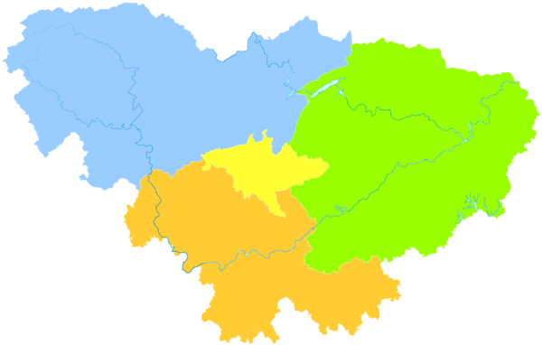
التقسيمات الادارية
تدير ژانگجياجيى مديريتين وناحيتين.
- مديرية يونگدينگ (永定区)
- مديرية وولينگيوان (武陵源区)
- ناحية تسيلي (慈利县)
- ناحية سانگژي (桑植县)
| الخريطة |
|---|
الجغرافيا

Zhangjiajie has a mountainous mid -subtropical monsoon climate with four distinct seasons. The annual average sunshine is 1,440 hours, the average temperature is 16 degrees Celsius, the average annual precipitation is about 1,400 mm, and the average frost-free period is 216 to 269 days. Due to the influence of topography, landforms and other factors, the climate within the territory is complex and changeable, and natural disasters such as droughts, floods, strong winds and hail are also relatively frequent.
Geographically , Zhangjiajie is located at the junction of the uplift of the Yunnan-Guizhou Plateau and the subsidence area of Dongting Lake . The map coordinates range from 109°40' to 111°20' east longitude and 28°52' to 29°48' north latitude. Neighboring counties (cities): Shimen County and Taoyuan County to the east, Yuanling County to the south , and Hefeng County and Xuanen County of Hubei Province to the north . The city is 167 kilometers long from east to west and 96 kilometers wide from north to south, with a total area of 9,653 square kilometers .
Geomorphologically , Zhangjiajie has mountains , karsts , hills , hills and plains , etc. The mountainous area accounts for 76% of the total area. The terrain is high in the northwest and slopes to the southeast along the Lishui River . The central part is slowly lowering northeast along both sides of the Lishui River, and the southern mountainous area descends gradually toward the Yuan River. The Wuling Mountains branch into this city from Yunwu Mountain in Guizhou, and are divided into three branches. The north branch comes from Fenglong and enters Lishan Mountain , Guiying Mountain and Qinglong Mountain in Sangzhi County of this city ; the middle branch along the north of Lishui includes Tianxing Mountain , Hongxi Mountain , Chaotian Mountain , Qingyan Mountain and Maohuajie . The southern branch runs between Lishui and Yuanshui , with Qixing Mountain, Chongshan Mountain and Tianmen Mountain , and extends into Dalong Mountain and Tianhe Mountain in Cili County. All three branches disappeared eastward to the Dongting Lake alluvial plain. The highest point in this area is 1890.4 meters above sea level, and the lowest point is 75 meters above sea level. The average altitude of the urban area is 183 meters, and the average altitude of the scenic spot is 1,000 meters.
المناخ
| بيانات المناخ لـ ژانگجياجيى (1991–2020 normals, extremes 1981–2010) | |||||||||||||
|---|---|---|---|---|---|---|---|---|---|---|---|---|---|
| الشهر | ينا | فب | مار | أبر | ماي | يون | يول | أغس | سبت | أكت | نوف | ديس | السنة |
| القصوى القياسية °س (°ف) | 21.8 (71.2) |
29.4 (84.9) |
33.9 (93.0) |
38.2 (100.8) |
37.0 (98.6) |
38.8 (101.8) |
40.8 (105.4) |
41.2 (106.2) |
38.6 (101.5) |
35.5 (95.9) |
30.0 (86.0) |
23.9 (75.0) |
41.2 (106.2) |
| متوسط القصوى اليومية °س (°ف) | 9.5 (49.1) |
12.2 (54.0) |
17.0 (62.6) |
23.4 (74.1) |
27.4 (81.3) |
30.5 (86.9) |
33.5 (92.3) |
33.6 (92.5) |
29.4 (84.9) |
23.3 (73.9) |
17.9 (64.2) |
12.2 (54.0) |
22.5 (72.5) |
| المتوسط اليومي °س (°ف) | 5.6 (42.1) |
7.9 (46.2) |
12.0 (53.6) |
17.7 (63.9) |
22.0 (71.6) |
25.5 (77.9) |
28.2 (82.8) |
28.0 (82.4) |
24.0 (75.2) |
18.4 (65.1) |
13.0 (55.4) |
7.9 (46.2) |
17.5 (63.5) |
| متوسط الدنيا اليومية °س (°ف) | 2.9 (37.2) |
4.9 (40.8) |
8.5 (47.3) |
13.8 (56.8) |
18.2 (64.8) |
21.9 (71.4) |
24.4 (75.9) |
24.2 (75.6) |
20.4 (68.7) |
15.1 (59.2) |
9.7 (49.5) |
4.9 (40.8) |
14.1 (57.3) |
| الصغرى القياسية °س (°ف) | −4.5 (23.9) |
−3.4 (25.9) |
−1.3 (29.7) |
3.1 (37.6) |
8.7 (47.7) |
11.9 (53.4) |
18.3 (64.9) |
15.8 (60.4) |
12.5 (54.5) |
4.1 (39.4) |
−0.9 (30.4) |
−3.6 (25.5) |
−4.5 (23.9) |
| متوسط تساقط الأمطار mm (inches) | 46.2 (1.82) |
58.3 (2.30) |
88.4 (3.48) |
125.5 (4.94) |
192.7 (7.59) |
219.8 (8.65) |
226.9 (8.93) |
114.9 (4.52) |
100.6 (3.96) |
94.5 (3.72) |
64.2 (2.53) |
26.9 (1.06) |
1٬358٫9 (53.5) |
| Average precipitation days (≥ 0.1 mm) | 11.1 | 11.2 | 13.9 | 14.4 | 16.3 | 15.2 | 13.8 | 11.0 | 9.1 | 12.6 | 10.4 | 8.6 | 147.6 |
| متوسط الرطوبة النسبية (%) | 74 | 73 | 74 | 74 | 76 | 78 | 76 | 73 | 72 | 75 | 76 | 72 | 74 |
| Mean monthly ساعات سطوع الشمس | 57.7 | 57.9 | 84.0 | 110.2 | 123.0 | 124.9 | 180.4 | 189.4 | 132.6 | 104.2 | 91.1 | 74.6 | 1٬330 |
| نسبة السطوع المحتمل للشمس | 18 | 18 | 22 | 28 | 29 | 30 | 42 | 47 | 36 | 30 | 29 | 23 | 29 |
| Source: China Meteorological Administration[6][7] | |||||||||||||
الحكومة
The current CPC Party Secretary (chief) of Zhangjiajie is Guo Zhenggui and the current Mayor is Liu Ge'an.
المعالم السياحية
The prefecture is mainly a tourist area. It attracts visitors from all over China and other Asian countries such as Korea, and is increasing in popularity for other international tourists.
Zhangjiajie Tourism Attractions
1.Wulingyuan Core Scenic Spots
Zhangjiajie national forest park
Yellow stone village(Huangshizhai)
Golden whip stream(Jinbianxi)
Yaozi village(Yaozizhai)
Yangjiajie(Peak wall)
Yuanjiajie(Avatar mountain)
Yuanjia ancient village
Tianzi mountain(Tianzishan)
Ten-mile gallery
2.Wulingyuan Area Other
Yellow dragon cave(Huanglongdong)
Baofeng lake(Baofenghu)
Wulingyuan xibu street
3.Zhangjiajie East Tourism
Zhangjiajie grand canyon
Zhangjiajie glass bridge
Jiangya hot spring holiday village
Zhangjiajie lou river drifting
4.Zhangjiajie Downtown Area
Tianmenshan national forest park(Tianmen mountain)
Tianmenshan glass plank road
Tujia Folk Custom Park
5.Zhangjiajie West Tourism
Zhangjiajie jiutian cave
Zhangjiajie maoyan river rafting
HeLong memorial hall
Source from:http://www.zjjbk.com/2017/guide_0511/5124.html
النقل
مطار ژانگجياجيى services scheduled service to major airports in China. It is about 5 km away from the downtown and 30 km away from Wulingyuan Scenic Area. There are domestic flights available between Zhangjiajie and other cities, such as Changsha, Beijing, Shanghai, Guangzhou etc. Flights between Zhangjiajie and Seoul, Busan are also available.[8]


.jpg&filetimestamp=20240320214550)
الطرق
Due to the mountainous region in the northwest, the slow development of road traffic, the territory no ordinary country road, is not connected to the motorway قالب:China Expwy Name and S10 S10 Expressway under the two roads.
العلاقات الدولية
البلدات التوأم — المدن الشقيقة
ژانگجياجيى متوأمة مع:
 ناحية هادونگ، South Gyeongsang، كوريا الجنوبية (2006)
 سانتا فى، نيو مكسيكو، الولايات المتحدة (2009)
 ناروتو، توكوشيما، اليابان (2011)
 أروكا، پورتو، المنطقة العمرانية، البرتغال (2017)
الهامش
- ^ "AAAAA Scenic Areas". ادارة السياحة الوطنية الصينية. 16 November 2008. Archived from the original on April 4, 2014. Retrieved 9 April 2011.
{{cite web}}: Unknown parameter|deadurl=ignored (|url-status=suggested) (help) - ^ "Zhangjiajie History, Zhangjiajie History Timeline, History of Ancient Zhangjiajie China". www.zhangjiajietourguide.com. Retrieved 2022-06-11.
- ^ أ ب "History of Zhangjiajie - Zhangjiajie Tour Guide, China". www.zhangjiajietourguide.com. Retrieved 2022-06-11.
- ^ "Tujia language". Zhangjiajie Municipal Government. 23 November 2010. Retrieved 10 July 2014.
- ^ "The Origin of Zhangjiajie Name". Zhangjiajie Municipal Government. 20 November 2013. Retrieved 10 July 2014.
- ^ 中国气象数据网 – WeatherBk Data (in الصينية المبسطة). China Meteorological Administration. Retrieved 11 June 2023.
- ^ "Experience Template" 中国气象数据网 (in الصينية المبسطة). China Meteorological Administration. Retrieved 28 May 2023.
- ^ "Zhangjiajie Travel Guide" ChinaTour.Net Accessed 2015-1-21
وصلات خارجية
| International | |
|---|---|
| National | |
- CS1 errors: unsupported parameter
- CS1 uses الصينية-language script (zh)
- CS1 الصينية المبسطة-language sources (zh-hans)
- Short description is different from Wikidata
- Articles containing صينية-language text
- Pages using gadget WikiMiniAtlas
- Articles containing simplified Chinese-language text
- Articles containing traditional Chinese-language text
- Articles with hatnote templates targeting a nonexistent page
- مدن خونان
- تقسيمات بمستوى محافظة في خونان
- ژانگجياجيى
- AAAAA-rated tourist attractions