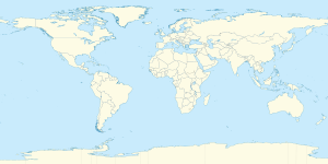
خط العرض 60° شمالاً

Line across the Earth
60°
خط العرض 60 شمال

خط العرض 60 شمالًا (إنگليزية: 60th parallel north) هي دائرة عرض بزاوية 60 درجة شمال خط الاستواء. تمر دائرة العرض 60° شمالاً عبر أفريقيا، المحيط الهندي، جنوب آسيا، جنوب شرق آسيا، المحيط الهادي، أمريكا الوسطى، امريكا الجنوبية والمحيط الأطلسي.


عند خط العرض هذا، تكون الشمس مرئية لمدة 18 ساعة و 52 دقيقة أثناء الانقلاب الصيفي، و5 ساعات و 52 دقيقة أثناء الانقلاب الشتوي .[1]. [2]

. . . . . . . . . . . . . . . . . . . . . . . . . . . . . . . . . . . . . . . . . . . . . . . . . . . . . . . . . . . . . . . . . . . . . . . . . . . . . . . . . . . . . . . . . . . . . . . . . . . . . . . . . . . . . . . . . . . . . . . . . . . . . . . . . . . . . . . . . . . . . . . . . . . . . . . . . . . . . . . . . . . . . . . .

حول العالم

بدءاً من خط الزوال الرئيسي، في الاتجاه الشرقي، يمر خط العرض 60° شمالاً عبر:

الإحداثيات البلد أو الإقليم أو البحر ملاحظات
60°0′N 0°0′E / 60.000°N 0.000°E / 60.000; 0.000 (Prime Meridian) Atlantic Ocean North Sea
60°0′N 5°3′E / 60.000°N 5.050°E / 60.000; 5.050 (Norway) Flag of Norway.svg نرويج Islands of Stolmen and Selbjørn, Hordaland
60°0′N 5°12′E / 60.000°N 5.200°E / 60.000; 5.200 (Prime Meridian) Atlantic Ocean Bekkjarviksundet, Selbjørnsfjorden, North Sea
60°0′N 5°15′E / 60.000°N 5.250°E / 60.000; 5.250 (Norway) Flag of Norway.svg نرويج Island of Huftarøy, Hordaland
60°0′N 5°17′E / 60.000°N 5.283°E / 60.000; 5.283 (Prime Meridian) Atlantic Ocean Langenuen, North Sea
60°0′N 5°22′E / 60.000°N 5.367°E / 60.000; 5.367 (Norway) Flag of Norway.svg نرويج Islands of Reksteren, Tysnesøy and the mainland Hordaland
60°0′N 5°52′E / 60.000°N 5.867°E / 60.000; 5.867 (Prime Meridian) Atlantic Ocean Hardangerfjorden, North Sea
60°0′N 5°59′E / 60.000°N 5.983°E / 60.000; 5.983 (Norway) Flag of Norway.svg نرويج Mainland: Folgefonna glacier, Telemark, Buskerud, Akershus, Oslo, Hedmark, Østfold
Passing just north of the capital Oslo
60°0′N 12°23′E / 60.000°N 12.383°E / 60.000; 12.383 (Sweden) Flag of Sweden.svg السويد Passing through Fagersta
Passing just north of Uppsala
60°0′N 18°53′E / 60.000°N 18.883°E / 60.000; 18.883 (Baltic Sea) Atlantic Ocean Baltic Sea
60°0′N 20°8′E / 60.000°N 20.133°E / 60.000; 20.133 (Åland Islands) Flag of Finland.svg فنلندا Högskär, Bäckö and several smaller islands, قالب:ALA
60°0′N 20°58′E / 60.000°N 20.967°E / 60.000; 20.967 (Baltic Sea) Atlantic Ocean Baltic Sea
60°0′N 23°30′E / 60.000°N 23.500°E / 60.000; 23.500 (Finland) Flag of Finland.svg فنلندا Passing through Tammisaari
60°0′N 25°00′E / 60.000°N 25.000°E / 60.000; 25.000 (Baltic Sea) Atlantic Ocean Baltic Sea
Passing just south of Helsinki, Flag of Finland.svg فنلندا
60°0′N 24°26′E / 60.000°N 24.433°E / 60.000; 24.433 (Finland) Flag of Finland.svg فنلندا Porkkala peninsula
60°0′N 27°00′E / 60.000°N 27.000°E / 60.000; 27.000 (Baltic Sea) Atlantic Ocean Gulf of Finland, Baltic Sea
Passing just south of the island of Gogland, Flag of Russia.svg روسيا
60°0′N 27°48′E / 60.000°N 27.800°E / 60.000; 27.800 (Russia) Flag of Russia.svg روسيا Moshchny Island
60°0′N 27°54′E / 60.000°N 27.900°E / 60.000; 27.900 (Baltic Sea) Atlantic Ocean Gulf of Finland, Baltic Sea
60°0′N 29°44′E / 60.000°N 29.733°E / 60.000; 29.733 (Russia) Flag of Russia.svg روسيا Island of Kotlin (city of Kronstadt)
60°0′N 29°47′E / 60.000°N 29.783°E / 60.000; 29.783 (Baltic Sea) Atlantic Ocean Gulf of Finland, Baltic Sea
60°0′N 30°5′E / 60.000°N 30.083°E / 60.000; 30.083 (Russia) Flag of Russia.svg روسيا Passing through Saint Petersburg, Lake Ladoga
60°0′N 154°30′E / 60.000°N 154.500°E / 60.000; 154.500 (Sea of Okhotsk) Pacific Ocean Shelikhov Gulf, Sea of Okhotsk
60°0′N 161°28′E / 60.000°N 161.467°E / 60.000; 161.467 (Russia) Flag of Russia.svg روسيا Kamchatka Peninsula
60°0′N 165°14′E / 60.000°N 165.233°E / 60.000; 165.233 (Bering Sea) Pacific Ocean Bering Sea
60°0′N 166°10′E / 60.000°N 166.167°E / 60.000; 166.167 (Russia) Flag of Russia.svg روسيا Pylgin Range
60°0′N 166°33′E / 60.000°N 166.550°E / 60.000; 166.550 (Bering Sea) Pacific Ocean Olyutor Gulf, Bering Sea
60°0′N 170°9′E / 60.000°N 170.150°E / 60.000; 170.150 (Russia) Flag of Russia.svg روسيا Olyutor Peninsula
60°0′N 170°26′E / 60.000°N 170.433°E / 60.000; 170.433 (Bering Sea) Pacific Ocean Bering Sea
60°0′N 167°8′W / 60.000°N 167.133°W / 60.000; -167.133 (United States)  الولايات المتحدة Alaska - Nunivak Island
60°0′N 165°39′W / 60.000°N 165.650°W / 60.000; -165.650 (Etolin Strait) Pacific Ocean Etolin Strait, Bering Sea
60°0′N 164°9′W / 60.000°N 164.150°W / 60.000; -164.150 (United States)  الولايات المتحدة Alaska
60°0′N 152°38′W / 60.000°N 152.633°W / 60.000; -152.633 (Cook Inlet) Pacific Ocean Cook Inlet, Gulf of Alaska
60°0′N 151°44′W / 60.000°N 151.733°W / 60.000; -151.733 (United States)  الولايات المتحدة Alaska - Kenai Peninsula, Evans Island, Elrington Island, Latouche Island and Montague Island
60°0′N 147°24′W / 60.000°N 147.400°W / 60.000; -147.400 (Pacific Ocean) Pacific Ocean Gulf of Alaska
60°0′N 144°24′W / 60.000°N 144.400°W / 60.000; -144.400 (United States)  الولايات المتحدة Alaska - Wingham Island, Kayak Island and a small section of mainland
60°0′N 143°50′W / 60.000°N 143.833°W / 60.000; -143.833 (Pacific Ocean) Pacific Ocean Gulf of Alaska
60°0′N 141°53′W / 60.000°N 141.883°W / 60.000; -141.883 (United States)  الولايات المتحدة Alaska
60°0′N 139°3′W / 60.000°N 139.050°W / 60.000; -139.050 (Canada) Flag of Canada.svg كندا Yukon / British Columbia border
Northwest Territories / British Columbia border
Northwest Territories / Alberta border - passes through Wood Buffalo National Park and beside Fort Smith, NT
Northwest Territories / Saskatchewan border
Nunavut / Manitoba border
60°0′N 94°49′W / 60.000°N 94.817°W / 60.000; -94.817 (Hudson Bay) Arctic Ocean Hudson Bay
Passing just north of the Ottawa Islands, Nunavut, Flag of Canada.svg كندا
60°0′N 77°17′W / 60.000°N 77.283°W / 60.000; -77.283 (Canada) Flag of Canada.svg كندا Quebec
Passing just south of Puvirnituq, Quebec
60°0′N 69°46′W / 60.000°N 69.767°W / 60.000; -69.767 (Ungava Bay) Arctic Ocean Ungava Bay
Passing just south of Kangirsuk, Quebec, Flag of Canada.svg كندا
60°0′N 65°7′W / 60.000°N 65.117°W / 60.000; -65.117 (Canada) Flag of Canada.svg كندا Quebec, Newfoundland and Labrador
60°0′N 64°9′W / 60.000°N 64.150°W / 60.000; -64.150 Atlantic Ocean Border between the Davis Strait (to the north) and the Labrador Sea (to the south)[3]
60°0′N 44°52′W / 60.000°N 44.867°W / 60.000; -44.867 (Greenland) Flag of Greenland.svg گرينلاند Passing just south of Narsaq
60°0′N 43°9′W / 60.000°N 43.150°W / 60.000; -43.150 (Atlantic Ocean) Atlantic Ocean
60°0′N 1°21′W / 60.000°N 1.350°W / 60.000; -1.350 (United Kingdom) Flag of the United Kingdom.png المملكة المتحدة Islands of Mainland and Mousa, Shetland Islands,  اسكتلندا
60°0′N 1°11′W / 60.000°N 1.183°W / 60.000; -1.183 (North Sea) Atlantic Ocean North Sea


كندا

ملف:60th parallel Canada.svg
The 60th parallel north in Canada, marking the southern borders of Yukon, Northwest Territories, and the Nunavut mainland.

في كندا ، يشكل خط العرض 60 الحد الجنوبي من البر الرئيسي لـ الأقاليم الشمالية من يوكون و الأقاليم الشمالية الغربية و نونافوت مع الغربية مقاطعات كولومبيا البريطانية ، ألبرتا ، ساسكاتشوان ، مانيتوبا. Accordingly, "north of 60" is an expression often used for the territories, although parts of Nunavut (the islands in Hudson Bay and James Bay) are located south of the 60th parallel, and parts of Quebec and Newfoundland and Labrador are located north, to the east of Hudson Bay. A 1990s TV show on CBC about life in the Northwest Territories was called North of 60.

Canada's only four corners are located at the intersection of the 60th parallel and the 102nd meridian west, between the Northwest Territories, Nunavut, Saskatchewan, and Manitoba. However, this is not a true quadripoint as the measurement of the Saskatchewan/Manitoba border in the 1880s placed it approximately 400 metres (440 yd) west of the 102nd meridian, which defines part of the Northwest Territories/Nunavut border.

جرينلاند

بين عامي 1776 و 1950 ، شكل خط العرض 60 الحد الجنوبي لاحتكار Royal Greenland Trade Department الحصري للتجارة بالقرب من دانو-النرويجية ولاحقًا الدنماركية مستعمرات جرينلاند (1776 - 1782) و جنوب جرينلاند (1782 - 1950 ؛).[4]


انظر ايضا

المصادر

  1. ^ "Duration of Daylight/Darkness Table for One Year". U.S. Naval Observatory. 2019-09-24. Archived from the original on 2019-10-12. Retrieved 2021-03-10.
  2. ^ NASA. "Earth Fact Sheet". Retrieved April 11, 2017.
  3. ^ "Limits of Oceans and Seas, 3rd edition" (PDF). International Hydrographic Organization. 1953. Archived from the original (PDF) on 8 October 2011. Retrieved 28 December 2020.
  4. ^ Marquardt, Ole. "Change and Continuity in Denmark's Greenland Policy" in The Oldenburg Monarchy: An Underestimated Empire?. Verlag Ludwig (Kiel), 2006.