أعالي فرنسا
Hauts-de-France
Heuts-d'Franche (Picard) | |
|---|---|
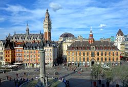
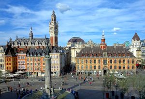
 Grand Place in Lille | |
 | |
| الإحداثيات: 49°55′14″N 2°42′11″E / 49.9206°N 2.7030°E | |
| Country | |
| Prefecture | Lille |
| Departments | 5
|
| الحكومة | |
| • President of the Regional Council | Xavier Bertrand (LR) |
| المساحة | |
| • الإجمالي | 31٬813 كم² (12٬283 ميل²) |
| ترتيب المساحة | 9th |
| التعداد (يناير 2019) | |
| • الإجمالي | 6٬004٬947 |
| • الكثافة | 190/km2 (490/sq mi) |
| GDP | |
| • Total | €185.472 billion (2022) |
| • Per capita | €30,900 (2022) |
| منطقة التوقيت | UTC+01:00 (CET) |
| • الصيف (التوقيت الصيفي) | UTC+02:00 (CEST) |
| ISO 3166 code | FR-HDF |
| NUTS Region | FRE |
| الموقع الإلكتروني | www |
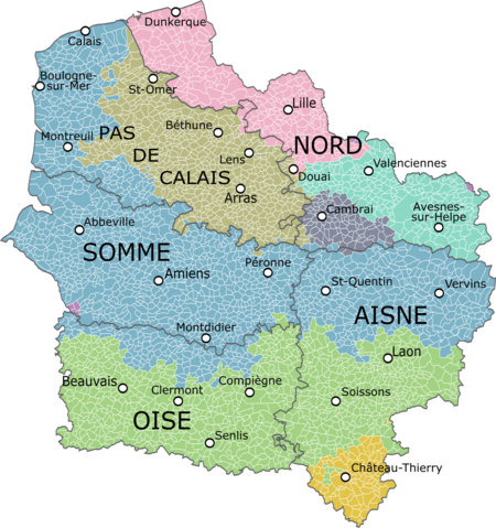
أعالي فرنسا (Hauts-de-France،[2] النطق الفرنسي: [o d(ə) fʁɑ̃s]) هي منطقة في فرنسا خلقها الإصلاح الإقليمي للمناطق الفرنسية في 2014، من دمج أراضي كاليه الشمالية وپيكاردي. ظهرت المنطقة الجديدة إلى حيز الوجود في 1 يناير 2016، بعد الانتخابات الإقليمية في ديسمبر 2015.[3] وافق مجلس الدولة الفرنسي على "أوتى-فغانس Hauts-de-France" اسماً للمنطقة في 28 سبتمبر 2016، اعتباراً من 30 سبتمبر 2016.[4]
تغطي المنطقة مساحة تزيد عن 31,813 كم²، ويسكنها 5,973,098 نسمة.[5]
اسم المكان
The region's interim name Nord-Pas-de-Calais-Picardie was a hyphenated placename, created by hyphenating the merged regions' names—Nord-Pas-de-Calais and Picardie—in alphabetical order.[6]
On 14 March 2016, well ahead of the 1 July deadline, the Regional council decided on Hauts-de-France as the region's permanent name,.[2][6] The provisional name of the region was retired on 30 September 2016, when the new name of the region, Hauts-de-France, took effect.[4]
الجغرافيا

المنطقة تحدها بلجيكا (الفلاندرز و والونيا) إلى الشمال الشرقي، القنال الإنگليزي إلى الشمال الغربي، بالإضافة إلى المناطق الفرنسيو Grand Est إلى الجنوب الشرقي، Île-de-France إلى الجنوب، و نورماندي إلى الجنوب الغربي. وهو مربوط بـالمملكة المتحدة (إنگلترة) عبر نفق القنال.
التجمعات الرئيسية
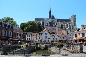
- ليل (227,560; region prefecture)
- أميان (133,448)
- Roubaix (94,713)
- Tourcoing (91,923)
- دنكرك (90,995)
- كاليه (72,589)
- Villeneuve-d'Ascq (62,308)
- Saint-Quentin (55,978)
- بوڤيه (54,289)
- ڤالنسيين (42,691)
انظر أيضاً
المراجع
- ^ "EU regions by GDP, Eurostat". Retrieved 18 September 2023.
- ^ أ ب "La Région a voté et s'appelle désormais Hauts-de-France" [The region has voted and is now called Hauts-de-France]. La Voix du Nord (in French). Lille. 15 March 2016. Retrieved 15 March 2016.
{{cite news}}: CS1 maint: unrecognized language (link) - ^ "La carte à 13 régions définitivement adoptée" [The 13-region map finally adopted]. Le Monde (in French). Agence France-Presse. 17 December 2014. Retrieved 13 January 2015.
{{cite news}}: CS1 maint: unrecognized language (link) - ^ أ ب قالب:Cite French decree
- ^ "Populations légales 2012 - Populations légales des régions". Insee. Retrieved 16 January 2015.
- ^ أ ب قالب:Cite French law
وصلات خارجية
- Official website
 (بالفرنسية)
 - Merger of the regions - France 3


