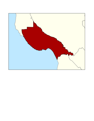
مقاطعة سانتا كروز، كاليفورنيا
Santa Cruz County, California | |
|---|---|
| County of Santa Cruz | |
|
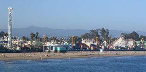
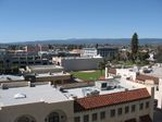
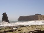
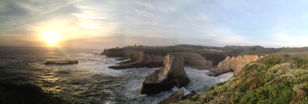
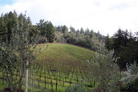
Images, from top down, left to right: The Santa Cruz Beach Boardwalk in 2005, a walkway through redwood groves in Big Basin Redwoods State Park, the Roaring Camp and Big Trees Narrow Gauge Railroad in 2008, Downtown Watsonville in 2010, Davenport Beach in 2006. | |
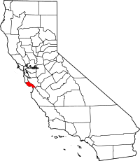 Location in the state of California | |
 California's location in the United States | |
| الإحداثيات: 37°02′N 122°01′W / 37.03°N 122.01°W | |
| Country | |
| State | |
| Region | Central Coast |
| CSA | San Jose-San Francisco-Oakland |
| Incorporated | February 18, 1850[1] |
| السمِيْ | Mission Santa Cruz and the city of Santa Cruz, both named after the Exaltation of the Cross |
| County seat | Santa Cruz |
| Largest city | Santa Cruz |
| المساحة | |
| • الإجمالي | 607 ميل² (1٬570 كم²) |
| • البر | 445 ميل² (1٬150 كم²) |
| • الماء | 162 ميل² (420 كم²) |
| أعلى منسوب | 3٬234 ft (986 m) |
| التعداد | |
| • الإجمالي | 262٬382 |
| • Estimate (2019)[4] | 273٬213 |
| • الكثافة | 430/sq mi (170/km2) |
| منطقة التوقيت | UTC−8 (Pacific Time Zone) |
| • الصيف (التوقيت الصيفي) | UTC−7 (Pacific Daylight Time) |
| Area code | 831 |
| FIPS code | 06-087 |
| GNIS feature ID | 277308 |
| الموقع الإلكتروني | www |
مقاطعة سانتا كروز إنگليزية: Santa Cruz County هي إحدى مقاطعات على ساحل المحيط الهادي في ولاية كاليفورنيا في الولايات المتحدة الأمريكية. As of the 2010 census, the population was 262,382.[3] The county seat is Santa Cruz.[5]
Santa Cruz County comprises the Santa Cruz–Watsonville, CA Metropolitan Statistical Area, which is also included in the San Jose–San Francisco–Oakland, CA Combined Statistical Area. The county is on the California Central Coast,[6] south of the San Francisco Bay Area region. The county forms the northern coast of the Monterey Bay, with Monterey County forming the southern coast.
التاريخ
Santa Cruz County was one of the original counties of California, created in 1850 at the time of statehood. In the original act, the county was given the name of "Branciforte" after the Spanish pueblo founded there in 1797. A major watercourse in the county, Branciforte Creek, still bears this name. Less than two months later on April 5, 1850,[7] the name was changed to "Santa Cruz" ("Holy Cross").
Mission Santa Cruz, established in 1791 and completed in 1794, was destroyed by the 1857 Fort Tejon earthquake, but a smaller-scale replica was erected in 1931.
الجغرافيا
According to the U.S. Census Bureau, the county has a total area of 607 ميل مربع (1،570 km2), of which 445 ميل مربع (1،150 km2) is land and 162 ميل مربع (420 km2) (27%) is water.[8] It is the second-smallest county in California by land area and third-smallest by total area. Of California's counties, only San Francisco is physically smaller.
Flora and fauna
Santa Cruz County is home to the following threatened or endangered species:[9]
- California clapper rail – endangered (1970)[10]
- California red-legged frog – threatened (1996)[11]
- California tiger salamander – Central California DPS, threatened (2004)[12]
- Coho salmon – Central California Coast ESU is endangered (2005)[13]
- Marbled murrelet – threatened (1992)[14]
- Mount Hermon June beetle – endangered (1997)[15]
- Ohlone tiger beetle – endangered (2001)[16]
- San Francisco garter snake – endangered (1967)[17]
- Santa Cruz long-toed salamander – endangered (1967)[18]
- Santa Cruz tarweed – threatened (2000)
- Smith's blue butterfly – endangered (1976)
- Southern sea otter – threatened (1977)[19]
- Steelhead – Central California Coast DPS is threatened (2011)[20]
- Tidewater goby – endangered (1994)
- Western snowy plover – threatened (1993)
- Yellow-billed cuckoo – threatened (2014)[21]
- Zayante band-winged grasshopper – endangered (1997)[22]
المقاطعات المجاورة
السكان
| Places by population and race | ||||||||
|---|---|---|---|---|---|---|---|---|
| Place | Type[23] | Population[24] | White[24] | Other[24] [note 1] |
Asian[24] | Black or African American[24] |
Native American[24] [note 2] |
Hispanic or Latino (of any race)[25] |
| Amesti | CDP | 3,599 | 96.0% | 3.3% | 0.4% | 0.0% | 0.3% | 69.5% |
| Aptos | CDP | 6,121 | 91.9% | 2.3% | 3.8% | 1.6% | 0.5% | 14.9% |
| Aptos Hills-Larkin Valley | CDP | 2,557 | 97.2% | 2.0% | 0.4% | 0.0% | 0.4% | 29.8% |
| Ben Lomond | CDP | 6,493 | 96.0% | 2.7% | 1.2% | 0.0% | 0.0% | 6.4% |
| Bonny Doon | CDP | 2,342 | 89.9% | 4.1% | 2.1% | 2.2% | 1.8% | 5.5% |
| Boulder Creek | CDP | 5,337 | 93.1% | 5.3% | 1.6% | 0.0% | 0.0% | 4.0% |
| Brookdale | CDP | 1,723 | 98.3% | 0.6% | 1.0% | 0.0% | 0.0% | 14.3% |
| Capitola | City | 9,864 | 85.9% | 9.6% | 2.3% | 1.1% | 1.1% | 22.3% |
| Corralitos | CDP | 2,439 | 83.8% | 14.4% | 1.0% | 0.8% | 0.0% | 24.4% |
| Davenport | CDP | 271 | 90.0% | 7.0% | 1.1% | 1.8% | 0.0% | 25.8% |
| Day Valley | CDP | 3,662 | 89.5% | 8.7% | 0.9% | 0.0% | 1.0% | 11.6% |
| Felton | CDP | 4,534 | 88.9% | 1.9% | 4.9% | 1.4% | 2.9% | 3.4% |
| Freedom | CDP | 3,078 | 51.5% | 43.9% | 4.1% | 0.0% | 0.5% | 66.4% |
| Interlaken | CDP | 7,002 | 73.5% | 22.2% | 3.8% | 0.4% | 0.1% | 72.5% |
| La Selva Beach | CDP | 2,597 | 95.0% | 1.2% | 3.2% | 0.7% | 0.0% | 5.2% |
| Live Oak | CDP | 16,550 | 79.8% | 12.6% | 6.6% | 0.6% | 0.4% | 28.2% |
| Lompico | CDP | 931 | 87.3% | 8.6% | 4.1% | 0.0% | 0.0% | 10.0% |
| Mount Hermon | CDP | 1,017 | 97.7% | 0.9% | 0.8% | 0.0% | 0.6% | 28.0% |
| Pajaro Dunes | CDP | 243 | 90.9% | 0.0% | 5.8% | 3.3% | 0.0% | 0.0% |
| Paradise Park | CDP | 413 | 100.0% | 0.0% | 0.0% | 0.0% | 0.0% | 0.0% |
| Pasatiempo | CDP | 1,201 | 89.9% | 4.8% | 4.4% | 0.0% | 0.8% | 11.2% |
| Pleasure Point | CDP | 5,195 | 84.3% | 12.3% | 2.1% | 0.7% | 0.7% | 21.1% |
| Rio del Mar | CDP | 9,200 | 94.1% | 3.0% | 2.0% | 0.8% | 0.1% | 7.8% |
| Santa Cruz | City | 59,022 | 81.8% | 8.4% | 6.4% | 2.4% | 1.0% | 18.1% |
| Scotts Valley | City | 11,480 | 83.4% | 7.7% | 7.2% | 1.0% | 0.9% | 8.9% |
| Seacliff | CDP | 3,141 | 84.3% | 8.2% | 6.4% | 1.0% | 0.1% | 27.2% |
| Soquel | CDP | 9,474 | 85.2% | 10.4% | 4.1% | 0.0% | 0.3% | 17.6% |
| Twin Lakes | CDP | 5,023 | 84.8% | 8.8% | 3.2% | 2.6% | 0.6% | 16.3% |
| Watsonville | City | 50,291 | 70.7% | 25.1% | 3.6% | 0.1% | 0.5% | 80.1% |
| Zayante | CDP | 781 | 97.6% | 2.4% | 0.0% | 0.0% | 0.0% | 14.1% |
| Places by population and income | |||||
|---|---|---|---|---|---|
| Place | Type[23] | Population[26] | Per capita income[27] | Median household income[28] | Median family income[29] |
| Amesti | CDP | 3,599 | $17,282 | $45,696 | $47,734 |
| Aptos | CDP | 6,121 | $39,867 | $76,862 | $87,854 |
| Aptos Hills-Larkin Valley | CDP | 2,557 | $35,232 | $76,743 | $85,313 |
| Ben Lomond | CDP | 6,493 | $39,584 | $87,300 | $98,623 |
| Bonny Doon | CDP | 2,342 | $43,428 | $90,147 | $108,015 |
| Boulder Creek | CDP | 5,337 | $41,960 | $81,111 | $93,185 |
| Brookdale | CDP | 1,723 | $53,246 | $98,333 | $102,668 |
| Capitola | City | 9,864 | $33,864 | $50,696 | $65,625 |
| Corralitos | CDP | 2,439 | $27,548 | $78,427 | $83,661 |
| Davenport | CDP | 271 | $35,831 | $61,563 | $97,344 |
| Day Valley | CDP | 3,662 | $39,815 | $87,969 | $105,064 |
| Felton | CDP | 4,534 | $36,438 | $75,250 | $88,320 |
| Freedom | CDP | 3,078 | $18,466 | $48,958 | $58,839 |
| Interlaken | CDP | 7,002 | $18,618 | $59,335 | $59,738 |
| La Selva Beach | CDP | 2,597 | $41,203 | $76,589 | $92,955 |
| Live Oak | CDP | 16,550 | $30,080 | $61,515 | $71,859 |
| Lompico | CDP | 931 | $36,112 | $83,375 | $94,191 |
| Mount Hermon | CDP | 1,017 | $34,723 | $57,951 | $59,464 |
| Pajaro Dunes | CDP | 243 | $109,776 | $90,938 | $76,250 |
| Paradise Park | CDP | 413 | $28,062 | $42,266 | $59,306 |
| Pasatiempo | CDP | 1,201 | $73,534 | $115,938 | $96,964 |
| Pleasure Point | CDP | 5,195 | $39,237 | $64,139 | $70,000 |
| Rio del Mar | CDP | 9,200 | $49,351 | $88,620 | $116,532 |
| Santa Cruz | City | 59,022 | $31,898 | $63,110 | $87,516 |
| Scotts Valley | City | 11,480 | $43,966 | $99,076 | $113,972 |
| Seacliff | CDP | 3,141 | $33,996 | $57,450 | $66,089 |
| Soquel | CDP | 9,474 | $41,599 | $69,676 | $82,159 |
| Twin Lakes | CDP | 5,023 | $33,362 | $49,335 | $79,800 |
| Watsonville | City | 50,291 | $16,407 | $46,073 | $49,550 |
| Zayante | CDP | 781 | $32,983 | $64,028 | $96,528 |
2010
| التعداد | Pop. | ملاحظة | %± |
|---|---|---|---|
| 1850 | 643 | — | |
| 1860 | 4٬944 | 668٫9% | |
| 1870 | 8٬743 | 76٫8% | |
| 1880 | 12٬802 | 46٫4% | |
| 1890 | 19٬270 | 50٫5% | |
| 1900 | 21٬512 | 11٫6% | |
| 1910 | 26٬140 | 21٫5% | |
| 1920 | 26٬269 | 0٫5% | |
| 1930 | 37٬433 | 42٫5% | |
| 1940 | 45٬057 | 20٫4% | |
| 1950 | 66٬534 | 47٫7% | |
| 1960 | 84٬219 | 26٫6% | |
| 1970 | 123٬790 | 47�0% | |
| 1980 | 188٬141 | 52�0% | |
| 1990 | 229٬734 | 22٫1% | |
| 2000 | 255٬602 | 11٫3% | |
| 2010 | 262٬382 | 2٫7% | |
| 2019 (تق.) | 273٬213 | [4] | 4٫1% |
| U.S. Decennial Census[30] 1790–1960[31] 1900–1990[32] 1990–2000[33] 2010–2015[3] | |||
| Population reported at 2010 United States Census | |||||||||
|---|---|---|---|---|---|---|---|---|---|
Population |
American |
American |
Islander |
races |
more races |
or Latino (of any race) | |||
| Santa Cruz County | 262,382 | 190,208 | 2,766 | 2,253 | 11,112 | 349 | 43,376 | 12,318 | 84,092 |
cities and towns |
Population |
American |
American |
Islander |
races |
more races |
or Latino (of any race) | ||
| Capitola | 9,918 | 7,963 | 123 | 59 | 424 | 10 | 869 | 470 | 1,957 |
| Santa Cruz | 59,946 | 44,661 | 1,071 | 440 | 4,591 | 108 | 5,673 | 3,402 | 11,624 |
| Scotts Valley | 11,580 | 9,958 | 101 | 57 | 590 | 18 | 292 | 564 | 1,158 |
| Watsonville | 51,199 | 22,399 | 358 | 629 | 1,664 | 40 | 23,844 | 2,265 | 41,656 |
places |
Population |
American |
American |
Islander |
races |
more races |
or Latino (of any race) | ||
| Amesti | 3,478 | 1,889 | 12 | 41 | 89 | 1 | 1,309 | 137 | 2,273 |
| Aptos | 6,220 | 5,420 | 58 | 43 | 247 | 8 | 175 | 269 | 611 |
| Aptos Hills-Larkin Valley | 2,381 | 1,936 | 12 | 5 | 55 | 1 | 295 | 77 | 541 |
| Ben Lomond | 6,234 | 5,692 | 32 | 51 | 70 | 11 | 98 | 280 | 515 |
| Bonny Doon | 2,678 | 2,474 | 9 | 15 | 51 | 5 | 48 | 76 | 168 |
| Boulder Creek | 4,923 | 4,429 | 54 | 31 | 81 | 5 | 119 | 204 | 366 |
| Brookdale | 1,991 | 1,790 | 9 | 12 | 19 | 8 | 66 | 87 | 202 |
| Corralitos | 2,326 | 1,980 | 16 | 12 | 48 | 1 | 190 | 79 | 532 |
| Davenport | 408 | 272 | 6 | 5 | 12 | 0 | 82 | 31 | 172 |
| Day Valley | 3,409 | 2,898 | 20 | 23 | 85 | 4 | 208 | 171 | 470 |
| Felton | 4,057 | 3,691 | 25 | 29 | 69 | 11 | 60 | 172 | 283 |
| Freedom | 3,070 | 1,452 | 44 | 31 | 100 | 0 | 1,285 | 158 | 2,170 |
| Interlaken | 7,321 | 3,856 | 58 | 128 | 302 | 2 | 2,573 | 402 | 5,261 |
| La Selva Beach | 2,843 | 2,399 | 27 | 23 | 116 | 3 | 146 | 129 | 372 |
| Live Oak | 17,158 | 12,636 | 240 | 171 | 773 | 41 | 2,444 | 853 | 4,796 |
| Lompico | 1,137 | 1,005 | 6 | 12 | 21 | 4 | 25 | 64 | 115 |
| Mount Hermon | 1,037 | 964 | 6 | 3 | 14 | 1 | 18 | 31 | 83 |
| Pajaro Dunes | 144 | 92 | 0 | 0 | 6 | 0 | 45 | 1 | 54 |
| Paradise Park | 389 | 371 | 2 | 3 | 3 | 0 | 4 | 6 | 15 |
| Pasatiempo | 1,041 | 925 | 5 | 6 | 34 | 1 | 22 | 48 | 85 |
| Pleasure Point | 5,846 | 4,847 | 63 | 45 | 144 | 5 | 506 | 236 | 1,140 |
| Rio del Mar | 9,216 | 8,310 | 61 | 50 | 313 | 7 | 188 | 287 | 899 |
| Seacliff | 3,267 | 2,758 | 28 | 40 | 100 | 4 | 189 | 148 | 482 |
| Soquel | 9,644 | 7,898 | 85 | 71 | 356 | 21 | 693 | 520 | 1,606 |
| Twin Lakes | 4,917 | 3,900 | 70 | 61 | 126 | 8 | 534 | 218 | 1,109 |
| Zayante | 705 | 647 | 10 | 6 | 4 | 0 | 18 | 20 | 57 |
unincorporated areas |
Population |
American |
American |
Islander |
races |
more races |
or Latino (of any race) | ||
| All others not CDPs (combined) | 23,899 | 20,696 | 155 | 151 | 605 | 21 | 1,358 | 913 | 3,320 |
2000
| Year | GOP | DEM | Others |
|---|---|---|---|
| 2016 | 17.26% 22,438 | 73.26% 95,249 | 9.48% 12,325 |
| 2012 | 19.98% 24,047 | 75.43% 90,805 | 4.60% 5,533 |
| 2008 | 19.76% 25,244 | 77.30% 98,745 | 2.93% 3,747 |
| 2004 | 24.86% 30,354 | 72.98% 89,102 | 2.15% 2,628 |
| 2000 | 27.34% 29,627 | 61.48% 66,618 | 11.17% 12,105 |
| 1996 | 26.94% 27,766 | 56.52% 58,250 | 16.54% 17,046 |
| 1992 | 21.86% 24,916 | 58.06% 66,183 | 20.08% 22,893 |
| 1988 | 36.77% 37,728 | 61.53% 63,133 | 1.71% 1,750 |
| 1984 | 45.20% 41,652 | 53.27% 49,091 | 1.52% 1,404 |
| 1980 | 43.53% 37,347 | 37.70% 32,346 | 18.77% 16,111 |
| 1976 | 43.09% 31,872 | 51.06% 37,772 | 5.85% 4,325 |
| 1972 | 49.88% 34,799 | 46.35% 32,336 | 3.76% 2,624 |
| 1968 | 50.79% 25,365 | 41.03% 20,492 | 8.19% 4,087 |
| 1964 | 41.27% 18,836 | 58.53% 26,714 | 0.21% 94 |
| 1960 | 59.61% 24,858 | 39.95% 16,659 | 0.45% 187 |
| 1956 | 63.58% 22,109 | 36.16% 12,574 | 0.27% 93 |
| 1952 | 67.13% 24,353 | 31.80% 11,536 | 1.08% 391 |
| 1948 | 57.68% 15,395 | 36.95% 9,862 | 5.37% 1,433 |
| 1944 | 53.80% 11,102 | 45.34% 9,357 | 0.86% 178 |
| 1940 | 50.93% 11,453 | 47.51% 10,683 | 1.56% 350 |
| 1936 | 46.12% 8,260 | 52.08% 9,326 | 1.80% 322 |
| 1932 | 40.06% 6,005 | 55.01% 8,246 | 4.93% 739 |
| 1928 | 68.53% 8,275 | 30.54% 3,688 | 0.93% 112 |
| 1924 | 60.84% 5,402 | 9.02% 801 | 30.14% 2,676 |
| 1920 | 66.28% 5,285 | 24.54% 1,957 | 9.18% 732 |
| 1916 | 44.76% 4,228 | 47.76% 4,511 | 7.48% 707 |
| 1912 | 0.04% 3 | 40.20% 2,875 | 59.76% 4,274 |
| 1908 | 54.71% 2,886 | 31.15% 1,643 | 14.14% 746 |
| 1904 | 60.66% 2,626 | 25.53% 1,105 | 13.81% 598 |
| 1900 | 53.19% 2,173 | 40.02% 1,635 | 6.78% 277 |
| 1896 | 48.24% 1,969 | 48.02% 1,960 | 3.75% 153 |
| 1892 | 44.82% 1,843 | 36.77% 1,512 | 18.41% 757 |
Voter registration
| Population and registered voters | ||
|---|---|---|
| Total population[24] | 259,402 | |
| Registered voters[35][note 3] | 158,244 | 61.0% |
| Democratic[35] | 85,812 | 54.2% |
| Republican[35] | 26,051 | 16.5% |
| Democratic–Republican spread[35] | +59,761 | +37.7% |
| Independent[35] | 3,699 | 2.3% |
| Green[35] | 3,145 | 2.0% |
| Libertarian[35] | 1,388 | 0.9% |
| Peace and Freedom[35] | 555 | 0.4% |
| Americans Elect[35] | 4 | 0.0% |
| Other[35] | 1,483 | 0.9% |
| No party preference[35] | 36,107 | 22.8% |
Cities by population and voter registration
| Cities by population and voter registration | |||||||
|---|---|---|---|---|---|---|---|
| City | Population[24] | Registered voters[35] [note 3] |
Democratic[35] | Republican[35] | D–R spread[35] | Other[35] | No party preference[35] |
| Capitola | 9,864 | 64.7% | 53.8% | 17.1% | +36.7% | 8.8% | 22.8% |
| Santa Cruz | 59,022 | 72.6% | 58.8% | 8.9% | +49.9% | 9.2% | 25.1% |
| Scotts Valley | 11,480 | 66.7% | 42.1% | 30.5% | +11.6% | 8.7% | 21.7% |
| Watsonville | 50,291 | 32.0% | 64.2% | 12.4% | +51.8% | 5.3% | 19.8% |
الاقتصاد
Top employers
According to the County's 2010 Comprehensive Annual Financial Report,[36] the top employers in the county are:
| # | Employer | # of Employees |
|---|---|---|
| 1 | University of California, Santa Cruz | 1,000–4,999 |
| 2 | Pajaro Valley Unified School District | 1,000–4,999 |
| 3 | County of Santa Cruz | 1,000–4,999 |
| 4 | Dominican Hospital | 1,000–4,999 |
| 5 | Santa Cruz Beach Boardwalk | 1,000–4,999 |
| 6 | Cabrillo College | 500–999 |
| 7 | Santa Cruz City School District | 500–999 |
| 8 | City of Santa Cruz | 500–999 |
| 9 | Seagate Technology | 500–999 |
| 10 | Watsonville Community Hospital | 500–999 |
| 11 | West Marine | 500–999 |
| 12 | Plantronics | 500–999 |
Winemaking and wineries
Winemaking—both the growing of the grapes and their vinting—is an important part of the economic and cultural life of Santa Cruz County. The wines of the David Bruce Winery and Ridge Vineyards were selected for tasting in the Paris Wine Tasting of 1976 (Tabor, p.167-169).
التجمعات السكنية
Cities
- Capitola
- Santa Cruz (county seat)
- Scotts Valley
- Watsonville
Census-designated places
Unincorporated communities
Population ranking
The population ranking of the following table is based on the 2010 census of Santa Cruz County.[37]
† county seat
| Rank | City/Town/etc. | Municipal type | Population (2010 Census) |
|---|---|---|---|
| 1 | † Santa Cruz | City | 59,946 |
| 2 | Watsonville | City | 51,199 |
| 3 | Live Oak | CDP | 17,158 |
| 4 | Scotts Valley | City | 11,580 |
| 5 | Capitola | City | 9,918 |
| 6 | Soquel | CDP | 9,644 |
| 7 | Rio del Mar | CDP | 9,216 |
| 8 | Interlaken | CDP | 7,321 |
| 9 | Ben Lomond | CDP | 6,234 |
| 10 | Aptos | CDP | 6,220 |
| 11 | Pleasure Point | CDP | 5,846 |
| 12 | Boulder Creek | CDP | 4,923 |
| 13 | Twin Lakes | CDP | 4,917 |
| 14 | Felton | CDP | 4,057 |
| 15 | Amesti | CDP | 3,478 |
| 16 | Day Valley | CDP | 3,409 |
| 17 | Seacliff | CDP | 3,267 |
| 18 | Freedom | CDP | 3,070 |
| 19 | La Selva Beach | CDP | 2,843 |
| 20 | Bonny Doon | CDP | 2,678 |
| 21 | Aptos Hills-Larkin Valley | CDP | 2,381 |
| 22 | Corralitos | CDP | 2,326 |
| 23 | Brookdale | CDP | 1,991 |
| 24 | Lompico | CDP | 1,137 |
| 25 | Pasatiempo | CDP | 1,041 |
| 26 | Mount Hermon | CDP | 1,037 |
| 27 | Zayante | CDP | 705 |
| 28 | Davenport | CDP | 408 |
| 29 | Paradise Park | CDP | 389 |
| 30 | Pajaro Dunes | CDP | 144 |
See also
- Hiking trails in Santa Cruz County
- List of museums in the California Central Coast
- List of school districts in Santa Cruz County, California
- National Register of Historic Places listings in Santa Cruz County, California
Sources
- Taber, George M. Judgment of Paris: California vs. France and the historic 1976 Paris Tasting that Revolutionized Wine. NY: Scribner, 2005.
Notes
References
- ^ "Chronology". California State Association of Counties. Retrieved February 6, 2015.
- ^ "Mount Bielewski". Peakbagger.com. Retrieved April 18, 2015.
- ^ أ ب ت "State & County QuickFacts". United States Census Bureau. Archived from the original on July 18, 2011. Retrieved April 6, 2016.
- ^ أ ب "American FactFinder". Archived from the original on June 2, 2013. Retrieved April 19, 2019.
- ^ "Find a County". National Association of Counties. Archived from the original on May 31, 2011. Retrieved June 7, 2011.
- ^ "Central Coast". California State Parks. California Department of Recreation. Retrieved July 26, 2014.
- ^ "California: Consolidated Chronology of State and County Boundaries". The Newberry Library. 2003. Retrieved May 15, 2012.
- ^ "2010 Census Gazetteer Files". United States Census Bureau. August 22, 2012. Retrieved October 4, 2015.
- ^ Libraries, Santa Cruz Public. "Endangered Species in Santa Cruz County – Santa Cruz Public Libraries". www.santacruzpl.org. Retrieved March 14, 2018.
- ^ "Species Profile California Clapper Rail". US Fish and Wildlife Service. Retrieved 2015-01-29.
- ^ "Species Profile California red-legged frog". US Fish and Wildlife Service. Retrieved 2015-01-29.
- ^ "Species Profile California tiger salamander". US Fish and Wildlife Service. Retrieved 2015-01-29.
- ^ "North-Central California Coast Recovery Program 5-Year Review: Summary and Evaluation of California Coastal Chinook Salmon ESU, Central California Coast Coho Salmon ESU" (PDF). National Oceanic and Atmospheric Administration. 2011. Archived from the original (PDF) on December 15, 2013. Retrieved December 3, 2013.
- ^ "Species Profile Marbled murrelet". US Fish and Wildlife Service. Retrieved 2015-01-29.
- ^ "Species Profile Mount Hermon June beetle". US Fish and Wildlife Service. Retrieved 2015-01-29.
- ^ "Species Profile Ohlone tiger beetle". US Fish and Wildlife Service. Retrieved 2015-01-29.
- ^ "Species Profile San Francisco garter snake". US Fish and Wildlife Service. Retrieved 2015-01-29.
- ^ "Species Profile Santa Cruz long-toed salamander". US Fish and Wildlife Service. Retrieved 2015-01-29.
- ^ "Species Profile Southern Sea Otter". US Fish and Wildlife Service. Retrieved 2015-01-29.
- ^ "North-Central California Coast Recovery Domain 5-Year Review: Summary and Evaluation of Central California Coastal Steelhead DPS Northern California Steelhead DPS" (PDF). National Oceanic and Atmospheric Administration. 2011. Retrieved December 3, 2013.
- ^ "Species Profile Yellow-billed cuckoo". US Fish and Wildlife Service. Retrieved 2015-01-30.
- ^ "Species Profile Zayante band-winged grasshopper". US Fish and Wildlife Service.
{{cite web}}: Missing or empty|url=(help) - ^ أ ب U.S. Census Bureau. American Community Survey, 2011 American Community Survey 5-Year Estimates. U.S. Census website . Retrieved October 21, 2013.
- ^ أ ب ت ث ج ح خ د U.S. Census Bureau. American Community Survey, 2011 American Community Survey 5-Year Estimates, Table B02001. U.S. Census website . Retrieved October 26, 2013.
- ^ U.S. Census Bureau. American Community Survey, 2011 American Community Survey 5-Year Estimates, Table B03003. U.S. Census website . Retrieved October 26, 2013.
- ^ U.S. Census Bureau. American Community Survey, 2011 American Community Survey 5-Year Estimates, Table B01003. U.S. Census website . Retrieved October 21, 2013.
- ^ U.S. Census Bureau. American Community Survey, 2011 American Community Survey 5-Year Estimates, Table B19301. U.S. Census website . Retrieved October 21, 2013.
- ^ U.S. Census Bureau. American Community Survey, 2011 American Community Survey 5-Year Estimates, Table B19013. U.S. Census website . Retrieved October 21, 2013.
- ^ U.S. Census Bureau. American Community Survey, 2011 American Community Survey 5-Year Estimates, Table B19113. U.S. Census website . Retrieved October 21, 2013.
- ^ "U.S. Decennial Census". United States Census Bureau. Retrieved October 4, 2015.
- ^ "Historical Census Browser". University of Virginia Library. Retrieved October 4, 2015.
- ^ Forstall, Richard L., ed. (March 27, 1995). "Population of Counties by Decennial Census: 1900 to 1990". United States Census Bureau. Retrieved October 4, 2015.
- ^ "Census 2000 PHC-T-4. Ranking Tables for Counties: 1990 and 2000" (PDF). United States Census Bureau. April 2, 2001. Retrieved October 4, 2015.
- ^ Leip, David. "Dave Leip's Atlas of U.S. Presidential Elections". uselectionatlas.org. Retrieved March 14, 2018.
- ^ أ ب ت ث ج ح خ د ذ ر ز س ش ص ض ط ظ California Secretary of State. February 10, 2013 – Report of Registration Archived يوليو 27, 2013 at the Wayback Machine. Retrieved October 31, 2013.
- ^ "Auditor-Controller" (PDF). www.co.santa-cruz.ca.us. Retrieved March 14, 2018.
- ^ "Decennial Census by Decades". Retrieved 2016-07-10.
External links
 Santa Cruz County, California travel guide from Wikivoyage
- Santa Cruz Wiki – The People's Guide to Santa Cruz, California
- Official website

- Historical resources for Santa Cruz County—from Santa Cruz Public Library
- Santa Cruz County Conference & Visitors Council – Visitor Information
- List of movies shot in Santa Cruz County
- Santa Cruz Metropolitan Transit District
- QuickFacts from the US Census Bureau
قالب:Santa Cruz County, California قالب:California Central Coast
- Pages using gadget WikiMiniAtlas
- CS1 errors: requires URL
- Short description is different from Wikidata
- Coordinates on Wikidata
- Articles containing إنگليزية-language text
- Pages using Lang-xx templates
- Pages using US Census population needing update
- Articles with hatnote templates targeting a nonexistent page
- Pages with empty portal template
- Portal-inline template with redlinked portals
- Santa Cruz County, California
- Counties in the San Francisco Bay Area
- 1850 establishments in California
- Populated places established in 1850
- مقاطعات كاليفورنيا
