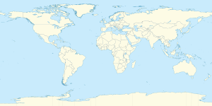
خط العرض 68° شمالاً

Line across the Earth
68°
خط العرض 68 شمال

خط العرض 68 شمالًا (إنگليزية: 68th parallel north) هي دائرة عرض بزاوية 68 درجة شمال خط الاستواء. تمر دائرة العرض 68° شمالاً عبر أفريقيا، المحيط الهندي، جنوب آسيا، جنوب شرق آسيا، المحيط الهادي، أمريكا الوسطى، امريكا الجنوبية والمحيط الأطلسي.

عند خط العرض هذا، تكون الشمس مرئية لمدة 24 ساعة ، 0 دقيقةة أثناء الانقلاب الصيفي، والشفق المدني أثناء الانقلاب الشتوي

. . . . . . . . . . . . . . . . . . . . . . . . . . . . . . . . . . . . . . . . . . . . . . . . . . . . . . . . . . . . . . . . . . . . . . . . . . . . . . . . . . . . . . . . . . . . . . . . . . . . . . . . . . . . . . . . . . . . . . . . . . . . . . . . . . . . . . . . . . . . . . . . . . . . . . . . . . . . . . . . . . . . . . . .

حول العالم

بدءاً من خط الزوال الرئيسي، في الاتجاه الشرقي، يمر خط العرض 68° شمالاً عبر:

الإحداثيات البلد أو الإقليم أو البحر ملاحظات
68°0′N 0°0′E / 68.000°N 0.000°E / 68.000; 0.000 (Prime Meridian) Atlantic Ocean Norwegian Sea
68°0′N 13°0′E / 68.000°N 13.000°E / 68.000; 13.000 (Norway) Flag of Norway.svg نرويج Moskenesøya, Lofoten, Nordland
68°0′N 13°17′E / 68.000°N 13.283°E / 68.000; 13.283 (Vestfjord) Atlantic Ocean Vestfjorden, Norwegian Sea
68°0′N 15°4′E / 68.000°N 15.067°E / 68.000; 15.067 (Norway) Flag of Norway.svg نرويج Engeløya, Nordland
68°0′N 15°7′E / 68.000°N 15.117°E / 68.000; 15.117 (Vestfjord) Atlantic Ocean Skagstadsundet, Norwegian Sea
68°0′N 15°4′E / 68.000°N 15.067°E / 68.000; 15.067 (Norway) Flag of Norway.svg نرويج Lundøya and Finnøya, and the mainland Nordland
68°0′N 13°17′E / 68.000°N 13.283°E / 68.000; 13.283 (Vestfjord) Atlantic Ocean Vestfjorden, Norwegian Sea
68°0′N 15°4′E / 68.000°N 15.067°E / 68.000; 15.067 (Norway) Flag of Norway.svg نرويج Engeløya, Lundøya and Finnøya, and the mainland Nordland
68°0′N 13°17′E / 68.000°N 13.283°E / 68.000; 13.283 (Vestfjord) Atlantic Ocean Vestfjorden, Norwegian Sea
68°0′N 15°6′E / 68.000°N 15.100°E / 68.000; 15.100 (Norway) Flag of Norway.svg نرويج Islands of Engeløya, Lundøya and Finnøya, and the mainland Nordland
68°0′N 17°1′E / 68.000°N 17.017°E / 68.000; 17.017 (Sweden) Flag of Sweden.svg السويد Norrbotten County (Lapland province)
68°0′N 17°48′E / 68.000°N 17.800°E / 68.000; 17.800 (Norway) Flag of Norway.svg نرويج Nordland, for about 5,8 km
68°0′N 17°56′E / 68.000°N 17.933°E / 68.000; 17.933 (Sweden) Flag of Sweden.svg السويد Norrbotten County (Lapland and Norrbotten provinces)
68°0′N 23°33′E / 68.000°N 23.550°E / 68.000; 23.550 (Finland) Flag of Finland.svg فنلندا Lapland
68°0′N 29°25′E / 68.000°N 29.417°E / 68.000; 29.417 (Russia) Flag of Russia.svg روسيا Kola Peninsula, Murmansk Oblast
68°0′N 39°58′E / 68.000°N 39.967°E / 68.000; 39.967 (White Sea) Arctic Ocean White Sea
68°0′N 44°14′E / 68.000°N 44.233°E / 68.000; 44.233 (Russia) Flag of Russia.svg روسيا Kanin Peninsula, Nenets Autonomous Okrug
68°0′N 46°33′E / 68.000°N 46.550°E / 68.000; 46.550 (Barents Sea) Arctic Ocean Barents Sea
68°0′N 49°43′E / 68.000°N 49.717°E / 68.000; 49.717 (Russia) Flag of Russia.svg روسيا Nenets Autonomous Okrug
Komi Republic
Yamalo-Nenets Autonomous Okrug
68°0′N 73°6′E / 68.000°N 73.100°E / 68.000; 73.100 (Gulf of Ob) Arctic Ocean Gulf of Ob, Kara Sea
68°0′N 74°48′E / 68.000°N 74.800°E / 68.000; 74.800 (Russia) Flag of Russia.svg روسيا Yamalo-Nenets Autonomous Okrug
68°0′N 77°12′E / 68.000°N 77.200°E / 68.000; 77.200 (Taz Estuary) Arctic Ocean Taz Estuary, Kara Sea
68°0′N 77°30′E / 68.000°N 77.500°E / 68.000; 77.500 (Russia) Flag of Russia.svg روسيا Yamalo-Nenets Autonomous Okrug
Krasnoyarsk Krai
Yakutia
Chukotka Autonomous Okrug
68°0′N 176°31′W / 68.000°N 176.517°W / 68.000; -176.517 (Chukchi Sea) Arctic Ocean Chukchi Sea
68°0′N 165°15′W / 68.000°N 165.250°W / 68.000; -165.250 (United States)  الولايات المتحدة Alaska
68°0′N 141°0′W / 68.000°N 141.000°W / 68.000; -141.000 (Canada) Flag of Canada.svg كندا Yukon
Northwest Territories
Nunavut
68°0′N 115°7′W / 68.000°N 115.117°W / 68.000; -115.117 (Coronation Gulf) Arctic Ocean Coronation Gulf
Passing just north of the Couper, Berens and Lawford Islands
Passing just north of Hepburn Island
Passing just south of the Jameson Islands
68°0′N 110°9′W / 68.000°N 110.150°W / 68.000; -110.150 (Canada) Flag of Canada.svg كندا Nunavut
68°0′N 110°0′W / 68.000°N 110.000°W / 68.000; -110.000 (Bathurst Inlet) Arctic Ocean Bathurst Inlet
68°0′N 109°26′W / 68.000°N 109.433°W / 68.000; -109.433 (Canada) Flag of Canada.svg كندا Nunavut - Chapman Islands
68°0′N 109°0′W / 68.000°N 109.000°W / 68.000; -109.000 (Bathurst Inlet) Arctic Ocean Bathurst Inlet
Passing just north of Lewes Island
Fishers Island
68°0′N 107°53′W / 68.000°N 107.883°W / 68.000; -107.883 (Canada) Flag of Canada.svg كندا Nunavut
68°0′N 103°17′W / 68.000°N 103.283°W / 68.000; -103.283 (Queen Maud Gulf) Arctic Ocean Queen Maud Gulf
68°0′N 98°59′W / 68.000°N 98.983°W / 68.000; -98.983 (Canada) Flag of Canada.svg كندا Nunavut - O'Reilly Island, Klutschak Peninsula and Adelaide Peninsula
68°0′N 96°6′W / 68.000°N 96.100°W / 68.000; -96.100 (Chantrey Inlet) Arctic Ocean Chantrey Inlet
68°0′N 95°25′W / 68.000°N 95.417°W / 68.000; -95.417 (Canada) Flag of Canada.svg كندا Nunavut
68°0′N 88°20′W / 68.000°N 88.333°W / 68.000; -88.333 (Committee Bay) Arctic Ocean Committee Bay
68°0′N 86°48′W / 68.000°N 86.800°W / 68.000; -86.800 (Canada) Flag of Canada.svg كندا Nunavut - Wales Island and Melville Peninsula
68°0′N 82°9′W / 68.000°N 82.150°W / 68.000; -82.150 (Foxe Basin) Arctic Ocean Foxe Basin
68°0′N 77°2′W / 68.000°N 77.033°W / 68.000; -77.033 (Canada) Flag of Canada.svg كندا Nunavut - Prince Charles Island, Air Force Island and Baffin Island
68°0′N 64°46′W / 68.000°N 64.767°W / 68.000; -64.767 (Davis Strait) Arctic Ocean Davis Strait
68°0′N 50°20′W / 68.000°N 50.333°W / 68.000; -50.333 (Greenland) Flag of Greenland.svg گرينلاند Avannaata
Sermersooq
68°0′N 31°49′W / 68.000°N 31.817°W / 68.000; -31.817 (Atlantic Ocean) Atlantic Ocean Greenland Sea
Norwegian Sea


انظر ايضا