خط العرض 65° شمالاً

Line across the Earth
65°
خط العرض 65 شمال

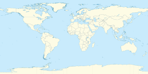
خط العرض 65 شمالًا (إنگليزية: 64th parallel north) هي دائرة عرض بزاوية 65 درجة شمال خط الاستواء. تمر دائرة العرض 65° شمالاً عبر أفريقيا، المحيط الهندي، جنوب آسيا، جنوب شرق آسيا، المحيط الهادي، أمريكا الوسطى، امريكا الجنوبية والمحيط الأطلسي.

عند خط العرض هذا، تكون الشمس مرئية لمدة 22 ساعة و 4 دقائق أثناء الانقلاب الصيفي، و3 ساعات و 35 دقيقة أثناء الانقلاب الشتوي

. . . . . . . . . . . . . . . . . . . . . . . . . . . . . . . . . . . . . . . . . . . . . . . . . . . . . . . . . . . . . . . . . . . . . . . . . . . . . . . . . . . . . . . . . . . . . . . . . . . . . . . . . . . . . . . . . . . . . . . . . . . . . . . . . . . . . . . . . . . . . . . . . . . . . . . . . . . . . . . . . . . . . . . .

حول العالم

بدءاً من خط الزوال الرئيسي، في الاتجاه الشرقي، يمر خط العرض 65° شمالاً عبر:
الإحداثيات البلد أو الإقليم أو البحر ملاحظات
65°0′N 0°0′E / 65.000°N 0.000°E / 65.000; 0.000 (Prime Meridian) Atlantic Ocean Norwegian Sea
65°0′N 10°49′E / 65.000°N 10.817°E / 65.000; 10.817 (Norway) Flag of Norway.svg نرويج Islands and skerries of Vikna, Trøndelag
65°0′N 11°9′E / 65.000°N 11.150°E / 65.000; 11.150 (Prime Meridian) Atlantic Ocean Risværfjorden, Norwegian Sea
65°0′N 11°37′E / 65.000°N 11.617°E / 65.000; 11.617 (Norway) Flag of Norway.svg نرويج Mainland Trøndelag
65°0′N 11°47′E / 65.000°N 11.783°E / 65.000; 11.783 (Prime Meridian) Atlantic Ocean Årsetfjorden, Lekafjorden, Norwegian Sea
65°0′N 11°48′E / 65.000°N 11.800°E / 65.000; 11.800 (Norway) Flag of Norway.svg نرويج Trøndelag, Nordland
65°0′N 20°03′E / 65.000°N 20.050°E / 65.000; 20.050 (Sweden) Flag of Sweden.svg السويد Jörn, Västerbotten County
65°0′N 21°23′E / 65.000°N 21.383°E / 65.000; 21.383 (Baltic Sea) Atlantic Ocean Gulf of Bothnia, Baltic Sea
65°0′N 24°34′E / 65.000°N 24.567°E / 65.000; 24.567 (Finland) Flag of Finland.svg فنلندا Island of Hailuoto and mainland, passing south of Oulu.
65°0′N 29°36′E / 65.000°N 29.600°E / 65.000; 29.600 (Russia) Flag of Russia.svg روسيا
65°0′N 34°48′E / 65.000°N 34.800°E / 65.000; 34.800 (White Sea) Arctic Ocean Onega Bay, White Sea, Barents Sea
65°0′N 35°42′E / 65.000°N 35.700°E / 65.000; 35.700 (Russia) Flag of Russia.svg روسيا Solovetsky Islands
65°0′N 35°51′E / 65.000°N 35.850°E / 65.000; 35.850 (White Sea) Arctic Ocean Onega Bay, White Sea, Barents Sea
65°0′N 36°48′E / 65.000°N 36.800°E / 65.000; 36.800 (Russia) Flag of Russia.svg روسيا Onega Peninsula
65°0′N 37°43′E / 65.000°N 37.717°E / 65.000; 37.717 (White Sea) Arctic Ocean Dvina Bay, White Sea, Barents Sea
65°0′N 40°19′E / 65.000°N 40.317°E / 65.000; 40.317 (Russia) Flag of Russia.svg روسيا
65°0′N 179°53′E / 65.000°N 179.883°E / 65.000; 179.883 (Bering Sea) Pacific Ocean Gulf of Anadyr, Bering Sea
65°0′N 175°52′W / 65.000°N 175.867°W / 65.000; -175.867 (Russia) Flag of Russia.svg روسيا Chukchi Peninsula
65°0′N 172°13′W / 65.000°N 172.217°W / 65.000; -172.217 (Bering Strait) Pacific Ocean Bering Strait, Bering Sea
Passing just north of King Island, Alaska,  الولايات المتحدة
65°0′N 166°41′W / 65.000°N 166.683°W / 65.000; -166.683 (United States)  الولايات المتحدة Alaska
65°0′N 141°0′W / 65.000°N 141.000°W / 65.000; -141.000 (Canada) Flag of Canada.svg كندا Yukon
Northwest Territories – passing through Great Bear Lake
Nunavut
65°0′N 87°7′W / 65.000°N 87.117°W / 65.000; -87.117 (Roes Welcome Sound) Arctic Ocean Roes Welcome Sound, Hudson Bay
65°0′N 86°12′W / 65.000°N 86.200°W / 65.000; -86.200 (Canada) Flag of Canada.svg كندا NunavutSouthampton Island
65°0′N 83°17′W / 65.000°N 83.283°W / 65.000; -83.283 (Foxe Basin) Arctic Ocean Foxe Basin
65°0′N 78°3′W / 65.000°N 78.050°W / 65.000; -78.050 (Canada) Flag of Canada.svg كندا NunavutBaffin Island
65°0′N 66°30′W / 65.000°N 66.500°W / 65.000; -66.500 (Cumberland Sound) Arctic Ocean Cumberland Sound, Labrador Sea
65°0′N 63°49′W / 65.000°N 63.817°W / 65.000; -63.817 (Canada) Flag of Canada.svg كندا NunavutCumberland Peninsula, Baffin Island
65°0′N 63°27′W / 65.000°N 63.450°W / 65.000; -63.450 (Davis Strait) Arctic Ocean Davis Strait
65°0′N 51°48′W / 65.000°N 51.800°W / 65.000; -51.800 (Greenland) Flag of Greenland.svg گرينلاند Fiskevandet
65°0′N 40°36′W / 65.000°N 40.600°W / 65.000; -40.600 (Pikiulleq) Atlantic Ocean Pikiulleq, Denmark Strait
65°0′N 39°46′W / 65.000°N 39.767°W / 65.000; -39.767 (Greenland) Flag of Greenland.svg گرينلاند Takiseeq
65°0′N 39°47′W / 65.000°N 39.783°W / 65.000; -39.783 (Atlantic Ocean) Atlantic Ocean Denmark Strait
65°0′N 23°14′W / 65.000°N 23.233°W / 65.000; -23.233 (Iceland) Flag of Iceland.svg آيسلندا
65°0′N 13°36′W / 65.000°N 13.600°W / 65.000; -13.600 (Atlantic Ocean) Atlantic Ocean Norwegian Sea


انظر ايضا

المصادر