خط العرض 55° شمالاً

Line across the Earth
55°
خط العرض 55 شمال

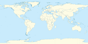
خط العرض 55 شمالًا (إنگليزية: 55th parallel north) هي دائرة عرض بزاوية 55 درجة شمال خط الاستواء. تمر دائرة العرض 55° شمالاً عبر أفريقيا، المحيط الهندي، جنوب آسيا، جنوب شرق آسيا، المحيط الهادي، أمريكا الوسطى، امريكا الجنوبية والمحيط الأطلسي.

عند خط العرض هذا، تكون الشمس مرئية لمدة 17 ساعة و 22 دقيقة أثناء الانقلاب الصيفي، و7 ساعات و 10 دقائق أثناء الانقلاب الشتوي .[1]

. . . . . . . . . . . . . . . . . . . . . . . . . . . . . . . . . . . . . . . . . . . . . . . . . . . . . . . . . . . . . . . . . . . . . . . . . . . . . . . . . . . . . . . . . . . . . . . . . . . . . . . . . . . . . . . . . . . . . . . . . . . . . . . . . . . . . . . . . . . . . . . . . . . . . . . . . . . . . . . . . . . . . . . .

حول العالم

بدءاً من خط الزوال الرئيسي، في الاتجاه الشرقي، يمر خط العرض 55° شمالاً عبر:

الإحداثيات البلد أو الإقليم أو البحر ملاحظات
55°0′N 0°0′E / 55.000°N 0.000°E / 55.000; 0.000 (Prime Meridian) North Sea
55°0′N 8°21′E / 55.000°N 8.350°E / 55.000; 8.350 (Germany) Flag of Germany.svg ألمانيا Island of Sylt, close to Germany's northernmost point
55°0′N 8°23′E / 55.000°N 8.383°E / 55.000; 8.383 (Wadden Sea) Wadden Sea
55°0′N 8°39′E / 55.000°N 8.650°E / 55.000; 8.650 (Denmark) Flag of Denmark.svg الدنمارك Jutland (mainland) and the island of Als
55°0′N 9°58′E / 55.000°N 9.967°E / 55.000; 9.967 (Little Belt) Little Belt
55°0′N 10°27′E / 55.000°N 10.450°E / 55.000; 10.450 (Denmark) Flag of Denmark.svg الدنمارك Islands of Skarø, Tåsinge and Langeland
55°0′N 10°54′E / 55.000°N 10.900°E / 55.000; 10.900 (Great Belt) Great Belt
55°0′N 11°5′E / 55.000°N 11.083°E / 55.000; 11.083 (Smålandsfarvandet) Smålandsfarvandet
55°0′N 11°53′E / 55.000°N 11.883°E / 55.000; 11.883 (Denmark) Flag of Denmark.svg الدنمارك Islands of Sjælland and Møn
55°0′N 12°32′E / 55.000°N 12.533°E / 55.000; 12.533 (Baltic Sea) Baltic Sea
55°0′N 14°59′E / 55.000°N 14.983°E / 55.000; 14.983 (Denmark) Flag of Denmark.svg الدنمارك Island of Bornholm. There is a small memorial at 55°N 15°E / 55°N 15°E / 55; 15
55°0′N 15°6′E / 55.000°N 15.100°E / 55.000; 15.100 (Baltic Sea) Baltic Sea
55°0′N 20°33′E / 55.000°N 20.550°E / 55.000; 20.550 (Russia) Flag of Russia.svg روسيا Kaliningrad Oblast - passing through the Curonian Lagoon
55°0′N 22°38′E / 55.000°N 22.633°E / 55.000; 22.633 (Lithuania) Flag of Lithuania.svg لتوانيا Marijampolė County
55°0′N 26°13′E / 55.000°N 26.217°E / 55.000; 26.217 (Belarus) Flag of Belarus.svg بلاروس Vitebsk Region
55°0′N 30°58′E / 55.000°N 30.967°E / 55.000; 30.967 (Russia) Flag of Russia.svg روسيا Smolensk Oblast
55°0′N 68°12′E / 55.000°N 68.200°E / 55.000; 68.200 (Kazakhstan) كازاخستان كازاخستان North Kazakhstan Region
55°0′N 71°1′E / 55.000°N 71.017°E / 55.000; 71.017 (Russia) Flag of Russia.svg روسيا Passing just north of Omsk at 54°59′N 73°22′E / 54.983°N 73.367°E / 54.983; 73.367 (Omsk)
Passing just south of Novosibirsk at 55°3′N 82°57′E / 55.050°N 82.950°E / 55.050; 82.950 (Omsk)
55°0′N 135°24′E / 55.000°N 135.400°E / 55.000; 135.400 (Sea of Okhotsk) Sea of Okhotsk
55°0′N 136°47′E / 55.000°N 136.783°E / 55.000; 136.783 (Russia) Flag of Russia.svg روسيا Feklistova Island
55°0′N 137°4′E / 55.000°N 137.067°E / 55.000; 137.067 (Sea of Okhotsk) Sea of Okhotsk
55°0′N 137°26′E / 55.000°N 137.433°E / 55.000; 137.433 (Russia) Flag of Russia.svg روسيا Bolshoy Shantar Island
55°0′N 138°11′E / 55.000°N 138.183°E / 55.000; 138.183 (Sea of Okhotsk) Sea of Okhotsk
55°0′N 155°35′E / 55.000°N 155.583°E / 55.000; 155.583 (Russia) Flag of Russia.svg روسيا Kamchatka Peninsula
55°0′N 161°59′E / 55.000°N 161.983°E / 55.000; 161.983 (Pacific Ocean) Pacific Ocean
55°0′N 166°8′E / 55.000°N 166.133°E / 55.000; 166.133 (Russia) Flag of Russia.svg روسيا Bering Island
55°0′N 166°23′E / 55.000°N 166.383°E / 55.000; 166.383 (Bering Sea) Bering Sea Passing just north of Medny Island, Flag of Russia.svg روسيا
55°0′N 163°57′W / 55.000°N 163.950°W / 55.000; -163.950 (United States)  الولايات المتحدة Alaska - Unimak Island and the Alaska Peninsula
55°0′N 162°34′W / 55.000°N 162.567°W / 55.000; -162.567 (Pacific Ocean) Pacific Ocean Gulf of Alaska - passing just south of Dolgoi Island and Unga Island, Alaska,  الولايات المتحدة
55°0′N 160°8′W / 55.000°N 160.133°W / 55.000; -160.133 (United States)  الولايات المتحدة Alaska - Nagai Island
55°0′N 160°4′W / 55.000°N 160.067°W / 55.000; -160.067 (Pacific Ocean) Pacific Ocean Gulf of Alaska
55°0′N 159°25′W / 55.000°N 159.417°W / 55.000; -159.417 (United States)  الولايات المتحدة Alaska - Little Koniuji Island
55°0′N 159°21′W / 55.000°N 159.350°W / 55.000; -159.350 (Pacific Ocean) Pacific Ocean Gulf of Alaska
55°0′N 133°9′W / 55.000°N 133.150°W / 55.000; -133.150 (United States)  الولايات المتحدة Alaska - Dall Island, Sukkwan Island and Prince of Wales Island
55°0′N 131°59′W / 55.000°N 131.983°W / 55.000; -131.983 (Clarence Strait) Clarence Strait
55°0′N 131°36′W / 55.000°N 131.600°W / 55.000; -131.600 (United States)  الولايات المتحدة Alaska - Annette Island and Duke Island
55°0′N 131°15′W / 55.000°N 131.250°W / 55.000; -131.250 (Revillagigedo Channel) Revillagigedo Channel
55°0′N 131°0′W / 55.000°N 131.000°W / 55.000; -131.000 (United States)  الولايات المتحدة Alaska - Alaska Panhandle
55°0′N 130°15′W / 55.000°N 130.250°W / 55.000; -130.250 (Canada) Flag of Canada.svg كندا British Columbia - Pearse Island and the mainland
Alberta
Saskatchewan
Manitoba
Ontario
55°0′N 82°16′W / 55.000°N 82.267°W / 55.000; -82.267 (Hudson Bay) Hudson Bay
55°0′N 78°28′W / 55.000°N 78.467°W / 55.000; -78.467 (Canada) Flag of Canada.svg كندا Quebec
Newfoundland and Labrador - for about 12 km
Quebec
Newfoundland and Labrador - for about 5 km
Quebec - for about 3 km
Newfoundland and Labrador
Quebec
Newfoundland and Labrador - mainland and the Adlavik Islands
55°0′N 58°40′W / 55.000°N 58.667°W / 55.000; -58.667 (Atlantic Ocean) Atlantic Ocean
55°0′N 8°33′W / 55.000°N 8.550°W / 55.000; -8.550 (Ireland) Flag of Ireland.svg أيرلندا Island of Arranmore and mainland
55°0′N 7°24′W / 55.000°N 7.400°W / 55.000; -7.400 (United Kingdom) Flag of the United Kingdom.png المملكة المتحدة Northern Ireland (passing through the city of Derry)
55°0′N 5°59′W / 55.000°N 5.983°W / 55.000; -5.983 (North Channel) North Channel
55°0′N 5°10′W / 55.000°N 5.167°W / 55.000; -5.167 (United Kingdom) Flag of the United Kingdom.png المملكة المتحدة Scotland (passing through Gretna)
England (passing through the Newcastle upon Tyne urban area)
55°0′N 1°25′W / 55.000°N 1.417°W / 55.000; -1.417 (North Sea) North Sea


المدن والبلدات البارزة عند 55 درجة شمالاً

استخدم كحد

خط العرض 55 يمثل الحد الجنوبي لإقليم نونافيك في كيبيك.

انظر ايضا

المصادر

  1. ^ "Duration of Daylight/Darkness Table for One Year". U.S. Naval Observatory. 24 سبتمبر 2019. Archived from the original on 12 أكتوبر 2019. Retrieved 10 مارس 2021.

قالب:سلطة التحكم