مقاطعة سكنكتادي، نيويورك
مقاطعة سكنكتادي | |
|---|---|
 | |
 Flag  الشعار | |
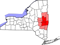
 الموقع ضمن ولاية نيويورك | |
 موقع نيويورك ضمن الولايات المتحدة | |
| البلد | |
| State | |
| تأسست | 1809 |
| Seat | سكنكتادي |
| أكبر مدينة | سكنكتادي |
| Area | |
• Total | 209 ميل² (540 كم²) |
| • Land | 205 ميل² (530 كم²) |
| • Water | 4٫9 ميل² (13 كم²) 2.3% |
| Population | |
• Estimate (2018) | 155٬350[1] |
| • Density | 759/sq mi (293/km2) |
| Time zone | UTC−5 (Eastern) |
| • Summer (DST) | UTC−4 (EDT) |
| Congressional district | 20th |
| Website | www |
مقاطعة سكنكتادي (Schenectady County ؛ /skəˈnɛktədi/) هي مقاطعة تقع في ولاية نيويورك. وحسب تعداد 2010، فإن تعداد المقاطعة هو 154,727 نسمة.[2] مقر المقاطعة هو سكنكتادي.[3] الاسم هو كلمة في لغة الموهك تعني "على الجانب الآخر من أراضي الصنوبر"، وهو تعبير كان يُطلق في الأصل على ألباني.
مقاطعة سكنكتادي هي جزء من ألباني-سكنكتادي-تروي، نيويورك المنطقة الإحصائية العمرانية، وتقع غرب التقاء الموهك مع نهر هدسون. وتضم أراضي على الجانبين الشمالي والجنوبي لنهر الموهك.
التاريخ
This area of the river valley was historically occupied by the Mohawk people, the easternmost of the Five Nations comprising the Iroquois Confederacy or Haudenosaunee. They cultivated maize fields in the flats along the Mohawk River and had villages in the hills.
الجغرافيا
According to the U.S. Census Bureau, the county has a total area of 209 ميل مربع (540 km2), of which 205 ميل مربع (530 km2) is land and 4.9 ميل مربع (13 km2) (2.3%) is water.[4]
Schenectady County is located in east central New York State, northwest of Albany, an area usually considered "Upstate".
المقاطعات المجاورة
- مقاطعة ساراتوگا - شمال شرق
- مقاطعة ألباني - جنوب شرق
- Schoharie County - جنوب غرب
- مقاطعة مونتگمري - غرب
الديمغرافيا
| التعداد | Pop. | ملاحظة | %± |
|---|---|---|---|
| 1810 | 10٬201 | — | |
| 1820 | 13٬081 | 28٫2% | |
| 1830 | 12٬347 | −5٫6% | |
| 1840 | 17٬387 | 40٫8% | |
| 1850 | 20٬054 | 15٫3% | |
| 1860 | 20٬002 | −0٫3% | |
| 1870 | 21٬347 | 6٫7% | |
| 1880 | 23٬538 | 10٫3% | |
| 1890 | 29٬797 | 26٫6% | |
| 1900 | 46٬852 | 57٫2% | |
| 1910 | 88٬235 | 88٫3% | |
| 1920 | 109٬363 | 23٫9% | |
| 1930 | 125٬021 | 14٫3% | |
| 1940 | 122٬494 | −2�0% | |
| 1950 | 142٬497 | 16٫3% | |
| 1960 | 152٬896 | 7٫3% | |
| 1970 | 160٬979 | 5٫3% | |
| 1980 | 149٬946 | −6٫9% | |
| 1990 | 149٬285 | −0٫4% | |
| 2000 | 146٬555 | −1٫8% | |
| 2010 | 154٬727 | 5٫6% | |
| 2018 (تق.) | 155٬350 | [5] | 0٫4% |
| U.S. Decennial Census[6] 1790-1960[7] 1900-1990[8] 1990-2000[9] 2010-2013[2] | |||
الحكومة والسياسة
| السنة | الجمهوريون | الديمقراطيون | الأحزاب الثالثة |
|---|---|---|---|
| 2016 | 43.0% 28,953 | 50.2% 33,747 | 6.8% 4,580 |
| 2012 | 40.9% 26,568 | 56.7% 36,844 | 2.3% 1,521 |
| 2008 | 42.6% 29,758 | 55.3% 38,611 | 2.1% 1,473 |
| 2004 | 46.2% 32,066 | 51.8% 35,971 | 2.1% 1,432 |
| 2000 | 41.8% 27,961 | 53.1% 35,534 | 5.2% 3,459 |
| 1996 | 33.1% 22,106 | 53.1% 35,404 | 13.8% 9,199 |
| 1992 | 35.6% 26,258 | 43.8% 32,335 | 20.7% 15,277 |
| 1988 | 47.4% 33,364 | 51.8% 36,483 | 0.8% 539 |
| 1984 | 58.1% 42,808 | 41.5% 30,612 | 0.4% 277 |
| 1980 | 45.4% 32,003 | 42.4% 29,932 | 12.2% 8,599 |
| 1976 | 54.6% 40,789 | 42.6% 31,838 | 2.8% 2,105 |
| 1972 | 61.5% 47,529 | 38.3% 29,619 | 0.3% 191 |
| 1968 | 46.8% 33,687 | 48.3% 34,786 | 4.9% 3,529 |
| 1964 | 29.6% 21,848 | 70.3% 51,892 | 0.1% 80 |
| 1960 | 52.0% 40,180 | 47.9% 37,003 | 0.1% 70 |
| 1956 | 73.0% 58,540 | 27.0% 21,673 | 0.0% 0 |
| 1952 | 66.5% 54,272 | 33.3% 27,157 | 0.3% 208 |
| 1948 | 52.6% 35,495 | 41.8% 28,225 | 5.6% 3,765 |
| 1944 | 51.1% 35,178 | 48.5% 33,397 | 0.4% 294 |
| 1940 | 51.3% 34,101 | 48.2% 32,041 | 0.5% 334 |
| 1936 | 45.3% 26,914 | 52.2% 31,027 | 2.5% 1,466 |
| 1932 | 52.8% 28,187 | 41.7% 22,230 | 5.5% 2,954 |
| 1928 | 56.6% 29,428 | 40.9% 21,277 | 2.5% 1,304 |
| 1924 | 61.8% 24,514 | 23.1% 9,167 | 15.2% 6,018 |
| 1920 | 57.2% 19,208 | 26.0% 8,741 | 16.8% 5,633 |
| 1916 | 47.5% 9,759 | 43.6% 8,962 | 9.0% 1,845 |
| 1912 | 30.7% 5,230 | 31.4% 5,345 | 37.9% 6,452[11] |
| 1908 | 52.7% 9,944 | 37.8% 7,129 | 9.5% 1,789 |
| 1904 | 57.7% 9,535 | 36.2% 5,981 | 6.1% 999 |
| 1900 | 56.5% 6,769 | 39.9% 4,783 | 3.6% 432 |
| 1896 | 55.1% 4,903 | 41.7% 3,711 | 3.3% 293 |
| 1892 | 43.2% 3,481 | 50.7% 4,081 | 6.1% 493 |
| 1888 | 51.0% 3,633 | 46.8% 3,328 | 2.2% 158 |
| 1884 | 51.1% 3,260 | 46.6% 2,977 | 2.3% 146 |
Voters in Schenectady County have typically leaned Democratic since the mid-20th century. They have given small to moderate leads to Democrats since 1988 in presidential elections. The congressman Paul Tonko is a Democrat. Legislative authority is vested in the County Legislature, which consists of 15 members representing 8 communities, separated into four districts. The current composition of the Legislature is as follows (10 Democrats, 2 Republicans, and 3 Conservatives who caucus with the Democrats):
District 1 - سكنكتادي:
- Karen B. Johnson (D), Vice Chair
- Richard Patierne (D)
- Richard Ruzzo (D)
District 2 - سكنكتادي:
- Philip Fields (D), Deputy Chair
- Gary Hughes (D), Majority Leader
- Jeffrey M. McDonald (D)
District 3 - Glenville, Niskayuna, and Scotia:
- James Buhrmaster (R), Minority Leader
- Thomas Constantine (D)
- Rory Fluman (D)
- Cathy Gatta (D)
- Grant Socha (C)
District 4 - Duanesburg, Princetown, and Rotterdam:
- Anthony Jasenski (D), Chair
- Brian McGarry (R)
- Randy Pascarella (C)
- Holly Vellano (C)
حكومة المقاطعة
Schenectady County was governed by an elected Board of Supervisors until 1966, after voters approved a new county charter under New York's home rule law.
On January 2, 1966 a Board of Representatives replaced the county supervisors. In 1987, a 15-member legislature replaced the Board of Representatives. The legislature hires a county manager to oversee day-to-day government operations.
| الاسم | المدة |
|---|---|
| Theodore Birbilis | January 2, 1966 – December 31, 1967 |
| Robert W. Williams | January 1, 1968 – June 30, 1968 (مؤقت) |
| Carl F. Sanford | July 1, 1968 – November 30, 1977 |
| Robert D. McEvoy | 1978 – December 31, 2000 |
| George A. Davidson | January 1, 2001 – February 10, 2002 (مؤقت) |
| Kevin D. DeFebbo | February 11, 2002 – December 31, 2005 |
| Kathleen A. Rooney | January 1, 2006 – June 6, 2019 |
| Dr. Rory L. Fluman | June 7, 2019 – الحاضر |
خدمات المقاطعة
The county operates the Schenectady County Public Library (SCPL), which consists of a central library and eight branches. http://www.scpl.org
التجمعات
المدينة
- سكنكتادي (مقر المقاطعة)
البلدات
القرى
Census-designated places
Hamlets
انظر أيضاً
- قائمة المقاطعات في نيويورك
- National Register of Historic Places listings in Schenectady County, New York
المراجع
- ^ Bureau, U.S. Census. "American FactFinder - Community Facts". factfinder.census.gov.
- ^ أ ب "State & County QuickFacts". United States Census Bureau. Retrieved October 13, 2013.
- ^ "Find a County". National Association of Counties. Retrieved 2011-06-07.
- ^ "2010 Census Gazetteer Files". United States Census Bureau. August 22, 2012. Archived from the original on May 19, 2014. Retrieved January 7, 2015.
- ^ "Population and Housing Unit Estimates". Retrieved December 20, 2019.
- ^ "U.S. Decennial Census". United States Census Bureau. Retrieved January 7, 2015.
- ^ "Historical Census Browser". University of Virginia Library. Retrieved January 7, 2015.
- ^ "Population of Counties by Decennial Census: 1900 to 1990". United States Census Bureau. Retrieved January 7, 2015.
- ^ "Census 2000 PHC-T-4. Ranking Tables for Counties: 1990 and 2000" (PDF). United States Census Bureau. Retrieved January 7, 2015.
- ^ Leip, David. "Dave Leip's Atlas of U.S. Presidential Elections". uselectionatlas.org.
- ^ There were only 3,456 votes for the leading "other" candidate, Socialist Eugene Debs, plus 2,640 for Progressive Theodore Roosevelt, 245 for the Prohibition Party's Eugene Chafin, and 111 for Socialist Labor candidate Arthur Reimer.
للاستزادة
- Yates, Austin A. (1902). Schenectady County, New York: Its History to the Close of the Nineteenth Century. the New York History Company., selected chapters available online in transcribed version, including one on genealogy
- Lockhart, Charlotte (1921). Family Bible Records of Schenectady County. Unknown.
وصلات خارجية

|
مقاطعة ساراتوگا | Montgomery County |
| |
| مقاطعة ألباني | Schoharie County |
بلديات ومجتمعات Schenectady County، New York، الولايات المتحدة | ||
|---|---|---|
| City |  | |
| Towns | ||
| Villages | ||
| CDPs | ||
| Other hamlets | ||