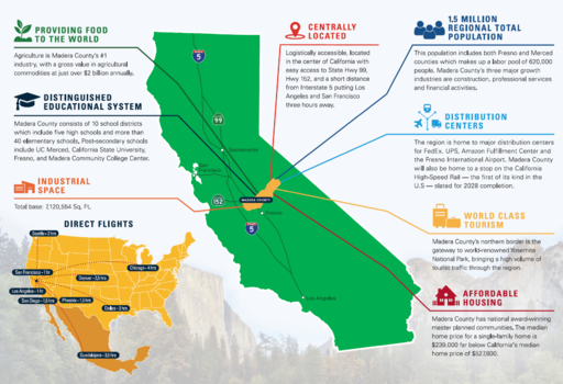
مقاطعة ماديرا، كاليفورنيا
Madera County, California | |
|---|---|
| County of Madera | |
|
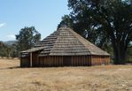
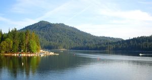
Images, from top down, left to right: Wassama Round House State Historic Park, Devils Postpile National Monument, Fresno Dome, Banner Peak above Thousand Island Lake, Bass Lake | |
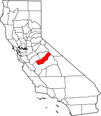 Location in the state of California | |
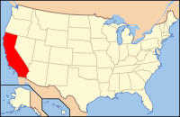 California's location in the United States | |
| Country | |
| State | |
| Regions | San Joaquin Valley, Sierra Nevada |
| Metropolitan area | Metropolitan Fresno |
| Incorporated | 1893 |
| السمِيْ | Spanish word meaning "wood" |
| County seat | Madera |
| Largest city | Madera |
| المساحة | |
| • الإجمالي | 2٬153 ميل² (5٬580 كم²) |
| • البر | 2٬137 ميل² (5٬530 كم²) |
| • الماء | 16 ميل² (40 كم²) |
| التعداد | |
| • الإجمالي | 150٬865 |
| • Estimate (2019)[2] | 157٬327 |
| • الكثافة | 70/sq mi (27/km2) |
| منطقة التوقيت | UTC−8 (Pacific Time Zone) |
| • الصيف (التوقيت الصيفي) | UTC−7 (Pacific Daylight Time) |
| FIPS code | 06-039 |
| GNIS feature ID | 277284 |
| الموقع الإلكتروني | www |
مقاطعة ماديرا إنگليزية: Madera County هي إحدى مقاطعات ولاية كاليفورنيا في الولايات المتحدة الأمريكية.
المناطق المحمية الوطنية
- Devils Postpile National Monument
- Inyo National Forest (part)
- Sierra National Forest (part)
- Yosemite National Park (part)
السكان
2011
| التعداد والأعراق والدخل | |||||
|---|---|---|---|---|---|
| Total population[3] | 149,611 | ||||
| White[3] | 121,045 | 80.9% | |||
| Black or African American[3] | 4,962 | 3.3% | |||
| American Indian or Alaska Native[3] | 2,541 | 1.7% | |||
| Asian[3] | 2,980 | 2.0% | |||
| Native Hawaiian or other Pacific Islander[3] | 755 | 0.5% | |||
| Some other race[3] | 12,152 | 8.1% | |||
| Two or more races[3] | 5,176 | 3.5% | |||
| Hispanic or Latino (of any race)[4] | 79,037 | 52.8% | |||
| Per capita income[5] | $18,817 | ||||
| Median household income[6] | $47,724 | ||||
| Median family income[7] | $51,658 | ||||
Places by population, race, and income
| Places by population and race | ||||||||
|---|---|---|---|---|---|---|---|---|
| Place | Type[8] | Population[3] | White[3] | Other[3] [note 1] |
Asian[3] | Black or African American[3] |
Native American[3] [note 2] |
Hispanic or Latino (of any race)[4] |
| Ahwahnee | CDP | 1,685 | 99.9% | 0.0% | 0.1% | 0.0% | 0.0% | 0.1% |
| Bass Lake | CDP | 473 | 96.6% | 0.0% | 0.0% | 0.0% | 3.4% | 3.4% |
| Bonadelle Ranchos-Madera Ranchos | CDP | 8,400 | 83.1% | 8.0% | 3.1% | 5.3% | 0.4% | 26.0% |
| Chowchilla | City | 18,465 | 68.1% | 14.3% | 2.5% | 10.2% | 5.0% | 36.7% |
| Coarsegold | CDP | 1,490 | 98.2% | 1.8% | 0.0% | 0.0% | 0.0% | 4.9% |
| Fairmead | CDP | 1,042 | 77.7% | 17.9% | 0.8% | 3.6% | 0.0% | 53.3% |
| La Vina | CDP | 788 | 100.0% | 0.0% | 0.0% | 0.0% | 0.0% | 100.0% |
| Madera | City | 60,221 | 80.2% | 12.7% | 2.9% | 3.0% | 1.3% | 74.9% |
| Madera Acres | CDP | 9,201 | 80.2% | 14.6% | 0.3% | 2.4% | 2.5% | 63.7% |
| Nipinnawasee | CDP | 644 | 90.1% | 9.9% | 0.0% | 0.0% | 0.0% | 7.1% |
| Oakhurst | CDP | 3,014 | 85.7% | 12.2% | 0.0% | 0.6% | 1.5% | 12.9% |
| Parksdale | CDP | 3,094 | 75.0% | 19.5% | 0.0% | 1.1% | 4.4% | 92.5% |
| Parkwood | CDP | 2,500 | 66.6% | 23.1% | 6.1% | 4.3% | 0.0% | 79.3% |
| Rolling Hills | CDP | 927 | 88.2% | 4.5% | 6.8% | 0.4% | 0.0% | 8.8% |
| Yosemite Lakes | CDP | 4,655 | 94.4% | 2.2% | 1.6% | 0.2% | 1.6% | 12.3% |
| Places by population and income | |||||
|---|---|---|---|---|---|
| Place | Type[8] | Population[9] | Per capita income[5] | Median household income[6] | Median family income[7] |
| Ahwahnee | CDP | 1,685 | $36,369 | $48,289 | $59,063 |
| Bass Lake | CDP | 473 | $53,315 | $77,857 | $78,839 |
| Bonadelle Ranchos-Madera Ranchos | CDP | 8,400 | $29,655 | $74,917 | $83,508 |
| Chowchilla | City | 18,465 | $12,612 | $41,858 | $47,283 |
| Coarsegold | CDP | 1,490 | $31,284 | $40,333 | $63,719 |
| Fairmead | CDP | 1,042 | $16,132 | $42,426 | $41,103 |
| La Vina | CDP | 788 | $7,404 | $27,917 | $28,333 |
| Madera | City | 60,221 | $14,685 | $41,991 | $43,584 |
| Madera Acres | CDP | 9,201 | $20,061 | $63,462 | $66,341 |
| Nipinnawasee | CDP | 644 | $23,104 | $43,083 | $63,447 |
| Oakhurst | CDP | 3,014 | $22,877 | $37,609 | $46,979 |
| Parksdale | CDP | 3,094 | $11,554 | $39,267 | $38,276 |
| Parkwood | CDP | 2,500 | $9,352 | $38,941 | $26,654 |
| Rolling Hills | CDP | 927 | $28,421 | $69,226 | $91,635 |
| Yosemite Lakes | CDP | 4,655 | $34,028 | $77,214 | $79,440 |
2010
| التعداد | Pop. | ملاحظة | %± |
|---|---|---|---|
| 1900 | 6٬364 | — | |
| 1910 | 8٬368 | 31٫5% | |
| 1920 | 12٬203 | 45٫8% | |
| 1930 | 17٬164 | 40٫7% | |
| 1940 | 23٬314 | 35٫8% | |
| 1950 | 36٬964 | 58٫5% | |
| 1960 | 40٬468 | 9٫5% | |
| 1970 | 41٬519 | 2٫6% | |
| 1980 | 63٬116 | 52�0% | |
| 1990 | 88٬090 | 39٫6% | |
| 2000 | 123٬109 | 39٫8% | |
| 2010 | 150٬865 | 22٫5% | |
| 2019 (تق.) | 157٬327 | [2] | 4٫3% |
| U.S. Decennial Census[10] 1790–1960[11] 1900–1990[12] 1990–2000[13] 2010–2015[1] | |||
| Population reported at 2010 United States Census | |||||||||
|---|---|---|---|---|---|---|---|---|---|
Population |
American |
American |
Islander |
races |
more races |
or Latino (of any race) | |||
| Madera County | 150,865 | 94,456 | 5,629 | 4,136 | 2,802 | 162 | 37,380 | 6,300 | 80,992 |
city |
Population |
American |
American |
Islander |
races |
more races |
or Latino (of any race) | ||
| Chowchilla | 18,720 | 11,533 | 2,358 | 376 | 395 | 37 | 3,313 | 708 | 7,073 |
| Madera | 61,416 | 30,640 | 2,069 | 1,933 | 1,369 | 72 | 22,603 | 2,730 | 47,103 |
place |
Population |
American |
American |
Islander |
races |
more races |
or Latino (of any race) | ||
| Ahwahnee | 2,246 | 2,064 | 6 | 30 | 16 | 0 | 38 | 92 | 196 |
| Bass Lake | 527 | 503 | 1 | 10 | 1 | 0 | 2 | 10 | 22 |
| Bonadelle Ranchos-Madera Ranchos | 8,569 | 7,034 | 114 | 120 | 207 | 4 | 811 | 279 | 2,305 |
| Coarsegold | 1,840 | 1,617 | 11 | 50 | 32 | 6 | 47 | 77 | 156 |
| Fairmead | 1,447 | 764 | 88 | 23 | 7 | 0 | 497 | 68 | 984 |
| La Vina | 279 | 117 | 3 | 0 | 0 | 0 | 150 | 9 | 265 |
| Madera Acres | 9,163 | 5,838 | 241 | 161 | 114 | 5 | 2,448 | 356 | 5,985 |
| Nipinnawasee | 475 | 422 | 2 | 9 | 0 | 0 | 3 | 39 | 50 |
| Oakhurst | 2,829 | 2,532 | 22 | 61 | 44 | 3 | 66 | 101 | 473 |
| Parksdale | 2,621 | 1,155 | 56 | 65 | 18 | 3 | 1,231 | 93 | 2,278 |
| Parkwood | 2,268 | 1,138 | 123 | 48 | 22 | 0 | 814 | 123 | 1,784 |
| Rolling Hills | 742 | 642 | 16 | 11 | 25 | 2 | 34 | 12 | 143 |
| Yosemite Lakes | 4,952 | 4,408 | 38 | 91 | 51 | 8 | 131 | 225 | 517 |
unincorporated areas |
Population |
American |
American |
Islander |
races |
more races |
or Latino (of any race) | ||
| All others not CDPs (combined) | 32,771 | 24,049 | 481 | 1,148 | 501 | 22 | 5,192 | 1,378 | 11,658 |
2000
Economy
السياسة
تسجيل الناخبين
| التعداد والناخبون المسجلون | ||
|---|---|---|
| إجمالي التعداد[3] | 149,611 | |
| Registered voters[14][note 3] | 53,782 | 35.9% |
| Democratic[14] | 18,212 | 33.9% |
| Republican[14] | 23,858 | 44.4% |
| Democratic–Republican spread[14] | -5,646 | -10.5% |
| مستقلون[14] | 1,615 | 3.0% |
| Green[14] | 208 | 0.4% |
| تحررية[14] | 264 | 0.5% |
| السلام والحرية[14] | 131 | 0.2% |
| الأمريكان ينتخبون[14] | 0 | 0.0% |
| غيرهم[14] | 191 | 0.4% |
| لا تفضيل لحزب[14] | 9,303 | 17.3% |
المدن حسب التعداد وتسجيل الناخبين
| المدن حسب التعداد وتسجيل الناخبين | |||||||
|---|---|---|---|---|---|---|---|
| المدينة | التعداد[3] | Registered voters[14] [note 3] |
Democratic[14] | Republican[14] | D–R spread[14] | Other[14] | No party preference[14] |
| Chowchilla | 18,465 | 22.5% | 30.8% | 45.1% | -14.3% | 9.0% | 18.8% |
| Madera | 60,221 | 26.8% | 44.9% | 33.1% | +11.8% | 6.2% | 18.4% |
Overview
Madera is a strongly Republican county in Presidential and congressional elections. The last Democrat to win a majority in the county was Jimmy Carter in 1976.
| Year | GOP | DEM | Others |
|---|---|---|---|
| 2016 | 53.69% 23,357 | 39.14% 17,029 | 7.17% 3,121 |
| 2012 | 57.23% 22,852 | 40.11% 16,018 | 2.66% 1,063 |
| 2008 | 55.52% 23,583 | 42.27% 17,952 | 2.21% 939 |
| 2004 | 64.02% 24,871 | 34.70% 13,481 | 1.28% 498 |
| 2000 | 60.74% 20,283 | 34.89% 11,650 | 4.37% 1,462 |
| 1996 | 53.85% 16,510 | 36.70% 11,254 | 9.45% 2,898 |
| 1992 | 43.20% 13,066 | 35.92% 10,863 | 20.88% 6,316 |
| 1988 | 54.59% 13,255 | 43.83% 10,642 | 1.58% 384 |
| 1984 | 60.04% 13,954 | 38.70% 8,994 | 1.26% 293 |
| 1980 | 53.58% 10,599 | 39.35% 7,783 | 7.07% 1,398 |
| 1976 | 45.96% 6,844 | 51.20% 7,625 | 2.84% 423 |
| 1972 | 52.61% 7,835 | 44.18% 6,580 | 3.20% 477 |
| 1968 | 43.55% 6,229 | 48.47% 6,932 | 7.98% 1,142 |
| 1964 | 32.18% 4,461 | 67.75% 9,391 | 0.07% 10 |
| 1960 | 41.75% 5,869 | 57.81% 8,126 | 0.44% 62 |
| 1956 | 42.12% 5,239 | 57.58% 7,162 | 0.31% 38 |
| 1952 | 49.67% 6,278 | 49.40% 6,244 | 0.93% 118 |
| 1948 | 38.03% 3,416 | 58.18% 5,226 | 3.79% 340 |
| 1944 | 39.85% 2,865 | 59.47% 4,276 | 0.68% 49 |
| 1940 | 31.20% 2,653 | 67.61% 5,749 | 1.19% 101 |
| 1936 | 22.61% 1,387 | 75.74% 4,646 | 1.65% 101 |
| 1932 | 25.22% 1,243 | 70.15% 3,457 | 4.63% 228 |
| 1928 | 54.88% 2,354 | 44.21% 1,896 | 0.91% 39 |
| 1924 | 42.66% 1,518 | 12.65% 450 | 44.69% 1,590 |
| 1920 | 55.46% 1,779 | 35.69% 1,145 | 8.85% 284 |
| 1916 | 38.01% 1,323 | 54.01% 1,880 | 7.99% 278 |
| 1912 | 0.04% 1 | 47.71% 1,154 | 52.25% 1,264 |
| 1908 | 44.85% 596 | 43.19% 574 | 11.96% 159 |
| 1904 | 51.85% 784 | 40.34% 610 | 7.80% 118 |
| 1900 | 49.58% 764 | 47.83% 737 | 2.60% 40 |
| 1896 | 37.32% 452 | 61.02% 739 | 1.65% 20 |
Madera is split between the 4th and 16th congressional districts,[16] represented by Tom McClintock (R–Elk Grove) and Jim Costa (D–Fresno), respectively.[17]
With respect to the California State Assembly, the county is in the 5 Assembly District, represented by Republican Frank Bigelow.
In the California State Senate, Madera is split between the 8 Senate District, represented by Republican Tom Berryhill, and the 12 Senate District, represented by Republican Anthony Cannella.[18]
الجريمة
The following table includes the number of incidents reported and the rate per 1,000 persons for each type of offense.
| Population and crime rates | ||
|---|---|---|
| Population[3] | 149,611 | |
| Violent crime[19] | 685 | 4.58 |
| Homicide[19] | 3 | 0.02 |
| Forcible rape[19] | 36 | 0.24 |
| Robbery[19] | 162 | 1.08 |
| Aggravated assault[19] | 484 | 3.24 |
| Property crime[19] | 2,144 | 14.33 |
| Burglary[19] | 1,166 | 7.79 |
| Larceny-theft[19][20] | 1,484 | 9.92 |
| Motor vehicle theft[19] | 520 | 3.48 |
| Arson[19] | 18 | 0.12 |
Cities by population and crime rates
| Cities by population and crime rates | ||||||||
|---|---|---|---|---|---|---|---|---|
| City | Population[21] | Violent crimes[21] | Violent crime rate per 1,000 persons |
Property crimes[21] | Property crime rate per 1,000 persons | |||
| Chowchilla | 19,221 | 115 | 5.98 | 446 | 23.20 | |||
| Madera | 62,796 | 466 | 7.42 | 1,621 | 25.81 | |||
التجمعات السكنية
المدن
- Chowchilla
- Madera (county seat)
Census-designated places
Unincorporated communities
ترتيب التعداد
The population ranking of the following table is based on the 2010 census of Madera County.[22]
† county seat
| الترتيب | City/Town/etc. | Municipal type | Population (2010 Census) |
|---|---|---|---|
| 1 | † Madera | City | 61,416 |
| 2 | Chowchilla | City | 18,720 |
| 3 | Madera Acres | CDP | 9,163 |
| 4 | Bonadelle Ranchos-Madera Ranchos | CDP | 8,569 |
| 5 | Yosemite Lakes | CDP | 4,952 |
| 6 | Oakhurst | CDP | 2,829 |
| 7 | Parksdale | CDP | 2,621 |
| 8 | Parkwood | CDP | 2,268 |
| 9 | Ahwahnee | CDP | 2,246 |
| 10 | Coarsegold | CDP | 1,840 |
| 11 | Fairmead | CDP | 1,447 |
| 12 | Rolling Hills | CDP | 742 |
| 13 | Bass Lake | CDP | 527 |
| 14 | Nipinnawasee | CDP | 475 |
| 15 | La Vina | CDP | 279 |
| 16 | Picayune Rancheria (Chukchansi Indians)[23] | AIAN | 69 |
| 17 | Northfork Rancheria (Mono Indians)[24] | AIAN | 60 |
انظر أيضاً
- Sierra National Forest
- Nelder Grove
- Fresno Dome
- List of museums in the San Joaquin Valley
- List of school districts in Madera County, California
- Madera Community Hospital
- National Register of Historic Places listings in Madera County, California
- USS Madera County (LST-905)
ملاحظات
المراجع
- ^ أ ب خطأ استشهاد: وسم
<ref>غير صحيح؛ لا نص تم توفيره للمراجع المسماةQF - ^ أ ب "American FactFinder". Archived from the original on February 14, 2020. Retrieved April 19, 2019.
- ^ أ ب ت ث ج ح خ د ذ ر ز س ش ص ض ط ظ U.S. Census Bureau. American Community Survey, 2011 American Community Survey 5-Year Estimates, Table B02001. U.S. Census website. Retrieved 2013-10-26.
- ^ أ ب U.S. Census Bureau. American Community Survey, 2011 American Community Survey 5-Year Estimates, Table B03003. U.S. Census website. Retrieved 2013-10-26.
- ^ أ ب U.S. Census Bureau. American Community Survey, 2011 American Community Survey 5-Year Estimates, Table B19301. U.S. Census website. Retrieved 2013-10-21.
- ^ أ ب U.S. Census Bureau. American Community Survey, 2011 American Community Survey 5-Year Estimates, Table B19013. U.S. Census website. Retrieved 2013-10-21.
- ^ أ ب U.S. Census Bureau. American Community Survey, 2011 American Community Survey 5-Year Estimates, Table B19113. U.S. Census website. Retrieved 2013-10-21.
- ^ أ ب U.S. Census Bureau. American Community Survey, 2011 American Community Survey 5-Year Estimates. U.S. Census website. Retrieved 2013-10-21.
- ^ U.S. Census Bureau. American Community Survey, 2011 American Community Survey 5-Year Estimates, Table B01003. U.S. Census website. Retrieved 2013-10-21.
- ^ "U.S. Decennial Census". United States Census Bureau. Retrieved September 28, 2015.
- ^ "Historical Census Browser". University of Virginia Library. Retrieved September 28, 2015.
- ^ Forstall, Richard L., ed. (March 27, 1995). "Population of Counties by Decennial Census: 1900 to 1990". United States Census Bureau. Retrieved September 28, 2015.
- ^ "Census 2000 PHC-T-4. Ranking Tables for Counties: 1990 and 2000" (PDF). United States Census Bureau. April 2, 2001. Retrieved September 28, 2015.
- ^ أ ب ت ث ج ح خ د ذ ر ز س ش ص ض ط ظ California Secretary of State. February 10, 2013 - Report of Registration Archived يوليو 27, 2013 at the Wayback Machine. Retrieved 2013-10-31.
- ^ Leip, David. "Dave Leip's Atlas of U.S. Presidential Elections". uselectionatlas.org. Retrieved 2018-08-31.
- ^ "Counties by County and by District". California Citizens Redistricting Commission. Archived from the original on September 30, 2013. Retrieved September 24, 2014.
- ^ قالب:Cite GovTrack
- ^ "Communities of Interest — County". California Citizens Redistricting Commission. Archived from the original on October 23, 2015. Retrieved September 28, 2014.
- ^ أ ب ت ث ج ح خ د ذ ر Office of the Attorney General, Department of Justice, State of California. Table 11: Crimes – 2009 Archived ديسمبر 2, 2013 at the Wayback Machine. Retrieved 2013-11-14.
- ^ Only larceny-theft cases involving property over $400 in value are reported as property crimes.
- ^ أ ب ت United States Department of Justice, Federal Bureau of Investigation. Crime in the United States, 2012, Table 8 (California). Retrieved 2013-11-14.
- ^ 2010 Census
- ^ 2010 Census Interactive Population Search
- ^ 2010 Census Interactive Population Search
وصلات خارجية
- Official website

- Madera County GenWeb - Genealogy
- Madera County History—Transcription of 1933 document on the county's history
- Oakhurst Area Chamber of Commerce
- Yosemite Sierra Visitors Bureau
- Madera Tribune, newspaper for the western half of the county founded March 31, 1892
- Superior Court of Madera County
- Madera County Library
- Madera Community Hospital
- Madera Values Quarterly Magazine

|
Tuolumne County and Mono County | Mariposa County | Merced County | 
|
| Fresno County | ||||
| Fresno County |
قالب:Cities of Madera County, California
قالب:Western U.S. majority-minority counties 37°13′N 119°46′W / 37.22°N 119.77°W
- Pages using gadget WikiMiniAtlas
- Short description is different from Wikidata
- Pages using infobox settlement with no coordinates
- Articles containing إنگليزية-language text
- Pages using Lang-xx templates
- Pages using US Census population needing update
- Portal-inline template with redlinked portals
- Pages with empty portal template
- Coordinates on Wikidata
- Madera County, California
- California counties
- San Joaquin Valley
- 1893 establishments in California
- Populated places established in 1893
