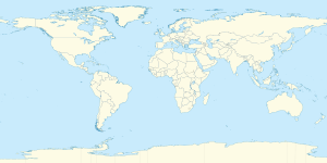
خط العرض 75° شمالاً

Line across the Earth
75°
خط العرض 75 شمال

خط العرض 75 شمالًا (إنگليزية: 75th parallel north) هي دائرة عرض بزاوية 75 درجة شمال خط الاستواء. تمر دائرة العرض 75° شمالاً عبر أفريقيا، المحيط الهندي، جنوب آسيا، جنوب شرق آسيا، المحيط الهادي، أمريكا الوسطى، امريكا الجنوبية والمحيط الأطلسي.

عند خط العرض هذا، تكون الشمس مرئية لمدة 24 ساعة ، 0 دقيقة أثناء الانقلاب الصيفي، والشفق البحري أثناء الانقلاب الشتوي

. . . . . . . . . . . . . . . . . . . . . . . . . . . . . . . . . . . . . . . . . . . . . . . . . . . . . . . . . . . . . . . . . . . . . . . . . . . . . . . . . . . . . . . . . . . . . . . . . . . . . . . . . . . . . . . . . . . . . . . . . . . . . . . . . . . . . . . . . . . . . . . . . . . . . . . . . . . . . . . . . . . . . . . .

حول العالم

بدءاً من خط الزوال الرئيسي، في الاتجاه الشرقي، يمر خط العرض 75° شمالاً عبر:

الإحداثيات البلد أو الإقليم أو البحر ملاحظات
75°0′N 0°0′E / 75.000°N 0.000°E / 75.000; 0.000 (Prime Meridian) Atlantic Ocean Greenland Sea
Norwegian Sea
75°0′N 18°27′E / 75.000°N 18.450°E / 75.000; 18.450 (Barents Sea) Barents Sea
75°0′N 55°56′E / 75.000°N 55.933°E / 75.000; 55.933 (Russia) Flag of Russia.svg روسيا Novaya Zemlya - Severny Island
75°0′N 60°26′E / 75.000°N 60.433°E / 75.000; 60.433 (Kara Sea) Kara Sea Passing just south of the Arkticheskiy Institut Islands, Flag of Russia.svg روسيا
75°0′N 87°19′E / 75.000°N 87.317°E / 75.000; 87.317 (Russia) Flag of Russia.svg روسيا Taymyr Peninsula, passing through Lake Taymyr
75°0′N 112°53′E / 75.000°N 112.883°E / 75.000; 112.883 (Laptev Sea) Laptev Sea
75°0′N 137°43′E / 75.000°N 137.717°E / 75.000; 137.717 (Russia) Flag of Russia.svg روسيا New Siberian Islands - Kotelny Island and Bunge Land
75°0′N 143°36′E / 75.000°N 143.600°E / 75.000; 143.600 (East Siberian Sea) East Siberian Sea Passing just south of Faddeyevsky Island, Flag of Russia.svg روسيا
75°0′N 147°11′E / 75.000°N 147.183°E / 75.000; 147.183 (Russia) Flag of Russia.svg روسيا New Siberian Islands - New Siberia
75°0′N 150°42′E / 75.000°N 150.700°E / 75.000; 150.700 (East Siberian Sea) East Siberian Sea
75°0′N 165°33′E / 75.000°N 165.550°E / 75.000; 165.550 (Arctic Ocean) Arctic Ocean
75°0′N 131°54′W / 75.000°N 131.900°W / 75.000; -131.900 (Beaufort Sea) Beaufort Sea
75°0′N 124°7′W / 75.000°N 124.117°W / 75.000; -124.117 (M'Clure Strait) M'Clure Strait
75°0′N 115°53′W / 75.000°N 115.883°W / 75.000; -115.883 (Canada) Flag of Canada.svg كندا Northwest Territories - Melville Island
75°0′N 114°47′W / 75.000°N 114.783°W / 75.000; -114.783 (Liddon Gulf) Liddon Gulf
75°0′N 112°29′W / 75.000°N 112.483°W / 75.000; -112.483 (Canada) Flag of Canada.svg كندا Northwest Territories - Melville Island
Nunavut - Melville Island
75°0′N 106°41′W / 75.000°N 106.683°W / 75.000; -106.683 (Viscount Melville Sound) Viscount Melville Sound Passing just south of Byam Martin Island, Nunavut, Flag of Canada.svg كندا
75°0′N 100°11′W / 75.000°N 100.183°W / 75.000; -100.183 (Canada) Flag of Canada.svg كندا Nunavut - Bathurst Island
75°0′N 98°36′W / 75.000°N 98.600°W / 75.000; -98.600 (McDougall Sound) McDougall Sound
75°0′N 96°36′W / 75.000°N 96.600°W / 75.000; -96.600 (Canada) Flag of Canada.svg كندا Nunavut - Cornwallis Island
75°0′N 93°28′W / 75.000°N 93.467°W / 75.000; -93.467 (Wellington Channel) Wellington Channel
75°0′N 92°11′W / 75.000°N 92.183°W / 75.000; -92.183 (Canada) Flag of Canada.svg كندا Nunavut - Devon Island and Philpots Island
75°0′N 79°31′W / 75.000°N 79.517°W / 75.000; -79.517 (Baffin Bay) Baffin Bay
75°0′N 57°48′W / 75.000°N 57.800°W / 75.000; -57.800 (Greenland) Flag of Greenland.svg گرينلاند Kjer Glacier
75°0′N 20°24′W / 75.000°N 20.400°W / 75.000; -20.400 (Greenland) Flag of Greenland.svg گرينلاند Grandjean Fjord and Kuhn Island
(King Christian X Land)
75°0′N 19°20′W / 75.000°N 19.333°W / 75.000; -19.333 (Atlantic Ocean) Atlantic Ocean Hochstetter Bay
75°0′N 17°30′W / 75.000°N 17.500°W / 75.000; -17.500 (Greenland) Flag of Greenland.svg گرينلاند Shannon Island
75°0′N 17°24′W / 75.000°N 17.400°W / 75.000; -17.400 (Atlantic Ocean) Atlantic Ocean Greenland Sea


انظر ايضا