الغات الشرقية
| Eastern Ghats | |
|---|---|
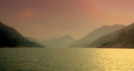
| Malayadri Mountains | |
 | |
| أعلى نقطة | |
| القمة | Arma Konda[1] |
| الارتفاع | 1،680 m (5،510 ft) |
| الجغرافيا | |
 | |
| البلد | India |
| الولاية | Odisha |
| الحيوم | Forests |
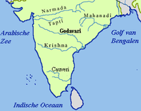
الغات الشرقية Eastern Ghats أو پورڤا كات، (بالهندي: पूर्व घाट) also known as Mahendra Parvatam in the south, are a discontinuous range of mountains along India's eastern coast. The Eastern Ghats run from the northern Odisha through أندرا پرادش إلى تاميل نادو in the south passing some parts of Karnataka. They are eroded and cut through by the four major rivers of peninsular India, known as the Godavari, Mahanadi, Krishna, and Kaveri.
The mountain ranges run parallel to the خليج البنغال. هضبة الدكن lies to the west of the range, between the Eastern Ghats and Western Ghats. The coastal plains, including the ساحل كوروماندل region, lie between the Eastern Ghats and the Bay of Bengal. The Eastern Ghats are not as high as the الغات الغربية.
الثقافة البوذية
|
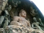
| |
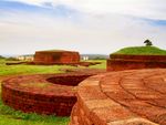
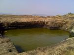
Left: Rock-cut cistern at Pavurallakonda;
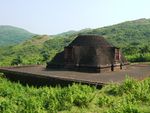
Right: Rock-cut Buddhist monastery at Bojjannakonda in the Eastern Ghats in Andhra Pradesh | ||
The Eastern Ghats are home to many Buddhist ruins, from Odisha to South Andhra. أندرا پرادش has 140 listed Buddhist sites, which provide a panoramic view of the history of Buddhism from the 3rd century BCE to the 14th century CE. There are as many as 501 inscriptions engraved upon various media, including lithic, copper plates, crystals, pots, and conch, of which 360 are lithic records, 7 are sets of copper plates, and 134 are inscribed pots and conches.
Some of the famous Buddhist sites in the Eastern Ghats include:
- Amaravati
- Bojjannakonda
- Bavikonda
- Guntupalle
- Kapavaram
- Lalitgiri
- Nagarjunakonda
- Pavurallakonda
- Ramatheertham
- Ratnagiri
- Salihundam
- Thotlakonda
- Udayagiri
- Undavalli caves
مواقع الحج الهندوسية
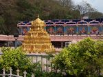
Some Hindu pilgrimage sites in the Eastern Ghats are:
- Ahobilam
- Amararama
- Annamalaiyar Temple
- Annavaram
- Ardhagiri
- Jaugada
- كاديري
- Kalahandi
- Kanipakam
- Mahanandi
- Mangalagiri
- Namakkal
- Pattiseema
- Penchalakona
- Rayagada
- Simhachalam
- Srikalahasti Temple
- Srisailam
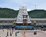
- Tirumala Venkateswara Temple
- Vijayawada
- Yaganti
انظر أيضاً
الهامش
- ^ Kenneth Pletcher (August 2010). The Geography of India: Sacred and Historic Places. The Rosen Publishing Group, 2010. pp. 28–. ISBN 978-16-1530-142-3. Retrieved 4 July 2013.
- Pages using gadget WikiMiniAtlas
- Infobox mapframe without OSM relation ID on Wikidata
- Wikidata value to be checked for Infobox mountain
- Pages using infobox mountain with unknown parameters
- Coordinates on Wikidata
- الغات الشرقية
- سلاسل جبال الهند
- تضاريس تاميل نادو
- تضاريس أندرا پرادش
- تضاريس أوديشا
- جغرافيا تاميل نادو
- تضاريس البنغال الغربية
- أقاليم فيزيوغرافية
- صفحات مع الخرائط
