سانتا باربرا، كاليفورنيا
Santa Barbara, California | |
|---|---|
| City of Santa Barbara | |
|
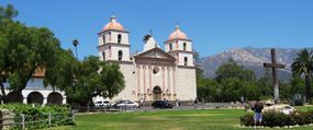
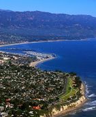
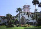
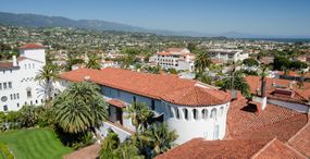
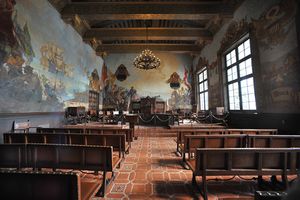
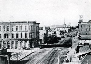
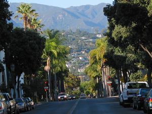
Clockwise: Mission Santa Barbara; California Riviera; Santa Barbara County Courthouse; View of Downtown; Presidio of Santa Barbara; Downtown Santa Barbara. | |
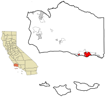 Location in Santa Barbara County and the state of California | |
Location in the الولايات المتحدة | |
| الإحداثيات: 34°25′N 119°42′W / 34.417°N 119.700°WCoordinates: 34°25′N 119°42′W / 34.417°N 119.700°W | |
| Country | |
| State | |
| County | |
| Incorporated | April 9, 1850[1] |
| السمِيْ | Saint Barbara |
| الحكومة | |
| • النوع | Council/Administrator[2] |
| • Mayor | Cathy Murillo[3] |
| • State Senator | Hannah-Beth Jackson (د)[4] |
| • CA Assembly | Das Williams (د)[4] |
| • U.S. Rep. | Lois Capps (د)[5] |
| المساحة | |
| • الإجمالي | 41٫99 ميل² (108٫75 كم²) |
| • البر | 19٫49 ميل² (50٫48 كم²) |
| • الماء | 22٫50 ميل² (58٫28 كم²) 53.61% |
| المنسوب | 49 ft (15 m) |
| التعداد | |
| • الإجمالي | 88٬410 |
| • Estimate (2017)[9] | 92٬101 |
| • الكثافة | 4٬725٫55/sq mi (1٬821٫19/km2) |
| منطقة التوقيت | UTC−8 (Pacific Time Zone) |
| • الصيف (التوقيت الصيفي) | UTC−7 (PDT) |
| ZIP codes[10] | 93101–93103, 93105–93111, 93116–93118, 93120–93121, 93130, 93140, 93150, 93160, 93190, 93199 |
| Area code | 805 |
| FIPS code | 06-69070 |
| GNIS feature IDs | 1661401, 2411815 |
| Primary Airport | Santa Barbara Municipal Airport |
| U.S. Routes | |
| State Routes | |
| الموقع الإلكتروني | www |
سانتا باربارا هي مدينة في مقاطعة سانتا باربارا، كاليفورنيا، وحسب تعداد 2000 يوجد بها ما يقارب 92,325 نسمة. Situated on a south-facing section of coastline, the longest such section on the West Coast of the United States, the city lies between the steeply rising Santa Ynez Mountains and the Pacific Ocean. Santa Barbara's climate is often described as Mediterranean, and the city has been promoted as the "American Riviera".[11] As of 2014, the city had an estimated population of 91,196,[12] up from 88,410 in 2010, making it the second most populous city in the county after Santa Maria.[13] The contiguous urban area, which includes the cities of Goleta and Carpinteria, along with the unincorporated regions of Isla Vista, Montecito, Mission Canyon, Hope Ranch, Summerland, and others, has an approximate population of 220,000. The population of the entire county in 2010 was 423,895.[14]
In addition to being a popular tourist and resort destination, the city economy includes a large service sector, education, technology, health care, finance, agriculture, manufacturing, and local government. In 2004, the service sector accounted for fully 35% of local employment.[15] Education in particular is well represented, with four institutions of higher learning on the south coast (the University of California, Santa Barbara, Santa Barbara City College, Westmont College, and Antioch University). The Santa Barbara Airport serves the city, Santa Barbara Aviation provides jet charter aircraft and train service is provided by Amtrak the Pacific Surfliner which runs from San Diego to San Luis Obispo). U.S. Highway 101 connects the Santa Barbara area with Los Angeles to the southeast and San Francisco to the northwest. Behind the city, in and beyond the Santa Ynez Mountains, is the Los Padres National Forest, which contains several remote wilderness areas. Channel Islands National Park and Channel Islands National Marine Sanctuary are located approximately 20 miles (32 km) offshore.
. . . . . . . . . . . . . . . . . . . . . . . . . . . . . . . . . . . . . . . . . . . . . . . . . . . . . . . . . . . . . . . . . . . . . . . . . . . . . . . . . . . . . . . . . . . . . . . . . . . . . . . . . . . . . . . . . . . . . . . . . . . . . . . . . . . . . . . . . . . . . . . . . . . . . . . . . . . . . . . . . . . . . . . .
التاريخ
الفترة المكسيكية والرانشو
Santa Barbara fell bloodlessly to a battalion of American soldiers under John C. Frémont on December 27, 1846, during the Mexican–American War, and after the Treaty of Guadalupe Hidalgo in 1848 it became part of the expanding United States.
النصف الثاني من القرن 19
القرن العشرين
الجغرافيا
المناخ
| بيانات مناخ Santa Barbara, California (1981–2010 Normals) | |||||||||||||
|---|---|---|---|---|---|---|---|---|---|---|---|---|---|
| الشهر | يناير | فبراير | مارس | أبريل | مايو | يونيو | يوليو | أغسطس | سبتمبر | اكتوبر | نوفمبر | ديسمبر | العام |
| العظمى القياسية °ف (°س) | 89 (31.7) |
89 (31.7) |
96 (35.6) |
101 (38.3) |
101 (38.3) |
103 (39.4) |
108 (42.2) |
99 (37.2) |
105 (40.6) |
103 (39.4) |
97 (36.1) |
92 (33.3) |
108 (42٫2) |
| العظمى المتوسطة °ف (°س) | 64.7 (18.17) |
65.4 (18.56) |
66.1 (18.94) |
69.0 (20.56) |
69.6 (20.89) |
71.2 (21.78) |
74.7 (23.72) |
76.0 (24.44) |
75.1 (23.94) |
72.8 (22.67) |
68.9 (20.5) |
64.7 (18.17) |
69٫9 (21٫06) |
| الصغرى المتوسطة °ف (°س) | 46.4 (8) |
48.1 (8.94) |
49.8 (9.89) |
51.8 (11) |
54.6 (12.56) |
57.5 (14.17) |
60.4 (15.78) |
60.4 (15.78) |
59.6 (15.33) |
56.2 (13.44) |
50.3 (10.17) |
46.7 (8.17) |
53٫5 (11٫94) |
| الصغرى القياسية °ف (°س) | 20 (-6.7) |
27 (-2.8) |
30 (-1.1) |
30 (-1.1) |
36 (2.2) |
42 (5.6) |
44 (6.7) |
46 (7.8) |
38 (3.3) |
34 (1.1) |
28 (-2.2) |
25 (-3.9) |
20 (−6٫7) |
| سقوط الأمطار inches (mm) | 4.14 (105.2) |
4.68 (118.9) |
3.59 (91.2) |
0.77 (19.6) |
0.35 (8.9) |
0.09 (2.3) |
0.01 (0.3) |
0.03 (0.8) |
0.29 (7.4) |
0.52 (13.2) |
1.48 (37.6) |
2.63 (66.8) |
18٫58 (471٫9) |
| Avg. rainy days (≥ 0.01 in) | 6.5 | 6.3 | 6.5 | 2.9 | 1.4 | 0.9 | 0.4 | 0.5 | 1.2 | 1.7 | 3.8 | 4.9 | 37 |
| Source: Western Regional Climate Center[16] | |||||||||||||
الاقتصاد
Aerospace and defense companies form the basis of the city's private employment as Alliant Techsystems, Channel Technologies Group, LogMeIn, FLIR Systems, and Raytheon have major operations in the area. Santa Barbara's tourist attractions have made the hospitality industry into a major player in the regional economy. Motel 6 was started in Santa Barbara in 1962.
اعتبارا من يونيو 2014[تحديث], the principal employers in the southern Santa Barbara County were:[17]
| # | Employer | # of Employees |
|---|---|---|
| 1 | University of California, Santa Barbara | 10,403 |
| 2 | County of Santa Barbara | 4,652 |
| 3 | Cottage Health System | 2,605 |
| 4 | Santa Barbara City College | 2,066 |
| 5 | Santa Barbara Unified School District | 1,988 |
| 6 | City of Santa Barbara | 1,716 |
| 7 | Raytheon Electronic Systems | 1,300 |
| 8 | Sansum Medical Foundation Clinic | 1,040 |
| 9 | Santa Barbara County Education Office | 929 |
| 10 | United States Postal Service | 805 |
Other major employers include Mission Linen Supply, Jordano's, the Santa Barbara Biltmore and San Ysidro Ranch, Westmont College, Mentor, CJ Affiliate, Fess Parker's Doubletree, Belmond El Encanto and QAD.[18]
. . . . . . . . . . . . . . . . . . . . . . . . . . . . . . . . . . . . . . . . . . . . . . . . . . . . . . . . . . . . . . . . . . . . . . . . . . . . . . . . . . . . . . . . . . . . . . . . . . . . . . . . . . . . . . . . . . . . . . . . . . . . . . . . . . . . . . . . . . . . . . . . . . . . . . . . . . . . . . . . . . . . . . . .
المدن الشقيقة
| City[19] | Country | Year relations established |
|---|---|---|
| پالما | 1972 | |
| دنگل | 2003 | |
| Puerto Vallarta | 1972 | |
| سان هوان | 2000 | |
| Toba City | 1966 | |
| Weihai | 1993 | |
| كوتور | 2013 | |
| پاترنو | 1978 |
Notable people
See also
- Chumash Painted Cave State Historic Park
- Labor relations at the Santa Barbara News-Press
- List of cities and towns in California
- List of mayors of Santa Barbara, California
- Santa Barbara City Fire Department
- USNS Mission Santa Barbara (T-AO-131)
- USS Santa Barbara
الهامش
- ^ "California Cities by Incorporation Date". California Association of Local Agency Formation Commissions. Archived from the original (Word) on نوفمبر 3, 2014. Retrieved أغسطس 25, 2014.
{{cite web}}: Unknown parameter|deadurl=ignored (|url-status=suggested) (help) - ^ "The City of Santa Barbara Employee Handbook". City of Santa Barbara. Retrieved مارس 24, 2015.
- ^ "Cathy Murillo, Mayor". City of Santa Barbara. Retrieved يناير 15, 2018.
- ^ أ ب "Statewide Database". UC Regents. Retrieved أكتوبر 9, 2014.
- ^ قالب:Cite GovTrack
- ^ "2016 U.S. Gazetteer Files". United States Census Bureau. Retrieved يونيو 28, 2017.
- ^ "Santa Barbara". نظام معلومات الأسماء الجغرافية، المسح الجيولوجي الأمريكي. Retrieved أكتوبر 9, 2014.
- ^ "Santa Barbara (city) QuickFacts". United States Census Bureau. Retrieved مايو 23, 2015.
- ^ خطأ استشهاد: وسم
<ref>غير صحيح؛ لا نص تم توفيره للمراجع المسماةUSCensusEst2017 - ^ "ZIP Code(tm) Lookup". United States Postal Service. Retrieved نوفمبر 29, 2014.
- ^ Horowitz, Joy. "New York Times article on Santa Barbara". Travel.nytimes.com. Retrieved مايو 20, 2012.
- ^ "American FactFinder – Results". United States Census Bureau. Retrieved مايو 23, 2015.
- ^ "Santa Maria grows 28.6%". Santa Maria Times. مارس 9, 2011. Retrieved مايو 20, 2012.
- ^ United States Census 2010
- ^ Santa Barbara economic statistics, 2005 Archived أبريل 13, 2010 at the Wayback Machine
- ^ "SANTA BARBARA, CALIFORNIA - Climate Summary". Wrcc.dri.edu. Retrieved أغسطس 1, 2018.
- ^ "Comprehensive Annual Financial Report: Fiscal Year Ended June 30, 2014". City of Santa Barbara. p. 163. Retrieved مايو 23, 2015.
- ^ Search Results – Santa Barbara, California – ReferenceUSA Current Businesses
- ^ Sister cities board - SB, CA
للاستزادة
- Baker, Gayle. Santa Barbara. Harbor Town Histories, Santa Barbara. 2003. ISBN (print) 0-9710984-1-7 (e-book) 978-0-9879038-1-5
- Birchard, Robert S. Silent-Era Filmmaking in Santa Barbara. Arcadia Publishing. 2007. ISBN 0-7385-4730-1
- Graham, Otis L.; Bauman, Robert; Dodd, Douglas W.; Geraci, Victor W.; Murray, Fermina Brel. Stearns Wharf: Surviving Change on the California Coast. Graduate Program in Public Historical Studies, University of California, 1994. ISBN 1-883535-15-8
- Tompkins, Walker A. Santa Barbara, Past and Present. Tecolote Books, Santa Barbara, CA, 1975.
- Tompkins, Walker A. It Happened in Old Santa Barbara. Sandollar Press, Santa Barbara, CA, 1976.
- Tompkins, Walker A. Santa Barbara History Makers. McNally & Loftin, Santa Barbara. 1983. ISBN 0-87461-059-1
وصلات خارجية
- Official website

- Movies and television shows filmed in Santa Barbara
- Santa Barbara on city-data.com
- Santa Barbara Conference & Visitors Bureau and Film Commission
- Ice Age Fossils At Santa Barbara, California Explore the famous paleontology of the Santa Barbara area.
- Santa Barbara Mission and Mission Archive-Library
- Santa Barbara earthquakes
- City of Santa Barbara TV Live Stream
- Summer Solstice Celebration
- National Register of Historic Places listings
- Local University UCSB
- Santa Barbara Views, ca. 1875, The Bancroft Library
- "Santa Barbara". C-SPAN Cities Tour. فبراير 2016.
قالب:Santa Barbara County, California قالب:California Central Coast
- CS1 errors: unsupported parameter
- Use mdy dates from September 2014
- Short description is different from Wikidata
- Coordinates on Wikidata
- مقالات فيها عبارات متقادمة منذ يونيو 2014
- جميع المقالات التي فيها عبارات متقادمة
- Santa Barbara, California
- 1850 establishments in California
- مقالات تحتوي مقاطع ڤيديو
- Cities in Santa Barbara County, California
- County seats in California
- مدن وبلدات مشهرة في كاليفورنيا
- Populated coastal places in California
- Populated places established in 1850
- Port cities in California
- Spanish mission settlements in North America
- مدن كاليفورنيا
- بذرة كاليفورنيا

