مناطق پيرو

مناطق (إسپانية: regiones) پيرو هي تقسيمات ادارية من الدرجة الأولى لپيرو. منذ استقلالها في 1821، تقسّمت پيرو إلى أقسام (إسپانية: departamentos) ولكنها واجهت مشكلة تزايد مركزية السلطتين السياسية والاقتصادية في عاصمتها، ليما. بعد العديد من المحاولات غير الناجحة للامركزية، أصبح الكيان القانوني منطقة رسمياً وتم انتخاب حكومات إقليمية لإدارة الأقسام في 20 نوفمبر 2002، إلى أن يتم دمج تلك الأقسام في مناطق حقيقية.
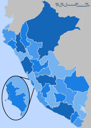
Under the new arrangement, the former 24 departments plus the Callao Province have become regional circumscriptions. The province of Lima has been excluded from this process and does not form part of any department. Unlike the earlier departments, regions have an elected government and have a wide array of responsibilities within their jurisdiction. Under the 2002 Organic Law of Regional Governments (إسپانية: Ley Orgánica de Gobiernos Regionales), there is an ongoing process of transfer of functions from the central government to the regions. A 2005 referendum for the merger of several departments failed to get the necessary electoral support.
Peruvian departments are subdivided into provinces and districts.
التاريخ
بعد إعلان استقلالها في 1821، تقسمت پيرو إلى أقسام (إسپانية: departamentos)، نمى عددها من أحد عشر في 1822 إلى أربع وعشرين في 1980:
|
|
As political and economic power increasingly concentrated in Lima, the capital city, several administrations attempted to decentralize the country with little success.[1] The 1979 Peruvian Constitution contained provisions for the decentralization of power through the creation of autonomous regions, but they were not implemented.[2] During the later years of the 1985–1990 presidency of Alan García, the government faced the prospect of losing the 1990 presidential elections because of a widespread economic crisis and faltering public support. As a way of creating an alternative source of power, the regime established twelve autonomous regions on January 20, 1989, in the hope of winning some elections at this level.[3] However, due to the haste of their creation, these regional governments were not provided with fiscal resources of their own, so they depended on the goodwill of the central government for funding.[4]
المناطق
Area and population information on the following list has been retrieved from official data by the Peruvian National Institute of Statistics and Informatics (إسپانية: Instituto Nacional de Estadística e Informática, INEI).[5] Areas are rounded to the nearest whole unit. Demographic data is based on the 2005 Census carried out from July 18 through August 20, 2005. Population density is given to one decimal place in persons per square kilometer. UBIGEO numbers are codes used by INEI to identify national administrative subdivisions.
| المنطقة | ISO |
UBIGEO |
العاصمة | المساحة (كم²) |
التعداد | الكثافة السكانية (/كم²) |
الموقع |
|---|---|---|---|---|---|---|---|
| أمازوناس | PE-AMA | 01 | Chachapoyas | 39٬249 | 389٬700 | 9٫9 | .svg&filetimestamp=20190220000200&)
|
| Ancash | PE-ANC | 02 | Huaraz | 35٬914 | 1٬039٬415 | 28٫9 | .svg&filetimestamp=20190220000204&)
|
| Apurímac | PE-APU | 03 | Abancay | 20٬896 | 418٬882 | 20٫0 | .svg&filetimestamp=20190220000206&)
|
| Arequipa | PE-ARE | 04 | Arequipa | 63٬345 | 1٬140٬810 | 18٫0 | .svg&filetimestamp=20190220000209&)
|
| Ayacucho | PE-AYA | 05 | Ayacucho | 43٬815 | 619٬338 | 14٫1 | .svg&filetimestamp=20190220000211&)
|
| كاخاماركا | PE-CAJ | 06 | كاخاماركا | 33٬318 | 1٬359٬023 | 40٫8 | .svg&filetimestamp=20190220000214&)
|
| كالاو | PE-CAL | 07 | كالاو | 147 | 810٬568 | 5٬514٫8 | .svg&filetimestamp=20190220000216&)
|
| كوسكو | PE-CUS | 08 | كوسكو | 71٬986 | 1٬171٬503 | 16٫3 | .svg&filetimestamp=20190220000219&)
|
| Huancavelica | PE-HUV | 09 | Huancavelica | 22٬131 | 447٬054 | 20٫2 | .svg&filetimestamp=20190220000224&)
|
| Huánuco | PE-HUC | 10 | Huánuco | 36٬849 | 730٬871 | 19٫8 | .svg&filetimestamp=20190220000226&)
|
| إيكا | PE-ICA | 11 | إيكا | 21٬328 | 665٬592 | 31٫2 | .svg&filetimestamp=20190220000229&)
|
| خونين | PE-JUN | 12 | هوانكايو | 37٬667 | 1٬091٬619 | 29٫0 | .svg&filetimestamp=20190220000232&)
|
| لا ليبرتاد | PE-LAL | 13 | تروخيو | 25٬500 | 1٬539٬774 | 60٫4 | .svg&filetimestamp=20190220000234&)
|
| Lambayeque | PE-LAM | 14 | Chiclayo | 14٬231 | 1٬091٬535 | 76٫7 | .svg&filetimestamp=20190220000237&)
|
| ليما | PE-LIM | 15 | هواتشو | 34٬802 | 864٬853 | 24٫9 | .svg&filetimestamp=20190207010325&)
|
| Loreto | PE-LOR | 16 | Iquitos | 368٬852 | 884٬144 | 2٫4 | .svg&filetimestamp=20190220000239&)
|
| مادرى دى ديوس | PE-MDD | 17 | Puerto Maldonado | 85٬301 | 92٬024 | 1٫1 | .svg&filetimestamp=20190220000242&)
|
| Moquegua | PE-MOQ | 18 | Moquegua | 15٬734 | 159٬306 | 10٫1 | .svg&filetimestamp=20190220000244&)
|
| Pasco | PE-PAS | 19 | Cerro de Pasco | 25٬320 | 266٬764 | 10٫5 | .svg&filetimestamp=20190220000247&)
|
| Piura | PE-PIU | 20 | Piura | 35٬892 | 1٬630٬772 | 45٫4 | .svg&filetimestamp=20190220000249&)
|
| Puno | PE-PUN | 21 | Puno | 66٬997 | 1٬245٬508 | 18٫6 | .svg&filetimestamp=20190220000256&)
|
| San Martín | PE-SAM | 22 | Moyobamba | 51٬253 | 669٬973 | 13٫1 | .svg&filetimestamp=20190220000258&)
|
| Tacna | PE-TAC | 23 | Tacna | 16٬076 | 274٬496 | 17٫1 | .svg&filetimestamp=20190220000303&)
|
| Tumbes | PE-TUM | 24 | Tumbes | 4٬046 | 191٬713 | 47٫4 | .svg&filetimestamp=20190220000306&)
|
| Ucayali | PE-UCA | 25 | Pucallpa | 101٬831 | 402٬445 | 4٫0 | .svg&filetimestamp=20190220000309&)
|
انظر أيضاً
- التقسيمات الادارية في پيرو
- أقسام پيرو Districts of Peru
- ISO 3166-2:PE
- Provinces of Peru
- List of regions of Peru by population
- List of Peruvian regions by GDP
الهامش
- ^ Schönwälder, Linking civil society, p. 94.
- ^ O'Neill, Decentralizing the State, p. 197.
- ^ O'Neill, Decentralizing the State, p. 199.
- ^ O'Neill, Decentralizing the State, p. 199.
- ^ Instituto Nacional de Estadística e Informática. Banco de Información Distrital Archived 2008-04-23 at the Wayback Machine. Retrieved on November 30, 2007.
المراجع
- BBC News. Fujimori: Decline and fall. November 20, 2000.
- (بالإسپانية) "Declaración de Huánuco" (PDF). Archived from the original (PDF) on 2012-02-10.
{{cite web}}: Unknown parameter|deadurl=ignored (|url-status=suggested) (help). March 20, 2007. - (بالإسپانية) "Decreto Supremo Nº 007-2007-PCM" (PDF). Archived from the original (PDF) on 2011-10-02.
{{cite web}}: Unknown parameter|deadurl=ignored (|url-status=suggested) (help). January 24, 2007. - (بالإسپانية) Instituto Nacional de Estadística e Informática. Banco de Información Distrital.
- (بالإسپانية) "Ley Nº 27783, Ley de Bases de la Descentralización" (PDF). Archived from the original (PDF) on 2011-11-25.
{{cite web}}: Unknown parameter|deadurl=ignored (|url-status=suggested) (help). July 17, 2002. - (بالإسپانية) "Ley Nº 27867, Ley Orgánica de Gobiernos Regionales" (PDF). Archived from the original (PDF) on 2007-07-02.
{{cite web}}: Unknown parameter|deadurl=ignored (|url-status=suggested) (help) (305 KiB). November 16, 2002. - (بالإسپانية) Monge, Carlos. "Los gobiernos regionales del periodo 2003–2006: la primera promoción que se gradúa de la descentralización". Quehacer 163: 33–36 (November–December 2006).
- (بالإسپانية) Oficina Nacional de Procesos Electorales, Elecciones Regionales y Municipales 2006.
- (بالإسپانية) Oficina Nacional de Procesos Electorales, Referendum para la Integracion y Conformacion de Regiones 2005.
- (بالإسپانية) Oficina Nacional de Procesos Electorales. Resultados regionales.
- O'Neill, Kathleen. Decentralizing the State: elections, parties, and local power in the Andes. Cambridge: Cambridge University Press, 2005.
- Schönwälder, Gerd. Linking civil society and the State: urban popular movements, the Left and local government in Perú, 1980–1992. Pennsylvania: The Pennsylvania State University Press, 2002.
- The New York Times. "Opposition Party Makes Strong Showing in Peru Election". November 18, 2002.
Peru's Lima Province is not part of any region. |