مقاطعة دوپيدج، إلينوي
DuPage County | |
|---|---|
County | |
| County of DuPage | |
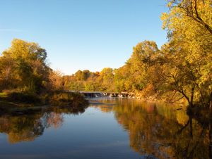
 Warrenville Grove Forest Preserve on the West Branch of the DuPage River | |
| الشعار: The Magnificent Miles West of Chicago | |
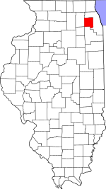
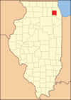
 الموقع ضمن ولاية Illinois | |
 موقع Illinois ضمن الولايات المتحدة | |
| الإحداثيات: 41°51′07″N 88°05′08″W / 41.85195°N 88.08567°W | |
| البلد | |
| State | |
| تأسست | February 9, 1839 |
| السمِيْ | DuPage River |
| Seat | Wheaton |
| أكبر مدينة | Naperville (area) Aurora (population) |
| المساحة | |
| • الإجمالي | 336 ميل² (870 كم²) |
| • البر | 327 ميل² (850 كم²) |
| • الماء | 8٫9 ميل² (23 كم²) 2.6%% |
| التعداد | |
| • Estimate (2017) | 930٬128 |
| • الكثافة | 2٬800/sq mi (1٬100/km2) |
| منطقة التوقيت | UTC−6 (Central) |
| • الصيف (التوقيت الصيفي) | UTC−5 (CDT) |
| Area code | 630 and 331 |
| Congressional districts | 3rd، 5th، 6th، 8th، 11th، 14th |
| الموقع الإلكتروني | www |
| [1] | |
مقاطعة دوبيج إنگليزية: DuPage County هي إحدى المقاطعات في ولاية إلينوي في الولايات المتحدة الأمريكية.
Politics
Historically, DuPage County was a stronghold of the Republican Party, and was reckoned as a classic bastion of suburban conservatism. However, like many suburban counties outside large cities, it has trended Democratic in presidential years since the 1990s. The county continues to lean Republican in state and local politics.
National politics
Presidential election results
| Year | Republican | Democratic | Third parties |
|---|---|---|---|
| 2016 | 38.6% 166,415 | 53.1% 228,622 | 8.3% 35,637 |
| 2012 | 48.6% 195,046 | 49.7% 199,460 | 1.6% 6,575 |
| 2008 | 43.9% 183,626 | 54.7% 228,698 | 1.4% 5,649 |
| 2004 | 54.4% 218,902 | 44.8% 180,097 | 0.9% 3,447 |
| 2000 | 55.2% 201,037 | 41.9% 152,550 | 3.0% 10,775 |
| 1996 | 50.7% 164,630 | 40.0% 129,709 | 9.3% 30,147 |
| 1992 | 48.1% 178,271 | 30.9% 114,564 | 21.1% 78,152 |
| 1988 | 69.4% 217,907 | 30.0% 94,285 | 0.6% 1,862 |
| 1984 | 75.7% 227,141 | 23.8% 71,430 | 0.6% 1,644 |
| 1980 | 64.0% 182,308 | 24.2% 68,991 | 11.8% 33,450 |
| 1976 | 68.8% 175,055 | 28.3% 72,137 | 2.9% 7,355 |
| 1972 | 75.0% 172,341 | 24.8% 57,043 | 0.2% 355 |
| 1968 | 66.6% 124,893 | 25.9% 48,492 | 7.5% 14,111 |
| 1964 | 59.9% 98,871 | 40.1% 66,229 | |
| 1960 | 69.5% 101,014 | 30.4% 44,263 | 0.1% 168 |
| 1956 | 79.8% 91,834 | 20.1% 23,103 | 0.2% 207 |
| 1952 | 75.8% 71,134 | 24.0% 22,489 | 0.2% 217 |
| 1948 | 73.6% 45,794 | 25.0% 15,528 | 1.5% 916 |
| 1944 | 68.9% 41,890 | 30.8% 18,711 | 0.3% 174 |
| 1940 | 67.9% 40,746 | 31.5% 18,923 | 0.6% 380 |
| 1936 | 55.0% 28,380 | 42.0% 21,684 | 3.0% 1,568 |
| 1932 | 56.2% 25,758 | 40.5% 18,547 | 3.3% 1,504 |
| 1928 | 72.4% 28,016 | 27.1% 10,479 | 0.6% 217 |
| 1924 | 72.8% 16,917 | 8.2% 1,893 | 19.0% 4,423 |
| 1920 | 82.0% 12,280 | 13.9% 2,084 | 4.1% 612 |
| 1916 | 62.8% 9,610 | 31.5% 4,816 | 5.7% 868 |
| 1912 | 14.3% 1,136 | 28.1% 2,236 | 57.6% 4,589 |
| 1908 | 64.0% 4,530 | 27.9% 1,975 | 8.1% 575 |
| 1904 | 68.1% 4,078 | 23.5% 1,407 | 8.5% 506 |
| 1900 | 63.9% 3,869 | 32.2% 1,947 | 3.9% 237 |
| 1896 | 68.9% 4,115 | 26.6% 1,588 | 4.5% 268 |
| 1892 | 50.4% 2,478 | 43.8% 2,154 | 5.9% 290 |
See also
- Kane-DuPage Regional Museum Association
- List of counties in Illinois
- List of Illinois townships
- National Register of Historic Places listings in DuPage County, Illinois
References
- ^ U.S. Geological Survey Geographic Names Information System: مقاطعة دوپيدج، إلينوي
- ^ Leip, David. "Dave Leip's Atlas of U.S. Presidential Elections". uselectionatlas.org. Archived from the original on March 23, 2018. Retrieved May 8, 2018.
{{cite web}}: Unknown parameter|deadurl=ignored (|url-status=suggested) (help)
وصلات خارجية
| Find more about مقاطعة دوپيدج، إلينوي at Wikipedia's sister projects | |
| Media from Commons | |
| News stories from Wikinews | |
| Source texts from Wikisource | |
- Official website
- DuPage Convention & Visitors Bureau
- DuPage County Fair Grounds in Wheaton
- DuPage County Historical Society
- Forest Preserve District of DuPage County
- Forest Preserve District of DuPage County Golf Facilities

|
Cook County | Cook County | Kane County | 
|
| Cook County | Kane County | |||
| Cook County and Will County | Will County | Kendall County |
?
تصنيفات:
- CS1 errors: unsupported parameter
- الصفحات بخصائص غير محلولة
- Pages using gadget WikiMiniAtlas
- Short description is different from Wikidata
- مقاطعات Illinois
- Articles containing إنگليزية-language text
- Pages using Lang-xx templates
- Pages with empty portal template
- Official website different in Wikidata and Wikipedia
- Portal-inline template with redlinked portals
- Coordinates on Wikidata
- DuPage County, Illinois
- 1839 establishments in Illinois
- Chicago metropolitan area
- Illinois counties
- Populated places established in 1839
- مقاطعات إلينوي


