كرايينا البوسنية

كرايينا البوسنية Bosanska Krajina (بالسيريلية: Босанска Крајина}؛ النطق الصربو-كرواتي: [bɔ̌sanskaː krâjina]؛ وأحياناً تُترجم التخوم البوسنية Bosnian Frontier) أو وأحياناً، ببساطة كرايينا Krajina، هي منطقة جغرافية، جزء من البوسنة، في غرب البوسنة والهرسك محاطة بعدد من الأنهار، هي: ساڤا (في الشمال)، گلينا (الشمال الغربي)، ڤربانيا و ڤرباس (من الشرق والجنوب الشرقي، بالترتيب). المنطقة هي أيضاً كيان تاريخي واقتصادي وثقافي في البوسنة والهرسك، يشتهر بجمال الطبيعة وتنوع الحياة البرية.[1]
The largest city, and its historical center is Banja Luka. Other cities include Bihać, Cazin, Velika Kladuša, Prijedor, Sanski Most, Gradiška, Kozarska Dubica, Novi Grad, Bosanska Krupa, Ključ, Bosanski Petrovac, Kotor Varoš, Šipovo, Mrkonjić Grad, Drvar, Bosansko Grahovo, Gornji Vakuf, Bugojno, Donji Vakuf, Jajce, Kneževo, Bužim, Laktaši, and Čelinac.[1]
Bosanska Krajina is not a formal entity within the structure of Bosnia and Herzegovina; however it has a significant cultural and historical identity that was formed through several historic and economic events. The territory of Bosanska Krajina is currently divided between two entities of Bosnia and Herzegovina: Republika Srpska and the Federation of Bosnia and Herzegovina.
التسمية
Between the 16th and 19th centuries, the territory between the Una and Vrbas rivers was referred to by the name Turkish Croatia.[2][3][4] The name was first used consistently by Austrian military topographers who worked in the Austro-Ottoman border commission after the Treaty of Karlowitz of 1699.[2] In the mid 19th century the name Turkish Croatia was replaced by cartographers in favor of Bosanska Krajina.[2]
الجغرافيا
The largest city, and its historical center is Banja Luka. Other cities include Bihać, Cazin, Velika Kladuša, Prijedor, Sanski Most, Gradiška, Kozarska Dubica, Novi Grad, Bosanska Krupa, Ključ, Bosanski Petrovac, Kotor Varoš, Šipovo, Mrkonjić Grad, Drvar, Bosansko Grahovo, Jajce, Kneževo, Bužim, Laktaši, and Čelinac.
Sub-regions (geographical and historical) include: Bihaćka krajina, Cazinska krajina, Potkozarje, Lijevče, etc.
التاريخ
العصور الوسطى
In the 6th century, today's northwestern Bosnia was part of the Roman province of Dalmatia. It fell under the jurisdiction of the Eastern Roman Empire. Shortly thereafter, Eurasian Avars and their Slavic subjects from central-eastern Europe invaded Dalmatia and settled in what is now Bosnia and Herzegovina. In the 7th century the Serbs and Croats formed principalities initially under the Eastern Roman Empire. It is unclear whether the region was under the Principality of Serbia or Duchy of Croatia in the Early Middle Ages. Fine, Jr. believes that what is today western Bosnia and Herzegovina was part of Croatia, while the rest was divided between Croatia and Serbia.[5] Bosnia proper, called Bosona in the De Administrando Imperio (ح. 960), was a "small country" part of the Serbian principality.
الحرب البوسنية
| 1991 | 1994 | |
|---|---|---|
| الصرب | 625,000 | 875,000 |
| البشناق والكروات | 550,000 | 50,000 |
أثناء حرب البوسنة 1992-95، قـُسـِّـمت كرايينا البوسنية بين جمهورية صرب البوسنة، جمهورية البوسنة والهرسك ومنطقة غرب البوسنة الذاتية. الكيان الصربي SAO Bosanska Krajina تأسس في صيف 1991. The region was also a place of concentration camps, including Manjača and Omarska where predominantly Bosniaks were held, tortured, raped, and killed.
For the past two years, non-Serbs in the Bosanska Krajina area have been "cleansed" through systematic persecution that includes torture, murder, rape, beatings, harassment, de jure discrimination, intimidation, expulsion from homes, confiscation of property, bombing of businesses, dismissal from work, outlawing of all scripts except the Cyrillic in public institutions, and the destruction of cultural objects such as mosques and Catholic churches.
— تقرير مرصد حقوق الإنسان 1994[7]
الديمغرافيا
The population of the region numbered almost one million before the war in Bosnia. The ethnic composition of Bosanska Krajina was in 1991 (per census data) 44% Serbs, 40% Bosniaks, 7% Croats, 5% Yugoslavs and 3% others (Romas, Ukrainians, Hungarians and Valachians).[بحاجة لمصدر] The composition of the current population of Bosanska Krajina has dramatically changed since, because of expulsions, forced relocation and emigration during the Bosnian war in 1992-95. Various parts have become less ethnically diverse, mainly Bosniak in the Northwest and Serb in Republika Srpska and a few other municipalities that border Croatia.
الاقتصاد
In the immediate aftermath of World War II Bosanska Krajina was considered one of the poorest regions of Bosnia and Herzegovina. This poverty was a contributing factor to 1950 Cazin Uprising against the communist government, the only such uprising in post-war Bosnia and Herzegovina and Yugoslavia.
معرض صور

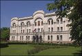
Banski dvor in Banja Luka

Velika Kladuša Castle


معرض صور تاريخية

Banja Luka at the turn of the 20th century

Bihać fortified place in 1590

Bosanska Krupa from Middle Age

An old drawing of Bosanska Dubica


انظر أيضاً
الهامش
- ^ أ ب Mučibabić B., Ed. (1998). Geografski atlas Bosne i Hercegovine. Sarajevo: Geodetski zavod BiH. ISBN 9958-766-00-0.
- ^ أ ب ت Magaš, Branka; Žanić, Ivo (2001). The War in Croatia and Bosnia-Herzegovina 1991-1995. Taylor & Francis. p. 11. ISBN 0-7146-8201-2.
- ^ "Bosnia and Herzegovina". 1911 Encyclopædia Britannica. LoveToKnow. Archived from the original on 2010-02-03. Retrieved 2010-06-18.
Donji Kraj, the later Krajina, Kraina or Turkish Croatia, in the north-west
{{cite web}}: Unknown parameter|deadurl=ignored (|url-status=suggested) (help) - ^ Borna Fuerst-Bjeliš, Ivan Zupanc (2007). "Images of the Croatian Borderlands: Selected Examples of Early Modern Cartography". Hrvatski geografski glasnik (69/1): 16. Retrieved 2010-06-25.
Schimek's Map of the Turkish Croatia, 1788. (Facsimile from Marković 1998). "Turkisch Croatien"
- ^ Fine 1991, p. 53.
- ^ Ramet, Sabrina P. (2006). The Three Yugoslavias: State-Building and Legitimation, 1918–2004. Indiana University Press. p. 430. ISBN 0-271-01629-9.
- ^ ""Ethnic Cleansing" Continues in Northern Bosnia" (PDF). Human Rights Watch. November 1994.
المصادر
- Fine, John Van Antwerp, Jr. (1991). The Early Medieval Balkans: A Critical Survey from the Sixth to the Late Twelfth Century. University of Michigan Press. ISBN 978-0-472-08149-3.
{{cite book}}: Invalid|ref=harv(help)CS1 maint: multiple names: authors list (link) - Mrgić, Jelena; Živković, Tibor (2008). Северна Босна: 13-16. век. Историјски институт.
{{cite book}}: Invalid|ref=harv(help)
| الجغرافية |  | |
|---|---|---|
| التاريخية | ||