النقل في مدينة نيويورك
| Transportation in New York City | |
|---|---|
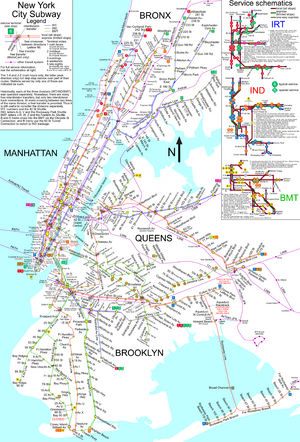 A 2009 map of New York City's passenger rail system | |
| Info | |
| Owner | Metropolitan Transportation Authority, Port Authority of New York and New Jersey, State of New Jersey, other local governments |
| Locale | New York City metropolitan area |
| Transit type | Rapid transit, commuter rail, bus and bus rapid transit, light rail, people mover, aerial tramway, bicycle sharing system, taxicab |
| Operation | |
| Operator(s) | MTA, NJ Transit, PATH, Port Authority of New York and New Jersey, and private operators |
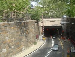
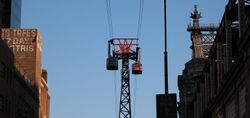
نظام النقل في مدينة نيويورك هو شبكة من نظم معقدة من البنى التحتية. فلكون مدينة نيويورك أكثر مدن الولايات المتحدة اكتظاظاً بالسكان، فلديها نظام مواصلات يضم one of the largest subway systems in the world; the world's first mechanically ventilated vehicular tunnel; and an aerial tramway. New York City's airport system, which includes John F. Kennedy International Airport, LaGuardia Airport, Newark Liberty International Airport (الواقع في نيوجرزي)، Stewart Airport and a few smaller facilities, is one of the largest in the world. New York City is also home to an extensive bus system in each of the five boroughs, and numerous taxis throughout the city.
خلفية
التاريخ
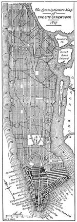
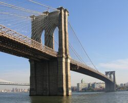
The history of New York City's transportation system began with the Dutch port of New Amsterdam. The port had maintained several roads; some were built atop former Lenape trails, others as "commuter" links to surrounding cities, and one was even paved by 1658 from orders of Petrus Stuyvesant, according to Burrow, et al.[1] The 19th century brought changes to the format of the system's transport: the establishment of a Manhattan street grid through the Commissioners' Plan of 1811,[2] as well as an unprecedented link between the then-separate cities of New York and Brooklyn via the Brooklyn Bridge, in 1883.[3]
The Second Industrial Revolution fundamentally changed the city – the port infrastructure grew at such a rapid pace after the 1825 completion of the Erie Canal that New York became the most important connection between all of Europe and the interior of the United States. Elevated trains and subterranean transportation ('El trains' and 'subways') were introduced between 1867 and 1904. In 1904, the first subway line became operational.[4] Practical private automobiles brought an additional change to the city by around 1930, notably the 1927 Holland Tunnel. With automobiles gaining importance, the later rise of Robert Moses was essential to creating New York's modern road infrastructure. Moses was the architect of all 416 ميل (669 km) of the parkway, many other important roads, and seven great bridges.[5]
استخدام النقل العام وملكية السيارات
الحافلات
الترام الهوائي
الطرق العادية والسريعة
Despite New York's reliance on public transit, roads are a defining feature of the city. Manhattan's street grid plan greatly influenced the city's physical development. Several of the city's streets and avenues, like Broadway, Wall Street and Madison Avenue are also used as shorthand or metonym in American vernacular for national industries located there: theater, finance, and advertising, respectively.
In Manhattan, there are twelve numbered avenues that run parallel to the Hudson River, and 220 numbered streets that run perpendicular to the river.
An advanced convergence indexing road traffic monitoring system was installed in New York City for testing purposes in May 2008.
To keep roadways, tunnels, and bridges safe for pedestrians and drivers, New York City has made efficient use of timers to regulate traffic lighting and help conserve energy.
الجسور والأنفاق
انظر أيضاً
- Cycling in New York City
- New York City Department of Transportation
- List of U.S. cities with most pedestrian commuters
- Rail freight transportation in New York City and Long Island
الهامش
- ^ Burrows; et al. (1999). Gotham. Oxford Press. ISBN 0-19-511634-8.
- ^ قالب:Cite citygrid
- ^ "Glorification! The Cities Celebrate the Work That Makes Them One". Brooklyn Daily Eagle. May 24, 1883. p. 12. Archived from the original on March 26, 2023. Retrieved June 26, 2019 – via Brooklyn Public Library; newspapers.com
 .
.
- ^ Walker, James Blaine (1918). Fifty Years of Rapid Transit, 1864–1917. Archived from the original on March 26, 2023. Retrieved January 7, 2015.
- ^ Caro, Robert (1974). The Power Broker: Robert Moses and the Fall of New York. New York: Knopf. ISBN 978-0-394-48076-3. OCLC 834874.
للاستزادة
- Ascher, Kate, The Works: Anatomy of a City, 2005
- Cheape, Charles W., Moving the masses: urban public transit in New York, Boston, and Philadelphia, 1880-1912, Harvard University Press, 1980. ISBN 0-674-58827-4
- Mathew, Biju, Taxi!: Cabs and Capitalism in New York City, 2005
- Solis, Julia, New York Underground, 2004
- Tanenbaum, Susie J., Underground Harmonies: Music and Politics in the Subways of New York , 1995
وصلات خارجية
- MTA official website
- PANYNJ official website
- NYC area transit map
- Regional Plan Association
- New York Metropolitan Transportation Council, an association of urban and suburban agencies
