تيانجين
| ||||||||||||||||||||||||||||||||||||||||||||||||||||||||||||||||||||||||||||||||||||||||||||||||||||
| ||||||||||||||||||||||||||||||||||||||||||||||||||||||||||||||||||||||||||||||||||||||||||||||||||||
| ||||||||||||||||||||||||||||||||||||||||||||||||||||||||||||||||||||||||||||||||||||||||||||||||||||


.svg&filetimestamp=20230707000635&)
.svg&filetimestamp=20230707000628&)
تيانجين ( Tianjin ؛ /tjɛnˈdʒɪn/;[4] صينية: 天津؛ پنين: Tiānjīn�; Mandarin: [tʰján.tɕín] (![]() استمع)), alternately romanized as Tientsin ( /ˈtjɛnˈtsɪn/),[5] هي municipality and a coastal metropolis in Northern China on the shore of the Bohai Sea. It is one of the nine national central cities in Mainland China, with a total population of 13,866,009 inhabitants during the 2020 Chinese census. Its built-up (or metro) area, made up of 12 central districts (all but Baodi, Jizhou, Jinghai and Ninghe), was home to 11,165,706 inhabitants and is also the world's 29th-largest agglomeration (between Chengdu and Rio de Janeiro) and 11th-most populous city proper.[6]
استمع)), alternately romanized as Tientsin ( /ˈtjɛnˈtsɪn/),[5] هي municipality and a coastal metropolis in Northern China on the shore of the Bohai Sea. It is one of the nine national central cities in Mainland China, with a total population of 13,866,009 inhabitants during the 2020 Chinese census. Its built-up (or metro) area, made up of 12 central districts (all but Baodi, Jizhou, Jinghai and Ninghe), was home to 11,165,706 inhabitants and is also the world's 29th-largest agglomeration (between Chengdu and Rio de Janeiro) and 11th-most populous city proper.[6]
It is governed as one of the four municipalities under the direct administration of Chinese central government and is thus under direct administration of the State Council. Tianjin borders Hebei Province and Beijing Municipality, bounded to the east by the Bohai Gulf portion of the Yellow Sea. Part of the Bohai Economic Rim, it is the largest coastal city in Northern China and part of the Jing-Jin-Ji megapolis.
In terms of urban population, Tianjin is the seventh largest city in China. In terms of administrative area population, Tianjin ranks fifth in Mainland China.[7] The walled city of Tianjin was built in 1404. As a treaty port since 1860, Tianjin has been a major seaport and gateway to Beijing. During the Boxer Rebellion the city was the seat of the Tianjin Provisional Government. Under the Qing dynasty and the Republic of China, Tianjin became one of the largest cities in the region.[8] At that time, numerous European-style buildings and mansions were constructed in concessions, many of which are well-preserved today. After the founding of the People's Republic of China, Tianjin suffered a depression due to the policy of the central government and 1976 Tangshan earthquake, but recovered from 1990s.[9] Tianjin is classified as the largest type of port-city, a Large-Port Megacity, due to its large urban population and port traffic volume.[10]
Nowadays, Tianjin is a dual-core city, with its main urban area (including the old city) located along the Hai River, which connects to the Yellow and Yangtze Rivers via the Grand Canal; and Binhai, an adjacent New Area urban core located east of the old city, on the coast of the Bohai Gulf. As of the end of 2010, around 285 Fortune 500 companies have set up base in Binhai. Since 2010, Tianjin's Yujiapu Financial District has become known as China's Manhattan[11][12] and the city is considered one of the world's top 100 cities, including in the Global Financial Centres Index.[13] Tianjin is ranked as a Beta (global second tier) city by the Globalization and World Cities Research Network.[14]
Tianjin is one of the top 20 cities in the world by scientific research outputs as tracked by the Nature Index,[15] and home to multiple notable institutes of higher education in Northern China, including Tianjin University, Nankai University, Tianjin Normal University, Tianjin Medical University, Tiangong University, Tianjin University of Science & Technology, Tianjin University of Technology, and Hebei University of Technology.[16][17]
الاسم
Tianjin is the pinyin romanization of the Chinese characters 天津, which means "Heavenly Ford" or "Ford of Heaven".
The origin of the name is obscure. One folk etymology is that it was an homage to the patriotic Chu poet Qu Yuan, whose "Li Sao" includes the verse "... departing from the Ford of Heaven at dawn ..." (朝發軔於天津兮, zhāo fārèn yú Tiānjīn xī). Another is that it honors a former name of the Girl, a Chinese constellation recorded under the name Tianjin in the Astronomical Record section of the Book of Sui. A third is that it derives from a place name noted in the River Record of the History of Jin. The most common is that it was bestowed by the Yongle Emperor of the Ming, who crossed Tianjin's Gu River on his way south to overthrow his nephew, the Jianwen Emperor.
Prior to the introduction of pinyin, the city's name was historically romanized as Tientsin in the Chinese postal romanization. The current English spelling of Tianjin was adopted in 1958 after pinyin was introduced by the PRC government. Several countries, international organizations and media outlets adopted the pinyin name beginning in 1979. The Government of the Republic of China on Taiwan continues to use the postal and Wade-Giles spelling after the adoption of pinyin by the ROC government in 2009.
التاريخ
التاريخ المبكر
The land where Tianjin is located today was created in between 900 and 1300 CE by sedimentation of various rivers entering the sea at Bohai Gulf, including the Yellow River, which entered the open sea in this area at one point. The construction of the Grand Canal under the Sui dynasty helped the future development of Tianjin as the canal ran from Hangzhou to the Beijing and Tianjin region by 609 CE. Grain from southern China was regularly transported to the north through the canal and was used during the subsequent dynasties. Tianjin begins to be increasingly mentioned in records during the Song dynasty and gains importance during the Yuan dynasty. Tianjin experienced development under the Yuan and became a prime location for the storage of goods and grains. Tianjin became a garrison town and shipping station during the Ming dynasty. It became a center of commerce and prosperity by the 17th century.[18]
أسرة تشينگ
During the Qing dynasty (1644 – 1911) Tianjin Prefecture or Zhou (州) was established in 1725, and Tianjin County was established within the prefecture in 1731. Later it was upgraded to an urban prefecture or Fu (府) before becoming a relay station (駐地) under the command of the Viceroy of Zhili.

الانفتاح كميناء معاهدة
In 1856, Chinese soldiers boarded The Arrow, a Chinese-owned ship registered in Hong Kong flying the British flag and suspected of piracy, smuggling, and of being engaged in the opium trade. They captured 12 men and imprisoned them. In response, the British and French sent gunboats under the command of Admiral Sir Michael Seymour to capture the Taku forts near Tianjin in May 1858. At the end of the first part of the Second Opium War in June of the same year, the British and French prevailed, and the Treaty of Tientsin was signed, which opened Tianjin (Tientsin) to foreign trade. The treaties were ratified by the Xianfeng Emperor in 1860, and Tianjin was formally opened to Great Britain and France, and thus to the outside world. Between 1895 and 1900, Britain and France were joined by Japan, Germany and Russia, and even by countries without Chinese concessions such as Austria-Hungary, Italy and Belgium, in establishing self-contained concessions in Tianjin, each with its own prisons, schools, barracks and hospitals.[19] These nations left many architectural reminders of their rule, notably churches and thousands of villas.

The presence of foreign influence in Tianjin was not always peaceful; one of the most serious violent incidents to date was the Tianjin Church Massacre. In June 1870, the orphanage held by the Wanghailou Church (Church Our Lady's Victories), in Tianjin, built by French Roman Catholic missionaries, was accused of the kidnapping and brainwashing of Chinese children. On June 21, the magistrate of Tianjin County initiated a showdown at the church that developed into violent clashes between the church's Christian supporters and some non-Christian Tianjin residents. The furious protesters eventually burned down Wanghailou Church and the nearby French consulate and killed eighteen foreigners including ten French nuns, the French consul himself, and merchants. France and six other Western nations complained to the Qing government, which was forced to pay compensation for the incident.
In 1885 Li Hongzhang founded the Tianjin Military Academy (天津武備學堂�) for Chinese army officers with German advisors, as part of his military reforms.[20] The move was supported by Anhui Army commander Zhou Shengchuan.[20] The academy was to serve Anhui Army and Green Standard Army officers. Various practical military, mathematic and science subjects were taught at the academy. The instructors were German officers.[20] Another program was started at the academy for five years in 1887 to train teenagers as new army officers.[20] Mathematics, practical and technical subjects including sciences, foreign languages, Chinese Classics and history were taught at the school. Exams were administered to students. The instruction for Tianjin Military Academy was copied at the Weihaiwei and Shanhaiguan military schools.[20] The 'maritime defense fund' supplied the budget for the Tianjin Military Academy, which was shared with the Tianjin Naval Academy.[20] The Tianjin Military Academy in 1886 adopted as part of its curriculum the Romance of the Three Kingdoms.[21] Among its alumni were Wang Yingkai and Duan Qirui. Among its staff was Yinchang.

In June 1900, the Boxers were able to seize control of much of Tianjin. On June 26, European defense forces heading towards Beijing were stopped by Boxers at nearby Langfang, and were defeated and forced to turn back to Tianjin. The foreign concessions were also under siege for several weeks.

In July 1900, the Eight-Nation Alliance recaptured Tianjin. This alliance soon established the Tianjin Provisional Government, composed of representatives from each of the occupying forces (Russian, British, Japanese, German, French, American, Austro-Hungarian, and Italian). The city was governed by this council until August 15, 1902 when the city was returned to Qing control. Eminent Qing General Yuan Shikai led efforts to transform Tianjin into a modern city, establishing the first modern Chinese police force. In 1907, Yuan supervised China's first modern democratic elections for a county council.

Western nations were permitted to garrison the area to ensure open access to Beijing. The British maintained a brigade of two battalions in Tianjin, and the Italians, French, Japanese, Germans, Russians, and Austro-Hungarians maintained under strength regiments; the United States did not initially participate. During World War I, the German and Austro-Hungarian garrisons were captured and held as Prisoners of War by Allied Forces while the Bolshevik government withdrew the Russian garrison in 1918. In 1920, the remaining participating nations asked the United States to join them, and the US then sent the 15th Infantry Regiment, less one battalion, to Tianjin from the Philippines.
Because of the rapid development of industry, commerce and finance, Tianjin was established as a municipality of China in 1927. From 1930 to 1935, Tianjin was the provincial capital of Hebei, after which it was reestablished as an independent municipality.
Garrison duty was highly regarded by the troops. General George C. Marshall, the "architect of victory" in World War II when he was the United States Army Chief of Staff, served at Tianjin in the 1920s as Executive Officer of the 15th Infantry. The US withdrew this unit in 1938 and a US presence was maintained only by the dispatch of a small US Marine Corps unit from the Embassy Guard at Beijing.

الحرب الصينية اليابانية الثانية
On July 30, 1937, Tianjin fell to Japan, as part of the الحرب الصينية اليابانية الثانية, but was not entirely occupied, as the Japanese for the most part respected foreign concessions until 1941, when the American and British concessions were occupied. In the summer of 1939, there occurred a major crisis in Anglo-Japanese relations with the Tientsin Incident. On June 14, 1939, the Imperial Japanese Army surrounded and blockaded the British concession over the refusal of the British authorities to hand over to the Japanese six Chinese who had assassinated a locally prominent Japanese collaborator, and had taken refuge in the British concession. For a time, the 1939 crisis appeared likely to cause an Anglo-Japanese war, especially when reports of the maltreatment by the Japanese Army of British subjects wishing to leave or enter the concession appeared in the British press. The crisis ended when the British Prime Minister Neville Chamberlain was advised by the Royal Navy and the Foreign Office that the only way to force the Japanese to lift the blockade was to send the main British battle fleet to Far Eastern waters, and that given the current crisis in Europe it would be inappropriate to send the British fleet out of European waters, thus leading the British to finally turn over the six Chinese, who were then executed by the Japanese. During the Japanese occupation, Tianjin was ruled by the North China Executive Committee, a puppet state based in Beijing.
On August 9, 1940, all of the British troops in Tianjin were ordered to withdraw. On November 14, 1941 the American Marine unit stationed in Tianjin was ordered to leave, but before this could be accomplished, the Japanese attacked the United States. The American Marine detachment surrendered to the Japanese on December 8, 1941. Only the Italian and French concessions (the local French officials were loyal to Vichy) were allowed by the Japanese to remain. When Italy signed an armistice with the Allies in September 1943, Japanese troops took the Italian concession following a battle with its garrison, and the Italian Social Republic formally ceded it to Wang Jingwei's Japan-controlled puppet state. Japanese occupation of the city lasted until August 15, 1945, with the surrender of Japan marking the end of World War II.
بعد الحرب العالمية الثانية

In the Pingjin Campaign of the Chinese Civil War, the city was captured after 29 hours of fighting. The Chinese Communist Party (CCP) took Tianjin on January 15, 1949.
From 1949 to February 1958, Tianjin was a municipality directly under the control of the central government. In October 1952, Tanggu New Port officially opened its doors, and the first 10,000-ton ferry arrived at Newport Pier. In February 1958, due to the "Great Leap Forward" and Tianjin's good industrial foundation, Tianjin was incorporated into Hebei Province and Hebei Province was relocated to Tianjin for eight years. During the period, under the coordination of the State Council, the city of Tianjin implemented a separate policy for central planning, which was independent of Hebei Province. However, a large number of factories and colleges in Tianjin moved to Hebei, adversely affecting Tianjin's economic development. In January 1967, due to "preparation, preparation for disasters", and concerns that Tianjin would become a battlefield, Hebei Province repatriated the provincial capital to Baoding, and the CCP Central Committee decided that Tianjin should be restored to the central municipality and remain so far. In April 1970, in the event that the Central Government had applied for funding for the construction of the subway, the Tianjin Municipal Government decided to raise funds on its own to establish the project on the basis of the name of the channel, and build it on the basis of the old walled river. In July 1973, five counties including Jixian, Baodi, Wuqing, Jinghai, and Ninghe were formally placed under the jurisdiction of Tianjin.

On July 28, 1976, during the 7.6 magnitude Tangshan Earthquake, Tianjin was affected by the shock waves and suffered major loss of life. In the city, 24,345 people died and 21,497 were seriously injured. 60% of the city's buildings were destroyed and more than 30% of the enterprises and Peking Port Reservoir and Yuqiao Reservoir were seriously damaged. Nearly 700,000 people were left homeless. On October 10 of the same year, the Tianjin Underground Railway was opened to traffic. In 1981, Miyun Reservoir was built on the upper reaches of the Hai River and is used to supply water for Beijing, however the reservoir stopped the river from supplying water to Tianjin, resulting in difficulty in the use of water in Tianjin. In the same year, the State Council of the People's Republic of China decided to initiate a project to solve the problem of water use in Tianjin and attract talented individuals to the city's academic centers.

In 1984, during the beginning of the Chinese government's economic reforms, Tianjin was listed as one of the 14 coastal open cities by the State Council and the Tianjin Development Zone's economy began to develop rapidly, However, the overall development speed of Tianjin is still slower than that of special economic zones and that of other southeast coastal areas. In 1994, Tianjin began its strategic industrial shift towards the east and developed the Binhai New Area with the Tianjin Port as the core. In October 2005, the Fifth Plenary Session of the 16th CCP Central Committee was convened. The meeting decided to incorporate the development and opening up of the Binhai New Area into the "Eleventh Five-Year Plan" and the national development strategy. In March 2006, the State Council executive meeting positioned Tianjin as an "international port city, a northern economic center, and an "ecological city". Since then, the dispute between the Beijing-Tianjin economic center at the policy level has come to an end. In May 2006, the State Council approved the Binhai New Area as a national integrated reform pilot area. In June of the same year, the "State Council's Opinions on Promoting the Development and Opening of the Tianjin Binhai New Area" was announced and clearly stated: "In financial enterprises, financial services, financial markets, and finance Major reforms such as opening up can, in principle, be scheduled to precede the Tianjin Binhai New Area.
In August 2008, China's first high-speed railway, the Beijing-Tianjin Intercity Railway, with a speed of 350 kilometers per hour was opened. In August 2008 Tianjin was the co-host city of the 29th Olympic Games. In September 2008, the Annual Meeting of the New Champions of World Economic Forum (also called Summer Davos) began to be established in Tianjin and is held every two years.[22] In October 2010, the UN Climate Change Conference convened in Tianjin.[23] In 2012, the Tianjin Metro Lines 2, 3, and 9 were completed and open to traffic, and Tianjin Rail Transit was formally networked.
In October 2013, Tianjin hosted the East Asian Games, which was the first time Tianjin hosted an international comprehensive event. In 2014, the coordinated development of Beijing, Tianjin, and Hebei was officially incorporated into the national strategy. Tianjin was positioned as "National Advanced Manufacturing R&D Base, Northern International Shipping Core Area, Financial Innovation Operation Demonstration Area, and Reform and Opening-up Preceding Area". In the same year, the first phase of the South-to-North Water Transfer Project was completed, and the water availability in Tianjin improved. On February 26, 2015, the Tianjin National Independent Innovation Demonstration Zone was formally established. On April 21, the China (Tianjin) Free Trade Pilot Zone was formally established. On April 27, Jincheng Bank, the first private bank in northern China, officially opened its doors.
انفجار تيانجين 2015
On August 12, 2015, a major fire and explosion accident occurred in a chemical warehouse in Tianjin Port, causing 173 deaths, hundreds of injuries, and property losses.[24] The first two explosions occurred within 30 seconds of each other at the facility, which is located in the Binhai New Area of Tianjin, China. The second explosion was far larger and involved the detonation of about 800 tonnes of ammonium nitrate (approx. 256 tonnes TNT equivalent). Fires caused by the initial explosions continued to burn uncontrolled throughout the weekend, resulting in eight additional explosions on 15 August. The buildings of seven more surrounding logistics companies were destroyed. The cost to businesses caused by the explosion was estimated at $9 billion, making it the third most expensive supply chain disruption of 2015.

الجغرافيا


تقع تيان-تسين على بعد 120 كم جنوب شرقي بكين، وبالقرب من التقاء خمسة مجار مائية أهمها نهر تزيا Tzeya وين دين Yongding مؤلفة أضخم شريان مائي في القسم الشرقي من الإقليم، وهو نهر هاي-هو Hai-Ho، الذي يصلها بخليج بوهاي Po-Hai على بعد 45 كم، وبذلك تستطيع السفن البحرية ذات حمولة 3 آلاف طن الوصول إلى ميناء تيان-تسين النهري، وخاصة في موسم المد الأعظم، أما سفن المحيط فميناؤها البحري الرئيسي هو سينكانغ Sin Kang، الذي يقع على مصب نهر هاي في خليج بوهاي، ويعد نافذة المدينة التجارية على البحر الأصفر، إذ يدخل سنوياً إلى أرصفته نحو 1600 باخرة تجارية من بلاد العالم المختلفة.
.jpg&filetimestamp=20230707000719&)


ونتيجة لموقع المدينة في السهل الصيني الشمالي المزدحم بالسكان (أكثر من 250ن/كم²) فالزراعة في محيطها متنوعة المحاصيل (القطن والقمح والسمسم والأشجار المثمرة والتبغ وفول الصويا)، ويعود ذلك إلى غزارة أمطارها الصيفية (250-750مم/سنوياً) وامتداد قناة الصين العظمى في أراضيها حيث ترويها، وهذه القناة تعد شريان اتصال اقتصادي وحضاري بين مقاطعات الصين الشرقية. ومما ساعد على تطوير الزراعة أيضاً، بناء قناة تصريف جنوب المدينة على نهر هاي، لتخفيف حدة فيضانه الصيفي، وإقامة سد تخزيني كوان تيان Kouan-ting في مجراه الأعلى.


Tianjin is located along the west coast of the Bohai Gulf, looking out to the provinces Shandong and Liaoning across those waters, bordered by Beijing 120 kilometers (75 mi) to the northwest, and is surrounded on all sides by Hebei, with the exception of its eastern border, the Bohai Sea. With a latitude ranging from 38° 34' to 40° 15' N, and longitude ranging from 116° 43' to 118° 04' E, the total area is 11,860.63 square kilometers (4,579.41 sq mi). There is 153 km (95 mi) of coastline and 1,137.48 kilometers (706.80 mi) of land border.[25] It lies at the northern end of the Grand Canal of China, which connects with the Yellow River and Yangtze River. The municipality is generally flat, and swampy near the coast, but hilly in the far north, where the Yan Mountains intrude into northern Tianjin. Extensive tidal flats occur on the coastal plain adjacent to the city.[26] The highest point in the municipality is Jiuding Peak (九顶山) in Ji County on the northern border with Hebei, at an altitude of 1,078.5 m (3,538 ft).
The Hai River forms within Tianjin Municipality at the confluence of the Ziya River (子牙河), Daqing River (大清河), Yongding River, North Grand Canal, and South Grand Canal, and enters the Pacific Ocean within the municipality, as well in Tanggu District. Major reservoirs include the Beidagang Reservoir in the extreme south (in Dagang District) and the Yuqiao Reservoir in the extreme north in Ji County.
المناخ
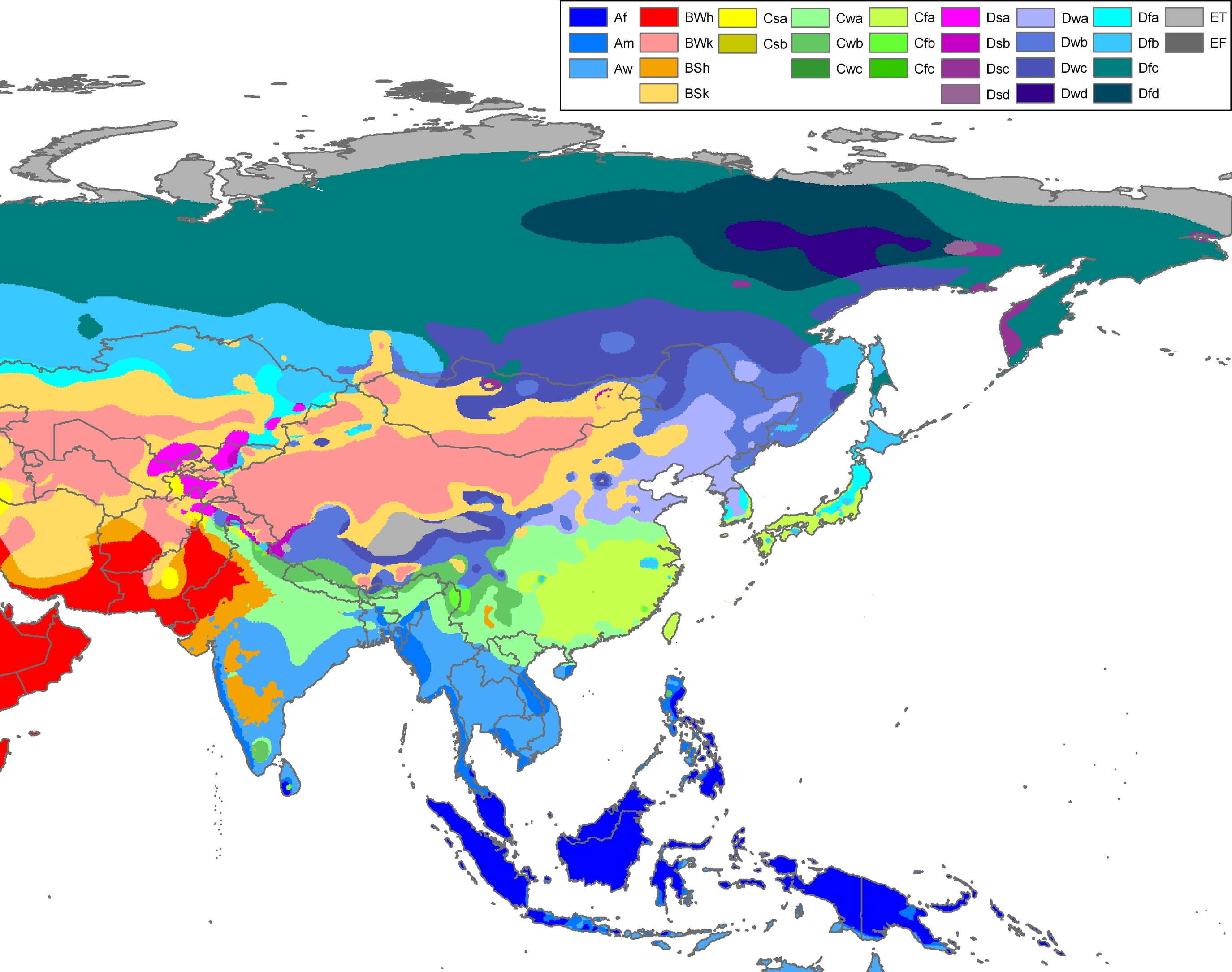
Tianjin has a semi-arid climate (Köppen BSk bordering on Dwa). It has a four-season, monsoon-influenced climate, typical of East Asia, with cold, windy, very dry winters reflecting the influence of the vast Siberian anticyclone, and hot, humid summers, due to the monsoon. Spring in the city is dry and windy, occasionally seeing sandstorms blowing in from the Gobi Desert, capable of lasting for several days. The monthly 24-hour average temperature ranges from −2.8 °C (27.0 °F) in January to 27.2 °C (81.0 °F) in July, with an annual mean of 13.3 °C (55.9 °F). With monthly percent possible sunshine ranging from 45% in July to 61% in March and April, the city receives 2,460 hours of bright sunshine annually. Having a low annual total precipitation of 521 millimeters (20.5 in), and nearly three-fifths of it occurring in July and August alone, the city lies within the semi-arid zone, with parts of the municipality being humid continental (Köppen BSk/Dwa, respectively).[27]
Extreme temperatures have ranged from −22.9 °C (−9 °F) to 40.5 °C (105 °F).[28]
| بيانات مناخ Tianjin (Dongli District) (1991–2020 normals) | |||||||||||||
|---|---|---|---|---|---|---|---|---|---|---|---|---|---|
| الشهر | يناير | فبراير | مارس | أبريل | مايو | يونيو | يوليو | أغسطس | سبتمبر | اكتوبر | نوفمبر | ديسمبر | العام |
| العظمى القياسية °س (°ف) | 14.3 (57.7) |
20.8 (69.4) |
30.5 (86.9) |
33.1 (91.6) |
40.5 (104.9) |
40.6 (105.1) |
40.5 (104.9) |
37.4 (99.3) |
34.9 (94.8) |
30.8 (87.4) |
23.1 (73.6) |
14.4 (57.9) |
40٫6 (105٫1) |
| العظمى المتوسطة °س (°ف) | 2.1 (35.8) |
5.8 (42.4) |
12.8 (55) |
20.8 (69.4) |
26.8 (80.2) |
30.2 (86.4) |
31.6 (88.9) |
30.7 (87.3) |
26.9 (80.4) |
19.8 (67.6) |
10.7 (51.3) |
3.7 (38.7) |
18٫49 (65٫29) |
| المتوسط اليومي °س (°ف) | −2.8 (27) |
0.4 (32.7) |
7.0 (44.6) |
14.8 (58.6) |
21.0 (69.8) |
25.0 (77) |
27.2 (81) |
26.3 (79.3) |
21.7 (71.1) |
14.3 (57.7) |
5.7 (42.3) |
−0.9 (30.4) |
13٫31 (55٫96) |
| الصغرى المتوسطة °س (°ف) | −6.5 (20.3) |
−3.7 (25.3) |
2.4 (36.3) |
9.6 (49.3) |
15.8 (60.4) |
20.6 (69.1) |
23.6 (74.5) |
22.7 (72.9) |
17.4 (63.3) |
9.9 (49.8) |
1.8 (35.2) |
-4.3 (24.3) |
9٫11 (48٫4) |
| الصغرى القياسية °س (°ف) | −18.1 (-0.6) |
−22.9 (-9.2) |
−17.7 (0.1) |
−2.8 (27) |
4.5 (40.1) |
10.1 (50.2) |
16.2 (61.2) |
13.7 (56.7) |
6.2 (43.2) |
−2.2 (28) |
−11.4 (11.5) |
−16.2 (2.8) |
−22٫9 (−9٫2) |
| هطول mm (inches) | 2.6 (0.102) |
6.0 (0.236) |
6.1 (0.24) |
22.8 (0.898) |
37.7 (1.484) |
78.0 (3.071) |
141.2 (5.559) |
122.3 (4.815) |
54.8 (2.157) |
32.8 (1.291) |
13.5 (0.531) |
3.1 (0.122) |
520٫9 (20٫508) |
| % Humidity | 54 | 54 | 49 | 48 | 53 | 64 | 73 | 75 | 67 | 62 | 60 | 56 | 59٫6 |
| Avg. precipitation days (≥ 0.1 mm) | 1.3 | 2.3 | 2.5 | 4.5 | 6.2 | 9.0 | 11.1 | 9.8 | 6.4 | 4.8 | 3.0 | 2.0 | 62٫9 |
| Sunshine hours | 167.6 | 175.9 | 227.7 | 243.8 | 267.8 | 233.9 | 202.2 | 203.3 | 212.3 | 199.8 | 165.2 | 160.9 | 2٬460٫4 |
| Source: China Meteorological Administration[29][30][31] | |||||||||||||
See or edit raw graph data.
Measures to improve air quality
In May 2014, the city's administration enacted new laws in an attempt to lower the city's pollution levels. These measures included several restrictions on days of severe pollution; halving the number of vehicles allowed on roads, halting construction and manufacturing activity, closing schools, and halting large-scale outdoor activities.[32]
Flights have also been grounded and highways closed.[33]
Foreign-born professional sportsmen have made statements regarding Tianjin's air quality, citing it as an impediment to athletic activity and being thick enough to "taste".[34]
التقسيمات الإدارية
Tianjin is divided into 16 county-level divisions, which are all المديريات.
| التقسيمات الإدارية لتيانجين | ||||||||||||||
|---|---|---|---|---|---|---|---|---|---|---|---|---|---|---|
| Division code[35] | التقسيم | Area in km2[36][استشهاد ناقص] | Total population 2010[37] | Urban area population 2010[38] |
المقر | الرمز البريدي | Subdivisions[39][استشهاد ناقص] | |||||||
| Subdistricts | البلدات | Townships | Ethnic townships | Residential communities | القرى | |||||||||
| 120000 | تيانجين | 11,760.00 | 12,938,693 | 10,277,893 | Hexi | 300000 | 112 | 118 | 10 | 1 | 1723 | 3762 | ||
| 120101 | Heping | 9.97 | 273,477 | Xiaobailou Subdistrict | 300041 | 6 | 63 | |||||||
| 120102 | Hedong | 15.06 | 860,852 | Dawangzhuang Subdistrict | 300171 | 13 | 158 | |||||||
| 120103 | خىشي | 41.24 | 870,632 | Dayingmen Subdistrict | 300202 | 13 | 171 | |||||||
| 120104 | Nankai | 40.64 | 1,018,196 | Changhong Subdistrict | 300110 | 12 | 180 | |||||||
| 120105 | Hebei | 29.14 | 788,451 | Wanghailou Subdistrict | 300143 | 10 | 109 | |||||||
| 120106 | Hongqiao | 21.30 | 531,526 | Xiyuzhuang Subdistrict | 300131 | 10 | 196 | |||||||
| 120110 | Dongli | 460.00 | 598,966 | 591,040 | Zhangguizhuang Subdistrict | 300300 | 9 | 90 | 102 | |||||
| 120111 | Xiqing | 545.00 | 713,060 | 524,894 | Yangliuqing town | 300380 | 2 | 7 | 106 | 151 | ||||
| 120112 | Jinnan | 401.00 | 593,063 | 590,072 | Xianshuigu town | 300350 | 8 | 68 | 165 | |||||
| 120113 | Beichen | 478.00 | 669,121 | 575,103 | Guoyuanxincun Subdistrict | 300400 | 5 | 9 | 115 | 126 | ||||
| 120114 | Wuqing | 1,570.00 | 951,078 | 352,659 | Yunhexi Subdistrict | 301700 | 6 | 24 | 64 | 695 | ||||
| 120115 | باودي | 1,523.00 | 799,157 | 271,992 | Baoping Subdistrict | 301800 | 6 | 16 | 37 | 765 | ||||
| 120116 | بينهاي | 2,270.00 | 2,423,204 | 2,313,361 | Xingang Subdistrict | 300451 | 19 | 7 | 254 | 144 | ||||
| 120117 | Ninghe | 1,414.00 | 416,143 | 152,388 | Lutai town | 301500 | 11 | 3 | 34 | 282 | ||||
| 120118 | Jinghai | 1,476.00 | 646,978 | 293,014 | Jinghai town | 301600 | 16 | 2 | 46 | 383 | ||||
| 120119 | Jizhou | 1,590.00 | 784,789 | 270,236 | Wenchang Subdistrict | 301900 | 1 | 20 | 5 | 1 | 32 | 949 | ||

| Divisions in Chinese and varieties of romanizations | ||||
|---|---|---|---|---|
| العربية | الصينية | پنين | ||
| بلدية تيانجين | 天津市 | Tiānjīn Shì | ||
| Heping District | 和平区 | Hépíng Qū | ||
| Hedong District | 河东区 | Hédōng Qū | ||
| Hexi District | 河西区 | Héxī Qū | ||
| Nankai District | 南开区 | Nánkāi Qū | ||
| Hebei District | 河北区 | Héběi Qū | ||
| Hongqiao District | 红桥区 | Hōngqiáo Qū | ||
| Dongli District | 东丽区 | Dōnglì Qū | ||
| Xiqing District | 西青区 | Xīqīng Qū | ||
| Jinnan District | 津南区 | Jīnnán Qū | ||
| Beichen District | 北辰区 | Běichén Qū | ||
| Wuqing District | 武清区 | Wǔqīng Qū | ||
| مديرية باودي | 宝坻区 | Bǎodǐ Qū | ||
| بينهاي الجديدة | 滨海新区 | Bīnhǎi Xīnqū | ||
| Ninghe District | 宁河区 | Nínghé Qū | ||
| Jinghai District | 静海区 | Jìnghǎi Qū | ||
| Jizhou District | 蓟州区 | Jìzhōu Qū | ||
In addition, the Tianjin Economic and Technological Development Area (TEDA) is not a formal level of administration, but nevertheless enjoys rights similar to a regular district. At the end of 2017, the total population of Tianjin is 15.57 million.[1]

These districts and counties are further subdivided, اعتبارا من 31 ديسمبر 2004[تحديث], into 240 تقسيمات بمستوى البلدية، including 120 towns, 18 townships, 2 ethnic townships and 100 subdistricts.
السياسة
The politics of Tianjin is structured in a dual party-government system like all other governing institutions في بر الصين الرئيسي.
عمدة تيانجين is the highest-ranking official in the People's Government of Tianjin. Since Tianjin is a municipality, the CCP Municipal Committee Secretary is colloquially termed the "Tianjin CCP Party chief".
الديمغرافيا
غالبية سكان تيانجين هم من صينيي الهان. الأقليات تضم الهوي المسلمين، الكوريين، مانشو ومنغول.

| الجماعات العرقية في تيانجين، في تعداد 2000 | ||
|---|---|---|
| الجماعات العرقية | التعداد | النسبة |
| هان | 9,581,775 | 97.29% |
| هوي | 172,357 | 1.75% |
| مانچو | 56,548 | 0.57% |
| المنغول | 11,331 | 0.12% |
| كوريون | 11,041 | 0.11% |
| ژوانگ | 4055 | 0.041% |
| توجيا | 3677 | 0.037% |
لا تتضمن أعضاء جيش التحرير الشعبي المنضوين في الخدمة.
المصدر: قسم السكان والإحصائيات الاجتماعية والعلوم والتكنولوجيا في المكتب الوطني الصيني للإحصاء (國家統計局人口和社會科技統計司) and Department of Economic Development of the State Ethnic Affairs Commission of China (國家民族事務委員會經濟發展司), eds. Tabulation on Nationalities of 2000 Population Census of China (《2000年人口普查中國民族人口資料》). 2 vols. Beijing: Nationalities Publishing House (民族出版社), 2003. (ISBN )
الاقتصاد

وتتميز المدينة بوظيفتها الصناعية، ويرجع ذلك إلى موقعها الجغرافي الذي يربط المنتجات الزراعية الداخلية بالسلع الأجنبية المستوردة، وإلى غنى ظهيرها الجغرافي بالمقومات الضرورية لتطوير صناعتها، ففي مقاطعة هوبي يتركز ثالث حوض نفطي في البلاد (حوض داكان)، وتحتوي أراضي المدينة على فلزات الحديد عالية الجودة، كما تستثمر مادة الملح البحري في منطقة شانغ-لو Tcháng-Lou، التي تقدم نحو ربع إنتاج البلاد. لذلك اشتهرت مدينة تيان-تسين منذ عام 1900، ولعدة عقود بالصناعات الخفيفة (الكبريت، والدراجات، والنسيج الصوفي والقطني، وصناعة التبغ والكيمياويات البسيطة)، ثم تطورت فيها سريعاً بعد عام 1949 الصناعات البترولية والثقيلة (التعدين والفولاذ، والآلات ومعدات توليد الكهرباء والتنقيب عن النفط ومحركات الديزل وعربات النقل) وصناعة الأجهزة الإلكترونية والسفن، وتتماثل مع مدينتي تاكو Ta-Ku وهانغو Hangu التابعتين لها إدارياً، بالصناعة الغذائية والكيمياوية. وبهذا تعد تيان-تسين المدينة الصناعية الثانية في البلاد بعد مدينة شنغهاي.
ومما ساعد على تطوير تيان-تسين أنها مركز مهم لشبكة مواصلات ضخمة تربط شمالي البلاد بالولايات الجنوبية، ومن أهمها: طريق تيان تسين-شنغهاي البري، خط تيان-تسين-نانكين Nanking (مقاطعة كيانغ سي) الحديدي، ميناء تيان-تسين الجوي، الطريق الملاحي النهري عبر قناة الري الكبرى، وأنابيب النفط التي تصل إلى السواحل الجنوبية من البلاد.
من بين أهم الصناعات المتواجدة في المدينة: الحديد والصلب، الآلات والكيماويات والطاقة الكهربائية والغزل والنسيج ومواد البناء وصناعة الورق والأطعمة. تطورت فيها مؤخرا صناعة السفن والسيارات واستخراج النفط ومعالجته وصناعة الجرارات والأسمدة الكيماوية والمبيدات الزراعية وساعات اليد والتلفزيونات وآلات التصوير وغيرها.
السياحة


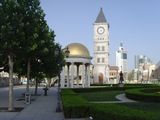
مشاهد ومعالم داخل منطقة تيانجين الحضرية:
- Luzutang (متحف تمرد الملاكمين)
- Guwan Shichang 古玩市场 (Antique Market)
- Guwenhua Jie 古文化街 (Ancient Culture Street)
- ون مياو 文庙 (معبد كونفوشيوس)
- Tianjin Radio and Television Tower 天津电视塔
- Tianjin Water Park 天津水上公园
- Tianjin Zoo 天津动物园
- Tianjin Museum 天津博物馆
- Hai River Park 海河公园
- Tianjin Olympic Center Stadium, also known as "The Water Drop" 天津奥体中心(水滴)
- Wu Da Dao 五大道 (Five Main Avenues)
- Italian District 意式风情区
- Shijia Dayuan 杨柳青:石家大院 (Shi Family Residence)
- Dabeiyuan 大悲禅院 (Temple of Great Compassion, Zen Buddhism Temple)
- Tianhou Palace 天后宫 (Mazu Temple in Tianjin, the biggest one in the entire Northern China region)
- Wanghailou Church 望海楼教堂
- Xikai Catholic Cathedral 西开天主教堂
- Memorial to Zhou Enlai and Deng Yingchao 周恩来邓颖超纪念馆
- Lishunde Grand Hotel 利顺德大酒店
- The Century Clock of Tianjin 天津世纪钟 (Tianjin Shijizhong)
مشاهد ومعالم خارج منطقة تيانجين الحضرية، ولكن ضمن البلدية:
- Soviet aircraft carrier Kiev Theme Park 前苏联航空母舰主题公园
- Taku Forts 大沽口炮台 (Cannon battlement Platform in Qing Dynasty)
- Huangyaguan Great Wall 黄崖关长城 (A famous fort on the Great Wall)
- Mount Panshan 盘山
معرض صور المدينة
Haihe River Park
(海河公园)
Old Guanyinhao Bank
(官银号)
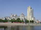
Haihe River
(海河)
Airport Industrial Park
(空港物流加工区)
Dongli District
(东丽)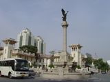
Italian District
(意式风情区)


المدن الشقيقة
انظر أيضا
- 天津 ("Heaven's port") is also the name of an asterism in the Chinese constellation of Girl Mansion (女宿)
- Gao Lingwen, founder of Tianjin's first public school
- List of cities in the People's Republic of China by population
- American, British, French, Italian, Belgian, Russian and Japanese Concessions in Tianjin
ملاحظات
المصادر
- ^ "China: Tiānjīn (Districts) - Population Statistics, Charts and Map". citypopulation.de.
- ^ "2021年天津Gdp达15695.05亿元 同比增长6.6%_中国经济网——国家经济门户". district.ce.cn (Press release).
- ^ "Sub-national HDI - Subnational HDI". globaldatalab.org. Global Data Lab. Retrieved 2020-04-17.
- ^ "Tianjin". Lexico UK English Dictionary. Oxford University Press. Archived from the original on April 11, 2021.
- ^ قالب:Cite Merriam-Webster
- ^ 2015年天津市国民经济和社会发展统计公报-新闻中心-北方网. news.enorth.com.cn. Archived from the original on October 2, 2016. Retrieved March 6, 2016.
- ^ 最新中国城市人口数量排名(根据2010年第六次人口普查). elivecity.cn. 2012. Archived from the original on March 3, 2015. Retrieved May 28, 2014.
- ^ 历史沿革. tj.gov.cn. Tianjin People's Government. December 4, 2009. Retrieved August 24, 2010.[dead link]
- ^ 河北人才被空吸 本地发展缓慢世界罕见. Sohu. February 26, 2006. Archived from the original on August 8, 2014. Retrieved August 20, 2010.
- ^ Roberts, Toby; Williams, Ian; Preston, John (2021). "The Southampton system: A new universal standard approach for port-city classification". Maritime Policy & Management. 48 (4): 530–542. doi:10.1080/03088839.2020.1802785. S2CID 225502755.
- ^ Alexandra Stenson and Cao Li (April 10, 2019). "'China's Manhattan' Borrowed Heavily. The People Have Yet to Arrive". The New York Times. Archived from the original on April 10, 2019. Retrieved April 11, 2019.
- ^ خطأ استشهاد: وسم
<ref>غير صحيح؛ لا نص تم توفيره للمراجع المسماةChinaManhattan2 - ^ "The Global Financial Centres Index 28" (PDF). Long Finance. September 2020. Retrieved 26 September 2020.
- ^ "The World According to GaWC 2020". lboro.ac.uk. Retrieved 2020-10-04.
- ^ "Leading 200 science cities | Nature Index 2022 Science Cities | Supplements | Nature Index". nature.com (in الإنجليزية). Retrieved 2022-11-26.
- ^ "Nature Index 2018 Science Cities | Nature Index Supplements | Nature Index". natureindex.com. Retrieved 2020-10-07.
- ^ "US News Best Global Universities Rankings in Tianjin". U.S. News & World Report. 2021-10-26. Retrieved 2021-10-30.
- ^ Schellinger, Paul; Salkin, Robert, eds. (1996). International Dictionary of Historic Places, Volume 5: Asia and Oceania. Chicago: Fitzroy Dearborn Publishers. p. 813. ISBN 1-884964-04-4.
- ^ Donati, Sabina (June 2016). "Italy's Informal Imperialism in Tianjin During the Liberal Epoch, 1902–1922". The Historical Journal. 59 (2): 447–468. doi:10.1017/S0018246X15000461. S2CID 163536150.
- ^ أ ب ت ث ج ح John King Fairbank (1978). The Cambridge History of China. Cambridge University Press. ISBN 978-0-521-22029-3. Archived from the original on August 21, 2016. Retrieved August 19, 2016.
- ^ Michael Lackner, Ph.D.; Natascha Vittinghoff (January 2004). Mapping Meanings: The Field of New Learning in Late Qing China; [International Conference "Translating Western Knowledge Into Late Imperial China", 1999, Göttingen University]. BRILL. pp. 269–. ISBN 978-90-04-13919-0.
- ^ "World Economic Forum: The Inaugural Annual Meeting of the New Champions". China.org. Archived from the original on September 23, 2015. Retrieved August 29, 2008.
- ^ "Global climate talks kick off in China". CNN. October 4, 2010. Archived from the original on November 8, 2012. Retrieved March 15, 2011.
- ^ "China blasts: Casualties as Tianjin warehouse blows up". BBC News. August 13, 2015. Archived from the original on July 18, 2018. Retrieved June 21, 2018.
- ^ 天津地理位置、行政区划、人口民族概况 (in الصينية المبسطة). Chinagate. نوفمبر 30, 2007. Archived from the original on يونيو 26, 2012. Retrieved يوليو 17, 2012.
- ^ Murray, N.J.; Clemens, R.S.; Phinn, S.R.; Possingham, H.P.; Fuller, R.A. (2014). "Tracking the rapid loss of tidal wetlands in the Yellow Sea" (PDF). Frontiers in Ecology and the Environment. 12 (5): 267–272. doi:10.1890/130260.
- ^ Peel, M. C. and Finlayson, B. L. and McMahon, T. A. (2007). "Updated world map of the Köppen-Geiger climate classification". Hydrol. Earth Syst. Sci. 11: 1633–1644.
- ^ "Extreme Temperatures Around the World". Archived from the original on أغسطس 4, 2014. Retrieved أغسطس 28, 2010.
- ^ CMA台站气候标准值(1991-2020) (in الصينية). China Meteorological Administration. Retrieved 2023-04-11.
- ^ 中国气象局 国家气象信息中心 (in الصينية المبسطة). China Meteorological Administration. June 2011. Archived from the original on July 10, 2014. Retrieved November 20, 2010.
- ^ "Index" 中国气象数据网 – WeatherBk Data. China Meteorological Administration. Archived from the original on September 5, 2018. Retrieved November 9, 2018.
- ^ "China's Tianjin to restrict vehicle use to curb pollution". Reuters. Archived from the original on سبتمبر 24, 2015. Retrieved أكتوبر 14, 2010.
- ^ "Highways shut, flights grounded as smog blankets China's Tianjin". Reuters. December 18, 2016.
- ^ "Paartalu Airs Player Concerns about Smoggy China". Archived from the original on أكتوبر 27, 2014. Retrieved أكتوبر 14, 2010.
- ^ 国家统计局统计用区划代码. National Bureau of Statistics of the People's Republic of China. Archived from the original on April 7, 2012.
- ^ 《保定经济统计年鉴2011》
- ^ Census Office of the State Council of the People's Republic of China; Population and Employment Statistics Division of the National Bureau of Statistics of the People's Republic of China (2012). 中国2010年人口普查分乡、镇、街道资料 (1 ed.). Beijing: China Statistics Print. ISBN 978-7-5037-6660-2.
- ^ 国务院人口普查办公室、国家统计局人口和社会科技统计司编 (2012). 中国2010年人口普查分县资料. Beijing: China Statistics Print. ISBN 978-7-5037-6659-6.
- ^ 《中国民政统计年鉴2012》
قراءات إضافية
- Ruth Rogaski. Hygienic Modernity: Meanings of Health and Disease in Treaty-Port China. University of California Press, 2004.
- بيانات اقتصادية
وصلات خارجية
- الموقع الرسمي لحكومة تيان جين
- Official Tianjing Media Gateway
- Tianjin Taoist Association
- Tianjin Travel Blog
- تيانجين travel guide from Wikitravel
 Media related to Tianjin at Wikimedia Commons
 "Tientsin". Encyclopædia Britannica (11th ed.). 1911.
روابط إلى مقالات ذات صلة | |||||||||||||||||||||||||||||||||||||||||||||||||||||||||||||||||||||||||||||||||||||||||||||||||||||||||||||||||||||||||||||||||||||||||||||||||||||||
|---|---|---|---|---|---|---|---|---|---|---|---|---|---|---|---|---|---|---|---|---|---|---|---|---|---|---|---|---|---|---|---|---|---|---|---|---|---|---|---|---|---|---|---|---|---|---|---|---|---|---|---|---|---|---|---|---|---|---|---|---|---|---|---|---|---|---|---|---|---|---|---|---|---|---|---|---|---|---|---|---|---|---|---|---|---|---|---|---|---|---|---|---|---|---|---|---|---|---|---|---|---|---|---|---|---|---|---|---|---|---|---|---|---|---|---|---|---|---|---|---|---|---|---|---|---|---|---|---|---|---|---|---|---|---|---|---|---|---|---|---|---|---|---|---|---|---|---|---|---|---|---|
قالب:Roads and Expressways of Tianjin قالب:Landmarks in Tianjin
| |||||||||||||||||||||||||||||||||||||||||||||||||||||||||||||||||||||||||||||||||||||||||||||||||||||||||||||||||||||||||||||||||||||||||||||||||||||||


.jpg&filetimestamp=20221025045004&)


.jpg&filetimestamp=20230707000719)
- صفحات بها مخططات
- CS1 uses الصينية-language script (zh)
- Articles with dead external links from July 2018
- CS1 الصينية المبسطة-language sources (zh-hans)
- CS1 الصينية-language sources (zh)
- Articles containing صينية-language text
- Short description is different from Wikidata
- Articles with hatnote templates targeting a nonexistent page
- Missing redirects
- Pages using multiple image with auto scaled images
- Coordinates on Wikidata
- صفحات تستخدم جدول مستوطنة بقائمة محتملة لصفات المواطن
- مقالات تحتوي نصوصاً باللغة الصينية
- مقالات تحتوي نصوصاً باللغة الصينية التقليدية
- Articles with incomplete citations from September 2018
- All articles with incomplete citations
- مقالات فيها عبارات متقادمة منذ 2004
- جميع المقالات التي فيها عبارات متقادمة
- Pages using adjacent communities with unknown parameters
- تيانجين
- مدن مستقلة
- سهل الصين الشمالي
- مدن صينية
- بلديات الصين
- مناطق عمرانية في الصين
- Populated coastal places in China
- تقسيمات بمستوى مقاطعة في الصين
- صفحات مع الخرائط