الإسقاط المتآصل في رسم الخرائط

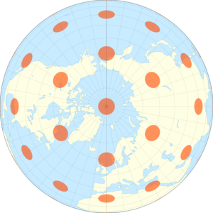
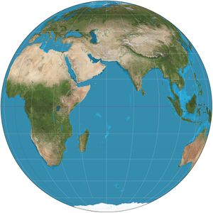
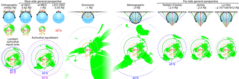
استخدام الإسقاط المتآصل في رسم الخرائط orthographic projection in cartography يعود إلى زمن بعيد. فمِثل إسقاط مجسم و gnomonic projection, إسقاط متآصل هو إسقاط منظوري (أو سمتي), in which the sphere is projected onto a tangent plane or secant plane. The point of perspective for the orthographic projection is at infinite distance. It depicts a hemisphere of the globe as it appears from outer space, where the horizon is a great circle. The shapes and areas are distorted, particularly near the edges.[1][2]
التاريخ
The orthographic projection has been known since antiquity, with its cartographic uses being well documented. Hipparchus used the projection in the 2nd century B.C. to determine the places of star-rise and star-set. In about 14 B.C., Roman engineer Marcus Vitruvius Pollio used the projection to construct sundials and to compute sun positions.[2]
الرياضيات
The formulas for the spherical orthographic projection are derived using trigonometry. They are written in terms of longitude (λ) and latitude (φ) on the sphere. Define the radius of the sphere R and the center point (and origin) of the projection (λ0, φ0). The equations for the orthographic projection onto the (x, y) tangent plane reduce to the following:[1]
Latitudes beyond the range of the map should be clipped by calculating the distance c from the center of the orthographic projection. This ensures that points on the opposite hemisphere are not plotted:
- .
The point should be clipped from the map if cos(c) is negative.
The inverse formulas are given by:
حيث
See References for an ellipsoidal version of the orthographic map projection.[3]
الإسقاطات المتآصلة على أسطوانات
وبنظرة شاملة، فكل الإسقاطات بنقطة منظور في اللانهاية (ولذلك فخطوط الإسقاط متوازية) تُعتبر متآصلة بغض النظر عن السطح المـُسقـَط عليه. هذه الأنواع من الإسقاطات تشوّه الزوايا والمساحات القريبة من القطبين.[مطلوب توضيح]
مثال للإسقاط المتآصل على أسطوانة هو إسقاط لامبرت الأسطواني متساوي المساحات.
انظر أيضاً
الهامش
- ^ أ ب Snyder, J. P. (1987). Map Projections—A Working Manual (US Geologic Survey Professional Paper 1395). Washington, D.C.: US Government Printing Office. pp. 145–153.
- ^ أ ب Snyder, John P. (1993). Flattening the Earth: Two Thousand Years of Map Projections pp. 16–18. Chicago and London: The University of Chicago Press. ISBN 0-226-76746-9.
- ^ Zinn, Noel (June 2011). "Ellipsoidal Orthographic Projection via ECEF and Topocentric (ENU)" (PDF). Retrieved 2011-11-11.


