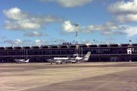
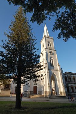
بيرا، موزمبيق
بيرا
Beira | |
|---|---|
 | |
| الإحداثيات: 19°50′S 34°51′E / 19.833°S 34.850°E | |
| Country | |
| Provinces | Sofala Province |
| Founded | 1887 |
| City Status | 1907 |
| الحكومة | |
| • Mayor | Daviz Simango |
| المساحة | |
| • الإجمالي | 633 كم² (244 ميل²) |
| المنسوب | 14 m (46 ft) |
| التعداد (2017 census) | |
| • الإجمالي | 533٬825 |
| • الكثافة | 840/km2 (2٬200/sq mi) |
| Climate | Aw |
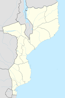
Beira is the fourth largest city in Mozambique.[1] It lies in the central region of the country in Sofala Province, where the Pungwe River meets the Indian Ocean. Beira had a population of 397,368 in 1997, which grew to 530,604 in 2019. It holds the regionally significant Port of Beira which acts as a gateway for both the central interior portion of the country as well as the land-locked nations of Zimbabwe, Zambia and Malawi.
Beira was originally developed by the Portuguese Mozambique Company in the 19th century, and directly developed by the Portuguese colonial government from 1947 until Mozambique gained its independence from Portugal in 1975.
In March 2019, 90% of the city was destroyed by Cyclone Idai.[2]
الجغرافيا
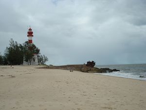
Beira is located on the Mozambique Channel, an arm of the Indian Ocean located between Madagascar and Mozambique. The city sits north of the mouth of the convergence of two major rivers of Mozambique: the Buzi River and the Pungwe River. The Buzi crosses 250 كيلومتر (160 mi) across Manica and Sofala provinces to form a wide estuary. The Pungwe crosses 400 كيلومتر (250 mi) from the Eastern Highlands of Zimbabwe also through Manica and Sofala provinces to Beira.[1]
التاريخ
الحكم البرتغالي
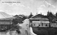
The city was established in 1890 by the Portuguese and soon supplanted Sofala as the main port in the Portuguese-administered territory. Originally called Chiveve, after a local river, it was renamed to honor the Portuguese Crown prince Dom Luís Filipe who, in 1907, was the first member of the Portuguese royal family to visit Mozambique. Traditionally the Portuguese Crown prince carried the title of Prince of Beira, a historical province of mainland Portugal.
The Portuguese built the port and a railway to Rhodesia, Portuguese families settled in the newly founded locality and started to develop commercial activities. With the growth of the village, in 1907 the Portuguese Crown elevated Beira to the status of city (cidade). Headquarters of the Companhia de Moçambique (Mozambique Company) from 1891,[3] the city's administration passed from the trading company to the Portuguese government in 1942.
Climate
Beira features a tropical savanna climate (Köppen Aw). Average temperature in January is 28.5 °C (83 °F) and in July (the coldest month) it's 21 °C (70 °F). The rainy season runs roughly from November to April.
| بيانات المناخ لـ Beira | |||||||||||||
|---|---|---|---|---|---|---|---|---|---|---|---|---|---|
| الشهر | ينا | فب | مار | أبر | ماي | يون | يول | أغس | سبت | أكت | نوف | ديس | السنة |
| القصوى القياسية °س (°ف) | 40.0 (104.0) |
37.8 (100.0) |
37.2 (99.0) |
37.5 (99.5) |
36.8 (98.2) |
33.4 (92.1) |
34.6 (94.3) |
34.7 (94.5) |
39.6 (103.3) |
41.6 (106.9) |
43.0 (109.4) |
41.0 (105.8) |
43.0 (109.4) |
| متوسط القصوى اليومية °س (°ف) | 31.4 (88.5) |
31.0 (87.8) |
30.4 (86.7) |
29.4 (84.9) |
27.6 (81.7) |
25.8 (78.4) |
25.2 (77.4) |
26.1 (79.0) |
27.6 (81.7) |
28.9 (84.0) |
30.0 (86.0) |
30.8 (87.4) |
28.7 (83.7) |
| متوسط الدنيا اليومية °س (°ف) | 23.8 (74.8) |
23.7 (74.7) |
23.2 (73.8) |
21.3 (70.3) |
18.4 (65.1) |
16.2 (61.2) |
15.7 (60.3) |
16.6 (61.9) |
18.4 (65.1) |
20.3 (68.5) |
21.8 (71.2) |
23.0 (73.4) |
20.2 (68.4) |
| الصغرى القياسية °س (°ف) | 18.5 (65.3) |
19.0 (66.2) |
18.5 (65.3) |
15.6 (60.1) |
13.2 (55.8) |
8.3 (46.9) |
8.2 (46.8) |
10.1 (50.2) |
12.0 (53.6) |
13.1 (55.6) |
16.2 (61.2) |
17.0 (62.6) |
8.2 (46.8) |
| متوسط تساقط الأمطار mm (inches) | 250.7 (9.87) |
302.3 (11.90) |
274.4 (10.80) |
139.6 (5.50) |
84.6 (3.33) |
48.3 (1.90) |
47.0 (1.85) |
42.4 (1.67) |
24.6 (0.97) |
38.0 (1.50) |
110.3 (4.34) |
231.6 (9.12) |
1٬593٫8 (62.75) |
| Average precipitation days (≥ 1.0 mm) | 10.8 | 12.5 | 11.7 | 8.2 | 7.0 | 7.2 | 7.7 | 5.4 | 3.4 | 5.1 | 7.3 | 10.2 | 96.5 |
| متوسط الرطوبة النسبية (%) | 76 | 78 | 77 | 77 | 77 | 76 | 78 | 77 | 76 | 74 | 74 | 76 | 76 |
| Mean monthly ساعات سطوع الشمس | 244.9 | 226.0 | 241.8 | 246.0 | 254.2 | 222.0 | 232.5 | 254.2 | 243.0 | 257.3 | 228.0 | 235.6 | 2٬885٫5 |
| المتوسط اليومي ساعات سطوع الشمس | 7.9 | 8.0 | 7.8 | 8.2 | 8.2 | 7.4 | 7.5 | 8.2 | 8.1 | 8.3 | 7.6 | 7.6 | 7.9 |
| Source 1: World Meteorological Organization[4] | |||||||||||||
| Source 2: Deutscher Wetterdienst (extremes, humidity and sun)[5] | |||||||||||||
السكان
| Year (census) | Population[6] |
|---|---|
| 1997 | 397,368 |
| 2007 | 431,583 |
| 2019 | 530,604 |
Tourism
Transportation
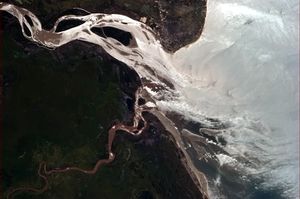
Beira has long been a major trade point for exports coming in and out of Zimbabwe, Malawi, Zambia and other Southern African nations. Because of this, the port of Beira is the second largest in Mozambique.
International relations
Beira has been twinned with Bristol, UK, since 1990 and the Bristol-Beira Link[7] manages a range of projects in education, culture, commerce, and disability.
Twin towns — sister cities
Beira is twinned with:
 Bristol, United Kingdom (since 1990)[8]
 Porto, Portugal[9]
 Boston, United States (since 1990) [10]
 Padua, Italy
 Coimbra, Portugal (since 1997)
 Bender, Moldova
 Luanda, Angola
 Port Elizabeth, South Africa (since 2008)
شخصيات بارزة
- Mia Couto (born 1955), writer
- Pedro Boese (born 1972), artist
- Carlos Cardoso (1951-2000), journalist
- Tasha de Vasconcelos (born 1966), actress, top model
- Jose Carlos Lopes Pereira (born 1955), sports person (roller hockey - African and World)
انظر أيضاً
المراجع
- ^ أ ب "Beira". Encyclopædia Britannica. Encyclopædia Britannica Inc. 2015. Retrieved 2015-10-12.
- ^ Onishi, Norimitsu. "Large City in Mozambique Nearly Wiped Out as Cyclone Leaves Vast Destruction". New York Times. New York Times. Retrieved 19 March 2019.
- ^ Derman & Kaarhus 2013, p. 42.
- ^ "World Weather Information Service–Beira". World Meteorological Organization. Retrieved June 18, 2015.
- ^
"Klimatafel von Beira / Mosambik" (PDF). Baseline climate means (1961-1990) from stations all over the world (in German). Deutscher Wetterdienst. Retrieved April 19, 2017.
{{cite web}}: CS1 maint: unrecognized language (link) - ^ http://worldpopulationreview.com/countries/mozambique-population/cities/.
{{cite web}}: Missing or empty|title=(help) - ^ "Bristol-Beira Link". Bristol-Beira Link. September 28, 2011. Retrieved December 5, 2011.
- ^ "Bristol City - Town twinning". Bristol City Council. Archived from the original on June 22, 2009. Retrieved July 17, 2009.
{{cite web}}: Unknown parameter|deadurl=ignored (|url-status=suggested) (help) - ^ Associação Porto Digital. "C.M. Porto". Cm-porto.pt. Retrieved December 5, 2011.
- ^ "Sister Cities" (in English). City of Boston. July 18, 2017. Retrieved July 20, 2018.
{{cite web}}: CS1 maint: unrecognized language (link)
Bibliography
- See also: Bibliography of the history of Beira
- Derman, Bill; Kaarhus, Randi (May 2013). In the Shadow of a Conflict. Crisis in Zimbabwe and Its Effects in Mozambique, South Africa and Zambia. African Books Collective. ISBN 978-1-77922-217-6.
{{cite book}}: Invalid|ref=harv(help)
وصلات خارجية
 Beira travel guide from Wikivoyage
- Municipio da Beira an official site of the Municipality of Beira, with news and recent pictures
- Cidade da Beira a Portuguese language site with some old and new pictures
- CS1 errors: missing title
- CS1 errors: bare URL
- CS1 errors: unsupported parameter
- Short description is different from Wikidata
- Pages using gadget WikiMiniAtlas
- Populated places in Sofala Province
- Provincial capitals in Mozambique
- Populated coastal places in Mozambique
- Mozambique Channel
- Populated places in Mozambique
- Populated places established in 1890
- Water transport in Mozambique
- Ports and harbours of Mozambique
- بيرا، موزمبيق
