مقاطعة جاكسون، داكوتا الجنوبية
Jackson County | |
|---|---|
 | |
 الموقع ضمن ولاية South Dakota | |
 موقع South Dakota ضمن الولايات المتحدة | |
| الإحداثيات: 43°42′N 101°38′W / 43.70°N 101.64°W | |
| البلد | |
| State | |
| تأسست | 1883 (created) 1915 (organized) |
| Seat | كادوكا |
| أكبر تجمع | كادوكا |
| المساحة | |
| • الإجمالي | 1٬871 ميل² (4٬850 كم²) |
| • البر | 1٬864 ميل² (4٬830 كم²) |
| • الماء | 7٫4 ميل² (19 كم²) 0.4% |
| التعداد (2020) | |
| • الإجمالي | 2٬806 |
| • Estimate (2021) | 2٬878 ▲ |
| • الكثافة | 1٫5/sq mi (0٫58/km2) |
| منطقة التوقيت | UTC−7 (Mountain) |
| • الصيف (التوقيت الصيفي) | UTC−6 (MDT) |
| Congressional district | At-large |
| Washabaugh County اندمجت في مقاطعة واشنطن في 1983 | |
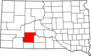
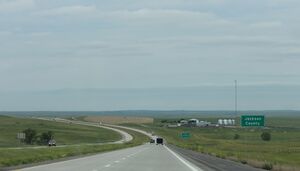
جاكسون إنگليزية: Jackson هي إحدى مقاطعات ولاية داكوتا الجنوبية في الولايات المتحدة الأمريكية. As of the 2020 census, the population was 2,806.[1] Its county seat is Kadoka.[2] The county was created in 1883, and was organized in 1915.[3] Washabaugh County was merged into Jackson County in 1983.[4]
الجغرافيا
 عينة غير معهودة من الكالسيت، متشابكة بكثافة مع حبيبات رمل. جـُمِعت من راتلسنيك بيوت في مقاطعة جاكسون. المقاس: 6.9 × 5.4 × 3.9 سم. |
The terrain of Jackson County consists of mountains rising from rolling hills. The ground is arid and carved with drainages. The White River flows eastward, cutting a meandering channel through the central part.[5] The terrain generally slopes to the NE; its highest point is a ridge near the SW corner, at 3,274' (998m) ASL.[6]
تبلغ المساحة الإجمالية لمقاطعة جاكسون 1،871 ميل مربع (4،850 km2)، منها 1،864 ميل مربع (4،830 km2) مساحة برية و 7.4 ميل مربع (19 km2) (0.4%) مسطحات مائية.[7] About 57 percent of its land, the portion south of White River, is on the Pine Ridge Indian Reservation. المقاطعة تضم الجزء الشرقي من بادلاندز، المنتزه الوطني.

South Dakota's eastern counties (48 of 66) observe Central Time; the western counties (18 of 66) observe Mountain Time. Jackson County is the easternmost of the state's counties to observe Mountain Time.[8]
الطرق السريعة

المقاطعات المجاورة
- Haakon County - north
- Jones County - northeast (observes Central Time)
- Mellette County - east (observes Central Time)
- Todd County[5] - southeast (observes Central Time)
- Bennett County - south
- Oglala Lakota County - southwest
- Pennington County - northwest
البحيرات[5]
- Kadoka Lake
- Wanblee Lake
المحميات الوطنية
- بادلاندز، المنتزه الوطني (جزء)
- Buffalo Gap National Grassland (جزء)
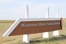
- منتمان، موقع الصواريخ التاريخي الوطني (جزء)
التجمعات السكنية
المدينة
- كادوكا (county seat) (Pop:543)
البلدات
- Belvidere (Population:46)
- Cottonwood (Population:12)
- Interior (Population:65)
Census-designated place
- Wanblee (Population:674)
تجمعات غير مشهرة[5]
- Cactus Flat
- Hisle
- Long Valley
- Potato Creek
- ستامفورد
- Weta
Townships
- Grandview II
- Interior
- Jewett
- Wall
- Weta
مناطق غير مشهرة
- East Jackson
- Northwest Jackson
- Southeast Jackson
- Southwest Jackson
السياسة
Jackson County voters have been reliably Republican for decades. In only one national election since 1936 has the county selected the Democratic Party candidate.[بحاجة لمصدر]
| السنة | الجمهوري | الديمقراطي | حزب ثالث | |||
|---|---|---|---|---|---|---|
| رقم. | % | رقم. | % | رقم. | % | |
| 2020 | 738 | 66٫19% | 359 | 32٫20% | 18 | 1٫61% |
| 2016 | 722 | 65٫94% | 323 | 29٫50% | 50 | 4٫57% |
| 2012 | 661 | 59٫76% | 426 | 38٫52% | 19 | 1٫72% |
| 2008 | 668 | 58٫96% | 435 | 38٫39% | 30 | 2٫65% |
| 2004 | 726 | 57٫12% | 508 | 39٫97% | 37 | 2٫91% |
| 2000 | 687 | 66٫06% | 319 | 30٫67% | 34 | 3٫27% |
| 1996 | 646 | 55٫26% | 423 | 36٫18% | 100 | 8٫55% |
| 1992 | 627 | 53٫68% | 351 | 30٫05% | 190 | 16٫27% |
| 1988 | 671 | 58٫81% | 450 | 39٫44% | 20 | 1٫75% |
| 1984 | 903 | 70٫82% | 365 | 28٫63% | 7 | 0٫55% |
| 1980 | 929 | 68٫71% | 354 | 26٫18% | 69 | 5٫10% |
| 1976 | 532 | 61٫50% | 313 | 36٫18% | 20 | 2٫31% |
| 1972 | 581 | 68٫68% | 261 | 30٫85% | 4 | 0٫47% |
| 1968 | 480 | 56٫80% | 267 | 31٫60% | 98 | 11٫60% |
| 1964 | 448 | 48٫28% | 480 | 51٫72% | 0 | 0�00% |
| 1960 | 581 | 61٫35% | 366 | 38٫65% | 0 | 0�00% |
| 1956 | 490 | 54٫57% | 408 | 45٫43% | 0 | 0�00% |
| 1952 | 607 | 70٫50% | 254 | 29٫50% | 0 | 0�00% |
| 1948 | 432 | 56٫40% | 321 | 41٫91% | 13 | 1٫70% |
| 1944 | 340 | 61٫48% | 213 | 38٫52% | 0 | 0�00% |
| 1940 | 620 | 58٫77% | 435 | 41٫23% | 0 | 0�00% |
| 1936 | 481 | 43٫57% | 593 | 53٫71% | 30 | 2٫72% |
| 1932 | 499 | 37٫13% | 812 | 60٫42% | 33 | 2٫46% |
| 1928 | 704 | 62٫63% | 417 | 37٫10% | 3 | 0٫27% |
| 1924 | 583 | 56٫93% | 194 | 18٫95% | 247 | 24٫12% |
| 1920 | 595 | 70٫58% | 206 | 24٫44% | 42 | 4٫98% |
| 1916 | 283 | 49٫39% | 279 | 48٫69% | 11 | 1٫92% |
المراجع
- ^ "2020 Census Results". United States Census Bureau. Retrieved August 14, 2021.
- ^ "Find a County". National Association of Counties. Archived from the original on May 31, 2011. Retrieved June 7, 2011.
- ^ "Dakota Territory, South Dakota, and North Dakota: Individual County Chronologies". Dakota Territory Atlas of Historical County Boundaries. The Newberry Library. 2006. Archived from the original on April 2, 2018. Retrieved March 30, 2015.
- ^ John H. Long, ed. (2006). "Dakota Territory, South Dakota, and North Dakota: Individual County Chronologies". Dakota Territory Atlas of Historical County Boundaries. Newberry Library. Archived from the original on November 13, 2007. Retrieved July 18, 2008.
- ^ أ ب ت ث Jackson County SD Google Maps (accessed February 4, 2019)
- ^ ""Find an Altitude" Google Maps (accessed February 4, 2019)". Archived from the original on May 21, 2019. Retrieved February 4, 2019.
- ^ "2010 Census Gazetteer Files". US Census Bureau. August 22, 2012. Retrieved March 26, 2015.
- ^ Map of Time Zone Line through South Dakota (accessed 30 January 2019)
- ^ Leip, David. "Atlas of US Presidential Elections". uselectionatlas.org. Retrieved April 15, 2018.

|
مقاطعة جونز | Haakon County | Pennington County | 
|
| Mellette County | ||||
| Todd County | Bennett County | Oglala Lakota County |
- Pages using gadget WikiMiniAtlas
- Short description is different from Wikidata
- Coordinates on Wikidata
- مقاطعات South Dakota
- Pages using infobox U.S. county with unknown parameters
- Articles containing إنگليزية-language text
- Pages using Lang-xx templates
- Articles with unsourced statements from July 2022
- مقاطعة جاكسون، داكوتا الجنوبية
- تأسيسات 1915 في داكوتا الجنوبية
- أماكن مأهولة تأسست في 1915
- مقاطعات داكوتا الجنوبية