سو (شعب)
Očhéthi Šakówiŋ ( داكوتا) | |
|---|---|
 | |
| إجمالي التعداد | |
| 170,110[1] | |
| المناطق ذات التجمعات المعتبرة | |
| US: (داكوتا الجنوبية, مينيسوتا, نبراسكا, مونتانا, داكوتا الشمالية, آيوا, ويسكنسن, إلينوي, وايومنگ) Canada: (مانيتوبا, ساسكاتشوان) | |
| اللغات | |
| لغة سيوكس ، ( لاكوتا ، داكوتا الغربية ، داكوتا الشرقية) ، أسينيبوين ، ستوني ، الإنجليزية | |
| الدين | |
| مسيحية (بما في ذلك التوفيق بين المعتقدات الدينية | |
| الجماعات العرقية ذات الصلة | |
| أسينيبوين ، داكوتا ، لاكوتا ، ناكودا (ستوني) ، والشعوب الأخرى الناطقة بالسيوان |
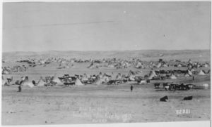
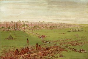
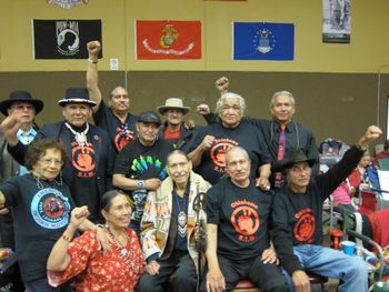
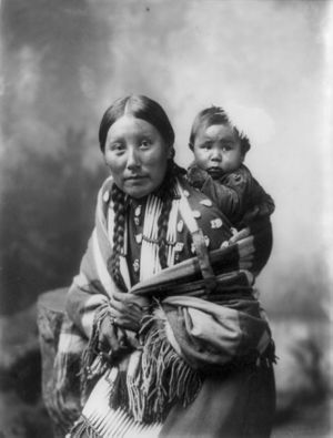
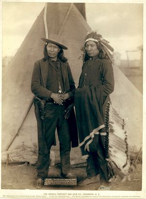
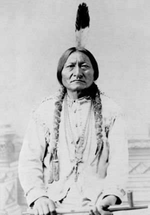
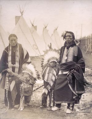
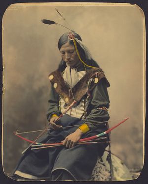
سو (شعب) or Oceti Sakowin (/suː/; Dakota: Očhéthi Šakówiŋ /otʃʰeːtʰi ʃakoːwĩ/) هي مجموعات من الأمريكان الأصليون في الولايات المتحدة و الأمم الأولى في أمريكا الشمالية. يتكون Sioux الحديث من قسمين رئيسيين يعتمدان على التقسيمات اللغوية: داكوتا و لاكوتا ؛ تُعرف مجتمعة باسم Očhéthi Šakówiŋ ("سبعة حرائق المجلس"). المصطلح "Sioux" هو اسم أجنبي تم إنشاؤه من نسخ الفرنسية لمصطلح Ojibwe "Nadouessioux" ، ويمكن أن يشير إلى أي مجموعة عرقية داخل أمة سيوكس العظيمة أو لأي من لهجات الأمة العديدة.
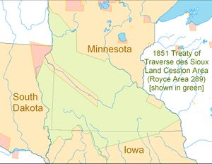
قبل القرن السابع عشر ، كان سانتي داكوتا (Isáŋyathi; "السكين" المعروف أيضًا باسم داكوتا الشرقية) يعيشون حول بحيرة سوپريور مع مناطق في الوقت الحاضر شمال مينيسوتا وويسكونسن. لقد جمعوا الأرز البري وصيدوا حيوانات الغابات واستخدموا الزوارق لصيد السمك. دفعت الحروب مع Ojibwe طوال القرن الثامن عشر الميلادي داكوتا إلى جنوب مينيسوتا ، حيث كان يسكن غرب داكوتا (يانكتون ، يانكتوناي) وتيتون (لاكوتا). في القرن التاسع عشر ، وقعت داكوتا معاهدات مع الولايات المتحدة ، وتنازلت عن الكثير من أراضيها في مينيسوتا. أدى فشل الولايات المتحدة في سداد مدفوعات المعاهدة في الوقت المحدد ، فضلاً عن انخفاض الإمدادات الغذائية ، إلى حرب داكوتا عام 1862 ، مما أدى إلى نفي داكوتا من مينيسوتا إلى محميات عديدة في نبراسكا وشمال وجنوب داكوتا وكندا. بعد عام 1870 ، بدأ شعب داكوتا في العودة إلى مينيسوتا ، وخلق الحجوزات الحالية في الولاية.
الثقافة
علم أصل الكلمة
البنية الاجتماعية التقليدية
قرابة Thiyóšpaye (المجتمع)
الدين
الحكم
Historical leadership organization
أدوار الجنسين
ممارسات الجنازة
Traditional Funeral Practices
الموسيقى
التاريخ
الأجداد سيوكس
أول اتصال بالأوروبيين
التجارة الفرنسية والحرب بين القبائل

المعاهدات وبدايات فترة الحجز
حرب داكوتا عام 1862 وشتات داكوتا
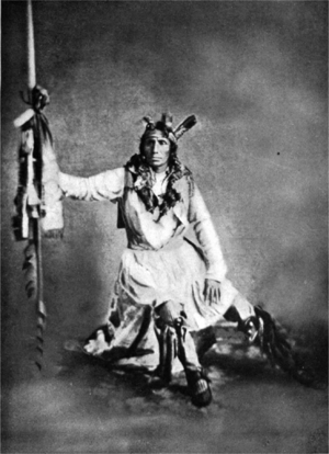
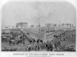
التوسع الغربي لاكوتا
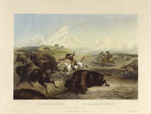
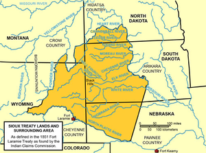
معاهدة فورت لارامي لعام 1851
معاهدة فورت لارامي لعام 1868
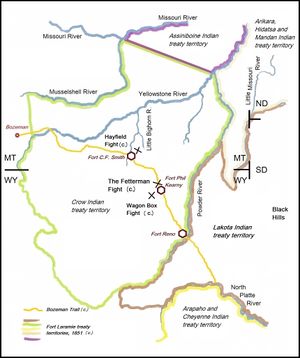
حرب سيوكس الكبرى عام 1876 ومذبحة الركبة المجروحة
عصر الاستيعاب : 1890–1920
تخصيص الأرض
المدارس الداخلية

ثلاثينيات وستينيات القرن العشرين: قانون إعادة التنظيم وقانون النقل
السبعينيات: حادث الركبة المصابة
الثمانينيات حتى الوقت الحاضر: تقرير المصير
مطالبات بلاك هيلز لاند
جمهورية لاكوتا
نظام رعاية التبني
احتجاج على خط أنابيب النفط داكوتا أكسيس
In the summer of 2016, Sioux Indians and the Standing Rock Sioux Tribe began a protest against construction of the Dakota Access oil pipeline, also known as the Bakken pipeline, which, if completed, is designed to carry hydrofracked crude oil from the Bakken oil fields of North Dakota to the oil storage and transfer hub of Patoka, Illinois.[2] The pipeline travels only half a mile north of the Standing Rock Sioux reservation and is designed to pass underneath the Missouri River and upstream of the reservation, causing many concerns over the tribe's drinking water safety, environmental protection, and harmful impacts on culture.[3][4] The pipeline company claims that the pipeline will provide jobs, reduce American dependence on foreign oil and reduce the price of gas.[5]
اللغة
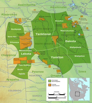
التقسيمات العرقية والجغرافية الحديثة
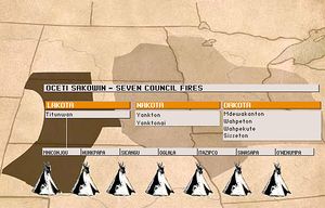
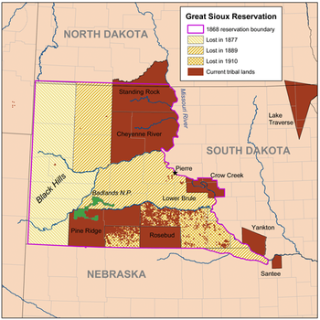
(the map still misnames the Yankton-Yanktonai grouping as Nakota)
Isáŋyathi (سانتي أو داكوتا الشرقية)
Iháŋkthuŋwaŋ-Iháŋkthuŋwaŋna (Yankton-Yanktonai أو داكوتا الغربية)
Thítȟuŋwaŋ (تيتون أو لاكوتا)
الحجوزات والاحتياطيات
- Reserves shared with other First Nations
سيوكس البارز
تاريخي
{{columns-list|
معاصر
حسب القبيلة الفردية
في وسائل الإعلام الشعبية
الإرث
المصادر
- ^ Norris, Tina; Vines, Paula L.; Hoeffel, Elizabeth M. (يناير 2012). "The American Indian and Alaska Native Population: 2010" (PDF). United States Census Bureau. United States Department of Commerce. Retrieved سبتمبر 9, 2012.
- ^ Healy, Jack (أغسطس 23, 2016). "Occupying the Prairie: Tensions Rise as Tribes Move to Block a Pipeline". The New York Times. ISSN 0362-4331. Retrieved أغسطس 24, 2016.
- ^ "More Than A Year After Spill, Colorado's Gold King Mine Named Superfund Site". Retrieved سبتمبر 8, 2016.
- ^ "Pipeline Spills Oil into Yellowstone River Again" (in الإنجليزية الأمريكية). يناير 21, 2015. Retrieved سبتمبر 8, 2016.
- ^ "What is the benefit of the Dakota Access Pipeline? - Dakota Access Pipeline Facts". Dakota Access Pipeline Facts (in الإنجليزية الأمريكية). Retrieved فبراير 2, 2018.
- ^ خطأ استشهاد: وسم
<ref>غير صحيح؛ لا نص تم توفيره للمراجع المسماةSioux nation
قراءات أضافية
- Chaky, Doreen (2014). Terrible justice: Sioux Chiefs and U.S. Soldiers on the Upper Missouri, 1854–1868. University of Oklahoma Press. ISBN 9780870624148.
- Hassrick, Royal B (1977). The Sioux: life and customs of a warrior society. University of Oklahoma Press. ISBN 0-8061-0607-7.
- Gibbon, Guy E (2003). The Sioux: the Dakota and Lakota nations. Blackwell. ISBN 1-55786-566-3.
- McLaughlin, Marie L (2010). Myths and Legends of the Sioux. BiblioBazaar. ISBN 978-1-141-80554-9.
- Hyde, George E (1993). A Sioux chronicle. University of Oklahoma Press. ISBN 0-8061-2483-0.
- Standing Bear, Luther; Brininstool, E A (2006). My People the Sioux. University of Nebraska Press. ISBN 0-8032-9332-1.
- In the Shadow of Wounded Knee August 2012 National Geographic (magazine) with Reservation map history
وصلات خارجية
الرسمية
- Official site of the Cheyenne River Reservation
- Official site of the Fort Peck Reservation
- Official site of the Spirit Lake Reservation
- Official site of the Standing Rock Reservation
- Official site of the Lake Traverse Reservation
- Official site of the Flandreau Reservation
- Official site of the Crow Creek Reservation
- Official site of the Lower Brule Reservation
- Official site of the Yankton Reservation
- Official site of the Pine Ridge Reservation
- Official site of the Rosebud Reservation
- Official site of the Upper Sioux Reservation
- Official site of the Lower Sioux Reservation
- Official site of the Shakopee Mdewakanton Sioux Community
- Official site of the Prairie Island Community
- Official site of the Sioux Valley Dakota Nation
- Official site of the Birdtail Sioux First Nation
- Official site of the Canupawakpa Dakota First Nation
- Official site of the Whitecap Dakota First Nation
- Official site of the Dakota Tipi First Nation
- Official site of the Dakota Plains First Nation
- CS1 الإنجليزية الأمريكية-language sources (en-us)
- Use American English from June 2020
- All Wikipedia articles written in American English
- Use mdy dates from June 2020
- "Related ethnic groups" needing confirmation
- Articles using infobox ethnic group with image parameters
- Articles containing Dakota-language text
- Articles with hatnote templates targeting a nonexistent page
- سيوكس
- قبائل السهول
- شعوب سيوان
- قبائل الأمريكيين الأصليين
- الأمم الأولى
- تاريخ الأمريكيين الأصليين في ولاية أيوا
- تاريخ مينيسوتا الأمريكيين الأصليين
- تاريخ الأمريكيين الأصليين لمونتانا
- تاريخ الأمريكيين الأصليين لنبراسكا
- تاريخ الأمريكيين الأصليين في ساوث داكوتا
- تاريخ الأمريكيين الأصليين في نورث داكوتا
- قبائل الأمريكيين الأصليين في ولاية أيوا
- قبائل الأمريكيين الأصليين في مينيسوتا
- قبائل الأمريكيين الأصليين في مونتانا
- قبائل الأمريكيين الأصليين في نبراسكا
- قبائل الأمريكيين الأصليين في ساوث داكوتا
- قبائل الأمريكيين الأصليين في نورث داكوتا
- الأمم الأولى في مانيتوبا
- الأمم الأولى في ساسكاتشوان
- قبائل الأمريكيين الأصليين في وايومنگ
- مقالات تحتوي على مقاطع فيديو
