ألاخويلا Alajuela
ألاخويلا
Alajuela | |
|---|---|
        Images, from top down, left to right: Alajuela skyline at night, Central Church, Juan Santamaría Statue, Central Park, Municipal Theater, a traditional Costa Rican bullock cart, the Juan Santamaría International Airport, Alejandro Morera Soto Stadium. | |
 Flag  Coat of arms | |
| الكنية: | |
| الشعار: Pro Patria Nostra — Sanguis Noster For our country, our blood | |
 Alajuela and surrounding area | |
 ألاخويلا Location of Alajuela within Costa Rica | |
| Coordinates: 10°01′N 84°13′W / 10.017°N 84.217°W | |
| البلد | كوستاريكا |
| المحافظة | محافظة ألاخويلا |
| الكانتون | ألاخويلا |
| تأسست | 1782 |
| Government | |
| • Syndic | Francisco Salazar Sánchez |
| Area | |
• Total | 8٫88 كم² (3٫43 ميل²) |
| Elevation | 952 m (3٬123 ft) |
| Population (2011) | |
• Total | 42٬975 |
| • Density | 4٬800/km2 (13٬000/sq mi) |
| Time zone | UTC−06:00 |
| Postal code | 20101 |
| Climate | Aw |
| Website | Official website |
ألاخويلا (Alajuela ؛ إسپانية pronunciation: [alaˈxwela]) هي district في كانتون ألاخويلا في محافظة ألاخويلا في كوستاريكا. كمقر لبلدية كانتون ألاخويلا، فقد حصلت على وضع "مدينة". لكونها مدينة الكانتون الأول في المحافظة، كما أنها عاصمة محافظة ألاخويلا.[2][3]
Because of its location in the Costa Rican Central Valley, Alajuela is nowadays part of the conurbation of the Greater Metropolitan Area. The city is the birthplace of Juan Santamaría, the national hero of Costa Rica and the figure who gives the name to the country's main international airport, which is south of Alajuela downtown.
الجغرافيا
Alajuela has an area of 8.89 km2 (3.43 sq mi)[4] and an elevation of 952 متر (3،123 ft).[2] It is located in the Central Valley, 19 kilometres northwest of San José.
المناخ
The climate is tropical, typical of the Central Valley, but slightly warmer than San José. Temperatures are moderate, averaging 23–26 درجات مئوية (73–79 درجات فهرنهايت) with a low humidity level, with dewpoints around 20 (68 °F) almost all year round. Alajuela and its surroundings are famed for having "the best weather in the world".[5]
| بيانات المناخ لـ ألاخويلا (1956–2003) | |||||||||||||
|---|---|---|---|---|---|---|---|---|---|---|---|---|---|
| الشهر | ينا | فب | مار | أبر | ماي | يون | يول | أغس | سبت | أكت | نوف | ديس | السنة |
| متوسط القصوى اليومية °س (°ف) | 27.8 (82.0) |
28.6 (83.5) |
29.6 (85.3) |
29.7 (85.5) |
28.4 (83.1) |
27.6 (81.7) |
27.7 (81.9) |
28.7 (83.7) |
27.3 (81.1) |
27.1 (80.8) |
27.2 (81.0) |
27.5 (81.5) |
28.1 (82.6) |
| متوسط الدنيا اليومية °س (°ف) | 17.5 (63.5) |
17.6 (63.7) |
17.8 (64.0) |
18.3 (64.9) |
18.4 (65.1) |
18.2 (64.8) |
18.4 (65.1) |
18.1 (64.6) |
17.7 (63.9) |
17.6 (63.7) |
17.8 (64.0) |
17.7 (63.9) |
17.9 (64.3) |
| متوسط تساقط الأمطار mm (inches) | 7.6 (0.30) |
12.6 (0.50) |
17.4 (0.69) |
79.6 (3.13) |
271.2 (10.68) |
265.6 (10.46) |
177.5 (6.99) |
253.8 (9.99) |
340.6 (13.41) |
338.5 (13.33) |
148.5 (5.85) |
32.8 (1.29) |
1٬945٫7 (76.62) |
| Average precipitation days | 2.0 | 1.9 | 3.0 | 8.2 | 21.6 | 23.3 | 20.1 | 21.8 | 25.2 | 25.5 | 16.0 | 5.9 | 174.5 |
| Source: World Meteorological Organization[6] | |||||||||||||
السكان
| Census | تعداد | ±% p.a. |
|---|---|---|
| 1864 | 2٬339 | — |
| 1883 | 3٬532 | +2.19% |
| 1892 | 3٬828 | +0.90% |
| 1927 | 8٬496 | +2.30% |
| 1950 | 13٬903 | +2.16% |
| 1963 | 24٬224 | +4.36% |
| 1973 | 33٬122 | +3.18% |
| 1984 | 34٬556 | +0.39% |
| 2000 | 42٬889 | +1.36% |
| 2011 | 42٬975 | +0.02% |
| 2022 | 44٬374 | +0.29% |
| Source: Instituto Nacional de Estadística y Censos[7] Centro Centroamericano de Población[8] | ||
For the 2011 census, Alajuela had a population of 42٬975 inhabitants.[9]
التاريخ

In pre-Columbian times the land where the canton of Alajuela is today was part of the Western Huetar Kingdom, which was inhabited by native tribes, who at the time of the Spanish conquest were led by Chief Garabito.
The first Spanish settlers established settlements in the region in about 1650.[10] In a letter of obligation granted in 1764, the place is mentioned as La Lajuela in the Valley of Barva, near the Canoas river.
In 1777, the dwellers of La Lajuela and Ciruelas, having been served with notice to move to Villa Vieja (today's Heredia), requested the provisional construction of a public place of prayer in the house of Don Dionysius Oconitrillo, of Spanish origin, 30 metres north of where Alajuela's cathedral is today.
After increases of population in the five existing quarters then: Targuaz, Puás, Ciruelas, La Lajuela and Rio Grande, the citizens faced difficulties to maintain their religious obligations, so they requested permission to establish a parish and a public place of prayer from the Bishop of Nicaragua and Costa Rica, Monsignor don Esteban Lorenzo de Tristán.[10]
According to a motion issued in the Spanish Parliament of Cádiz on 19 May 1812, the first town hall of Alajuela was founded in 1813. On 18 December of the same year, the La Lajuela quarter obtained the title of town and it was renamed. It was first called "Villa Hermosa", then it was called "San Juan Nepomuceno de Alajuela" and finally the title of city was granted on 20 November 1824 and with it the name "Alajuela" which remains today.
Participation in important historical events by citizens of Alajuela has ensured the city's reputation as a storied place in Costa Rican history. The national hero Juan Santamaría, who died during the Filibuster War in 1856 to remove invaders threatening Costa Rica's sovereignty, was born in Alajuela. This historical event is celebrated and remembered every year on 11 April and it is a national holiday.
The area often experiences earthquakes. The 2009 magnitude 6.1 earthquake caused several landslides.[11]
الاقتصاد
The main exports of the region are coffee, sugar-cane, maize, beans, tobacco, citrus fruits, strawberries, tubers like cassava, flowers and ornamental plants. Other commercial activities include poultry farming, beekeeping, pig farming and the dairy industry. More recently, Alajuela has seen important investment in free zone parks and heavy industry companies, with a considerable number of them dedicated to manufacturing a variety of medical devices.
النقل
Alajuela is an important transport hub for the country, connecting the capital city of San José with northwestern Costa Rica. As a part of the Greater Metropolitan Area, most of the inhabitants of Alajuela work in other cities or regions of the Central Valley, and every day receives residents from other locations to work in local factories. Central America's second busiest airport, Juan Santamaría International Airport, is three kilometers south of the district center.
الطرق
The district is covered by the following road routes:
 National Route 3
 National Route 123
 National Route 124
 National Route 125
 National Route 130
 National Route 153
السكك الحديدية
The Interurbano Line operated by Incofer goes through this district.
الرياضة
Liga Deportiva Alajuelense is the province's major football club, having won 30 league titles. The club has a historical rivalry with Deportivo Saprissa, both popularly viewed as the two best football clubs of Costa Rica. They play their home games at the Estadio Alejandro Morera Soto, located in this district, and a new stadium is currently being built on another location inside the Alajuela Province.
معرض
-

-
 Alajuela skatepark
 -
 Monument to Juan Santamaria, who was born in Alajuela, popular hero of the Filibuster War
 -
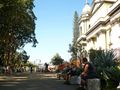 Alajuela´s catholic Cathedral is located in front of Alajuela´s central park (Officially named Parque General Tomás Guardia)
 -
 Municipal Theatre of Alajuela
 -
 Alajuela´s Methodist Church


مدن شقيقة
 San Bartolomé de Tirajana, Spain[12]
 Lahr, Germany[13]
 Montegrotto Terme, Italy[14]
- Bordano, Italy[14]
 Downey, California, USA[15]
- Dothan, Alabama, USA
 Guadalajara, Mexico[16]
 Ibaraki Prefecture, Japan[17]
 Hangzhou, China
سكان بارزون
تاريخيون
- Gregorio Jose Ramirez (1796–1823) Politician, Military Commander.
- José María Alfaro Zamora (1799–1856) Costa Rican Head of State (1842–44, 1846–47)
- Florentino Alfaro Zamora (1805–1873) Politician
- Juan Alfaro Ruiz (1810–1856) Politician
- Jose Maria Figueroa (1820–1900) Artist. He recorded the early events of Costa Rican history in his Album de Figueroa
- Apolinar de Jesus Soto (1827–1911) Vice-President of Costa Rica (1886–1889). The title was called then Primer Designado
- Juan Santamaría (1831–1856) Costa Rican national hero.
- Tomás Guardia Gutiérrez (1831–1882) President of Costa Rica (1870–82) Born in Bagaces, Guardia married and lived in Alajuela most of his life
- Emilia Solórzano Alfaro (1835–1914) Costa Rican First lady (1870–1882) For her activism in favor of Education and Human Rights, she was declared Benemerita de la Patria in 1972.
- Leon Fernandez Bonilla (1840–1887) Historian, Lawyer, Diplomat, Journalist. Declared Benemerito de la Patria (Distinguished Citizen) in 1994.
- Bernardo Soto Alfaro (1854–1931) President of Costa Rica (1885–1889)
- Anastasio Alfaro (1865–1951) Zoologist, Geologist, Archeologist, Ethnologist. Creator of the Museo Nacional de Costa Rica.
- Ricardo Fernandez Guardia (1867–1950) Historian, Author, Diplomat. Declared Benemerito de la Patria (Distinguished Citizen) in 1944.
- León Cortés Castro (1882–1946) President of Costa Rica (1936–40)
- Otilio Ulate (1891–1973) President of Costa Rica (1949–53)
- Carlos Luis Fallas (1909–1966) Costa Rican most important author, political activist. Elected for the Congress (1944–48). Posthumously declared Benemérito de la Patria (Distinguished Citizen) in 1977.
- Alejandro Morera Soto (1909–1995) Footballer. Played with LD Alajuelense in Costa Rica, and FC Barcelona, Spain.
- Margarita Madrigal (1919–1983) Best-selling author of language textbooks.
مواليد أو سكان ألاخويلا
- Fernando Durán (1939– ) Author
- Edgar Zúñiga (1950– ) Sculptor
- Jorge Arroyo (1959– ) Playwright
المراجع
- ^ "Dos lucidas exposiciones conmemorarán los 100 años de la Diócesis de Alajuela". L Nación (in الإسبانية). Retrieved 13 February 2021.
- ^ أ ب "Declara oficial para efectos administrativos, la aprobación de la División Territorial Administrativa de la República N°41548-MGP". Sistema Costarricense de Información Jurídica (in الإسبانية). 19 March 2019. Retrieved 26 September 2020.
- ^ División Territorial Administrativa de la República de Costa Rica (PDF) (in الإسبانية). Editorial Digital de la Imprenta Nacional. 8 March 2017. ISBN 978-9977-58-477-5.
- ^ "Área en kilómetros cuadrados, según provincia, cantón y distrito administrativo". Instituto Nacional de Estadística y Censos (in الإسبانية). Archived from the original on 24 October 2020. Retrieved 26 September 2020.
- ^ Alajuela, Climate and info, in Costa Rica WeatherCentre Archived 23 يناير 2018 at the Wayback Machine
- ^ "World Weather Information Service". World Meteorological Organization. Retrieved 18 August 2024.
- ^ "Instituto Nacional de Estadística y Censos" (in الإسبانية).
- ^ Centro Centroamericano de Población de la Universidad de Costa Rica. "Sistema de Consulta a Bases de Datos Estadísticas" (in الإسبانية).
- ^ "Censo. 2011. Población total por zona y sexo, según provincia, cantón y distrito". Instituto Nacional de Estadística y Censos (in الإسبانية). Retrieved 26 September 2020.
- ^ أ ب Ocampo Barrantes, Marlon. "Los Orígenes de la Población de Alajuela, 1601-1782". Editorial UNED, Costa Rica, 2009.
- ^ "10 confirmed dead, 32 injured after quake in Costa Rica". CNN.com. Cable News Network. 2009-01-09.
- ^ nacion.com: Costa Rican News in Brief Archived 13 مايو 2014 at archive.today, accessdate: 5/13/2014, 9/21/1995
- ^ Alajuela: Stadt Lahr online - Alajuela Archived 18 مايو 2015 at the Wayback Machine, accessdate: 5/13/2014
- ^ أ ب Page 2: Murals of La Guacima | Page 2 Archived 17 مايو 2014 at the Wayback Machine, accessdate: 5/13/2014
- ^ : http://downeybeat.com/2012/05/downey-looking-for-a-sister-that-may-not-exist-43737/ Archived 4 أغسطس 2019 at the Wayback Machine, accessdate: 5/13/2014
- ^ "Sister Cities, Public Relations". Guadalajara municipal government. Archived from the original on 2 March 2012. Retrieved 12 March 2013.
- ^ pref.ibaraki.jp: IBARAKI Prefectural Government Archived 25 يونيو 2012 at the Wayback Machine, accessdate: 5/13/2014
وصلات خارجية
 Alajuela travel guide from Wikivoyage
- Municipalidad de Alajuela, December 2007
- Directorios de Costa Rica - Alajuela
- Directorio y Guía de Alajuela
قالب:Provincial capitals of Costa Rica
- CS1 الإسبانية-language sources (es)
- Webarchive template archiveis links
- Pages using gadget WikiMiniAtlas
- Short description is different from Wikidata
- Articles containing إسپانية-language text
- Pages using infobox settlement with possible nickname list
- Articles containing لاتينية-language text
- Pages using infobox settlement with possible motto list
- Pages with إسپانية IPA
- Coordinates on Wikidata
- ألاخويلا
- Greater Metropolitan Area (Costa Rica)
- Districts of Alajuela Province
- صفحات مع الخرائط