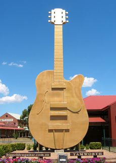
نيوساوث ويلز
| نيوساوث ويلز | |||||
|---|---|---|---|---|---|
| |||||
| Slogan or nickname | The First State The Premier State | ||||
| Motto(s) | Orta Recens Quam Pura Nites (Newly Risen, How Brightly You Shine) | ||||
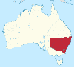 Other Australian states and territories | |||||
| Capital city | Sydney | ||||
| Demonym | New South Welshman[1][2] | ||||
| Government | Constitutional monarchy | ||||
| - Governor | Margaret Beazley | ||||
| - Premier | Gladys Berejiklian (LP) | ||||
| Australian state | |||||
| - Established as Colony | 26 January 1788 | ||||
| - Responsible government | 6 June 1856 | ||||
| - Became Australian state | 1 January 1901 | ||||
| - Australia Act | 3 March 1986 | ||||
| Area | |||||
| - Total | 809٬444 كم² (5th) 312٬528 sq mi | ||||
| - Land | 800٬642 كم² 309٬130 sq mi | ||||
| - المياه | 8٬802 طك² (1.09%) 3٬398 sq mi | ||||
| السكان (December 2018)[3] | |||||
| - السكان | 8٬046٬070 (1st) | ||||
| - Density | 10.05/km² (3rd) 26 /sq mi | ||||
| Elevation | |||||
| - Highest point | Mount Kosciuszko 2,228 m (7,310 ft) | ||||
| Gross state product (2017–18) | |||||
| - Product ($m) | $593٬275[4] (1st) | ||||
| - ن.م.إ. للفرد | $74٬955 (3rd) | ||||
| منطقة التوقيت | UTC+10 (AEST) UTC+11 (AEDT) UTC+9:30 (ACST) (Broken Hill) UTC+10:30 (ACDT) (Broken Hill) UTC+10:30 (LHST) (Lord Howe Island) UTC+11:00 (LHDT) (Lord Howe Island) | ||||
| التمثيل الفدرالي | |||||
| - مقاعد مجلس النواب | 48/150 | ||||
| - مقاعد مجلس الشيوخ | 12/76 | ||||
| Abbreviations | |||||
| - الرمز البريدي | NSW | ||||
| - ISO 3166-2 | AU-NSW | ||||
| Emblems | |||||
| - الزهرة | Waratah (Telopea speciosissima)[5] | ||||
| - الحيوان | Platypus (Ornithorhynchus anatinus) | ||||
| - الطائر | Kookaburra (Dacelo gigas) | ||||
| - السمكة | Blue groper (Achoerodus viridis) | ||||
| - المعدن أو الحجر | Black Opal | ||||
| - Fossil | Mandageria fairfaxi | ||||
| - Colours | Sky blue (Pantone 291)[6] | ||||
| الموقع الإلكتروني | www | ||||
| Footnotes | Coordinates[7] Emblems[8] | ||||
نيوساوث ويلز (بالإنجليزية: New South Wales) هي أقدم ولايات أستراليا وأكثرها اكتظاظاً بالسكان، حيث بلغ عدد سكانها 6764600 نسمة في نهاية مارس عام 2005. تقع جنوب شرق أستراليا، شمال ولاية فكتوريا، وجنوب ولاية كوينزلاند. تأسست عام 1788.
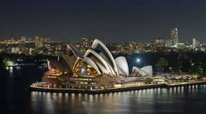
تغطي نيوساوث ويلز مساحة قدرها 809444 كم2، وهي خامس أكبر ولاية أسترالية. عاصمة الولاية هي مدينة سيدني، أقدم وأكبر مدن أستراليا، والتي تعتبر مركزاً اقتصادياً هاماً في البلاد.
. . . . . . . . . . . . . . . . . . . . . . . . . . . . . . . . . . . . . . . . . . . . . . . . . . . . . . . . . . . . . . . . . . . . . . . . . . . . . . . . . . . . . . . . . . . . . . . . . . . . . . . . . . . . . . . . . . . . . . . . . . . . . . . . . . . . . . . . . . . . . . . . . . . . . . . . . . . . . . . . . . . . . . . .
تاريخ
أبورجيني (السكان الأصليون)
في عام 1770، اكتشف القبطان جيمس كوك الساحل الشرقي لهولندا الجديدة (التي أخذت اسمها من هولندا)، والتي أصبحت الآن نيوساوث ويلز، التي أخذت هي الأخرى اسمها من جنوب ويلز. وفي عام 1788، أسس القبطان آرثر فيليب مستعمرة بريطانية جزائية في ميناء جاكسون، والتي هي الآن مدينة سيدني.
منتصف القرن 19
مطلع القرن العشرين
فترة ما بعد الحرب
الحكم

البرلمان
الديمغرافيا
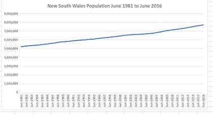
The estimated population of New South Wales at the end of September 2018 was 8,023,700 people, representing approximately 31.96% of nationwide population.[3]
In June 2017 Sydney was home to almost two-thirds (65.3%) of the NSW population.[9]
المدن والبلدات
| NSW rank | Statistical Area Level 2 | Population 30 June 2014[10] | 10-year growth rate | Population density (people/km2) |
|---|---|---|---|---|
| 1 | سيدني الكبرى | 4,840,628 | 15.7 | 391.4 |
| 2 | Newcastle and Lake Macquarie | 368,131 | 9.0 | 423.1 |
| 3 | Illawarra | 296,845 | 9.3 | 192.9 |
| 4 | Hunter Valley excluding Newcastle | 264,087 | 16.2 | 12.3 |
| 5 | Richmond Tweed | 242,116 | 8.9 | 23.6 |
| 6 | Capital region | 220,944 | 10.9 | 4.3 |
| 7 | Mid North Coast | 212,787 | 9.2 | 11.3 |
| 8 | Central West | 209,850 | 7.9 | 3.0 |
| 9 | New England and North West | 186,262 | 5.3 | 1.9 |
| 10 | Riverina | 158,144 | 4.7 | 2.8 |
| 11 | Southern Highlands and Shoalhaven | 146,388 | 10.4 | 21.8 |
| 12 | Coffs Harbour-Grafton | 136,418 | 7.6 | 10.3 |
| 13 | Far West and Orana | 119,742 | 0.3 | 0.4 |
| 14 | Murray | 116,130 | 4.0 | 1.2 |
| New South Wales | 7,518,472 | 10.4 | 13.0 |
| NSW rank | Significant Urban Area | Population 30 June 2014[10] | Australia rank | 10-year growth rate |
|---|---|---|---|---|
| 1 | Sydney | 4,451,841 | 1 | 16.1 |
| 2 | Newcastle – Maitland | 430,755 | 7 | 11.3 |
| 3 | Central Coast (New South Wales) | 323,079 | 9 | 10.5 |
| 4 | Wollongong | 289,236 | 11 | 9.2 |
| 5 | Coffs Harbour | 68,052 | 26 | 11.2 |
| 6 | Albury | 61,146 | 34 | 8.2 |
| 7 | Wagga Wagga | 55,364 | 28 | 10.5 |
| 8 | Port Macquarie | 44,875 | 33 | 13.7 |
| 9 | Tamworth | 41,810 | 34 | 12.0 |
| 10 | Orange | 39,766 | 36 | 13.3 |
| 11 | Bowral – Mittagong | 37,495 | 39 | 9.6 |
| 12 | Dubbo | 36,622 | 40 | 9.2 |
| 13 | Bathurst | 35,391 | 42 | 15.3 |
| 14 | Nowra – Bomaderry | 35,383 | 43 | 13.4 |
| 15 | Lismore | 29,388 | 49 | 3.3 |
| 16 | Nelson Bay – Corlette | 27,135 | 54 | 16.0 |
| 17 | Taree | 26,448 | 55 | 2.3 |
| 18 | Ballina | 25,058 | 57 | 6.5 |
| 19 | Morisset – Cooranbong | 23,694 | 59 | 12.1 |
| 20 | Armidale | 23,691 | 60 | 5.4 |
| 21 | Goulburn | 22,906 | 61 | 8.1 |
| 22 | Cessnock | 22,180 | 63 | 15.0 |
| 23 | Forster – Tuncurry | 20,706 | 66 | 6.4 |
| 24 | Griffith | 19,318 | 71 | 10.3 |
| 25 | Broken Hill | 19,048 | 72 | −5.3 |
| 26 | Grafton | 18,698 | 73 | 2.1 |
| 27 | Kurri Kurri – Weston | 17,241 | 79 | 11.2 |
| 28 | Singleton | 16,904 | 80 | 8.1 |
| 29 | Batemans Bay | 16,593 | 81 | 11.3 |
| 30 | Camden Haven | 16,289 | 84 | 8.8 |
| 31 | Ulladulla | 15,057 | 89 | 6.0 |
| 32 | St Georges Basin – Sanctuary Point | 13,657 | 96 | 15.9 |
| 33 | Lithgow | 12,989 | 97 | 3.1 |
| 34 | Muswellbrook | 12,723 | 88 | 10.9 |
| 35 | Parkes | 11,491 | 101 | 6.9 |
| New South Wales | 7,518,472 | N/A | 10.4 | |
. . . . . . . . . . . . . . . . . . . . . . . . . . . . . . . . . . . . . . . . . . . . . . . . . . . . . . . . . . . . . . . . . . . . . . . . . . . . . . . . . . . . . . . . . . . . . . . . . . . . . . . . . . . . . . . . . . . . . . . . . . . . . . . . . . . . . . . . . . . . . . . . . . . . . . . . . . . . . . . . . . . . . . . .
Ancestry and immigration
| Country of Birth (2016)[11] | |
| Birthplace[N 1] | Population |
|---|---|
| Australia | 4,899,090 |
| Mainland China | 234,508 |
| England | 226,564 |
| India | 143,459 |
| New Zealand | 117,136 |
| Philippines | 86,749 |
| Vietnam | 84,130 |
| Lebanon | 57,381 |
| South Korea | 51,816 |
| Italy | 49,476 |
| South Africa | 43,058 |
| Hong Kong | 42,347 |
جغرافيا
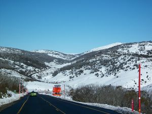
مدن ولاية نيوساوث ويلز الثلاثة الرئيسية من الشمال إلى الجنوب هم: نيوكاسل، وسيدني، ووولونغونغ، ويقع جميعها على الساحل. المدن الأخرى المعروفة في الولاية هي: ألبري، وبروكن هيل، ودوبو، وميناء ماكواري، وتاموورث، وآرمدال، وإنفيريل، وليسمور، ونورا، وغريفيث، وكوينبيان، وجيرابومبيرا، وليتون، وواغا واغا، وغوولبورن، وميناء كوفس.
تجاور نيوساوث ويلز كوينزلاند من الشمال، وجنوب أستراليا من الغرب، وولاية فكتوريا من الجنوب. يواجه ساحلها بحر تاسمان.
المناخ
| بيانات مناخ نيو ساوث ويلز | |||||||||||||
|---|---|---|---|---|---|---|---|---|---|---|---|---|---|
| الشهر | يناير | فبراير | مارس | أبريل | مايو | يونيو | يوليو | أغسطس | سبتمبر | اكتوبر | نوفمبر | ديسمبر | العام |
| العظمى القياسية °س (°ف) | 49.7 (121.5) |
48.5 (119.3) |
45.0 (113) |
40.0 (104) |
34.4 (93.9) |
31.0 (87.8) |
31.7 (89.1) |
37.8 (100) |
39.6 (103.3) |
43.9 (111) |
46.8 (116.2) |
48.9 (120) |
49٫7 (121٫5) |
| الصغرى القياسية °س (°ف) | -5.6 (21.9) |
-7.0 (19.4) |
-7.2 (19) |
-13.0 (8.6) |
-13.4 (7.9) |
-23.0 (-9.4) |
-19.6 (-3.3) |
-20.6 (-5.1) |
-16.7 (1.9) |
-12.0 (10.4) |
-9.4 (15.1) |
-7.0 (19.4) |
−23٫0 (−9٫4) |
| Source: Bureau of Meteorology[13] | |||||||||||||
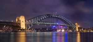
الاقتصاد

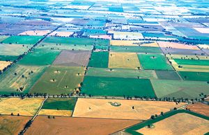
الزراعة

الثقافة
الولايات الشقيقة
New South Wales in recent history has pursued bilateral partnerships with other federated states/provinces and metropolises through establishing a network of sister state relationships. The state currently has 7 sister states:[14]
- Guangdong, China (since 1979)
- Tokyo, Japan (since 1984)
- Ehime, Japan (since 1999)[15]
- North Rhine-Westphalia, Germany (since 1989)
- Seoul, South Korea (since 1991)
- Jakarta, Indonesia (since 1994)
- California, United States (since 1997)
. . . . . . . . . . . . . . . . . . . . . . . . . . . . . . . . . . . . . . . . . . . . . . . . . . . . . . . . . . . . . . . . . . . . . . . . . . . . . . . . . . . . . . . . . . . . . . . . . . . . . . . . . . . . . . . . . . . . . . . . . . . . . . . . . . . . . . . . . . . . . . . . . . . . . . . . . . . . . . . . . . . . . . . .
انظر أيضاً
- قالب:Books-inline
- Outline of Australia
- Index of Australia-related articles
- Geology of New South Wales
- NSW Volunteer of the Year
- Postage stamps and postal history of New South Wales
- Selection (Australian history)
- Squattocracy
- Territorial evolution of Australia
ملاحظات
- ^ In accordance with the Australian Bureau of Statistics source, England, Scotland, Mainland China and the Special Administrative Regions of Hong Kong and Macau are listed separately
- ^ The Australian Bureau of Statistics has stated that most who nominate "Australian" as their ancestry are part of the Anglo-Celtic group.[12]
- ^ Of any ancestry. Includes those identifying as Aboriginal Australians or Torres Strait Islanders. Indigenous identification is separate to the ancestry question on the Australian Census and persons identifying as Aboriginal or Torres Strait Islander may identify any ancestry.
المراجع
- ^ "The origin of the term 'cockroach'". Australian Broadcasting Corporation. 13 June 2012. Retrieved 29 January 2013.
- ^ Jopson, Debra (23 May 2012). "Origin of the species: what a state we're in". The Sydney Morning Herald. Retrieved 29 January 2013.
- ^ أ ب "Australian Demographic Statistics, Dec 2018". 20 June 2019. Retrieved 12 July 2019. Estimated Resident Population – 1 December 2018
- ^ "5220.0 – Australian National Accounts: State Accounts, 2017–18". Australian Bureau of Statistics. 16 November 2018. Retrieved 19 April 2019.
- ^ "Floral Emblem of New South Wales". www.anbg.gov.auhi. Retrieved 23 January 2013.
- ^ "New South Wales". Parliament@Work. Retrieved 22 January 2013.
- ^ قالب:NSW GNR
- ^ "NSW State Flag & Emblems". NSW Government. Archived from the original on 18 September 2015. Retrieved 5 October 2015.
{{cite web}}: Unknown parameter|dead-url=ignored (|url-status=suggested) (help) - ^ خطأ استشهاد: وسم
<ref>غير صحيح؛ لا نص تم توفيره للمراجع المسماةABSCapitalPop - ^ أ ب "3218.0 – Regional Population Growth, Australia, 2013–14". Australian Bureau of Statistics. 31 March 2015.
- ^ http://www.censusdata.abs.gov.au/CensusOutput/copsub2016.NSF/All%20docs%20by%20catNo/2016~Community%20Profile~1/$File/GCP_1.zip?OpenElement
- ^ Statistics, c=AU; o=Commonwealth of Australia; ou=Australian Bureau of. "Feature Article - Ethnic and Cultural Diversity in Australia (Feature Article)". www.abs.gov.au.
{{cite web}}: CS1 maint: multiple names: authors list (link) - ^ "Official records for Australia in January". Daily Extremes. Bureau of Meteorology. 31 July 2013. Retrieved 12 March 2014.
- ^ "Building international relationships". NSW Government. Archived from the original on 14 November 2017. Retrieved 14 November 2017.
{{cite web}}: Unknown parameter|dead-url=ignored (|url-status=suggested) (help) - ^ "International exchange activated with globalization". Ehime Prefecture. Archived from the original on 30 September 2018. Retrieved 1 November 2018.
{{cite web}}: Unknown parameter|deadurl=ignored (|url-status=suggested) (help)
وصلات خارجية
- Official NSW Website
- NSW Parliament
- Official NSW Tourism Website
- New South Wales at the Open Directory Project
 Geographic data related to نيوساوث ويلز at OpenStreetMap


