رالي، كارولاينا الشمالية
رالي، كارولاينا الشمالية | |
|---|---|
| City of Raleigh | |
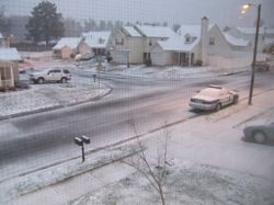
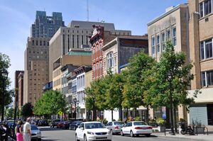
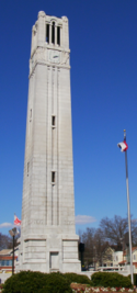
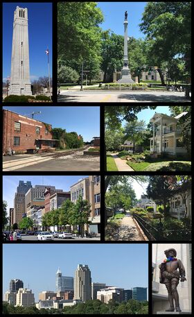 Clockwise from top left: NC State bell tower, Confederate Monument at the North Carolina State Capitol (now removed), houses in Boylan Heights, houses in Historic Oakwood, statue of Sir Walter Raleigh, skyline of the downtown, Fayetteville Street, and the warehouse district | |
|
| |
| الكنية: "مدينة البلوط" | |
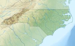
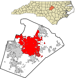 خريطة مقاطعة ويك، كارولاينا الشمالية | |
| الإحداثيات: 35°46′N 78°38′W / 35.767°N 78.633°WCoordinates: 35°46′N 78°38′W / 35.767°N 78.633°W[1] | |
| الدولة | |
| الولاية | كارولينا الشمالية |
| المقاطعات | ويك، درم |
| Chartered | December 31, 1792 |
| السمِيْ | السير والتر رالي |
| الحكومة | |
| • النوع | Council–Manager |
| • العمدة | ماري-آن بالدوين (د.) |
| • المجلس | |
| المساحة | |
| • عاصمة ولاية ومدينة | 147٫64 ميل² (382٫38 كم²) |
| • البر | 146٫54 ميل² (379٫55 كم²) |
| • الماء | 1٫09 ميل² (2٫83 كم²) |
| المنسوب | 315 ft (96 m) |
| التعداد (2010) | |
| • عاصمة ولاية ومدينة | 403٬892 |
| • Estimate (2019)[4] | 474٬069 |
| • الكثافة | 3٬234٫97/sq mi (1٬249٫03/km2) |
| • Urban | 1٬012٬994 |
| • MSA | 1٬337٬331 (44th) |
| • CSA | 2٬201٬103 (29th) |
| صفة المواطن | Raleighite |
| منطقة التوقيت | UTC−05:00 (EST) |
| • الصيف (التوقيت الصيفي) | UTC−04:00 (EDT) |
| ZIP Codes | 27601, 27603, 27604, 27605, 27606, 27607, 27608, 27609, 27610, 27612, 27613, 27614, 27615, 27616, 27617 |
| Area code(s) | 919, 984 |
| FIPS code | 37-55000[5] |
| GNIS feature ID | 1024242[1] |
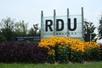
| Major airport | RDU |
| Interstate Highways | I-40, I-87, I-440, I-540 |
| Other major highways | US 1, US 64, US 70, US 401, NC 50, NC 540 |
| الموقع الإلكتروني | raleighnc |
رالي إنگليزية: Raleigh هي مدينة أمريكية ومركز مقاطعة ويك في ولاية كارولاينا الشمالية في الولايات المتحدة الأمريكية، أسست عام 1588 ويبلغ عدد سكانها 380.174 نسمة، وتعد مدينة رالي بضواحيها أسرع المدن نموا في الولايات المتحدة. رالي هي عاصمة ولاية كارولاينا الشمالية. فيها العديد من الجامعات، وشركات الحاسوب والأدوية والاتصالات.Raleigh is known as the "City of Oaks" for its many oak trees, which line the streets in the heart of the city.[6] The city covers a land area of 147.6 square miles (382 km2). The U.S. Census Bureau estimated the city's population as 474,069 as of July 1, 2019.[4] It is one of the fastest-growing cities in the country.[7][8] The city of Raleigh is named after Walter Raleigh, who established the lost Roanoke Colony in present-day Dare County.
Raleigh is home to North Carolina State University (NC State) and is part of the Research Triangle together with Durham (home of Duke University and North Carolina Central University) and Chapel Hill (home of the University of North Carolina at Chapel Hill). The name of the Research Triangle (often shortened to the "Triangle") originated after the 1959 creation of Research Triangle Park (RTP), located in Durham and Wake counties, among the three cities and their universities. The Triangle encompasses the U.S. Census Bureau's Raleigh-Durham-Chapel Hill Combined Statistical Area (CSA), which had an estimated population of 2,037,430 in 2013.[9] The Raleigh metropolitan statistical area had an estimated population of 1,390,785 in 2019.[10]
Most of Raleigh is located within Wake County, with a very small portion extending into Durham County.[11] The towns of Cary, Morrisville, Garner, Clayton, Wake Forest, Apex, Holly Springs, Fuquay-Varina, Knightdale, Wendell, Zebulon, and Rolesville are some of Raleigh's primary nearby suburbs and satellite towns.
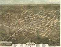
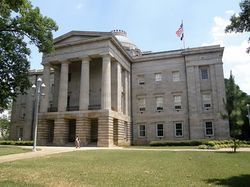
Raleigh is an early example in the United States of a planned city.[12] Following the American Revolutionary War when the U.S. gained independence, this was chosen as the site of the state capital in 1788 and incorporated in 1792 as such. The city was originally laid out in a grid pattern with the North Carolina State Capitol in Union Square at the center. During the American Civil War, the city was spared from any significant battle. It fell to the Union in the closing days of the war, and struggled with the economic hardships in the postwar period related to the reconstitution of labor markets, over-reliance on agriculture, and the social unrest of the Reconstruction Era. Following the establishment of the Research Triangle Park (RTP) in 1959, several tens of thousands of jobs were created in the fields of science and technology, and it became one of the fastest-growing communities in the United States by the early 21st century.
تشكل المدينة مع كل من مدينتي درم وتشاپل هل، ما يعرف باسم حديقة مثلث الأبحاث أو المثلث اختصارا.
. . . . . . . . . . . . . . . . . . . . . . . . . . . . . . . . . . . . . . . . . . . . . . . . . . . . . . . . . . . . . . . . . . . . . . . . . . . . . . . . . . . . . . . . . . . . . . . . . . . . . . . . . . . . . . . . . . . . . . . . . . . . . . . . . . . . . . . . . . . . . . . . . . . . . . . . . . . . . . . . . . . . . . . .
التاريخ
الحكومة والقانون
الجريمة
الجغرافيا
المناخ
| متوسطات الطقس لرالي، كارولينا الشمالية | |||||||||||||
|---|---|---|---|---|---|---|---|---|---|---|---|---|---|
| شهر | يناير | فبراير | مارس | أبريل | مايو | يونيو | يوليو | أغسطس | سبتمبر | اكتوبر | نوفمبر | ديسمبر | السنة |
| العظمى القياسية °F (°C) | 80 (27) | 84 (29) | 92 (33) | 95 (35) | 97 (36) | 104 (40) | 104 (40) | 105 (41) | 104 (40) | 98 (37) | 88 (31) | 80 (27) | 105 (41) |
| متوسط العظمى °ف (°م) | 49.8 (10) | 54 (12) | 62.5 (17) | 71.8 (22) | 78.7 (26) | 85.5 (30) | 89.1 (32) | 87.2 (31) | 81.3 (27) | 71.8 (22) | 62.4 (17) | 53.3 (12) | 70٫6 (21) |
| متوسط الصغرى °ف (°م) | 29.6 (-1) | 31.9 (-0) | 38.9 (4) | 46.4 (8) | 55.3 (13) | 63.8 (18) | 68.5 (20) | 67.2 (20) | 61 (16) | 48.2 (9) | 39.5 (4) | 32.6 (0) | 48٫6 (9) |
| الصغرى القياسية °ف (°C) | -9 (-23) | 0 (-18) | 11 (-12) | 23 (-5) | 29 (-2) | 38 (3) | 48 (9) | 46 (8) | 37 (3) | 19 (-7) | 11 (-12) | 4 (-16) | −9 (−23) |
| هطول الأمطار بوصة (mm) | 4.02 (102.1) | 3.47 (88.1) | 4.03 (102.4) | 2.8 (71.1) | 3.79 (96.3) | 3.42 (86.9) | 4.29 (109) | 3.78 (96) | 4.26 (108.2) | 3.18 (80.8) | 2.97 (75.4) | 3.04 (77.2) | 43٫04 (1٬093٫2) |
| المصدر: National Climatic Data Center[13] June 2009 | |||||||||||||
أفق المدينة
Raleigh is divided into several major geographic areas, each of which use a Raleigh address and a ZIP code that begins with the digits 276. PNC Plaza, formerly known as RBC Plaza, is the largest and tallest skyscraper in the city of Raleigh. The tower rises to a height of 538 feet (164 m), with a floor count of 34.
الاقتصاد
. . . . . . . . . . . . . . . . . . . . . . . . . . . . . . . . . . . . . . . . . . . . . . . . . . . . . . . . . . . . . . . . . . . . . . . . . . . . . . . . . . . . . . . . . . . . . . . . . . . . . . . . . . . . . . . . . . . . . . . . . . . . . . . . . . . . . . . . . . . . . . . . . . . . . . . . . . . . . . . . . . . . . . . .
الديموغرافيا
| التعداد تاريخياً | |||
|---|---|---|---|
| الإحصاء | التعداد | %± | |
| 1800 | 669 | ||
| 1820 | 2٬674 | ||
| 1830 | 1٬700 | -36.4% | |
| 1840 | 2٬244 | 32.0% | |
| 1850 | 4٬518 | 101.3% | |
| 1860 | 4٬780 | 5.8% | |
| 1870 | 7٬790 | 63.0% | |
| 1880 | 9٬265 | 18.9% | |
| 1890 | 12٬678 | 36.8% | |
| 1900 | 13٬643 | 7.6% | |
| 1910 | 19٬218 | 40.9% | |
| 1920 | 24٬418 | 27.1% | |
| 1930 | 37٬379 | 53.1% | |
| 1940 | 46٬879 | 25.4% | |
| 1950 | 65٬679 | 40.1% | |
| 1960 | 93٬931 | 43.0% | |
| 1970 | 122٬830 | 30.8% | |
| 1980 | 150٬255 | 22.3% | |
| 1990 | 212٬092 | 41.2% | |
| 2000 | 276٬093 | 30.2% | |
| تقديري 2009 | 388٬926 | [14] | 40.9% |
| [14] | |||
التعليم

الثقافة
الرياضة
النقل
الاعلام
المدن الشقيقة
رالي لديها العديد من المدن الشقيقة:[15][16]
. . . . . . . . . . . . . . . . . . . . . . . . . . . . . . . . . . . . . . . . . . . . . . . . . . . . . . . . . . . . . . . . . . . . . . . . . . . . . . . . . . . . . . . . . . . . . . . . . . . . . . . . . . . . . . . . . . . . . . . . . . . . . . . . . . . . . . . . . . . . . . . . . . . . . . . . . . . . . . . . . . . . . . . .
انظر أيضا
- Research Triangle Metropolitan Region ("The Triangle")
- I-85 Corridor
- Capital Area Transit (CAT)
- Triangle Transit
- مطار رالي درهام الدولي
المصادر
- ^ أ ب "Raleigh". نظام معلومات الأسماء الجغرافية، المسح الجيولوجي الأمريكي.
- ^ "City Council: Raleigh's Governing Body". City of Raleigh. May 6, 2016. Retrieved May 9, 2016.
- ^ "2019 U.S. Gazetteer Files". United States Census Bureau. Retrieved July 27, 2020.
- ^ أ ب خطأ استشهاد: وسم
<ref>غير صحيح؛ لا نص تم توفيره للمراجع المسماةUSCensusEst2019 - ^ "U.S. Census website". United States Census Bureau. Retrieved January 31, 2008.
- ^ "Population & Census Information". City of Raleigh. Archived from the original on July 21, 2009. Retrieved August 21, 2009.
- ^ "Cary third fastest growing city in '08; Raleigh is 8th, Durham 16th". wral.com. July 1, 2009. Retrieved July 2, 2009.
- ^ Fisher, Daniel. "America's Fastest-Growing Cities". Forbes.com. Retrieved May 14, 2012.
- ^ "Population Estimates 2013 Combined Statistical Areas: April 1, 2010 to July 1, 2013". U.S. Census Bureau. Archived from the original on April 15, 2014. Retrieved March 27, 2014.
- ^ "Census profile: Raleigh-Cary, NC Metro Area". Census Reporter (in الإنجليزية). Retrieved 2020-10-21.
- ^ "Raleigh Durham Annexation Agreement Lines" (PDF). City of Raleigh. Archived from the original (PDF) on October 19, 2011. Retrieved January 4, 2012.
- ^ "City of Raleigh". North Carolina History Project (in الإنجليزية الأمريكية). Retrieved 2020-10-21.
- ^ "NOW Data-NOAA Online Weather Data". National Oceanic and Atmospheric Administration. 2009. Retrieved 2009-06-23.
- ^ أ ب [1]
- ^ [2]
- ^ [3]
وصلات خارجية
- CS1 الإنجليزية الأمريكية-language sources (en-us)
- Short description is different from Wikidata
- Coordinates on Wikidata
- Articles containing إنگليزية-language text
- رالي، كارولينا الشمالية
- مدن كارولينا الشمالية
- مقاعد مقاطعة في كارولينا الشمالية
- مدن مخططة في الولايات المتحدة
- مدن تأسست في 1792
- The Triangle, North Carolina


