سان خوزيه، كاليفورنيا
مدينة سان خوزيه | |
|---|---|
| مدينة سان خوزيه | |
|
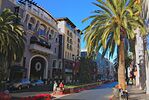
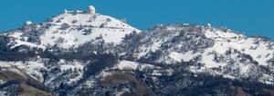
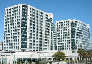
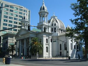
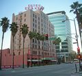
من أعلى لأسفل، من اليسار لليمين: أفق وسط مدينة سان خوزيه، فندق دى أنزا، مبنى بنك أوف إيطاليا، قاعة مدينة سان خوزيه، فندق ڤالنسيا في سانتانا رو؛ مرصد ليك على جبل هامليتون. | |
|
| |
| الكنية: سان خوزيه، عاصمة وادي السليكون | |
| الشعار: عاصمة وادي السليكون | |
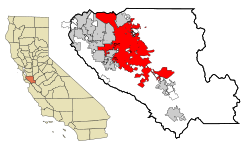 الموقع في مقاطعة سانتا كلارا | |
| خطأ لوا في وحدة:Location_map على السطر 525: Unable to find the specified location map definition: "Module:Location map/data/كاليفورنيا" does not exist. | |
| الإحداثيات: 37°18′15″N 121°52′22″W / 37.30417°N 121.87278°WCoordinates: 37°18′15″N 121°52′22″W / 37.30417°N 121.87278°W | |
| البلد | |
| الولاية | |
| المقاطعة | مقاطعة سانتا كلارا |
| تأسيس پبلو | 29 نوفمبر 1777 |
| دُمجت | 27 مارس 1850 |
| الحكومة | |
| • النوع | مدينة مشهرة بميثاق، العمدة-المجلس |
| • العمدة | تشك ريد |
| • نائب العمدة | جودي تشيركو |
| • رئيس المدينة | دبرا فيون |
| • مجلس الشيوخ | قائمة أعضاء مجلس الشيوخ
|
| • المجلس | قائمة الأعضاء
|
| المساحة | |
| • مدينة | 461٫5 كم² (178٫2 ميل²) |
| • البر | 452٫9 كم² (174٫9 ميل²) |
| • الماء | 8٫6 كم² (3٫3 ميل²) |
| • الحضر | 716٫53 كم² (447٫83 ميل²) |
| • العمران | 6٬979٫4 كم² (2٬694٫7 ميل²) |
| المنسوب | 26 m (85 ft) |
| التعداد (1 يوليو 2008)[3] | |
| • مدينة | 948٫279 (رقم 10) |
| • الكثافة | 2٬223٫2/km2 (5٬758/sq mi) |
| • Urban | 1٫819٫198 (MSA 7/1/08) |
| • العمرانية | 7٫354٫555 (CSA 7/1/08) |
| • صفة المواطنة | سان خوزييهي |
| منطقة التوقيت | UTC-8 (PST) |
| • الصيف (التوقيت الصيفي) | UTC-7 (PDT) |
| الرمز البريدي | 95101-95103, 95106, 95108-95139, 95141, 95142, 95148, 95150-95161, 95164, 95170-95173, 95190-95194, 95196 |
| مفتاح الهاتف | 408 |
| رمز FIPS | 06-68000 |
| GNIS feature ID | 1654952 |
| الموقع الإلكتروني | www.sanjoseca.gov |

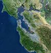
سان هوزيه (إنگليزية: San Jose)، هي ثالث أكبر مدن كاليفورنيا، وعاشر أكبر مدن الولايات المتحدة الأمريكية، وحاضرة مقاطعة سانتا كلارا. تقع في وادي السليكون جنوب خليج سان فرانسيسكو. عدد سكانها 912332 نسمة (2005) وهي أكبر مدن منطقة كاليفورنيا الشمالية. كانت في الماضي مدينة زراعية، ومع حلول عام 1950 جذبت الكثير من السكان، وتطورت كثيراً بين العقد 1960 والعقد 1990، فأصبحت مركزاً كبيراً مزدهراً بالنسبة لكاليفورنيا الشمالية. تسمى المدينة أحياناً "لوس أنجلس الشمال" لتشابهها بمدينة لوس أنجلس مع نهاية القرن 20. مساحتها 461.5 كم2.
With an estimated 2019 population of 1,021,795, it is the third-most populous city in California (after Los Angeles and San Diego) and the tenth-most populous in the United States.[4] Located in the center of the Santa Clara Valley, on the southern shore of San Francisco Bay, San Jose covers an area of 179.97 square miles (466.1 km2). San Jose is the county seat of Santa Clara County, the most affluent county in California and one of the most affluent counties in the United States.[5][6][7][8] San Jose is the main component of the San Jose–Sunnyvale–Santa Clara Metropolitan Statistical Area, with an estimated population of around 2 million residents in 2018.[9] It is also the most populous city in both the San Francisco Bay Area and the San Jose-San Francisco-Oakland Combined Statistical Area, which contain 7.7 million and 8.7 million people respectively.[10][11][12]
San Jose is notable as a center of innovation, for its affluence,[13][14][15] Mediterranean climate, and extremely high cost of living.[16] Its location within the booming high tech industry as a cultural, political, and economic center has earned the city the nickname "Capital of Silicon Valley". San Jose is one of the wealthiest major cities in the United States and the world, and has the third-highest GDP per capita in the world (after Zürich, Switzerland and Oslo, Norway), according to the Brookings Institution.[17] The San Jose Metropolitan Area has the most millionaires and the most billionaires in the United States per capita.[18] With a median home price of $1,085,000,[19] San Jose has the most expensive housing market in the country and the fifth most expensive housing market in the world, according to the 2017 Demographia International Housing Affordability Survey.[20][21][22][23] Major global tech companies including Cisco Systems, eBay, Adobe Inc., PayPal, Broadcom, Samsung, Acer, Hewlett Packard Enterprise, and Zoom maintain their headquarters in San Jose, in the center of Silicon Valley. The CSA San Jose shares with San Francisco was the country's third-largest urban economy as of 2018, with a GDP of $1.03 trillion.[24] Of the 500+ primary statistical areas in the U.S., this CSA had among the highest GDP per capita in 2018, at $106,757.[24]
Before the arrival of the Spanish, the area around San Jose was inhabited by the Tamien nation of the Ohlone peoples of California. San Jose was founded on November 29, 1777, as the Pueblo de San José de Guadalupe, the first city founded in the Californias.[25] It then became a part of Mexico in 1821 after the Mexican War of Independence. Following the American Conquest of California during the Mexican–American War, the territory was ceded to the United States in 1848. After California achieved statehood two years later, San Jose became the state's first capital.[26] Following World War II, San Jose experienced an economic boom, with a rapid population growth and aggressive annexation of nearby cities and communities carried out in the 1950s and 1960s. The rapid growth of the high-technology and electronics industries further accelerated the transition from an agricultural center to an urbanized metropolitan area. Results of the 1990 U.S. Census indicated that San Jose had officially surpassed San Francisco as the most populous city in Northern California.[27] By the 1990s, San Jose and the rest of Silicon Valley had become the global center for the high tech and internet industries, making it California's fastest-growing economy.[28]
. . . . . . . . . . . . . . . . . . . . . . . . . . . . . . . . . . . . . . . . . . . . . . . . . . . . . . . . . . . . . . . . . . . . . . . . . . . . . . . . . . . . . . . . . . . . . . . . . . . . . . . . . . . . . . . . . . . . . . . . . . . . . . . . . . . . . . . . . . . . . . . . . . . . . . . . . . . . . . . . . . . . . . . .
التاريخ

تأسست المدينة في 29 نوفمبر 1777، وسميت سابقاً بـ "إل پويپلو دي سان خوسيه دي گوادالوپه" (El Pueblo de San José de Guadalupe) حينما كانت أول مدينة للمستعمرة الإسبانية في "نويڤا كاليفورنيا" التي عرفت لاحقاً بألتا كاليفورنيا (وهي دولة سابقة في أمريكا الشمالية). خدمت المدينة كمنطقة زراعية لتزويد المعسكرات الإسبانية في سان فرانسيسكو ومونتيري. بعد أن تحولت كاليفورنيا إلى ولاية أمريكية في عام 1850، كانت سان هوزيه أول عاصمة لها.
الجغرافيا
المناخ


تتمتع مدينة سان خوزيه مثلها مثل معظم المدن الساحلية بمناخ مداري.[29] على عكس سان فرانسيسكو ، والتي بحكم موقعها على شاطئ المحيط من ثلاث جهات ، مما يعطيها درجات حرارة متفاوته وطقص متغير طوال اليوم ، حيث يحد مدينة سان خوزيه الجبال من ثلاث جهات. ويبلغ متوسط نسبة سقوط الأمطار سنوية 14.4 بوسة (366 مم) وهي بذلك تزيد بمقدار أربع أضعاف بالمقارنة بمناطق شاطئية أخرى.
| متوسطات الطقس لسان خوزيه، كاليفورنيا | |||||||||||||
|---|---|---|---|---|---|---|---|---|---|---|---|---|---|
| شهر | يناير | فبراير | مارس | أبريل | مايو | يونيو | يوليو | أغسطس | سبتمبر | اكتوبر | نوفمبر | ديسمبر | السنة |
| العظمى القياسية °F (°C) | 83 (28) | 85 (29) | 87 (31) | 95 (35) | 101 (38) | 109 (43) | 108 (42) | 105 (41) | 104 (40) | 101 (38) | 85 (29) | 83 (28) | 109 (43) |
| متوسط العظمى °ف (°م) | 59 (15) | 64 (18) | 67 (19) | 72 (22) | 77 (25) | 82 (28) | 84 (29) | 84 (29) | 81 (27) | 74 (23) | 65 (18) | 59 (15) | 73 (23) |
| متوسط الصغرى °ف (°م) | 41 (5) | 45 (7) | 46 (8) | 48 (9) | 52 (11) | 55 (13) | 57 (14) | 57 (14) | 57 (14) | 52 (11) | 45 (7) | 41 (5) | 50 (10) |
| الصغرى القياسية °ف (°C) | 24 (-4) | 26 (-3) | 30 (-1) | 35 (2) | 37 (3) | 42 (6) | 47 (8) | 47 (8) | 42 (6) | 36 (2) | 21 (-6) | 19 (-7) | 19 (−7) |
| هطول الأمطار بوصة (mm) | 3.2 (81.3) | 2.8 (71.1) | 2.6 (66) | 1.0 (25.4) | 0.4 (10.2) | 0.1 (2.5) | 0.1 (2.5) | 0.1 (2.5) | 0.2 (5.1) | 0.9 (22.9) | 1.2 (30.5) | 2.0 (50.8) | 15٫1 (383٫5) |
| المصدر: AccuWeather.com[30] 2 March 2009 | |||||||||||||
.
منظر المدينة
الإقتصاد
السكان

| التعداد تاريخياً | |||
|---|---|---|---|
| الإحصاء | التعداد | %± | |
| 1850 | 3٬500 | ||
| 1860 | 4٬579 | 30.8% | |
| 1870 | 9٬089 | 98.5% | |
| 1880 | 12٬567 | 38.3% | |
| 1890 | 18٬060 | 43.7% | |
| 1900 | 21٬500 | 19.0% | |
| 1910 | 28٬946 | 34.6% | |
| 1920 | 39٬642 | 37.0% | |
| 1930 | 57٬651 | 45.4% | |
| 1940 | 68٬457 | 18.7% | |
| 1950 | 95٬280 | 39.2% | |
| 1960 | 204٬196 | 114.3% | |
| 1970 | 459٬913 | 125.2% | |
| 1980 | 629٬442 | 36.9% | |
| 1990 | 782٬248 | 24.3% | |
| 2000 | 894٬943 | 14.4% | |
| تقديري 2008 | 948٬279 | 6.0% | |
| sources: [3][31][32] | |||
. . . . . . . . . . . . . . . . . . . . . . . . . . . . . . . . . . . . . . . . . . . . . . . . . . . . . . . . . . . . . . . . . . . . . . . . . . . . . . . . . . . . . . . . . . . . . . . . . . . . . . . . . . . . . . . . . . . . . . . . . . . . . . . . . . . . . . . . . . . . . . . . . . . . . . . . . . . . . . . . . . . . . . . .
الرياضة
| النادي | الرياضة | التأسيس | الإتحاد | المكان |
|---|---|---|---|---|
| San Jose Sharks | هوكي | 1991 | National Hockey League: Western Conference | HP Pavilion at San José |
| San Jose Earthquakes | كرة قدم | 1995 | Major League Soccer: Western Conference | Buck Shaw Stadium |
| Real San Jose | كرة قدم | 2006 | National Premier Soccer League | Yerba Buena High School |
| San Jose Frogs | كرة قدم | 2006 | USL Premier Development League | PAL Stadium |
| San Francisco Dragons | Lacrosse | 2006 | Major League Lacrosse (field/outdoor) | Spartan Stadium |
| San Jose Giants | بيسبول | 1988 | California League | San Jose Municipal Stadium |
| San Jose SaberCats | Arena Football | 1995 | Arena Football League | HP Pavilion at San José |
| San Jose Stealth | Lacrosse | 2003 | National Lacrosse League (box/arena/indoor) | HP Pavilion at San José |
النقل


الطرق السريعة الرئيسية
المرافق
. . . . . . . . . . . . . . . . . . . . . . . . . . . . . . . . . . . . . . . . . . . . . . . . . . . . . . . . . . . . . . . . . . . . . . . . . . . . . . . . . . . . . . . . . . . . . . . . . . . . . . . . . . . . . . . . . . . . . . . . . . . . . . . . . . . . . . . . . . . . . . . . . . . . . . . . . . . . . . . . . . . . . . . .
التعليم
الجامعات والكليات
التعليم الإبتدائي والثانوي
نظام مكتبة سان جوزيف
مزارات


الحدائق والمتنزهات
- Almaden Quicksilver County Park, 4,147 acres (17 km²) of former mercury mines in South San Jose (operated and maintained by the County of Santa Clara, Parks and Recreation Department).
- Alum Rock Park, 718 acres (2.9 km²) in East San Jose, the oldest municipal park in California
- Emma Prusch Farm Park, 43.5 acres (176,000 m²) in East San Jose. Donated by Emma Prusch to demonstrate the valley's agricultural past, it includes a 4-H barn (the largest in San Jose), community gardens, a rare-fruit orchard, demonstration gardens, picnic areas, and expanses of lawn. [1]
- California's Great America
- Circle of Palms Plaza, a ring of palm trees surrounding a California state seal and historical landmark at the site of the first state capitol
- Kelley Park, including diverse facilities such as Happy Hollow Park & Zoo (a child-centric amusement park), the Japanese Friendship Garden (Kelley Park), History Park at Kelley Park, and the Portuguese Historical Museum within the history park
- Kirk Park, home to the San Jose Young People's Theater
- Overfelt Gardens, including the Chinese Cultural Garden
- Plaza de César Chávez, a small park in Downtown, hosts outdoor concerts and the Christmas in the Park display
- Raging Waters, water park with water slides and other water attractions. This sits within Lake Cunningham Park
- Rosicrucian Park, nearly an entire city block in the Rose Garden neighborhood; the Park offers a setting of Egyptian and Moorish architecture set among lawns, rose gardens, statuary, and fountains, and includes the Rosicrucian Egyptian Museum, Planetarium, Research Library, Peace Garden and Visitors Center
- San Jose Flea Market
- San Jose Municipal Rose Garden, 5½ acre (22,000 m²) park in the Rose Garden neighborhood, featuring over 4,000 rose bushes
==
أثار
المتاحف والمكتبات وأماكن ثقافية أخرى
- Children's Discovery Museum of San Jose
- History Park at Kelley Park
- Ira F. Brilliant Center for Beethoven Studies, home of the largest Beethoven collection outside Europe
- Dr. Martin Luther King, Jr. Library, the largest U.S. public library west of Mississippi River
- Mexican Heritage Plaza, a museum and cultural center for Mexican Americans in the area
- Portuguese Historical Museum
- Rosicrucian Egyptian Museum, the largest collection of Egyptian artifacts on display in the western United States, located at Rosicrucian Park
- San Jose Museum of Art
- The Tech Museum of Innovation
الإعلام
معرض الصور
الحكومة والقانون

المحلي

الولاية والدولة
الجريمة
مدن شقيقة
مجلس التنمية الإقتصادي في سان خوزيه على علاقات مع ثمان مدن شقيقة:[33]
 - أوكاياما, اليابان (established in 1957)
- قالب:Country data كوستا ريكا - سان خوزيه, كوستا ريكا (1961)
 - Veracruz, المكسيك (1975)
 - تيانان, الصين (1975)
 - دبلن, جمهورية أيرلاندا (1986)
 - Pune, الهند (1992)
 - Yekaterinburg, روسيا (1992)
 - مدينة المكسيك, المكسيك (2003)
المراجع
- Do You Know the Way to San Jose, lyrics, Hal David – music, Burt Bacharach; Grammy-winning 1968 hit single (Pop #10, R&B #23) for Dionne Warwick, Scepter Records 12216; more than 100 other recordings.
- Michaela Roessner. Vanishing Point. Tor, New York, 1993. ISBN 0-3128-5213-4. Post-apocalyptic novel, largely set in San Jose; many South Bay survivors have gathered to live in the Winchester Mystery House and the nearby Century Theatres dome.
انظر أيضا
- قائمة الأشخاص من سان خوزيه, كاليفورنيا
- List of school districts in Santa Clara County, California
- شرطة سان خوزيه
قراءات إضافية
- Beilharz, Edwin A.; and DeMers Jr., Donald O.; San Jose: California's First City; 1980, ISBN 0-932986-13-7
- The California Room, the San Jose Library's collection of research materials on the history of San Jose and Santa Clara Valley.
وصلات خارجية
| San Jose, California
]].- City of San Jose Web site
- Photos of San Jose - 1975 vs. 2005
- San Jose Silicon Valley Chamber of Commerce
- Hispanic Chamber of Commerce Silicon Valley
- Pacific Neighbors San Jose Sister Cities Program
- San Jose - Dublin Sister City Program
- San Jose and Santa Clara Election Information
المصادر
- ^ US Census Bureau Lists of Urbanized Areas
- ^ "USGS—San Jose, California". Retrieved 2007-02-17.
- ^ أ ب خطأ استشهاد: وسم
<ref>غير صحيح؛ لا نص تم توفيره للمراجع المسماةpopulation - ^ "U.S. Census website". U.S. Census Bureau. Retrieved December 3, 2019.
- ^ 2012 American Community Survey Archived يوليو 1, 2014 at the Wayback Machine
- ^ "Richest Counties In The United States". Archived from the original on April 19, 2017. Retrieved April 18, 2017.
- ^ Levy, Francesca (March 4, 2010). "America's 25 Richest Counties". Archived from the original on April 19, 2017. Retrieved April 18, 2017.
- ^ "Santa Clara County has highest median household income in nation, but wealth gap widens". The Mercury News. Archived from the original on April 19, 2017. Retrieved April 18, 2017.
- ^ "Annual Estimates of the Resident Population: April 1, 2010 to July 1, 2018". United States Census Bureau, Population Division. April 2019. Archived from the original on February 13, 2020. Retrieved May 30, 2019.
- ^ "Metropolitan and Micropolitan Statistical Area Totals Dataset: Population and Estimated Components of Change: April 1, 2010 to July 1, 2015" (CSV). 2015 Population Estimates. United States Census Bureau, Population Division. March 2016. Retrieved April 1, 2016.[dead link]
- ^ "Combined Statistical Area Totals Dataset: Population and Estimated Components of Change: April 1, 2010 to July 1, 2015" (CSV). 2015 Population Estimates. United States Census Bureau, Population Division. March 2016. Retrieved April 1, 2016.[dead link]
- ^ "Annual Estimates of the Resident Population for Counties: April 1, 2010 to July 1, 2015". 2015 Population Estimates. United States Census Bureau, Population Division. March 2016. Archived from the original on June 6, 2016. Retrieved April 1, 2016.
- ^ Hsu, T. (September 20, 2012). "America's richest cities: Census say San Jose, San Francisco" Archived يونيو 29, 2013 at the Wayback Machine. Los Angeles Times. Retrieved August 16, 2013.
- ^ Glink, I. (February 22, 2013). "America's Richest Cities in 2013." Archived مارس 8, 2017 at the Wayback Machine. Yahoo Finance. Retrieved August 16, 2013
- ^ Bass, F., Homan, T. (October 18, 2011). "Beltway Earnings Make US Capital Richer Than Silicon Valley" Archived يوليو 29, 2014 at the Wayback Machine. Bloomberg. Retrieved August 16, 2013.
- ^ Zeveloff, J. (February 14, 2013). "The 10 Most Expensive Cities in the United States" Archived مايو 7, 2016 at the Wayback Machine. Daily Finance. Retrieved August 16, 2013
- ^ "Silicon Valley Business Journal – San Jose Area has World's Third-Highest GDP Per Capita, Brookings Says". Archived from the original on March 9, 2017. Retrieved March 8, 2017.
- ^ "America's Greediest Cities". Forbes. ديسمبر 3, 2007. Archived from the original on يوليو 29, 2017.
- ^ "The first US city where average homes cost over $1 million". Archived from the original on March 9, 2017. Retrieved March 8, 2017.
- ^ "13th Annual Demographia International Housing Affordability Survey: 2017" (PDF). Archived (PDF) from the original on January 23, 2013. Retrieved March 8, 2017.
- ^ "San Jose is the most 'unaffordable' major housing market in U.S., survey says". Archived from the original on March 9, 2017. Retrieved March 8, 2017.
- ^ Kate Springer. "The least affordable places to live in 2017". CNN. Archived from the original on May 19, 2017. Retrieved May 21, 2017.
- ^ "The 10 most expensive cities to live in around the world in 2017". Archived from the original on March 9, 2017. Retrieved March 8, 2017.
- ^ أ ب "GDP by Metropolitan Area | U.S. Bureau of Economic Analysis (BEA)". www.bea.gov (in الإنجليزية). Retrieved August 16, 2018.
- ^ "The First City". California History Online. Archived from the original on February 18, 2008. Retrieved March 15, 2008.
- ^ "California Admission Day—September 9, 1850". California State Parks. 2007. Archived from the original on March 28, 2016. Retrieved March 15, 2008.
- ^ خطأ استشهاد: وسم
<ref>غير صحيح؛ لا نص تم توفيره للمراجع المسماة1990census - ^ "Silicon Valley Business Journal – San Jose has the Fastest-Growing Economy in California". Archived from the original on August 19, 2018. Retrieved September 27, 2017.
- ^ Miguel Miller. "Climate of San Jose". National Weather Service. Retrieved 2007-06-18.
- ^ [accuweather&zipcode=95032&metric=0 "San Jose, CA Typical Weather"]. Accuweather. Retrieved 2 March 2009.
{{cite web}}: Check|url=value (help); Unknown parameter|dateformat=ignored (help) - ^ Moffatt, Riley. Population History of Western U.S. Cities & Towns, 1850-1990. Lanham: Scarecrow, 1996, 54.
- ^ "Population and Housing Data".
- ^ "Sister City Program". The City of San Jose. Retrieved 2007-06-05.
- Bruno, Andy; INCONSISTENCY ACCENTED BY SAN JOSE AND SAN JOSE; San Jose Mercury News; February 15, 1996, p. 2E
- The Weather Channel data for San Jose
- Peck, Willys I., "When Ma Bell Spoke With a Human Voice," Saratoga Stereopticon: A Magic Lantern of Memory, (Cupertino, California: California History Center and Foundation, 1998, pp. 41–42.
- Map: Mobile Communications: Reaching the World by Mobile Telephone Service, (San Francisco: Pacific Telephone Co., 1983.)
- Undated San Jose Mercury News article describing exchange names possibly written by Patricia Loomis or Clyde Arbuckle.
- Articles with dead external links from September 2018
- CS1 errors: unsupported parameter
- CS1 errors: URL
- Short description with empty Wikidata description
- Coordinates not on Wikidata
- Pages using infobox settlement with unknown parameters
- Articles containing إنگليزية-language text
- Articles with hatnote templates targeting a nonexistent page
- Neighborhoods in San Jose, California
- سليكون ڤالي
- سان خوزيه, كاليفورنيا
- مدن في سان فرانسيسكو
- مدن في مقطاعة سانتا كلارا
- مقاعد في ولاية كاليفورنيا
- عواصم سابقة لولايات أمريكية
- أقاليم في سان خوزيه ، كاليفورنيا
- أستت عام 1777
- مدن الولايات المتحدة الأمريكية


