أورومچي
| ||||||||||||||||||||||||||||||||||||||||||||||||||||||||||||||||||||||||||||||||||||||||||
| ||||||||||||||||||||||||||||||||||||||||||||||||||||||||||||||||||||||||||||||||||||||||||
| قالب:Contains Uyghur text | ||||||||||||||||||||||||||||||||||||||||||||||||||||||||||||||||||||||||||||||||||||||||||

.png)


.svg)
اورومتشي Ürümchi (بالاويغورية: ئۈرۈمچی ، وبالصينية: 乌鲁木齐 = وولوموتشي ) مدينة في شمال شرقي الصين، وحاضرة (عاصمة) منطقة شينجيانگ الذاتية الحكم الاويغورية. يبلغ عدد سكانها 1.6 مليون نسمة. تقع المدينة وسط واحة تشرف على جبال "تيان شان"، وترتفع بـ2.740 مترا على سطح البحر.
تعد المدينة مركز النشاطات الصناعية المحلية (الصديد والصلب، المنسوجات، عتاد الميكانيكا) والفلاحية (الحبوب، محاصيل زيوت الطعام وغيرها) . تقع على مقربة منها مناجم الفحم، الجص والكلس.
كانت المدينة محط رحال القوافل الآتية من آسيا الوسطى، يشكل سكانها خليطا من قوميات مختلفة: اليغور و بعض الأقليات الصينية ، الكازاخ والقرغيز.
. . . . . . . . . . . . . . . . . . . . . . . . . . . . . . . . . . . . . . . . . . . . . . . . . . . . . . . . . . . . . . . . . . . . . . . . . . . . . . . . . . . . . . . . . . . . . . . . . . . . . . . . . . . . . . . . . . . . . . . . . . . . . . . . . . . . . . . . . . . . . . . . . . . . . . . . . . . . . . . . . . . . . . . .
التاريخ
بعد مرحلة هيمنة صينية أثناء فترتي حكم أسرة "هان" (206 ق.م-220 م) ثم "تانگ" (618-907 م)، دخلت "أورومتشي" تحت سيطرة الخانيات التركية (الاويغورية) التي حكمت المنطقة، ثم وقعت مرة أخرى تحت الهيمنة الصينية (1760). ضمت بعدها إلى منطقة تركستان الصينية. كانت عملية التصنيع تتقدم ببطىء شديد نظرا لبعدها وعزلتها، إلا أن اكتشاف حقول النفط بالقرب من "كاراماي" عام 1955، أعاد إليها بعضا من الحيوية.
الديمغرافيا
Ürümqi has been a multi-ethnic city from the time of the Qing conquest; in the early years, the Manchus lived in Gongning Cheng, Han Chinese in Dihua, and various other ethnic groups such as the Hui, Uyghurs and others in the suburban districts.[1] The Muslims settled to the south of the walled-city of Dihua, and although the walls have since been demolished, the Muslims are still concentrated there.[2] A census of in 1787 showed that there were 114,348 Hui and Han in the prefectures of Zhenxi (which included Barköl and Hami) and Ürümqi.[3] In Ürümqi city itself, there were 39,000 people in the 1880s, and by the early 20th century, 50,000 people.[1] Ürümqi in 1908 was said to have been inhabited by Uyghurs (then called Turkis), Chinese, Manchus and a few Mongols, with the Uyghurs estimated to comprise a quarter of the population.[4]
In the People's Republic era, an active program to resettle Han population in Xinjiang was initiated.[5] In 1960, there were 76,496 Uyghurs and 477,321 Han Chinese in Ürümqi.[6]
According to the 2000 census, Ürümqi had 2,081,834 inhabitants, with a population density of 174.53 inhabitants/km2 (452.3 inhabitants/sq. mi.).[7]
In the 2010 census, the population was recorded as 3,112,559. Part of the increase is due to boundary changes, for example, Miquan was merged into Midong District and became part of Ürümqi in 2007.[8]
- التعداد حسب العرق
| Ethnicity | 2000[7] | 2010[9][10] | ||
|---|---|---|---|---|
| التعداد | % | Population | % | |
| Han Chinese | 1,567,562 | 75.30 | 2,331,654 | 74.91 |
| Uyghur | 266,342 | 12.79 | 387,878 | 12.46 |
| Hui | 167,148 | 8.03 | 280,186 | 9.00 |
| Kazakhs | 48,772 | 2.34 | 68,076 | 2.19 |
| Manchu | 7,682 | 0.37 | 8,541 | 0.27 |
| Mongol | 7,252 | 0.35 | 10,454 | 0.34 |
| Xibe | 3,674 | 0.18 | 4,820 | 0.15 |
| Russian | 2,603 | 0.13 | 3,010 | 0.10 |
| Tu | 1,613 | 0.08 | 2,869 | 0.09 |
| Kyrgyz | 1,436 | 0.07 | 2,207 | 0.07 |
| Uzbek | 1,406 | 0.07 | 1,581 | 0.05 |
| Zhuang | 878 | 0.04 | ||
| Tatar | 767 | 0.04 | ||
| Tibetan | 665 | 0.03 | ||
| Dongxiang | 621 | 0.03 | 2,333 | 0.07 |
| Miao | 620 | 0.03 | ||
| Korean | 588 | 0.03 | ||
| Other | 2,205 | 0.09 | 8,950 | 0.29 |
| Total | 2,081,834 | 3,112,559 | ||
الاقتصاد

Ürümqi is a major industrial center within Xinjiang. Ürümqi, together with Karamay and Korla, account for 64.5 percent of the total industrial output of Xinjiang. Ürümqi is also the largest consumer center in the region, recording ¥41.9 billion retail sales of consumer goods in 2008, an increase of 26 percent from 2007. The GDP per capita reached US$6,222 in 2008.[11] According to statistics, Ürümqi ranked 7th in 2008 by the disposable income for urban residents among cities in Western China.[12] Ürümqi has been a central developmental target for the China Western Development project that the Central Government is pursuing.
The Ürümqi Foreign Economic Relations and Trade Fair (صينية: 乌洽会�) has been held annually since 1991 and has been upgraded into the first China-Eurasia Expo in 2011. Its purpose is to promote domestic and foreign markets. The 17th Fair has attracted participants from the Ministry of Commerce and the China Council for Promotion of International Trade.[13]

Xinjiang Guanghui Group (新疆广汇集团) is the largest real estate enterprise and most powerful privately owned company in Xinjiang and is currently engaged in energy and automobile. China CITIC Bank Mansion (中信银行大厦), headquarters of Guanghui, located in one of the CBDs in North Xinhua Road, is the tallest building in Ürümqi and Xinjiang; with a height of 229 metres (751 feet), it is also the tallest in Northwestern China and Central Asia. Zhongshan Road (Sun Yat-sen Road, Chinese: 中山路) has been one of the ten most famous commercial streets in China since 2005. Zhongshan Road has always been the hub of consumer electronics in the city, with the largest computer, mobile phone and consumer electronics market in Xinjiang, including Baihuacun, Cyber Digital Plaza and Fountain Plaza.
As the economic center in Xinjiang, Ürümqi has expanded its urban area since the 1990s. The CBDs in the city increased rapidly all around the major districts. Despite the old city areas being primarily in the south, the development in the north part began since the late 1980s. The completion of the new office tower for Ürümqi Municipal Government in 2003 at Nanhu Square (南湖广场) in Nanhu Road marked a shift of the city center to the north. Lacking a subway, the city commenced the construction of viaducts for Outer Ring Road (外环路) since 2003, which considerably facilitates transport. Youhao Road (友好路) and surrounding neighborhood, is the commercial center for business, shopping and amusement. Youhao Group (友好集团), the namesake local enterprise, owns a major market share of retails. Maison Mode Urumqi (乌鲁木齐美美百货), open since 2008, became one of the few notable department stores for luxury merchandise in the city.[14] The Ürümqi Economic and Technological Development Zone (UETD) located in the northern Toutunhe District, has been a leading base for steel, machinery manufacturing, biochemistry and other industrial innovations.
المناخ
| اورومچي | ||||||||||||||||||||||||||||||||||||||||||||||||||||||||||||
|---|---|---|---|---|---|---|---|---|---|---|---|---|---|---|---|---|---|---|---|---|---|---|---|---|---|---|---|---|---|---|---|---|---|---|---|---|---|---|---|---|---|---|---|---|---|---|---|---|---|---|---|---|---|---|---|---|---|---|---|---|
| جدول طقس (التفسير) | ||||||||||||||||||||||||||||||||||||||||||||||||||||||||||||
| ||||||||||||||||||||||||||||||||||||||||||||||||||||||||||||
| ||||||||||||||||||||||||||||||||||||||||||||||||||||||||||||
. . . . . . . . . . . . . . . . . . . . . . . . . . . . . . . . . . . . . . . . . . . . . . . . . . . . . . . . . . . . . . . . . . . . . . . . . . . . . . . . . . . . . . . . . . . . . . . . . . . . . . . . . . . . . . . . . . . . . . . . . . . . . . . . . . . . . . . . . . . . . . . . . . . . . . . . . . . . . . . . . . . . . . . .
التقسيمات الإدارية
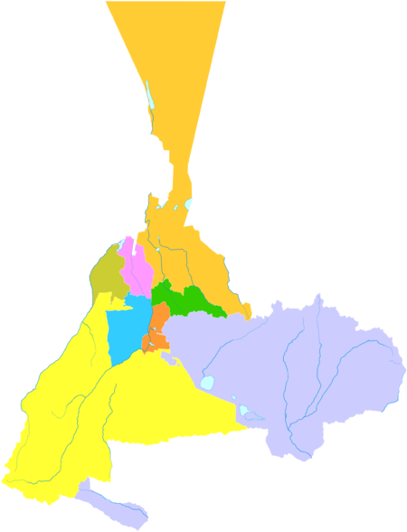
مناطق المدينة مقسمة إلى 7 مناطق و 1 county: Ürümqi currently comprises 8 county-level subdivisions: 7 districts and 1 county.
| Map | ||||||||
|---|---|---|---|---|---|---|---|---|
| Name | Simplified Chinese | Hanyu Pinyin | Uyghur (UEY) | Uyghur Latin (ULY) | Population (2010)[15] | Area (km2) | Density (/km2) | |
| City proper | ||||||||
| Tianshan District | 天山区 | Tiānshān Qū | تەڭرىتاغ رايونى | Tengritagh Rayoni | 696,277 | 171 | 4071.79 | |
| Saybag District | 沙依巴克区 | Shāyībākè Qū | سايباغ رايونى | Saybagh Rayoni | 664,716 | 422 | 1575.15 | |
| Xinshi District | 新市区 | Xīnshì Qū | يېڭىشەھەر رايونى | Yëngisheher Rayoni | 730,307 | 143 | 5107.04 | |
| Shuimogou District | 水磨沟区 | Shuǐmògōu Qū | شۇيموگۇ رايونى | Shuymogu Rayoni | 390,943 | 92 | 4249.38 | |
| Suburban | ||||||||
| Toutunhe District | 头屯河区 | Tóutúnhé Qū | تۇدۇڭخابا رايونى | Tudungxaba Rayoni | 172,796 | 276 | 626.07 | |
| Dabancheng District | 达坂城区 | Dábǎnchéng Qū | داۋانچىڭ رايونى | Dawanching Rayoni | 40,657 | 5,188 | 7.83 | |
| Midong District | 米东区 | Mǐdōng Qū | مىدوڭ رايونى | Midong Rayoni | 333,676 | 3,594 | 92.84 | |
| Rural | ||||||||
| Ürümqi County | 乌鲁木齐县 | Wūlǔmùqí Xiàn | ئۈرۈمچى ناھىيىسى | Ürümchi Nahiyisi | 83,187 | 4,332 | 19.20 | |
الاقتصاد

السياحة


- Grand Bazaar, a bazaar on South Jiefang Road (解放南路).
- Hong Shan (Red Mountain) is the symbol of Ürümqi, located in Hongshan Park.
- People's Park, south of Hongshan Park.
- People's Square
- Nanhu Square (南湖广场)
- Xinjiang Uygur Autonomous Region Museum (新疆维吾尔自治区博物馆), which was completely rebuilt in the early 2000s.[16]
- Heavenly Lake Scenic Area, a popular park with some of China's most famous alpine scenery, a little more than two hours outside Ürümqi.
- Shuimogou Hot Springs (水磨沟温泉) is located 5 km (3.1 mi) northeast of Ürümqi.
- Xinjiang Silk Road Museum (新疆丝绸之路博物馆) is located right next to the Grand Bazaar at No. 160 Shengli Road. It is located on the fourth and fifth floor of a very large European style building which houses a shopping complex as well. Most of the exhibits have English names as well and some of their guides speak some English.
- Ürümqi City Museum (乌鲁木齐博物馆) is located at South Nanhu Road 123 (南湖南路123号).
- Ürümqi Tatar Mosque (乌鲁木齐塔塔尔寺清真寺) is a luxuriously furbished mosque located on Jiefang Road. The mosque is open to female and male visitors unlike other mosques. However, permission must have been obtained prior to visiting the mosque.[17]
- The monument at the Geographical Center of Asian Continent, in Yongfeng Township, Ürümqi County
- Xinjiang International Grand Bazaar in Ürümqi City Tianshan District, which is currently the country's largest bazaar. The architectural style of the Grand Bazaar grand scale and very Islamic style, bazaar inside the market characteristics of ethnic minorities commodity dazzling, rich and exquisite. International Grand Bazaar in Ürümqi in most ethnic customs, visitors came to Ürümqi play will come to see
- Ürümqi Silk Road Ski Resort (丝绸之路滑雪场) is located in National Forest Park of Nan Shan.
الإعلام
. . . . . . . . . . . . . . . . . . . . . . . . . . . . . . . . . . . . . . . . . . . . . . . . . . . . . . . . . . . . . . . . . . . . . . . . . . . . . . . . . . . . . . . . . . . . . . . . . . . . . . . . . . . . . . . . . . . . . . . . . . . . . . . . . . . . . . . . . . . . . . . . . . . . . . . . . . . . . . . . . . . . . . . .
المدن الشقيقة
المصادر
وصلات خارجية
|  | |
مدن رئيسية في الصين العظمى | |||||||||
|---|---|---|---|---|---|---|---|---|---|
بر الصين |
| ||||||||
منطقة تايوان | |||||||||
| أكبر مدن أو بلديات في جمهورية الصين الشعبية
China Urban Construction Statistical Yearbook 2020 Urban Population and Urban Temporary Population | |||||||||
|---|---|---|---|---|---|---|---|---|---|
| الترتيب | المقاطعة | التعداد | الترتيب | المقاطعة | التعداد | ||||
 شنغهاي .jpg&filetimestamp=20221025045004&) بكين |
1 | شنغهاي | SH | 24,281,400 | 11 | Hong Kong | HK | 7,448,900 |  Guangzhou  Shenzhen |
| 2 | بكين | BJ | 19,164,000 | 12 | Zhengzhou | HA | 7,179,400 | ||
| 3 | Guangzhou | GD | 13,858,700 | 13 | Nanjing | JS | 6,823,500 | ||
| 4 | Shenzhen | GD | 13,438,800 | 14 | Xi'an | SN | 6,642,100 | ||
| 5 | Tianjin | TJ | 11,744,400 | 15 | Jinan | SD | 6,409,600 | ||
| 6 | Chongqing | CQ | 11,488,000 | 16 | Shenyang | LN | 5,900,000 | ||
| 7 | Dongguan | GD | 9,752,500 | 17 | Qingdao | SD | 5,501,400 | ||
| 8 | Chengdu | SC | 8,875,600 | 18 | هاربين | HL | 5,054,500 | ||
| 9 | ووهان | HB | 8,652,900 | 19 | Hefei | AH | 4,750,100 | ||
| 10 | Hangzhou | ZJ | 8,109,000 | 20 | Changchun | JL | 4,730,900 | ||
- CS1 errors: deprecated parameters
- CS1 errors: unsupported parameter
- Articles containing صينية-language text
- CS1 uses الصينية-language script (zh)
- CS1 الصينية المبسطة-language sources (zh-hans)
- Short description is different from Wikidata
- Coordinates on Wikidata
- Articles containing منغولية-language text
- مقالات تحتوي نصوصاً باللغة الصينية
- اورومقي
- أماكن مأهولة على طريق الحرير
- مدن في آسيا الوسطى
- مدن في شينجيانغ
- تقسيمات بمستوى محافظة في شينجيانگ
- عواصم المقاطعات في الصين
- مدن صينية