تصنيف:Locator maps of municipalities in Kyoto prefecture
الملفات في التصنيف "Locator maps of municipalities in Kyoto prefecture"
الملفات ال18 التالية في هذا التصنيف من إجمالي 18.
 Ayabe in Kyoto Prefecture Ja.svg 600 × 712؛ 15 كيلوبايت
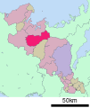
 Fukuchiyama in Kyoto Prefecture Ja.svg 600 × 712؛ 15 كيلوبايت
 Ide in Kyoto Prefecture Ja.svg 600 × 712؛ 15 كيلوبايت
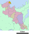 Ine in Kyoto Prefecture Ja.svg 600 × 712؛ 15 كيلوبايت
 Joyo in Kyoto Prefecture Ja.svg 600 × 712؛ 15 كيلوبايت
 Kasagi in Kyoto Prefecture Ja.svg 600 × 712؛ 15 كيلوبايت
 Kizugawa in Kyoto Prefecture Ja.svg 600 × 712؛ 15 كيلوبايت
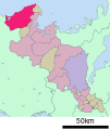
 Kumiyama in Kyoto-fu.png 220 × 200؛ 6 كيلوبايت
 Kyotanabe in Kyoto Prefecture Ja.svg 600 × 712؛ 15 كيلوبايت
 Kyotango in Kyoto Prefecture Ja.svg 600 × 712؛ 15 كيلوبايت
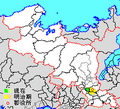
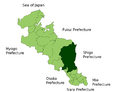
 Kyotango in Kyoto-fu.png 1٬181 × 901؛ 43 كيلوبايت
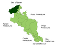
 Kyoto in Kyoto-fu.png 1٬181 × 901؛ 43 كيلوبايت
 Kyoto Kyotango-city.png 216 × 196؛ 4 كيلوبايت
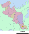
 Maizuru in Kyoto Prefecture Ja.svg 600 × 712؛ 15 كيلوبايت
 Minamiyamashiro in Kyoto Prefecture Ja.svg 600 × 712؛ 15 كيلوبايت
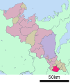
 Miyazu in Kyoto Prefecture Ja.svg 600 × 712؛ 15 كيلوبايت
 Seika in Kyoto Prefecture Ja.svg 600 × 712؛ 15 كيلوبايت
 Yosano in Kyoto Prefecture Ja.svg 600 × 712؛ 15 كيلوبايت


