جراند جنكشن، كولورادو
گراند جنكشن، كولورادو
Grand Junction, Colorado | |
|---|---|
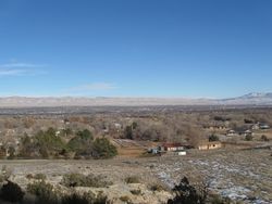
 النظر شمالاً من گراند جنكشن | |
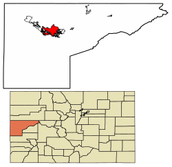
 موقع گراند جنكشن في مقاطعة ميسا، كولورادو. | |
| الإحداثيات: 39°04′N 108°34′W / 39.067°N 108.567°W | |
| البلد | الولايات المتحدة |
| الولاية | كولورادو |
| المقاطعة | ميسا[1] |
| Incorporated | July 22, 1882[2] |
| السمِيْ | Confluence of Grand River and Gunnison River |
| الحكومة | |
| • النوع | بلدية حكم ذاتي |
| • العمدة | Duke Wortmann |
| • City Manager | Greg Caton |
| المساحة | |
| • بلدية حكم ذاتي | 39٫64 ميل² (102٫66 كم²) |
| • البر | 39٫28 ميل² (101٫74 كم²) |
| • الماء | 0٫36 ميل² (0٫92 كم²) |
| • العمران | 3٬341٫11 ميل² (8٬653 كم²) |
| المنسوب | 4٬593 ft (1٬397 m) |
| التعداد (2010) | |
| • بلدية حكم ذاتي | 58٬566 |
| • Estimate (2019)[4] | 63٬597 |
| • الكثافة | 1٬575٫38/sq mi (608٫25/km2) |
| • العمرانية | 147٬083 |
| • الكثافة العمرانية | 44/sq mi (17/km2) |
| منطقة التوقيت | UTC−7 (MST) |
| • الصيف (التوقيت الصيفي) | UTC−6 (MDT) |
| ZIP Codes[5] | 81501–81507 |
| مفتاح الهاتف | 970 |
| FIPS code | 08-31660 |
| GNIS feature ID | 0204662 |
| Highways | I-70, U.S. Highway 6, U.S. Highway 50, CO SH 340, CO SH 141, CO SH 139 |
| الموقع الإلكتروني | City of Grand Junction |
گراند جنكشن Grand Junction هي بلدية حكم ذاتي التي هي مقر المقاطعة والبلدية الأكبر تعداداً في مقاطعة ميسا، كولورادو، الولايات المتحدة. المدينة لها شكل حكم مجلس-مدير، وهي أكبر البلديات تعداداً في غرب كولورادو.[6] Grand Junction is 247 ميل (398 km) west-southwest of the Colorado State Capitol في دنڤر. As of the 2010 census, the city's population was 58,566.[7] Grand Junction is the 15th most populous city في ولاية كولورادو and the most populous city on the Colorado Western Slope. It is a major commercial and transportation hub within the large area between the Green River and the Continental Divide. It is the principal city of the Grand Junction Metropolitan Statistical Area, which had a population of 146,723 in 2010 census.
The city is along the Colorado River, at its confluence with the Gunnison River, which comes in from the south. "Grand" refers to the historical Grand River; it was renamed the Upper Colorado River in 1921. "Junction" refers to the confluence of the Colorado and Gunnison rivers. Grand Junction has been nicknamed "River City". It is near the midpoint of a 30-ميل (48 km) arcing valley, known as the Grand Valley; since the late 19th century it has been a major fruit-growing region. The valley was long occupied by the Ute people and earlier indigenous cultures. It was not settled by European-American farmers until the 1880s. Since the late 20th century, several wineries have been established in the area.
The Colorado National Monument, a unique series of canyons and mesas, overlooks the city on the west. Most of the area is surrounded by federal public lands managed by the US Bureau of Land Management. Interstate 70 connects the city eastward to Glenwood Springs and Denver and westward to Green River, Utah; Salt Lake City is reached to the west via Interstate 70 and U.S Route 6; and Las Vegas (via Interstate 70 and Interstate 15).
التاريخ
الجغرافيا
المناخ
| بيانات المناخ لـ گراند جنكشن، كولورادو (مطار گراند جنكشن الإقليمي)، 1981–2010 normals, extremes 1893–present[أ] | |||||||||||||
|---|---|---|---|---|---|---|---|---|---|---|---|---|---|
| الشهر | ينا | فب | مار | أبر | ماي | يون | يول | أغس | سبت | أكت | نوف | ديس | السنة |
| القصوى القياسية °ف (°س) | 62 (17) |
70 (21) |
81 (27) |
89 (32) |
101 (38) |
105 (41) |
106 (41) |
103 (39) |
100 (38) |
88 (31) |
76 (24) |
66 (19) |
106 (41) |
| متوسط القصوى اليومية °ف (°س) | 37.7 (3.2) |
45.4 (7.4) |
56.5 (13.6) |
65.3 (18.5) |
76.1 (24.5) |
87.6 (30.9) |
93.2 (34.0) |
89.7 (32.1) |
80.1 (26.7) |
66.2 (19.0) |
50.4 (10.2) |
38.5 (3.6) |
65.6 (18.7) |
| متوسط الدنيا اليومية °ف (°س) | 17.0 (−8.3) |
23.7 (−4.6) |
31.4 (−0.3) |
38.1 (3.4) |
47.0 (8.3) |
56.3 (13.5) |
63.2 (17.3) |
61.3 (16.3) |
52.0 (11.1) |
39.9 (4.4) |
27.6 (−2.4) |
18.5 (−7.5) |
39.7 (4.3) |
| الصغرى القياسية °ف (°س) | −23 (−31) |
−21 (−29) |
5 (−15) |
11 (−12) |
24 (−4) |
34 (1) |
44 (7) |
43 (6) |
28 (−2) |
6 (−14) |
−4 (−20) |
−21 (−29) |
−23 (−31) |
| متوسط تساقط الأمطار inches (mm) | 0.58 (15) |
0.54 (14) |
0.92 (23) |
0.91 (23) |
0.88 (22) |
0.46 (12) |
0.61 (15) |
0.95 (24) |
1.19 (30) |
1.06 (27) |
0.73 (19) |
0.59 (15) |
9.42 (239) |
| متوسط هطول الثلج inches (cm) | 4.9 (12) |
3.2 (8.1) |
2.6 (6.6) |
0.9 (2.3) |
0.1 (0.25) |
0 (0) |
0 (0) |
0 (0) |
0 (0) |
0.4 (1.0) |
2.1 (5.3) |
4.9 (12) |
19.1 (49) |
| Average precipitation days | 5.9 | 6.2 | 7.3 | 7.3 | 6.4 | 4.1 | 5.3 | 6.7 | 7.0 | 6.5 | 5.9 | 5.7 | 74.3 |
| متوسط الرطوبة النسبية (%) | 69.7 | 60.4 | 50.1 | 40.3 | 36.3 | 29.4 | 33.5 | 36.6 | 38.8 | 45.6 | 58.5 | 68.0 | 47.3 |
| Mean monthly ساعات سطوع الشمس | 192.3 | 204.4 | 240.9 | 278.0 | 328.5 | 359.3 | 356.2 | 329.8 | 292.2 | 255.1 | 186.9 | 180.0 | 3٬203٫6 |
| نسبة السطوع المحتمل للشمس | 63 | 68 | 65 | 70 | 74 | 81 | 79 | 78 | 78 | 74 | 62 | 61 | 72 |
| Source: NOAA (sun 1961–1990),[8][9][10] The Weather Channel[11] | |||||||||||||
الديمغرافيا
| التعداد | Pop. | ملاحظة | %± |
|---|---|---|---|
| 1890 | 2٬030 | — | |
| 1900 | 3٬503 | 72٫6% | |
| 1910 | 7٬754 | 121٫4% | |
| 1920 | 8٬665 | 11٫7% | |
| 1930 | 10٬247 | 18٫3% | |
| 1940 | 12٬479 | 21٫8% | |
| 1950 | 14٬504 | 16٫2% | |
| 1960 | 18٬694 | 28٫9% | |
| 1970 | 20٬170 | 7٫9% | |
| 1980 | 27٬956 | 38٫6% | |
| 1990 | 29٬034 | 3٫9% | |
| 2000 | 41٬986 | 44٫6% | |
| 2010 | 58٬566 | 39٫5% | |
| 2019 (تق.) | 63٬597 | [4] | 8٫6% |
| U.S. Decennial Census[12] | |||
انظر أيضاً
- Outline of Colorado
- Index of Colorado-related articles
- State of Colorado
- Mesa County Valley School District 51
- Grand Junction, CO Metropolitan Statistical Area
- Mesa Mall
- Old Spanish National Historic Trail
- Western Colorado Botanical Gardens
ملاحظات
الهامش
- ^ "Active Colorado Municipalities". State of Colorado, Department of Local Affairs. Archived from the original on 2009-12-12. Retrieved 2007-09-01.
- ^ "Colorado Municipal Incorporations". State of Colorado, Department of Personnel & Administration, Colorado State Archives. 2004-12-01. Retrieved 2007-09-02.
- ^ "2016 U.S. Gazetteer Files". United States Census Bureau. Retrieved Jul 25, 2017.
- ^ أ ب "Population and Housing Unit Estimates". Retrieved May 21, 2020.
- ^ "ZIP Code Lookup". United States Postal Service. Archived from the original (JavaScript/HTML) on November 4, 2010. Retrieved September 24, 2007.
- ^ "Find a County". National Association of Counties. Archived from the original on 2011-05-31. Retrieved 2011-06-07.
- ^ "Profile of General Population and Housing Characteristics: 2010 Demographic Profile Data (DP-1): Grand Junction city, Colorado". United States Census Bureau. Retrieved November 22, 2011.
- ^ "NowData – NOAA Online Weather Data". National Oceanic and Atmospheric Administration. Retrieved 2014-03-04.
- ^ "Station Name: CO GRAND JUNCTION WALKER FLD". National Oceanic and Atmospheric Administration. Retrieved 2014-03-29.
- ^ "WMO Climate Normals for GRAND JUNCTION/WALKER FIELD CO 1961–1990". National Oceanic and Atmospheric Administration. Retrieved 2014-03-11.
- ^ "Monthly Averages for Grand Junction, CO – Temperature and Precipitation". The Weather Channel. Retrieved 2008-11-02.
- ^ "Census of Population and Housing". Census.gov. Retrieved June 4, 2015.
وصلات خارجية
- Pages using gadget WikiMiniAtlas
- Short description is different from Wikidata
- Coordinates on Wikidata
- Pages using infobox settlement with unknown parameters
- Pages using US Census population needing update
- Pages with empty portal template
- Official website different in Wikidata and Wikipedia
- گراند جنكشن، كولورادو
- مدن كولورادو
- مدن مقاطعة ميسا، كولورادو
- السفح الغربي لكولورادو
- County seats in Colorado
