مقاطعة ويلر، أوريگون
Wheeler County | |
|---|---|
 Wheeler County Courthouse in Fossil | |
 الموقع ضمن ولاية Oregon | |
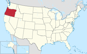
 موقع Oregon ضمن الولايات المتحدة | |
| الإحداثيات: 44°44′N 120°01′W / 44.73°N 120.02°W | |
| البلد | |
| State | |
| تأسست | February 17, 1899 |
| Seat | Fossil |
| أكبر مدينة | Fossil |
| المساحة | |
| • الإجمالي | 1٬715 ميل² (4٬440 كم²) |
| • البر | 1٬715 ميل² (4٬440 كم²) |
| • الماء | 0٫5 ميل² (1 كم²) 0.03%% |
| التعداد | |
| • Estimate (2016) | 1٬344 |
| • الكثافة | 0٫8/sq mi (0٫3/km2) |
| منطقة التوقيت | UTC−8 (Pacific) |
| • الصيف (التوقيت الصيفي) | UTC−7 (PDT) |
| Congressional district | 2nd |
| الموقع الإلكتروني | www |
مقاطعة ويلر إنگليزية: Wheeler County هي إحدى مقاطعات ولاية أوريگون في الولايات المتحدة الأمريكية.
الديمغرافيا
| التعداد | Pop. | ملاحظة | %± |
|---|---|---|---|
| 1900 | 2٬443 | — | |
| 1910 | 2٬484 | 1٫7% | |
| 1920 | 2٬791 | 12٫4% | |
| 1930 | 2٬799 | 0٫3% | |
| 1940 | 2٬974 | 6٫3% | |
| 1950 | 3٬313 | 11٫4% | |
| 1960 | 2٬722 | −17٫8% | |
| 1970 | 1٬849 | −32٫1% | |
| 1980 | 1٬513 | −18٫2% | |
| 1990 | 1٬396 | −7٫7% | |
| 2000 | 1٬547 | 10٫8% | |
| 2010 | 1٬441 | −6٫9% | |
| 2016 (تق.) | 1٬344 | [1] | −6٫7% |
| U.S. Decennial Census[2] 1790-1960[3] 1900-1990[4] 1990-2000[5] 2010-2016[6] | |||
التجمعات السكنية
المدن
Unincorporated communities
بلدات مهجورة
انظر أيضاً
الهامش
- ^ "Population and Housing Unit Estimates". Retrieved June 9, 2017.
- ^ "U.S. Decennial Census". United States Census Bureau. Retrieved February 28, 2015.
- ^ "Historical Census Browser". University of Virginia Library. Retrieved February 28, 2015.
- ^ Forstall, Richard L., ed. (March 27, 1995). "Population of Counties by Decennial Census: 1900 to 1990". United States Census Bureau. Retrieved February 28, 2015.
- ^ "Census 2000 PHC-T-4. Ranking Tables for Counties: 1990 and 2000" (PDF). United States Census Bureau. April 2, 2001. Retrieved February 28, 2015.
- ^ خطأ استشهاد: وسم
<ref>غير صحيح؛ لا نص تم توفيره للمراجع المسماةQF
للاستزادة
- Mary Fitzgerald, An Independent Folk: A History of Early Wheeler County, Oregon. Mitchell, OR: M. Fitzgerald, 2011.
- F. Smith Fussner (ed.), Glimpses Of Wheeler County's Past: An Early History of North Central Oregon. Portland, OR: Binford and Mort, 1975.
- Janet L Stinchfield and McLaren E Stinchfield, The History of Wheeler County, Oregon. n.c.: Times-Journal, 1983.
- An Illustrated History of Central Oregon, Embracing Wasco, Sherman, Gilliam, Wheeler, Crook, Lake, and Klamath Counties, State of Oregon. Spokane, WA: Western Historical Publishing Co., 1905.
وصلات خارجية
- Wheeler County Oregon (official website)
- Wheeler County listing in the Oregon Blue Book
الكلمات الدالة:
?
تصنيفات:
- Pages using gadget WikiMiniAtlas
- Short description is different from Wikidata
- مقاطعات Oregon
- Articles containing إنگليزية-language text
- Pages using Lang-xx templates
- Pages using US Census population needing update
- Portal-inline template with redlinked portals
- Pages with empty portal template
- Coordinates on Wikidata
- Wheeler County, Oregon
- 1899 establishments in Oregon
- Populated places established in 1899
- مقاطعات أوريگون
