مقاطعة كومانتشي، أوكلاهوما
Comanche County | |
|---|---|
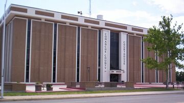
 Comanche County Courthouse | |
 الموقع ضمن ولاية Oklahoma | |
 موقع Oklahoma ضمن الولايات المتحدة | |
| الإحداثيات: 34°40′N 98°28′W / 34.66°N 98.46°W | |
| البلد | |
| State | |
| تأسست | July 8, 1901 |
| Seat | Lawton |
| أكبر مدينة | Lawton |
| المساحة | |
| • الإجمالي | 1٬084 ميل² (2٬810 كم²) |
| • البر | 1٬069 ميل² (2٬770 كم²) |
| • الماء | 14 ميل² (40 كم²) 1.3%% |
| التعداد (2010) | |
| • الإجمالي | 124٬098 |
| • Estimate (2019) | 120٬749 |
| • الكثافة | 116/sq mi (45/km2) |
| منطقة التوقيت | UTC−6 (Central) |
| • الصيف (التوقيت الصيفي) | UTC−5 (CDT) |
| Congressional district | 4th |
| الموقع الإلكتروني | www |
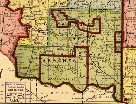
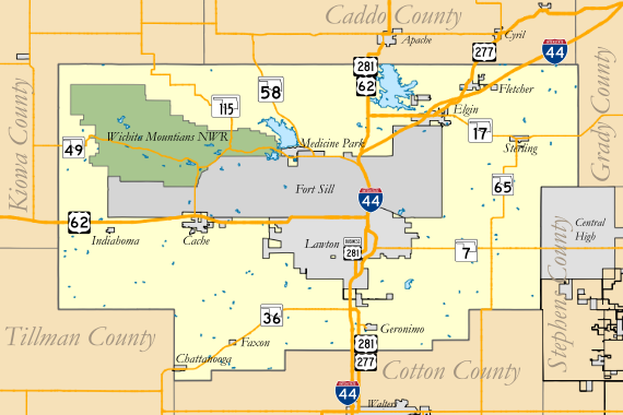
مقاطعة كومانتشي إنگليزية: Comanche County هي إحدى مقاطعات ولاية أوكلاهوما في الولايات المتحدة.
التاريخ
الجغرافيا
الديمغرافيا
| التعداد | Pop. | ملاحظة | %± |
|---|---|---|---|
| 1910 | 41٬489 | — | |
| 1920 | 26٬629 | −35٫8% | |
| 1930 | 34٬317 | 28٫9% | |
| 1940 | 38٬988 | 13٫6% | |
| 1950 | 55٬165 | 41٫5% | |
| 1960 | 90٬803 | 64٫6% | |
| 1970 | 108٬144 | 19٫1% | |
| 1980 | 112٬456 | 4�0% | |
| 1990 | 111٬486 | −0٫9% | |
| 2000 | 114٬996 | 3٫1% | |
| 2010 | 124٬098 | 7٫9% | |
| 2019 (تق.) | 120٬749 | [1] | −2٫7% |
| U.S. Decennial Census[2] 1790-1960[3] 1900-1990[4] 1990-2000[5] 2010-2019[6] | |||
السياسة
style="background-color: #3333FF; width: 0.3em;" | style="background-color: #E81B23; width: 0.3em;" | style="background-color: #DDDDBB; width: 0.3em;" || Voter Registration and Party Enrollment as of January 15, 2019[7] | |||||
|---|---|---|---|---|---|
| الحزب | عدد الأصوات | النسبة | |||
| Democratic | 22,543 | 40.78% | |||
| Republican | 21,787 | 39.41% | |||
| Others | 10,953 | 19.81% | |||
| Total | 55,283 | 100% | |||
Presidential election results
| Year | Republican | Democratic | Third parties |
|---|---|---|---|
| 2020 | 58.7% 20,905 | 38.6% 13,747 | 2.8% 979 |
| 2016 | 58.9% 19,183 | 35.2% 11,463 | 5.9% 1,918 |
| 2012 | 58.5% 17,664 | 41.5% 12,521 | |
| 2008 | 58.8% 20,127 | 41.2% 14,120 | |
| 2004 | 63.8% 21,170 | 36.2% 12,022 | |
| 2000 | 58.3% 17,103 | 40.8% 11,971 | 0.9% 259 |
| 1996 | 47.8% 14,461 | 42.4% 12,841 | 9.8% 2,976 |
| 1992 | 44.2% 15,704 | 34.5% 12,237 | 21.3% 7,579 |
| 1988 | 60.0% 17,464 | 39.3% 11,441 | 0.7% 194 |
| 1984 | 70.4% 21,382 | 29.3% 8,890 | 0.4% 122 |
| 1980 | 59.5% 16,609 | 35.7% 9,972 | 4.8% 1,329 |
| 1976 | 50.0% 13,163 | 49.1% 12,910 | 0.9% 230 |
| 1972 | 79.9% 19,759 | 18.4% 4,559 | 1.7% 427 |
| 1968 | 39.8% 9,225 | 34.8% 8,061 | 25.4% 5,879 |
| 1964 | 36.9% 7,936 | 63.1% 13,585 | |
| 1960 | 52.8% 10,691 | 47.2% 9,562 | |
| 1956 | 46.2% 7,532 | 53.8% 8,756 | |
| 1952 | 49.2% 8,756 | 50.8% 9,029 | |
| 1948 | 25.9% 2,787 | 74.1% 7,955 | |
| 1944 | 35.8% 4,109 | 64.0% 7,342 | 0.2% 28 |
| 1940 | 35.2% 3,703 | 64.5% 6,796 | 0.3% 36 |
| 1936 | 30.0% 3,039 | 69.3% 7,026 | 0.7% 75 |
| 1932 | 21.2% 2,046 | 78.8% 7,586 | |
| 1928 | 62.5% 5,069 | 36.4% 2,956 | 1.1% 92 |
| 1924 | 41.4% 3,084 | 47.3% 3,523 | 11.3% 841 |
| 1920 | 49.2% 3,332 | 44.8% 3,037 | 6.0% 406 |
| 1916 | 29.3% 1,221 | 51.1% 2,130 | 19.6% 815 |
| 1912 | 34.1% 1,320 | 49.8% 1,931 | 16.1% 625 |
القانون والحكم
See also
References
- ^ "Population and Housing Unit Estimates". Retrieved March 26, 2020.
- ^ "U.S. Decennial Census". United States Census Bureau. Retrieved February 19, 2015.
- ^ "Historical Census Browser". University of Virginia Library. Retrieved February 19, 2015.
- ^ Forstall, Richard L., ed. (March 27, 1995). "Population of Counties by Decennial Census: 1900 to 1990". United States Census Bureau. Retrieved February 19, 2015.
- ^ "Census 2000 PHC-T-4. Ranking Tables for Counties: 1990 and 2000" (PDF). United States Census Bureau. April 2, 2001. Retrieved February 19, 2015.
- ^ خطأ استشهاد: وسم
<ref>غير صحيح؛ لا نص تم توفيره للمراجع المسماةQF - ^ "Oklahoma Registration Statistics by County" (PDF). OK.gov. January 15, 2019. Retrieved February 27, 2019.
- ^ Leip, David. "Dave Leip's Atlas of U.S. Presidential Elections". uselectionatlas.org. Retrieved March 28, 2018.
وصلات خارجية
?
تصنيفات:
- Pages using gadget WikiMiniAtlas
- Articles with hatnote templates targeting a nonexistent page
- Short description is different from Wikidata
- Coordinates on Wikidata
- مقاطعات Oklahoma
- Pages using infobox U.S. county with unknown parameters
- Articles containing إنگليزية-language text
- Pages using Lang-xx templates
- Pages using US Census population needing update
- Comanche County, Oklahoma
- تأسيسات 1901 في إقليم أوكلاهوما
- أماكن مأهولة تأسست في 1901
- مقاطعات أوكلاهوما


