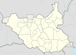
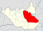
ماثيانق، جنوب السودان
ماثيانق
Mathiaŋ Mathiang | |
|---|---|
 قرية ماثيانق | |
| الإحداثيات: 6°25′46″N 31°34′57″E / 6.42944°N 31.58250°E | |
| البلد | جنوب السودان |
| الولاية | ولاية جونقلي |
| المقاطعة | مقاطعة غرب بور (منذ 2016) [1] |
| پايام | بايديت |
ماثيانق Mathiang هي بوما (قرية) في پايام بايديت، مقاطعة غرب بور، ولاية جونقلي، جنوب السودان، على بعد نحو 30 كيلومتر شمال بور. البلدة تقع في الامتداد الجنوبي لمنطقة السد، مستنقعات وسط دولة جنوب السودان، على الجانب الشرقي من بحر الغزال.
الديمغرافيا
According to the Fifth Population and Housing Census of Sudan, conducted in April 2008, Mathiang boma had a population of 8,949 people, composed of 4,469 male and 4,480 female residents.[2][note 1]
ملاحظات
- ^ In 2008, at the time of the census, Mathiang was located in Bor South County. The data collected during the Fifth Population and Housing Census of Sudan were to be the primary source of information for decisions about the number and demarcation of electoral constituencies and administrative boundaries in what was then southern Sudan. South Sudanese officials rejected census results for southern Sudan. See Darfur Relief and Documentation Centre (2010). 5th Population and Housing Census in Sudan – An Incomplete Exercise. Darfur Relief and Documentation Centre, Geneva (Switzerland). Archived from the original on September 18, 2017. http://www.sudanconsortium.org/member_publications/2010/February/DRDC.Report%20on%20the%205th%20Population%20Census%20in%20Sudan.February2010.pdf. Retrieved on June 11, 2017.. أيضاً انظر ديمغرافيا جنوب السودان.
المراجع
- ^ Mading, Juuk Othana (May 3, 2016). "Governor Establishes Additional Counties In Jonglei". Gurtong. Bor, South Sudan. Retrieved June 12, 2017.
- ^ National Bureau of Statistics (2013). Population Distribution by Sex by Boma, Vol. III. The Republic of South Sudan, The National Bureau of Statistics. p. 34. Archived from the original on November 14, 2017. http://www.ssnbss.org/home/document/census/population-distribution-by-sex-by-BOMA. Retrieved on June 11, 2017. "Table 138: Jonglei State, Bor South County, Baidit Payam"
الكلمات الدالة:
?

