القائمة الرئيسية
القائمة الرئيسية
انقل للشريط الجانبي
أخف
تصفح
الصفحة الرئيسة
أحدث التغييرات
الصفحات الخاصّة
رفع ملف
تصفح
المواضيع
أبجدي
دليل الأسلوب
صفحة عشوائية
مشاريع شقيقة
معرفة_المصادر
معرفة_الأخبار
معرفة_البيانات
خريطة_ذهنية
المشاركة والمساعدة
بوابة المجتمع
مساعدة
الميدان
المعرفة
بحث
بحث
إنشاء حساب
دخول
أدوات شخصية
إنشاء حساب
دخول
قالب
:
Canada image map
قالب
ناقش هذه الصفحة
العربية
اقرأ
عرض المصدر
تاريخ
أدوات
أدوات
انقل للشريط الجانبي
أخف
إجراءات
اقرأ
عرض المصدر
تاريخ
عام
ماذا يرتبط هنا؟
تغييرات ذات علاقة
الصفحات الخاصّة
نسخة للطباعة
وصلة دائمة
معلومات عن هذه الصفحة
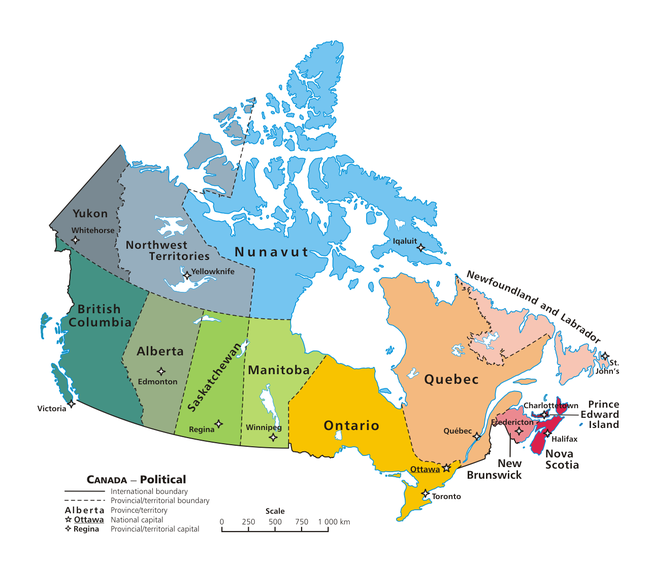
A clickable map of Canada exhibiting its ten provinces and three territories, and their capitals.
A clickable map of Canada exhibiting its ten provinces and three territories, and their capitals.
تصنيف
:
خرائط المعرفة المنقورة
تبديل عرض المحتوى المحدود