إرزنجان
إرزنجان
Erzincan | |
|---|---|
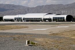
 منظر إرزنجان | |
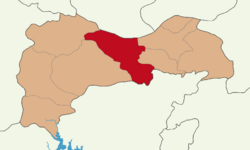 مقاطعة إرزنجان في محافظة إرزنجان | |
| الإحداثيات: 39°44′47″N 39°29′29″E / 39.74639°N 39.49139°ECoordinates: 39°44′47″N 39°29′29″E / 39.74639°N 39.49139°E | |
| البلد | تركيا |
| المحافظة | إرزنجان |
| الحكومة | |
| • العمدة | بكير آقصون (MHP) |
| المساحة | |
| • District | 1٬622٫08 كم² (626٫29 ميل²) |
| المنسوب | 1٬185 m (3٬888 ft) |
| التعداد (2012)[2] | |
| • Urban | 96٬474 |
| • District | 144٬545 |
| • كثافة District | 89/km2 (230/sq mi) |
| الموقع الإلكتروني | www.erzincan.bel.tr |
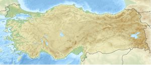
إرزنجان (Erzincan ؛ تُنطق [æɾˈzindʒan][3] بالأرمينية: Երզնկա؛ يرزنكا) هي عاصمة محافظة إرزنجان في شمال شرق تركيا. المدن القريبة هي أرضروم وسيڤاس وتونجلي، بنگول وإلازيغ وملاطية وگموشخانه وبايبورت وگيرسون. وتقع على ارتفاع 1,185 متر فوق سطح البحر. ويبلغ تعداد سكانها حوالي 107,175 نسمة.
. . . . . . . . . . . . . . . . . . . . . . . . . . . . . . . . . . . . . . . . . . . . . . . . . . . . . . . . . . . . . . . . . . . . . . . . . . . . . . . . . . . . . . . . . . . . . . . . . . . . . . . . . . . . . . . . . . . . . . . . . . . . . . . . . . . . . . . . . . . . . . . . . . . . . . . . . . . . . . . . . . . . . . . .
التاريخ
أكيليسنى Acilisene، المدينة القديمة التي هي الآن إرزنجان، كانت محل توقيع سلام أكيليسنى في عام 387م الذي قسّم أرمنيا إلى دولتين تابعتين، الأصغر فيهما تعتمد على الامبراطورية البيزنطية والأكبر تعتمد على بلاد فارس.[4][5] هذا هو الاسم (Ἀκιλισηνή باليونانية) الذي ذكره سطرابون لها في كتابه جغرافيا، 11.4.14. أصل الاسم هو موضع خلاف، إلا أن المتفق عليه هو أن المدينة كانت تسمى في يومٍ ما "أرض Erez". ولبرهة كانت تُدعى جستنيانوپوليس Justinianopolis تكريماً للامبراطور جستنيان. وباليونانية الأحدث كانت تُسمى Κελτζηνή (Keltzene) و Κελεζηνή (Kelezene)[6]
سنوات الدمار
في تسعينيات القرن التاسع عشر ، تعطلت الحياة الثقافية والاقتصادية الأرمنية في يرزنكا. في 7 أكتوبر 1895 ، استفزت السلطات المحلية الخوجان التركي الذي هاجم المحلات والورش وأكشاك الأرمن في سوق يرزنكا. مات أكثر من 100 أرمني في ذلك اليوم. في عام 1915 ، كان عدد سكان يرزنكا 40 ألف نسمة، منهم 15 ألفًا من الأرمن. بأمر من حاكم يرزنكا التركي، "ممدوح"، في مايو 1915، تم تهجير السكان الأرمن في يرزنكا وهلكوا بالكامل تقريبًا في خانق كاماخ. تمكن عدد قليل من الاحتماء في الجبال والغابات المجاورة.[7]
في 12 يوليو 1916 ، استولت القوات الروسية على يرزنكا. تجمع حوالي 3000-4000 أرمني من أماكن مختلفة في يرزنكا. في 5 ديسمبر 1917 ، تم توقيع هدنة في يرزنكا بين قيادة القوات التركية ومفوضية عبر القوقاز. بحجة الأحداث بين الحرس الإسلامي والمسيحي الذين يعيشون في الأراضي المحتلة من قبل جيش القوقاز ، انتهكت القيادة التركية الهدنة وأمرت القوات باجتياح القوقاز. في فبراير 1918، استعادوا يرزنكا. إلى جانب المتطوعين الأرمن المنسحبين، غادر السكان الأرمن الذين لجأوا إلى هناك يرزنكا. انتقل أتباع الإرزنيق الذين نجوا من الإبادة الجماعية وأحفادهم إلى أرمينيا السوفيتية والولايات المتحدة وفرنسا ومصر ولبنان واليونان والعراق وأماكن أخرى.[7]
معركة إرزنجان
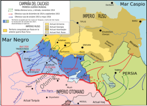
معركة إرزنجان نشبت أثناء حملة القوقاز في الحرب العالمية الأولى. أرزنجان كانت مقر الجيش الثالث التركي بقيادة عبد الكريم باشا. قاد الجنرال الروسي نيقولاي يودنيتش جيش القوقاز الروسي الذي استولى على ماما خاتون في 12 يوليو 1916. They then gained the heights of Naglika and took a Turkish position on the banks of the Durum Durasi river, with their cavalry breaking through the Boz-Tapa-Meretkli line. They then advanced on Erzincan arriving by 25 July and taking the city in two days. The city was relatively untouched by battle and Yudenich seized large quantities of supplies. Despite the strategic advantages gained from this victory, Yudenich made no more significant advances and his forces were reduced due to Russian reverses further north.[8]
سوڤيت أرزنجان
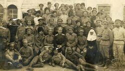

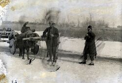
A short-lived soviet council had been at Erzincan between 1916 and 1918. Mainly today's Erzincan and Tunceli provinces were under Russian occupation. After the revolution, Bolshevik soldiers took control of the officer corps. Arshak Djamalian who was a Bolshevik soldier, called Kurdish, Turkish, and Armenian representatives to take charge of the administration of Erzincan Soviet.[9][10]
استيلاء الأتراك على أرزنجان
Following the withdrawal of the Russian Army, the commander of the First Caucasian Army Corps Kâzım Karabekir regained control over Erzincan on the 13 February 1918. This event is celebrated annually by its inhabitants.[11]
زلزال إرزنجان 1939
The city was completely destroyed by a major earthquake on December 27, 1939. The sequence of seven violent shocks, the biggest measuring 7.8 on the moment magnitude scale, was the joint most-powerful earthquake recorded in Turkey, tied with the 2023 Turkey–Syria earthquake. The first stage of the earthquake killed about 8,000 people. The next day, it was reported that the death toll had risen to 20,000. An emergency relief operation began. By the end of the year, 32,962 had died due to more earthquakes and several floods. So extensive was the damage to Erzincan city that its old site was entirely abandoned, and a new town was founded a little further to the north. Certain local folklore attributed the earthquake to "Armenians’ curse taking effect," referring to local victims of the Armenian genocide.[12]
المناخ
| بيانات مناخ إرزنجان | |||||||||||||
|---|---|---|---|---|---|---|---|---|---|---|---|---|---|
| الشهر | يناير | فبراير | مارس | أبريل | مايو | يونيو | يوليو | أغسطس | سبتمبر | اكتوبر | نوفمبر | ديسمبر | العام |
| العظمى القياسية °س (°ف) | 14.0 (57.2) |
17.2 (63) |
25.2 (77.4) |
30.0 (86) |
32.5 (90.5) |
35.0 (95) |
40.6 (105.1) |
40.2 (104.4) |
36.6 (97.9) |
30.8 (87.4) |
22.5 (72.5) |
19.0 (66.2) |
40٫6 (105٫1) |
| العظمى المتوسطة °س (°ف) | 1.9 (35.4) |
3.9 (39) |
9.9 (49.8) |
16.8 (62.2) |
22.0 (71.6) |
26.9 (80.4) |
31.5 (88.7) |
31.9 (89.4) |
27.4 (81.3) |
19.8 (67.6) |
11.5 (52.7) |
4.5 (40.1) |
17٫33 (63٫2) |
| الصغرى المتوسطة °س (°ف) | -6.5 (20.3) |
-5.1 (22.8) |
-0.4 (31.3) |
5.2 (41.4) |
8.9 (48) |
12.5 (54.5) |
15.8 (60.4) |
15.5 (59.9) |
10.8 (51.4) |
6.0 (42.8) |
0.6 (33.1) |
-3.5 (25.7) |
4٫98 (40٫97) |
| الصغرى القياسية °س (°ف) | -24.4 (-11.9) |
-25.2 (-13.4) |
-22.4 (-8.3) |
-8.2 (17.2) |
-0.4 (31.3) |
4.2 (39.6) |
5.0 (41) |
6.4 (43.5) |
0.9 (33.6) |
-5.4 (22.3) |
-11.0 (12.2) |
-25.0 (-13) |
−25٫2 (−13٫4) |
| هطول mm (inches) | 26.1 (1.028) |
29.6 (1.165) |
41.8 (1.646) |
54.1 (2.13) |
53.2 (2.094) |
29.2 (1.15) |
9.8 (0.386) |
7.4 (0.291) |
15.6 (0.614) |
46.7 (1.839) |
40.9 (1.61) |
28.2 (1.11) |
382٫6 (15٫063) |
| Avg. rainy days | 9.3 | 9.3 | 11.4 | 14.0 | 14.3 | 9.1 | 3.9 | 3.0 | 4.5 | 9.2 | 8.8 | 9.9 | 106٫7 |
| Sunshine hours | 89.9 | 106.4 | 158.1 | 171 | 226.3 | 288 | 328.6 | 310 | 261 | 192.2 | 126 | 74.4 | 2٬331٫9 |
| Source: Devlet Meteoroloji İşleri Genel Müdürlüğü [13] | |||||||||||||
. . . . . . . . . . . . . . . . . . . . . . . . . . . . . . . . . . . . . . . . . . . . . . . . . . . . . . . . . . . . . . . . . . . . . . . . . . . . . . . . . . . . . . . . . . . . . . . . . . . . . . . . . . . . . . . . . . . . . . . . . . . . . . . . . . . . . . . . . . . . . . . . . . . . . . . . . . . . . . . . . . . . . . . .
الاقتصاد
مزارع أشجار التوت كانت منتشرة في مطلع القرن العشرين، وقد استـُخدِمت في انتاج الحرير.[14]
الهامش
- ^ "Area of regions (including lakes), km²". Regional Statistics Database. Turkish Statistical Institute. 2002. Retrieved 2013-03-05.
- ^ "Population of province/district centers and towns/villages by districts - 2012". Address Based Population Registration System (ABPRS) Database. Turkish Statistical Institute. Retrieved 2013-02-27.
- ^ Barış Kabak and Irene Vogel, "The phonological word and stress assignment in Turkish", Phonology 18 (2001), p. 325.
- ^ Suny, Ronald Grigor (1994). The Making of the Georgian Nation. Indiana University Press. p. 22. ISBN 978-0-25320915-3.
- ^ A. J. Hacikyan; Gabriel Basmajian; Edward S. Franchuk; Nourhan Ouzounian, eds. (2000). The Heritage of Armenian Literature: From the Oral Tradition to the Golden Age. Detroit: Wayne State University Press. p. 378. ISBN 9780814328156.
- ^ Raymond Janin, v. Celtzene ou Celezene في Dictionnaire d'Histoire et de Géographie ecclésiastiques, vol. XII, Paris 1953, coll. 130–131
- ^ أ ب "إرزنجان". ويكيبيديا الأرمنية.
- ^ World War I: A Student Encyclopedia by John S.D. Eisenhower (Foreword), Spencer Tucker, Priscilla Mary Roberts (Ed.s)
- ^ (in تركية) Karabekir, Kâzım. Erzincan ve Erzurum'un Kurtuluşu: Sarıkamış, Kars ve Ötesi (The Liberation of Erzincan and Erzurum: Sarıkamış, Kars and Beyond). Erzurum Ticaret ve Sanayi Odası Araştırma, Geliştirme ve Yardımlaşma Vakfı, 1990, p. 377. ISBN 978-975-512-072-0.
- ^ “Ekim Devrimi Tartışmaları 2009: Ekim Devrimi ve İki Cumhuriyet” panel, Köz Gazetesi, 15 November 2009, Yüz Çiçek Açsın Kültür Merkezi - Okmeydanı, İstanbul.
- ^ "13 Şubat 1918 Erzincan'ın Düşman işgalinden kurtuluşunun 101. Yılı Çeşitli Etkinliklerle Kutlandı | T.C. Erzincan Belediyesi". www.erzincan.bel.tr. Retrieved 2022-11-13.
- ^ Çaylı, Eray (2015-12-30). ""Accidental" Encounters with the Ottoman Armenians in Contemporary Turkey". Études arméniennes contemporaines (6): 257–270. doi:10.4000/eac.919. ISSN 2269-5281.
- ^ http://www.dmi.gov.tr/veridegerlendirme/il-ve-ilceler-istatistik.aspx?m=ERZINCAN
- ^ Prothero, W. G. (1920). Armenia and Kurdistan. London: H.M. Stationery Office. p. 64.


