محافظة بيلجيك
محافظة بيلجيك
Bilecik ili | |
|---|---|
 High speed train at Bilecik | |
 موقع محافظة بيلجيك في تركيا. | |
| البلد | بيلجيك |
| المنطقة | شرق مرمرة |
| المنطقة الفرعية | بورصة |
| الحكومة | |
| • الدائرة الانتخابية | بيلجيك |
| المساحة | |
| • الإجمالي | 4٫307 كم² (1٫663 ميل²) |
| التعداد (2018) | |
| • الإجمالي | 223٬448 |
| • الكثافة | 52٬000/km2 (130٬000/sq mi) |
| مفتاح الهاتف | 0228 |
| لوحة السيارة | 11 |
محافظة بيلجيك (تركية: Bilecik ili، إنگليزية: Bilecik Province)، هي إحدى محافظات تركيا، وتقع في غرب-وسط البلاد، تحدها محافظة بورصة من الغرب، محافظتي خوجةإلي وصقاريا من الشمال، محافظة بولو من الشرق، محافظة إسكيشهر من الجنوب الشرقي ومحافظة كوتاهية من الجنوب. تمتد محافظة بيلجيك بمساحة 4.307 كم2. يبلغ عدد سكان المحافظة 225.381 نسمة. معظم المحافظة تقع في منطقة مرمرة لكن المناطق الشرقية منها ومقاطعة شوغوت ومقاطعتي إنحصار وينيپازار تقع في منطقة البحر الأسود، وتقع المناطق الجنوبية الشرقية وشوغوت في منطقة وسط الأناضول وتقع منطقة بوزويوك الجنوبية الغربية في منطقة إيجة.
. . . . . . . . . . . . . . . . . . . . . . . . . . . . . . . . . . . . . . . . . . . . . . . . . . . . . . . . . . . . . . . . . . . . . . . . . . . . . . . . . . . . . . . . . . . . . . . . . . . . . . . . . . . . . . . . . . . . . . . . . . . . . . . . . . . . . . . . . . . . . . . . . . . . . . . . . . . . . . . . . . . . . . . .
التاريخ
The region was inhabited as early as 3000 BC, and was part of the territory controlled by such notable civilizations as the Hittites (1400–1200 BC), the Phrygians (1200–676 BC), Lydians (595–546 BC), Persians (546–334 BC), Romans (74–395 AD) and Byzantians (395 AD to late 13th century, with two brief occupations by Ummayads in between).
The region also contains Söğüt, the small town where the Ottoman Empire was founded in 1299, and is the source of important archeological as well as cultural artifacts.
الجغرافيا

المقاطعات
تنقسم محافظة بيلجيك إلى 8 مقاطعات (عاصمة المقاطعة بالخط العريض):
المعالم الرئيسية
In Söğüt a site of interest is the Ethnographical Museum.
The town Bilecik is famous for its numerous restored Turkish houses.
Some other sites of interest in the province are: Osman Gazi and Orhan Gazi mosques, Seyh Edebali and Mal Hatun mausoleums, Köprülü Mehmet Pasha mosque, Köprülü Caravanserai, Kaplikaya tombs, Rüstem Pasha mosque, and Gülalan Pavilion.
معرض الصور
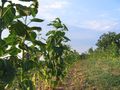
A view from Çengeller village in Gölpazarı
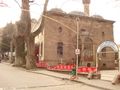
Çelebi Mehmet Mosque in Söğüt
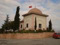
The türbe of Dursun Fakih in Söğüt


انظر أيضاً
المصادر
- ^ "Present and future Köppen-Geiger climate classification maps at 1-km resolution". Nature Scientific Data. DOI:10.1038/sdata.2018.214.
وصلات خارجية
- (in تركية) Bilecik governor's official website
- (in تركية) Bilecik municipality's official website
- Bilecik weather forecast information
- (in تركية) Yerel Yöneylem Kalkınma Derneği - Gölpazarı
- (in تركية) Bayırköy's local website
- (in تركية) Virtual platform of Bilecik Archived 2019-06-02 at the Wayback Machine
- (in تركية) www.bilecikhayat.com/ Bilecik hayat platform]
| الأقضية الريفية |  | |
|---|---|---|
المناطق | ||
| إيجه | ||
| البحر الأسود | ||
| وسط الأناضول | ||
| شرق الأناضول | ||
| مرمرة | ||
| البحر المتوسط | ||
| جنوب شرق الأناضول | ||
Coordinates: 40°06′24″N 30°07′33″E / 40.10667°N 30.12583°E