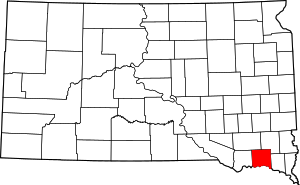
مقاطعة يانكتون، داكوتا الجنوبية
Yankton County | |
|---|---|
 Location within the U.S. state of South Dakota | |
 موقع South Dakota ضمن الولايات المتحدة | |
| الإحداثيات: 43°01′N 97°23′W / 43.01°N 97.39°W | |
| البلد | |
| State | |
| تأسست | April 10, 1862 |
| السمِيْ | Yankton Sioux |
| Seat | Yankton |
| Largest city | Yankton |
| المساحة | |
| • الإجمالي | 532 ميل² (1٬380 كم²) |
| • البر | 521 ميل² (1٬350 كم²) |
| • الماء | 11 ميل² (30 كم²) 2.1%% |
| التعداد (2010) | |
| • الإجمالي | 22٬438 |
| • الكثافة | 43/sq mi (17/km2) |
| منطقة التوقيت | UTC−6 (Central) |
| • الصيف (التوقيت الصيفي) | UTC−5 (CDT) |
| Congressional district | At-large |
| الموقع الإلكتروني | www |
يانكتون إنگليزية: Yankton هي إحدى مقاطعات ولاية داكوتا الجنوبية في الولايات المتحدة.
. . . . . . . . . . . . . . . . . . . . . . . . . . . . . . . . . . . . . . . . . . . . . . . . . . . . . . . . . . . . . . . . . . . . . . . . . . . . . . . . . . . . . . . . . . . . . . . . . . . . . . . . . . . . . . . . . . . . . . . . . . . . . . . . . . . . . . . . . . . . . . . . . . . . . . . . . . . . . . . . . . . . . . . .
Adjacent counties
- Turner County, South Dakota - northeast
- Clay County, South Dakota - east
- Cedar County, Nebraska - southeast
- Knox County, Nebraska - southwest
- Bon Homme County, South Dakota - west
- Hutchinson County, South Dakota - northwest
National protected area
Demographics
| التعداد تاريخياً | |||
|---|---|---|---|
| الإحصاء | التعداد | %± | |
| 1870 | 2٬097 | ||
| 1880 | 8٬390 | 300.1% | |
| 1890 | 10٬414 | 24.1% | |
| 1900 | 12٬649 | 21.5% | |
| 1910 | 13٬135 | 3.8% | |
| 1920 | 15٬233 | 16.0% | |
| 1930 | 16٬589 | 8.9% | |
| 1940 | 16٬725 | 0.8% | |
| 1950 | 16٬804 | 0.5% | |
| 1960 | 17٬551 | 4.4% | |
| 1970 | 19٬039 | 8.5% | |
| 1980 | 18٬952 | -0.5% | |
| 1990 | 19٬252 | 1.6% | |
| 2000 | 21٬652 | 12.5% | |
| 2010 | 22٬438 | 3.6% | |
| تقديري 2014 | 22٬684 | 4.8% | |
Communities
Cities
Towns
Townships
The county is divided into nine townships:
- Gayville
- Jamesville
- Marindahl
- Mayfield
- Mission Hill
- Turkey Valley
- Utica
- Volin
- Walshtown
Unorganized territories
The county contains two areas of unorganized territory: Southeast Yankton and West Yankton.
See also
مشاع المعرفة فيه ميديا متعلقة بموضوع [[commons: Category:Yankton County, South Dakota
| Yankton County, South Dakota
]].References
- ^ "U.S. Decennial Census". United States Census Bureau. Retrieved March 28, 2015.
- ^ "Historical Census Browser". University of Virginia Library. Retrieved March 28, 2015.
- ^ Forstall, Richard L., ed. (March 27, 1995). "Population of Counties by Decennial Census: 1900 to 1990". United States Census Bureau. Retrieved March 28, 2015.
- ^ "Census 2000 PHC-T-4. Ranking Tables for Counties: 1990 and 2000" (PDF). United States Census Bureau. April 2, 2001. Retrieved March 28, 2015.
- ^ خطأ استشهاد: وسم
<ref>غير صحيح؛ لا نص تم توفيره للمراجع المسماةQF
وصلات خارجية

|
Turner County | Hutchinson County | 
| |
| Clay County | Bon Homme County | |||
| Cedar County, Nebraska | Knox County, Nebraska |
الكلمات الدالة:
تصنيفات:
- Short description is different from Wikidata
- مقاطعات South Dakota
- U.S. Counties Missing Ex Image
- Articles containing إنگليزية-language text
- Yankton County, South Dakota
- South Dakota counties on the Missouri River
- 1862 establishments in Dakota Territory
- Populated places established in 1862
- مقاطعات ولاية داكوتا الجنوبية الأمريكية