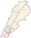
القنطرة (مرجعيون)
Qantara
قنطرة | |
|---|---|
Village | |
| الإحداثيات: 33°16′25″N 35°27′49″E / 33.27361°N 35.46361°ECoordinates: 33°16′25″N 35°27′49″E / 33.27361°N 35.46361°E | |
| موقع الجريدة | 193/297 PAL |
| البلد | |
| المحافظة | محافظة النبطية |
| القضاء | قضاء مرجعيون |
| المنسوب | 470 m (1٬540 ft) |
| منطقة التوقيت | UTC+2 (EET) |
| • الصيف (التوقيت الصيفي) | UTC+3 (EEST) |
| Dialing code | +961 |
القنطرة هي احدى القرى اللبنانية من قرى قضاء مرجعيون في محافظة النبطية.
. . . . . . . . . . . . . . . . . . . . . . . . . . . . . . . . . . . . . . . . . . . . . . . . . . . . . . . . . . . . . . . . . . . . . . . . . . . . . . . . . . . . . . . . . . . . . . . . . . . . . . . . . . . . . . . . . . . . . . . . . . . . . . . . . . . . . . . . . . . . . . . . . . . . . . . . . . . . . . . . . . . . . . . .
التاريخ
في 1875 وجد ڤكتور گيران أن القرية يقطنها 150 نسمة، كلهم من المتاولة.[1] He further remarked: "The mosque is built of hewn stones of apparent antiquity. Its door is surmounted by a lintel belonging to an ancient Christian church, in the midst of which can be made out a cross with equal branches enclosed in a circle."[2]
In 1881, the Palestine Exploration Fund's Survey of Western Palestine (SWP) described it: "A village, built of stone, containing about 250 [..] Metawileh, situated on an isolated and conspicuous hill, and surrounded by gardens, olives, and figs. There are two perennial springs a little to the south of the village."[3]
المراجع
| هل أنت مهتم ببلد الأرز لبنان ؟ ستجد الكثير من المعلومات عنه في بوابة لبنان. |


