ملف:Uludoruk Glaciers ali 2012253 lrg.jpg
حجم هذه المعاينة: 600 × 600 بكسل. البعدان الآخران: 2٬049 × 2٬048 بكسل | 2٬731 × 2٬730 بكسل.
الملف الأصلي (2٬731 × 2٬730 بكسل حجم الملف: 2٫72 ميجابايت، نوع MIME: image/jpeg)
وصف قصير
| Description |
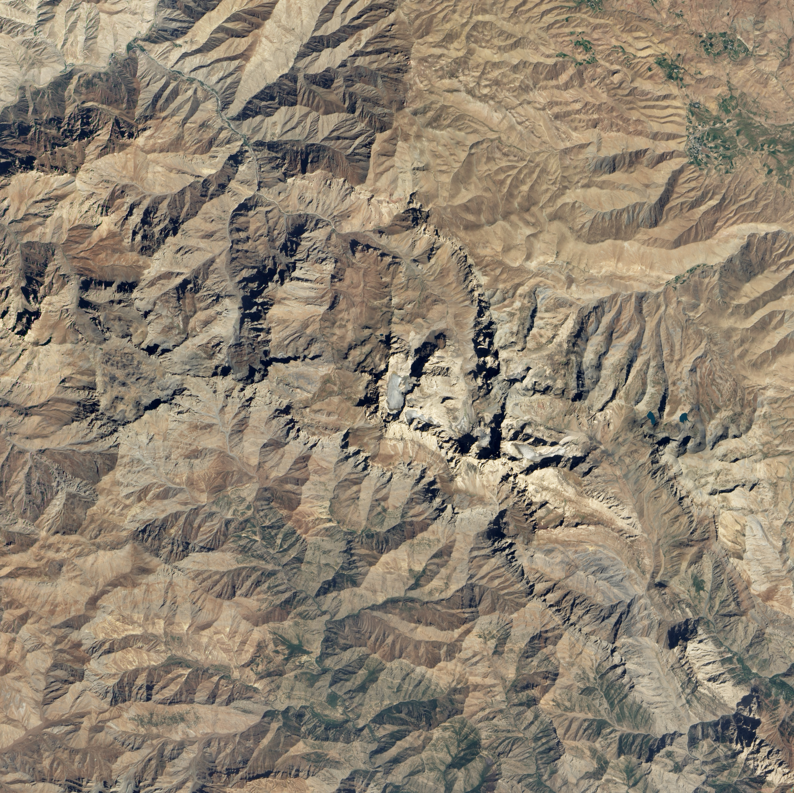
English: About two-thirds of Turkey’s glaciers lie within the Taurus Mountains, a chain of peaks that stretch from the Mediterranean coast toward the borders of Iran and Iraq. The southeastern portion of the range supports Turkey’s largest glaciers.
On September 9, 2012, at 10:30 a.m. local time, the Advanced Land Imager (ALI) on NASA’s Earth Observing-1 (EO-1) satellite acquired this view of glaciers near Mount Uludoruk, the second tallest mountain in Turkey. At 4,135 meters (13,566 feet) Uludoruk trails only Mount Ararat. Uludoruk’s glaciers are located within bowl-shaped hollows called cirques that are etched into the sides of steep ridges. The features form when snow piles up in a depression, accumulates into a glacier, and broadens as it spills down the slopes into adjacent valleys. |
| Date | 2012-09-17 08:17:07 |
| Source | http://visibleearth.nasa.gov/view.php?id=79395 |
| Author | Robert Simmon |
ترخيص
تاريخ الملف
اضغط على زمن/تاريخ لرؤية الملف كما بدا في هذا الزمن.
| زمن/تاريخ | صورة مصغرة | الأبعاد | مستخدم | تعليق | |
|---|---|---|---|---|---|
| حالي | ★ مراجعة معتمدة 23:37، 13 نوفمبر 2023 | | 2٬731 × 2٬730 (2٫72 ميجابايت) | Pastakhov (نقاش | مساهمات) | Upload https://upload.wikimedia.org/wikipedia/commons/e/e9/Uludoruk_Glaciers_ali_2012253_lrg.jpg |
لا يمكنك استبدال هذا الملف.
وصلات
لا يوجد صفحات تصل لهذه الصورة.