ملف:The River Rea, near Nineveh - geograph.org.uk - 461043.jpg
لا توجد دقة أعلى متوفرة.
The_River_Rea,_near_Nineveh_-_geograph.org.uk_-_461043.jpg (640 × 426 بكسل حجم الملف: 137 كيلوبايت، نوع MIME: image/jpeg)
وصف قصير
| Description |
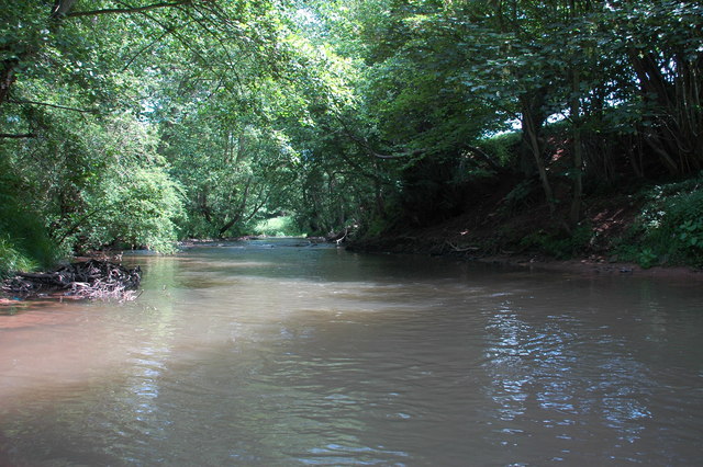
English: The River Rea, near Nineveh The River Rea is a tributary of the River Teme, here it is the county boundary between Shropshire (left bank) and Worcestershire (right bank). |
| Date | 2007-06-09 |
| Source | From geograph.org.uk |
| Author | Philip Halling |
| ⧼wm-license-cc-attribution⧽ (قالب:I18n/Credit line) |
Philip Halling / The River Rea, near Nineveh / |
52°21′36″N 2°28′58″W / 52.36006°N 2.4827°W
_heading:90)
| Object location | ملف:Compass-icon bb E.svg | View all coordinates using: OpenStreetMap |
|---|
_heading:90.00&language=⧼lang⧽)
ترخيص
تاريخ الملف
اضغط على زمن/تاريخ لرؤية الملف كما بدا في هذا الزمن.
| زمن/تاريخ | صورة مصغرة | الأبعاد | مستخدم | تعليق | |
|---|---|---|---|---|---|
| حالي | ★ مراجعة معتمدة 21:07، 26 يناير 2024 | | 640 × 426 (137 كيلوبايت) | Pastakhov (نقاش | مساهمات) | Upload https://upload.wikimedia.org/wikipedia/commons/a/a2/The_River_Rea%2C_near_Nineveh_-_geograph.org.uk_-_461043.jpg |
لا يمكنك استبدال هذا الملف.
وصلات
لا يوجد صفحات تصل لهذه الصورة.