ملف:The First Saudi State Greatest Extent.png
حجم هذه المعاينة: 644 × 600 بكسل. البعدان الآخران: 2٬199 × 2٬048 بكسل | 3٬366 × 3٬135 بكسل.
الملف الأصلي (3٬366 × 3٬135 بكسل حجم الملف: 14٫72 ميجابايت، نوع MIME: image/png)
وصف قصير
| Description |
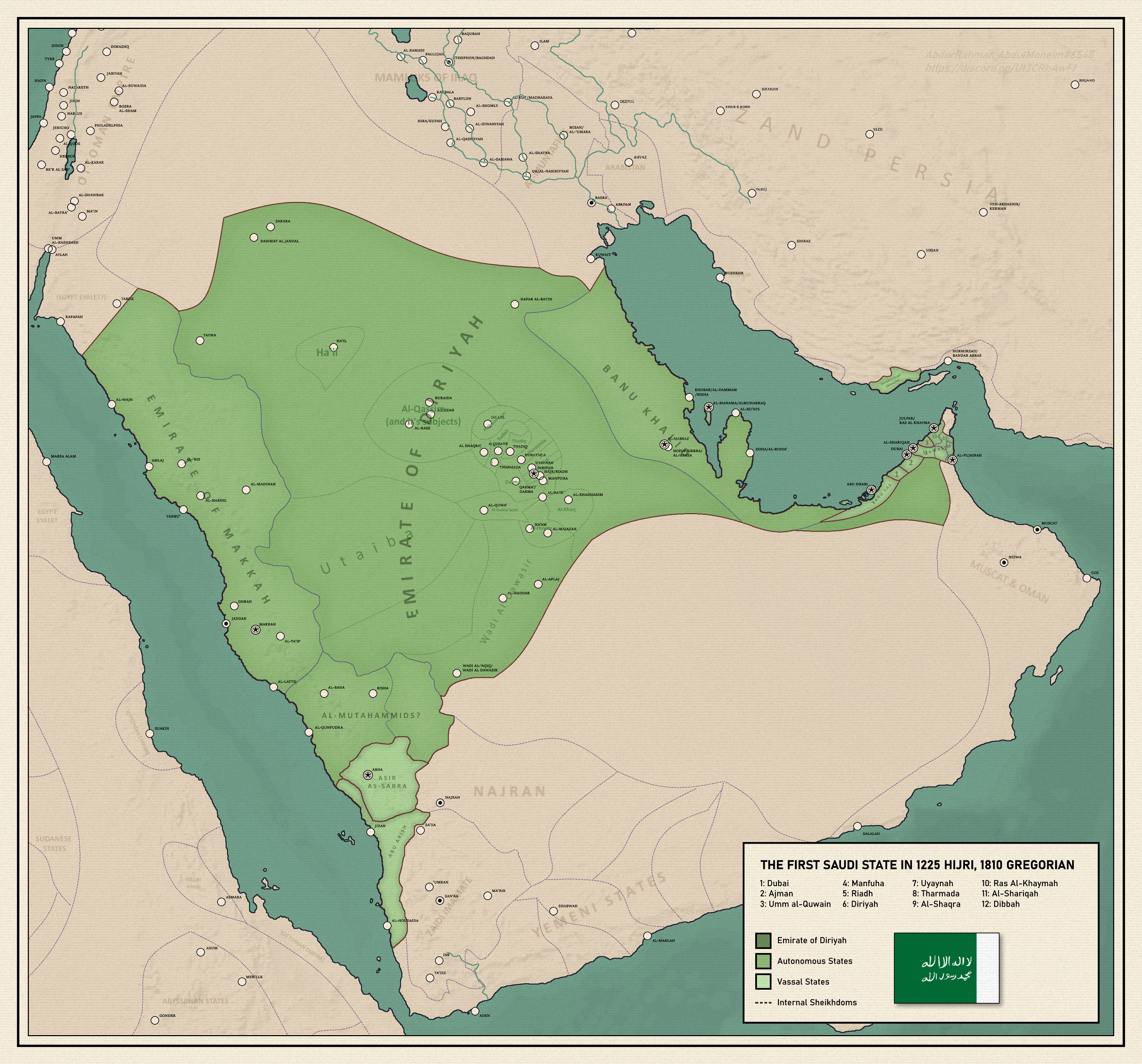
English: A map of the first Saudi state at it's greatest extent in 1225 hijri, 1810 Gregorian, depicting vassals, autonomies, and sheikhdoms, with a map of the surrounding areas |
| Date | 2021-04-22 |
| Source | Own work |
| Author | AbdurRahman AbdulMoneim |
ترخيص
|
تاريخ الملف
اضغط على زمن/تاريخ لرؤية الملف كما بدا في هذا الزمن.
| زمن/تاريخ | صورة مصغرة | الأبعاد | مستخدم | تعليق | |
|---|---|---|---|---|---|
| حالي | ★ مراجعة معتمدة 06:18، 26 أبريل 2025 | | 3٬366 × 3٬135 (14٫72 ميجابايت) | Pastakhov (نقاش | مساهمات) | Upload https://upload.wikimedia.org/wikipedia/commons/d/da/The_First_Saudi_State_Greatest_Extent.png |
لا يمكنك استبدال هذا الملف.
وصلات
لا يوجد صفحات تصل لهذه الصورة.