ملف:The Falls of Leny - geograph.org.uk - 94426.jpg
لا توجد دقة أعلى متوفرة.
The_Falls_of_Leny_-_geograph.org.uk_-_94426.jpg (640 × 480 بكسل حجم الملف: 133 كيلوبايت، نوع MIME: image/jpeg)
وصف قصير
| Description |
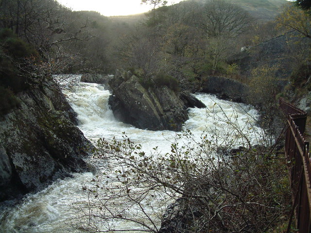
English: The Falls of Leny. It is easy to see why the river is called the Garbh Uisge (rough water) |
| Date | 2005-11-16 |
| Source | From geograph.org.uk |
| Author | James Allan |
| ⧼wm-license-cc-attribution⧽ (قالب:I18n/Credit line) |
James Allan / The Falls of Leny / |
56°15′05″N 4°16′22″W / 56.25139°N 4.2729°W
_heading:225)
| Object location | ملف:Compass-icon bb SW.svg | View all coordinates using: OpenStreetMap |
|---|
_heading:225.00&language=⧼lang⧽)
ترخيص
تاريخ الملف
اضغط على زمن/تاريخ لرؤية الملف كما بدا في هذا الزمن.
| زمن/تاريخ | صورة مصغرة | الأبعاد | مستخدم | تعليق | |
|---|---|---|---|---|---|
| حالي | ★ مراجعة معتمدة 19:25، 30 أكتوبر 2023 | | 640 × 480 (133 كيلوبايت) | Pastakhov (نقاش | مساهمات) | Upload https://upload.wikimedia.org/wikipedia/commons/3/38/The_Falls_of_Leny_-_geograph.org.uk_-_94426.jpg |
لا يمكنك استبدال هذا الملف.
وصلات
لا يوجد صفحات تصل لهذه الصورة.