ملف:Table Mountain 2634s.JPG
حجم هذه المعاينة: 645 × 600 بكسل. البعدان الآخران: 2٬203 × 2٬048 بكسل | 7٬829 × 7٬277 بكسل.
الملف الأصلي (7٬829 × 7٬277 بكسل حجم الملف: 10٫18 ميجابايت، نوع MIME: image/jpeg)
وصف قصير
| Description |
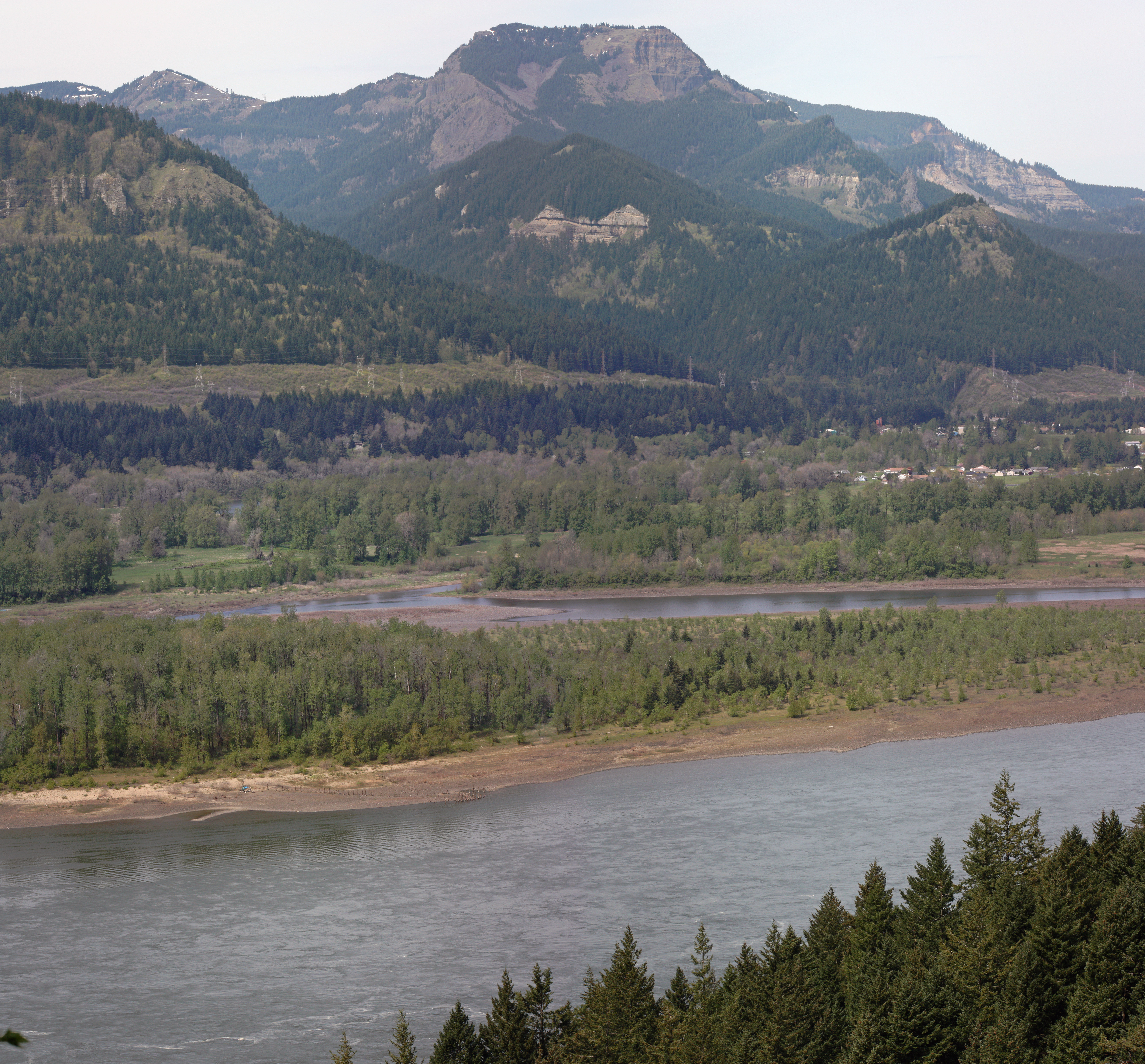
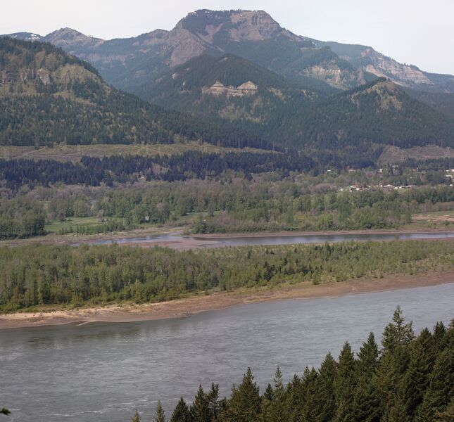
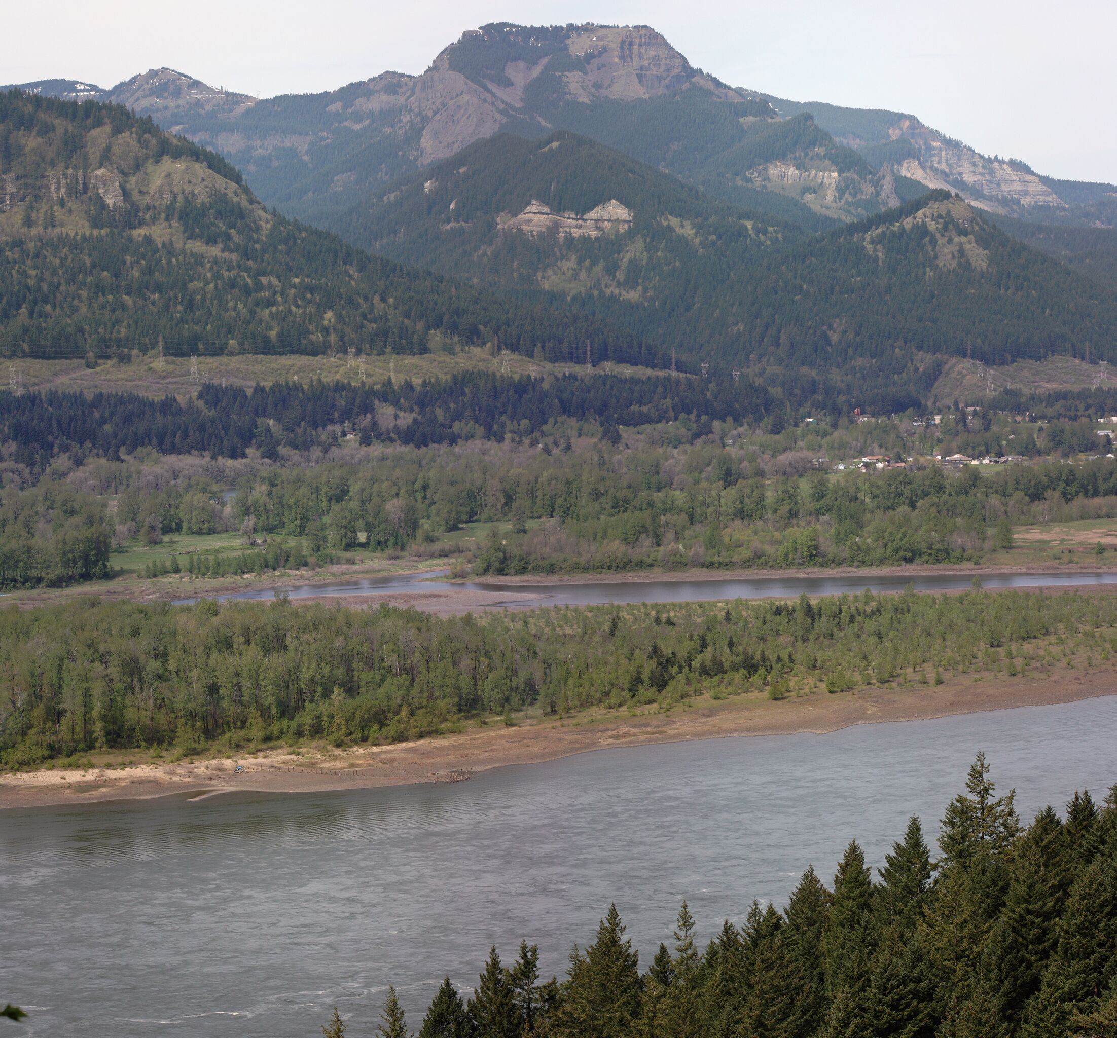
English: Table Mountain (Skamania County, Washington) (3417 ft, 1042 m; center skyline); Hamilton Mountain (2438 feet, in Beacon Rock State Park, left skyline); Ives Island in the Columbia River; Aldrich Butte (1141 feet) immediately above the buildings of North Bonneville; stitched panorama from other versions قالب:Hugin |
| Date | قالب:DTZ |
| Source | Own work |
| Author | Walter Siegmund (talk) |
| ⧼wm-license-information-other-versions⧽ |
|
- Location source: Garmin GPSmap 60CSx
- Location Datum: WGS84
- Viewpoint location: Gorge Trail #400; Elowah Falls Trail, John B. Yeon State Park
- Viewpoint elevation: 197 meter (647 ft)
- View direction: NbE°
- Camera: Canon EOS DIGITAL REBEL XSi
- F Number: f/0.0
- Focal Length: 0.0
©2010 Walter Siegmund
ترخيص
|

تاريخ الملف
اضغط على زمن/تاريخ لرؤية الملف كما بدا في هذا الزمن.
| زمن/تاريخ | صورة مصغرة | الأبعاد | مستخدم | تعليق | |
|---|---|---|---|---|---|
| حالي | ★ مراجعة معتمدة 13:14، 12 نوفمبر 2023 | | 7٬829 × 7٬277 (10٫18 ميجابايت) | Pastakhov (نقاش | مساهمات) | Upload https://upload.wikimedia.org/wikipedia/commons/1/12/Table_Mountain_2634s.JPG |
لا يمكنك استبدال هذا الملف.
وصلات
لا يوجد صفحات تصل لهذه الصورة.