ملف:South Dakota Sandhills.JPG
حجم هذه المعاينة: 800 × 543 بكسل. البعدان الآخران: 2٬560 × 1٬738 بكسل | 4٬857 × 3٬297 بكسل.
الملف الأصلي (4٬857 × 3٬297 بكسل حجم الملف: 10٫97 ميجابايت، نوع MIME: image/jpeg)
وصف قصير
| Description |
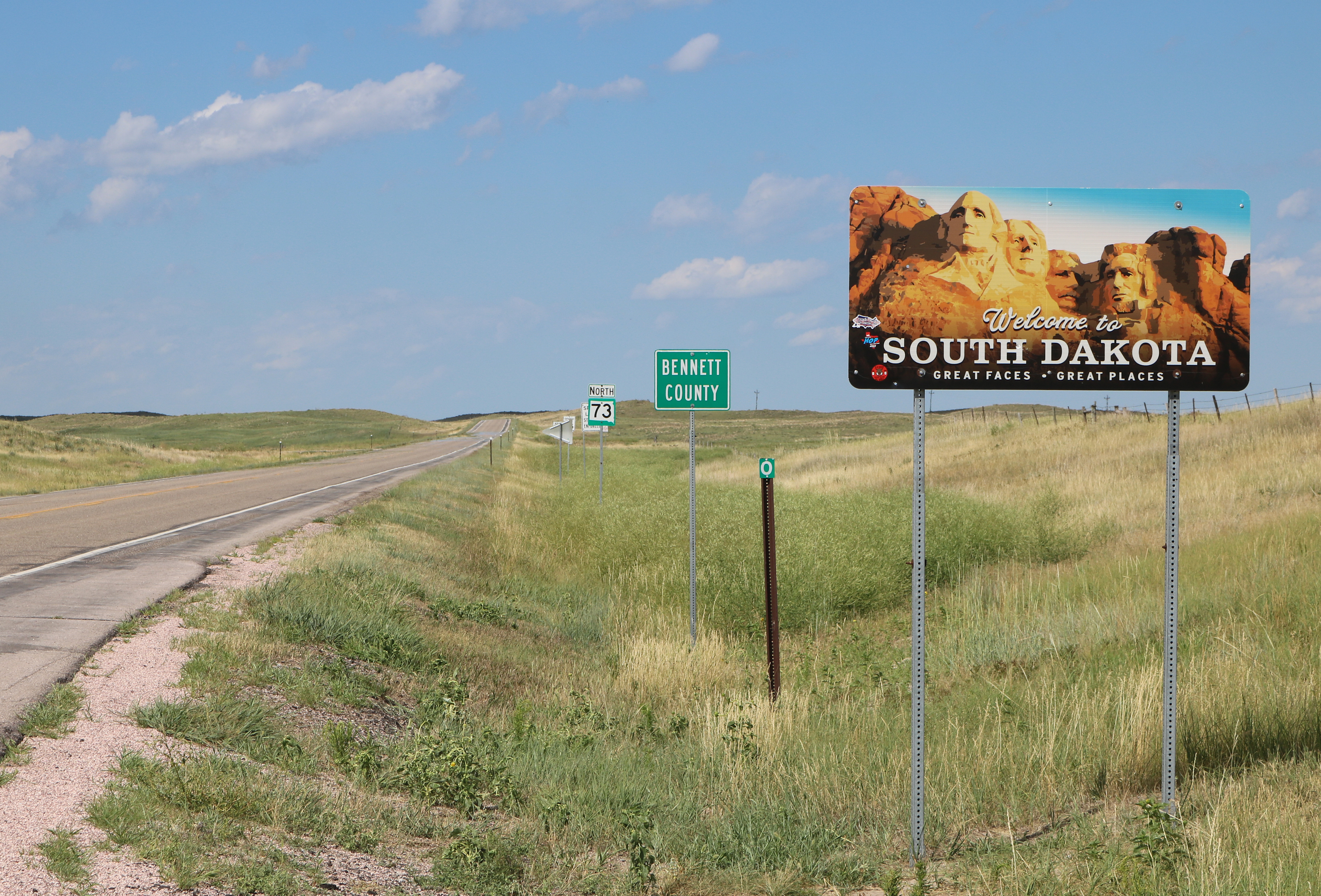
English: A view of part of the South Dakota sandhills. The view is looking north from the Nebraska-South Dakota border into South Dakota along South Dakota Highway 73 (a continuation of Nebraska Highway 61). |
| Date | 2020-07-27 |
| Source | Own work |
| Author | Jeffrey Beall |
| Object location | | View all coordinates using: OpenStreetMap |
|---|
ترخيص
تاريخ الملف
اضغط على زمن/تاريخ لرؤية الملف كما بدا في هذا الزمن.
| زمن/تاريخ | صورة مصغرة | الأبعاد | مستخدم | تعليق | |
|---|---|---|---|---|---|
| حالي | ★ مراجعة معتمدة 21:17، 28 يناير 2025 | | 4٬857 × 3٬297 (10٫97 ميجابايت) | Pastakhov (نقاش | مساهمات) | Upload https://upload.wikimedia.org/wikipedia/commons/0/0d/South_Dakota_Sandhills.JPG |
لا يمكنك استبدال هذا الملف.
وصلات
لا يوجد صفحات تصل لهذه الصورة.
معلومات الصورة (ميتا)
تصنيفات:
- Self-published work
- State border signs in South Dakota
- Bennett County, South Dakota
- Welcome signs in South Dakota
- South Dakota Highway 73
- County signs in South Dakota
- Number 73 on highway signs
- Mile marker signs in South Dakota
- Landforms of South Dakota
- Geomorphology of South Dakota
- Hills of South Dakota
- Sedimentology of South Dakota
- July 2020 in South Dakota
- Mile marker 0
- Nebraska-South Dakota border
- صفحات مع الخرائط